
-
 13132 Hits
-
 84.27% Score
-
 18 Votes
|
|
Mountain/Rock |
|---|---|
|
|
39.21360°N / 106.1535°W |
|
|
Hiking, Mountaineering |
|
|
Spring, Summer, Fall, Winter |
|
|
13684 ft / 4171 m |
|
|
Overview
 White Ridge from the west
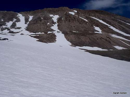
White Ridge is a very beautiful mountain, both from a distance and up-close while on the mountain. From the southwest, the peak presents a powerful presence and is carved by numerous couloirs. A curious variety of rock adorns its northern summit ridge. White Ridge is overshadowed by more popular neighbors such as Horseshoe Mountain, Mount Sheridan, Gemini and of course the Fourteener Mount Sherman, but it is by virtue of sitting in the virtual shadow of these more popular peaks that White Ridge affords the visitor peace, quiet and a more of a wilderness experience than on these more popular mountains.
White Ridge combines the accessibility of Mt. Sherman via Leavick mine with the solitude of a Thirteener, and, indeed, it’s a joy to sit on the summit of White Ridge in the peace and quiet while the crowds congregate on Sherman’s busy summit. Due to the high elevation of the saddle shared with Mount Sherman , White Ridge lacks the magical 300 feet of prominence. But this peak possesses dramatic beauty, affords the visitors great views near and far, and provides a quiet sanctuary from the bustling masses on Mount Sherman.
Colorado Rank: Unranked
Prominence: 184 feet
USGS Quad: Mount Sherman
Planning Map: Trails Illustrated #110
Rank & Prominence: Lists of John
Getting There
 White Ridge from the northeast
 Upwards toward the saddle
 Through the snow toward saddle
 Summit is in view
White Ridge is most frequently accessed via Fourmile Creek. Private property hinders access from the northeast and east, while numerous other high peaks to the west make Fourmile Creek the most logical option to access White Ridge. White Ridge is fine as a destination of its own, but plenty of visitors combine White Ridge with a visit to one or area summits, most notably Fourteener Mount Sherman.
The Fourmile Creek road is rough but passable for most passenger vehicles when dry and clear of snow. It should be noted, however, that those with high-clearance 4x4s will have a safer and more pleasant drive on this road than those without.
To get to this road from Fairplay, follow US 285 south for about one mile and turn right onto County Road 18. In the winter, this road is typically plowed to approximately 11,000 feet. In late summer, after the snow has melted, it is possible to drive to the gate at about 12,000 feet. Roadside parking can be limited and awkward on busy days or when snow banks narrow the road.
Red Tape
 Strange Rock on Ridge
 Southeast along the ridge
White Ridge resides within the Pike National Forest. Few formal restrictions apply to this area as it lies outside of federally-designated wilderness. Follow LNT (Leave No Trace) principals and be courteous of other recreationalists. Unfortunately, private property and in-holdings dominate northern access to this peak via Little Sacramento Gulch as well as direct access from the east.
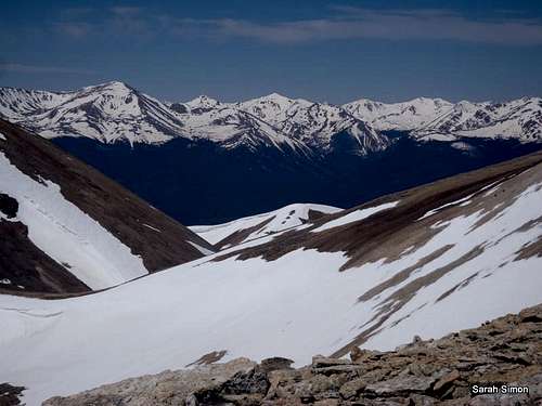
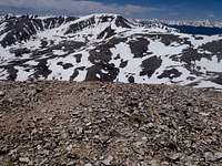 Summit Views_Horseshoe Mountain Summit Views_Horseshoe Mountain |  Summit View to the Southwest Summit View to the Southwest |  Summit View to the North Summit View to the North |
Camping
The US Forest Service operates two campsites along Fourmile Road:| Fourmile Campground | Horseshoe Campground |
|---|---|
|
|
Fairplay Hotels
Several hotels are available in the nearby town of Fairplay, approximately 8 miles north of this area on Hwy 285.
Weather & Seasons
 Heading toward White Ridge
 | Snow Season: Because county road 18 is typically plowed to about 11,000 feet in elevation, White Ridge is a viable year-round objective. Immediately following large dumps of snow, however, the road may not be plowed adding mileage to the outing. Exercise caution in the many west-ish facing couloirs and any snow slope. Summer: Due to proximity to popular, walk-up Fourteener Mount Sherman, the Fourmile Creek Road / Leavick Mine area trailhead/parking can be a zoo on weekends in summer and into early fall. |  |
External Links and Additional Information
 Sawatch Views
• Pike & San Isabel National Forests
• South Park Ranger District campground Information
• Pike National Forest Recreation Map
 Cabin Near Hilltop Mine | Steven Cross