
-
 24593 Hits
-
 78.27% Score
-
 9 Votes
|
|
Mountain/Rock |
|---|---|
|
|
39.37700°N / 106.1592°W |
|
|
Lake |
|
|
Hiking, Mountaineering, Skiing |
|
|
Spring, Summer, Fall, Winter |
|
|
13400 ft / 4084 m |
|
|
Overview
Bartlett Mountain is located in the Tenmile/Mosquito Range less than one mile northwest of Clinton Peak. Bartlett Mountain was once the largest source of molybdenum in the world. Since its mining, the summit has been lowered from 13555' to 13400'. The new elevation has been measured at both Bartlett's summit and the Bartlett-Little Bartlett saddle by Gerry Roach. Bartlett Mountain is still ranked despite this elevation loss.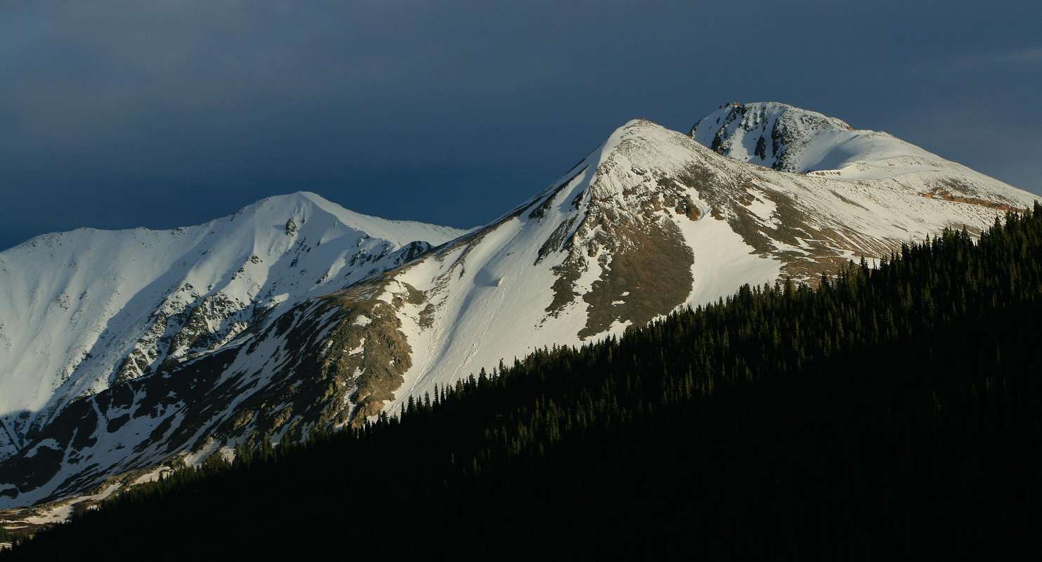
Bartlett & Little Bartlett Mountains, from right to left. Photo: dclimb14me
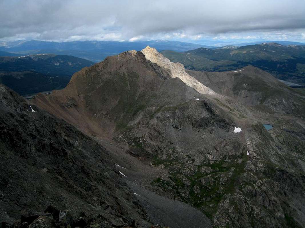
Bartlett now has 460' of prominence and is the 322nd highest peak in Colorado. The new summit is very loose and looks like it will topple over soon. Bartlett Mountain's west face is scarred, but it's north face shows little signs of mining and provides a fun ski descent. The summit provides good views of Clinton Peak, Mount Arkansas and Wheeler Mountain. Mining operations are scheduled to resume in 2010.
Mount Bartlett. Photo: RyanS
Getting There
Clinton Reservoir TrailheadDrive 7.6 miles south from the Colorado 91/Interstate 70 intersection or 3.6 miles north on Colorado 91 from Fremont Pass. The trailhead is on the east side of the road and is plowed in the winter.
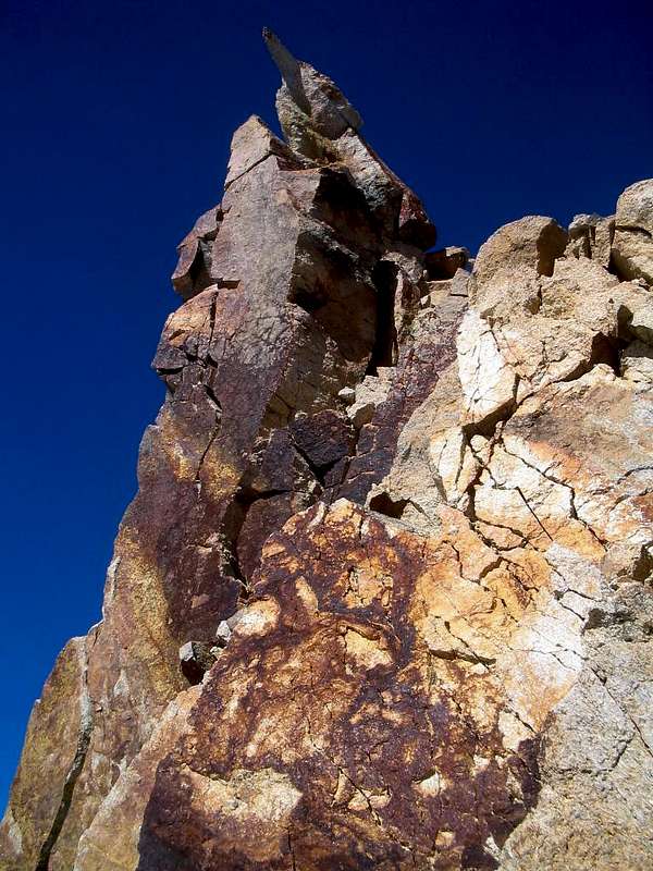
Bartlett Mountain's pointy, tumbling summit. Photo: chicagotransplant
West Face Route
Hike southeast looking for a natural gas line. Follow the natural gas line, then a rough road, then travel cross country to Little Bartlett Mountain's northwest face. Gain the mining road on Bartlett Mountain's west face and follow to the base of Bartlett Mountain's west ridge. Follow the ridge to the summit. The summit has a summit register tube, but no lid or register. Climb the summit block to the summit (Class 3+). The summit block is exposed and loose and feels like it will crumble below you when climbing it.

Bartlett Mountain's West Face Route.
Red Tape
The entire, aforementioned West Face Route is on private land owned by Climax Molybdenum Company, as indicated by signage at Clinton Reservoir. There are currently no "No Trespassing" signs en route as of 11/2008 (SarahThompson).Mountain Conditions
7 Day Forecast for Climax, COColorado Avalanche Information Center
Camping
You can camp south of the Clinton Reservoir en route to the summit.External Links
Teton Gravity Research Trip ReportLists of John