


-
 100611 Hits
-
 95.66% Score
-
 55 Votes
|
|
Mountain/Rock |
|---|---|
|
|
46.12773°N / 8.01202°E |
|
|
Mountaineering |
|
|
Summer |
|
|
13179 ft / 4017 m |
|
|
Overview
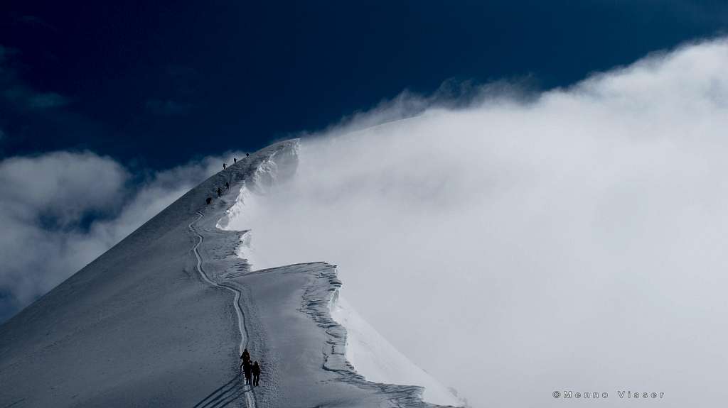
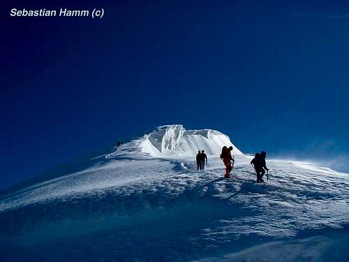
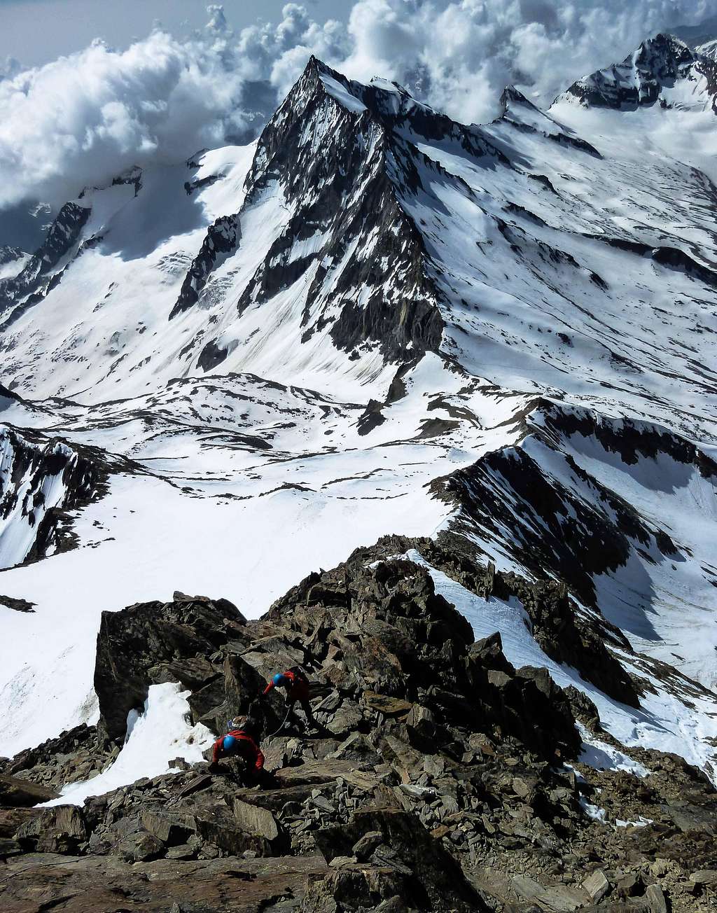
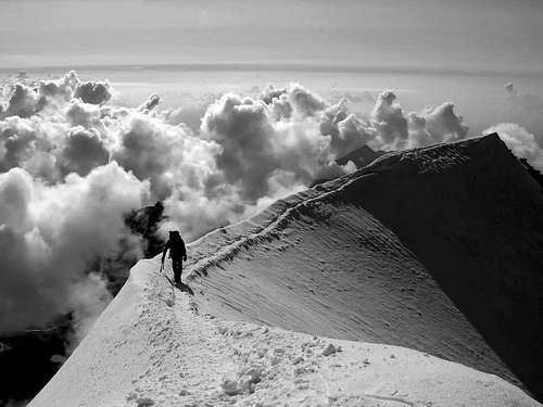
Climbers approaching the summit of Weissmies by MammoetMenno
Weissmies is a prominent mountain surrounding the famous Saas valley in Wallis, Switzerland. Weissmies is one of the 82 mountains above 4000 meters (UIAA-list)in the Alps and therefore a (very) popular objective for climbers. “Mies” is a local dialect for the German word “moos” which translates into “moss”. So the name “Weissmies” literally means “white moss”, which refers the glaciated summit of the mountain, resembling a white moss-like cover. Weissmies is considered an “easy” 4000 meter peak, since the normal route to the summit is graded PD. The relative ease of the ascent adds to the popularity of this grand mountain. The mountain was first climbed in 1855 by Jacob Christian Häuser en Peter Josef Zurbriggen.
Weissmies has a prominence of 1186 meters (Mondellipass) and an isolation of 11km with the nearest higher neighbor being Lenzspitze (4294m), part of the Mischabel chain. The elevation of Weissmies used to be 4023 meters. Due to global warming, the elevation of the snowcapped summit has somewhat decreased to 4017 meters, which is at present time, the widely accepted altitude of Weissmies. Lots of older topographic maps and books still state 4023 meters as altitude though.
 NW Face | 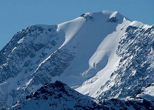 East Face | 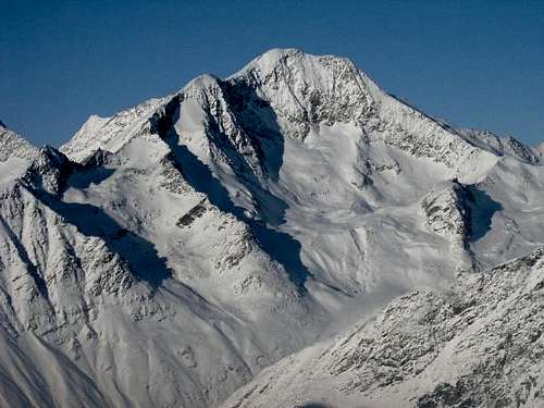 South Face |
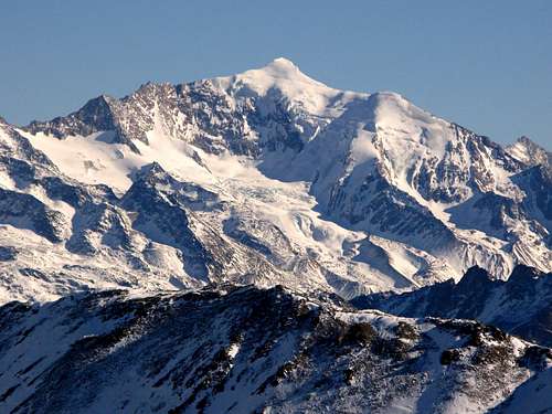
Weissmies is located in the very eastern part of the Swiss Kanton Wallis, near the border with Italy. The mountain is part of the Weissmies Group and is also the highest mountain of the group, shortly followed by Lagginhorn (4010m), the only other 4000 meter peak in the group. The third main mountain in the Weissmies Group is Fletschhorn,with 3993m, falling just short of the magical 4000m barrier.
Directly north of Weissmies rises Lagginhorn, separated from Weissmies by the Lagginjoch(3499m). To the south of Weissmies is Pizzo d’Andolla/ Portjengrat (3654m), situated on the border with Italy and separated from Weissmies by the Zwischbergenpass (3268m). The Weissmies Group is 12 km long, 8 km wide and has a North-South orientation. It also is the easternmost mountain group of the Pennine Alps and Walliser kanton.
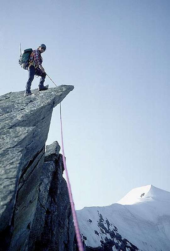
 Triftgrat near the summit | 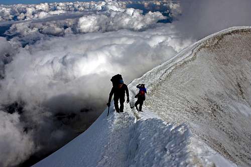 Summit ridge | 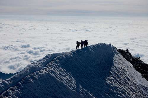 Summit ridge |
To the east Weissmies is bordered by the Simplon Pass (2000m) and Gondo Valley, including the villages named Simplon (1472m) and Gondo (855m). To the west the mountain is bordered by the Saas Valley, including the villages Saas Balen (1483m), Saas Grund (1559m), Saas Fee (1803m) and Saas Almagell (1673m). The northeast side of Weissmies is covered by the Weissmies glacier, the southeast side by the Rottalglacier and the west side by the Trift- & Mellig glacier.
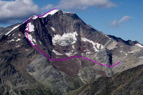
Weismies has several routes up to its summit. The route along the NW-flank of the mountain (over the Trift glacier) is considered the normal route up the mountain. This route is also the most climbed one: The vicinity of the Hohsaas cableway, which takes climbers up to 3100 meters and allows them to climb Weissmies in a single day, is one of the main reasons for it. The route is also often climbed by starting from the Weissmiesshütten (2724m) or the Hohsaas Bergrestaurant/Hütte (3200m). This route is graded PD. Another popular route is along the SE-ridge from the Almageller Hut (2894m). This route is also graded PD but involves much more rock Climbing (up to UIAA grade II) compared to the normal route, which is almost fully on glaciated terrain. A traverse combining both routes is also a popular objective for climbers. Other routes on the mountain are the SW-ridge, the North ridge and the difficult East Face.
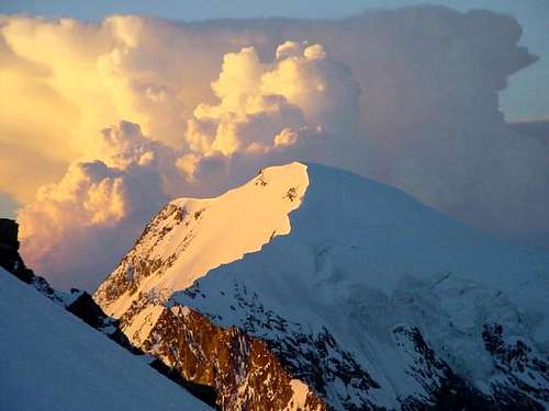 North Face |  East Face |  West Face |
Weissmies offers tremendous views from its summit. It is the easternmost 4000 meter peak in the Walliser kanton and as result summit views in an eastern direction are near endless. The only other 4000 meter peak in that direction, Piz Bernina, is more than 100km away, so basically everything is lower in elevation when standing on top of Weissmies. To the north you can see Lagginhorn (4010m) and to the west the Mischabel chain with Taschhorn (4491m), Dom (4545m), Nadelhorn and co. and of course Saas Fee below in the valley. Towards the south you can see Allalinhorn (4027m), Strahlhorn (4190m), the Mattmark Reservoir and the sharp Pizzo d’Andolla / Portjengrat (3654m).
Routes
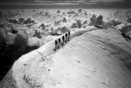
Climbers approaching the summit
I NW- Flank (Normal Route)
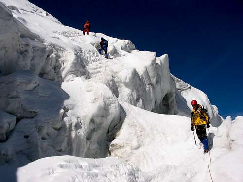
The normal route is graded PD and is a "walk" over glaciated terrain. No rock climbing is involved in this route. Even though there are no technical difficulties along the route, the snow flank is quite steep: at some points up to 40º. The biggest danger though, is the presence of crevasses. The Trift glacier is filled with huge crevasses, so watch out fot this. Also, because of global warming the route tends to change a bit from season to season because of the shifting ice mass. In some years large ladders were put in place to be able to cross the large crevasses, but in other years this was not neccessary. Be sure to check the present conditions before making an attempt! A final reccommendation is to make a traverse of the mountain. Take the SE-ridge route up (see below) and descend along the normal route. This is a fine traverse including both rock and snow, but relatively easy: PD (UIAA II)
II SE-ridge
Unlike the normal route there are no lift facilities to use here. Climbing the SE-ridge involves ascending every single vertical meter from the valley floor starting in Saas Almagell. The trail goes up through the Almageller valley up to the scenic Almageller Hut at 2894m. From here the route goes up to the saddle named Zwischbergenpass und further up onto the SE-ridge. Most climbers make a traverse of the mountain, which means descending from the summit along the normal route. This traverse is one of the finest easier routes in a 4000m mountain in the Alps.
For more information about this route see the SP Page by member LeslieH.
For more information about the traverse route see the SP Page by member jsurinx.
III North Ridge
IV SW-ridge
V Other routes
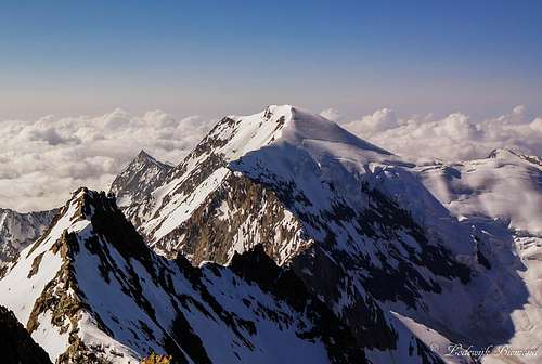
Weissmies (4017m) from the summit of Lagginhorn (4010m)
- NW-Wall (IV, 90º)
- East Wall (multiple routes, seldomly ascended)
Climbing History
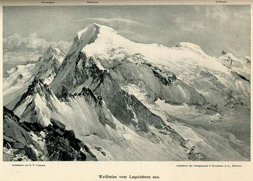
Weissmies in the year 1900
A decade later the first successful climb on the eastern side of the mountain was made. On August 1, 1876 the Americans E.P.Jackson and J.A. Peebles,together with their guides Peter Schlegel, Ulrich Rubi and Jean Martin, made a successful ascent through Weissmiess’ dangerous (brittle rock, falling ice) East wall.
A memorable first ascent was made by Claude and Herbert Wilson together with their guides Aloys Burgener and Jospeh Furrer. On August 7, 1882 they reached the SW-ridge after climbing the 500 meter high south wall of Weissmies.
The north ridge was first climbed by Johan Peter Zurbriggen on August25, 1884 and last but not least, over a century later, the Germans Jurgen Straub and Hans Rothwangl climbed the “ViaAndrea”, a route through the 680 meter high NW-wall.
Getting there
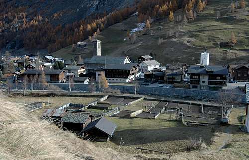
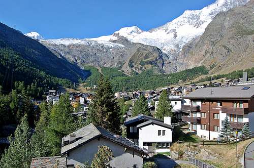
Saas Grund
The links below provide information about the Hohsaas cabelway and about how to get to Saas Grund and Saas Almagel. Also see the section ''Mountain Huts'' for more information about the Huts surrounding Weissmies and how to get to them from the Saas valley.
How to get to Saas- (Fee, Grund, Almagell): Click Here
When to climb
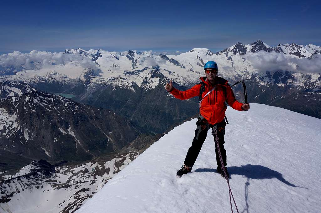
On the Summit with the Mischabel chain behind
Red Tape
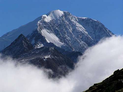
Weissmies South Face in summer
Technical equipment: rope, harness, ice axe, crampons
Mountain Huts
There are several mountain huts surrounding Weissmies. The Weissmieshütten are located to the west of Weissmies high above the Saas valley. They are easily reached from Saas Grund by using the cableway system up to either Kreuzboden or Hohsaas. The Weissmieshütten are situated at the base of the normal route up to Weissmies along the Trift glacier (NW-flank). Also ascents of the North ridge can be done from here. An alternative for the Weissmieshütten is the Hohsaas Hut (also referred to as Bergrestaurant Hohsaas). This mountain hut is less cosy and doens't have the typical mountain hut "feeling" like the Weissmieshütten, but it is closer to the summit (and at an higher elevation) and therefore a good alternative. The Almagellerhütte is located to the south of Weissmies and is the base for climbing the mountain along the SE-ridge (via Zwischbergenpass) as well as the SW-ridge / Triftgrat. Clicking on the name of the Hut in the table below directs you to the official internet page. Also the SP-link is given when available.
| Hut | Elevation | Telephone | SP-link | Photo |
| Weissmies Hütten | 2726m | +49 27 957 25 54 | Here | 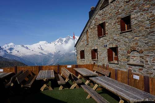 |
| Almageller Hütte | 2894m | +41 27 957 11 79 | Here | 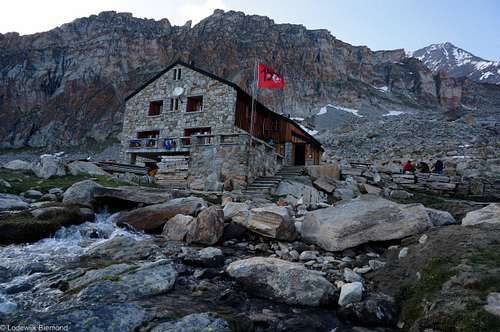 |
| Hohsaas Hütte | 3101m | +41 78 789 07 87 | / | 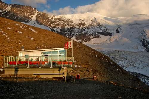 |

Books
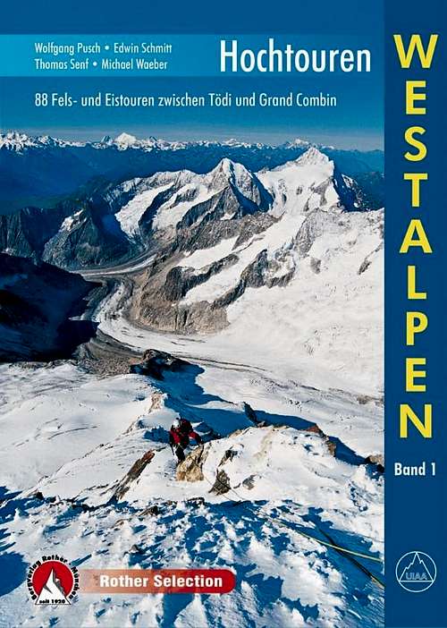
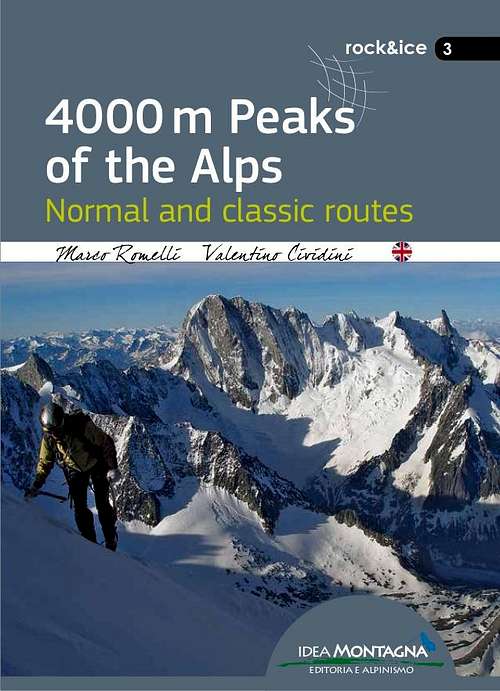
There are several books describing one or more climbing routes on Weissmies. The ''Hochtouren Westalpen'' by Rother Verlag is a very popular choice. This guidebook includes photos, route descriptions and detailed route maps for many climbs in the Western Alps, including Weissmies. For me this is the best guidebook at this moment. The ''Viertausender der Alpen'' by Dumler is a true classic. It is a 2014 reprint of one of the truly classic mountain books. The English version is still accessible as ''The high mountains of the Alps''. If you are looking for a smaller format the 4000er tourenfuhrer by Goedeke is a good choice as well. This guidebook has a description on every normal route on a 4000 meter peak in the Alps. If you are planning a ski-touring ascent of Weissmies the guidebook ''Walliser Alpen'' by Rother Verlag is the guide to go with. Other recent publications like ''the 4000m peaks of the Alps'' and ''Topo Verlag Walliser Alpen'' are shown below.
 |  |  |  |  |  |
| Publisher | Name | Author | Year (last Print) | ISBN / EAN |
| Rother Verlag | Hochtouren Westalpen Band I | Wolfgang Pusch | 2015 | 9783763330287 |
| Rother Verlag | Viertausender der Alpen | Helmut Dumler | 2014 | 9783763374311 |
| Rother Verlag | The High mountains of the Alps | Helmut Dumler | 1994 | 9780898863789 |
| Idea Montagna | 4000m peaks of the Alps | Marco Romelli | 2015 | 9788897299585 |
| Rother Verlag | Walliser Alpen Skitourenfuhrer | Daniel Haussinger | 2012 | 9783763359301 |
| Topo Verlag | Walliser Alpen | Daniel Silbernagel | 2016 | 9783033024311 |
| Bruckmann Verlag | 4000er Tourenfuhrer | Richard Goedeke | 2015 | 9783765457616 |
Maps
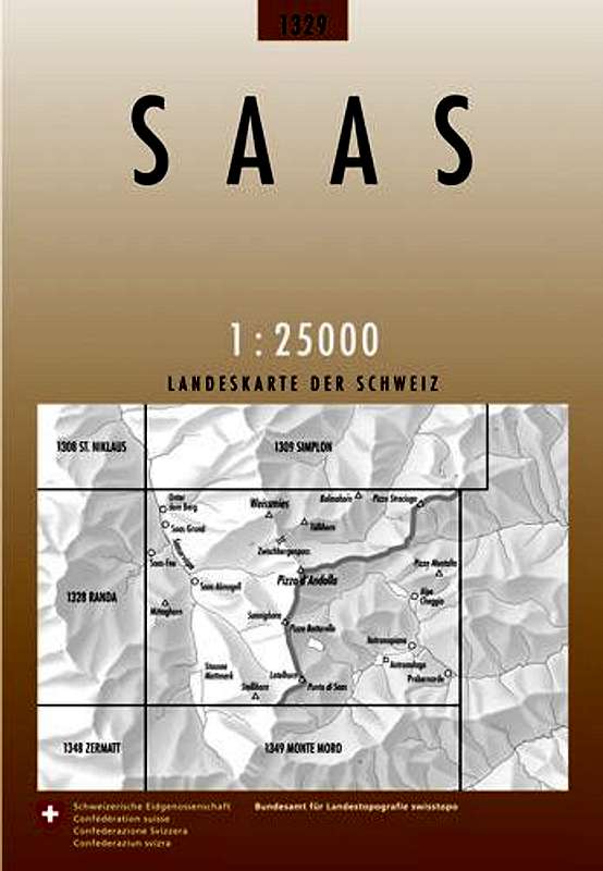
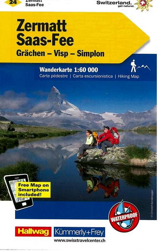
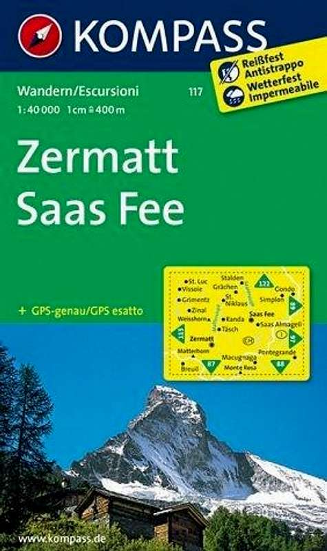
There are several maps for climbing Weissmies. However, the only map on a 1:25.000 scale is the Swisstopo map ''1329 Saas". For climbing Weissmies I would recommend this map. Another map covering the area is the Kummerley & Frey map "Zermatt Saas Fee". This map covers a large area incluing Weissmies but the downside is the 1:60.000 scale. The third map covering the area is the Kompass Map "Zermatt Saas Fee''. This map has a 1:50.000 scale and also covers the whole Saas & Zermatt area including Weissmies.
 |  |  |
| Type | Name | Scale | ISBN / EAN | Additional Info. |
| SchweizerLandeskarte | 1329 Saas | 1:25.000 | 9783302013299 | Covers the entire area |
| Kummerley & Frey | 24 Zermatt Saas Fee | 1:60.000 | 9783259022245 | Covers the entire area |
| Kompass Map | 117 Zermatt Saas Fee | 1:50.000 | 9783850269261 | Covers the entire area |
Campings & Hotels
Saas Fee
In the Saas valley there are 3 good options for camping. Camping Mischabel, Camping am Kapellenweg and camping Schonblick. All three are located in the vicinity of Saas Grund in the Saas valley.
Hotels
External Links
Weissmies summit ridge
Weissmies at Camptocamp Description of all major routes on Allalinhorn; Partly in English, mostly French
Mountain Guides for Climbing Weissmies: Saas Fee Guides in Saas Fee, Active Dreams Weissmies in Saas Grund.
Webcam Weissmies by Bergfex
Webcam Hohsaas by Bergfex (from Langfluh)
Weather Forecast by mountain-forecast.com
Weather
Weissmies Panorama
  Panorama from the normal route on Lagginhorn towards Weissmies (left) and the Mischabel Chain (4545m) |
Erik Salters - Jul 1, 2004 7:19 am - Hasn't voted
Untitled CommentJust before we climbed it in july 2003, large crevasses developed in the middle section of the route. It requires some nice, not to difficult steps. Some ice screws are adviseable. An unsecurred 60 foot ladder has been placed to overcome an overhanging icewall. Add about 30 minutes to 1 hour in your route planning when you have a pre 2003 route description.
Garfield - Dec 12, 2005 8:39 am - Hasn't voted
Untitled CommentPhoto
Mauntainfreak - Jan 7, 2016 4:32 pm - Hasn't voted
Photo from PeakThis photo was taken from a plane. (click it to enlarge):