|
|
Mountain/Rock |
|---|---|
|
|
33.86646°N / 112.03206°W |
|
|
Maricopa |
|
|
Hiking, Scrambling |
|
|
Spring, Fall, Winter |
|
|
3219 ft / 981 m |
|
|
Overview
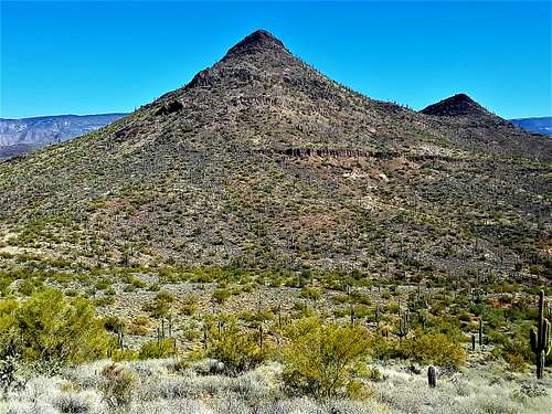
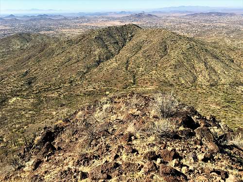
Apache Peak is located in New River, Arizona about 25 miles north of downtown Phoenix. Its conical shape makes it distinct from where it can be seen. However, given its location in the North Valley, most people haven’t seen it, and don’t know it exists.
It does see hikers from time to time, but it isn’t very popular. A trail goes almost all the way to the summit. The last 100’ or so follows cairns and requires some scrambling. However, for all intents and purposes, there is no bushwhacking required. It’s all a pretty standard route.
This area is away from the hustle and bustle, and this is a very pretty hike. The best times to hike here are November through March.
Getting There
Apache Peak is best accessed from the west. Although there is access from the east, there is no dedicated trailhead, and it requires passing through neighborhoods and then on dirt roads, which takes longer, even if the hike might be a little shorter.
From the west, take 7th Street north from Carefree Highway for 4 1/2 miles. You want to reach the Andy Kunasek Trailhead for the Maricopa Trail. From here, there are two options. First, you can park at the trailhead; or second you can get on the dirt road just past the trailhead and drive about 0.9 miles and park there to get you closer. The dirt road is fine for 2WD vehicles.
Route
After 0.9 miles, the dirt road turns north. There is a sign here to get back on the Maricopa Trail. From here, it is about 1.3 miles from the turn off to the trail to Apache Peak. There is a sign, although it doesn’t mention Apache Peak. The trail meanders as it snakes its way up to the ridge. After about 0.7 miles, the trail seems to keep going the opposite direction from Apache Peak. There is a trail split and a sign. Head towards the left, and it will go back towards Apache Peak.
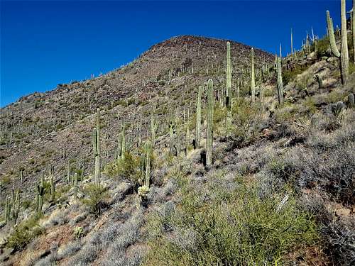
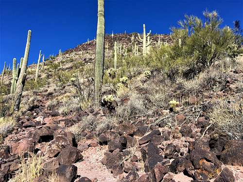
Once at the base of Apache Peak, it seems like the trail ends, but it doesn’t. Look closely, and you’ll see it continues up the east face of the mountain. It’s just really steep. The trail gains over 500 feet in less than a third of a mile. The last section requires some light scrambling. At one point there are no cairns, and it is a little confusing, but by that point, you are almost at the summit.
The summit has an American flag and a summit register in an old mailbox.
The total distance from this shorter route is 2.5 miles, gaining about 1,200’. If starting at the trailhead, it is about 3.4 miles.
Apache Peak is ideally combined with nearby Sage Gustafson Peak 2,875’, which adds about 1.6 miles round trip and another 760’. Alternatively, you can hike East Apache Peak 2,926’, which only has a prominence of about 260’ and no trail. That adds only 260’ and about 0.4 miles total.
Red Tape
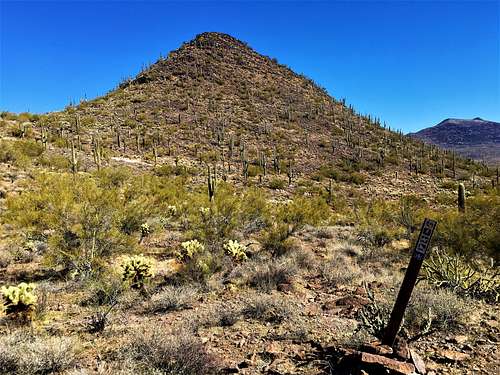
There is no red tape in particular. Just avoid the nearby Spear S Ranch, which is on private land. The trailhead is pretty open, so I wouldn’t expect a closed gate. The dirt road is always open, since people live off of it. There is wide open hiking here. The dirt road is an access road to additional houses, but some landowners are trying to discourage hikers and have put up signs. If you want to avoid this, then just use the trail.
External Links
Hike Arizona page: https://hikearizona.com/decoder.php?ZTN=16094


LLCoolBob - Jan 26, 2021 8:42 am - Hasn't voted
Access via road may cross private propertyIt appears that there is no longer public access to the trail from the point 0.9 miles down the dirt road. The owner of the property where you would have picked up the trail has posted "No Trespassing" signs. Fortunately, there is access to the Maricopa trail directly from the parking area. Although this entails some extra ups and downs along the way, it's much more scenic than walking on the road. Btw, I have no idea if this really is private property or if the nearby homeowner just enjoys his space. Given the high level of gun ownership and occasional sign expressing gun culture humor ("No trespassing, we're getting tired of hiding the bodies"), it's probably prudent to just use the trail.
hgrapid - Jan 26, 2021 11:51 am - Hasn't voted
Re: Access via road may cross private propertyIt is a public access road to numerous homes, so definitely not illegal, since we aren't crossing HIS road. Good to know though!