
|
|
Mountain/Rock |
|---|---|
|
|
33.67644°N / 111.81191°W |
|
|
Maricopa |
|
|
Hiking |
|
|
Spring, Fall, Winter |
|
|
3949 ft / 1204 m |
|
|
Overview
The Lookout Trail Highpoint, aka Peak 3949, is a summit located in the very popular Tom’s Thumb hiking area in northeast Scottsdale, AZ. Located just over a third of a mile south of Tom’s Thumb, the summit is only about 80 yards off the trail to The Lookout.
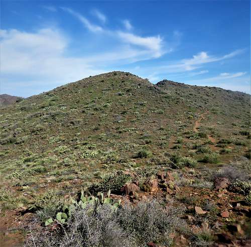 The Lookout Trail Highpoint from the south
There has been some uncertainty as to whether this Lookout Trail Highpoint is higher than Tom's Thumb. However, if going with Lists of John, which has the elevation at 3,970', that would give the Lookout Trail Highpoint a little over 200' of prominence. If Tom's Thumb is 3,925' as listed on some other sites, that would mean the Lookout Trail has a prominence of about 335’ between it and East End 4,067’, the highest summit in the McDowell Mountain Range.
Regardless of the uncertaintly over its prominence, and it being overshadowed by Tom’s Thumb, it is a worthy destination for hikers, especially with the summit views towards Tom's Thumb from the south.
As with most lower elevation Arizona mountains, the best time to hike here is between November and March, in order to avoid the heat and the critters.
Getting There
Take the 101 Highway to North Pima Road and drive 4 miles north on Pima to Happy Valley Road. Take a right on Happy Valley and continue for about 5 ½ miles to Ranch Gate Road. This is the 2nd signed turn off for the Tom’s Thumb Trail. The first is at Alameda, but if you take Ranch Gate Road, it is paved the entire way to the trailhead.
The trailhead is very large, and very popular, with plenty of spots to park; and excellent trails.
Route
Start from the bathrooms at the south end of the trailhead. Take the trail as it steeply switchbacks. After about 1.4 miles,there is a junction with the Tom’s Thumb Trail. Take a right at the junction and continue towards Tom’s Thumb. The trail is steep in sections, with gorgeous rock formations along the way.
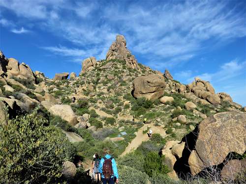 Rock formation along the trail
After a third of a mile, there is a junction with The Lookout Trail. This trail heads to the south end of the ridge, where there is a view of the entire McDowell Mountain Range.
The summit can be reached before you reach The Lookout. From the junction with the Tom’s Thumb Trail, follow the trail for 1/3rd of a mile and you’ll be right under the summit. Walk carefully up the slope and onto the obvious summit. There is ample room to avoid various types of cactus plants during the late fall and winter.
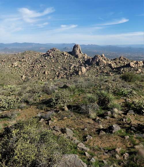 Tom's Thumb from The Lookout Trail Highpoint
It is a little over 2 miles to the summit from the trailhead, gaining about 1,250’. However,there are plenty of add-on miles, including heading all the way to The Lookout, to the base of Tom’s Thumb, or even up to East End.
Red Tape
The park is open sun-up to sun-down only. No overnight parking or camping allowed. Technically, the summit is off-limits because it is not on a designated trail. However, the distance off-trail is very minor, and unlikely to result in an infraction, since the rules for off-trail hiking are designed to protect less disturbed areas far off the trail system.