
|
|
Mountain/Rock |
|---|---|
|
|
33.64421°N / 111.81209°W |
|
|
Maricopa |
|
|
Hiking |
|
|
Spring, Fall, Winter |
|
|
3982 ft / 1214 m |
|
|
Overview
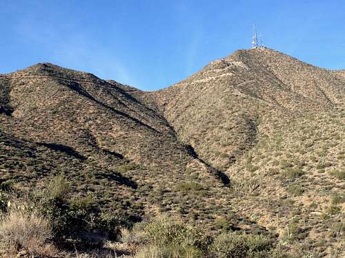
Thompson Peak is a prominent summit in the McDowell Mountains just north of Scottsdale and Fountain Hills. It is not the highest mountain in this range, that honor belong to East End but due to its shape and the radio towers on top, Thompson is much more visible. It can easily be spotted from Scottsdale and Fountain Hills and is in plain sight when approaching the peak.
On a clear day, Thompson Peak provides great views to the Four Peaks and the entire Mazatzals, the Superstitions and Weavers Needle, most of the Phoenix Metropolitan area including Camelback Mountain as well as the McDowell Mountain ridgeline with East End and Sunrise Peak.
Getting There
From Loop 101 take the Shea exit and go east on Shea for 7.5 miles. Turns left onto N Palisades Blvd. and continue on for 3.0 miles. Then turn left onto E Golden Eagle Blvd. Follow it for 1.9 miles until to get to the gate of the private community; the trailhead parking is on the left side. Alternatively take Hwy. 87 (Beeline) to Shea and turn towards Fountain Hills. From Shea turn right onto Palisades and then follow the directions above.
There are only about 20 spots at the trailhead parking and they do fill up on busy weekends. When we got there at 7 am on a Sunday we were the first 2 cars to pull in but when we got back from our hike the lot was full except for one spot where somebody had just left.
Route
From the parking lot walk through the private community gate and follow the well marked trail for about 0.5 miles to the actual trailhead where you have to pay the $2 entrance fee.
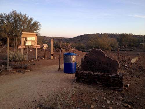
This is where the actual trail starts and where you have to pay $2 entrance fee.
Follow the Dixie Mine trail through a classic Sonoran desert landscape and crossing a couple of washes for about 2 miles until you reach the Dixie Mine. Turn left here onto the jeep road. Follow the Jeep raod all the way to the top. The road is extremely steep in parts, my guess is about 30º road grade, and it is actually paved on the steepest parts. Care should be taken when coming down these steep parts.
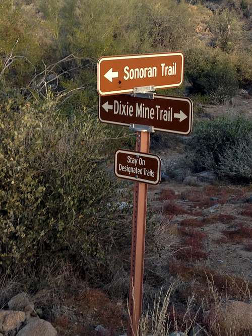
Turn left onto Dixie Mine Trail here
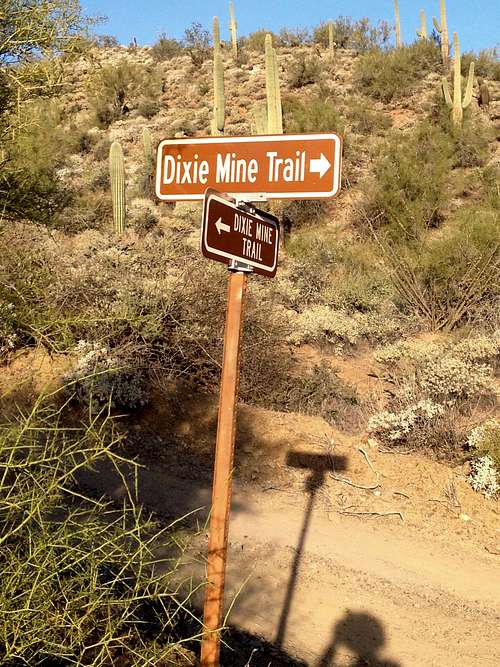
Turn left onto the jeep road here
The route is very straight forward and difficult to miss. Since the area is quite popular among the locas you will not find any solitude in particular on the lower trails until you reach the mine. Few people seem to go on to the summit though.
Total round trip distance: 9.5 miles; total elevation gain: 2000 ft
Caution: the area is very popular among mountain bikers, so do pay attention; we saw about half a dozen on our hike.
Red Tape
You have to pay $2 entrance fee at the trailhead and there is no overnight parking at the trailhead. Otherwise there is no Red Tape I am aware of.When to Climb
This mountain should be climbed in the cooler months which means from mid October to April. Summer gets very hot.
Camping
No camping allowed at the trailhead since you are in suburbia. Since your are in the Phoenix metropolitan area there are countless lodging option for any budget close by.External Links
Thompson Peak
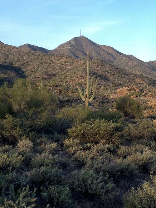
View at Thompson from close to the trailhead