
|
|
Mountain/Rock |
|---|---|
|
|
33.88350°N / 112.10385°W |
|
|
Maricopa |
|
|
Hiking |
|
|
Spring, Fall, Winter |
|
|
3180 ft / 969 m |
|
|
Overview
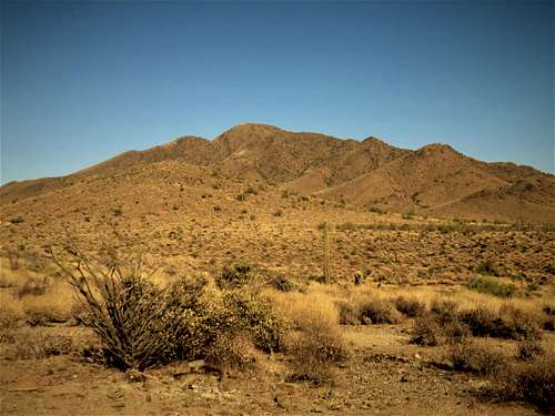 Daisy Mountain from the west
Daisy Mountain is a well-known peak north of Phoenix, in the unincorporated community of Anthem. The summit of this small set of peaks rises to 3,180 feet, with the north summit slightly higher than the south summit - which is marked on topographic maps at 3,176'. An excellent trail forms a loop hike that covers both summits, but its location within a new suburb staunches the flow of visitors to a manageable few. (In other words, there is little parking).The peaks are set amid mid-elevation desert, with cholla and ocotillo. Summer gets very hot, while Fall through Spring can be nice (possibly warm). It is ideal to hike here during the winter.
Getting There
From Phoenix, go north on Interstate-17 to the Anthem Way exit (not the Daisy Mountain Exit). This is about 25 miles north of downtown. Go east on Anthem Way about a quarter-mile, and then left (north) on Navigation Way. Drive north on Navigation Way into suburbia and after about a half a mile. Most people park near the corner of Navigation and National Trail, near a small park. It appears to be accepted practice. The trailhead is at a bend where Navigation turns into Livingstone Way. Do not park on Navigation Way, and do not park in front of someone's home. Use judgement here. There usually aren't too many hikers at once, so the limited parking isn't a killer.
The route
Enter onto the trail and follow it north. It will eventually bend northeast. You can see a toothy peak ahead - this is Gavilan Peak. At the first major Y-junction you come to, stay right. A left goes to an overlook near Gavilan. Stay right at another Y-junction a little later on.You ascend a gentle slope then drop into a drainage, then ascend again, now below Daisy itself. You'll come to a 4x4 wooden post. To here you've covered about 1.9 miles and gained a little over 400 feet. At the post, choose your direction. A left loops around to catch a saddle, an old road, and more trail to the north summit, on which a big flag stands. A right leads up to the south ridges and to the south summit. I suggest go left, hit the north summit, drop and gain to the south summit, and then follow the trail out back to the post. The trail goes over and down from the south summit, which is very convenient.
The northern peak is the highest and has the register. There is a flag below the south summit, on the shoulder of the summit ridge. The total round trip distance is about 6 3/4 miles for the loop. The total elevation gain is about 1,450'.
 North summit from south summit
Red Tape
The parking issue is one factor to consider. The peak is on State Trust Land. One normally needs a permit. It isn't needed to park, but best to have on your person. It can be purchased for 1-year here for $16.