|
|
Mountain/Rock |
|---|---|
|
|
33.85645°N / 112.04341°W |
|
|
Maricopa |
|
|
Hiking |
|
|
Spring, Fall, Winter |
|
|
2875 ft / 876 m |
|
|
Overview
Sage Gustafson Peak is located in New River, Arizona about 25 miles north of downtown Phoenix. It is about a mile southwest of Apache Peak 3,219’.
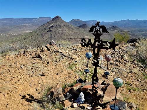
On topographic maps, the mountain is just called “2,875”. However, family of Sage Gustafson, a 16 month old who died tragically in an accident on February 1, 2012, took the time to place a decorative memorial to their child on this relatively obscure mountain. Therefore, they have earned the right to have the mountain named in honor of their late son.
The mountain doesn’t get a lot of visitors. It is further north from the popular Phoenix metro hiking areas, and most people don’t know there is a trail to the summit. It isn’t a very well-marked trail, but it is easy enough to follow to the summit if you watch where you are going and use common sense.
This area is away from the hustle and bustle, and this is a very pretty hike. The best times to hike here are November through March.
Getting There
Sage Gustafson Peak is best accessed from the west. Although there is access from the east, there is no dedicated trailhead, and it requires passing through neighborhoods and then on dirt roads, which takes longer. It is also a longer hike distance.
From the west, take 7th Street north from Carefree Highway for 4 1/2 miles. You want to reach the Andy Kunasek Trailhead for the Maricopa Trail. From here, there are two options. First, you can park at the trailhead; or second you can get on the dirt road just past the trailhead and drive about 0.9 miles and park there to get you closer. The dirt road is fine for 2WD vehicles.
It appears there is a route much more direct from the west side, but that might involve crossing into the nearby ranch, which is private.
Route
After 0.9 miles, the dirt road turns north. There is a sign here to get back on the Maricopa Trail. From here, it is about nine tenths of a mile to the turn off to the trail junction on the right. There is no sign, but there is an obvious trail, and two rocks on each side of the trail. I built up an additional cairn on the right side of the trail to leave no doubt.

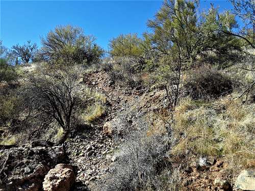
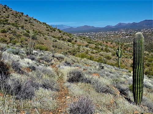
From here, the trail is very rustic. It’s a use trail. Use your best judgment as it snakes up towards a saddle in about three-quarters of a mile. The summit is just 120 yards to the left, and just about 120’ up. There is no summit register, but the memorial to Sage Gustafson is placed on top.


The total distance from this shorter route is 1.7 miles, gaining about 900’. If starting at the trailhead, it is about 2.6 miles and a little under 1,000’.
Red Tape
There is no red tape in particular. Just avoid the nearby Spear S Ranch, which is on private land. The trailhead is pretty open, so I wouldn’t expect a closed gate. The dirt road is always open, since people live off of it. There is wide open hiking here. The dirt road is an access road to additional houses, but some landowners are trying to discourage hikers and have put up signs. If you want to avoid this, then just use the trail.
Do not move the memorial to Sage Gustafson to ensure that it remains on top and isn't blown away by wind or in any other way is impacted.


LLCoolBob - Jan 26, 2021 8:36 am - Hasn't voted
Access via road may cross private propertyIt appears that there is no longer public access to the trail from the point 0.9 miles down the dirt road. The owner of the property where you would have picked up the trail has posted "No Trespassing" signs. Fortunately, there is access to the Maricopa trail directly from the parking area. Although this entails some extra ups and downs along the way, it's much more scenic than walking on the road. Btw, I have no idea if this really is private property or if the nearby homeowner just enjoys his space. Given the high level of gun ownership and occasional sign expressing gun culture humor ("No trespassing, we're getting tired of hiding the bodies"), it's probably prudent to just use the trail.
hgrapid - Jan 26, 2021 11:55 am - Hasn't voted
Re: Access via road may cross private propertyNoted in Red Tape section. Thanks!