
|
|
Mountain/Rock |
|---|---|
|
|
33.75160°N / 111.8095°W |
|
|
Maricopa |
|
|
Hiking |
|
|
Spring, Fall, Winter |
|
|
3055 ft / 931 m |
|
|
Overview
Fraesfield Mountain is located in North Scottsdale northeast of Pinnacle Peak Park. Although it has its own trailhead, there is no trail to the actual summit. This is the case with a few nearby mountains, where trails loop around, but don’t go to the top. That’s maybe because the summit itself isn’t on preserve land.
However, reaching the summit from off the trail isn’t too difficult. It just makes it less attractive in warmer months when snakes and other critters are around. It is recommended to hike to the summit November through February; or March in the mornings.
The trailhead has good parking, and is easy to find. The area is relatively popular for its location – far east in the suburbs. Don’t expect to be hiking out here all day. The summit can be reached in about 1 ¼ miles. However, there are plenty of other trails in the area that are used for mountain biking and trail running.
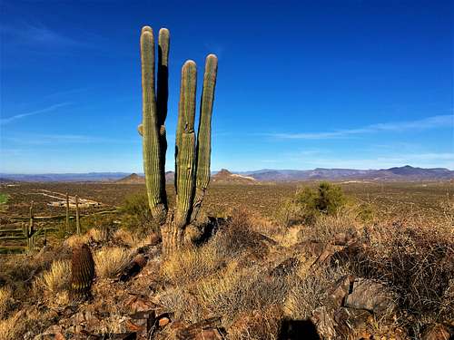
Summit view west
Getting There
Take Pima north from the 101 and take either Happy Valley or Dynamite Roads. Either can get to the trailhead, which is on Rio Verde (a continuation of Dynamite) a quarter mile past 132nd Street. The trailhead is on the left (north) side of the road. There is a trail map with more information.
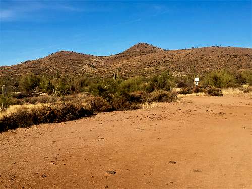
View from the trailhead
Route
From the trailhead, follow signs and then go up the Whiskey Bottle Trail, which gradually goes up the hillside. Once you go around the back side, Fraesfield Mountain comes into view.
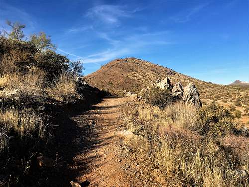
First view of Fraesfield along the Whiskey Bottle Trail
Follow the trail down a hill and once it turns you will be at the base of the summit. This is about 0.9 miles from the trailhead. It’s pretty obvious.
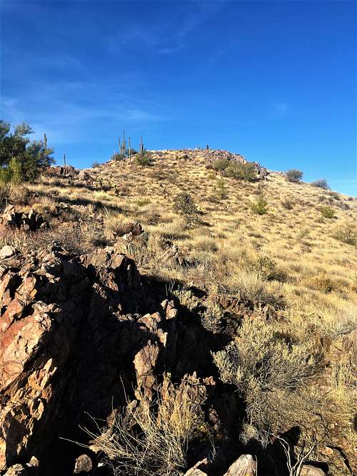
View of the final summit from the ascent
It is relatively steep in all directions. It is over 400 feet in about a third of a mile to the summit. However, it is grassy, without too much cactus. It is much easier and safer to do this between November and February.
Round trip, it is about 2 ½ miles, gaining about 600 feet total; although you can add to that easily with the many other trails in the area.
Red Tape
There is no red tape in particular. The trailhead may be closed in the evenings and very early morning. However, you can hike here whenever. The summit itself is on private land. However, there are no signs indicating any restrictions to access. The only consequence is that there isn’t a trail to the summit.External Links
http://www.mcdowellsonoran.org/trailhead/fraesfield-trailhead/https://www.scottsdaleaz.gov/Assets/ScottsdaleAZ/Preserve/Preserve+North+Area+Trail+Map.pdf