
|
|
Mountain/Rock |
|---|---|
|
|
33.48900°N / 111.63965°W |
|
|
Maricopa |
|
|
Hiking |
|
|
Spring, Fall, Winter |
|
|
2786 ft / 849 m |
|
|
Overview
Usery Mountain South is located in Mesa, Arizona. It is actually the highest point within city limits, despite being less than a mile south from a higher summit - Usery Benchmark. Although it is in the Usery Mountain area, it isn’t accessed from the Usery Mountain Pass Road. That is because of a microwave tower on the east and north sides of the mountain that is on restricted land.Instead, it can be accessed from the neighborhoods in northeast Mesa. There are two trails leading to the summit. One is from the South and the other from the West. The South route appears excellent, but it has a “No Trespassing Sign”. It isn’t clear that this is 100% off-limits, or just covers the immediate area, but better safe than sorry. Therefore, the only fully legal option is from Hawes Blvd.
There is actually a trail that starts from the road itself behind a gate with a yellow arrow on it. The trail is not maintained. It is a use trail created by local hikers, with lots of cairns.
The route is easy enough to follow, and there are excellent views, particularly from the summit. This trail isn’t very popular, and there aren’t any designated parking spots. So, don’t expect company.
The best time to hike here is during the colder weather months; particularly November through March. It is a rocky trail, so rattlesnakes could be present in warmer weather months.
Getting There
Take the 202 to Power Road, and head south to McDowell Road. Take McDowell Road east for 2 miles, and then turn left on Hawes Blvd and go north for about a mile.
Parking is the big question mark. There is no parking across from the trail. The safest bet is to turn left on Thomas Road and park on the right side of the road on the dirt. The trail start is about a quarter mile north on Hawes Blvd on the right. It is at a gate with a yellow arrow (see photo below).
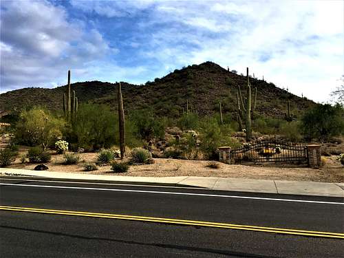
Trail entrance from Hawes Blvd
It is a tenth of a mile past Scarlett Road, where you cannot park. I parked on Scarlett Road on the west side of the road, but I wasn’t comfortable about it given there are just a few houses. Parking on Thomas Road is recommended. As of 12/17/2017, there is 300 feet of parking on dirt before you even reach a house.
Route
Once past the gate, the trail winds over to the right side of the mountain, and then steeply gains the ridge. Once on the ridge, continue to follow the cairns. Use your instincts if you don’t see the trail. It is easy to lose sometimes, but easy to find again. Eventually, the summit route becomes obvious on the left as you reach the summit ridge. It’s another third of a mile to the top.
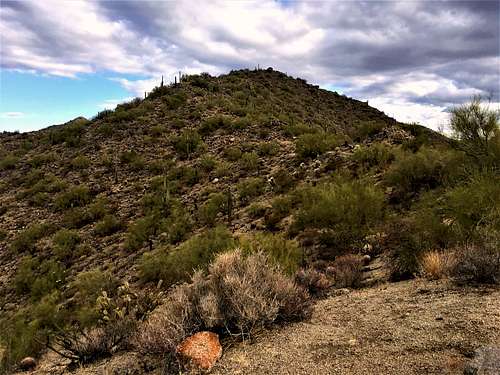
View of the summit from the trail
Once on the summit, there is summit register. It’s about 1.1 miles from the gate to the summit, gaining about 900 feet.