
|
|
Mountain/Rock |
|---|---|
|
|
33.49655°N / 111.62957°W |
|
|
Maricopa |
|
|
Hiking |
|
|
Spring, Fall, Winter |
|
|
2933 ft / 894 m |
|
|
Overview
Phoenix Mountain is located in the Usery Pass area; which is actually to the east of Mesa, Arizona. On topographic maps, it is labeled as “2933”. The reason for the name “Phoenix Mountain” is that P-H-O-E-N-I-X is spelled out on its south face. It is ideally hiked along with Usery Benchmark, which is ¾ miles away, and has a trail to the top.
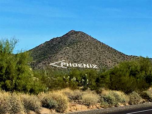 Phoenix Mountain from the south
A private road goes up the south side of Phoenix Mountain, which cannot be accessed by the public. Therefore, the mountain must be approached from the east or the north. All of these require some bushwhacking.
There are two potential starting points. The first is the Bulldog Canyon Trailhead/EJ Peak Trailhead and the second is on the east side of Usery Pass Road, about 1 mile north of the entrance to the Pass Mountain Trailhead/Usery Park Road. Both offer direct routes to the summit.
Summit views are excellent, particularly to the east. There is a summit register, placed there on November 24, 2017.
The best time to hike here is during the colder weather months; particularly November through February. If going outside of those times, go in the morning if the weather is cool enough. If it is hot enough weather, you risk running into rattlesnakes, especially in the morning.
Getting There
Take the 202 North loop to Power Road, and head south to McDowell Road. Take McDowell Road east for 3 miles, and then turn left on Ellsworth Road and go north for about 2 ½ miles for the southern parking area or 3 ¼ miles for the Bulldog Canyon Trailhead/EJ Peak Trailhead.
Route
From the southern trailhead on the side of the road, cross the road and head up the open slope towards the peak, directly up the east ridge. There isn’t much elevation gain for the first third of a mile. But, then the terrain gets steep. There really is no trail. The route is obvious. It is only about 0.8 miles to the summit, gaining about 810’.
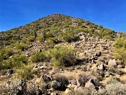 East Ridge
For the EJ Peak Trailhead, cross the road, and walk over the fence. A wide open trail continues for about a half mile until it forks. The trail to Usery Benchmark is in the center, with two other roads on either side. Take the left fork. About a quarter mile up, start looking for options to cross over to the west ridge. This is tougher later in the year when it’s hot and brushy. It’s easier in winter time. However, there are pathways to the ridge that aren’t too difficult. The final summit block is steep. You gain 260 feet in less than 300 yards. It’s a fun little scramble/hike to the top. Descend the way you came, or via the east ridge described above. Elevation gain is about 900-950’ depending on your route, in at least 1 ½ miles one way.
 View towards Usery Benchmark from the mountainside
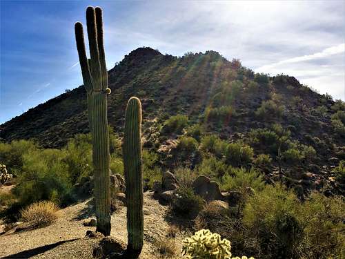 Final summit block from the west ridge
Red Tape
There is only Red Tape for the private road. There are no restrictions for the other approaches.