
|
|
Mountain/Rock |
|---|---|
|
|
33.68174°N / 111.81165°W |
|
|
Maricopa |
|
|
Trad Climbing, Toprope |
|
|
Spring, Summer, Fall, Winter |
|
|
3925 ft / 1196 m |
|
|
Overview
There are over 30 established routes to the summit from 5.2 and up. It is worth noting that the McDowells are notorious for their sandbagged ratings. Considering Tom's Thumb was first climbed in 1948 by Tom Kreuser, the old school ratings should come as no surprise!
Getting There
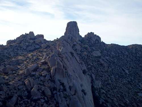
Tom's Thumb and Gardener's Wall
Route
Toms' Thumb from the approach
The approach:
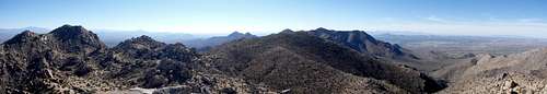
While there is a climber's use trail that heads straight up towards Tom's Thumb, the city of Scottsdale and park officials ask that it no longer be used for resource protection. Instead, leave the parking lot through the visitor ramada and follow the main trail keeping right at the first junction 0.1 miles in. Follow signs for Tom's Thumb keeping right at 0.5 miles at the second junction. At this point the trail starts to aggressively switchback, climbing about 1200' to a saddle that separates East End, the range HP, from the long ridgeline holding Tom's Thumb. East End is well worth the visit if time allows, with a faint use trail shortly before the saddle. Hike past Glass Dome, another prominent rock formation in the range, and turn right onto the marked climbers trail towards Tom's Thumb (straight heads towards Lookout Point). From there it's only another 1/4 mile to the base of the thumb. Free paper maps are available at the entrance ramamda if needed.
Climbs:![Annotated West Face]()
Annotated West Face
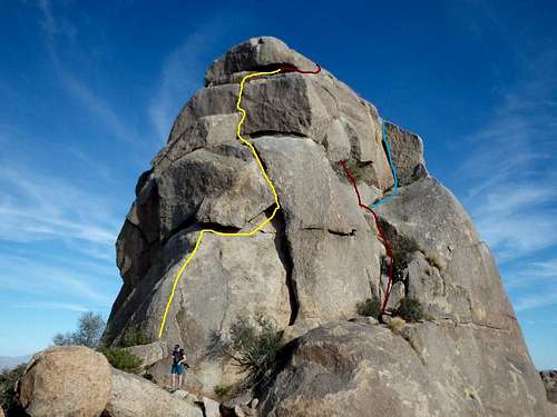
Annotated West Face
Tom's Thumb has many excellent climbs for all skill levels. Keep in mind that many of these ratings are sandbagged. Many of the harder lines are climbed with a top rope built off a number of boulders and cracks on the summit.
All routes can be rapped with a solid two bolt anchor and chain down the West Face. A single 60m rope makes it with a few feet to spare.
A short breakdown of some of the classic lines on Tom's Thumb based off personal experience and information off the internet.
| Route | Rating | Location |
| West Corner | 5.2 | Right Corner of W Face |
| Kreuser's Route | 5.4 | NE Corner |
| Treiber's Deception | 5.7 | SW Corner |
| Fat Man's Delight | 5.6 | Right Corner of W Face |
| The Settlement | 5.7 | West Face |
| Garbanzo Bean | 5.7 | NE Face |
| Garbanzo Bean Direct | 5.10d | NE Face |
| Deep Freeze | 5.11- | N Face |
| Succubus | 5.10b | N Face |
West Corner Crux
West Corner 5.2:
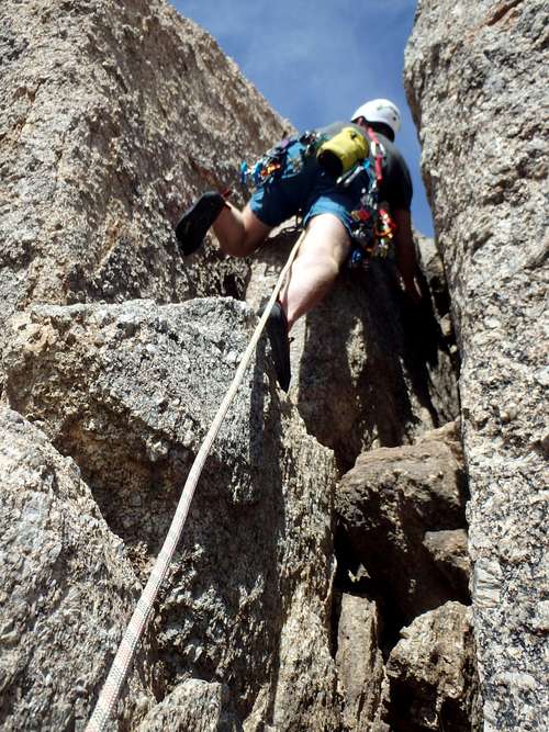
This is the original line on Tom's Thumb way back in 1948. From the West Face (opposite side of the ridgeline you hike in on) scramble an obvious ramp on the right to a crack with an overhanging tree. Rope up and start up the crack, avoiding the temptation to go right on the low angle slab and instead heading left up a second crack with another tree above it. Once on top of the second small tree, climb a dual crack system for about 15', the crux of the climb. A chokestone deep in the right crack can be wrapped with a sling for protection, or a medium sized cam can be placed in the left crack with a large alpine draw to cut down on rope drag. Above the dual crack is a wide ledge that can be used as a belay station if breaking the climb in two pitches. The ledge could fit multiple people if leading up a group. From the ledge, traverse under a large overhand on the right to reach a shallow crack up to the summit. It is recommended that this be broken into two pitches given the serious rope drag around the overhang.
Kreuser's Route 5.4:![Kreuser's Route base]()
Kreuser's Route base
Kreuser's Route base
This has been described as having a "real mountaineer's route feel" in some guidebooks. Scramble a narrow ramp on the left hand side of the West Face to the start of a wide crack. The route up is straightforward although the left hand side of the crack has some loose rock. The top of the pitch involves some stemming to get above a slightly overhanging boulder, and meets up with the West Corner route immediately below the traverse beneath the overhang for the second pitch (see above).
Treiber's Deception 5.7:
Considered by many to be the most classic route on the mountain, and well named given it's deceptive rating. The climb starts on the SW corner (left hand side when you first hike to the base). Get between the main wall and a boulder and stem up to reach a large flake on the main wall. This is the first spot to place pro. Climb up the crack to a face protected by a bolt, which has been recently replaced. Traverse left and up to a stance below a crack (bolted). Lever your way up this corner, following it up left to the base of a wide crack, which leads up to the top.
Information on other routes can be found with the links below.
Gear
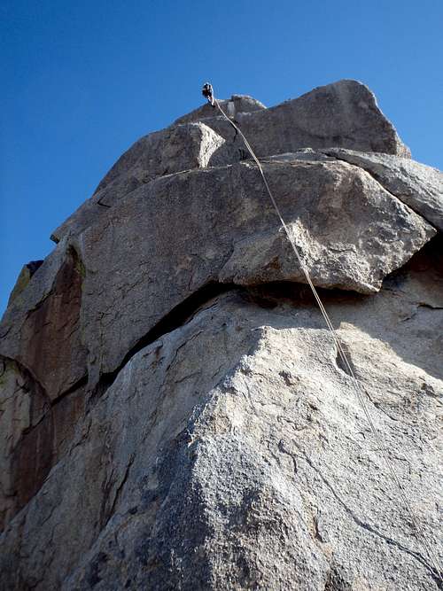
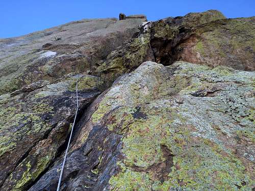
Rappel down the W Face
When to Climb
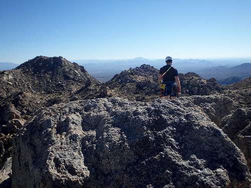
Tom's Thumb Summit
Fall and Winter are best. Summer is dangerously hot in the McDowells, although the West Face climbs do have good morning shade if you want to get a climb in early. Many of the north and west face routes are closed in the spring to protect nesting falcons. And since all routes rappel down the West Face, essentially all route are closed in the spring. The park is closed (gated shut) sunset to sunrise.