
|
|
Mountain/Rock |
|---|---|
|
|
33.49740°N / 111.5321°W |
|
|
Maricopa |
|
|
Spring, Fall, Winter |
|
|
3134 ft / 955 m |
|
|
Overview
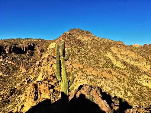
East Dome Mountain (Peak 3134 on topographic maps) is the summit east of Dome Mountain 3,381’. It has a prominence of 514’ between it and the saddle it shares with Dome Mountain.
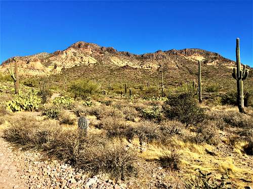
Unlike its neighbors, Dome Mountain and South Dome Mountain (Peak 3269), East Dome Peak has a trail all the way to the summit. As long as you can follow the unmarked route, it is actually a rather easy hike that can be done in less than 2 ½ hours. It can easily be combined with Dome Mountain, which would add at least another 45 minutes round trip, or you can add Dome Mountain and even South Dome Mountain, which adds another hour on top of it. You could also add Bulldog Mountain 2,685', which is another great option.
The hardest part about this hike is just making sure you follow the correct roads. Bring a map of the area. There are sufficient markings where needed to get you there.
Any of these summits are best hiked between November and March. This is rattlesnake country, and you don’t want to be on the thin trails in the area or climbing rocks on the other summits when they are around.
Getting There
In Apache Junction, about 35 miles east of Phoenix, exit US-60 at Idaho Road. Here is a more detailed set of directions, courtesy of mstender:
- Take exit 196 for AZ-88 E/Idaho Rd
- Turn left onto S Idaho Rd go 4.5 mi
- Turn right onto E McKellips Blvd go 0.5 mi
- Turn left onto N Wolverine Pass Rd go 0.9 mi
- Turn right onto E Tonto St go 0.2 mi
- Take the 2nd left onto N Cactus Rd go 0.1 mi
- N Cactus Rd turns right and becomes E McDowell Blvd
- E McDowell Blvd turns left and becomes N Cactus Rd
The last road will bend left and cross the Tonto National Forest boundary, coming to a large gate and parking area. If you have a permit, you can drive beyond the gate. Otherwise, park here. Elevation here is about 2,050 feet.
Route
Past the gate, hike north on Tonto Road 10. When it starts to bend west, look for FR-1356, which continues north. Take it for a third of a mile and turn right. Continue north for a mile and a quarter. Turn right again. A map is helpful; particularly a satellite image. Trail hiking apps, like All Trails, can be good guides as well for this route.
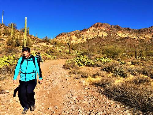
Continue for about three-quarters of a mile up this road/trail. You will reach an overlook point. This is over two and quarter miles into the hike. There is a use trail on the right with cairns marking the turnoff. Take it and follow as best you can. After about a half a mile, there is a trail junction. Look for a trail on the left along the north side of East Dome Mountain. Even if tough to find initially, go uphill just a little bit and you’ll see it. The trail reaches the summit in about four-tenths of a mile. It gets very steep towards the top. You can also just go straight up the hillside from the saddle between in and Dome Mountain and it is pretty-straight-forward as well.
The hike is about 3 miles to the summit, gaining a little over 1,200’.
Red Tape
If you are planning to hike the roads, no permits are necessary. If you plan to drive the roads north past the gate, you'll need a permit from the Tonto Ranger Station in Mesa. Here is their contact information:
Mesa Ranger District 5140 E. Ingram St. Mesa, Arizona 85205 (480) 610-3300