
-
 296 Hits
-
 77.48% Score
-
 8 Votes
|
|
Mountain/Rock |
|---|---|
|
|
38.84913°N / 104.91292°W |
|
|
El Paso County |
|
|
Hiking |
|
|
Spring, Summer, Fall, Winter |
|
|
7141 ft / 2177 m |
|
|
Overview
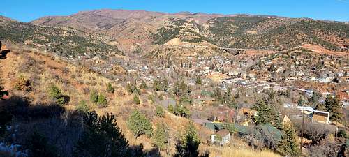
Iron Mountain
Manitou Springs, Colorado
Elevation: 7131 ft / 2174 m
Manitou Springs is famous for being the gateway to America's Mountain. From town, people walk to Barr Trail and embark on the 13.1-mile hike to Pikes Peak. Lesser known are the trailheads of lower-profile mountains. They, too, are found in town, hiding in neighborhoods. They're not as heralded as the route to the 14,115-foot summit or to the uber-popular Incline. But anyone who seeks them is guaranteed solitude and views.
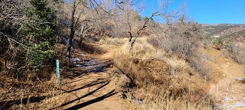
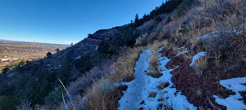
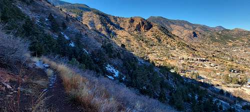
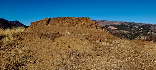
Take Iron Mountain, for example. The trailhead is up Pawnee Avenue, the street rising up the hill at the downtown stoplight. But for a worthwhile extension of this trip, we recommend starting at the Intemann trailhead reached off Ruxton Avenue. After a short, steep ascent, the path flattens on a ridge overlooking the town, the Waldo Canyon burn scar and the red rock walls bordering Ute Pass.
At the junction for Red Mountain, continue straight to spot Garden of the Gods in the distance. At the next power-line post, see the trail continuing up to the right. Ahead, nearing 0.75 miles, continue on the wider path going straight, not to the right. Iron Mountain enters into view, imposing enough to seem as if the top is much farther than a mile.
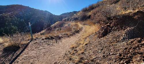
Intemann Trail spills onto the road, with Iron Mountain's switchbacking trail clearly marked across the way. You'll rise and dip at first but never significantly. The pines blend with the scrub oak as the path steadily climbs into wilder surroundings of the foothills.
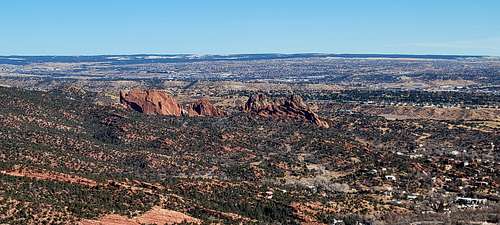
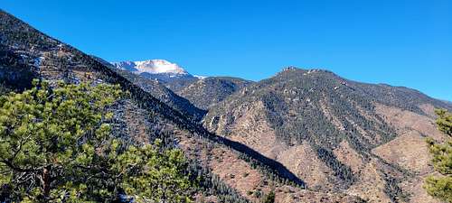
Along with downtown Colorado Springs and the hazy plains spreading east, you'll see outcrops marking the scenic area known as Section 16. A longer day can be had by heading left toward that area at the trail 'T.' Go right for the final push to the overlook, where Pikes Peak joins the 360-degree vistas.
 |
 |
 |
 |
 |
 |
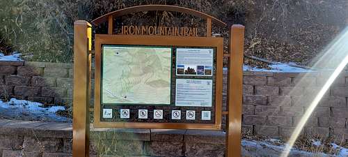
Getting There
 |
 |
 |
Iron Springs Trailhead (Note that this peak is also accessible via the Pawnee Avenue trailhead to the east)
• Follow CO 24 (“Old Highway 24”) into Manitou Springs.
• At the roundabout, turn left on Ruxton Avenue.
• Continue on Ruxton Avenue for about ½ mile. There are a few places to pick up the Intemann Trail in this area, but the Iron Spring gazebo provides a solid landmark.
• Park along the road wherever you can, obeying No Parking signs to avoid being towed, and proceed to the Iron Spring gazebo (or simply follow signs to the Intemann Trail).
Getting there: For the Intemann trailhead off Ruxton Avenue, follow the street to the left of the traffic circle in downtown Manitou. Cross the bridge for Spring Street and follow the dirt path up.
FYI: Park at the free lot at Hiawatha Gardens, 10 Old Man's Trail. Hiking and mountain biking. Dogs on leash.
Route
Red Tape
Most maps suggest that Iron Mountain is not accessible due to private property restrictions. Thankfully, the Paul Intemann Trail system provides legal access to the top of this peak.
• Trail signage requests that dogs be kept leashed and picked up after.
• Parking may be extremely limited in the Manitou area during tourist season (summer). Obey No Parking signs or risk being towed.
When to Climb
Spring/ Summer / Fall / Winter
Camping
The National Forest Service operates three general-use campgrounds in its Manitou Park Recreation Area. The Manitou Park Recreation Area is located about 5 miles north of Woodland Park along Hwy 67. Below is information about these campgrounds as provided by the Forest Service.
The nearest semi-developed US Forest Service campsites would be in the Rampart Reservoir area.
Meadow Ridge Campground:
- 19 campsites
- 9,200 feet elevation
- Season: Generally early May through September
- $15 per night, per site
- Amenities include tables, fire grates, drinking water, latrines, and trash collection
Thunder Ridge Campground:
- 21 campsites
- 9,200 feet elevation
- Season: Generally early May through September
- $15 per night, per site
- Amenities include tables, fire grates, drinking water, latrines, and trash collection
External Links