
|
|
Mountain/Rock |
|---|---|
|
|
41.39150°N / 111.7922°W |
|
|
Cache/Webber |
|
|
Skiing |
|
|
Spring, Summer, Fall, Winter |
|
|
9421 ft / 2872 m |
|
|
Overview
Tucked away on the northern border of the Powder Mountain ski area is a mountain known today as James Peak. For those who have skied at this ski area, most likely they have skied near the foot of the peak without realizing that James Peak is the 66th highest prominence peak in the state of Utah. It's elevation of 9421' would make it a major mountain in many many states but in Utah, it is just one of the average peaks found in this mountainous state.What makes this peak interesting to many is the fact that it has 2281' feet of prominence and has really nice access all year round. You can drive to a bit more than a mile from the summit and the summit is easily obtained by hiking up cross country to it. An elevation gain of 1500' is the price tag and a round trip effort of under three miles from the highest parking area is a reasonable way to seek out the peak. No ski lift services the part of the ski area that James Peak is on but that is a blessing. In the wintertime, its slopes are serviced by snowcats but you can gather that from looking at the
ski area map found in the Powder Mtn ski area information link.
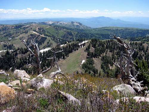
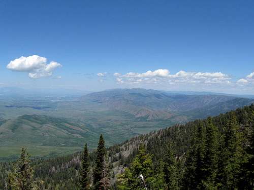
The views are truly outstanding as on a clear day the panorama you are going to see is literally breathtaking.

Getting There
LOCATION19 miles northeast of Ogden, Utah
55 miles north of Salt Lake International Airport.
DIRECTIONS FROM SALT LAKE CITY
Take I-15 north to Ogden’s 12th Street,
turn east and follow the signs through
Ogden Canyon.
Check out the linked map for more detail
The road leading up from Eden, is 7 miles and a good mountain road. Paved all the way and not a problem for normal passenger vehicles with low clearance. Just after the junction at Eden, you will find yourself entering a very congested area (condo's and time shares and private residences) in the first two miles and then it is smooth sailing all the way up to the large lot at the 8000-8100 foot level. In the first two miles, be alert for children and bicyclists.
Summit view to west
Route
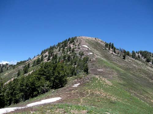
From the large parking area near the top (mentioned above), I picked a route up the hillside to a ridge at the 9000 foot level and a sign denoting the Big Kash ski run. The way to the peak dropped down from there about a hundred and twenty feet and then climbed up to the summit which was about 500 feet higher and a half mile from the ridge. A use path made the direction obvious and a small talus slope near the top could be almost entirely bypassed. The summit contained a Benchmark (Wolf Creek) and a cairn, a large cairn. Nestled amongst the cairns rocks was a very nice white tube that served as the register container. A large notebook and pencil were inside the white poly container. Of course, in the winter the cairn and register will likely be covered with snow.Overall, it took me about two hours round trip and required a bit over 2 1/2 miles round trip with 1500 feet of elevation gain.
In snow, you could probably snowshoe up the slope and work your way up the mountain, using common sense in your approach and good judgement of the conditions. Skiing is also another way to access this peak but having no experience in skiing this mountain area, I will leave that information up to someone who can provide it.

Peakbagger.com has several trip reports and a register of those who have climbed it. As of 2015, twenty three had indicated that they had climbed this summit.
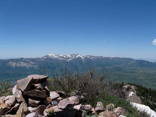
Looking north to Logan Peak
Red Tape
Since you are on a privately owned ski area, respect property rights and leave no trace. At this moment, it is no problem to access the peak from just about any direction in the ski area. Avoid the private homes and structures.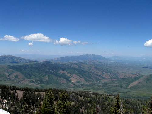
Views are what makes this peak special
Camping
No camping but lodging is available in Ogden and Salt Lake City.
Register
Weather
Powder Mountain Weather reportEDEN
hgrapid - Jun 22, 2009 11:37 am - Hasn't voted
Latitude and LongitudeDean, I noticed you hadn't found the latitude and longitude for this mountain. Here they are: 41°23'29.31"N 111°47'34.15"W
Dean - Jun 22, 2009 12:55 pm - Hasn't voted
Re: Latitude and LongitudeI have them but I just forgot to put them in. A late night page always has something that you forget to put in. Thanks for the reminder. I use lat / long nad 27 though but I appreciate your gesture.