
|
|
Mountain/Rock |
|---|---|
|
|
36.33545°N / 50.98113°E |
|
|
Mountaineering |
|
|
13963 ft / 4256 m |
|
|
Overview
Click for Introduction to the Central Alborz Mountains.Click to see the Map of the Takhte Soleyman Massif.
My GPS measured an elevation of 4270 m. The 4256 m figure is per the 1:50 000 Iranian Map.
In Farsi: LASHGARAKE BOZORG
 North Face
 NE Face
 Lashgarak, Gardoonek Kooh & Marji Kesh
Lashgarak the Great is one of the southern peaks of the Takhte Soleyman Massif. To the south, Lashgarak the Great is connected to the 4184 m Lashgarak the Small Peak and to the northwest, it is connected to the 4402 m Gardooneh Kooh Peak (via a high point known as Hezar Cham Peak). On the slopes below the saddle between Lashgarak the Great and Hezar Cham you will find a large permanent snow field. A small lake sits at the bottom of this snow field.
 South Face
The northern slopes of Lashgarak the Great are gentle and go down to reach a plateau named Hesar Chal which has an elevation of 3600 to 4000 m. These slopes are ideal for back country skiing. The southern slopes of Lashgarak the Great go down to reach a branch of the Shah Rood (Taleghan) River and its eastern slopes reach a branch of the Chalus River.
 Southwest Face Southwest Face |  South Face South Face |
 North Face
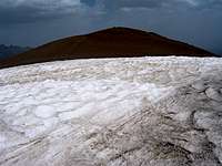 Summit
Lashgarak the Great can be approached from the northeast starting at the village of Roodbarak or from the south starting at the village of Parachan. Round trip usually takes two days. Most people who come to the area, climb Lashgarak the Great along with its nearby peaks in a multi-day program. The Hesar Chal Plateau is an ideal place for establishing a base camp to tackle the peaks.
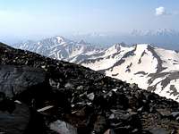
VIEWS FROM THE SUMMIT OF LASHGARAK THE GREAT:
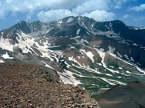 Alam Kooh
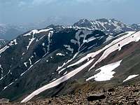 Kalvan & Meeshchalak Kalvan & Meeshchalak | 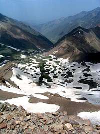 Hesar Chal Hesar Chal |  Avidar Avidar |
 Gardooneh Kooh, Hezar Cham, snowfield and lake
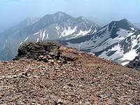 Zarrin Kooh & Alaneh Sar Zarrin Kooh & Alaneh Sar | 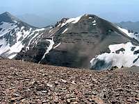 Lashgarak the Small Lashgarak the Small |
Getting There
From downtown Tehran drive 40 km west to the town of Karaj and take the Karaj-Chalus Road north (This road crosses the Alborz Mountains taking you through the Kandovan Tunnel to the Caspian Coast). 30 km south of Chalus, you will reach the town of Marzan Abad. Turn left and follow a side road into the Sardab Rood River drainage and to the town of Roodbarak. Distance from Tehran to Roodbarak is roughly 200 km. A branch of Taleghan Valley