|
|
Mountain/Rock |
|---|---|
|
|
36.06620°N / 51.55120°E |
|
|
14393 ft / 4387 m |
|
|
Overview
Click for Introduction to Central Alborz Mountains
Click for Nader's map of Kholeno area
Click for Nader's map of Dizin/Kandovan area
| North face: |
 [by] [by] |
| Notes |
|
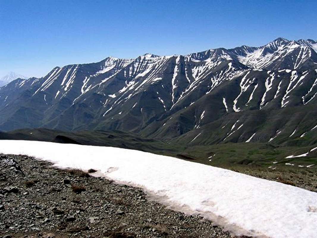
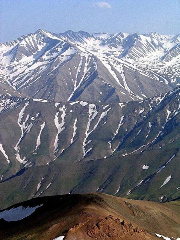
Kholeno is located in Noor mountains ridgelines a sub division of central Alborz, limited by Karaj-Chaloos road from west, Gachsar-Dizin-Meeygoon road from south, Baladeh road from north and end tips of the ridges from east. There is an ambiguity in minds and some resources that Kholeno is the tallest peak of the Noor mountains, but according to reliable maps and sources Kholeno(4387m) has been mistaken by Azadkouh(4390m), well only 3 meters who knows the truth ! Damavand(5671m)>Takht-e-Soleimans(4390+m)>Azadkouh(4390m)>Big Kholeno(4387m)
|
| Topography and location |
Noor mountains are made of some almost east-west parallel 4000m+ high ridgelines. Three of them from south to north are:
1 and 2 have a junction at east by Sarakchal(4210m) and Borj(4326m) at Varzab pass(4018m).
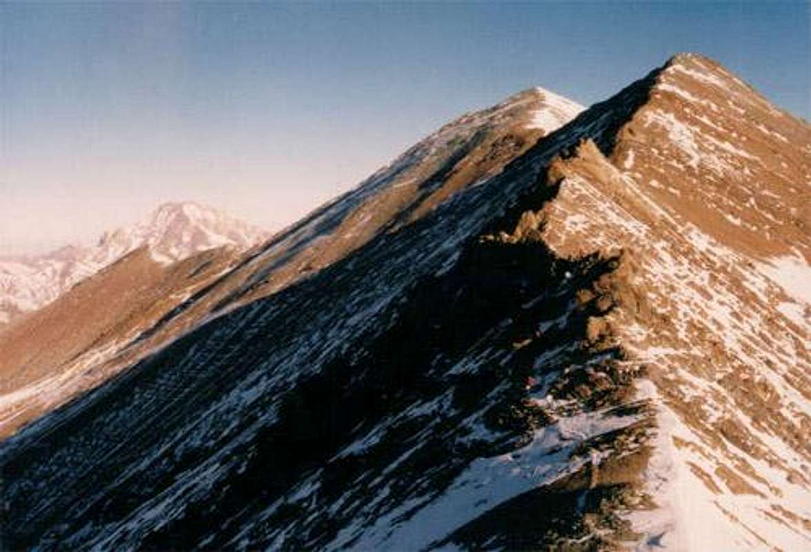
Kholeno has three main ridges 1-2-3 make the south ridge, 3-4-5-6-7-8 make the north-east ridge and 3-Asbichal(4200m) makes the north-west ridge also from north by a narrow flank Big Kholeno drops down to Sarkharsang valley and Varangroud valley. Summery: Kholeno is located north to Laloun village and at the end tip of Varangroud valley.
|
| General information |
|
| Being one the second highest summit of the Noors, many mountaineers climb it every year it would be an easy summer climb but a challenging winter attempt. Standing on the peak you will have a big panorama of Alborz, from Takht-e-Soleimans to Damavand. The nearest village to the peak is Laloun still so far, camping near Kholeno would be a pleasure. |
| South ridge |
 |
Getting There
| South face | From Tehran drive Sadr and Babaee freeways -> turn right into Lashgarak road -> drive to Shemshak village or Laloun village (depends on demanded route). (about 70Km / 1 hour driving) Laloun starting route: Climb Small Kholeno then big Kholeno via Borj(4326m) Shemshak starting rout: Climb Sarakchal(4210) reach Borj via Varzab pass then climb Small Kholeno and Big Kholeno |
| North face | From Tehran drive the freeway about 40Km to Karaj, drive 71Km inside Karaj-Chalous road to Gachsar, turn right and drive less than 10Km before Dizin turn north to Varangroud village (I don't know if this need permission or not but there is a sign for entering Varangroud that says something like Alborz protected area, don't enter ...) From Varangroud village have a long hike until you reach the end. |
Red Tape and Regional Hints
| The whole Alborz mountains area and it's wild nature is a protected place, hunting, fishing and abusing the nature is prohibited |
| No fees of permission is required for climbing or camping |
| No problem for camping but avalanche danger ! |
When To Climb
| Best | Late spring and early autumn (June, July, September and October) |
| Photography | Winter and spring |
| Summer | Fairly easy, takes two days but if you are in shape and speedy you can do it in one day |
| Winter | Takes several days, known as one of the hardest attempts of central Alborz, being far from base, mass of snow, snow caps, rocks on the route and frequent unexpected storms would reduce the chance of reaching the peak |
Mountain Conditions
| Summer (June-October) | Weather is clear, isolated thunderstorms may occur, if precipitation occurs it will be snow or sleet in higher elevations. |
| Winter | Heavy snow, serious snow caps along the ridge lines, frequent snow storms and wild wind all the time. |