
|
|
Mountain/Rock |
|---|---|
|
|
36.38330°N / 50.96220°E |
|
|
Mountaineering |
|
|
Summer |
|
|
14648 ft / 4465 m |
|
|
Overview
NOTES:Click for Introduction to Takhte Soleyman Massif.
Click for a map of Central Alborz.
Click for a map of Takhte Soleyman Massif.
Click for an aerial photo of Takhte Soleyman Massif.
My GPS/altimeter showed the elvation of this peak to be 14690 ft (4478 m). The 4465 m figure is per the 1:50 000 map listed below.
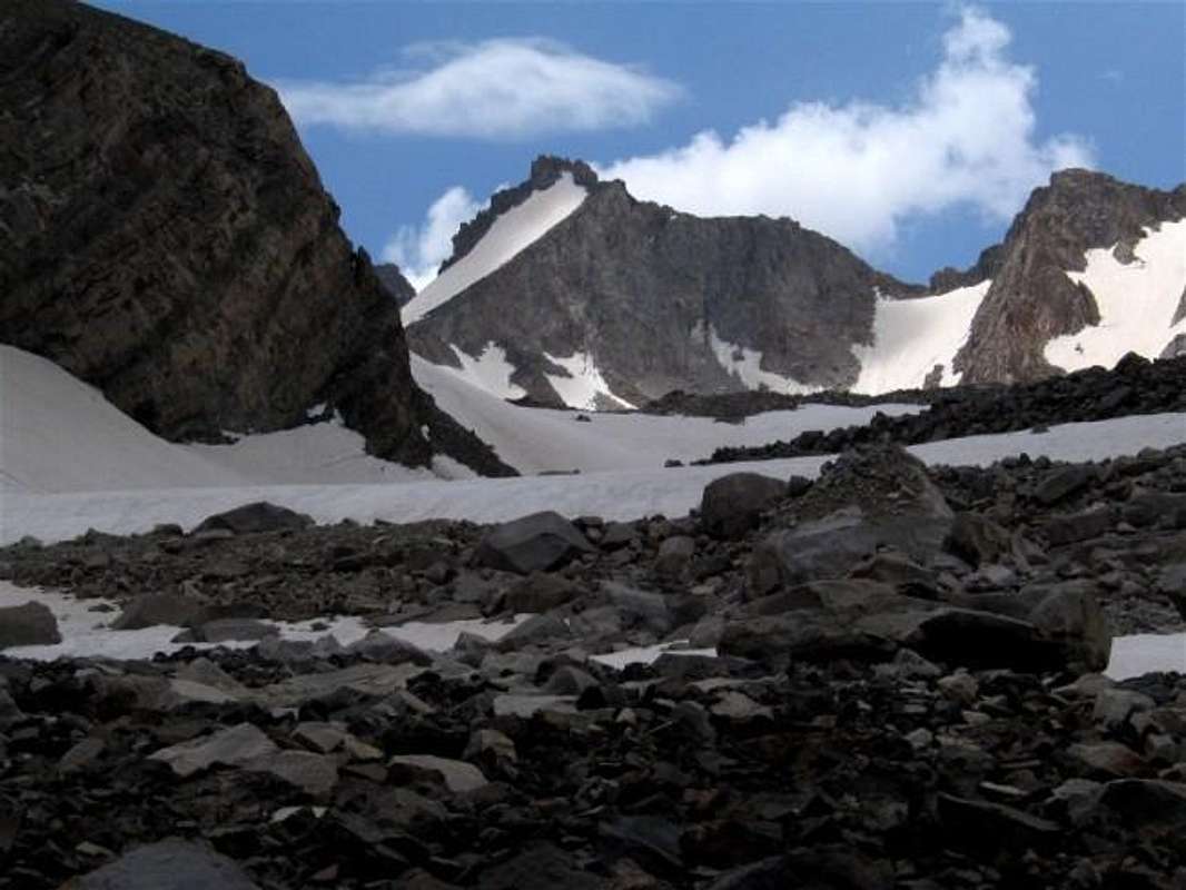
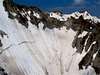
Looking west at Shaneh Kooh rising at the upper end of the valley of Pa Takht Glacier.
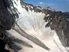
Looking east at Shaneh Kooh. From the junction of the valleys of Split & Haft Khan Glaciers
OVERVIEW:
A high peak dwarfed by the giants to the north and south of it!
 Shaneh Kooh & Takhte Soleyman
 Shaneh Kooh & Alam Kooh
From far away, Shaneh Kooh may appear as a bump on the ridgeline that connects the 4850 m (15912 ft) summit of Alam Kooh to the 4659 m (15285 ft) Takhte Soleyman Peak. Close up, however, Shaneh Kooh proves to be a formidable peak in its own right.
The Alam Chal and Pa Takht Glaciers sit to the east of Shaneh Kooh. A one km (0.65 mile) long ridgeline starts at the base of the summit of Shaneh Kooh and heads northeast separating the mentioned glaciers and ending in the summit of Mian-Se-Chal. To the west of Shaneh Kooh, you will find a high glacially carved cirque that leads down to the tail end of the Haft Khan Glacier. On the southern slopes of this cirque (northwestern wall of Alam Kooh), there is a very steep snow bank that is known as Split Glacier (because of a huge crack in the middle of it PIC1, PIC2).
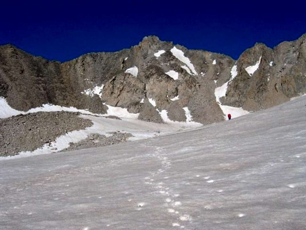
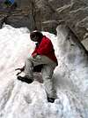
Shaneh Kooh is usually climbed via its eastern slopes. The starting point is the village of Roodbarak (elevation 1400 m, 4700 ft). On day one, you hike from Roodbarak to the 3750 m (12300 ft) Sar Chal Shelter (more about this under Route). On day 2, you climb the mountain and descend to Sar Chal or Roodbarak. From Sar Chal shelter you could bag Shaneh Kooh along with Mian-Se-Chal and Takhte Soleyman Peak in one day. The shortest way from Sar Chal Shelter to Shaneh Kooh is via the valley of Pa Takht Glacier but the "usual route" takes you through the valley of Alam Chal Glacier. The last 50 m (150 ft) of Shaneh Kooh consist of steep slopes that are usually covered with snow. An ice axe may come in handy here (but is not "required"). The very top is made of a series of pinnacles that require class III or class IV climbing.
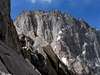
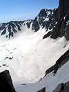
From the summit of Shaneh Kooh you get great views of the Pa Takht, Alam Chal, Split and parts of the Haft Khan Glaciers. To the south, the magnificent wall of Alam Kooh towers 385 m (1265 ft) above you.
 |  |  |  |  |
 Looking west at Shaneh Kooh rising at the upper end of the valley of Alam Chal Glacier
Getting There
See Map.From downtown Tehran drive 40 km west to the town of Karaj and take the Karaj-Chalus Road north (This road crosses the Alborz Mountains taking you through the Kandovan Tunnel to the Caspian Coast). 30 km south of Chalus, you will reach the town of Marzan Abad. Turn left and follow a side road into the Sardab Rood River drainage and to the town of Roodbarak. Distance from Tehran to Roodbarak is roughly 200 km (125 miles)
 |  |  |  |  |
Red Tape
I am not aware of any permit or fee requirement. Hunting will require a license. |  |  |  |
When To Climb
June to October is the ideal season. Climbing in winter will obviously be much harder due to extreme cold and heavy snow cover.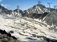 |  | 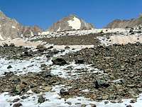 | 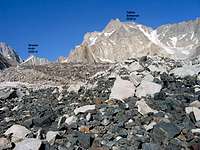 |
Camping
Accommodations are available at the Iran Mountaineering Federation Hotel in Roodbarak (call Mountaineering Federation at 98 21 8839928).Sar Chal Shelter (3750 m, 12300 ft), or camp anywhere.
Mountain Conditions
In summer, the weather is generally clear. Unexpected thunderstorms do occur frequently. Precipitation at higher elevations will almost always be in the form of snow/hail.Miscellaneous Info
TOURS/GUIDES:If you are not familiar with these mountains, you will greatly benefit from the presence of a guide. I worked with Araz Adventure Tours and was very satisfied with their services. They were flexible, courteous and knowledgeable and were able to custom design an 8 day trekking tour allowing me to climb the lesser known peaks of the area. My guide: Mr. Rasool Naghavi was a kind man who was a native of Roodbarak and knew the mountains like the back of his hand. Having climbed Everest and several other Himalayan giants made him, in my opinion, one of the most qualified guides for these mountains.
MAPS:
1) The most accurate topographical maps of the area are those with a scale of 1:50 000 (contour lines of 20 m) provided by the Iranian Armed Forces. You will need sheet #6162 I "Shahrestanak" for Shaneh Kooh and Alam Kooh (To fully cover the entire Takhte Soleyman Massif, you will also need sheet #6262 IV "Rudbarak"). These maps are available in Tehran at the Geographical Office of the Armed Forces on Moalem St. (98 21 8408088) for the equivalent of $3 per sheet (in 2004). Outside of Iran, the same maps can be purchased at www.cartographic.com for the exorbitant price of $150 per sheet (in 2003). These maps are in Farsi. While they give the exact elevation of most of the peaks, they do not give the names of the individual peaks.
2) Soviet Military Maps sheet # J-39-126-G available at www.omnimap.com. I do not recommend this map. It seems as if the creators of this map lacked detailed info and eliminated many of the lower peaks.
3) Different schematic maps available in Iran. My favorite is the "Guide Map of Takht-e-Soleiman & Alam Kuh Region" by Iran Kuhro Co. available at Varzesh Kooh store, Ferdowsi Sq., Tehran (98 21 8826642).
External Links
- Map of Takhte Soleiman area
Main peaks : Alam Kooh , Khersan , Takhte Soleiman , Haft Khan peaks , ...