
|
|
Mountain/Rock |
|---|---|
|
|
36.37299°N / 50.97746°E |
|
|
Mountaineering |
|
|
Summer |
|
|
15105 ft / 4604 m |
|
|
Overview
Click for Introduction to the Takhte Soleyman Massif.Click for a map of the Central Alborz Mountains.
Click for a map of the Takhte Soleyman Massif.
Click for an aerial photo of the Takhte Soleyman Massif.
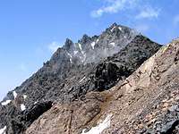
 NE Face
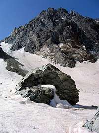 NE Face
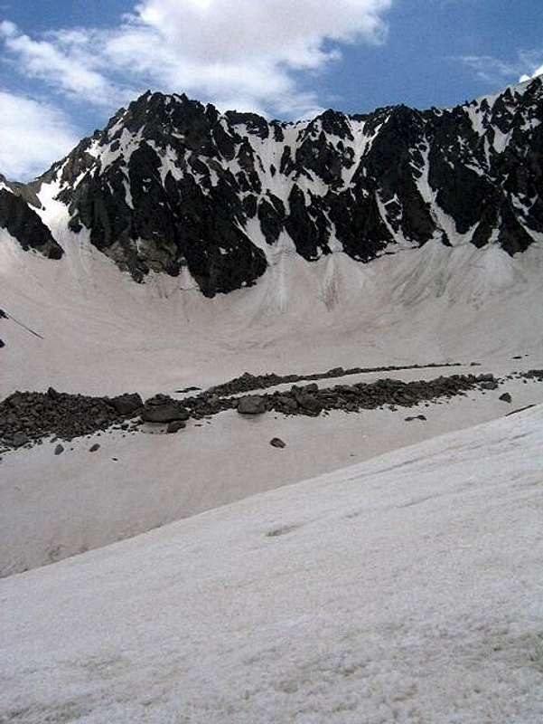
"Siah" means "black" and "Sang" mean "stone"(rock).
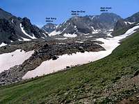
Siah Sang is a black rocky peak that rises above the Alam Chal Glacier near the 4850 m Alam Kooh Peak in the Takhte Soleyman Massif of Central Alborz Mountains in northern Iran. To the west, a rocky ridgeline connects Siah Sang to the 4700 m Alam Kooh Shakhak #5 (Shakhaks refer to horn-like subpeaks of Alam Kooh). West of the summit of Siah Sang, the ridgeline continues for less than a kilometer and drops very little in elevation before it sharply rises to the top of Shakhak #5. For this reason, when viewed from Alam Chal Glacier, Siah Sang appears as a mountain with a very long summit. From Sar Chal Shelter, however, this feature is not evident.
To the NE the 4400 m Chaloon Pass separates Siah Sang from the 4516 m Chaloon Peak. The northern slopes of Siah Sang rise directly above the Alam Chal Glacier. The elevation of the glacier at the base of Siah Sang is roughly 4200 m. To the south and east, the slopes of Siah Sang lead to the valleys of Marji Kesh and Chaloon Glaciers. (click to see a photo of Siah Sang rising above the Marji Kesh Glacier).
The summit of Siah Sang is on the "usual" non-technical route for climbing the nearby Alam Kooh Peak. Climbing Siah Sang takes three or at least two days. The starting point is the village of Roodbarak (elevation 1400 m) to the northeast. On day one, you will hike or drive a 10 Km long dirt road to a place known as Vandar Bon (2300 m) where you can follow a trail up the "Barir" drainage to reach the Sarchal Shelter (3750 m, a 4 hour hike). On the second day, you can climb Siah Sang and return to the shelter or Roodbarak. From Sarchal Shelter, you will hike 3.5 Km up the tail end of the Alam Chal Glacier to near the base of the Siah Sang Peak (4200 m) where you will have to go up a steep rocky slope to the 4400 m Chaloon Pass. You will then have to do intense Class III scrambling 200 vertical meters up the rocky slopes to access the summit. Arrows painted on the rock and safety cables installed in critical spots highlight the route. The presence of snow until early-late July, can turn this into a technical climb. The danger of rockfall is high. From the summit of Siah Sang, you will still have to traverse another 1.5 Km on the rocky slopes of the Shakhaks (sub-peaks) of Alam Kooh before you will be able to tackle the summit of Alam Kooh.
 From Sarchal Shelter From Sarchal Shelter |  North Face North Face | 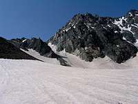 Base of the Summit Base of the Summit | 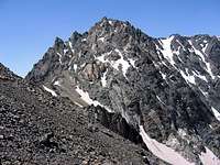 Summit Summit |
 |  |
Getting There
 Summit
 Summit
See map.
From downtown Tehran drive 40 km west to the town of Karaj and take the Karaj-Chalus Road north (This road crosses the Alborz Mountains taking you through the Kandovan Tunnel to the Caspian Coast). 30 km south of Chalus, you will reach the town of Marzan Abad. Turn left and follow a side road into the Sardab Rood River drainage and to the town of Roodbarak. Distance from Tehran to Roodbarak is roughly 200 km.
 |
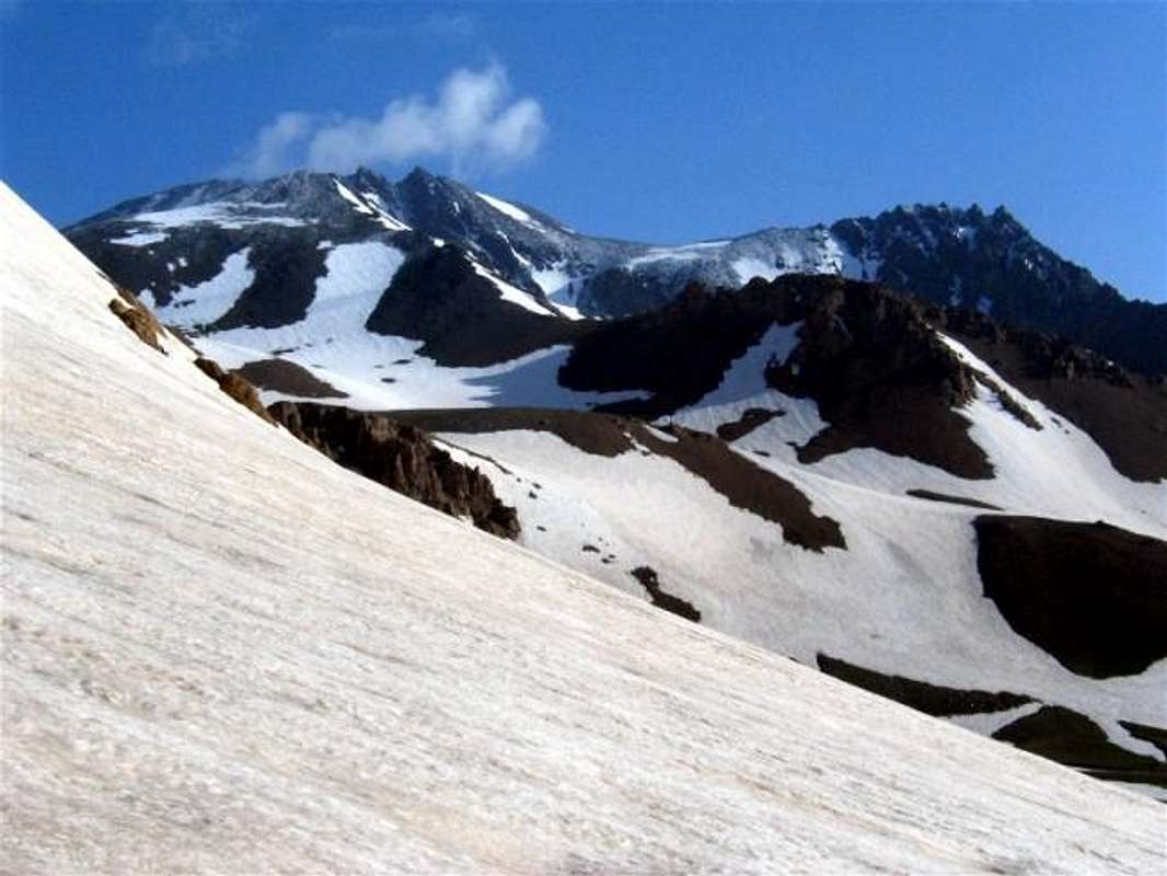
 South Face South Face |  North Face North Face | 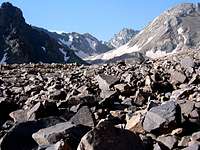 North Face North Face | 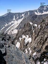 Alam Chal Glacier Alam Chal Glacier |
Red Tape
No fees or permits required. |  |  |  |
When To Climb
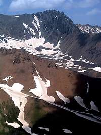
The southern slopes of Siah Sang (on the far right). Alam Kooh and its sub-peaks to the left
June to October is the ideal season. Climbing in winter will obviously be much harder due to extreme cold and heavy snow cover.
Camping
Accommodations are available at the Iran Mountaineering Federation Hotel in Roodbarak (call Mountaineering Federation at 98 21 8839928).Sar Chal Shelter (3750 m, first come first served) can accommodate close to 200 people, or camp anywhere.
.