
|
|
Mountain/Rock |
|---|---|
|
|
36.37200°N / 50.93880°E |
|
|
14885 ft / 4537 m |
|
|
Overview
NOTES:Click for Introduction to Takhte Soleyman Massif.
Click for a map of Central Alborz.
Click for a map of Takhte Soleyman Massif.
Click for an aerial photo of Takhte Soleyman Massif.
My GPS/altimeter showed the elevation of this peak to be 14940 ft (4554 m). The 4537 m figure is per the 1:50 000 map listed below.
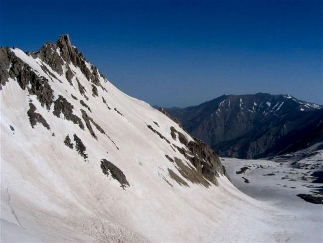

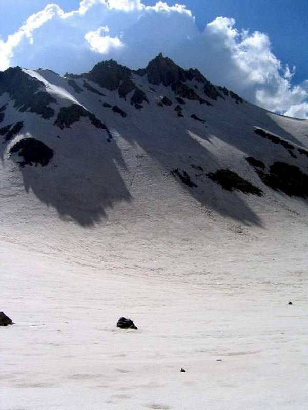
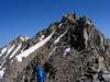
The Haft Khans are a series of jagged peaks that rise above the largest glacier in Iran in one of the remotest corners of the Takhte Soleyman Massif. Difficult access and rugged beauty give these mountains a mysterious and magical aura.
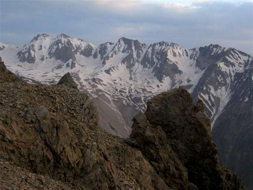
The main spine of the Takhte Soleyman Massif is made of a 19 km (12 mile) long ridgeline that is entirely above 4000 m (13123 ft).A branch ridgeline starts in the mid/southern portions of the main spine and heads northwest. This branch is 5.2 km (3.25 miles) long and is also entirely above 4000 m. Haft Khan Peaks rise on the crest of this branch.
Up to 22 peaks/high points have been identified along the length of the Haft Khan ridgeline. The most prominent of these peaks are (southeast to northwest):
Haft Khan #1 4537 m (14885 ft)
Haft Khan #2 4528 m (14856 ft)
Haft Khan #7 4389 m (14400 ft)
Haft Khan #5 4457 m (14623 ft)
Peak 4376 m (14357 ft)
Peak 4324 m (14186 ft)
(The northwestern-most peaks are sometimes referred to as Langari Peaks)
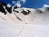
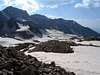
Between the main spine of the Takhte Soleyman Massif and the Haft Khan Ridgeline there is a large and gently sloped valley that is 3850-4250 m (12600-13900 ft) high. This valley houses the Haft Khan Glacier which is said to be the largest glacier in Iran. The northeastern slopes of the Haft Khan Peaks create dramatic walls that rise above the Haft Khan Glacier. To the southwest, the seemingly endless scree slopes of these peaks drop 1300-1500 m (4200-5000 ft) into the Garma Rood (Sehezar) River Valley.
The usual route to the Haft Khan summits is via the 4400 m saddle that separates them from the rest of the Takhte Soleyman Massif. This saddle is a two day hike from any trailhead. The possible approaches are (see map):
1) Via Shaneh Kooh Peak (Roodbarak Village-Alam Chal Glacier-Shaneh Kooh Peak-Haft Khan Glacier-saddle)
2) Via Menareh Peak (Roodbarak Village-Hesar Chal-Menareh Peak-saddle)
3) Via Sehezar valley to the west (I have no information on what you might encounter on this route. Any detailed info is welcomed)
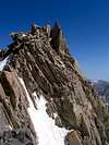
From the saddle, you will hop amongst the boulders on the top of the ridgeline doing intense class III scrambling and going over three lower peaks/high points to reach the summit of Haft Khan #1 which is the highest of the Haft Khan Peaks. This peak is also known as “Soozan Sar” (Needle Head) because of the many small spires on the summit of it. From the prickly summit of Haft Khan #1, you will have a unique perspective on the Takhte Soleyman Massif to the east. The largest glacier in Iran will be 350 m (1150 ft) below your feet. Other nearby peaks of Central Alborz outside of the Takhte Soleyman Massif will also be in good view. The Haft Khans are rugged and rarely climbed peaks that are perfect for those who love to do ridge-top scrambling in a pristine alpine setting.
The term “Haft Khan” refers to the seven great obstacles that “Rostam” the legendary hero of the pre-Islamic Persian Empire had to overcome. The stories of Rostam have been forever immortalized by “Ferdowsi” the great Persian poet who lived in the 10th century A.D. A very appropriate name for these challenging peaks.
Getting There
See Map.From downtown Tehran drive 40 km west to the town of Karaj and take the Karaj-Chalus Road north (This road crosses the Alborz Mountains taking you through the Kandovan Tunnel to the Caspian Coast). 30 km south of Chalus, you will reach the town of Marzan Abad. Turn left and follow a side road into the Sardab Rood River drainage and to the town of Roodbarak. Distance from Tehran to Roodbarak is roughly 200 km (125 miles)
 |  |  |  |  |
Red Tape
I am not aware of any permit or fee requirement. Hunting will require a license.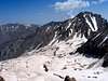 |  | 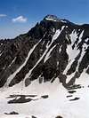 |  |  |
When To Climb
June to October is the ideal season. Climbing in winter will obviously be much harder due to extreme cold and heavy snow cover. | 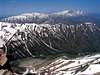 | 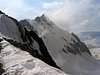 |  |  |
Camping
Accommodations are available at the Iran Mountaineering Federation Hotel in Roodbarak (call Mountaineering Federation at 98 21 8839928) or camp anywhere. | 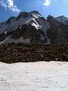 |
Mountain Conditions
In summer, the weather is generally clear. Unexpected thunderstorms do occur frequently. Precipitation at higher elevations will almost always be in the form of snow/hail |  |  |  |  |
Miscellaneous Info
TOURS/GUIDES:If you are not familiar with these mountains, you will greatly benefit from the presence of a guide. I worked with Araz Adventure Tours and was very satisfied with their services. They were flexible, courteous and knowledgeable and were able to custom design an 8 day trekking tour allowing me to climb the lesser known peaks of the area. My guide: Mr. Rasool Naghavi was a kind man who was a native of Roodbarak and knew the mountains like the back of his hand. Having climbed Everest and several other Himalayan giants made him, in my opinion, one of the most qualified guides for these mountains.
MAPS:
1) The most accurate topographical maps of the area are those with a scale of 1:50 000 (contour lines of 20 m) provided by the Iranian Armed Forces. You will need sheet #6162 I "Shahrestanak" for Menareh and Alam Kooh (To fully cover the entire Takhte Soleyman Massif, you will also need sheet #6262 IV "Rudbarak"). These maps are available in Tehran at the Geographical Office of the Armed Forces on Moalem St. (98 21 8408088) for the equivalent of $3 per sheet (in 2004). Outside of Iran, the same maps can be purchased at www.cartographic.com for the exorbitant price of $150 per sheet (in 2003). These maps are in Farsi. While they give the exact elevation of most of the peaks, they do not give the names of the individual peaks.
2) Soviet Military Maps sheet # J-39-126-G available at www.omnimap.com. I do not recommend this map. It seems as if the creators of this map lacked detailed info and eliminated many of the lower peaks.
3) Different schematic maps available in Iran. My favorite is the "Guide Map of Takht-e-Soleiman & Alam Kuh Region" by Iran Kuhro Co. available at Varzesh Kooh store, Ferdowsi Sq., Tehran (98 21 8826642).
nader - Nov 9, 2004 7:21 pm - Hasn't voted
Untitled CommentThanks for the map. The only problem is that the Haft Khans fall just outside of that map. You can use the link on top of the main page to see the topographic map I made.
Damavand - Nov 9, 2004 1:46 pm - Voted 10/10
Untitled CommentMap of Alam Kooh and Takhte Soleiman peaks .
Damavand - Nov 9, 2004 2:29 pm - Voted 10/10
Untitled CommentYou can see also more informatoin about Haft-Khan peaks and its ridge in this page of summitpost :
Haft-Khaan ridge
nader - Nov 9, 2004 7:21 pm - Hasn't voted
Untitled CommentThanks for the map. The only problem is that the Haft Khans fall just outside of that map. You can use the link on top of the main page to see the topographic map I made.
babri - Nov 17, 2020 11:47 pm - Voted 10/10
ElevationMore accurate elevation of the prominent peaks can be read from Iran Coverage Map (1:25000). Measurement method is aerial imagery with 1:40000 accuracy, done in 2010' decade. The results for aforementioned peaks are as below: Haft Khan #1 4539 m Haft Khan #2 4531 m Haft Khan #7 4390 m (actually not a prominent peak) Haft Khan #5 4455 m Haft Khan #8 4378 m Zard 4316 m
nader - Nov 18, 2020 1:49 pm - Hasn't voted
Re: ElevationThank you for this info. My page is now 16 years old and the elevations that I used came from maps that are now probably 30+ years old. Since the numbers that you gave are not that different than what appears on my page, I will not make any changes for now.
babri - Nov 23, 2020 4:18 am - Voted 10/10
Re: ElevationI should thank you for Central Alboz topographic maps you created. Those maps were the most accurate free maps on the web and I used them several years for hiking, effectively.
nader - Dec 1, 2020 5:56 am - Hasn't voted
Re: ElevationThank you for saying that. I am glad you found them helpful.