

|
|
Area/Range |
|---|---|
|
|
49.16869°N / 18.60123°E |
|
|
Hiking, Trad Climbing, Sport Climbing, Toprope, Bouldering |
|
|
Spring, Summer, Fall, Winter |
|
|
2844 ft / 867 m |
|
|
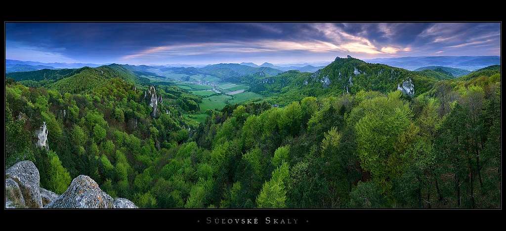
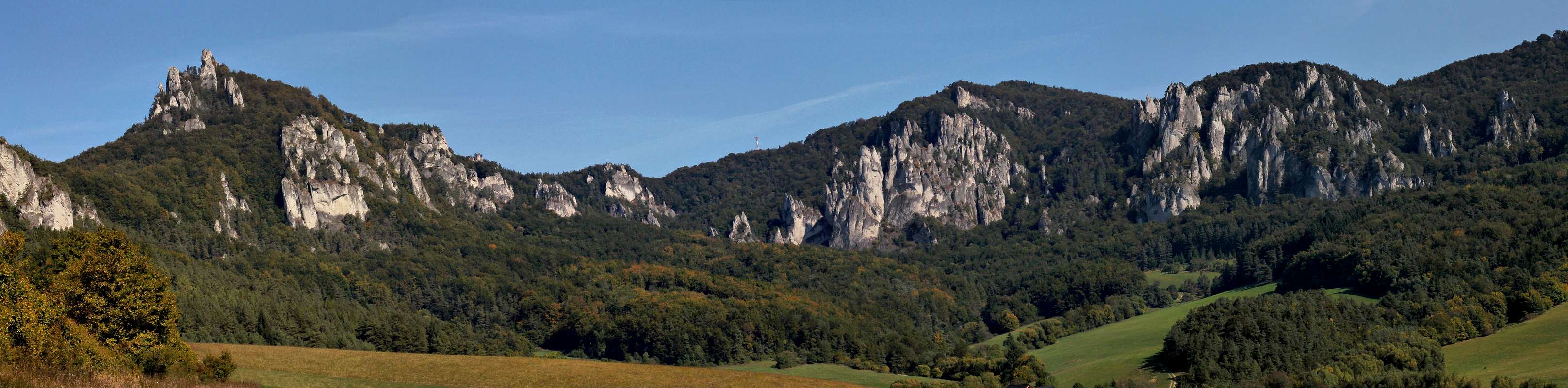
Overview
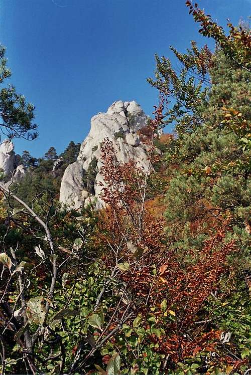
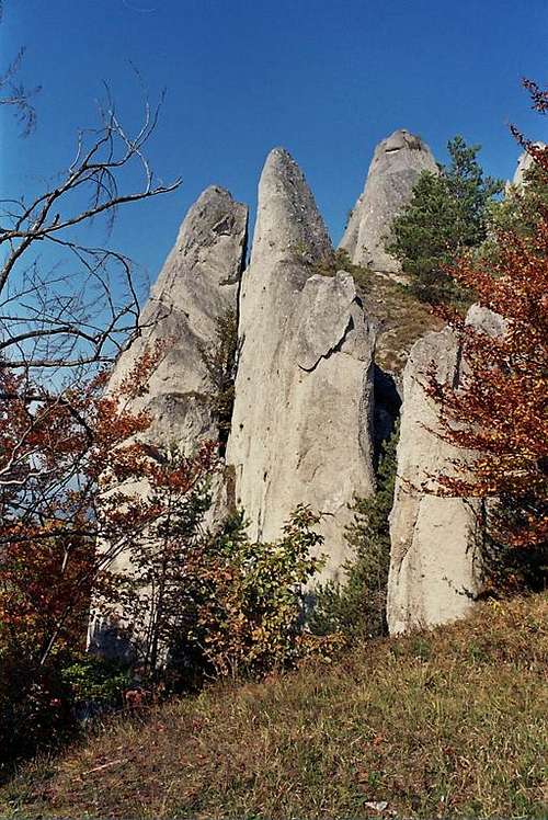
The Súľovské skaly, meaning the Rocks of Sulov, are the most interesting, craggiest part of a mountain range called the Súľovské vrchy, which is often considered part of a much larger mountainous area known as the Strážovské vrchy (Strážov, 1213m), bounded by the southern part of the Little Fatra range (Lúčanská Mala Fatra) on the east and the Váh River on the west and north. The most interesting part of the Sulov Rocks forms the northwest and north rim of the little basin in which the village of Súľov sits. It has been designated a nature reserve. This is just about a dozen kilometers WSW of the city of Žilina, one of the largest in Slovakia. Thanks to the nature of the local calcareous rocks, mostly conglomerate, a fantastic stone forest – made up of countless rock pinnacles and needles bearing some resemblance to the great karstic formations of China or Madagascar - has developed here. And this lures both the hiker and the climber.
As previously explained, the Súľovské skaly is a subrange of the Súľovské vrchy, which sit between the Váh and Rajčanka rivers. The Súľovské vrchy are composed of three parts:
|


Getting there

The Súľovské skaly sit in the vicinity of Žilina, which is very easily accessible from every corner of Slovakia by road or rail. From Žilina, head for Bytča, where you turn left in the direction of Súľov (8-10 km from the main road; 15 minutes by bus from the railway station).
Trains/Buses in Slovakia
Rock Climbing
The Sulov conglomerate can be compared to concrete (in fact it is kind of limestone) dotted with stones of various size and holes where the stones have dropped out. Rock climbers marvel at the excellent friction, characteristic of these crags. Nearly all of the routes are bolted, the typical length is 20 to 40 meters.
The beginning of climbing in the Súľovské skaly dates back to the time of World War II. The first climbers were German soldiers who found a route to the summit of Brada. Other routes were created on Mních, Sokolia veža, Veža nad Ohniskom, Budkova veža, Jazdec etc. By the 1960s, all major towers, needles and chimneys had been climbed and the Súľovské skaly were largely abandoned. In the 1970s the area was re-discovered by the local climbers. The next generation started using different techniques and protection and more difficult routes were blazed. In the beginning of 1990s, climbing reached the UIAA grade X- (10-) in terms of difficulty.
There are two main climbing areas, located near each other, about 45 minutes' walk from Súľov via the red trail and Lúka pod hradom (Meadow under the Castle): Javor and Hrad.
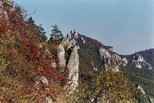 Just past Rapsódia v modrom, Brada in the background - photo by Bocian
! In order to protect endangered bird species, such as falcons and the black stork, rock climbing in the area of Brada – possible until quite recently - has been banned. Not all routes listed below may currently be available. Also, the number of routes one is allowed to climb is always much bigger throughout the second half of the year. (Please see the Red Tape chapter.)
Some of the Routes (and UIAA grades):
Area of Javor
Školská veža (Halabala 4, See the light 7-, Prázdne zrkadlo 8+/9-, Spomienka 9-)
Tisícročná veža (Něco za něco 7-, Viagra 7/7+, Čierna diera 8-)
Podsvetie (Vrásky starého otca 5)
Veterná (Limonáda 6, Climbing for you 7-, Lego 7, Domino 8+, Olymp 10+)
Veža nad ohniskom (Vaničky 7-, Žltá mašľa 8, Hrana 1624 9, Nový zákon 10-, Dio 10-/10)
Kamenná tabuľa (Cesta k lavičke 4, Vajdátor 6, Adrenalín 7+, Rodeo 8, Súľovské návraty 10-/10)
Kozie diery (Neisté publikum 8, Zbierka hriechov 8+)
Neviniatko (Kakavko 7-, Vnútorné zlo 8-, Divočina 8+,)
Sokolíky (5-P 8, Fortuna 9, Laguna 9+, Čertovské prsty 9+)
Kameň mudrcov (Sibila 7, Nostradamus 8-, Ezechiel 8)
Area of Hrad
Vyhliadka (Hurá systém 5, Dejavu 8+, Kiss me 8+ )
Obelisk (Niagara 6-, Tahiti 6+, Bermudy 7 , Beštia 8+)
VPN (Scrabánia 5, Venušino čaro 6-, Odysea 7, Matrix 8, Runway 8+)
Chrám (65000mm 7-, Hombré 7, Kamasutra 7+)
Zrkadlo (Mrkvička 5, Rapsódia v modrom 6-, Presýpacie hodiny 7, S odretými ušami 8)
Harfa (Katedral 5, Kopa zlosti 6, Cháron 7, Sťahovaví vtáci 8)
Krídlo (Stratený svet 6, Lancelot 7+, Camelot 8-, Prirodzená autorita 8, Extáza 9/9+)
Trojzubec (Climbing for all 4, New Age 6, Adela ešte nevečerala 7-, Artuš 8-, Bláznivý projekt 9-)
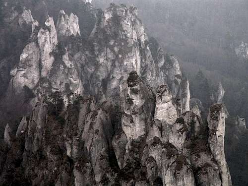
 Brada - both photos by Bocian Brada - both photos by Bocian |
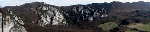
 Skaly pod Hradom Skaly pod Hradom |
Hiking
Talking of the non-technical, hiking objectives, the route not to be missed is the following (see the online map in the Maps chapter):Gorge of the Hradnianka-Lúka pod hradom (green marks, 1.25 h):
The (interpretive) trail leads past the 13-meter-tall Gothic Gate, then climbs to the summit of Hrad, where a medieval castle stood of which hardly anything has survived to this day. (There are several interesting, better preserved constructions, on hilltops around Súľovské vrchy, such as Lietava or Považský castles.) The summit offers an interesting, westerly view of the narrow ridge, beyond the Hradnianka gorge, towards the Strážovské vrchy proper. The easterly view is pretty as well.
 On the summit of Hrad: Looking east.
then
Lúka pod hradom-Brada-Roháč (red marks, 1.25 h):
Lúka pod hradom is a little clearing from which the red marks run through the forest to excellent vantage points, such as Stefanikova vyhliadka on the edge of the cliff under the summit crag of Brada, inaccessible for the hiker. The next vantage points offering views like that will be found near the summit of Roháč. Brada and Roháč rise just above 800 meters a.s.l., which – considering the village of Súľov sits at about 400 m – gives the net elevation gain of a little more than 400 m. In fact, the top of Roháč does not have much to offer so instead of climbing it, it may be a better idea to pick the green marks at the Roháč-Čiakov Saddle before Roháč, so as to continue along the cliff at least to the next vantage point nearby (or perhaps even as far as the pass named Sedlo pod Roháčom, where there is a modest cross by the trail and several rows of benches in front of it, and an excellent view point close to it). Anyhow, so as not to miss some of the key karst wonders, you turn back to Roháč-Čiakov
then descend
Roháč-Súľov (yellow marks, 1.5 h):
From the intersection of the trails at the pass called Roháč-Ciakov follow the yellow marks heading downslope south-west, back into the basin of Súľov. On the way there will be really interesting rock formations, including the largest of Súľov's "gates", namely Obrovská brana. After nearly half an hour's descent, there is a cul-de-sac leading to a cave called Šarkania diera (Dragon's Hole).
Altogether: 4-4.5 hours
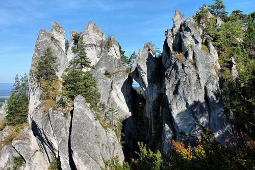
The Arches known as the Gates
The Slovak word brána translates as "gate". Of the Sulov gates Obrovská brána (literally the Huge Gate) is the largest whereas Goticka brána is both the tallest (13m) and the most popular.
 Dragon's Hole Dragon's Hole |
 Gothic Gate Gothic Gate |
 Obrovská brána Obrovská brána |
Below you will find the basics about the waymarked trails running out of the village of Súľov.
1.Brada
Distance: 7,5 km
Time: 3 h
Súľovská tiesňava (parking lot) - red marked trail - Lúka pri kamennom hríbe - Lúka pod Hradom (45 min from Tiesňavy) - Sedlo Pod Bradou Saddle - Štefánikova vyhliadka - foots of the summit rocks of Brada (accessible only for climbers, 816 m), 780 m - Roháč Čiakov (718 m) - yellow marked trail - Obrovská brána - Lúka pod Roháčom - Súľovská tiesňava.
2. Roháč
Distance: 8 km
Time: 3 h 30 min
Súľovská tiesňava (parking lot) - red marked trail - Lúka pri kamennom hríbe - yellow marked trail - Lúka pod Roháčom - Obrovská brána - Roháč Čiakov (718 m) - green marked trail - Roháč (790 m) - Roháčske sedlo Saddle (692 m) - blue marked trail - Súľov - Súľovská tiesňava.
3. Javor
Distance: 6 km
Time: 1 h 30 min
Súľovská tiesňava (parking lot) - red marked trail - Lúka pri kamennom hríbe - Lúka pod Hradom - green marked trail - Javor - Súľov.
 Near Brada Near Brada |
 Goticka brána Goticka brána |
 Hlbocký Falls Hlbocký Falls |
4. Východný hrebeň (Eastern ridge)
Distance: 15 km
Time: 5 h 30 min
Súľov (385 m) - blue marked trail - Roháčske sedlo (692 m) - green marked trail - Bosmanica (751 m) - Kečka (822 m) - Patúch Saddle (621 m) - yellow marked trail - Súľov.
5. Žibrid
Distance: 10 km
Time: 3 h 30 min
Súľov (385 m) - yellow marked trail - Patúch Saddle (621 m) - green marked trail - Žibrid (867 m) and back to Súľov.
6. Hlbocký vodopád Waterfall (once called Súľovský vodopád), 15 m high, two steps
Distance: 9 km
Time: 3 h
Súľovská tiesňava - red marked trail - Lúka pri kamennom hríbe - yellow marked trail - Lúka pod Roháčom - Obrovská brána - Roháč Čiakov (718 m) - green marked trail - Hlbocký vodopád
 Hričov Castle Hričov Castle |
 Súlov Castle Súlov Castle |
 Lietava Castle Lietava Castle |
Red Tape
The area this pages focuses on lies within a nature reserve in which you are only allowed to walk along the marked trails.Rock climbing is for members of UIAA only, and it is restricted to a few areas. The number of routes available can be disappointing unless you come in the second half of the year. Compare these two maps from 2008 (outdated - valid lists below) for the Hrad and Javor areas:
- January-June
All year (till 2012):
Javor - Tabuľa, Veža nad ohniskom, Školská veža, Veterná, Podsvetie, Sokolia veža dolná, Buldrovňa , Neviniatko, Sokolíky
Skaly pod Hradom - Obelisk, VPN, Vyhliadka, Chrám, Zrkadlo
Súľovská tiesňava (Hradnianka Gorge) - Vinice - July-December
From July 1 on - what's listed above plus:
Javor - Kozie diery, Zabudnutý kaňon, Ivanka, Patoniková, Sokolia veža horná, Tisícročná veža
Skaly pod Hradom - Tri puky, Harfa, Krídlo, Trojzubec
Súľovská tiesňava (Hradnianka Gorge) - Mních
Guidebooks and Maps
 Guidebook:Slovenské skaly II by Daniel Pauer Guidebook:Slovenské skaly II by Daniel Pauer |
 Map:Súlovské vrchy,sheet 157 by VKÚ Map:Súlovské vrchy,sheet 157 by VKÚ |
Weather & Accommodation
In Súľov, there is a campsite and a range of guesthouses to choose from, and there are many more options in the neighborhoods, for example in the valley of Rajčanka which you will definitely like to visit/stay in if you like swimming. In the valley there is the old spa of Rajecké Teplice but the town of Rajec has a much better, less crowded swimming pool inside a little water park, built a few years ago and named Veronika.(However, although it sits just 10 km SE of Súľov, you will have to drive nearly an hour to get there, so it seems that going by bike may be more fun.)- AccuWeather forecast for Sulov
- Guesthouses in Súľov
- Campsite in Súľov
- Žilina area
- Water park Veronika
Images On Other Websites
- The interpretive trail on hiking.sk: Parking lot by Sulov Hut-Gothic Gate-Hrad (Castle)-Meadow under Hrad-Meadow at Stone Mushroom-parking lot by Sulov Hut)
|
|
|