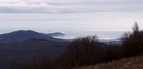
Between the vast plains of Pannonia to the west and the basin of Transylvania (Land beyond the Forest, coined in the Middle Ages) sits a remarkable bulk of medium-height mountains nearing 1850m a.s.l. in elevation. In shape, this mountain group resembles the palm of a hand approximately a hundred kilometers across, spreading its five fingers ("Western Hills") westerly and northerly. Romanian people call it Munţii Apuseni, which means the Western Mountains or the Mountains of the Setting Sun. Hungarian people used to call them the Island Mountains of East Hungary, but today refer to them as Erdélyi-szigethegység, i.e. the Island Mountains of Transylvania. Among the other - surely confusing - names for these mountains are: the Western Carpathians (for Slovaks, Poles and Czechs this stands for what we - on SP - call the Northwestern Carpathians) and the Bihor Mountains (this is the name of the highest subgroup). On the south, the Western Transylvanian Mountains are bounded by the the valley of the Mureş/Maros River (and the Southern Carpathians beyond it). To the north, the Western Transylvanian Mountains extend as far as the Someş/Szamos River. The location of the mountains against the Carpathian arc as well as the map showing their breakdown into particular mountain groups can be studied here.
High Central Massifs
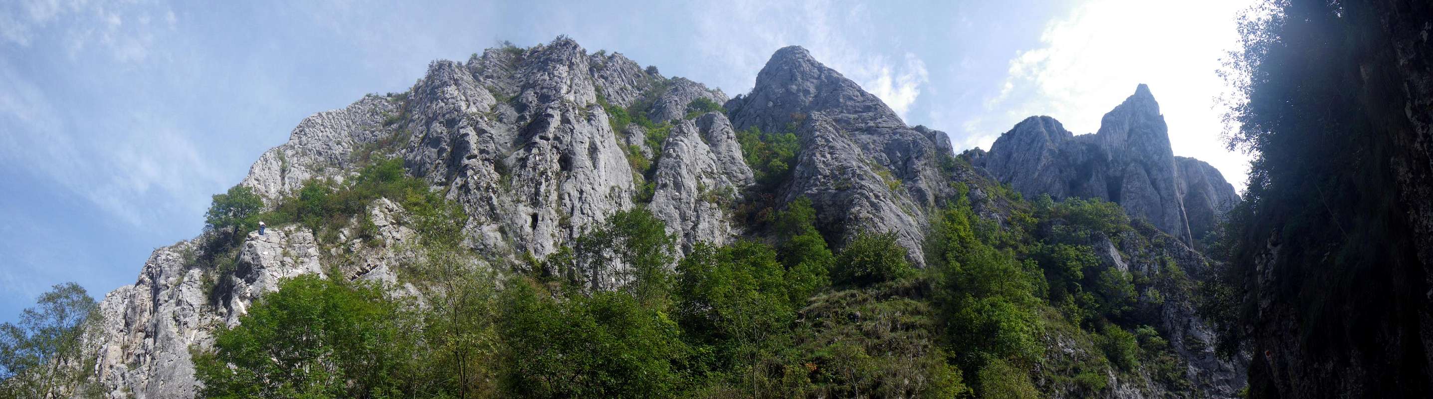
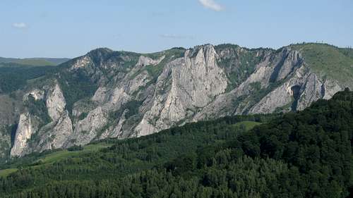
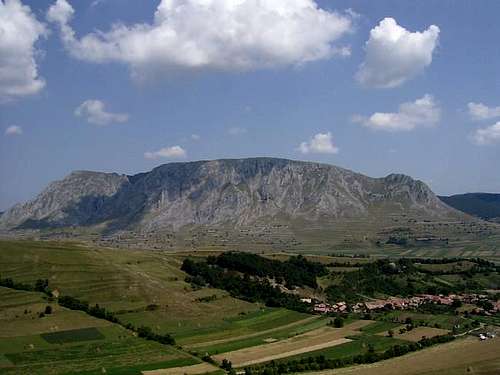
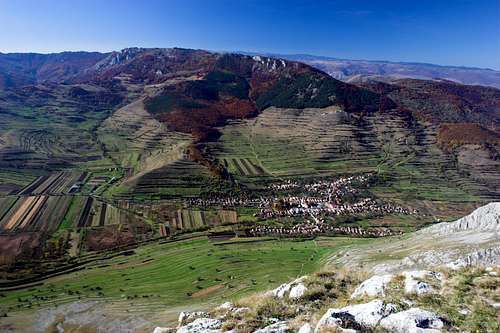
Bihor/Bihar Mts from ENE
The highest mountains rise in the central part of Munţii Apuseni/Erdélyi-szigethegység. This heart of the Western Transylvanian Mountains can be divided into three major mountain groups, whose highest summits exceed 1800m in elevation: the Vlădeasa/Vlegyásza in the north, the Bihor/Bihar in the south and the Gilău/Gyalu in the east.
Vladeasa Mts
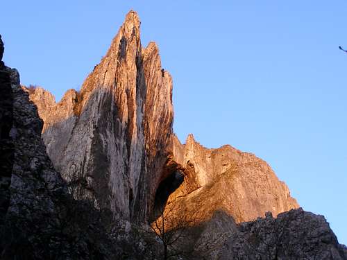
Great Bihor
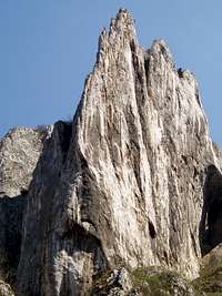
Scărita-Belioara
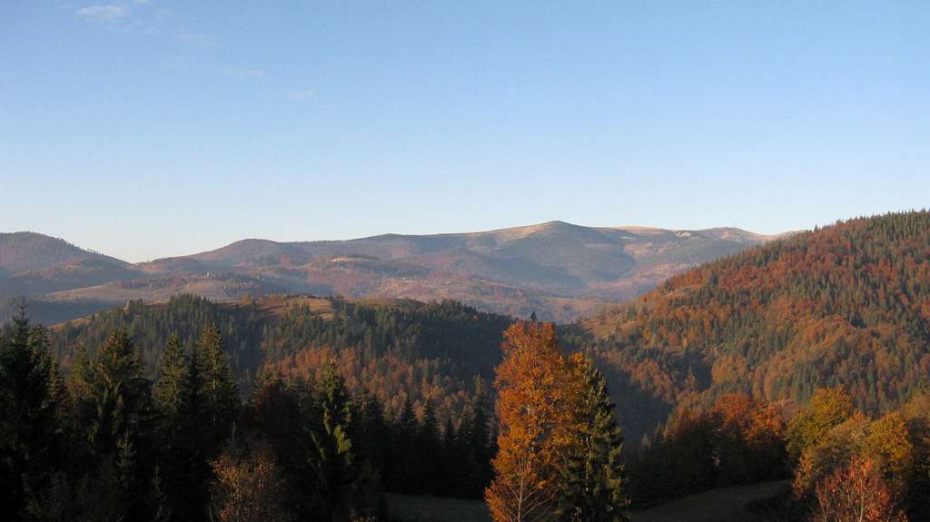
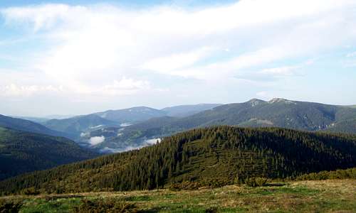
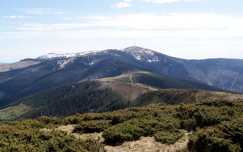
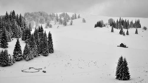
These mountains - composed of crystalline rocks - feature long, gentle slopes and rounded tops. The scenery is a blend of coniferous forests and mountain pastures and is rather monotonous, despite being charming. A rather small - compared to other Carpathian ranges - number of big predators, such as the bear, wolf and lynx live there.
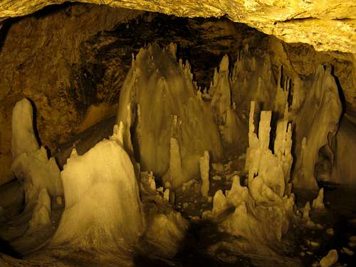
The main attractions of the Bihor are located in the northern chunk of the mountains, around the sources of the Aries River. South of the Vladeasa lies the limestone plateau of Padis, often called the kingdom of the Carpathian karst, which is regarded as part of the Bihor Mountains. East of Padis, north of the village of Arieşeni/Lepus sits another, smaller karst plateau which boasts Scărişoara/Aranyosfői Cave, holding loads of ice. Several kilometers in the opposite direction from Arieseni, south of the Aries River stands the highest mountain of all in the Western Transylvanian Mountains, Cucurbăta Mare/Nagy-Bihar (Great Bihor) with a tall transmitter mast on the summit.
Munţii Gilău
Gyalui-havasok
Gilau Mountains
Muntele Mare
Öreghavas
1826
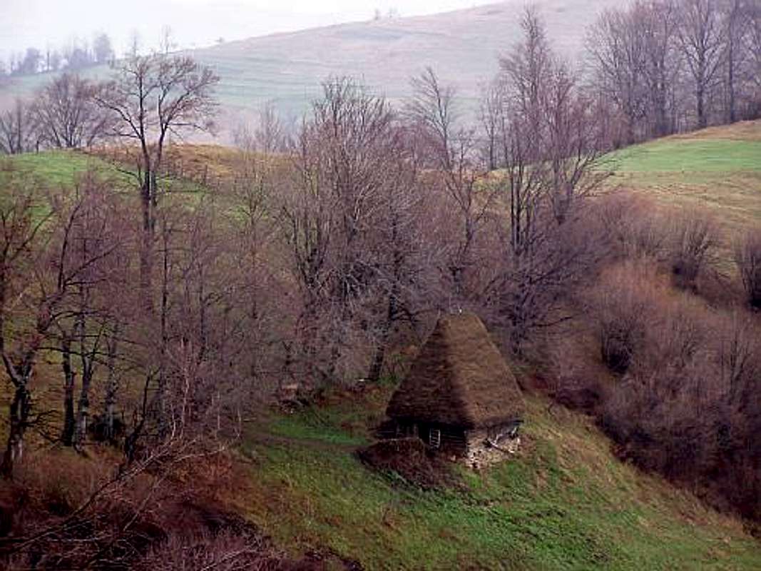
Between the Aries River in the south, the Vladeasa massif in the west and the city of Cluj-Napoca/Kolozsvár to the north-east. Most of these mountains looks like a plateau with rolling hills on top: gentle, long slopes, endless mosaic of pastures and vast spruce forests, surprisingly steep valleys. In geologic terms, the axis of the mountains is a granite batholith. As elsewhere, the granite core is surrounded by metamorphic rocks such as schists. Both the geology and the relief are monotonous since the elevation was not enough for the Pleistocene glaciers to develop. In the east, however, there are patches of spectacular limestone karst relief, such as Scărita-Belioara/Bélavár, west of the Turda Gorge (please see next chapter). In fact, the area around that gorge also lies within the eastern reaches of the Gilau, although it is usually classified as part of the Trascău/Torockó Mountains.) Pastoralism, transhumance, traditional wooden architecture and lifestyles are still alive throughout the Gilau - these mountains are a huge theater showing what most of the Carpathians looked like until the last decades of the twentieth century.
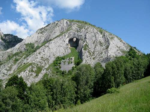
Between the three major crystalline massifs stretches a limestone plateau named Padis (Padiş/Pádis), packed with the classic forms of karst relief and usually classified as part of the Bihor Mountains. The karst landscapes extend northward into the Vladeasa Mountains and easterly along the Arieş/Aranyos River as far as the Turda Gorge (Cheile Turzii/Tordai-hasadék) on the outskirts of the Transylvanian Basin. But the karst west of the historic town of Turda/Torda - despite being located north of the Aries River - is traditionally believed to be part of the Trascău/Torockó Mountains.
Padis
Scărişoara ice cave
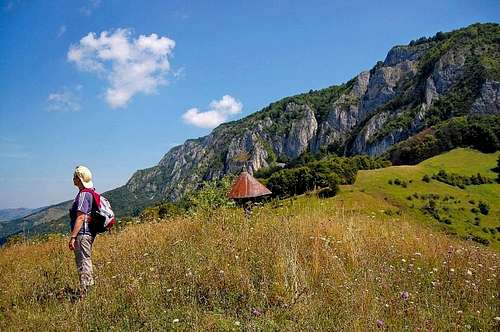
Scărita-Belioara Nature Reserve
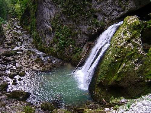
Gorges & Crags of the South-East
Between the middle course of the Maros River and the Aries/Aranyos, its tributary which rises in the heart of the Western Transylvanian Mountains, sits a mountainous land whose main features are limestone gorges and crags in the east and rich deposits of metals, including gold, toward the west.
These mountains are formed of limestone and stretch across the watersheds of the northwestern tributaries of the Maros River between the towns of Alba Iulia/Gyulafehérvár in the south and Turda/Torda in the north. The most attractive and most frequented are the following spots along with their immediate surroundings: the Turda Gorge (Cheile Turzii/Tordai-hasadék), the Rock of the Szeklers (Piatra Secului/Székelykő), the Râmeţ/Remete (Eremite's) Gorge and Intregalde/Havasgáld.
Munţii Metaliferi
Erdélyi-érchegység
Transylvanian Ore Mountains
Poieniţa
Poienica
1437
The southernmost range of the mountains of western Transylvania - the Ore Mountains - is rich in metals, which have been mined for millennia and were one of the incentives that prompted the Romans to occupy Dacia in the 2nd and 3rd centuries AD. The Ore Mountains are extremely interesting to the geologist since - within a fairly small area - they hold three major lithologic components which form the three distinct belts characteristic of the Northwestern Carpathians: flysch, crystalline core with attached limestone and volcanic rocks. This translates into interesting geomorphology.
Szeklers' Rock
Turda area
Eremite's Gorge
Ore Mountains
Western Hills
In the west and north-west, the central massifs are surrounded by several groups of low mountains whose geological composition does not differ much from that of the higher ranges of the Western Transylvanian Mountains: mostly old crystalline rocks and several large areas of Mesozoic limestone; of the latter the Royal Forest stands out, looking like a lower version of the Padis Plateau.
Mountain Group
Highest Summit
Elevation in Meters
Description
Munţii Zarandului
Zarándi-hegység
Zarand Mts
Drocea
Drócsa
836
These mountains run west from the Transylvanian Ore Mountains, north of the Mureş/Maros River, constituting the southwest corner of the Western Transylvanian Mountains. Composed mostly of Paleozoic crystalline rocks, they are covered by broad-leaved woodland.
Munţii Codru-Moma
Béli-hegység
Codru-Moma Mountains
Vf. Plesu
Pilis/Szár-tető
1112
West of the Bihor Mountains, between the Crişul Alb (White)/Fehér Körös River in the south and the Crişul Negru (Black)/Fekete-Körös to the north, this group of mountains is made up of the Codru (north) and the Moma (south) - crystalline rocks and limestone. The elevation of these mountains above the adjacent lowlands is up to 800m, which does give them mountainous looks.
Pădurea Craiului
Király-erdő
Royal Forest
Hodrânguşa
Holdringató
1027
The name of these mountains comes from the fact that for several centuries they were the hunting ground of the kings of Hungary. It is this silva beyond which Transylvania lies (please see the first line of the Overview). The Royal Forest, mostly of limestone, rises slowly from the Great Hungarian Plain in the west to gradually gain elevation toward the Vladeasa Mountains in the east. The Royal Forest’s highest summit is located near its eastern boundary, which is delineated by the Iad/Jád River. The area contains a large number of interesting caves.
Munţii Şes/Plopiş
Réz-hegység
Ses Mountains
Măgura Mare
Magura
918
North of the Rapid Criş/Körös. The mountains run from NW to SE and look like typical Central European foothills: rolling hills, fields and pastures, serene villages and little towns, castle ruins, patches of deciduous and mixed woodland.
The easterly extension of the Ses Mountains, the Meses run from SW to NE, i.e. at a right angle to the Ses Mountains. Formed of ancient gneiss but also young flysh and sandstone, including a little "rock city" called Grădină Zmeilor/Sárkányok kertje (Dragon's Garden).
Mesesh Mts
Royal Forest
Mesesh Mts
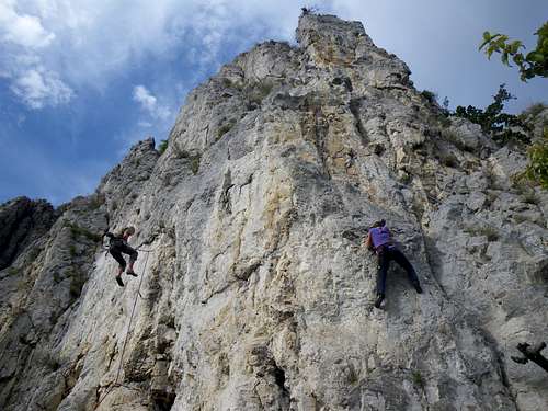
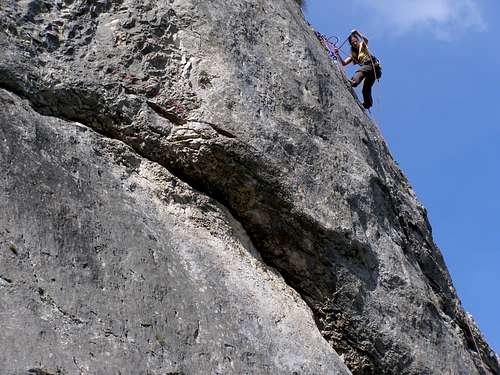
Rock Climbing
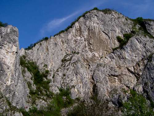
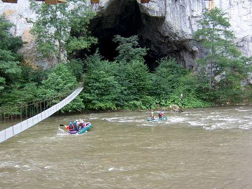
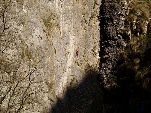
Rock climbing in the Western Transylvanian Mountains is all about limestone. The major climbing areas are located in the South-East, especially in the gorges of the Trascau Mountains, of which the Turda Gorge is a mecca for the Transylvanian rock climbers. In the Ore Mountains, the gorge of Crăciuneşti/Krecsunesd lures most of the climbers.
Turda area
Ore Mountains
Turda Gorge
Turda Gorge
Historic Landscapes
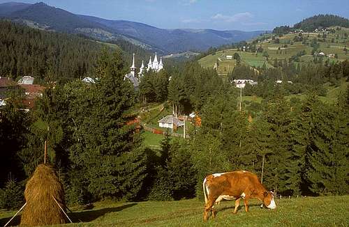
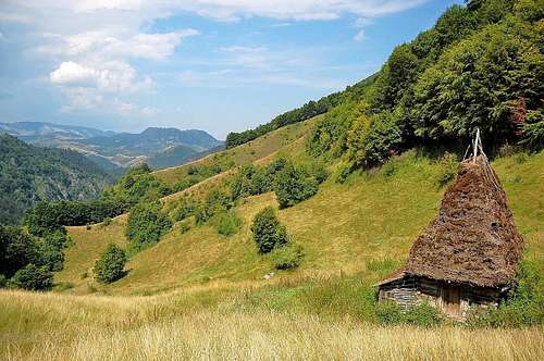
To understand the man-made features of Transylvania's landscapes, especially the architecture of its towns and villages sitting at lower elevations, including the outskirts of the Western Transylvanian Mountains, one has to to bear in mind that for about a thousand years - from the 10th century A.D. up to the 1st World War - the country was multinational as well as being either the east part of the kingdom of Hungary or a principality ruled by Hungarian princes. But the people who built Transylvania's greatest towns were the "Saxon" settlers who came from the overpopulated lands which are today western Germany. While the Hungarians, Hungarian-speaking Szeklers and Saxons thrived in the lower lying areas and the towns, most of the mountains and rural areas were populated by Romanian people (then called Vlachs). They assimilated the remainders of the older settlers, such as Slavs. In ethnographic terms, the heart of Munţii Apuseni/Erdélyi-szigethegység is the homeland of a distinct group of highlanders known as the Moţi people.
"The land hides salt and precious metals of all kind in surprising abundance. From the iron which shields life to the gold that corrupts it. Innumerable thermal and mineral springs flow from earth's bosom, creeks and rivers beautify and water the land everywhere. On sunny slopes the grape glows and the sumptuous fruit tree blooms. Wheat fields wave in the valleys, wild animals roam the forests, domesticated animals are in abundance. This is the land of Transylvania and should the people lack something, it's mostly their own fault." G. D. Teutsch, History of the Transylvanian Saxons, Kronstadt (today's Braşov) 1858
"...in every place the preachers shall preach and explain the Gospel each according to his understanding of it, and if the congregation like it, well. If not, no one shall compel them for their souls would not be satisfied, but they shall be permitted to keep a preacher whose teaching they approve. Therefore none of the superintendents or others shall abuse the preachers, no one shall be reviled for his religion by anyone, according to the previous statutes, and it is not permitted that anyone should threaten anyone else by imprisonment or by removal from his post for his teaching..." John II Sigismund Zápolya, Edict of Torda, 1568
Public transport between Romania's cities is well developed, in contrast to the local bus networks. Hitchiking is commonplace, the (little) fare is not usually asked for but is supposed to be handed.
One of the most convenient ways of getting to as well as getting to know the heart of the Western Transylvanian Mountains - from the city of Cluj or the towns south of it, such as Turda - is a journey by car/bus/bike up the valley of the Aries River
There is virtually no red tape except for the area of the Apuseni Nature Park and the few other nature reserves. One's own tent and sleeping bag is the perfect solution. Also, there will be numerous cozy guesthouses like these as well as an occasional mountain hut in the most popular areas.
Children refers to the set of objects that logically fall under a given object. For example, the
Aconcagua mountain page is a child of the 'Aconcagua Group' and the 'Seven Summits.' The
Aconcagua mountain itself has many routes, photos, and trip reports as children.
Parents refers to a larger category under which an object falls. For example, theAconcagua mountain page has the 'Aconcagua Group' and the 'Seven Summits' asparents and is a parent itself to many routes, photos, and Trip Reports.


 20756 Hits
 88.19% Score
 26 Votes