Page Type Page Type: Area/Range
Location Lat/Lon: 48.54900°N / 24.11930°E
Activities Activities: Hiking
Seasons Season: Spring, Summer, Fall, Winter
Additional Information Elevation: 6024 ft / 1836 m
Sign the Climber's Log

Overview

Gorgany winter. Vysoka and Ihrovets from Grofa.


Ґорґани (Ukrainian/Rusyn)


Gorgany (Polish/Czech/Slovak)


Gorgánok (Hungarian)


The Gorgany mountains are exceptional. They have as many as thirteen summits with more than 500 m of prominence, while no other range in the Carpathians have more than three! The central and northern ridges of the Gorgany, formed of hard sandstone, feature – unlike the other parts of the flysch Carpathians – vast blockfields, locally called grekhot or gorgan. Thanks to these seas of rocks most of the Gorgany has always been sparsely populated, spared from pastoralism and covered – above the vast forest zone – by blockfields or densely growing bushes of dwarf mountain pine (Pinus mugo) rather than meadows. Apart from that talus, the Gorgany is atypical of the flysch ranges for its bold relief. The slopes can be very steep, the valleys deep and many peaks resemble pyramids, or tumuli, in shape, which makes you wonder if the name of the mountains might derive from the word kurgan, Turkic and Slavic for tumulus. All this makes the Gorgany one of the wildest mountain ranges in all of the Carpathians. Hiking off the waymarked trail normally means arduous bushwhacking here.

Mount Syvula - Gorgany mtns.
Syvulia - the highest mountain
Mount Popadya - Gorgany mtns.
Popadia

The Gorgany with an area of about three thousand square kilometers is the largest mountain range in the Ukrainian Carpathians. In a nutshell, it is a large rectangle stretching between the Skole Beskyds in the northwest and the Prut River in the southeast. More precisely, it is part of the Wooded Carpathians (called Wooded Beskids in Poland) lying between the Skole Beskyds (Skolivs’ky Beskydy) and the Eastern Bieszczady (Vododilnyi Khrebet) to the northwest, and the upper course of the Prut River (beyond which the Pokuts’ki Karpaty extend) to the southeast. On the southwest the Gorgany is bounded by three polonyna ranges: Borzhava, Krasna and Svydovets. The rectangle of the Gorgany would be more regular if the south part of their southwest boundary had not been pushed north by the Svydovets, which has nearly cut the Gorgany off from the Chornohora.

Western Gorgany on Easters
360-degree panorama from Grofa

The topography of the mountains is terribly complicated, thus difficult to describe. Due to the homogeneous geology of the mountains, the drainage pattern is rectangular – it forms a very regular grid. The main ridge, separating the drainage basins of the Dniester and the Tisza (Tisa) runs between the passes of Toruns'kyi Pereval to the northwest and Yablunitskyi Pereval to the southeast. As some of the tributaries of the Dniester, which flow north, have managed to cut across what once must have been the main ridge and move their sources further south by headward erosion, today’s main ridge winds its way taking unexpected sharp turns. Although it is 75 km as the crow flies between the opposite ends of the main ridge, its actual length is as much as 130 kilometers! It is still marked by stone posts placed after World War I on the then Poland-Czechoslovakia border (formerly the NE boundary of Hungary), thus making for a long route popular with tough trekkers.

Mount Popadya summit - Gorgany mtns.
Old boundary stone on Popadia from the then Czechoslovak side
Gorgany dark woods
"P" stood for Poland

To clarify the Gorgany’s complex topography as well as adjusting the description to the needs of the hiker and peakbagger, we are going to focus on the ridges that rise above 1600 m (and one topographically important ridge that falls just several meters short of the mark).

On a map of the Ukrainian Carpathians you will find almost all of the Gorgany between the P-21 regional road and the H-09 national road. The key bases for hikes in the most attractive parts of the mountains are the villages of Osmoloda on the Limnytsia River (NW quarter of the Gorgany) and Bystrytsia on the Bystrytsia Nadvirnianska River (in the SE quarter, before World War II known as Rafajłowa). Between these villages extend the highest ridges in the Gorgany attaining their highest elevation in Velyka (Great) Syvulia at 1836 m (about 770 m of prominence), not far from the geographic center of the mountains. (The second highest summit is Mala (Little) Syvulia at 1818 m, around a kilometer away. The third and fourth are Ihrovets at 1804 m and Vysoka at 1803 m on a nearby ridge extending a bit farther northwest.) Nearly in the same direction as the Osmoloda-Bystrytsia line, northwest from Osmoloda runs the rather monotonous ridge of Arshytsia (1587 m), while southeast from Bystrytsia stretches the beautiful, wild ridge of Dovbushanka (1754 m) and further southeast its continuation (cut off from Dovbushanka by Zubrinka Creek), the ridge of Syniak (1665 m).

Parallel to the Arshytsia Ridge, southwest of it, across Mshana creek, still a good few kilometers north of the main ridge, sits the group of Yayko Ilemske and Moloda. To the southeast of it and southwest of Osmoloda village, in the very heart of the Gorgany, is the huge Popadia-Grofa Group reaching a peak in Grofa at 1748 m, which gives breathtaking panoramic vistas. Popadia at 1740 m, the mid-point of this U-shaped mountain group, where it connects to the main ridge, commands even better views, but is harder to reach.

Easter´s scenery
The ridge of Popadia

The ridges that lie in the northwest part of the Gorgany, branching off the main ridge to generally trend southwest, are similar in character to the neighboring polonyna ranges – their highest parts are covered by grass rather than talus. The two highest of them, namely Pishkonia and Strymba, exceed 1700 m in elevation.

East of Strymba, on a huge ‘meander’ of the main ridge, sits Bushtul at 1691m - a real challenge to the hiker, completely overgrown with dwarf mountain pine. The highest ridge in the southeast of the Gorgany is Bratkivskyi Khrebet, another stretch of the main ridge, trending southeast, which tops out at 1788 m. It is characterized by endless forests and seas of Pinus mugo

Strymba (1719 m) and Streminis (1652 m) in spring
Strymba (left) and Stremynis (1652 m) in April
Gorgany from Grofa
Strymba (right) and Stremynis in January


The table below lists the above-mentioned chunks of the Gorgany. (Polish and Slovak/Czech toponyms sound and spell almost the same as the Ukrainian/Rusyn ones. If the traditional Polish name is noticeably or entirely different, it is given in italics in brackets.)


Mountain

group/ridge


Location

within

the Gorgany


Photo

Highest summit

and its elevation

in meters

Good access

points


Syvulia


Central part,

SE of

Osmoloda,

NW of

Bystrytsia


Mount Syvula


Velyka

Syvulia

1836 


Osmoloda,

Stara Huta,

Bystrytsia

Ihrovysche

Central part,

NW of

Syvulia,

SE of

Osmoloda

Mount Vysoka from Plystsye

Ihrovets

1804,

Vysoka

1803 


Osmoloda,

Stara Huta


Bratkivskyi

Khrebet


(Połonina

Czarna)

In the SE

Mount Bratkovska

Velyka

Bratkivska

1788 

Bystrytsia,

Chorna Tysa

(via source

of the river)

Dovbushanka

(Doboszanka)

and

Syniak

In the East


Dovbushanka

1754 


Syniak

1665 

Access

banned


Bukovel resort,

Tatariv

on H-09


Popadia-

Grofa


Central part,

west of

Syvulia

Grofa (1748m)

Grofa

1748 

Osmoloda


Moloda

and

Yayko

Ilemske


In the NW,

SW of

Arshytsia

Moloda-Yayko Ilemske summits


Moloda

1724

and

Yayko

Ilemske

1680 


Myslivka

on P-21,

Osmoloda


Strymba

In the SW,

E of

Pishkonia

Strymba in autumn

Strymba

1719 

Kolochava

Polonyna

Pishkonia

In the SW

Nehrovets (1709 m)

Nehrovets

1709 

Kolochava,

Synevyr

Bushtul

S of Popadia,

NW of

Bratkivskyi

Khrebet

Mount Bushtul - Gorgany mtns.

Bushtul

1691 

No marked

trail,

access via 

historic

boundary

Arshytsia

NW part,

NW of

Osmoloda


Gorgan

Ilemskyi

1587 


Osmoloda,

Myslivka

on P-21


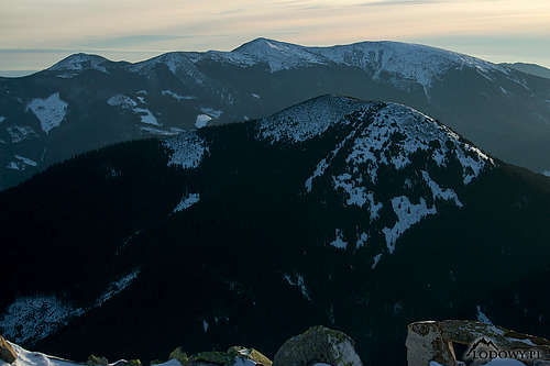
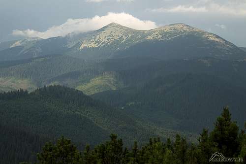
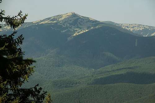
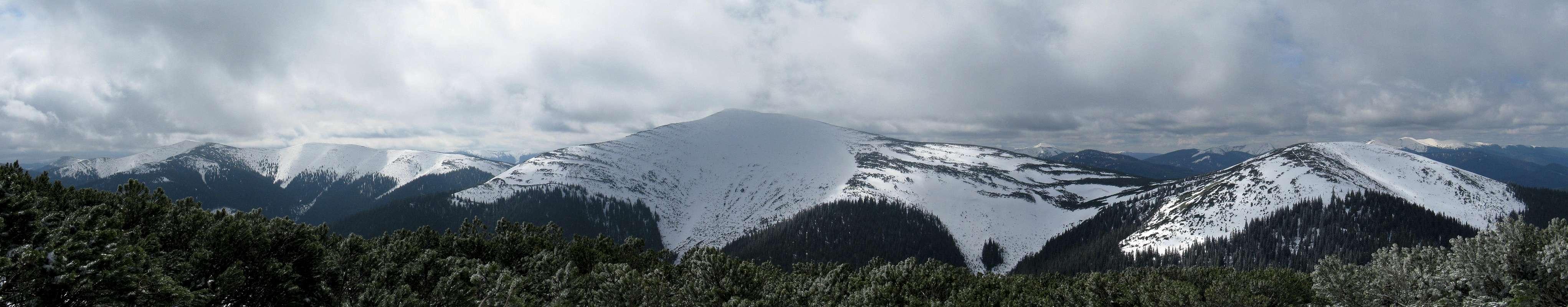
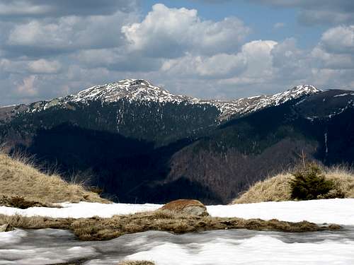
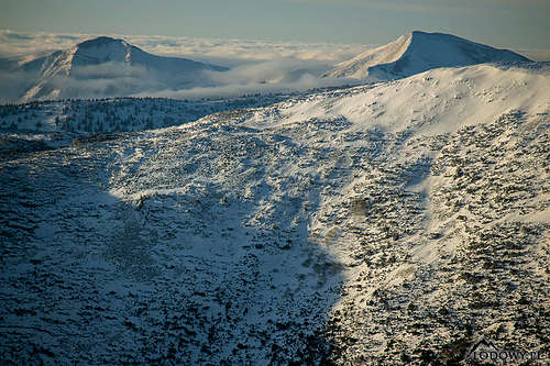
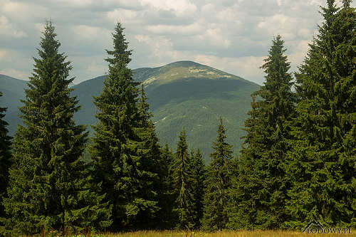
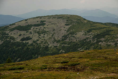
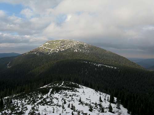
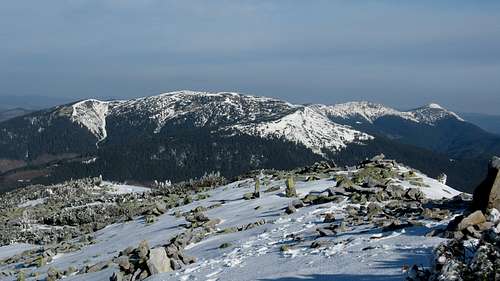
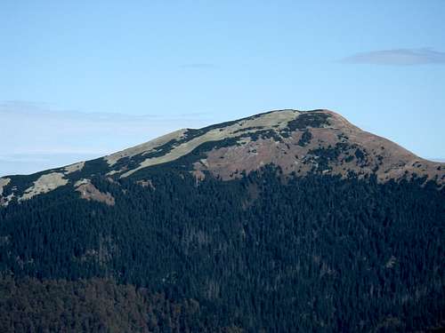
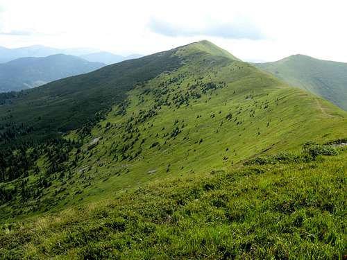
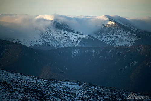
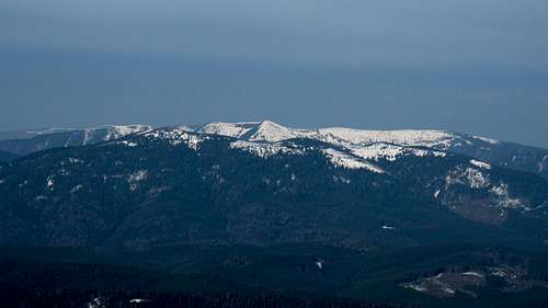
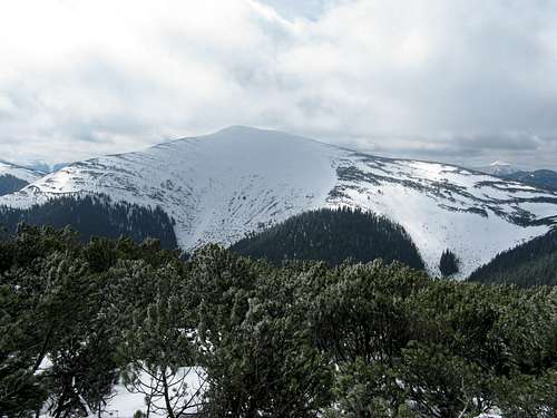
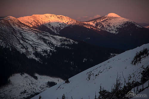
The following summits have more than 500 m of prominence: Syvulia, Dovbushanka, Moloda, Grofa, Velyka Bratkivska, Kamyanka (southwest of the village of Synevyrs'ka Polyana), Bushtul, Strymba, Stanymyr (between the villages of Stara Huta and Bystrytsia), Ovul (between Popadia and Syvulia), Nehrovets, Kanch (east of Synevyrs'ka Polyana) and - assuming that the western frontier of the Gorgany to the south of the Torun Pass runs along Holyatynka creek - Smerek at 1421 m (north of the village of Verkhnyi Bystryi). The first four of these summits and Smerek have over 600 m of prominence.

Mount Kanch in morning mist
Kanch at 1578 m
Kamionka (1578m)
Kamyanka at 1578 m
Synevir lake
Synevyr Lake

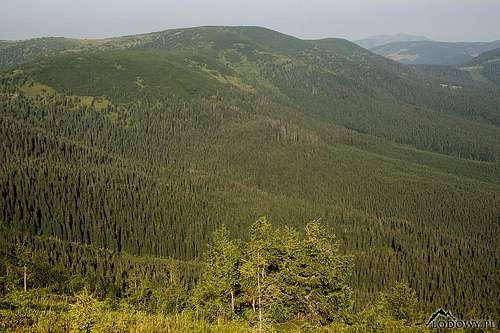
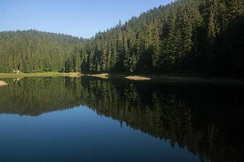
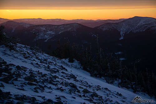
As the Gorgany is formed of flysch, landslides are not uncommon here and sometimes they create lakes, of which Synevyr Lake in the northwest part of the mountains, over 20 meters deep, is the largest and deepest.
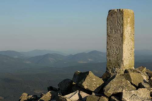
Red Tape

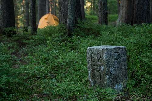
Unfortunately, since late 2010s the ridge of Dovbushanka has been closed to hikers. It lies within a strict nature reserve that bears the name of Gorgany and stretches as far west as the outskirts of Bystrytsia village. There are a few smaller protected areas in the Gorgany, one of them on the Popadia-Grofa Ridge, and in the southwest is Synevyr National Park, but you can enjoy hiking there as well as bivouacking at designated spots. The nature reserves were originally intended to preserve stands of the Arolla pine (Stone pine).
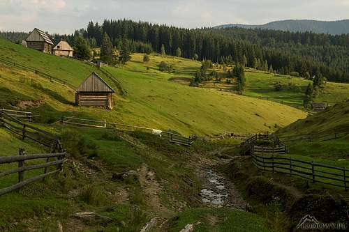
Popadia (1740m)
Gorgany dawn

Camping & Trails

Pieklo at sunrise
S of Syvulia
Legions' Pass - Gorgany mtns.
Legions' Pass
Ozertse tarn
In Synevyr NP

Day hike opportunities are rather limited, for example the distance between Osmoloda and the summits of Velyka Syvulia or Popadia is about 19 km.

There are no mountain huts at all.

It is highly advisable to take your own tent – there are designated bivouacking sites, but you can bivvy practically anywhere, except for nature reserves.

Less than 1.5 km away from the summit of Grofa are two hiker’s shelters:

  • north of the summit at the saddle between Grofa and Kin’ Grofetskyi, around 1270 m
  • south of the summit at Plystse (Płyśce in Polish) clearing, around 1440 m

There are several disused shepherd huts or log cabins, some of them might be suitable - see here.

It should not be difficult to find a bed (and often breakfast) in the villages.

The key hiking trails have been waymarked with stripes of different colors against white background – the way it is in Poland, Czechia, Slovakia and Hungary.  

Refuge at Kin´ Grofetskiy
By Kin' Grofetskyi
Plistse refuge (1450m)
Plystse
Into the wild of Gorgany
By old border

Mountain Conditions

Moloda and Yayko at sunrise
Not much snow in January 2020

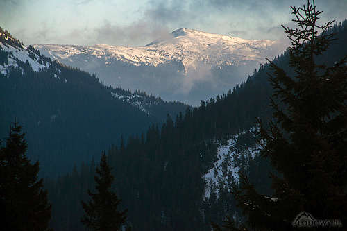
The best time to go seems to be late spring, late summer or early autumn. Brace yourself for a lot of mud on forest tracks and torrential rain in summer. In winter temperatures may drop below minus 20°C. Count on yourself rather than rescue service (the emergency telephone number is often shown on trail signs), which is not going to come instantly.

Plystsye meadow

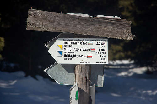
AccuWeather forecast for:

Calm after the storm
After a summer storm

Maps


online map on freemap.sk


The Gorgany against the other ranges of the Ukrainian Carpathians: Annotated by A. Rugała

Peper/Waterproof 1:50,000 maps by Hutyriak can be bought online (NB in Ukraine their price is lower):

Getting There

Sloboda idyll
The village of Svoboda in the west of the Gorgany

The nearest Ukrainian city is Ivano-Frankivsk (to the northeast of the Gorgany), which has fairly good transport links with Lviv, the capital of the Western Ukraine. Direct buses from Lviv also reach the Gorgany.

From Ivano-Frankivsk it is 70 km by road to Bystrytsia and 80 km to Osmoloda. Non-driving hikers usually take a minibus, which is called marshrutka in Ukraine. The eastern boundary of the Gorgany can be reached by train as well, also from the other side – from Solotvyno on the Ukraine-Romania border (about 100 km away).

As for access from the west, it is about 120 km by car from Hungary and about 160 km from Slovakia to the northwest reaches of the Gorgany.

Select External Links

Tangerine Dream