|
|
Area/Range |
|---|---|
|
|
45.25803°N / 22.67237°E |
|
|
Hiking |
|
|
Spring, Summer, Fall, Winter |
|
|
7516 ft / 2291 m |
|
|
LukZem Video
Overview
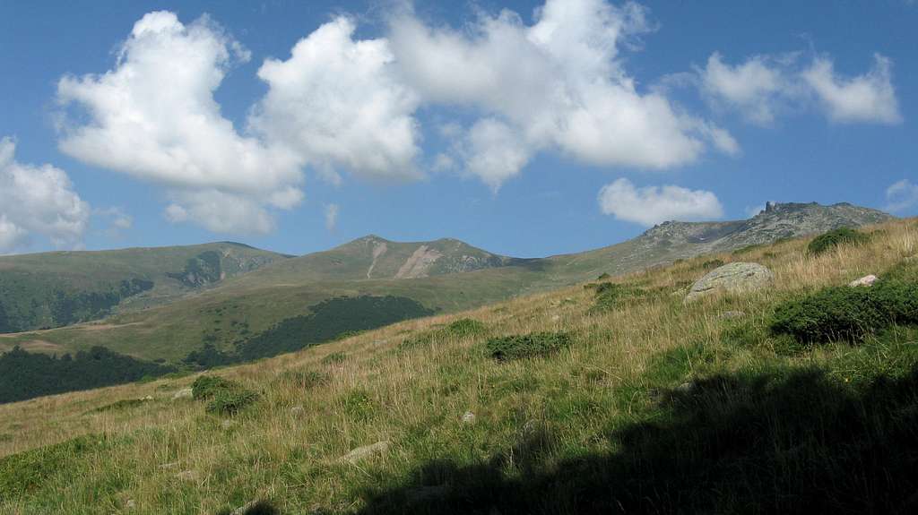
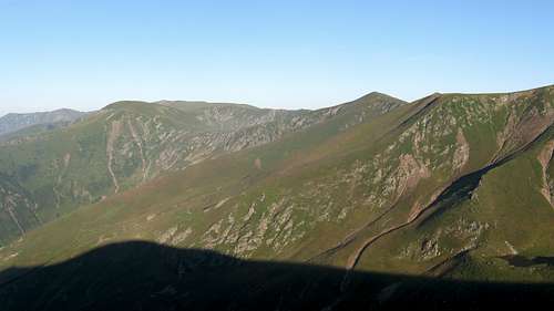
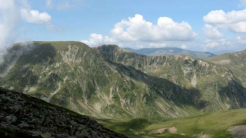
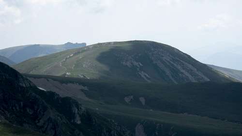
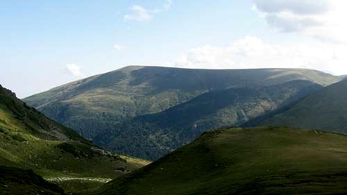
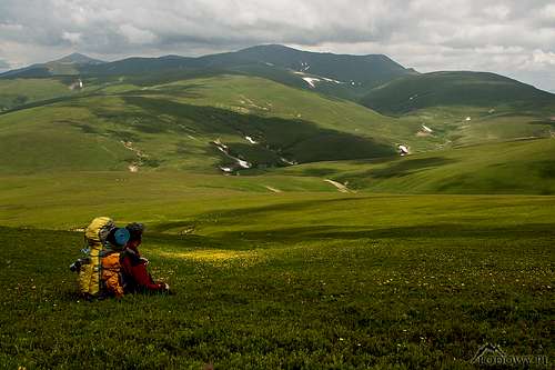
The Godeanu range constitutes a massive mountain hub located in the western extremity of the Southern Carpathians. Separated from the Mehedinţi and the Vâlcan mountains by the valley of the Cerna, which forms their southeastern border, they sit between the Retezat Mountains in the northeast and the Cernei Mountains in the southwest, beyond Olanelor saddle. To the northwest of the Godeanu extends what can be called their twin range, namely the Ţarcu Mountains. The Godeanu and the Ţarcu are connected by the Corhale-Prislop ridge. From the perspective of a Carpathian hiker, the Godeanu Mountains are SPACE. A large part of the Godeanu rises well above timberline, creating a world of vast alpine pastures, still being grazed by flocks of sheep and herds of cattle or horses, although not nearly as intensely as in the 20th and previous centuries. The tree line must have been lowered by slash-and-burn, probably centuries ago. The krummholz zone has virtually vanished – patches of dwarf mountain pine have survived in few places, mostly in the rockiest terrain. Still, the lower parts of the deep valleys are thickly forested, wild and home to the bear, wolf and lynx. 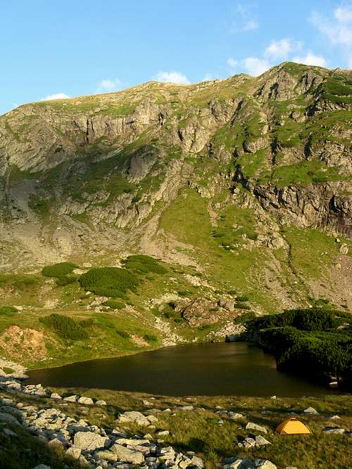
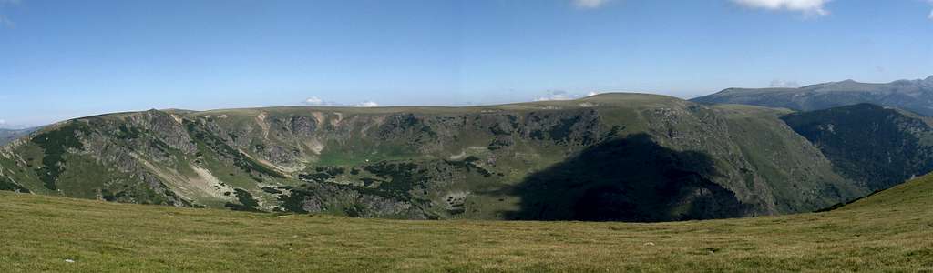
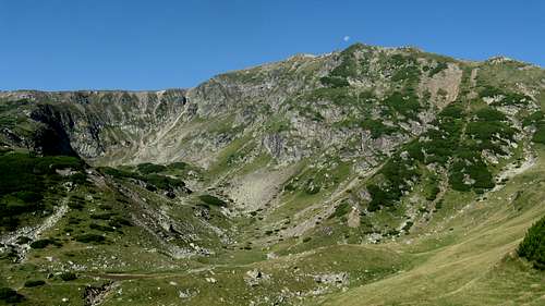
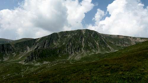
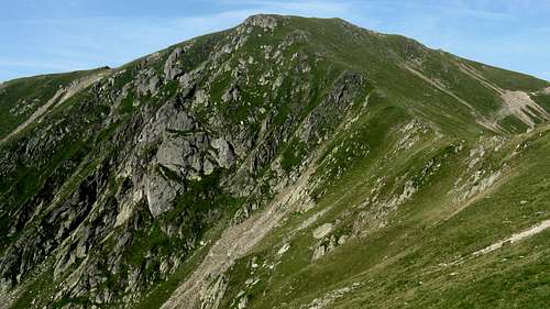
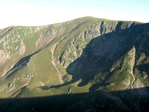
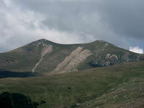
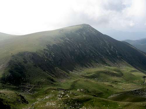
The rocks forming the Godeanu Mountains are predominantly metamorphic schists. The grass-covered ridges are broad and gentle, the adjacent valleys bear traces of glacial action which took place in the Pleistocene epoch. Most of the valley heads have been converted into more or less shapely cirques, some of which cradle small tarns now. The main ridge runs from NE to SW and has a length of approximately 25 km. The highest summit of the Godeanu, Gugu rises in a massive lateral ridge, which branches off the main ridge near Moraru (2279 m – the second highest peak in these mountains) and runs north towards what used to be the confluence of the streams marking the northern boundary of the Godeanu: Râul Șes and Lăpușnicul Mare. Towards the end of the 20th century, the place was converted into a large reservoir named Gura Apei. Gugu stands about 3.5 km north of the main ridge (and about 6 km south of the reservoir), and tops out at 2291 m.
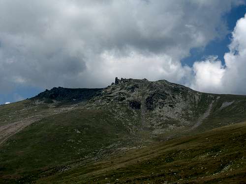
 Cheile Corcoaiei Cheile Corcoaiei Bisericile din Bulz Bisericile din BulzEven though the bulk of the Godeanu is formed of crystalline schists, patches of sedimentary rocks do occur in a few places. From among rock formations composed of conglomerates, Bisericile din Bulz, up to ten metres tall, located 2 km south of Muntele Scărişoara is worth mentioning. The River Cerna, which flows along the southeast flank of the Godeanu, has sculpted spectacular gorges, such as Cheile Corcoaiei (Corcoaia Gorge), but these are limestone features which are typical of the adjacent Mehedinţi range and therefore should be regarded as part of it. A few kilometers above Cheile Corcoaiei, the Cerna has been recently dammed, thus the second large reservoir (Lacul Iovanul) on the fringe of the Godeanu Mountains has been created. Due to their westerly location as well as high elevation, the Godeanu Mountains are one of the wettest mountain ranges in the South Carpathians. They are often covered in clouds, which – combined with the topography – can result in navigation being quite difficult. 
The table below lists the highest summits of the Godeanu Mountains.
|


Getting There
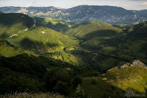
 Between the Cernei and the Godeanu
| Access routes | Trailhead at | Marks | Destination |
Camping, Accommodation & Red Tape
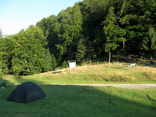
- you can pitch your tent anywhere in the Godeanu Mountains.
- There is no mountain hut in the Godeanu Mountains, but you can use some of the abandoned shepherd's huts.
- In 2011 a brand new Gugu refuge was built. It is situated under Branu summit on the pink line trail leading from Gura Apei reservoir. Its capacity is about 10 hikers.
- The southern edge of the Godeanu lies within the territory of Domogled-Valea Cernei NP
- In the valley of the River Cernei is a mountain hut named Cabana Doru - Izvoarele Cernei
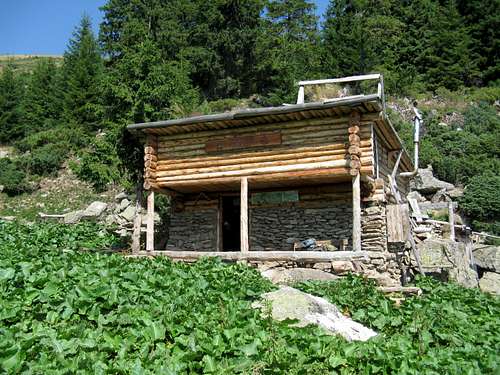 Gugu Refuge Gugu Refuge |
 Jiu-Cerna Pass at the east end of the Godeanu Jiu-Cerna Pass at the east end of the Godeanu |
Maps
Online maps
Paper maps
- 1 : 65 000 Godeanu-Țarcu-Muntele Mic by Muntii Nostri
- 1 : 50 000 Retezat Mts including the central and eastern parts of the Godeanu Mountains by BEL ALPIN
 Just south of the Godeanu
Weather & Mountain Rescue
Weather forecast for the Godeanu Mountains (1769 m)
The Salvamont (mountain rescue) national dispatcher's telephone number is: 0-SALVAMONT (0725-826668)
Salvamont Gorj Coco (member of the rescue team): 0724 758 577
No Salvamont team is stationed in the Godeanu.
![Godeanu Massif in spring]() The Godeanu (Gugu on the right) seen from the Retezat (May)
The Godeanu (Gugu on the right) seen from the Retezat (May)
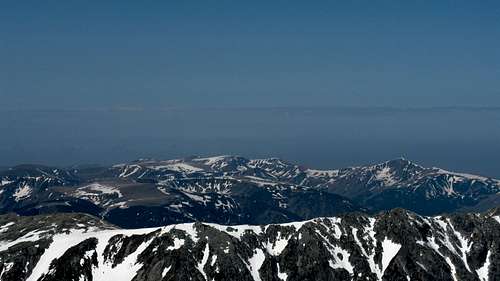 The Godeanu (Gugu on the right) seen from the Retezat (May)
External Links