|
|
Area/Range |
|---|---|
|
|
46.95439°N / 25.94531°E |
|
|
Hiking, Mountaineering, Trad Climbing, Sport Climbing |
|
|
Spring, Summer, Fall, Winter |
|
|
6257 ft / 1907 m |
|
|
LukZem Video
Overview
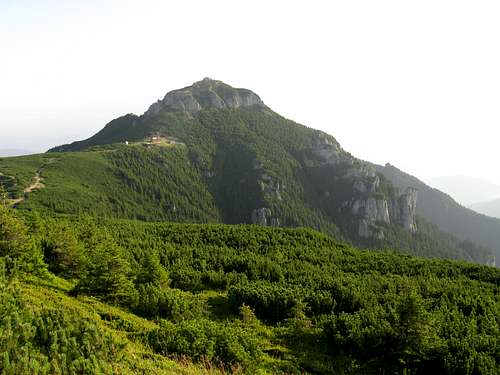
Also nicknamed the Olympos of Moldova, the Ceahlău Massif is one of the most spectacular mountain units in the Eastern Carpathians. In the northwest, the Ceahlău is separated from the Bistriţa Mountains by the Bistricioara River. In the southwest, the valley of the Bistra Mare separates the massif from the Haşmaş Mountains, while to the southeast rise the Ţarcău Mountains. The eastern boundary is the shore of a large reservoir on the Bistriţa River (Lacul Bicaz, also known as Izvorul Muntelui), beyond which sit the Stânişoara Mountains. 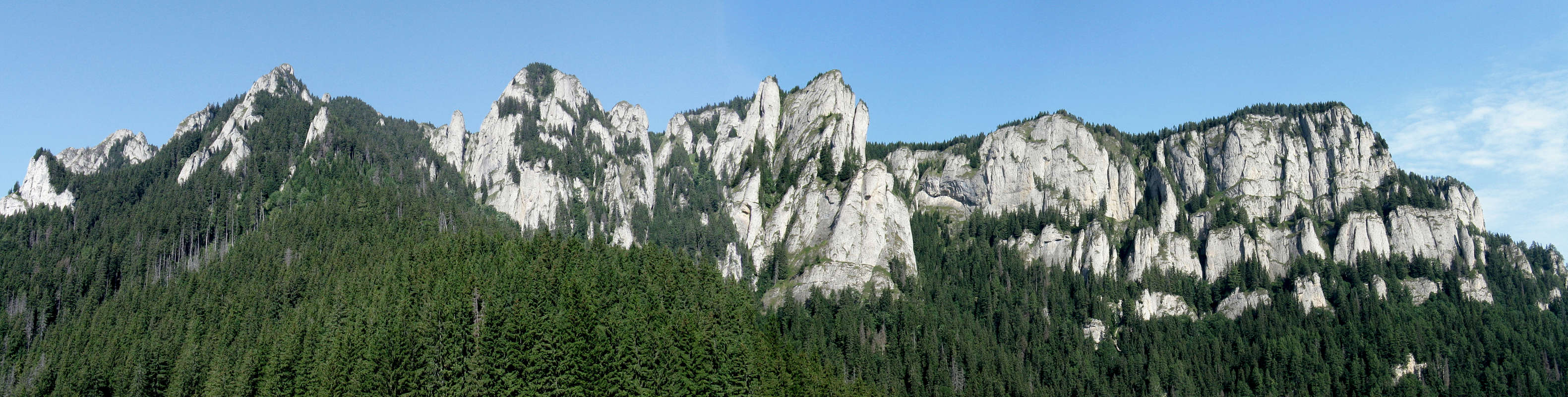
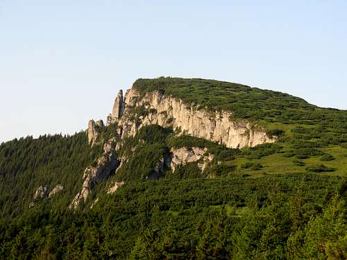
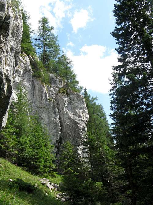
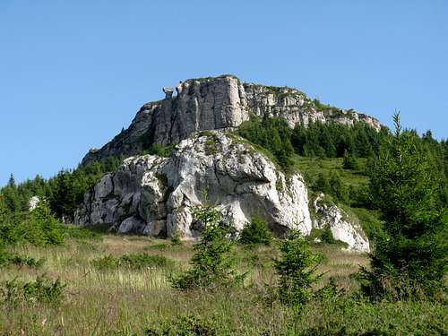
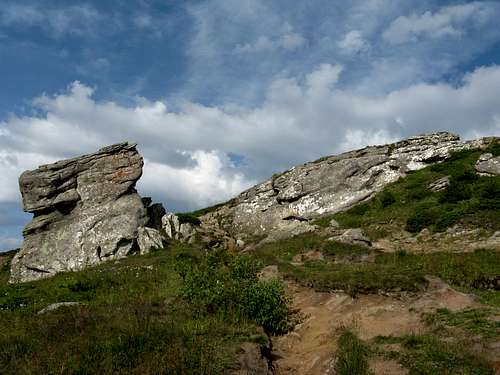
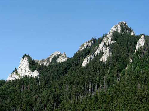
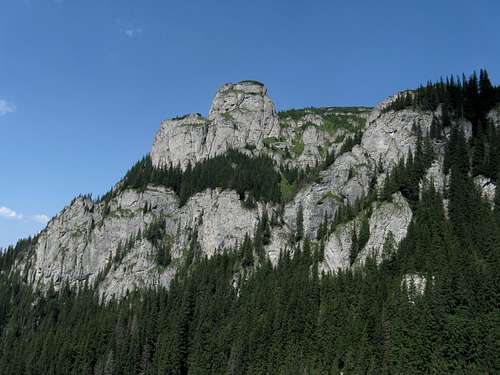
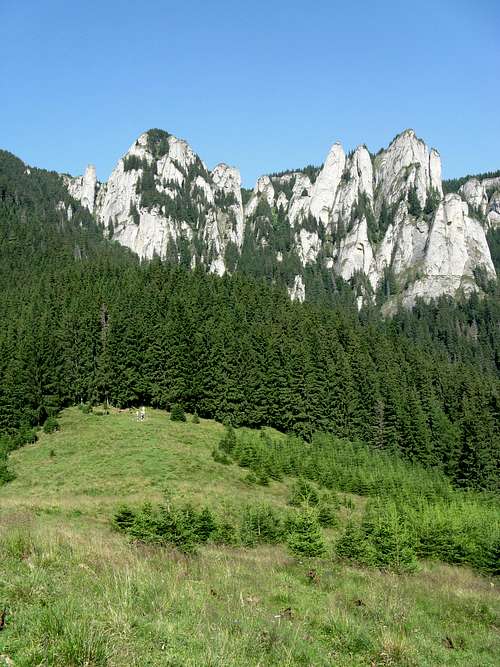
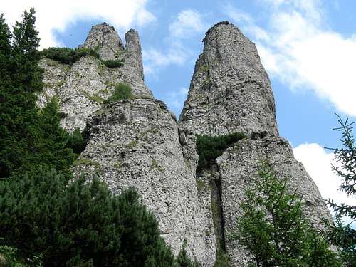
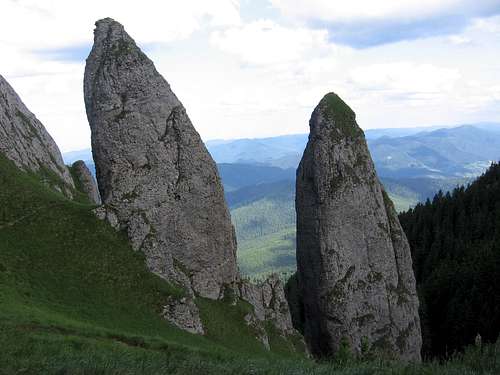
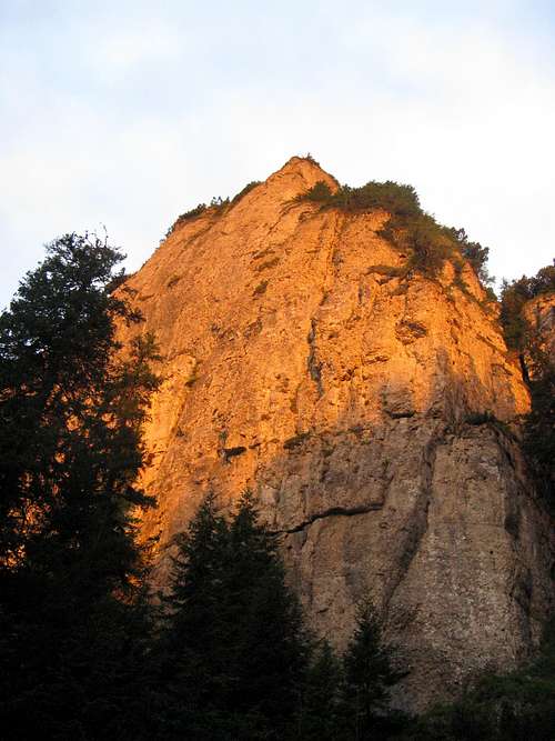
The rocks of the Ceahlău were folded in such a way that the axes of the folds run north to south, and so does the main ridge. The highest, central part of the massif presents a plateau, which has been raised to 1800-1900 m and is about 5 km long and up to 1 km wide (in its central part). It resembles a suspended trough culminating in two highest summits: Ocolaşul Mare (1907 m) in the south and pyramid-shaped Toaca (1900 m), with a weather station on its top, at the plateau's north end. Ocolaşul Mare is surrounded by cliffs from three sides, except from the north. About 1 km south and east of Ocolaşul Mare extend lower bands of cliff, which are in fact taller and no less impressive than the cliffs marking the lofty edges of the central plateau. The cliffy walls of the Ceahlău contain a couple of characteristic ledges, marked by belts of coniferous trees that have managed to take roots there, Poliţa cu crini with its 30 m tall larches being a case in point.
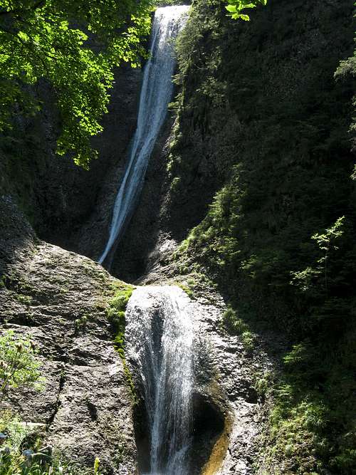
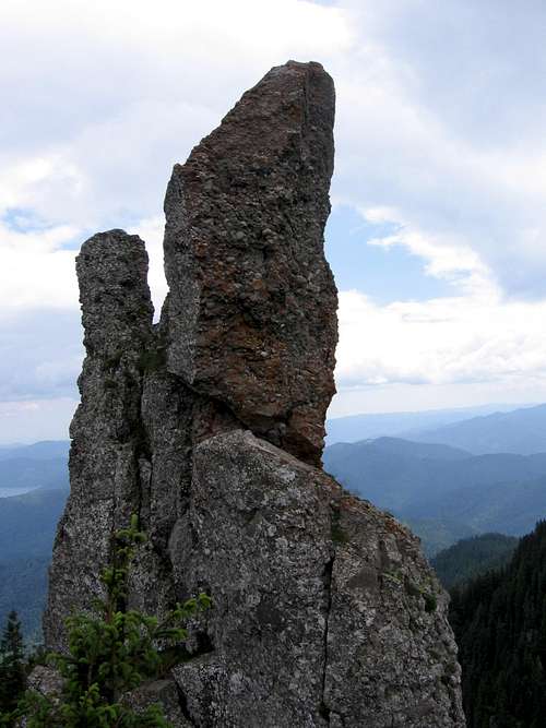
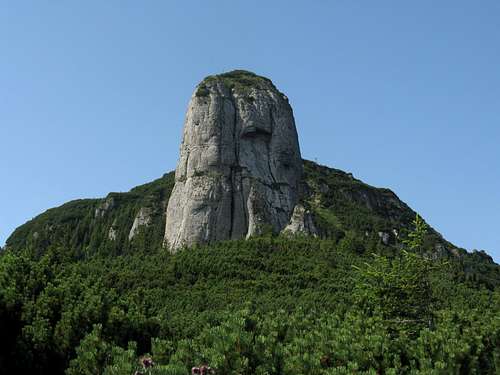
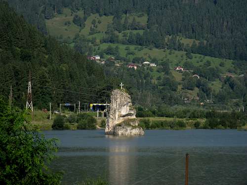
The rock material building the Ceahlău is mostly conglomerate and limestone, so it is no wonder that the mountains resemble both the Bucegi Mountains, with their picturesque, towering cliffs, and the Ciucaş range, with its impressive towers and spires. The most emblematic rock tower of the Ceahlău is Panaghia, steeped in legend, like the other unusual rock formations in the massif. Apart from the crags, the Ceahlău Massif also boasts one of the most picturesque waterfalls in Romania, called Cascada Duruitoarea (Dörgö-vízesés in Hungarian). This monument of nature is about 25 m tall. The fall of water is divided into two tiers by a threshold. The height of the upper part is approximately 20 m, while the lower part measures about 5 m. There are wooden ladders enabling access over the exposed sections. The table below lists the highest as well as some other conspicuous summits and rock formations.
Rock Climbing
Maps & Books
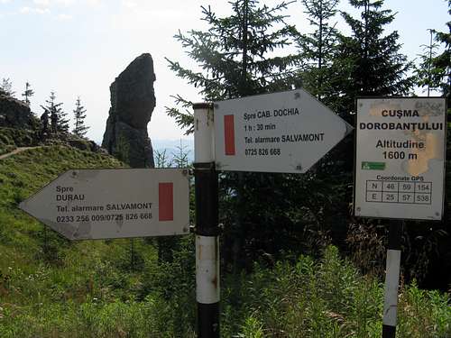
Getting There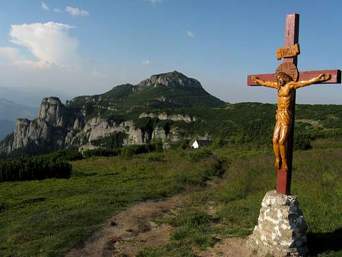 Toaca (2nd highest summit) ahead Toaca (2nd highest summit) ahead
AccommodationDurău resort offers plenty of accommodation facilities. The Dochia hut is the most convenient option for hikers. It is situated in the middle of the central plateau, by the junction of the most frequented hiking trails (1750m). Its capacity is about 100 people.  Dochia hut Dochia hut
Camping & Red Tape Campsite CampsiteThe only designated campsite in the Ceahlău Massif is located at Piatra Lata din Ghedeon (1718m) about half a kilometre SE of the Dochia hut. In 1955 Ceahlău National Park was established and the visitors must pay an entrance fee at one of the checkpoints, which are located at the Durău, Dochia and Izvorul Muntelui huts. There are two strictly protected scientific reserves:
Weather & Mountain Rescue Edelweiss EdelweissWeather forecast for Toaca summit(1898m) The national Salvamont dispatcher can be reached on 0-SALVAMONT or 0725-826668 Salvamont Neamt External Links
|