-
 11805 Hits
-
 79.04% Score
-
 10 Votes
|
|
Mountain/Rock |
|---|---|
|
|
69.71914°N / 18.33765°E |
|
|
Mountaineering, Skiing |
|
|
Spring, Summer, Fall, Winter |
|
|
2900 ft / 884 m |
|
|
Overview


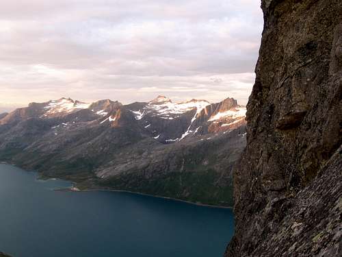
Skamtind to the Right, Storstolpan Center
Skamtind fronts the open ocean, is the first peak guarding Ersfjord, and is the beginning of the 25+ kilometer technical Ersfjord Traverse.
It was featured in an episode of "71 Grader Nord", a Norwegian Reality series.
It is one of the more popular non-technical day climbs in the Tromsø area because of the access, long season, and wonderful views.

Summit Pinnacle of Skamtind
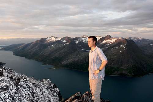
The view to Ersfjord from the summit.
Getting There
The drive to Skamtind in itself is a pleasure. It is one of those "drive until the very end of the road" type of approaches. It's a grand tour of Kvaløya starting from downtown Trosmø, past white sand beaches, fjords with glaciers spilling down, enclosed mountain cirques with lakes, tiny fishing communities, frequent slow-downs for reindeer, a little mini tour of the North Norwegian landscape.
From Tromsø it is a little over an hours drive.
Cross the bridge to Kvaløya on route 862. Follow this road for 10 kilometers or so until reaching a junction where 862 goes right, and 858 goes left. Stay on 862 and continue to Kaldfjord. There should now be a fjord on your right.
Stay on 862 until it leaves the water and turns left. DO NOT turn left, stay right, hugging the shoreline. Continue following the shore until reaching a sign to Tromvik. Stay on this road as it winds along the shore, over a pass and past a lake,
and down again to Grøtfjord. Drive all the way past Grøtfjord until reaching the village of Tromsvik. This feels like the end of the road, but its not. The road now turns to gravel and goes up over yet another pass. From here one
can view Skamtind, and many of the Ersfjord Traverse peaks. Drive down to Rekvik, past all the houses until you can go no further. There is parking for about 8-10 cars here.

Skamtind to the right as seen from the road to Rekvik

Rekvik village from the hike up.

Route info


Standard Route Equipment: Boots and Trekking Pole
Rating: Moderately exposed 3rd class.
There is a use trail that follows the shoreline, and the turn off to Skamtind can be missed as it gets a little overgrown. But it's very clear once the uphill section begins. There is a gradual section in the middle, but the top third is steep talus, with an intermittent use trail that is easier to see on the way down than up.
There are 3 summits to Skamtind. The highest is to the right, though it doesn't appear that way from the approach. Keep to the left of the summit pinnacle until almost reaching the mini-saddle. Then upward traverse right on ledges and large cracks. If you are doing anything harder than exciting 3rd class, you are off route.

Rappelling from Skamtind's subsummit
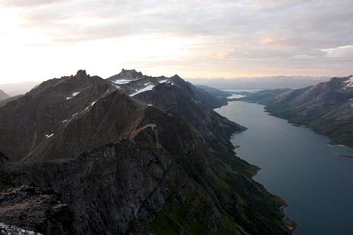
Ersfjord and some of the Ersfjord traverse peaks.

Continuing on the Ersfjord Traverse
Equipment: Rope, light alpine rack.
Rating: 5.6
Go below the middle subsummit and head directly over to the left (southern) summit.
Carefully downclimb large cracks until reaching a rappel anchor. It's a one rope rappel straight over the wall to the base of the ridge.
From there on it's one or two days worth of exposed traversing along the ridge crest over at least 9 named summits.