|
|
Mountain/Rock |
|---|---|
|
|
45.98449°N / 11.37706°E |
|
|
Veneto |
|
|
Hiking, Mountaineering, Skiing |
|
|
Spring, Summer, Fall, Winter |
|
|
6722 ft / 2049 m |
|
|
Overview
Cima Manderiolo 2049 m
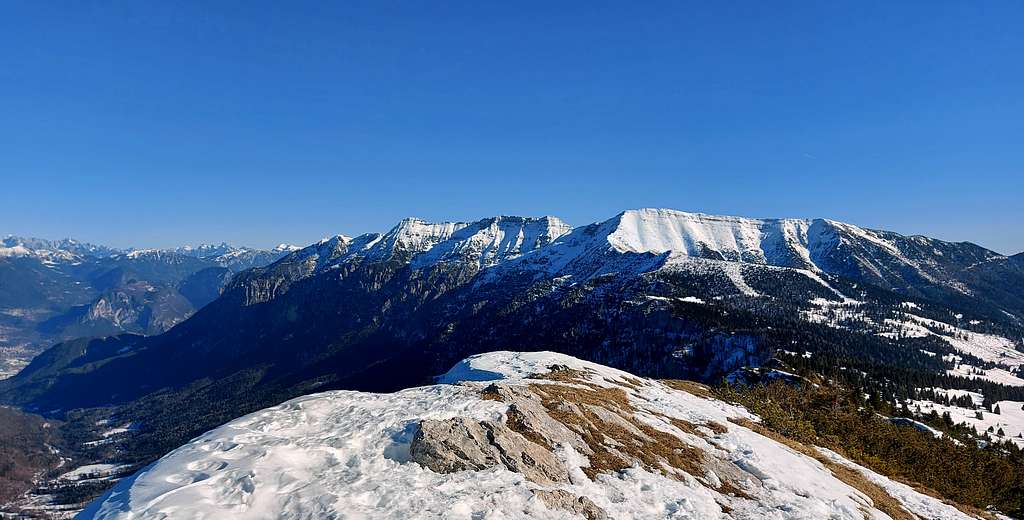
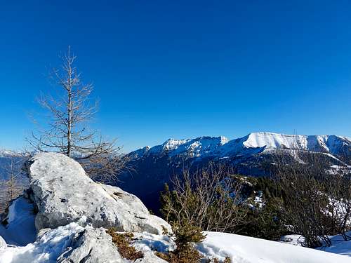
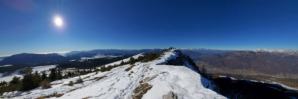
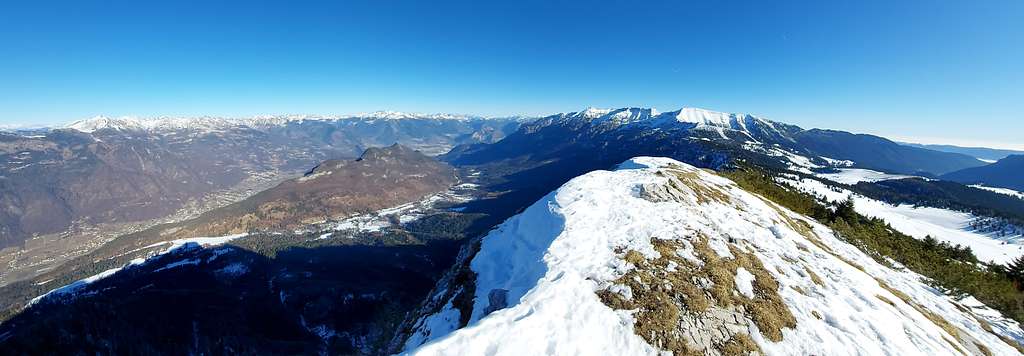
Cima Manderiolo 2029 m, also called Cima Mandriolo, is an interesting minor summit belonging to the Cima Dodici - Ortigara chain, Prealpi Venete, and located on the Altopiano dei Sette Comuni, on the border between Veneto and Trentino. It is a mountain with two completely different faces. In fact, the North side plunges towards the Val Sella in Valsugana with wild and steep rocky walls, while the South side slopes gently towards the Val d’Assa. In addition to the incomparable view of the Valsugana, Cima Manderiolo offers an extremely vast panorama: to the West over the Adamello, Brenta, Ortles-Cevedale groups, to the North over the Lagorai chain and to the East on the Dolomites with the Marmolada, Civetta and Pale di San Lucano groups. Closer on the right the beautiful summits of Cima Portule and Cima Dodici.
History
On Cima Manderiolo there is the homonymous "Italian observatory in the cave", equipped with slits that open on the North wall, overlooking the Valsugana. During the WWI from here the Italian soldiers could control both the underlying area of Levico and Caldonazzo, and the Vezzena plateau with its forts. Just below Cima Manderiolo there is the Costalta cave at an altitude of 1748 m, which was the Italian stronghold before the famous Austrian Strafexpedition, when it was occupied by the Austro-Hungarians. It is one of the largest caves in this area, extending for about 320 meters into the side of the mountain.
Getting there
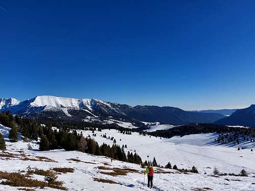
Val Formica is a nice place at an altitude of 1700 meters on the high mountains of Altopiano di Asiago (Asiago plateau). Its name ("formica" means "ant") comes from the presence of huge anthills spread around the woods of the valley, as described in Mario Rigoni Stern’s book “Stagioni”. Here nature reigns supreme and pastures are enclosed in the sky. A magic place to be lived in every season.
- From Valsugana
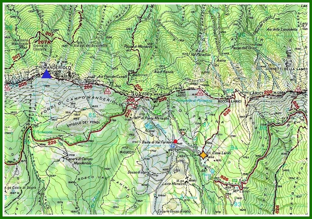
From Valsugana reach Monterovere (through Folgaria or alternatively along the narrow Menador road that comes from Levico - not always open), then Passo Vezzena (1417m). From the pass head towards Ghertele and before reaching the village you will find a road on the left signposted "Rifugio Val Formica". Take this road to reach the startingbpoint of the itinerary near the hut (6 km).
- From Asiago
From Asiago take the S.S. 349 towards Trento, pass the town of Camporovere and after about 10 km, past Ghertele, there is the road leading to Larici - Rif. Formica, coming from this side the road is on the right. Continue for another 6 km to the parking near the huts .
Route from Rifugio Val Formica
Difficulty: E, EI in wintertime
Difference in level: 400 from the parking lot at 1700 m
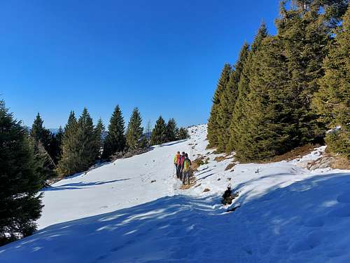
Pleasant snowshoes walk starting from the Rifugio Val Formica
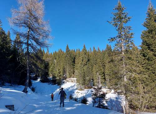
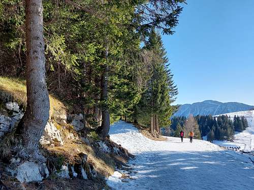
It is possible to start from the parking lot of the Rifugio Val Formica, or alternatively without reaching the refuge, you can start at a road-bend where you take a forest road that enters the fir and larch forest.
After crossing the dense forest, the forest road proceeding towards the Porta Manazzo alm reaches a large clearing, on the left of which it's situated the alm. From the clearing proceed in the direction of a wide saddle, where it's possible to take the first panoramic look over Valsugana and Cima Portule and Cima Dodici.
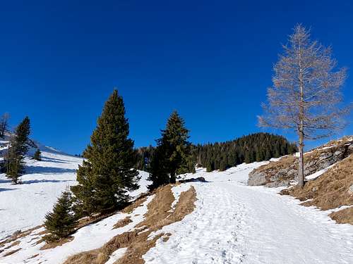
From this saddle the route aims decidedly to the left, crosses a stretch with vegetation of firs and mountain dwarf pines. After a while two possibilities are offered: the first is to continue in the snowy basin with a more monotonous and not direct itinerary.
Alternatively keep a little to the left of the beautiful and panoramic West summit ridge of the mountain and follow it until you reach the highest point of the mountain, which does not coincide with the summit cross, located on a fore-summit located about 50 meters Eastwards. Enjoy the wide 360 degree panorama!
Descent: reversing the same itinerary or alternatively follow the itinerary that was not chosen uphill, making a small loop, with the return point in common
Red Tape
No fees no permits required
Cima Manderiolo summit views
When to Climb
All year round.
Accomodation
At the start of the route you will find two refuges offering possibilities of accomodation. Alternatively different possibilities in the surrounding.
Rifugio Valformica
Rifugio Larici
Meteo
ARPAV - Meteo Veneto
Dolomiti Meteo
Meteotrentino
Bibliography
Map Tabacco, 1:25.000 – sheet 050 – “Altopiano dei Sette Comuni Asiago - Ortigara”