La montagna chiama i suoi figli, ed essi rispondono fedelmente al suo appello…
Osvaldo Cardellina, Diario alpinistico, 1964-65
Page texts: @ OsvaldoCardellina"Osva", passed away on May 2, 2022. Page owners: Christian Cardellina e Osvaldo Cardellina. Any updates from September 12, 2022: Antonio Giani, page administrator, friend and climbing companion.
Testi della pagina: @ OsvaldoCardellina "Osva", scomparso il 2 maggio 2022. Proprietari pagina:Christian Cardellina e Osvaldo Cardellina. Eventuali aggiornamenti dal 12 settembre 2022: Antonio Giani, amministratore della pagina, amico e compagno di salite.
Reddish Overview Waters
An old track for Mineral through the Red Waters. When from the small Church of Cret reach the Tsavanis Waterfall immediately before the homonym Alp you pass below the Cote Piemont. Went there on the ancient route that carried the ore Veins of Larsinaz, Costa del Pino and Colonna Magnetite or Loadstone Mines, below the overhanging Mont Creya (3.015m), that "traveling" to the Canavese and Ivrea (Piedmont Region). In those days there was no tunnel, drilling the mountain crossed with that long tunnel of 11 km, comes out to Eaux Froides (just below Pila); and then transported by cable car in Aosta at Ansaldo (current Steelworks Cogne S.p.a.). But it is something of the past century. But first? First, came the next Broillot or even called Broillà Pastures, just at the feet of Punta Nera Miserino right at entrance into Acque Rosse Valley.
Una vecchia pista per Minerale attraverso le Acque Rosse. Quando dalla chiesetta di Cret si raggiunge la Cascata di Tsavanis subito prima dell'omonima Alpe si passa sotto la Cote Piemonte. Vi si recava sull'antica via che portava le Vene di Larsinaz, Costa del Pino e Colonna Magnetite o Miniere di Loadstone, sotto lo strapiombante Mont Creya (3.015 m), che "viaggiava" verso il Canavese e Ivrea (Piemonte). A quei tempi non c'era galleria, perforando la montagna attraversata con quella galleria lunga 11 km, esce a Eaux Froides (appena sotto Pila); e poi trasportato in funivia ad Aosta presso Ansaldo (l'attuale Acciaierie Cogne S.p.a.). Ma è qualcosa del secolo scorso. Ma prima? Dapprima venne il successivo Pascolo Broillot o anche detto Broillà, proprio ai piedi della Punta Nera Miserino proprio all'imbocco della Valle delle Acque Rosse.
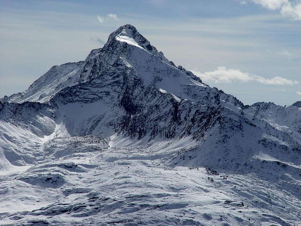
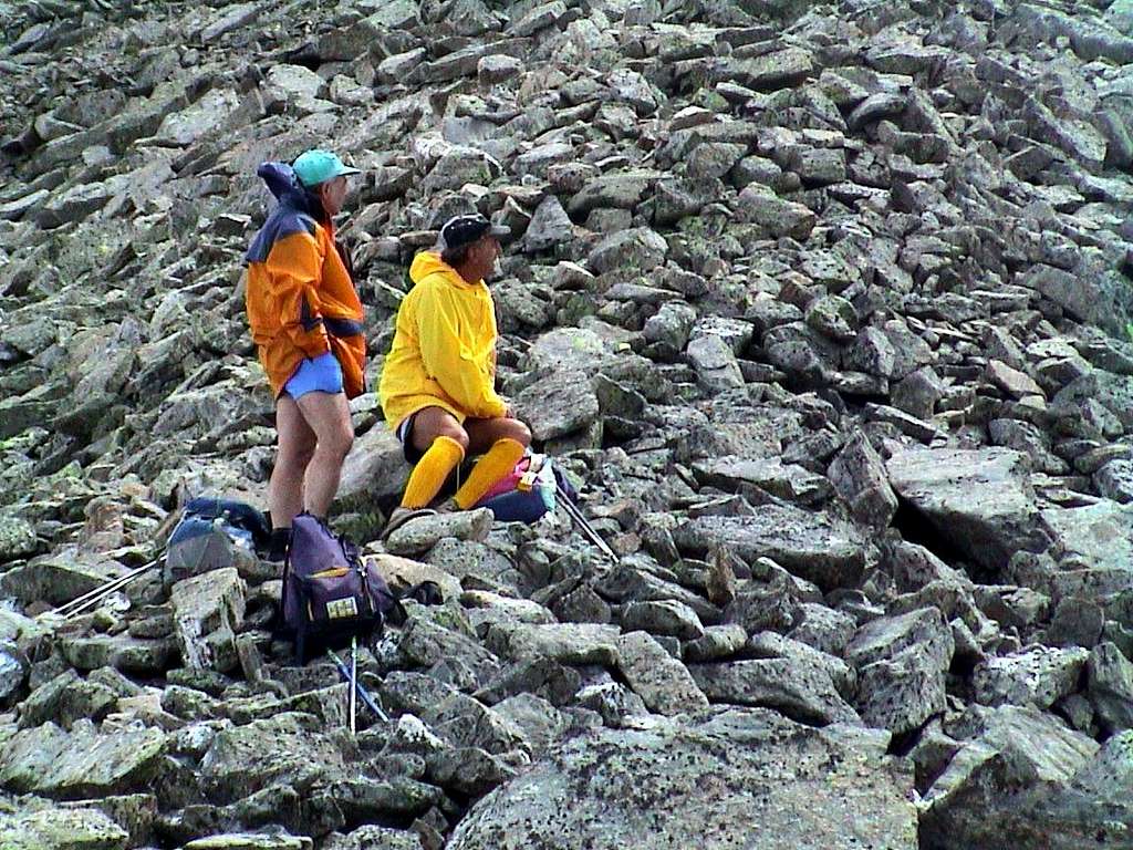
To Acque Rosse Pass from the entrance just after Broillot Alp, by marco87
Was loaded on a beautiful carriageway (still the remains), then the trail, taking the ancient road to the Arietta Pass, just more to the East of Miserino Basin. From there they did go down to San Besso and the Vallon of Rancio which in turn flows into the much more important than Locana Valley, also called Orco's Valley, named after its main stream. A long and dangerous because, passing under the walls of the Testa (Head) of the Nouva or Noua was somewhat exposed to falling rocks. Also a crossing exposed immediately below the hill, with a diagonal descent, increased even more risk. Yet they passed. Continuously. But this was only one of the transport routes, or in anticipation of a deep valley, is passed to the Hill of the Scaletta (Ladder) or to that of the Bocchetta (Nozzle) of Rancio. But above that of Acque Rosse (Red Water, due to the iron in the same) at the end of the namesake vallon and at the foot of the Tower of Lavina. To "enter" this must be, always starting from Broillot, dubbed the Punta Nera on the right following a path beginning at the Southwest and Southeast while reaching a series of ponds. From here the carriageway is dispersed in a great heap of stones; riding the "rump" of that we reach the end where the road, now reduced to a simple path, is wedged between rocks left in disrepair reaching the narrow passage. It was not to be easy to get up here with the ore, although the main effort was definitely one done by mules. Followed even here the long descent into Rancio Vallon (Piedmont), as in the previous route. A particular valley and "flat", content to the East by the great watershed connecting Punta Nera Miserino's with two Lavina's Towers. On the opposite side, however, after a ridge that descends to the North-northwest of this forming various small Summits and carvings of Acque Rosse (3.016m, 2.996m, 3.009m, 2.966m, 2.947m, 2.928m, 2.948m) relax quieter "slipping" progressively towards West on the next Vallone of Bardoney.
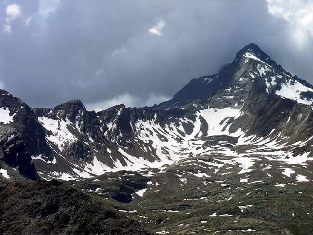
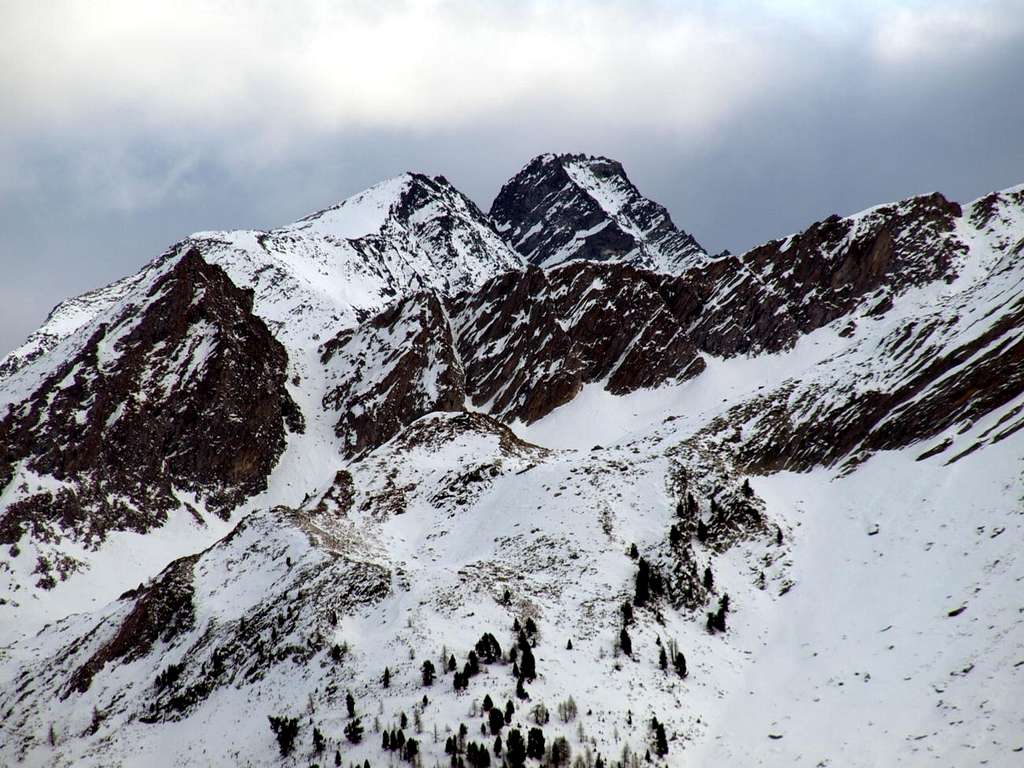
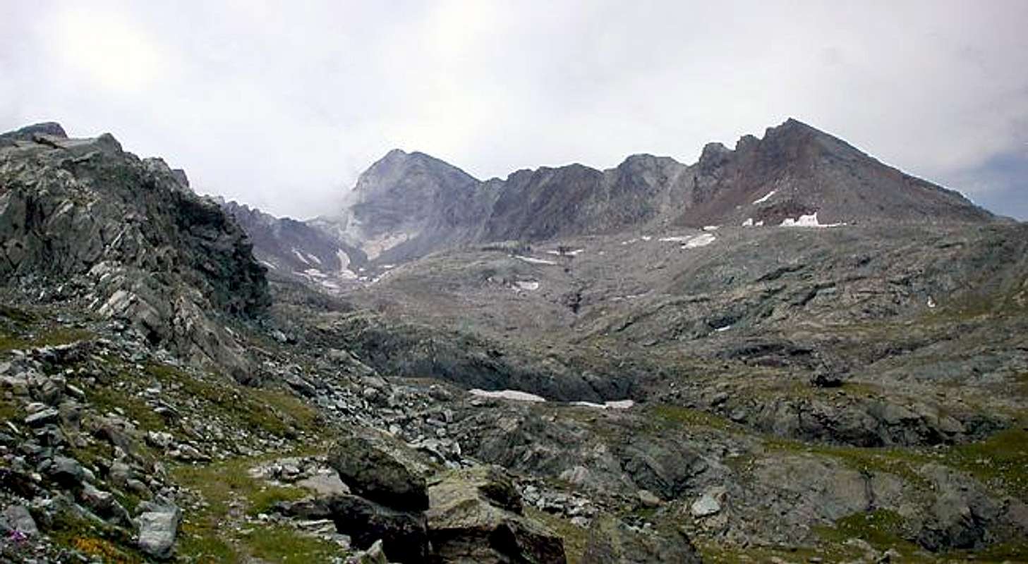
Acque Rosse: Punta Nera, Scaletta, Rancio, Acque Rosse Pass, Lavina Tower, Gr. & Pt. Arolla, by emilius 2002Un'antica pista per il Minerale attraverso le Acque Rosse.Quando dalla Chiesetta del Cret raggiungi la Cascata e l'Alpe del Tsavanis o Chavanis tu passi al di sotto della Cote Piemont. Là sopra passava l'antica via trasportante il minerale delle Vene di Larsinaz, Costa del Pino e Colonna che "viaggiava" verso il Canavese ed Eporedia (Ivrea) in Piemonte. A quei tempi non esisteva la galleria che, trapanando la montagna attraversava con quel lungo tunnel di 11 Kilometri, esce fuori ad Eaux Froides (Pila); per poi essere trasportato con la funicolare ad Aosta allo Stabilimento Ansaldo (attuale Cogne S.p.a.). Ma é cosa del secolo passato. Ma prima? Prima, giunto alla successiva Alpe Broillot o Broillà, veniva caricato su una bella strada carraia (ne rimangono i resti), poi mulattiera, prendendo la strada per il Colle dell'Arietta, appena più ad Oriente della Conca del Miserino. Da lì lo facevan scendere verso San Besso ed il Vallone del Rancio che a sua volta sfocia in quello ben più importante della Valle di Locana, detta anche Valle dell'Orco dal nome del principale torrente. Una via lunga e pericolosa poiché, passando sotto le pareti della Testa de la Nouva era alquanto esposta a caduta di pietre. Inoltre una traversata esposta subito appresso al colle, con un diagonale in discesa, aumentava ancor più i rischi. Eppur passavano. Continuamente. Quest'era soltanto una delle varie vie di trasporto.
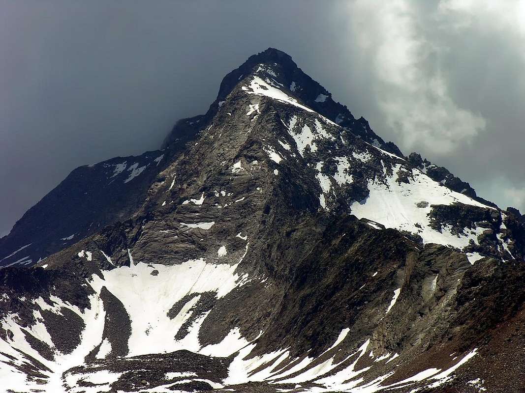
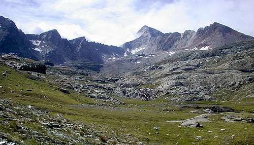
Towards Acque Rosse Pass from Punta Nera to Lavina's Tower, by livioz 1993
Altrimenti, anticipando d'un vallone, si passava ai Colli della Scaletta e della Bocchetta del Rancio, collocati sullo spartiacque prima del Colle e Torre di Lavina.Ma soprattutto a quello d'Acque Rosse (causa il ricco contenuto in materiale ferroso) al termine dell'omonimo vallone ed ai piedi della Torre di Lavina. Per "entrare" in questo si deve, partendo sempre dal Broillot o Broillà, doppiare sulla destra la Punta Nera del Miserino seguendo un sentiero dapprima a Sudovest e poi a Sudest raggiungendo una serie di laghetti, in genere ghiacciati insino a stagione avanzata. Da qui la carraia si disperde in grande pietraia; cavalcando la "groppa" della stessa si raggiunge la parte finale ove la via, ormai ridotta a semplice sentiero, s'incunea a sinistra tra nevati e rocce in sfacelo raggiungendo lo stretto passo tra grandi blocchi. Non doveva esser facile arrivar quassù col minerale, anche se lo sforzo maggiore era sicuramente quello fatto dai muli. Seguiva anche qui la lunga discesa verso il Vallone del Rancio e Piemonte, come nella precedente. Un vallone particolare e "piatto", contenuto ad Est da questo grande spartiacque che unisce la Punta Nera alla Torre di Lavina. Sul lato opposto invece, dopo una cresta che discende a Nord-nordovest di questa formando le cosiddette Punte d'Acque Rosse, si distende più tranquillo "scivolando" progressivamente verso il successivo del Bardoney.
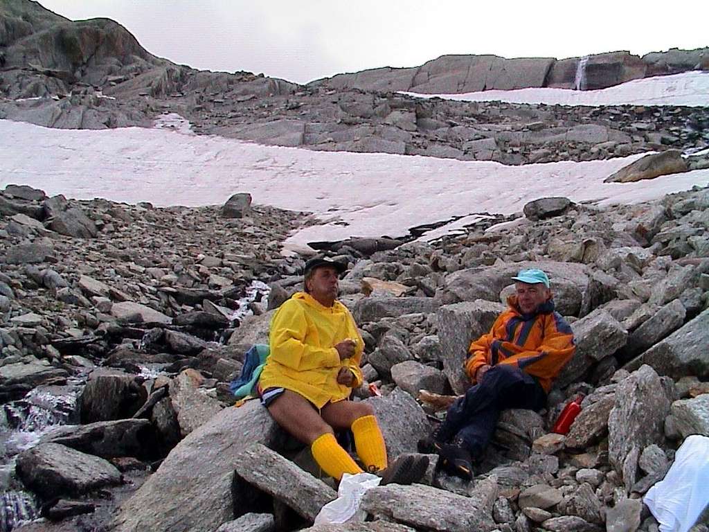
Arriving from Lillaz through Alp Broillà to Acque Rosse Vallon, by Lupino 2008
Getting There
BY CAR:
From TORINO, MILANO, etc: Motorway A5. Exit at IVREA or Quincinetto (PIEDMONT) AOSTA West/Aymavilles, Cogne Municipalities.
Specific Roads From Aymavilles Municipality(646m) towards Cogne Valley progressively reaching the Hamlets of Vieyes(1.158m), Epinel(1.436m), Crétaz(1.494m) until Cogne Common(1.563m). From this in East through the Regional Road (7,5 Km.) to arrive at Lillaz Fraction (1.607m), passing near Champlong(1.596m) Village. Take the farms dirt road towards "Sogno di Berdzé" Refuge at Peradzà Alp in Urtier Vallon, under the Fenêtre of Champorcher. Reach the junction 2.363 meters on dirt road, after turn South to the Broillot or Broillà Alp (2.399m) at the feet and just at entrance on Miserino's Conca.
From FRANCE: through the Mont Blanc Tunnel to Entrèves-crossroads to Vény/Ferret Valleys - Mountain Guides of Courmayeur - La Saxe Rock Gym - Courmayeur.ByLittle Saint Bernard Hill, closed since November until half May to La Thuile Valley - Pré Saint Didier - Courmayeur. It is not necessary to take Motorway A5: you can drive on SR.26, in the direction of AOSTA - IVREA - TURIN.
BY PLANE:
Aeroporto "Corrado Gex" Saint Christophe (Aosta).
Recommended Excursions
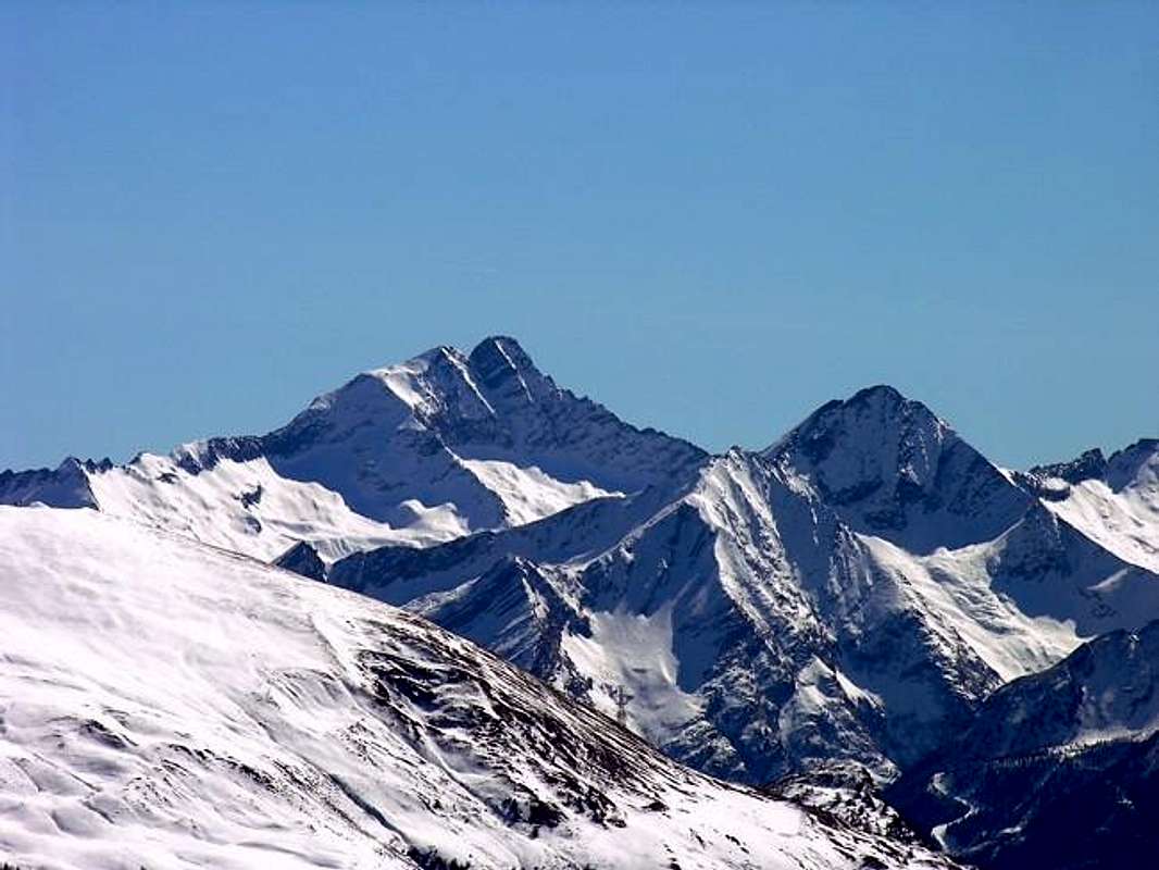
Winter Emilius to Tersiva Point/Lavina’s Towers Groups, by Marco Cossard, 1975
The Vallons most important & the recommended Excursions (4)
1) - From Broillot Alp towards Punta Nera (3.063/4m): Excursion-Climbing from Lillaz Village with trails 10/13A before in South-southeastast towards Alp Broillot (2.399m), after with path TVC/13D in Southwest and South entering in Acque Rosse Vallon. Reached the ponds (2.586m, 2.626m) continue East towards the large saddle 2.956 metres,through the steep and not easy rocky Western Slope. By Southern Crest in final part easily through debris and broken rocks to Punta Nera (EE/A/F+; 2h'15/2h'30).
2) - Broillot Alp (2.399m) to Acque Rosse Pass (2.947m): Excursion-Climbing from Lillaz Village with path TVC/13D before in East to Alp Broillot, after Southwest and South entering in Acque Rosse Vallon with path TVC/13D. Reached the two ponds (2.655m, 2.660m) towards the end of the vallon with path always TVC/13D and Acque Rosse Pass, through sparce traces in moraine on short and easy Northern Slope, just before the beginning of Northeast Ridge Lavina's Tower (EE/A/F+; 5h'15/5h'30).
3) - By Lillaz Hamlet through Goilles Dèsott, Bouc, Planes, Cabin P.N.G.P. (1.831m, 1.861m) towards Longues Teppes at the entrance of Acque Rosse Vallon: Excursion with paths in East-southeast on 13/Alta Via n° 2 and along the Southern shore of Urtier Torrent to two following forks to Bouc and Planes Pastures (1.861m, 2.023m). Crossing Eaux Rousses Torrent, towards the Casotto P.N.G.P. (2.156m) above Longues Teppes and at the beginning of Acque Rosse Vallon (E/F; 2h'00/2h'30).
4) - Acque Rosse Pass traverse by Northeast and North Ridges towards two Lavina's Towers (Northern 3.277m; Southern 3.308m): Excursion-Climbing in West from pass through Northeast Ridge with two workarounds first South then North (more difficult on edge) towards the Northern Ante Top (3.277m) and subsequent traverse to Southern Summit, the highest (3.308m), by North Ridge after a short descent to carving 3.245 meters and always North Crest in final part (A/PD+/PD-/PD+; 1h'20/1h'40).
Acque Rosse Pass (2.947m) & Lavina Tower (3.308m) above the small Valley of Acque Rosse, by emilius 2002, Antonio 2005/6 & Osw 2016
Red Tape
Within the borders of the P.N.G.P. (Parco Nazionale del Gran Paradiso), at the moment (summer 2004), dogs generally are not allowed, except on a couple of trails, and camping is forbidden (except for climbers from sunset till dawn). No fees are due.
"Guida delle Alpi Occidentali" di Giovanni Bobba e Luigi Vaccarone C.A.I. Sezione di Torino Volume II (parte II), 25 Maggio 1896.
"Rifugi e bivacchi in Valle d'Aosta" di Cosimo Zappelli aggiornata da Pietro Giglio. Musumeci Editore, Luglio 2002.
"Il Parco Nazionale del Gran Paradiso (Valli di Champorcher-Clavalitè-Saint Marcel-Laures-Cogne-Valsavarenche-Conca di Pila" di Giulio Berruto 3/volume 2°, IGC, Torino 1981, 2a Ed. 2000. (in Italian)
"Guida dei Monti d'Italia-Gran Paradiso Parco Nazionale" E. Andreis, R. Chabod, M. C. Santis, Club Alpino Italiano/Touring Club Italiano, prima Ed. 1939; seconda Ed. 1963; terza Ed. 1980.
"Gran Paradiso", A. Gegenfurtner, G. Klotz, F. Müller, Ed. Bergverlag Rudolf Rother, Monaco 1980 (in tedesco).
"Gran Paradiso", G. Klotz, Ed. Bergverlag GmbH Rother, Monaco 2005 (in tedesco).
"Gran Paradiso", di Pierandrea Mantovani e Renato Misischi, Ed. Rassegna Alpina, 1974.
MAPS:
Kompass "Gran Paradiso Valle d'Aosta Sentieri e rifugi" Carta turistica 1:50.000.
L'Escursionista "Tour de la Vallée de Cogne Grand Paradis" Carta dei sentieri 1:25.000.
I.G.C. Istituto Geografico Centrale "Gran Paradiso-La Grivola-Cogne" Carta turistica 1:25.000.
I.G.M. Istituto Geografico Militare Foglio 41 1:25000: I SO Gran Paradiso - I NE Cogne.
A.IA.T "Cogne Gran Paradiso Cogne Aymavilles-Walking map" 1:25.000.
L'Escursionista "Valle di Cogne" Carta dei sentieri (n° 10) 1:25.000.
Parents refers to a larger category under which an object falls. For example, theAconcagua mountain page has the 'Aconcagua Group' and the 'Seven Summits' asparents and is a parent itself to many routes, photos, and Trip Reports.


 3975 Hits
 79.78% Score
 11 Votes

 To Acque Rosse Pass from the entrance just after Broillot Alp, by marco87
 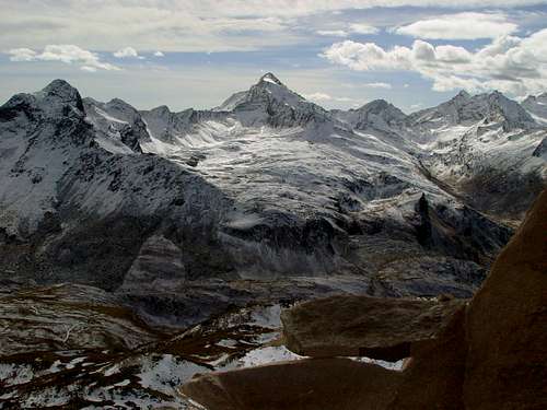 Acque Rosse: Punta Nera, Scaletta, Rancio, Acque Rosse Pass, Lavina Tower, Gr. & Pt. Arolla, by emilius 2002
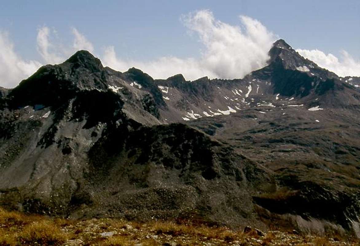 Towards Acque Rosse Pass from Punta Nera to Lavina's Tower, by livioz 1993
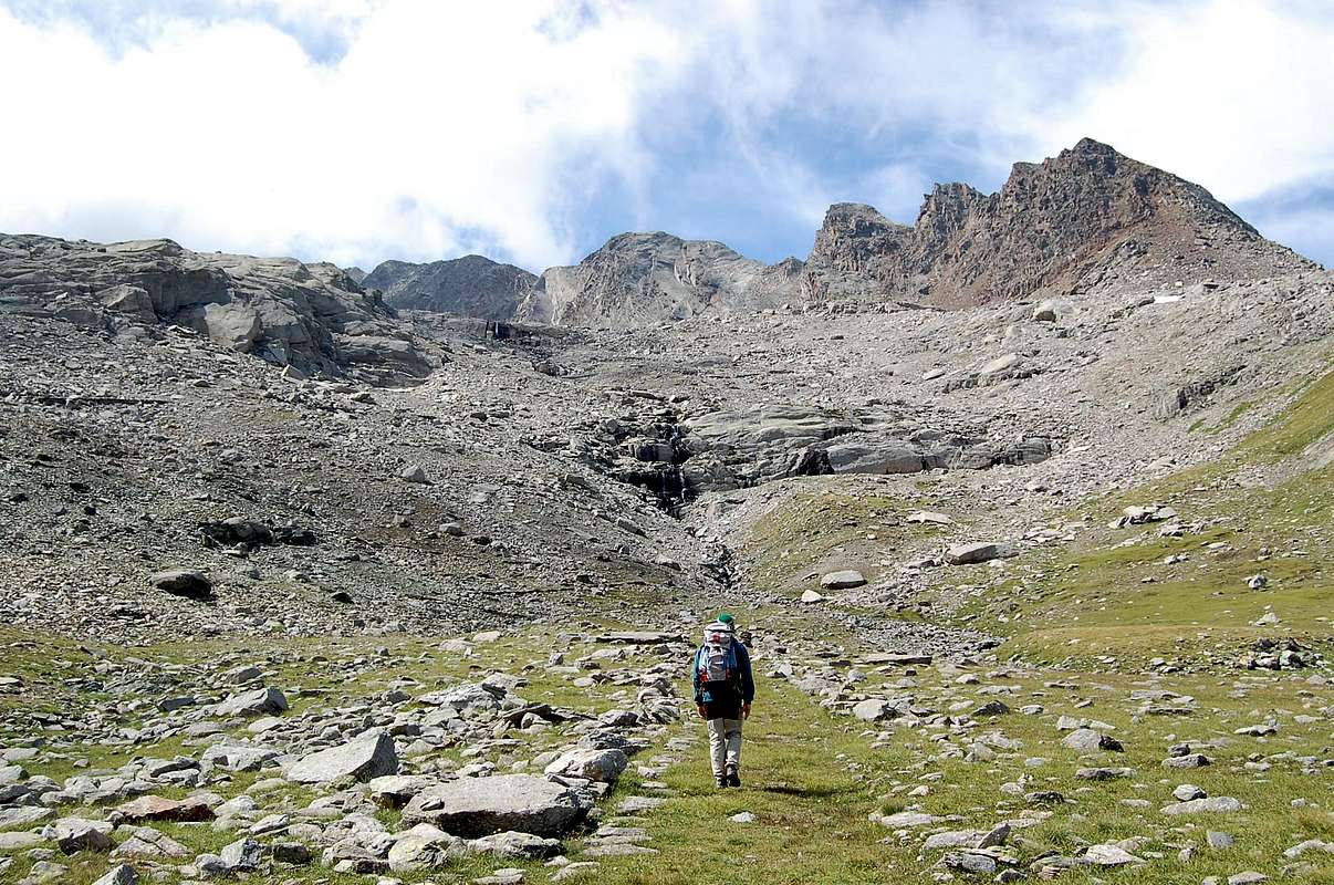
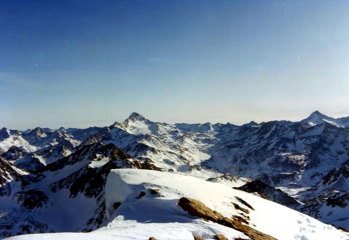 Winter Emilius to Tersiva Point/Lavina’s Towers Groups, by Marco Cossard, 1975