Hiking, Mountaineering, Trad Climbing, Sport Climbing, Bouldering, Ice Climbing, Aid Climbing, Big Wall, Mixed, Scrambling, Via Ferrata, Canyoneering, Skiing
La montagna chiama i suoi figli, ed essi rispondono fedelmente al suo appello…
Osvaldo Cardellina, Diario alpinistico, 1964-65
Page texts: @ OsvaldoCardellina"Osva", passed away on May 2, 2022. Page owners: Christian Cardellina e Osvaldo Cardellina. Any updates from September 12, 2022: Antonio Giani, page administrator, friend and climbing companion.
Testi della pagina: @ OsvaldoCardellina "Osva", scomparso il 2 maggio 2022. Proprietari pagina:Christian Cardellina e Osvaldo Cardellina. Eventuali aggiornamenti dal 12 settembre 2022: Antonio Giani, amministratore della pagina, amico e compagno di salite.
Overview
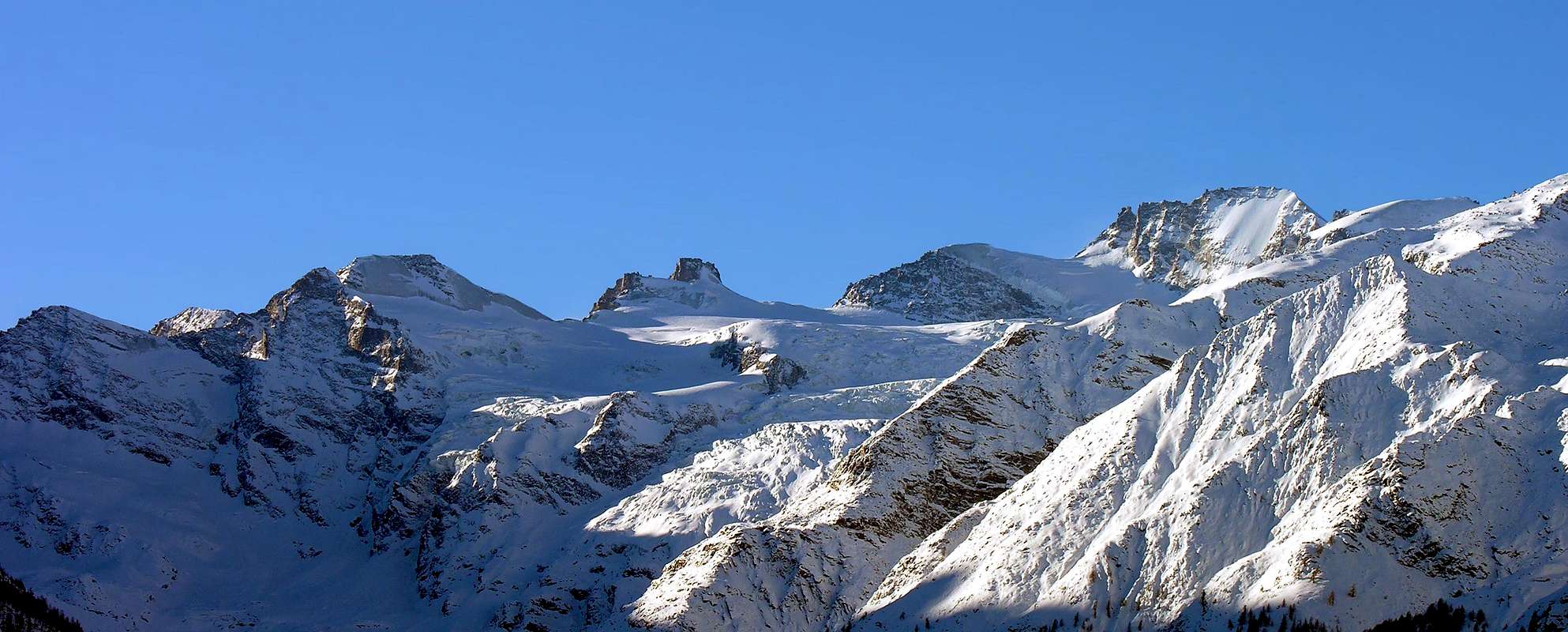
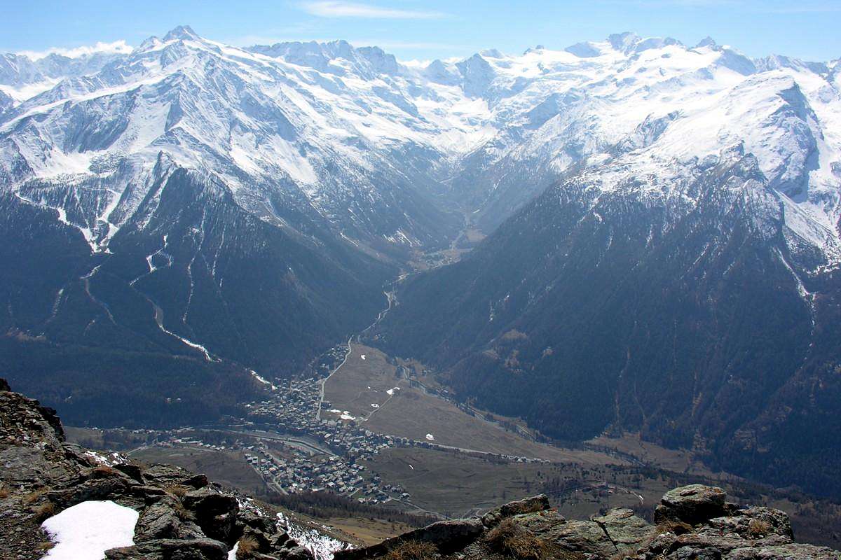
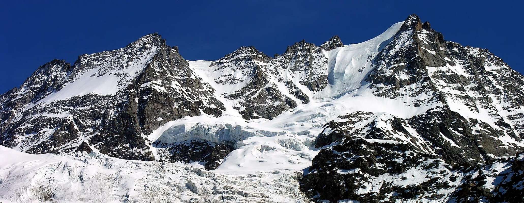
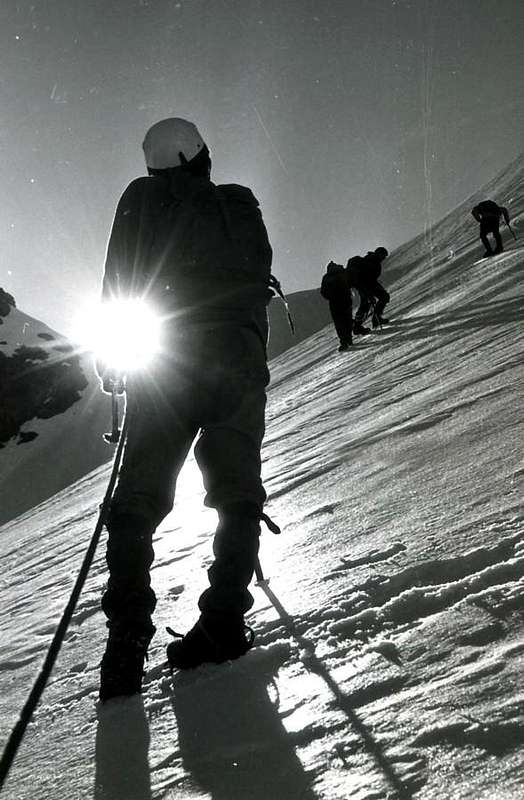
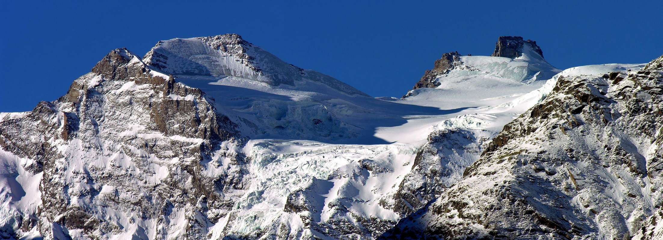
A valley too busy. Surely it is the vallon, almost a valley, the most popular of the whole Val de Cogne or at least the most characteristic. Indeed, even if Lillaz, at least in the summer, knows a large influx, for Valnontey this fact occurs throughout the year. The renowned and now very famous "Marciagranparadiso" reaches them both, but while "touches" the first, "wraps" the second completely. In summer, however, are the masters of the Horses, offering great walks, starting and arriving in a few tourist stall. But his true calling is another; its essence is Mountaineering. Big and beautiful mountains unfold from East to the West, where end with the pyramids Grivola Gran Nomenon.
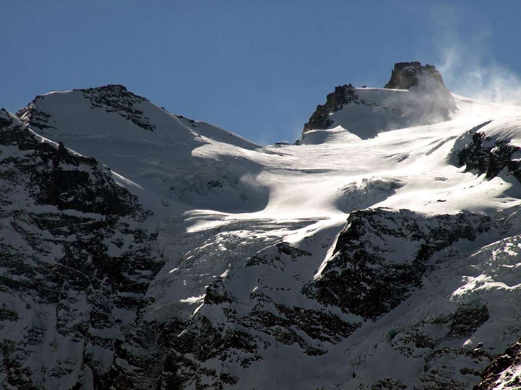
If it goes to Gimillan or Dzimillan or you can see it all. Without even paying a cent or, if you like, a dollar. Start on the left with the tracks of downhill skiing under the Montseuc and above the beautiful forest of Sylvenoire. Then, slowly, salt forming pyramids of Fenilia, of Vermiana and Valletta. Here begin the ice that spread at the foot of Pointe Tsissettaz and two Punte Patrì. Then "explodes" the Chain of the Apostles with the Towers of Sant'Orso, St. Andrea and Gran San Pietro, now the border with Piedmont. With a turn off and the patient reaches the watershed Becco of the Pazienza, the Roccia Viva and, down there down, Becca of Gay. The name makes it clear to us that we are increasingly projected towards this region. But the three North Walls, with their steep chutes, remind us that we are always on the ground Aosta Valley, with its glaciers that reach from Money Grand Crou to turn into a massive flood with the upset of the Tribolazione Glacier. At the foot of the Punta Ceresole, but especially those in the Gran Paradiso, which falls on the same with his beautiful and icy East Wall. From here the watershed with the adjacent Valsavarenche drops very long towards the North, reaching the first Herbetet then La Grivola and Gran Nomenon, where "dies" over the Central Valley of Dora Baltea. Here, as in Savarenche, to see the top you have to "get out" from population centers: one discovers gradually that you follow the valley that goes to his heart, like a big wedge. Or go upwards to Gimillan Hamlet. The Bivouacs of Money, Martinotti, Borghi, Gerard-Grappein and Pol "heartened" a little the Mountaineers should expect great labors. But on this side of the "Granpa" not allowed" so easily and you should ask the pass bypassing the Roc to put your foot on the Glacier of Gran Paradiso, on the Normal Route by Valsavarenche, passing through Vittorio Emanuele II° Shelter. Or face hard walls or walk along the long ridge that rises North from Piccolo Paradiso. Here nothing is given to you, even if you face the first easy excursions to the beginning: they are long and require good hocks ...
Consiste in vallone anche troppo frequentato. Sicuramente é quello, quasi una valle, più frequentato dell'intera Val de Cogne o perlomeno il più caratterizzante. Infatti anche se la Frazione di Lillaz, almen in estate, conosce un grande afflusso, per Valnontey questo fatto si verifica per tutto l'anno. La "Marciagranparadiso" le raggiunge entrambe, ma, mentre "sfiora" la prima, "avvolge" completamente la seconda. In estate invece la fan da padroni i Cavalli, che propongono grandi passeggiate, partendo ed arrivando tra qualche bancarella turistica. Ma la sua vera vocazione é altra; la sua essenza é Alpinistica. Grandi e belle montagne si dispiegano da Oriente ad Occidente, dove terminano con le slanciate nonché ardue piramidi della Grivola e del Gran Nomenon.
Se si và a Gimillan o Dzimillan si può ammirar il tutto. Senza neppure pagare un centesimo o, se volete, un dollaro. Inizia a sinistra con le piste di Sci da discesa sotto il Montseuc e sopra il bel bosco di Sylvenoire. Poi, pian piano, sale formando le piramidi della Fenilia, di Vermiana e Valletta. Qui iniziano i ghiacci che s'allargano ai piedi della Tsissettaz e delle Patrì. Poi si spalanca la Catena degli Apostoli con le Torri di Sant'Orso, Sant'Andrea e del Gran San Pietro, ormai al confine con il Piemonte. Con un giro largo e paziente lo spartiacque raggiunge il Becco della Pazienza, la Roccia Viva e laggiù, in fondo, la Becca di Gay. Il nome ci fà capire che siam sempre più proiettati verso questa regione. Ma le tre Pareti Nord, con i loro ripidissimi scivoli, ci ricordano che siamo sempre in terra valdostana, con i suoi ghiacciai che da Money raggiungon quelli di Grand Crou per tramutarsi in un'immane fiumana con lo sconvolto Ghiacciaio della Tribolazione. Ai piedi della Punta di Ceresole, ma, soprattutto, a quelli del Gran Paradiso, che scende sopra il medesimo con la sua bella e ghiacciata Parete Est. Da qui lo spartiacque con l'adiacente Valsavarenche scende lunghissimo verso Settentrione raggiungendo dapprima l'Herbetet e poi La Grivola ed il Gran Nomenon, dove "muore" sopra la Valle Centrale della Dora Baltea. Anche qui, come nella Savarenche, per veder la cima devi "uscire" dai centri abitati: si scopre a poco a poco che tu segui la valle dirigentesi verso il suo cuore, come un grande cuneo. Oppure vai sù a Gimillan. I Bivacchi di Money, Martinotti, Borghi, Gerard-Grappein e Pol "rincuorano" un pò gli Alpinisti che debbon aspettarsi grandi faticate. Ma da questa parte il "Granpa" non si concede" sì facilmente e devi chiedere il lasciapassare scavalcando il Roc per mettere piede sul Ghiacciaio del Gran Paradiso, sulla Via Normale da Valsavara dall'Emanuele II°. Oppure affronti ostiche pareti o percorri la lunga Cresta Nord che sale dal Piccolo. Qui nulla ti vien regalato, anche affrontando le prime escursioni sin dall'inizio: son lunghe e richiedono buoni garretti ...
Getting There
BY CAR:
From TORINO, MILANO, etc: Motorway A5. Exit at IVREA or Quincinetto (PIEDMONT).
AOSTA West: Aymavilles, Cogne Municipalities. From Aymavilles(646m) towards Cogne Valley: Vieyes (1.158m) Epinel (1.436m), Crétaz(1.494m) Hamlets to Cogne(1.534m) Commune; through Main Road. From this towards Valnontey (1.678m) below Money, Alessandro Martinotti, Stefano Borghi, Carlo Pol, Marcello Gerard-Ettore Grappein, Lionello e Lucio Leonessa, Mario Balzola, Luciano Gratton, at the base of the district that goes from Punte Patrì East to the West to Punta Rossa, passing under the Gran Paradiso. (This last from Epinel or Crétaz Fractions) Bivouacs, through paths, moraines and glacier, and Vittorio Sella Refuge, through muletrack).
From FRANCE: through the Mont Blanc Tunnel to Entrèves-crossroads to Vény/Ferret Valleys - Mountain Guides of Courmayeur - La Saxe Rock Gym - Courmayeur.
ByLittle Saint Bernard Hill, closed since November until half May to La Thuile Valley - Pré Saint Didier - Courmayeur. It is not necessary to take Motorway A5: you can drive on SS.26, in the direction of AOSTA - IVREA - TURIN.
BY PLANE:
Aeroporto "Corrado Gex" Saint Christophe (Aosta).
New & Old Routes (15)
Vallons most important & some recommended Excursions & Climbs (15)
1) -From Valnontey Hamlet towards Vermiana or Valmiana Alpage(1.674m, 1.729m): Walk with path-muletrack in South n° 23/TVC/Alta Via n° 2 to the Pasture (junction towards the Refuge Vittorio Sella into the Lauson or Lozon Basin) at the beginning of Valnontey Vallon, below Tribolazione Glacier (T/F; 0h'40/0h'50).
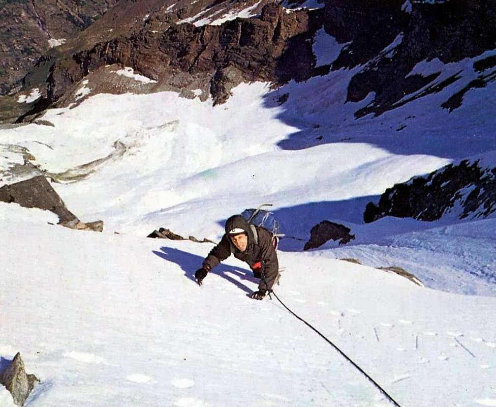
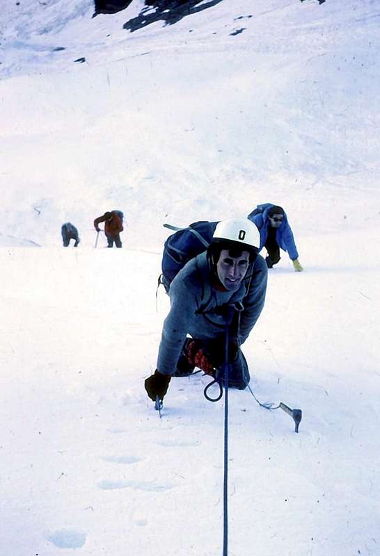
2) - By Vermiana towards the fork before Eurfalets Bridge (about 1.800 meters, 1.826m): Excursion-Climbing from Valnontey with path n° 22C/TVC in Southeast through Comba Couteleina towards Money Alp and Money Bivouac(2.334m, 2.872m), below Southern Punte Patrì, Patrì/Coupè de Money Glaciers (EE/A/F+; 3h'15/3h'30).
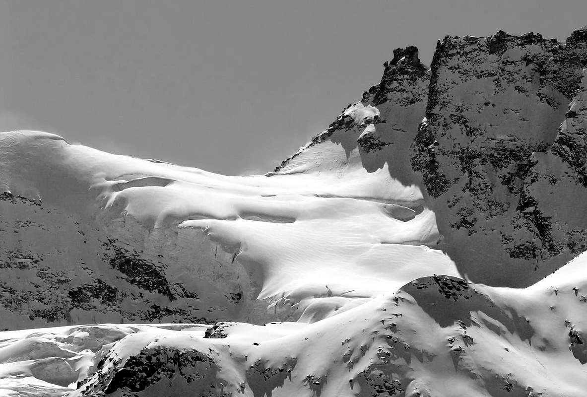
3) - From Vermiana Alp towards the Comba Valletta and Punta Cissetta or Tsissettaz: Excursion-Climbing from Valnontey Village before with path n° 23/TVC in South, after pathless but with traces through Comba Valletta towards the Tsissettaz or Cissetta Glacier and Punta (3.417m), by easy and icy Northern Slope (A/F+; 4h'00/4h'30).
4) - From Money Bivouac to Patrì Pass: Excursion-Climbing from bivouac with enough easy traverse in Northeast to Patrì Pass (3.359m) (A/PD/PD+; 4h'00/4h'15).
5) - By Money Bivouac to Patrì Northwest Face: Climbing in ice rather challenging (from 40° to 45°) to Southern and Northern Punte Patrì (3.579m, 3.558m), by Northwest Face right side, above Patrì Glacier, with easy traverse (be careful in "verglass" and to the snowy cornices) of the two Summit in both directions (A/PD+/AD; 3h'15/3h'45).
6) - Money to St. Orso Tower: Crossing on Coupé de Money Glacier to Pass (3.383m) and Climbing of the Tower (3.618m), by West-northwest Face (A/PD-; 3h'15/3h'30).
7) - By Money Bivouac Apostles Crossing: from bivouac to Coupé de Money and Money Glaciers with Climbing on Gran San Pietro Tower (3.692m) by West-northwest Face (43° to 48°) and great Apostles "Classic" Traverse towards Sant'Andrea Southern Northern and Sant'Orso Towers (3.640m, 3.643m, 3.610m) (A/PD-/PD+; 5h'30/6h'30).
8) - Towards Alessandro Martinotti and Stefano Borghi Bivouacs: Excursion before in South from Valnontey with base trail n° 22 towards Eurfalets Bridge (1.825m-1.846m) along Valnontey Torrent, after in Southeast with path n° 22E towards Alessandro Martinotti Bivouac (2.588m), below the West Face of Roccia Viva. Else more to the South by path n° 22F towards Stefano Borghi Bivouac (2.684m), just below the North Wall Becca di Gay, both between two Eastern Gran Crou Glaciers (EE/F; 3h'00/3h'15).
9) - From Alessandro Martinotti Bivouac to Roccia Viva by Normal Route or West-northwest Ridge: Climbing from bivouac to Low Gran Crou Glacier and crossing quite easily on Southern Hanging Gran Crou Glacier, by the rocky West-northwest Crest (along the edge of the Western Wall and more in South to the Becca of Gay and avoiding initially with some workarounds on Southern side, and after completely in edge) of Roccia Viva (3.383m) or Standard Route from Cogne Valley (A/F+PD-; 5h'00/5h'30).
10) - Alessandro Martinotti Bivouac to Roccia Viva by West-northwest "Crestone": Climbing from bivouac to Lower Gran Crou Glacier and crossing in South Hanging Gran Crou Glacier, by West-northwest "Crestone" on Northwest Wall Roccia Viva in parallel but more to the North than the Standard Via (A/PD+/AD+/AD-; 6h'15/6h'30).
11) - Bivouacs Carlo Pol and Marcello Gerard-Ettore Grappein: Crossing from Valnontey to the South always through the base path n° 22 of the entire valley with Ascent by scarce traces towards the two camps (3183m) through the great rocky promontory called "Balma des Bouquetins", below Tribolazione Glacier (A/F+/PD-; 3h'30/4h'00).
12) - From the two Bivouacs Carlo Pol and Gerard-Grappein to Roc of Gran Paradiso: delicate Crossing before to the South ((Due to large crevasses are often impossible to overcome). Then West-southwest on Tribolazione Glacier reaching the "Ape (Bear) Pass" over the "Cresta Gastaldi". From this climbing on the Eastern Face of Roc through broken and rotten rocks oten with ice. Descent towards the opposite slope or Northwest above Gran Paradiso Glacier with traverse on the same up to the Maxim Vertex. Possibility of crossing towards the Valsavarenche, passing near Refuge Vittorio Emanuele II°, via Southwest Slope or the Normal Via of Gran Paradiso (A/F+/PD-/PD/F; 4h'00/4h'30; in descent from Summit 1h'30/1h'45 to shelter; 2h'30/3h'00 towards Pont Valsavarenche Village at 2.000 meters about with great parking in earth.
13) - From Valnontey to Refuge Vittorio Sella and Lauson or Lozon Hill: by Valnontey with a comfortable muletrack starting from the meadows once crossed the bridge you can get the Rifugio Vittorio Sella (2.584m) placed in a wide plain near the Loson Torrent to get the "Alpine Garden Paradisia", on the path of the 18/TVC/Alta Via n° 2. From shelter in West along the same uo to the Lauson Hill (3.296m), between Punta del Tuf and Punta Vermiana (E/F; 2h'00/2h'30 from refuge; 3h'45/4h'15 by Valnontey).
14) - From Sella towards the Nera Pass and Traverse to Nera and Bianca Grivola's: by refuge on, along a well marked path 18C, up to the morain of the small Rayes Noires Glacier, near the Nera Pass (3.491m); here you must ascend, along path unreported but tracks on debris and snow fields, the couloir leading to the West of the lower depression. Following along the easy Northeast Ridge of Punta Nera (3.683m) in about 0h'40 you can get its Summit. Herefrom, along the West Ridge, down, on easy rocks, to the notch (3.669m). Following the easy ridge, in less than half hour, you arrive to the Punta Bianca (3.793m) (EEA/F+; 3h'00/3h'30 from Sella; 5h'15/5h'45 by Valnontey).
15) - By refuge towards the Rossa Pass and Traverse to Punta Rossa of the Grivola: by refuge before continue towards the Lauson Hill until the junction (2.815m) the turn to the North along the path 18C/TVC that, with narrow hairpins, leads to the Colle della Rossa. Once at the Plan de Tsalende to take by direction to Rossa Pass or Plan Tsalende Pass (3.190m). To cross under East Face of the Punta Rossa Grivola and to go through same path to North towards Gratton Bivouac excluding in route, reaching the path 25 by Epinel. To climb on watershed between the altitudes 3.364, 3.338 meters rejoind in previous route (EE/F; 3h'30/4h'00 from shelter; 5h'00/6h'00 by Valnontey).
Valloni più importanti ed alcune Escursioni & Salite raccomandate (15)
1) - Da Valnontey verso l'Alpeggio di Vermiana o Valmiana (1.674 m, 1.729 m): Passeggiata tramite sentiero-mulattiera n° 23/TVC/Alta Via n° 2 verso Sud sino all'Alpe (deviazione per il Rifugio Vittorio Sella dentro la Conca del Lauson o Lozon) all'iabnizio del Vallone di Valnontey, sotto il Ghiacciaio della Tribolazione (T/F; 0h'40/0h'50).
2) - Da Vermiana al bivio prima del Ponte Eurfalets (1.800 metri circa, 1.826 m): Escursione-Ascensione da Valnontey con sentiero n° 22C/TVC a Sudest attraverso la Comba Couteleina all'Alpe e Bivacco di Money (2.334 m, 2.872 m), sotto la Punta Patrì Meridionale ed i Ghiacciai di Patrì/Coupè de Money (EE/A/F+; 3h'15/3h'30).
3) - Da Valmiana a Comba Valletta e Cissetta: Escursione-Arrampicata partendo da Valnontey dapprima a Sud con sentiero-mulattiera n° 23/TVC, dopodiché senza sentiero e su tracce nella Comba Valletta in direzione del Ghiacciaio di Tsissettaz o Cissetta e l'omonima Punta (3.417 m), con il Versante Settentrionale (A/F+; 4h'00/4h'30).
4) - Dal Bivacco di Money al Col Patrì: Escursione su ghiacciaio dal bivacco tramite attraversata a Nordest raggiungendo il Col Patrì (3.359 m) (A/PD/PD+; 4h'00/4h'15).
5) - Sempre dal Bivacco di Money alle Punte Patrì tramite la Parete Nordovest Salita abbastanza impegnativa in ghiaccio (con pendenze varianti da 40° a 45°) dal medesimo alle due Punte Patrì Meridionale e Settentrionale (3.579 m, 3.558 m), sul lato destro della Faccia Nordovest ed al di sopra del Ghiacciaio di Patrì e successiva ed abbastanza facile traversata dall'una all'altra (prestar attenzione alle placche in "verglass" nonché alle cornici nevose) in ambo i sensi di marcia (A/PD+/AD; 3h'15/3h'45).
6) - Dal Bivacco di Money al Col Coupé de Money e Faccia Nordovest della Torre di Sant'Orso: facile Traversata del Ghiacciaio Coupé de Money fino all'omonimo Colle (3.383 m) ed abbastanza facile Salita mista (roccette) alla Torre di Sant'Orso (3.618 m), tramite la ghiacciata (da 35° a 40°) Faccia Ovest-nordovest (A/PD-; 3h'15/3h'30).
7) - Ancora dal Money Gran San Pietro con Traversata degli Apostoli: Attraversata dei Ghiacciai di Coupé de Money e Money con salita mista alla Torre del Gran San Pietro (3.692 m) tramite l'impegnativa (da 43° a 48°) Parete Ovest-nordovest e la Faccia Orientale nella parte finale e susseguente gran Traversata "Classica" degli Apostoli) alle due Torri di Sant'Andrea Meridionale e Settentrionale fino alla Torre di Sant'Orso (3.640 m, 3.643 m, 3.610 m) al di sopra del Col Coupé de Money (A/PD-/PD+; 5h'30/6h'30).
8) - Ai Bivacchi Alessandro Martinotti e Stefano Borghi: Escursione dapprima a Sud da Valnontey con il sentiero di base n° 22 sino al Ponte dell'Eurfalets (1.825 m-1.846 m) affianco del Torrent de Valnontey, indi a Sudest raggiungendo con il sentiero n° 22E il Bivacco Alessandro Martinotti (2.588 m), sotto Faccia Ovest della Roccia Viva. Oppure più a Sud col sentiero n° 22F al Bivacco Stefano Borghi (2.684 m), sotto la Parete Nord della Becca di Gay, entrambe tra i due Ghiacciai Orientali di Gran Crou (EE/F; 3h'00/3h'15).
9) - Sempre dal Martinotti alla roccia Viva tramite via Normale o Cresta Ovest-nordovest: Arrampicata dal bivacco verso il Ghiacciaio di Gran Crou Inferiore con attraversamento a Meridione sul Ghiacciaio Sospeso di Gran Crou, per mezzo della Cresta Ovest-nordovest (al margine della Parete Occidentale nonché più a Sud verso la Becca di Gay ed inizialmente con alcuni aggiramenti sul lato Sud e poi completamente sul filo di cresta) della Roccia Viva (3.383m) o Standard Via da Cogne (A/F+PD-; 5h'00/5h'30).
10) - Ancora dal Bivacco Alessandro Martinotti alla Roccia Viva tramite il "Crestone" Ovest-nordovest della Parete Nordovest : facile Attraversata dal bivacco sul Ghiacciaio inferiore di Gran Crou Glacier e successiva abbastanza impegnativa verso Sud al di sopra del Ghiacciaio Suoperiore o Sospeso di Gran Crou con Arrampicata del "Crestone" Ovest-nordovest della Parete Nordovest della Roccia Viva. Ma più a Settentrione e parallelamente alla precedente Via Normale (A/PD+/AD+/AD-; 6h'15/6h'30).
11) - Bivacchi Carlo Pol e Gerard-Grappein: Attraversata da Valnontey verso Sud dell'intera vallata sempre con il sentiero di base n° 22 ed Ascensione su esili tracce verso i due bivacchi (3.183 m) tramite il grande promontorio roccioso detto "Balma des Bouquetins", sottostantemente al Ghiacciaio della Tribolazione (A/F+/PD-; 3h'30/4h'00).
12) - Dai due Bivacchi Carlo Pol e Marcello Gerard-Ettore Grappein al Roc del Gran Paradiso: delicata Traversata dapprima verso Sud (causa grandi crepacce spesso insuperabili direttamente). Indi ad Ovest-sudovest sull Ghiacciaio della Tribolazione raggiungendo il "Colle dell'Ape" sulla "Cresta Gastaldi". Da questo salita sul Versante Orientale del Roc su terreno misto e alquanto rotto con massi sospesi. Discesa sul versante opposto o Nordovest sopra il Ghiacciaio del Gran Paradiso e con traversata del medesimo alla Vetta Massima. Possibilità di Traversata alla Valsavarenche, passando dal Rifugio Vittorio Emanuele II°, tramite il Versante Sudovest o Normale del Gran Paradiso. (A/F+/PD-/PD/F; 4h'00/4h'30; in discesa 1h'30/1h'45 al rifugio; 2h'30/3h'00 al Villaggio di Pont Valsavarenche a 2.000 metri circa con grande parcheggio in terrapieno).
13) - da Valnontey al Rifugio Sella e Col Loson, Lauson o Lauzon: salire, passando dapprima presso il "Giardino Alpino Chanousia" ed una successiva cascata, al Rifugio Vittorio Sella (2.584 m), situato in un ampio pianoro, presso il Torrente Gran Loson. Il rifugio si raggiunge seguendo la comoda mulattiera 18/TVC/Alta Via n° 2 che si distacca dai prati al di là del ponte nelle vicinanze del parcheggio di Valnontey. Seguire lo stesso sino al Col Lauson (3.296 m) (E/F; 2h'00/2h'30 dal Sella; 3h'45/4h'15 da Valnontey).
14) - Dal Rifugio Sella al Colle della Nera e Traversata alle Punte Nera e Bianca della Grivola: dal rifugio si prosegue su evidente sentiero 18C insino alle morene del piccolo Ghiacciaio della Rossa (o delle Rayes Noires), nei pressi del Colle della Nera (3.491 m). Risalire su tracce detritiche di sentiero non segnalato e nevai il canalone detritico con qualche roccetta fuoriuscente ad Occidente della massima depressione. Continuare per la facile e detritica cresta Nord-Est e in circa 0h'40 si giunge sulla Punta Nera (3.683 m), dalla quale in breve per la Cresta Ovest si scende sino all'intaglio (3.669 m) su blocchi e rocce molto rotte. Seguire comodamente la cresta che, con le stesse caratteristiche, in circa mezz'ora si conclude sulla Punta Bianca (3.793 m), semplice spallone della Cresta Sud della Grivola (EEA/F+; 3h'00/3h'30 dal Sella; 5h'15/5h'45 dalla Valnontey).
15) - Dal rifugio al Colle della Rossa e Traversata alla Punta Rossa della Grivola: dal Sella proseguire verso il Colle Lauson insino al bivio (2.815 m), ove si svolta a Nord prendendo il sentiero 18C/TVC a stretti tornanti per il Colle della Rossa; giunti al Plan de Tsalende prendere il bivio verso Nordest in direzione del Colle della Rossa o di Plan Tsalende (3.190 m). Attraversare sotto la parete Est della Punta Rossa e percorrere il sentiero verso Nord in direzione del Bivacco Gratton inserendosi sul sentiero 25 da Epinel. Senza raggiungerlo risalire sulla cresta spartiacque tra le Quote 3.364, 3.338 metri ricongiungendosi al precedente (EE/F; 3h'30/4h'00 dal Sella; 5h'00/6h'00 da Valnontey).
Mountain Condition
Meteo: you can find all the needed informations at the official site of the Valle d'Aosta Region:
"Guida delle Alpi Occidentali", di Giovanni Bobba e Luigi Vaccarone C.A.I. Sezione di Torino Volume II (parte II), 25 Maggio 1896.
"Guida della Regione Autonoma Valle d'Aosta", di Mario Aldrovandi; Ed. S.P.E. di Carlo Fanton, Torino 1964.
"Rifugi e bivacchi in Valle d'Aosta", di Cosimo Zappelli aggiornata da Pietro Giglio, Musumeci Editore, Luglio 2002.
"Guida dei Monti d'Italia-Gran Paradiso Parco Nazionale" E. Andreis, R. Chabod, M. C. Santis, Club Alpino Italiano/Touring Club Italiano, prima Ed. 1939; seconda Ed. 1963; terza Ed. 1980.
"Il Parco Nazionale del Gran Paradiso (Valli di Champorcher-Clavalitè-Saint Marcel-Laures-Cogne-Valsavarenche-Conca di Pila", di Giulio Berruto 3/volume 2°, IGC Torino; prima Ed. 1981; seconda Ed. 2000 (in Italian).
"Gran Paradiso", A. Gegenfurtner, G. Klotz, F. Müller, Ed. Bergverlag Rudolf Rother, Monaco 1980 (in tedesco).
"Gran Paradiso", G. Klotz, Ed. Bergverlag GmbH Rother, Monaco 2005 (in tedesco).
"Gran Paradiso", di Pierandrea Mantovani e Renato Misischi, Ed. Rassegna Alpina, 1974.
"Gran Paradiso-Itinerari Alpinistici e Sci Alpinistici", di Franco Brevini, Ed. Musumeci, Giugno 1982.
Kompass "Gran Paradiso Valle d'Aosta Sentieri e Rifugi" Carta Turistica 1:50.000.
SIRIO Blue Vision "Cogne Valnontey" Carte fotografiche.
Children refers to the set of objects that logically fall under a given object. For example, the
Aconcagua mountain page is a child of the 'Aconcagua Group' and the 'Seven Summits.' The
Aconcagua mountain itself has many routes, photos, and trip reports as children.
Parents refers to a larger category under which an object falls. For example, theAconcagua mountain page has the 'Aconcagua Group' and the 'Seven Summits' asparents and is a parent itself to many routes, photos, and Trip Reports.


 3454 Hits
 79.78% Score
 11 Votes