


-
 1747 Hits
-
 79.04% Score
-
 10 Votes
|
|
Area/Range |
|---|---|
|
|
45.59150°N / 7.27890°E |
|
|
Hiking, Mountaineering |
|
|
Spring, Summer, Fall |
|
|
11909 ft / 3630 m |
|
|
Note
La montagna chiama i suoi figli, ed essi rispondono fedelmente al suo appello… Osvaldo Cardellina, Diario alpinistico, 1964-65 Page texts: @ OsvaldoCardellina "Osva", passed away on May 2, 2022. Page owners: Christian Cardellina e Osvaldo Cardellina. Any updates from September 12, 2022: Antonio Giani, page administrator, friend and climbing companion. Testi della pagina: @ OsvaldoCardellina "Osva", scomparso il 2 maggio 2022. Proprietari pagina: Christian Cardellina e Osvaldo Cardellina. Eventuali aggiornamenti dal 12 settembre 2022: Antonio Giani, amministratore della pagina, amico e compagno di salite. |
Overview
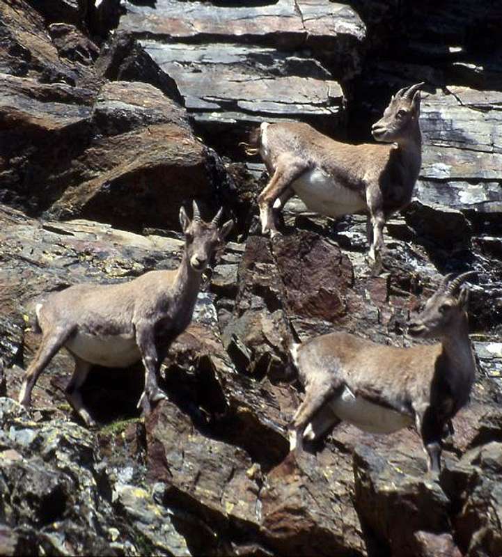
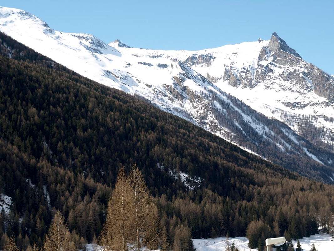
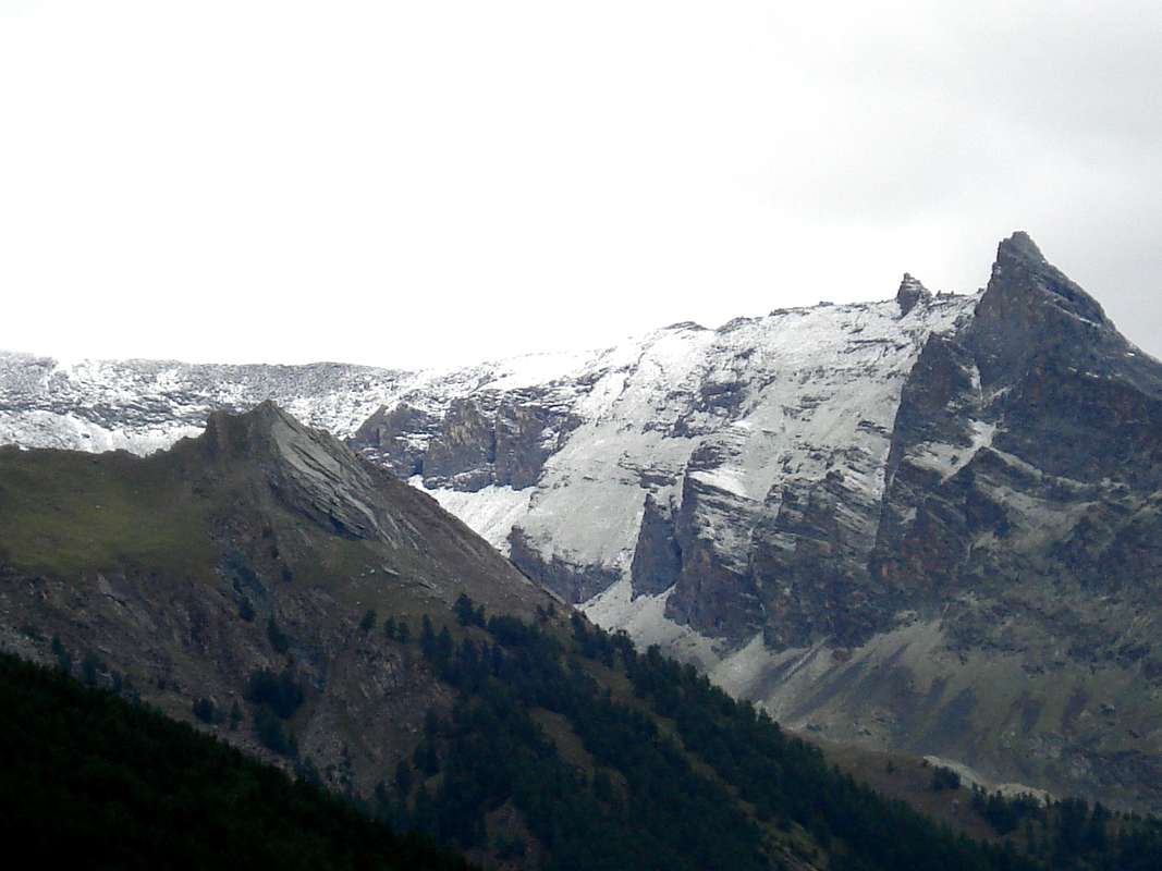
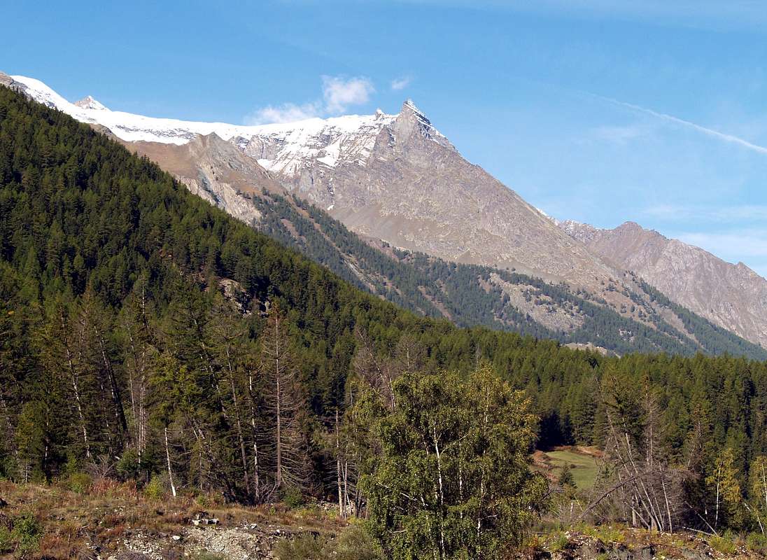
Why Pousset Valley? We explain it to the end, because now it is more important to a survey by the topographic point of view to frame this picturesque small valley in the interior of the more important and renowned Cogne Valley. A small valley that has, however, met its moments of glory in the early days of the Mountaineering indeed become the symbol par excellence against the panoramic views. So much so that all to be valued were compared to Pousset in this respect. Becca di Nona permitting, as the "Parorama the Pennine Alps in one day" by Georges Carrel in 1861 had begun to undermine this myth. A still amazing landscape, although less central location than that of the "Becca", but certainly better against the nearby Grivola Gran Paradiso. To do him the nickname "Gorner-grat Cogne", even for the views towards the almost complete Mont Blanc Chain and to the almost entire Group of the Pennine Alps. Despite that his climb must be ascribed "ab immemorabilis", that at the dawn of Mountaineering, certainly not possess the Mountaineering History very close and very famous of the Grivola, theater competition among lovers of the mountains by Cogne and from the adjacent Valsavarenche. A "war" began in the first half of the 800 and ended with the victory of those Valsavara with the ascent along with "their" side of 23 August 1859 by the British J. Ormsby and R. Bruce with the local Guide F. A. Dayné and those of Chamonix Z. Cachat and J. Tairraz. "Our" vallon does not see or achieve great things, because do not possess them and at best can become the point of support, through Damiano Gratton Bivouac (3.204m), the Normal Route to the same as an alternative to theVittorio Sella Shelter opposite side of Lauson or Lozon. Revenge for those of Cogne, because the way "historical" from Valsavarenche, too dangerous, has now been almost completely abandoned. After having climbed the easy Northeast Ridge of Punta Rossa (3.630m) by H. and F. Montgomery, S. Taylor with J. Tannler Guide in 1864, starting from the Pousset Hill (3.198m), must indeed wait the beginnings of '900 (1903, 1909, 1913) to record beautiful climbings by Swiss, English Climbers accompanied by local Guides or from Valtournanche on the Punta del Pousset (3.046m) ridges and faces. The rest are things "à vaches" (to cows), as would said by the good Abbé Henry, or easy excursions like Mount Herban and not Erban (3.004m) and a little less for the underlying Mont-de-l'Ouille (2.521m), that some small delicate passage presents him to reach the Summit with some bypass on the steep slabs of Southern Crest. Amid "stands" Tête du Gavio (3.047m), both in plain view from the valley floor as poorly known and "courted" by mountain climbers and hikers. From this unknown and abandoned Summit is "birth" a barely mentioned median spur dividing the actual Vallon of Pousset (further West) from a secondary sector called Pian Vario or Plan Varioz below Mount Herban. The other two are from Punta Rossa, highest Vertex in this valley, this vallon contain respectively reaching the Punta Pousset towards the North and Mont-de-l'Ouille and Vermiana Dèsott Pastures (2.093m) towards the Northeast, immediately above the Hamlet of Crétaz. But on all dominate the fast herds of chamoises and "untouchables" Ibexes from the majestic Royal Horns and Regal Habit with almost Unroyal Behavior...
![]()
![]()
![]()
Perché Vallone del Pousset? Lo spieghiamo alla fine, perché adesso risulta più importante un'indagine dal punto di vista topografico per inquadrare questo vallone pittoresco all'interno della ben più importante e rinomata Val di Cogne. Un valloncello che ha però conosciuto i suoi momenti di gloria nei primordi dell'Alpinismo diventando anzi il simbolo per antonomasia nei confronti delle viste panoramiche. Tanto che tutte per essere valorizzate venivano paragonate al Pousset sotto questo aspetto. Becca di Nona permettendo, poiché il "Parorama delle Alpi Pennine in un giorno" di Georges Carrel nel 1861 aveva incominciato ad intaccare questo mito. Un panorama comunque eccezionale, anche se in posizione meno centrale rispetto a quello della "Becca", ma sicuramente superiore nei confronti di Grivola e Gran Paradiso. Da farlo soprannominare il "Gorner-grat di Cogne", anche per le vedute verso la Catena del Monte Bianco e la cerchia delle Alpi Pennine, registrabili sopra le lor più significative Vette. Nonostante che la sua salita debba essere ascritta "ab immemorabilis", cioé agli albori dell'Alpinismo, non possiede certamente la Storia Alpinistica della vicinissima e famosissima Grivola, teatro di competizione tra gli appassionati di Cogne e dell'attigua Valsavarenche. Una "guerra" iniziata nella prima metà dello '800 e conclusa con la vittoria di quelli di Valsavara con l'ascensione lungo il "loro" versante il 23 Agosto 1859 da parte degli inglesi J. Ormsby e R. Bruce con la Guida locale F. A. Dayné ed a quelle di Chamonix Z. Cachat e J. Tairraz.
 |
 |
 |
 |
 |
Il "nostro" vallone non vede invece realizzare grandi cose, anche perché non le possiede ed al massimo può diventar punto d'appoggio, tramite il Bivacco Damiano Gratton (3.204 m), per la Via Normale verso la medesima in alternativa al Rifugio Vittorio Sella dal versante opposto del Lauson o Lozon. Una rivincita per quelli di Cogne, poiché la via "storica" dalla Valsavarenche, troppo pericolosa, ormai é stata quasi completamente abbandonata. Dopo la salita per la facile Cresta Nordest della Punta Rossa (3.630 m) da parte di H. e F. Montgomery, S. Taylor con la Guida J. Tannler nel 1864 partendo dal Colle del Pousset (3.198 m), bisogna infatti attendere gli inizi del '900 (1903, 1909, 1913) per registrare belle arrampicate da parte di svizzeri, inglesi accompagnati dalle Guide locali o di Valtournanche sulle creste e pareti della Punta del Pousset (3.046 m). Il resto son cose "à vaches", come direbbe il bravo Abbé Henry, ovvero facili escursioni come per il Monte Herban e non Erban (3.004 m) ed un pò meno per il sottostante Mont-de-l'Ouille (2.521 m), che qualche passaggetto delicato lo presenta per raggiungere la Cima con piccoli aggiramenti sulle ripide placche della Cresta Meridionale. In mezzo "troneggia" Testa del Gavio (3.047 m), tanto bene in vista dal fondovalle quanto scarsamente conosciuta e "corteggiata" da alpinisti ed escursionisti. Da questa incognita ed abbandonata Sommità viene "partorito" un appena accennato contrafforte mediano che divide il vero e proprio Vallone del Pousset (più ad Ovest) da un settore secondario denominato Pian Vario o Plan Varioz sottostante al Monte Herban. Gli altri due che provengono dalla Punta Rossa, Vertice massimo di questo vallone, lo contengono rispettivamente raggiungendo la Punta Pousset verso Nord ed il Mont-de-l'Ouille nonché l'Alpe Vermiana Dèsott (2.093 m) in direzione Nordest al di sopra della sottostante Frazione di Crétaz. Ma su tutti dominano branchi di veloci camosci ed "intoccabili" Stambecchi dalle maestose Corna Reali, Portamento Regale e Comportamento quasi Irreale ...
Why Pousset? All names of this valley have a precise meaning for local inhabitants. So in this small area, immediately to the West of Cogne and beyond the Crétaz and Epinel Fractions, we find, just below the Grivola, Grivola's Punta Rossa to distinguish her from the many existing and because of the reddish color of its rocks, the Mont-de-l'Ouille or simply the Ouille because in shaped spire or aiguille, Mont Herban because covered with grassy slopes on the Eastern side above Cogne and Valnontey and Testa del Gavio (Head of Gavius; 3.047m) which you do not understand the etymology. The Guide of "Gran Paradiso National Park" inserts on Map between 296/7 pages, but then makes disappear she in the text. A "desasparecido of mountain" which probably has caused headaches to the three Authors. Incidentally if you do not even know by Renato Chabod! I do not know even us. As answers my Biochemistry Professor Van Hoecke University of Djon while student spirit I was trying to put him in trouble with a critic question about the permeability of the cerebral membrane against the lactic acid following a discovery of the Italian Researcher Carmelo Bosco made in Finland from few days. Looking at me from his white hair flowing from a mixture of good-natured and bad: "Do not I know, you can not know everything in the Life ...", then turning on his blackboard over seven metres long to write new formulas. Then we became friends, he smoking a cigar "Tuscan" and I a thin and long "More". However, receiving a good lesson in humility. But for Pousset? Easy. Does not come from the Piedmont, then Italianate, "poussa via" or send away with badly and even from French pousser", ie push, but by "pouce", ie like a thumb, and the diminutive-endearment "poucet", ie small thumb rocky turned impertinently against the sky, as with all impertinent of this world, famous and scenic photographically until the beginning or, more artistically, for designs to 360° with pencil on "papier", as well as from the beginning of the true and old mountaineering "classic". In contrast to the green, "peaceful", and nearby Mount Herban and contemptuous towards the underlying similar but more tiny Ouille ...
Perché Pousset? Tutti i nomi di questa vallata hanno un preciso significato per gli abitanti locali. Così in questa ristretta area, subito ad Ovest di Cogne ed al di sopra delle Frazioni di Crétaz ed Epinel, troviamo la Punta Rossa della Grivola per distinguerla dalle tante esistenti e a causa del colore rossiccio delle sue rocce, il Mont-de-l'Ouille o più semplicemente l'Ouille poiché in forma di guglia od aiguille, il Mont Herban perché ricoperto da pendii prativi sul lato Orientale sopra Cogne e la Valnontey e la Testa del Gavio (3.047 m) della quale non se ne comprende l'etimologia. La Guida Gran Paradiso Parco Nazionale" la inserisce nella Cartina tra le pagine 296/7, ma poi la fà sparir nel testo. Un "desasparecido di montagna" che probabilmente ha procurato il mal di testa ai tre Autori. Daltronde, se non lo sapeva neppur Renato Chabod, chi poteva saperlo! Non lo conosciam neppur noi. Come rispondeva il mio Professore di bio-chimica Van Hoecke all'Università di Djon mentre con spirito goliardico cercavo di metterlo in difficoltà con domanda sibillina sulla permeabilità della membrana cerebrale nei confronti dell'acido lattico a seguito d'una recente scoperta del Ricercatore italiano Carmelo Bosco, testé realizzata in Finlandia. Guardandomi dalla sua bianca e fluente chioma tra un misto di bonario e cattivo: "Non lo sò, non si può saper tutto nella Vita ..." Girandosi poi sulla sua lavagna lunga oltre sette metri a scriver nuove formule. Diventammo amici, lui fumando un sigaro Toscano" ed io un sottil, lungo "More". Ricevendo però salutar lezion d'umiltà. Ma per il Pousset? Facile. Non deriva dal piemontese, poi italianizzato, "poussa via" ovvero cacciar via in malomodo e nemmeno dal francese pousser", cioé spingere, ma da "pouce", ovvero a guisa di pollice, e dal diminutivo-vezzeggiativo "poucet" cioé piccolo pollice roccioso, rivolto impertinentemente al cielo e, come per tutti gli impertinenti di questo mondo, famoso fino dai primordi fotograficamente panoramici o, più artisticamente, per i disegni con "papier" e matita a 360°, nonché dall'inizio dell'alpinismo "classico". In contrasto col verdeggiante, "pacifico" e vicino Mont Herban e sprezzante verso il sottostante similare ma ben più minuscolo Ouille ...
Getting There
BY CAR:
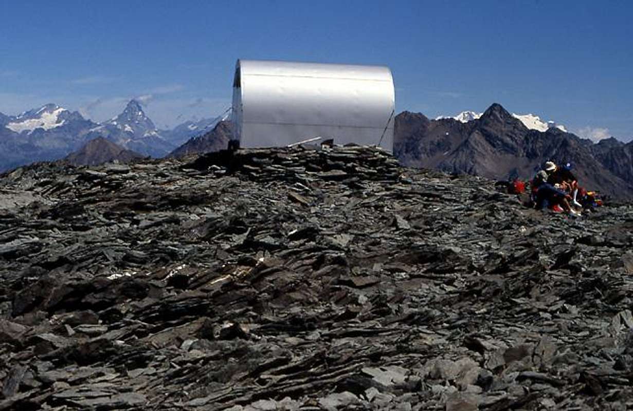
- From TORINO, MILANO, etc: Motorway A5. Exit at IVREA or Quincinetto (PIEDMONT) also Pont Saint Martin, Verrès, Chatillon, AOSTA East (Nus) and West (Aymavilles) Municipalities. From Aymavilles towards Cogne Valley From Aymavilles (646m) towards Cogne Valley with Regional Road: Vieyes (1.132m) Fraction; continue to Silvenoire, Epinel and Crétaz Hamlets just before Cogne (1.534m), through Main Road. From Epinel Fraction (1.434m) to Damiano Gratton Bivouac, by paths in Pousset Vallon, with traces on moraines in terminal parts.
![Gran Paradiso GROUP: Bivacco Gratton 3204m, near colle del Pousset 3198m]()
- From Switzerland: through the Grand Saint Bernard Tunnel or the namesake Pass. Drive to Aosta, then follow the direction for Courmayeur on SS.26. Just after Sarre, turn to the left, in the direction of Valle di Cogne.
- From France: through Mont Blanc Tunnel or Petit St. Bernard Pass. It isn't necessary to take Motorway A5: you can drive on SS.26, in the direction of Aosta. Before arriving at the Village of Sarre, turn right following the sign for Valle di Cogne.
- Aeroporto "Corrado Gex" Saint Christophe (Aosta).
Mountain Condition
- Meteo: you can find all the needed informations at the official site of the Valle d'Aosta Region:
- Valle d'Aosta Meteo
Books and Maps
BOOKS:- "Il Parco Nazionale del Gran Paradiso (Valli di Champorcher-Clavalitè-Saint Marcel-Laures-Cogne-Valsavarenche-Conca di Pila" di Giulio Berutto 3/volume 2°, I.G.C., Torino 1981, 2a Ed. 2000.
- "Guida dei Monti d'Italia-Gran Paradiso Parco Nazionale" E. Andreis, R. Chabod, M. C. Santis, Club Alpino Italiano/Touring Club Italiano, prima Ed. 1939; seconda Ed. 1963; terza Ed. 1980.
- "Guida delle Alpi Occidentali", di Giovanni Bobba e Luigi Vaccarone C.A.I. Sezione di Torino Volume II (parte II), 25 Maggio 1896.
- "Rifugi e bivacchi in Valle d'Aosta", di Cosimo Zappelli aggiornata da Pietro Giglio, Musumeci Editore, Luglio 2002.
 |
 |
 |
MAPS:
- Kompass "Gran Paradiso Valle d'Aosta Sentieri e Rifugi" Carta Turistica 1:50.000.
- Enrico Editore Ivrea-Aosta "Gruppo del Gran Paradiso" 1:50.000.
- I.G.C. Istituto Geografico Centrale "Il Parco Nazionale del Gran Paradiso" 1:50.000.
- L'Escursionista "Valle di Cogne Carta dei Sentieri" (n° 10) 1:25.000.
- L'Escursionista "Tour de la Vallée de Cogne Grand Paradis" 1:25.000.
Important Information
- REGIONE AUTONOMA VALLE D'AOSTA the official site.
- FONDAZIONE MONTAGNA SICURA Villa Cameron, località Villard de la Palud n° 1 Courmayeur (AO) Tel: 39 0165 897602 - Fax: 39 0165 897647.
- SOCIETA' GUIDE ALPINE DI COGNE Tel. 347/9473526 – 328/1373728.
- A.I.NE.VA. (Associazione Interregionale Neve e Valanghe).
- A.IA.T. Cogne Gran Paradis via Bourgeois n° 34 Tel. 0165-74040. E-mail: aiat@cogne.org
- Ezio Sport articoli sportivi - via Bourgeois n° 64 Tel. 0165-74204.
Useful numbers
- Soccorso Alpino Cogne (SAR) Tel. 3482685406.
- Protezione Civile Valdostana località Aeroporto n° 7/A Saint Christophe (Ao) Tel. 0165-238222.
- Bollettino Meteo (weather info) Tel. 0165-44113.
- Bollettino Valanghe Tel. 0165-776300.
- Unità Operativa di Soccorso Sanitario Tel. 118.