


-
 2959 Hits
-
 80.49% Score
-
 12 Votes
|
|
Area/Range |
|---|---|
|
|
45.66690°N / 7.34632°E |
|
|
Hiking, Mountaineering, Trad Climbing |
|
|
Spring, Summer, Fall, Winter |
|
|
11676 ft / 3559 m |
|
|
Note
La montagna chiama i suoi figli, ed essi rispondono fedelmente al suo appello… Osvaldo Cardellina, Diario alpinistico, 1964-65 Page texts: @ OsvaldoCardellina "Osva", passed away on May 2, 2022. Page owners: Christian Cardellina e Osvaldo Cardellina. Any updates from September 12, 2022: Antonio Giani, page administrator, friend and climbing companion. Testi della pagina: @ OsvaldoCardellina "Osva", scomparso il 2 maggio 2022. Proprietari pagina: Christian Cardellina e Osvaldo Cardellina. Eventuali aggiornamenti dal 12 settembre 2022: Antonio Giani, amministratore della pagina, amico e compagno di salite. |
Dubitative (?) Overview
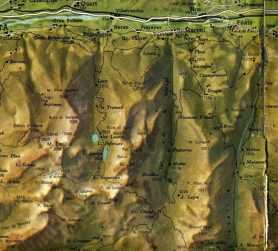
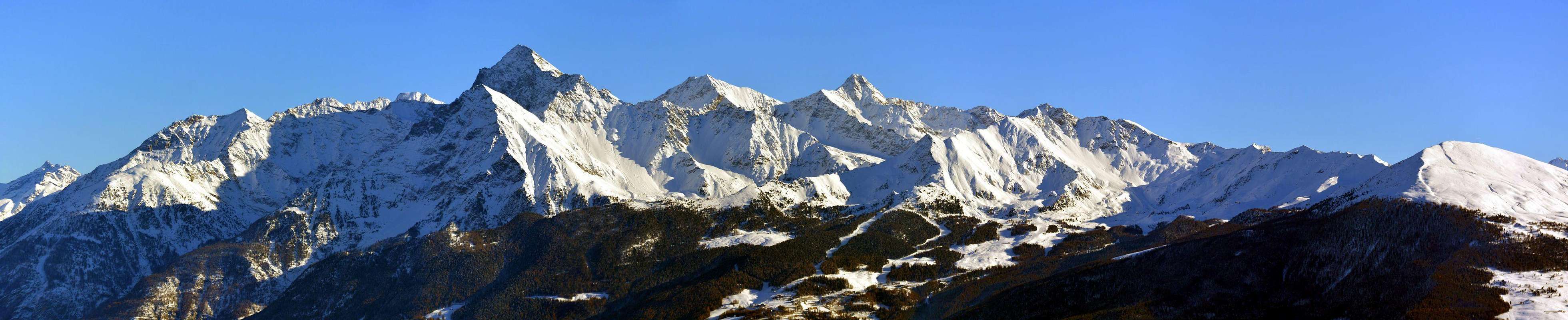
Arbole or Arbolle? A question not easy to unravel, because the term Arbole has remained in place for many decades, or at least until the construction of the namesake refuge with the two lakes at the entrance of the valley. Then it had been transformed into Arbolle after a search, it seems, in the historical archives of the Charvensod Common, territory to which it belongs, at least the seventies when the same was acquired by Mr. Quendoz Gressan. Choose whichever you prefer, so this is definitely the territory of the Monte Emilius (3.559m), the beautiful pyramid above it towards the South. The highest not only in this area, but above the entire sector in the North by the Torrents Grand'Eyvia, Urtier and Ayasse that form the Graian East; except to the Gran Paradiso Massif (4.061m) up to the foothills of Tower of Lavina, now on the border with Piedmont. This vallon almost a real valley, which, sinuous flowing first South, then to the West to fold forming a great arc toward the North, originates more in below to Comboé's Vallon and Gorge of Dard (Waterfall Ravine), all crossed from the same waters or Torrent de Comboé up to the Dora Baltea, in turn, can be identified in three well distinct parts:
1) - the lower area of the two Lakes Arbolle that flexing in East-northeast reaches progressively the Col Garin and Pas du Valaisan.
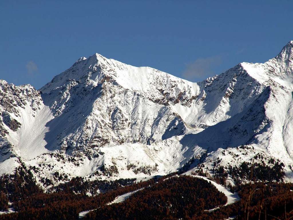
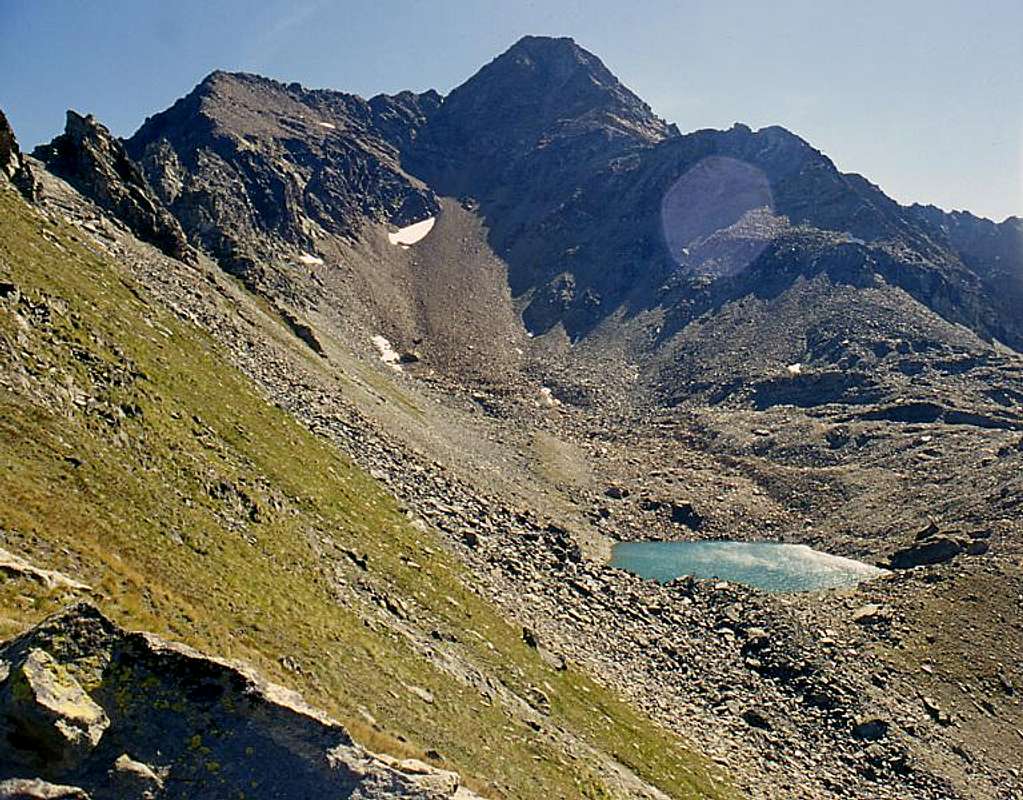
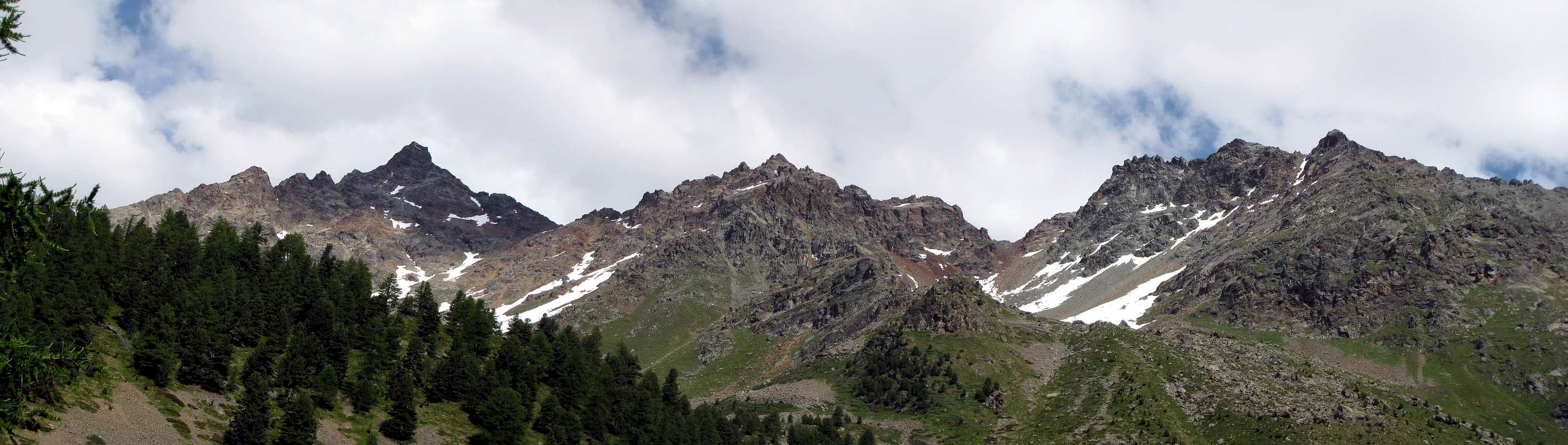
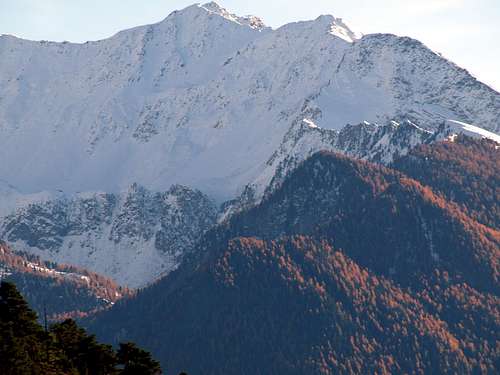
2) - the central zone (here in the photo) that reaches the Loch de l'Echo and the Ròss Pass to then turn Eastwards Lake and Glacier Gelato.
3) - branching to the right or Northeastward to Arbolle Hill, the Pass of Three Capuchins up to the Maximum Vertex of Monte Emilius (3.559m).

Arbole od Arbolle? Un interrogativo non facile da dipanare, perché il termine Arbole é rimasto in auge per molti decenni od almeno fino alla costruzione dell'omonimo rifugio presso i due laghi all'ingresso del vallone. Poi é stato trasformato in Arbolle dopo una ricerca, sembra, negli archivi storici del Comune di Charvensod territorio al quale appartiene, almeno dagli anni Settanta allorché il medesimo é stato acquistato dal Signor Quendoz di Gressan. Scegliete come preferite, tanto questo é sicuramente il territorio del Monte Emilius (3.559 m), la bella piramide sovrastantelo verso Mezzogiorno. La più alta non solo di questa area, bensì di tutto quel settore che a Settentrione dei Torrenti Grand'Eyvia, Urtier ed Ayasse forma le Alpi Graie Orientali; quindi Massiccio del Gran Paradiso (4.061 m) escluso fino alle propaggini della Torre di Lavina al confine con il Piemonte. Questo vallone, che, scorrendo sinuoso dapprima verso Sud, poi ad Occidente sino a ripiegare formando un grande arco verso Nord, più in basso origina quello di Comboé e la Gorgia del Dard, tutti percorsi dalle stesse acque o Torrent de Comboé insino a raggiungere la Dora Baltea, a sua volta può essere identificato in tre ben distinte parti:
1) - l'area inferiore dei due Laghi d'Arbolle che flettendo ad Est-nordest raggiunge progressivamente il Col Garin ed il Pas du Valaisan..
2) - la zona centrale zone (qui nella foto) raggiungente il Lac de l'Echo ed il Col Ròss per poi ripiegare ad Est verso il Lago ed il Ghiacciaio Gelato.
3) - la ramificazione verso destra o Nordorientale verso il Col d'Arbolle, il Passo dei Tre Cappuccini sino alla Sommità del Monte Emilius (3.559 m).
Getting There
BY CAR:
- From TORINO, MILANO, etc: Motorway A5. Exit at IVREA or Quincinetto (PIEDMONT) From IVREA Town: Charvensod, Gressan, Jovençan, Aymavilles Municipalities.
- From Charvensod to Dard-Comboé-Arbolle Vallons towards Ponteilles (1.697m) Alp & Waterfall, through dirt road, Comboé Alp & Saint Ours private Shelter (2.114m), through dirt road, and Arbolle Refuge (2.516m), nearby Lakes (2.495m, 2.497m), by Chair Lift to Chamolé Station (2.309m), Lake (2.325m) and muletrack. From Charvensod (main road from Pont Suaz 567m) or Gressan (603m; alternative road) to Tivet, Les Fleurs Hamlets (1.292m, 1.414m) Pila Basin and Resort (low parking nearby Cableway 1.800m; upper parking 1.850m). From Jovençan (631m) to Western Pila Conca, exclusively through path-muletrack to Tourlin Dessous (1.466m) and by dirt road to Pila-Posse Tennis (1.776m). From Aymavilles (646m) to Western Pila Conca, through Main Road to Cogne Valley, alternative road to Ozein/Turlin Dessus Hamlets and dirt road to Pila-Posse.
- From FRANCE: through the Mont Blanc Tunnel to Entrèves-crossroads to Vény/Ferret Valleys - Mountain Guides of Courmayeur - La Saxe Rock Gym - Courmayeur. By Little Saint Bernard Pass, closed since November until half May to La Thuile Valley - Pré Saint Didier - Courmayeur. It is not necessary to take Motorway A5: you can drive on SS.26, in the direction of AOSTA - IVREA - TURIN.
BY PLANE:
- Aeroporto "Corrado Gex" Saint Christophe (Aosta).
 |
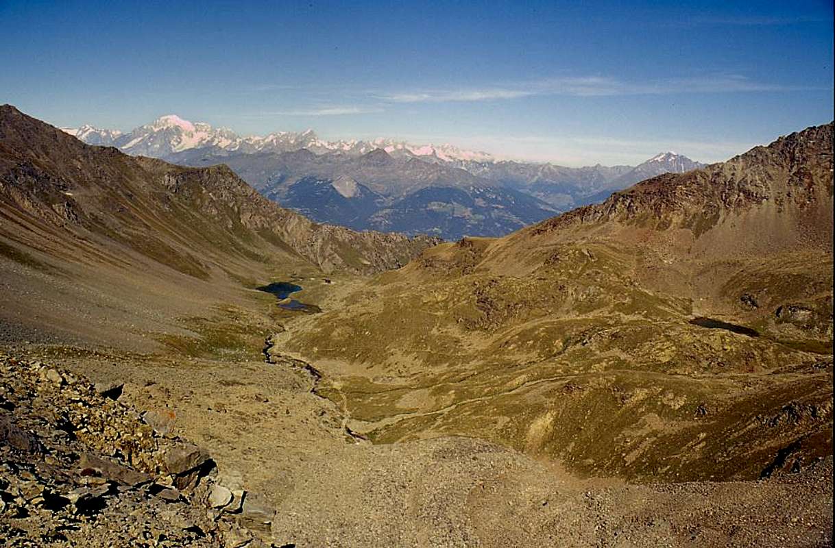
Various possibilities of departure towards Arbolle Vallon
VALLEYS & small Valleys In order to deploy clockwise from Charvensod, Gressan, Jovençan, Aymavilles and Cogne Municipalities
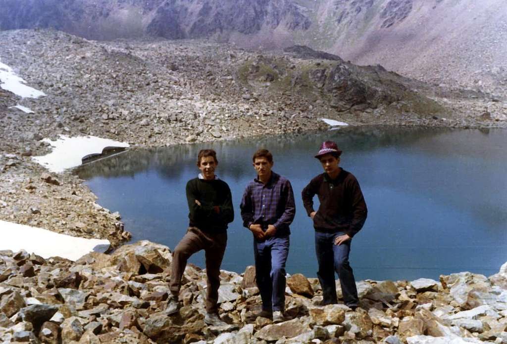
1) - various possibilities of departure towards the Arbolle Refuge (2.516m), nearby two Arbolle Lochs (2.496m).
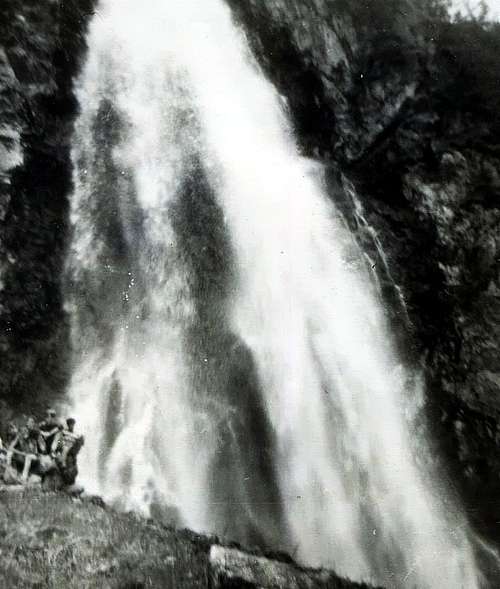
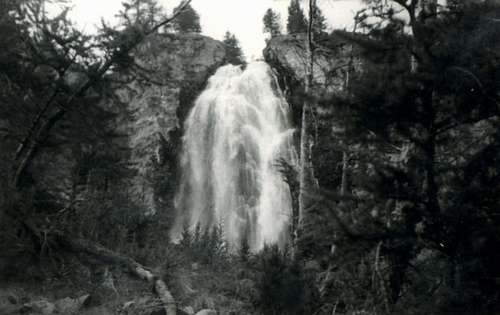
2) - From Pila main road (the best Saint Salo-Les Gorres (1.835m), Les Pousses Pasture (1.601m) or from Dessous (1.042m; Lower) or Dessus (1.124m) Reverier to La Mare (1.187m; waters intake) to Ponteilles Alp (1.706m) and waterfall;
3) - from this to Low Comboé Alp (2.041m), Comboé Pasture (2.114m). In East up Comboé Torrent path to Plan Valé (2.379; ruins), Gros Scez fork 2.526 meters to
4) - Becca of Nona (3.142m) through path on Southwest Slope;
5) - path-connection to Federigo Zullo Bivouac (2.907m) at Carrel Hill. From Comboé in South Grand Plan Alp (2.158m; ruins) and
6) - connection to Plan Valé;
7) - gorge to Arbolle Refuge, with paths. From Shelter in North-norteast
8) - Three Capuchins Pass (3.242m) and Mont Emilius;
9) - in Northeast Arbolle Pass and three Rossa Points.
10) - In East Valaisan Pass (3.210m; absolutely not recommended for the various danger);
11) - in East-southeast Garin Hill to Franco Nebbia Bivouac (2.740m) and Arpisson small Vallon, with paths.
 |
A) - Pila Basin: from Aosta City by Cable Railway (Place near Cogne Iron & Steel Works), main road or various muletracks. Possibilities with paths to
1) - Plan Fenetre Hill (2.229m), Comboé small Valley and Alp (2.114m), in East Carrel Hill (2.912m) and nearby Federigo Zullo Bivouac, with paths, to Becca of Nona, through Southeast Crest with traces/path.
2) - in South Chamolé Alp, Lake, Pass (2.152m, 2.325, 2.641m) to Arbolle small Valley and Refuge, with paths.
3) - From Pass in South easy traverse to Testa Nera (2.820m), through Northeast Crest, Mont Bellefaçe (2.970m), Valletta Point (3.090m) on watershed.
4) - From Chamolé Lake (2.925m) in Southwest Plan de l'Eyvie Pasture (2.253m) to Tsa Sètse small Valley and Hill (2.815m) and descent to Arpisson-Gimillan Southern small Valley.
5) - From Hill in East Via Ferrata to Point Valletta (3.090m), rope required;
6) - in Northwest Equipped Via Panorama to Tsa Sètse Point, Piatta of Montpers, Piatta di Grevon, Couis, Drinc, de la Pierre Points, on watershed Cogne Valley/Pila Basin to la Pierre Vallon/Pila Basin. This crossing can be accomplished starting from Refuge Arbolle to return to Pila.
 |
 |
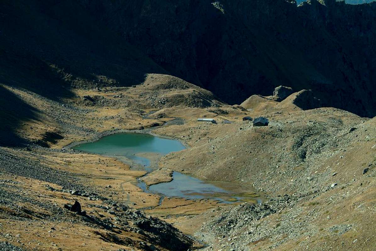
1) - Arbolle Refuge (2.516m),
2) - to Lake Gelato (2.957m),
3) - Little Emilius (3.342m) South Slope up to the middle part of Via Ferrata to
4) - Monte Emilius (3.559m) or by the South-southeast Ridge or Standard Route of "Three Capuchins Crest",
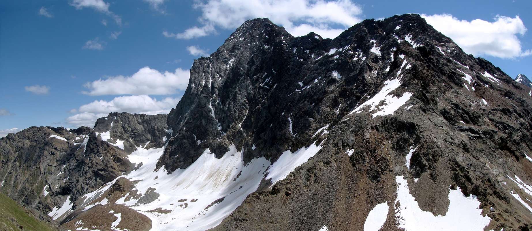
5) - Arbolle Pass (3.154m; towards Les Laures Vallon),
6) - Punta Rossa (3.401m) Northeast Ridge or Normal Via.
Four trips and three small climbs Recommended
This vallon offers numerous possibilities of excursions or climbings. While these last are often influenced by the bad quality of the rock and the considerable danger of falling rocks, the excursions are always as beautiful, easy and above all safe. For this very reason we limit our advice to four easy (and starting from Rifugio Arbolle comfortable) and beautiful hikes and towards three small climbs quite easy but still require care and attention, having accidents or death, have occurred in recent times. Everything else We Refer to the desire for individual discovery of each of you, always in relation to the personal knowledge of the area as well as the technical skills and the degree of training. Always remembering to properly evaluate the conditions (rocks, snowfields and "verglass" presence) of the mountain and the changing of the time ...
 |
 |
 |
Questo vallone offre diverse possibilità di escursioni od arrampicate. Mentre queste ultime sono spesso condizionate dalla cattiva qualità della roccia e dal notevole pericolo di caduta di pietre, le escursioni si presentano sempre come belle, facili e soprattutto sicure. Per questo preciso motivo limitiamo il nostro consiglio a quattro semplici (e partendo dal Rifugio di Arbolle comode) e belle escursioni ed a tre piccole arrampicate abbastanza facili ma che comunque richiedono prudenza ed attenzione, visti gli incidenti, anche mortali, verificatesi negli ultimi tempi. Tutto il resto lo demandiamo al desiderio di scoperta individuale di ognuno di Voi, sempre in rapporto alle conoscenze personali del territorio nonché alle capacità tecniche ed al grado di allenamento. Ricordando sempre di valutare bene le condizioni della montagna ed il mutare del tempo ...
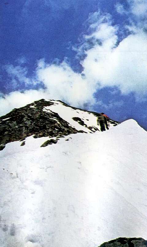
Dal Rifugio di Arbolle (2.516 m) salire verso Nordest raggiungendo tramite il sentiero n° 14 il Lago Gelato (2.957 m) e da questo su di una traccia nella morena tra grandi blocchi sparsi il soprastante Passo dei Tre Cappuccini (3.242 m), caratterizzato da tre pinnacoli rocciosi simili a tre frati ripiegati in preghiera. Da questo seguire l'omonima cresta o S-SE restando su di una traccia appena sotto il filo di cresta sul versante Orientale o Laures, altrimenti sul medesimo (I°; EE/F/F+; 1h'00 dal Colle; 3h'00/3h'30 dal rifugio). b) - Punta Rossa (3.401m) Northeast Ridge from Arbolle Pass (3.154m). From the Arbolle Shelter goes up into the vallon to the Northeast with the previous itinerary reaching through trail n° 14 the Lake Gelato. This, just above the junction 3.048 meters into the wide moraine, follow a track n° 14/102 first in the same and then the Glacier du Lac Gelé (remains of the ancient Glacier of Mount Emilius) at the base of the Northern Wall of the three Punta Rossa (3.400m, about 3.395m, 3.401m) reaching the above Colle Arbolle (3.154m), characterized by a boulder with adjacent "salle à manger". From this follow the NE Ridge remaining on a poor track just below the ridge on the Western side paying well attention to several rocks balanced and therefore unsafe, otherwise the same thread of the crest (I°/I°+; EE/F/F+; 0h'45 from Colle; 2h'40/3h'10 refuge).
Dal rifugio salire verso Nordest con il precedente itinerario raggiungendo tramite il sentiero n° 14 il Lago Gelato; da appena sopra questo al bivio (3.048 m) seguire una traccia n° 14/102 dapprima nella morena e poi sul Glacier du Lac GèLé (resti dello antico Ghiacciaio del Monte Emilius) alla base della Parete Settentrionale della Punta Rossa il soprastante Colle di Arbolle (3.154 m), caratterizzato da un masso con attigua "salle à manger". Da questo seguire la Cresta NE restando su d'una scarsa traccia appena sotto il filo di cresta sul versante Ovest prestando attenzione a diversi massi pericolosamente in bilico, altrimenti sul medesimo (I°/I°+; EE/F/F+; 0h'45 dal Colle; 2h'40/3h'10 dal rifugio).
Dal rifugio salire verso Nordovest per mezzo del sentiero n° 18/TVC raggiungendo il Colle di Chamolè (2.640 m; TE/F; 0h'30). Da questo percorrere la Cresta Nordest della Testa Nera (2.820 m) restando a Settentrione sotto il filo della medesima con il sentiero-traccia n° 19A. Da questa traversare verso Mezzogiorno sempre tramite il medesimo e, oltrepassato il Mont Bellefaçe (2.970 m) e la quota 3.016 metri, raggiungere l'antecima Orientale e poi la grande Croce della Cima (3.090 m; EE/F; 2h'15/2h'45 dal rifugio).
|
|
 |
 |
Three classic excursions and a more "adventurous"
They now have three easy hikes, that over time have become "classic" for this valley.. The fourth proposal is instead in one "more adventurous" who belongs instead to the past, when it was still fashionable the spirit to explorations. The main gateway to Arbolle remains the Chamolé Pass (2.640m), above the lake of the same name (2.325m), but a lot has changed over time. In fact, until 1960, the year of construction of the lift, for here it had to compulsorily get from those who in those days were only the Pastures of Pila, scattered to the average of 1.700/800 meters. Already the construction of the cable car departing from Aosta, the intermediate arrival in Les Fleurs-Gerdaz and conclusive in Pila in 1957 had "revolutionized" what was the traditional approach that, even before the construction of the Regional Road, took place on foot or by mule. So for the famous Procession of San Grato, or for climbing these mountains. Request information from the Abbé Henry, and by the Guide of Charvensod Grégoire Comé, or to the various Bishops of the last 400 years ... We, who have begun to frequent these mountains above our house, we experienced these three steps beginning, for lack of cars and money, walk from the valley floor to reach the Arbolle and then climb this or that mountain. Before returning, perhaps late at night, with the same paths (many have disappeared and "eaten" by the vegetation) through the dense forests and the dark woods. In the footsteps of the Abbot, of Grégoire, of Questa, Quaini, and many other Pioneers. We do not want to involve and shuffling you in these "trials", which now belong to the "ghosts of the past", for which I want to propose here three trips simple and safe departure from Pila, through paths often concomitant with ski slopes or dirt roads, or by Chamolé, reached by chairlift, without power not to emphasize that the construction of the Shelter Arbolle in 1998 has changed things even more. The fourth proposal instead costutuisce a fascinating revival of those good old days. You choose. Ah. do not forget, if you park at the square of the cable car near Aosta to "empty" the car from everything of value. Otherwise it will make others, ie thieves ...
 |
 |
 |
Si presentano ora tre facili escursioni, nel tempo diventate "classiche" per questo vallone. La quarta proposta consiste invece in una "più avventurosa" appartenente invece a tempi passati, quand'era ancora di moda lo spirito dell'esploraziomi. La porta d'ingresso principale all'Arbolle rimane sempre il Colle di Chamolé (2.640 m), soprastante l'omonimo lago (2.325 m), ma molte cose son cambiate nel tempo. Infatti fino al 1960, anno della costruzione della seggiovia, per qui arrivare obbligatoriamente si doveva partire da quelli che a quei tempi eran soltanto gli Alpeggi di Pila, disseminati alla media di 1700/800 metri circa. Già la costruzione della funivia con partenza da Aosta, arrivo intermedio a Les Fleurs-Gerdaz e conclusivo a Pila nel 1957 aveva "rivoluzionato" quello che era l'approccio tradizionale che, prima ancora della costruzione della Strada Regionale, avveniva a piedi o tramite il mulo. Così per la famosa Processione di San Grato oppure per le ascensioni a queste montagne. Chiedere informazioni all'Abbé Henry ed alla Guida di Charvensod Grégoire Comé, oppure ai vari Vescovi degli ultimi 400 anni ... Noi, che abbiamo cominciato a frequentare ste montagne sopra casa nostra, abbiamo vissuto queste tre fasi iniziando, per mancanza di mezzi e di quattrini, a piedi dal fondovalle per raggiungere l'Arbolle e poi scalare questa o quella montagna. Per poi rientrare, magari a notte fonda, con gli stessi sentieri (molti ormai scomparsi e "divorati" dalla vegetazione) attraverso le fitte foreste e gli oscuri boschi. Sulle orme dell'Abbé, di Grégoire, di Questa, Quaini e molti altri Pionieri. Non vogliamo incasinarvi in queste "tribolazioni", appartenenti ormai ai "fantasmi del passato", per la qual cosa vogliam qui proporre tre escursioni semplici e sicure con partenza da Pila, tramite sentieri spesso concomitanti con piste da sci o poderali, o da Chamolé, raggiunto con la seggiovia, senza non poter non sottolineare che la costruzione del Rifugio d'Arbolle nel 1998 ha ancora di più cambiato le cose. La quarta proposta invece costutuisce un affascinante revival di quei bei tempi andati. Scegliete voi. Ah. non dimenticate, se parcheggiate al piazzale di partenza della funivia, di "svuotare" l'auto d'ogni cosa di valore. Altrimenti lo fan gli altri ...
d) - Arbolle Refuge and Lochs (2.516m, 2.496m) through Chamolé Pass (2.640m). From the station of arrival of the chair lift (2.311m), go to the East with the wide mule track n° 19C that reaches the lake of the same name (2.325m; T; 0h'15). Leaving left (Northeast; signs in yellow; path n° 19) the deviation for the two hills of Replan and Comboé, continue with the diagonal path n° 14/19A/TVC over the same followed by a series of wide hairpin turns that lead to the Chamolé Pass (TE; 0h'40). A steep but short descent with trail n° 14/TVC leads at a catwalk above the emissary of the lake, and according to this, with small slope, above the refuge (TE; 0h'15; total 1h'20).
Dalla Stazione di arrivo della seggiovia (2.311 m) proseguire verso Oriente con il largo sentiero-mulattiera n° 19C che raggiunge lo omonimo lago (2.325 m; T; 0h'15). Lasciando a sinistra (Nordest; cartelli segnaletici in giallo; sentierino n° 19) la deviazione per i due Colli di Replan ed il Comboé, continuare con il sentiero diagonale n° 14/19A/TVC sopra il medesimo seguito da una serie di larghi tornanti che portano al Colle di Chamolé (TE; 0h'40). Una ripida ed all'inizio esposta ma breve discesa sul sentiero n° 14/TVC conduce presso una passerella sopra l'emissario del secondo lago e da questa, con piccola risalita, al soprastante rifugio (TE; 0h'15; in totale 1h'20).
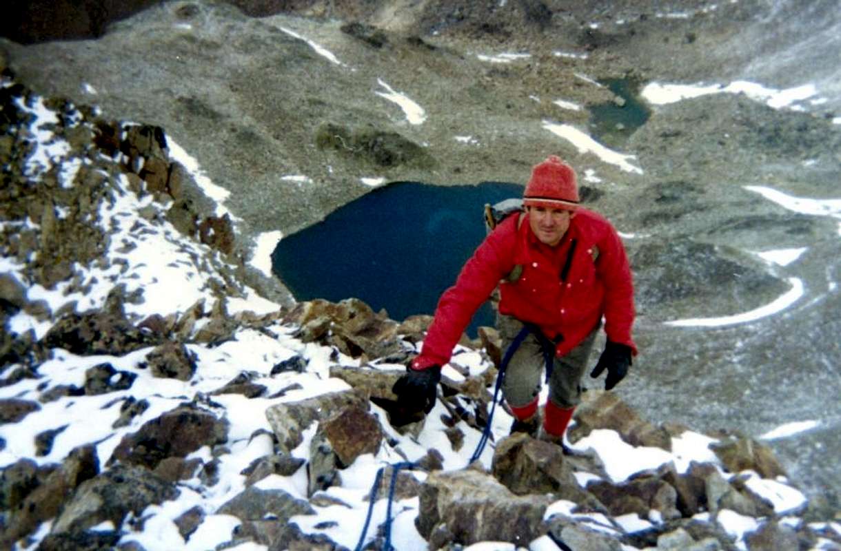
e) - "Bassa de Garin" or Garin Hill and Loch (2.815m, 2.854m). From the refuge descend briefly with the trail sentiero n° 14 reaching the Northern shore of the first lake (2.495m) and circumnavigate the second (2.497m) up to approach the Torrent de Arbolle (in the beginning or at the end of the season in grassy strip allows to transit between the two); continuous alongside the same reaching the junction between the "Baraque des Poulains" (2.574m) and the "Modzons". Leaving left the trail n° 14/102 that goes to Emilius, continuing instead with the small path n° 18/TVC that rises to the Southeast towards Col Garin. Skirting boulders and zigzagging between small narrowings the path with not always obvious, the same reaches the terminal part, with more open and steep path, leading to the hill, located between the Spiers of Arbolle and Punta Pian Bessey (E; 1h'30/1h'45 from the refuge). Having to cross towards the Lake Garin, now in the Arpisson Vallon above Gimillan in Cogne Valley, should go back an about hundred metres to the left and then navigate to the steep grassy slopes, small rocks and debris to reach the small path n° 2 Bivouac Franco Nebbia (EE; 0h'30/0h'45 from the hill).
 |
 |
 |
Dal rifugio scendere brevemente con il sentiero n° 14 raggiungendo la sponda Settentrionale del primo lago (2.495 m) e circumnavigare, sempre a Nord, anche il secondo (2.497 m) fino ad avvicinare il Torrent de Arbolle (in inizio o al termine della stagione una striscia erbosa permette di transitare tra i due); continuare a fianco del medesimo raggiungendo il bivio tra la "Baraque des Pouleins" (2.574 m; Puledri) e quella "de Modzons" o Manzi. Lasciando a sinistra il sentiero n° 14/102 che và all'Emilius, continuare invece con il n° 18/TVC che sale verso Sudest in direzione del Col Garin. Contornando alcuni massi e zigzagando tra piccole strettoie con percorso non sempre evidente, lo stesso raggiunge la parte terminale che, con percorso più aperto ed anche un pò più ripido, conduce al colle, posto tra le Guglie di Arbole e la Punta di Pian Bessey (E; 1h'30/1h'45 dal rifugio). Volendo attraversare al Lago Garin, ormai nel Vallone di Arpisson sopra Gimillan in Val di Cogne, conviene risalire d'una trentina di metri a sinistra (Nordest) e quindi traversare per ripidi pendii erbosi, roccette e detriti fino a raggiungere il sentiero n° 2 proveniente dal Bivacco Franco Nebbia (EE; 0h'30/0h'45 dal colle).
f) - Lake Gelato of Monte Emilius (2.957m). From the junction between the very old "Baraque des Poulains" (2.574m; Foals) and "de Modzons" or of the Steers continue on the previous route, leaving on the right the way to the Hill or "Bassa de Garin", by means of the trail n° 14/102 passing along the headland that runs first toward the North and then to the Northeast the middle part of the Vallon of Arbole reaching a small clearing surrounded by cyclopic moraines where, at the foot of the Southern Wall of Mount Emilius and below the poor remains of Glacier du Lac Gelé also ancient Glacier du Mont Emilius, is located the Lake Gelato or Frozen Loch (1h'45/2h'15 from Rifugio Arbolle).
Dal bivio tra la "Baraque des Pouleins" (2.574 m; Puledri) e quella "de Modzons" o Manzi del precedente itinerario continuare, lasciando sulla destra la via per il Colle o "Bassa di Garin", per mezzo del sentiero n° 14/102 superando il lungo promontorio che percorre dapprima verso Settentrione e poi a Nordest la parte mediana del Vallone di Arbole raggiungendo la piccola spianata circondata da ciclopiche morene rossicce dove, ai piedi della Parete Meridionale dell'Emilius e sottostantemente ai miseri resti del Glacier du Lac Gelé anticamente conosciuto quale Ghiacciaio del Monte Emilius, é collocato il Lago Gelato, che nel passato rimaneva tale sino a metà dell'estate (1h'45/2h'15 dal rifugio).
Finally a trip for those who love adventure and fatigue ...
This last was "traditional & classic", but it has fallen into oblivion. Exclusively to describe the same but you have to make a small "premise historical research": But once, in a time not too far away, it was not so. People walked more, crossed entirely the Alps on foot and carried the very long and Sacred Processions.
Almost always starting from the valley floor to reach, through ancient small paths or large muletracks tested by the Time, Sanctuaries, Hermitages or maybe only votive Chapels. It was the Top of the Sunday, after a hard week of work. Often in the fields. Then the trails have turned into lanes, these ruts in the roads and finally paved roads, which all have deleted doing progressively lose touch with the low hills and the highlands. But the trails were there, perhaps hidden by vegetation, to bear witness to a more ancient with which the Man is connected with the Mountain. Departed from each village or hamlet of Commons of Charvensod and Pollein and gradually going up to feed the herd; of alp alp in the snow as they retreated, giving space to the grass. Until they reached, here, and then the Ponteilles Alpage with a waterfall and beyond Combuì, above the same Pollein via La Barma or Les Barmes crossing under the rocky Promontory of Morion at the base of Becca di Nona with a path diagonally very exposed above the Gorge du Dard, nowadays in many places collapsed and therefore dangerous, first reaching the Torrent de Comboé and then Ponteilles. Is still trail by shepherds of Charvensod, the brothers Munier, but requires a good knowledge of the area and is therefore impractical and totally inadvisable. On the other side, directly above Pollein, climbed to Tchino or Chenoz, Terreblanche, Lower, Mid and Upper Martsaouchy then, from Plan Croix, directed to the Pastures of Arpisson the entrance of the wild vallon of the same name, under the springs of Emilius with its large Northern Wall. A whole series of trails connecting united the two walloons and the same still, even at high altitude, to the East towards Les Laures and those in the Valley of Saint Marcel, while the opposite reached the Conca-Basin Pila. From Combuì then went higher and, from Grand Plan nearby Pasture, it reached the two lakes Arbole or Arbolle the beginning of the Southern Vallon of Mount Emilius. But up here rise only steers and foals as evidenced by the pitiful remains of two ancient shelters also called "des Poulains and des Modzons", just below the Col or "Bassa (Low) of Garin", as it was called the pass that leads to Gimillan Village into Cogne Valley. Even the lower-middle hill was completely crossed by paths, climbing, were always linked together; urbanization of the valley floor and the construction of the first roads in asphalt and then the farms private dirt roads have semi or completely deleted the same now choked with uncultivated vegetation. Even the ancient "Strada dei Morti" or Route of the Dead, which saw carry on their shoulders the deads from the bottom up to the Graveyard of Charvensod, has been covered by a farm dirt road that cuts from East to West above the forest. Civilization does not spare anyone. Likewise has disappeared near the path from Creton, cutting the same, led directly to the nearby Pointier, from which then went on to the various Pastures of Reverier reaching Ponteilles with its beautiful waterfalls. Are the paths of our Youth. A World almost disappeared during the period of half a century, ie since postwar period. Nevertheless other paths have managed to survive. Just try to know them, because they still exist and are always a great and splendid Discovery, featuring marvellous and unexpected Surprises.
 |
Quest'ultima era "tradizionale e classica", ma é caduta nel dimenticatoio. Per descrivere la medesima però bisogna effettuarne una piccola "premessa istorica": Ma una volta, in un tempo neppur troppo lontano, così non era. La Gente camminava di più, attraversava l'Alpi a piedi effettuando lunghe e Sacre Processioni.
Quasi sempre partendo da fondovalle per raggiungere, tramite antichi sentieri collaudati dal Tempo, Santuari, Eremitaggi o magari soltanto Cappelle votive. Era il Top della Domenica, dopo dura settimana di lavoro. Spesso nei campi. Poi i sentieri si son tramutati in viottoli, questi in strade carraie ed infine in strade asfaltate, che tutto han cancellato facendo progressivamente perdere il contatto con la bassa collina e la media montagna. Ma i sentieri sono rimasti lì, magari nascosti dalla vegetazione, per testimoniare di un modo più antico col quale l'Uomo si rapportava con la Montagna. Partivano da ogni villaggio o frazione dei Comuni di Pollein e Charvensod progressivamente salendo per alimentare la mandria; di alpe in alpe man mano che le nevi si ritiravano dando spazio all'erba. Fino a che raggiungevano, di qua, Ponteilles e poi il Combuì e di là, sopra Pollein lo stesso passando per La Barma o Les Barmes attraversando sotto il roccioso Promontorio del Morion alla base della "Becca" con un sentiero in diagonale molto esposto sopra la Gorge du Dard, oggigiorno in molti punti franato e per ciò pericoloso, raggiungendo dapprima il Torrent de Comboé e quindi Ponteilles. Viene ancora percorso dai Pastori di Charvensod, i fratelli Munier, ma richiede un'ottima conoscenza del territorio e quindi risulta poco praticabile e del tutto sconsigliabile. Dall'altra parte, direttamente sopra Pollein, salivano a Tchino o Chénoz, Terreblanche, Martsaouchy per poi, passando dal Plan Croix, indirizzarsi agli Alpeggi dello Arpisson allo ingresso dello omonimo selvaggio vallone, sotto le sorgenti dello Emilius con la sua grande Parete Nord. Tutta una serie di sentieri di collegamento univa i due valloni e la stessa continuava, anche a grande altitudine, ad Est verso Les Laures e da queste nel Vallone di Saint Marcel, mentre all'opposto raggiungevano il Bacino-Conca di Pila. Dal Combuì poi si proseguiva più in alto e, passando dall'Alpe di Grand Plan, si raggiungevano i due Laghi di Arbole od Arbolle allo inizio del Vallone Meridionale dello Emilius. Ma quassù salivano soltanto i manzi ed i puledri come testimoniano i miseri resti di due antichi ricoveri ovverso "des Poulains e des Modzons", appena sotto il Col o Bassa di Garin, com'era chiamato il valico che conduce a Cogne. Anche la medio-bassa collina era completamente percorsa da sentieri che, salendo, erano sempre collegati tra di loro; l'urbanizzazione del fondovalle e la costruzione prima delle strade in asfalto e poi delle poderali hanno semi o del tutto cancellato i medesimi ormai soffocati da incolta vegetazione. Anche l'antica "Strada dei Morti", che vedeva portare gli stessi "a spalla" dal fondovalle fino al Cimitero di Charvensod, é stata ricoperta da una strada poderale che taglia da Est verso Ovest il soprastante bosco. La Civiltà non risparmia nessuno. Parimenti é scomparso il vicino sentiero che dal Creton appena sopra al Pian di Felina, tagliando la stessa, conduceva direttamente verso il vicino Pointier a picco sulla Gorgia del Dard, dal quale poi si proseguiva pei vari Reverier onde raggiungere Ponteilles e cascata. Sono i sentieri della nostra Gioventù. Mondo quasi del tutto scomparso nel periodo di mezzo Secolo, cioé dal dopoguerra ad oggi. Ciononostante altri sentieri son riusciti quasi a sopravvivere. Basta saperli cercare, perché esiston ancora e son sempre grande Scoperta, ricca di magnifiche Sorprese.
 |
g ) - Towards Arbolle from Villages Reverier du Tzat, Merendet, Dessous, Dessus or Gorres-St Salo also by Chenaux-La Barma (Pollein). The other alternative route along the wild Gorge of Dard from Comboé that descends to the North through a deep gorge, passing from the Falls Ponteilles under the North Face of the Becca di Nona, until you reach the Baltea right on the border between the Commons of Pollein (to the East) and Charvensod. The path of that lends itself to many solutions with departures from the valley floor (Chenaux, Roulaz, Alto Felina, Creton, Pian Felina), from mid-hill (Pointier, various Reverier or du Tzat, Merendet, and Dessus Dessous and water intake of La Mare); or from the highest part of the same (Villages of Saint Salò-Les Gorres (1.307m, 1.385m) or from the Alps of Combatissière and Pouce or Pousses). If desired, the departure can also be done from Pila-Resort passing through the Hermitage of San Grato and connecting with a panoramic descent, but that makes losing 270 meters in altitude, via the private dirt road, a series of Pastures (Combatissière, Chevrère, Les Usellières, The Vaccoz, Les Leyzères), which always reach Les Pousses (1.601m), at the entrance of the Dard Walloon. Among all these we choose one, we believe the most logical and comforted by the presence of the beautiful path n° 14D that Gorres, on the Regional Road to Pila, leads along an old "Ru de l'Eyve", Alp Ponteilles (1.697m) and the overlying namesake waterfalls (1.899m), right at the base of the tremendous landslide in 2000 that, breaking away from the base of "Becca", came down to here lapping the Torrent de Comboé. Note: Ponteilles comes the trail n° 13D/14A that, starting from the Municipal Road from Chenaux (650m; Municipality of Pollein) near La Barma (1.255m), here comes crossing the Torrent de Comboé just below Alp. By it a series of steep switchbacks but comfortable with the route n° 14 leads to the entrance of Comboé real and true at Comboé Dessous (2.041m); following the river and through meadows magnificent soon you reach the Dessus (2.114m; E; 1h'15/1h'30 Les Gorres). This route is suitable for children and is also very instructive, since it allows you to observe life in the mountain pastures, the construction of an old irrigation canal, the famous "Devil's Wall" (erosion pyramids of 30/40 meters high, 150 meters long, well-known, as reported by the Abbot Henry, since the end of '800) and finally the observation of the enormous (a earthy couloir of more than 800 meters) landslide of 2000.
 |
 |
 |
 |
 |
g) - All'Arbolle dai Villaggi di Reverier du Tzat, Merendet, Dessous, Dessus o da Gorres-St. Salò oppure da Chenaux-La Barma (Pollein). L'altra via alternativa percorre il selvaggio Vallone del Dard che dal Comboè scende verso Settentrione tramite una gola profonda, passando dalle Cascate di Ponteilles sotto la Parete Nord della Becca di Nona, sino a raggiungere la Dora Baltea giusto al confine tra i Comuni di Pollein (ad Est) e Charvensod. Il percorso del medesimo si presta a molteplici soluzioni con partenze dal fondovalle (Chenaux, Roulaz, Alto Felina, Creton, Pian Felina), dalla media collina (Pointier, i vari Reverier o du Tzat, Merendet, Dessous e Dessus e dalla presa dell'acqua di La Mare); oppure dalla parte più elevata della stessa (Villaggi di Saint Salò-Les Gorres (1.307 m, 1.385 m) o dalle Alpi di Combatissière e Pouce o Pousses). Volendo, la partenza può essere effettuata anche da Pila transitando per l'Eremitaggio di San Grato e collegandosi con una discesa panoramica, ma che fà perdere 270 metri di quota, tramite la strada poderale, ad una serie di Alpeggi (Combatissière, Chevrère, Les Usellières, Le Vaccoz, Les Leyzères), che sempre raggiungono Les Pousses (1.601 m), all'ingresso del Vallone del Dard. Tra tutti queste ne scegliamo una, a nostro avviso la più logica e confortata dalla presenza del bel sentiero n° 14D che da Gorres, sulla Strada Regionale per Pila, conduce lungo un vecchio "Ru de l'Eyve", all'Alpe di Ponteilles (1.697 m) ed alle soprastanti omonime Cascate (1.899 m), proprio alla base della tremenda frana del 2000, che, staccandosi dalla base della "Becca", scese fino a qui lambendo il Torrent de Comboé. Nota: a Ponteilles arriva anche il sentiero n° 13D/14A che, partendo dalla Strada Municipale da Chenaux (650 m; Comune di Pollein) nei pressi di La Barma (1.255 m), ivi giunge attraversando il Torrent de Comboé appena sotto l'Alpe. Dalla medesima una serie di ripidi ma comodi tornanti con il sentiero n° 14 conduce all'ingresso del Comboé vero e proprio presso il Comboé Dessous (2.041 m); seguendo il torrente ed attraverso magnificici prati in breve tempo si raggiunge il Dessus (114 m; E; 1h'157/1h'30 da Les Gorres). Questo itinerario é adatto anche ai bambini e risulta inoltre molto istruttivo, poiché permette di osservare la vita negli alpeggi, la costruzione di un vecchio canale di irrigazione ("Ru"), il famoso "Muro del Diavolo" (piramidi di erosione alte da 30 a 40 metri e lunghe 150 metri, così conosciute, come riporta l'Abbé Henry, dalla fine dell'800) e da ultimo l'osservazione dell'enorme frana del 2000.
- Meteo: you can find all the needed informations at the official site of the Valle d'Aosta Region:
- Valle d'Aosta Meteo
BOOKS:
- "Guida del Monte Emilius", di Osvaldo Cardellina Editore in collaborazione con il Club Alpino Italiano Sezione di Aosta, Dicembre 1978.
- "Guida dei Monti d'Italia – Emilius Rosa dei Banchi Parco del Mont Avic" di Giulio Berutto e Lino Fornelli - Club Alpino Italiano/Touring Club Italiano, Marzo 2005.
- "Guida delle Alpi Occidentali" di Giovanni Bobba e Luigi Vaccarone C.A.I. Sezione di Torino Volume II (parte II), 25 Maggio 1896.
- "80 itinerari di Escursionismo Alpinismo e Sci Alpinismo in Valle d'Aosta", di Osvaldo Cardellina, Ed. Musumeci, Giugno 1977 (in Italian); seconda Ed. Luglio 1981; terza Ed. Luglio 1984; (in French), prima Ed. Febbraio 1978; seconda Ed. Marzo 1980.
- "Diari Alpinistici" di Osvaldo Cardellina e Indice Generale accompagnato da Schedario Relazioni Ascensioni 1964-2019 (inediti).
 |
 |
 |
MAPS:
- Kompass "Gran Paradiso Valle d'Aosta Sentieri e Rifugi" Carta turistica 1:50.000.
- L'Escursionista "Conca di Aosta-Pila-Monte Emilius" Carta dei sentieri (n° 4) 1:25.000.
- Hapax "Les Sentiers Comunità Montana Monte Emilius", Luglio 2000 1:25.000.
- Enrico Editore Ivrea-Aosta "Gruppo del Gran Paradiso" 1:50.000.
- I.G.C. Istituto Geografico Centrale, Torino "Carta delle Passeggiate ed Escursioni in V.D.A. Conca di Pila-Gressan, 1:20.000.
External Links
- More about Emilius Another description with 40 shots, 6 panoramas and a "handmade" map, about Emilius.
- Pila web-site Pila, the famous winter station, has an active life even in summertime. In this link, you'll able to find time schedule for Chamolè Chair Lift.
- REGIONE AUTONOMA VALLE D'AOSTA the official site.
- FONDAZIONE MONTAGNA SICURA Villa Cameron, località Villard de la Palud n° 1 Courmayeur (AO) Tel: 39 0165 897602 - Fax: 39 0165 897647.
- A.I.NE.VA. (Associazione Interregionale Neve e Valanghe).
Useful numbers
- Protezione Civile Valdostana località Aeroporto n° 7/A Saint Christophe (Ao) Tel. 0165-238222.
- Bollettino Valanghe Tel. 0165-776300.
- Bollettino Meteo Tel. 0165-44113.
- Unità Operativa di Soccorso Sanitario Tel. 118.