La montagna chiama i suoi figli, ed essi rispondono fedelmente al suo appello…
Osvaldo Cardellina, Diario alpinistico, 1964-65
Page texts: @ OsvaldoCardellina"Osva", passed away on May 2, 2022. Page owners: Christian Cardellina e Osvaldo Cardellina. Any updates from September 12, 2022: Antonio Giani, page administrator, friend and climbing companion.
Testi della pagina: @ OsvaldoCardellina "Osva", scomparso il 2 maggio 2022. Proprietari pagina:Christian Cardellina e Osvaldo Cardellina. Eventuali aggiornamenti dal 12 settembre 2022: Antonio Giani, amministratore della pagina, amico e compagno di salite.
Overview
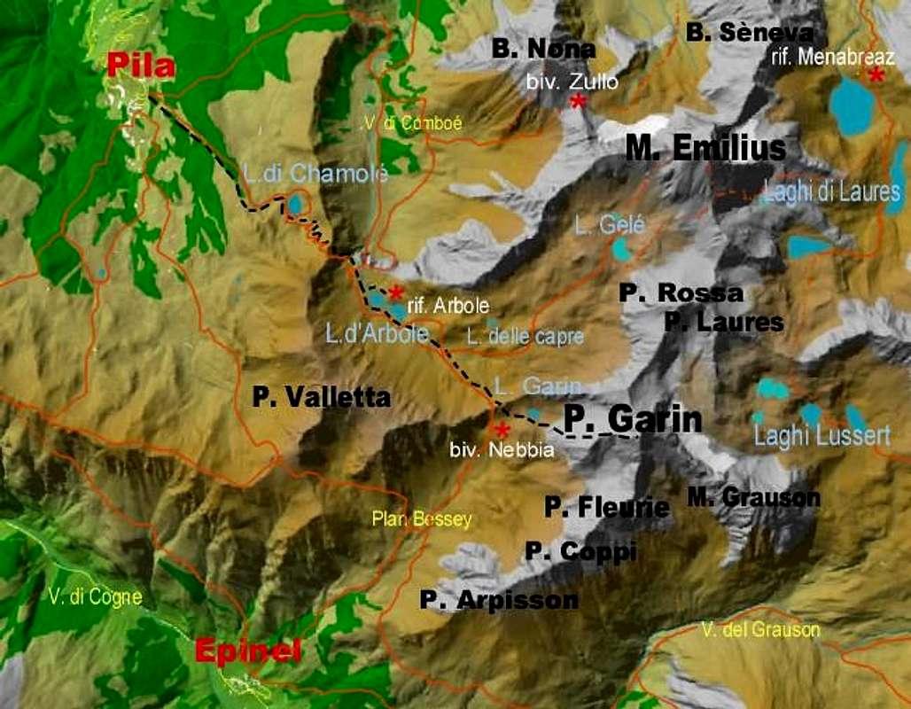
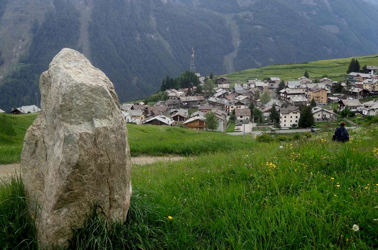
This vallon (small valley) is located within the much wider Grauson or Groson Valley of which we have already spoken several times on other specific occasions citing, as well as a basic description of the same, the ramifications towards the Vallons of Tessonet / Doreire ( to the East), diTsesère or Chesère (to the North) and Lussert (to the West-northwest). This complex mountainous area, located immediately North of the Municipality of Cogne and its important Hamlet of Gimillan or Dzimillan (1.787m), also presents a whole series of other small basins within them. Thus, with a description in a clockwise direction ie in a circular way from West to North, East and South, for that of the Costa di Lavà at the base of the long Southern Buttress which from Punta Garin (3.451m) descends to Punta di Arpisson (3.030/5m), for the next one of the Chaz Fleurie (also known locally as Val Crot Fleurie), of the Lussert in the upper circus of the homonymous lakes, of Tsesère or Chesère at the foot of the coastal Punta di Lussert / Punta di Leppe (3.221 meters, 3.305/7 meters), of Corona near Mont Vallonet and the important Colle di Saint Marcel or Col Coronas (2.916m); then, expanding and stretching to the East, Tessonet/Doreire at the foot of Punta Tersiva (3.515m) with the remains of the only small glacier left in the area and finally the basins that host more towards the South, as well as at the foot of Mont Penne Blanche (3.254m), that series of ponds ranging from three Doreire Lakes to Money Lake. Precisely from this last one enjoys a frontal and complete view towards the first sector or the Western one, such as to clearly highlight the steep couloirs and gullies that descend from the aforementioned buttress with, in order from left or South, the Punta di Arpisson, the three Pointes Coupèes d'Arpisson (from 3.168 to 3.231 meters)) , the Torre or Tour di Arpisson (3.227/31m), the two Punte di Lavà (3.214/8m), the Punta Fiorito or Pointe Fleurie (from 3.258 to 3.260/1 meters) and at the last the pyramid of the Garin Peak or Punta Garin, the highest in the stretch that from the first then, in a circular sense, reaches at the extreme Orient the Punta Tersiva or maximum elevation of the entire Vallone del Grauson. These new measurements, shown here alternating with those made by I.G.M. (Italian Military Geographical Institute), come from the Maps:
a) -Valle di Cogne Map of the paths 10 , on a scale of 1:25.000 with UTM coordinates by "L'ESCURSIONISTA editore" Rimini 2007 and
b) - Conca di Aosta Map of paths 4, on a scale of 1:25.000 with coordinates U.T.M. by "L'ESCURSIONISTA editore", Rimini 2008; moreover further measurements (more "skinny" and with minimal differences) in Carta Hapax - Aosta 2008, always on a scale of 1:25000 by the "Comunità Montana Mont - Emilius Cartografia Hiking ", 2nd edition, Aosta 2008. Generally, about almost all the Summits, however in summitpo su SP. in the first mentioned were taken into account, in order not to incur various inconsistencies. In other cases, where certain or completely non-existent measurements do not yet exist, an assessment was made based on personal experience by adding, second the opportunities, the preposition or adverb entry "circa" (about, around).
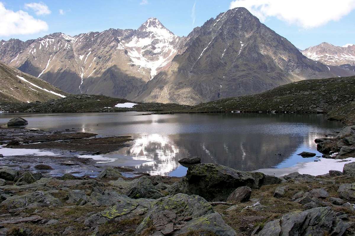
Val Crot Fleurie also Chaz Fleurie at the foot of Pic Garin (3.451 meters) & Mont Groson or Tour Grauson (3.240 meters), by emilius 2005
^^^^^^
Questo piccolo vallone é situato all'interno della ben più ampia Valle del Grauson o Groson della quale abbiamo parlato già più volte in altre specifiche occasioni citandone, oltre che ad una descrizione di base della medesima, le ramificazioni verso i Valloni di Tessonet-Doreire (ad Est), diTsesère o Chesère (a Nord) e di Lussert (ad Ovest-nordovest) . Questa complessa area montagnosa, posta subito a Settentrione del Comune di Cogne e della sua importante Frazione di Gimillan o Dzimillan (1.787 m) , presenta inoltre tutta una serie di altri piccoli bacini all'interno delle medesime. Così, con descrizione in senso orario cioé ed in modo circolare da Ovest verso Nord, Est e Sud, per quello delle Coste di Lavà alla base del lungo Contrafforte Meridionale che dalla Punta Garin (3.451 m) scende fino alla Punta di Arpisson (3.030/5 m) , per il successivo della Chaz Fleurie (conosciuto in loco anche come Val Crot Fleurie), del Lussert nel circo superiore degli omonimi laghi, di Tsesère o Chesère ai piedi della costiera Punta di Lussert/Punta di Leppe (3.221 metri, 3.305/7 metri), di Corona nei pressi del Mont Vallonet e dell'importante Colle di Saint Marcel o Col Coronas (2.916 m); quindi, ampliandosi e distendendosi ad Oriente, di Tessonet/Doreire ai piedi della Punta Tersiva (3.515 m) con i resti dello unico piccolo ghiacciaio rimasto in zona ed infine i bacini che ospitano più verso Meridione, nonché ai Piedi del Mont Penne Blanche (3.254 m), quella serie di laghetti che vanno dai tre Laghi Doreire al Lago di Money. Proprio da questo ultimo si fruisce di una vista frontale e completa verso il primo settore od Occidentale, tale da evidenziare in modo chiaro i ripidi canaloni che scendono dal succitato contrafforte con, in ordine da sinistra o Sud, la Punta di Arpisson, le tre Pointes Coupèes d'Arpisson (da 3.168 a 3.231 metri), la Torre o Tour d'Arpisson (3.227/31 m), , le duplici Punte di Lavà (3.214/8 m), la Punta Fiorito o Pointe Fleurie (da 3.258 a 3.260/1 metri) nonché buon ultima la piramide del Picco o Punta Garin, la più elevata nel tratto che dalla prima poi, in senso circolare, raggiunge all'estremo Oriente la Tersiva o massima elevazione dell'intero Vallone del Grauson. Queste nuove misurazioni, qui riportate in alternanza a quelle effettuate dall'I.G.M. (Istituto Geografico Militare Italiano), provengono dalle Carte:
a) -Valle di Cogne Carta dei sentieri 10, su scala 1:25.000 con coordinate U.T.M. ad opera di "L'ESCURSIONISTA editore" Rimini 2007 e di
b) - Conca di Aosta Carta dei sentieri 4, su scala 1:25.000 con coordinate U.T.M. ad opera di "L'ESCURSIONISTA editore", Rimini 2008; inoltre ulteriori rilevamenti (più "scarni" e con minime differenze) in Carta Hapax - Aosta 2008, sempre su scala 1:25000 ad opera della "Comunità Montana Mont - Emilius Cartografia Escursionistica", 2° edizione, Aosta 2008. Generalmente, a proposito di quasi tutte le Sommità, però in SP si sono tenute in conto le prime citate, onde non incorrere in incongruenze varie. In altri casi, laddove non esistano ancora delle misurazioni certe oppure del tutto inesistenti, ci si é affidati, a seconda dei casi, a valutazione in base alla personale esperienza aggiungendo la voce preposizione od avverbio "circa".
Historically speaking ...
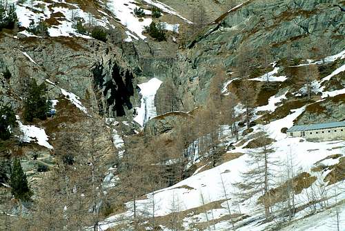
Coming in greater detail, we must identify this small wild and absolutely ice-free basin, in a valley located at the base of the Eastern slope of the Punta or Peak Garin, of which the origin of the toponym escapes (probably it marked the limits of an old pasture) which absolutely has nothing to do with the cyclist Maurice Garin, originally from Arvier in Aosta Valley and winner of the first Tour de France registered in 1903 (of cycling names we already see enough of them as for the nearby Pointes Coupèes or Coupì d'Arpisson which have become for the IGM Punte Coppi and as such taken from all the cartography in existence; while instead the herdsman of the time questioned by the topographer had simply replied : Pointes Couppì, or "Cut Tips", being that all three appear as truncated cleanly by a razor. Besides, at the time the famous cyclist Fausto Coppi was still not born ...). While the toponym Chaz and also Crot refers to the term alp, pasture or pasture the highest and probably the oldest known. Certainly also abandoned, since no trace of it remains, as for the relative "sentierucolo" (little path) which, lost in time, has experienced a certain "rebirth" in recent times, especially thanks to the wooden walkway built on the Torrent de Lussert, immediately behind of the Alpe di Grauson Vieux or Desòt (Vecchio or di Sotto, 2.271/3 meters). Where cows grazed, over time it has become a steep terrain suitable for goats. But it was not so once, when the same had had a certain attendance so that:... "... Chaz Fleurie, three quarters of an hour, tradition places a gold mine there. Pic Garin, summit; two and a half hours. In all four and a half hours." As told by the first climbers of the pyramid from the Cogne side, that is, by the party of the famous Abbé Gorret (one of the protagonists of the first ascent to the Matterhorn in 1865) which reports in an article in the Bulletin "CAI 1866 , n. 7, where on page 48 it tells with detail of the "Ascension de la Pointe Garin sur Cogne ... Enfin, le 23 aout 1866, je pars deCogne accompé de M. le recteur Carrel, de trois élèves de Cogne et d'un jeune homme d'Aosta. Nous nous proposons bien de laisser le jeune Laurent au chalet de Grauson, mais il voulout nous suivre et il y reussit. Nous partons a six heures, à huit et un quart nous étions a Grauson. De là nous montons herborisant, jusque au creux de Chaz Fleurie; puis par les pierres et les clapeys (great broken boulders), nous arrivons à midi au sommet du pic ... ". And this also explains that "Crot", synonymous with "Creux", which means a hole, a hole, or a poor shelter, almost a cave as it must have been where the poor shepherds they had found each other a place and space for night rest . Before going back to the chalets of Grauson Vieux which, by comparison, seemed to be a royal palace. Again the Gorret in "Guide de la Vallée d'Aoste 1977": " ... on suit la route précédentejousu'à Grauson (vedi Col du Coronas ou Pas de St. Marcel) d'ou l'on prend à gauche en contournant la Tour Grauson pour se rendre à Chaz Fleurie, de où l'on monte en ligne droite par des clapeys et des rochers faciles jusq'à la sommité d'où l'on jouit d'un magnifique panorama ...". Further confirmation of this also occurs from the famous mountain guide book "Guide of the Western Alps vol. II, part II", published by the CAI Section of Turin 1896 and 1889; which as regards the Via Normale at Punta Garin starting from Cogne reads: "... followed the itinerary of the Colle Coronas up to the Grauson farmhouses. Then crossed the stream you take a path that heading west climbs along the southern slopes of the Tour Grauson, and then, turning north, leads into a dingy little valley, occupied by a maceret of shards of sharp rock, called Chaz Fleurie. summit. 3 hours from the farmhouses. ". Thus from the middle to the end of the 19th century the ascent to the pyramid was "framed" starting from the town of Cogne.
^^^^^^
^^^^^^
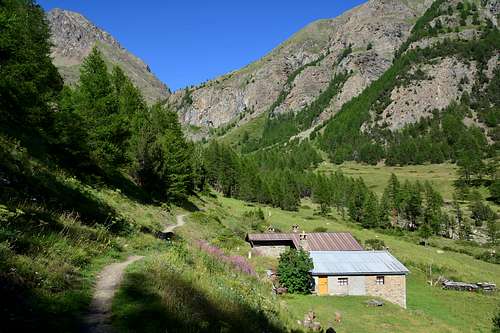
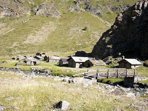
Venendo a maggior dettaglio, si deve individuare questo piccolo bacino selvaggio ed assolutamente privo di ghiacci, in un valloncello posto alla base del Versante Orientale della Punta o Picco Garin, della quale sfugge l'origine del toponimo (probabilmente segnava i limiti di un pascolo) che non centra assolutamente con il ciclista Maurice Garin, originario di Arvier in Valle d'Aosta nonché vincitore del primo Tour de France targato 1903 (di denominazioni ciclistiche già ne vediamo abbastanza come per le vicine Pointes Coupèes o Coupì d'Arpisson che sono diventate in IGM Punte Coppi e come tali riprese da tutta la cartografia in esistenza; mentre invece il mandriano dell'epoca interrogato dal topografo aveva semplicemente risposto: Pointes Couppì, ovvero "Punte Tagliate", essendo che appaiono tutte e tre come troncate di netto da un rasoio. Tralaltro all'epoca il famoso ciclista Fausto Coppi ancora non era nato ...). Mentre il toponimo Chaz ed anche Crot si riferisce al termine di alpe, alpeggio ovvero di pascolo il più elevato e probabilmente il più antico conosciuto. Di certo anche abbandonato, poiché non ne rimane traccia alcuna, come per i relativo sentierucolo che, andato disperso nel tempo, ha conosciuto una certa "rinascita" negli ultimi tempi, soprattutto grazie alla passerella in legno costruita sul Torrent de lussert, subito alle spalle dell'Alpe di Grauson Vieux o Desòt (Vecchio o di Sotto, 2.271/3 metri). Là dove pascolavano le mucche, nel tempo é diventato un erto terreno adatto alle capre. Ma non era così una volta, allorché il medesimo aveva avuto una certa frequentazione tanto che: ... "... Chaz Fleurie, trois quarts d'heure, la tradition y place une mine d'or. Pic Garin, sommet; deux heures et demi.En tout quatre heures et demi.". Come da racconto effettuato dai primi salitori della piramide dal versante di Cogne, cioé dalla comitiva del famoso Abbé Gorret (uno dei protagonisti della prima ascensione al Cervino nel 1865) che ne relazione in un articolo del Bollettino" CAI 1866, n. 7, dove in pagina 48 racconta con dovizia di particolari de l'"Ascension de la Pointe Garin sur Cogne ... Enfin, le 23 aout 1866, je pars de Cogne accompagné de M. le recteur Carrel, de trois élèves de Cogne et d'un jeune homme d'Aosta. Nous nous proposons bien de laisser le jeune Laurent au chalet de Grauson, mais il voulout nous suivre et il y reussit. Nous partons a six heures, à huit et un quart nous étions a Grauson. De là nous montons herborisant, jusque au creux de Chaz Fleurie; puis par les pierres et les clapeys, nous arrivons à midi au sommet du pic ...". E ciò spiega anche quel "Crot", sinonimo di "Creux", che sta a significare di un buco, un pertugio, ovvero un ricovero misero, quasi una caverna come doveva essere quello dove i poveri pastori trovavano addiaccio e spazio per il riposo notturno. Prima di ridiscendere ai chalets di Grauson Vieux che, al confronto, parevano essere una reggia. Ancora il Gorret in "Guide de la Vallée d'Aoste 1977": " ... on suit la route précédentejousu'à Grauson (vedi Col du Coronas ou Pas de St. Marcel) d'ou l'on prend à gauche en contournant la Tour Grauson pour se rendre à Chaz Fleurie, de où l'on monte en ligne droite par des clapeys et des rochers faciles jusq'à la sommité d'où l'on jouit d'un magnifique panorama ...". L'ulteriore conferma acciò avviene anche dalla famosa guida di montagna "Guida delle Alpi Occidentali vol. II, parte II", edita dalla Sezione del CAI di Torino 1896 e 1889; la quale per quanto concerne la Via Normale alla Punta Garin partendo da Cogne recita: " ... seguesi l'itinerario del Colle Coronas fino ai casolari Grauson. Poi attraversato il torrente si prende un sentiero che dirigendosi verso ovest sale lungo le propaggini meridionali della Tour Grauson, e quindi, volgendo verso nord, conduce in uno squallido valloncello, occupato da un macereto di frantumi taglienti di roccia, chiamato Chaz Fleurie. Lo si risale fino alla sommità dove si afferrano le roccie della piramide che con un agevole scatata portano alla vetta. Ore 3 dai casolari.". Così dalla metà alla fine dell'800 era "inquadrata" la salita alla piramide con partenza dall'abitato di Cogne. E, passando per il Villaggio di Montroz (1.702 m), la Frazione di Gimillan (1.787 m), il Villaggetto del Tarabouc (1.831 m), oppure con un sentierucolo ancora più in basso e tutt'oggi esistente che si riuniva al precedente nei pressi della Croce e poi dell'Alpe diroccata del Rèvènti (1.895, 1.906 metri), per poi "scollinare" all'Ecloseur (1.903 m) transitando sull'omonimo ponte in legno e pietra al di sopra del Torrent Gru (contrazione di Groson o Grauson); quindi all'Alpe Pila con la sua impetuosa cascata (2.003, 2.021 metri), alla quale perviene un orrido canalone che, scendendo dalle Pointes Coupées d'Arpisson, taglia in due le Cote Lavà o Lavaz. Oltre, il sentiero N° 8, doppiato un promontorio roccioso con bella vista dall'alto sulla cascata (2.156 m), si distende a Nordest fronteggiando dall'alto di un centinaio di metri la parte basale del Vallone di Crot Fleurie, che da questo tratto risale al di là del torrente in piena vista verso nord-nordovest. Ma non ci si può ancora indirizzare verso il Vallone della Chaz Fleurie, perché vi è una discesa ripida che conduce ad un guado molto pericoloso, oltre il quale si erge una fascia di rocce ripide solcate da una mezza dozzina di torrentelli. Conviene continuare in quasi rettilinea salita verso l'Alpe di Creuzet (2.244 m) che si lascia appena dabbasso per raggiungere un'evidente Croce (2.294 m) allo imbocco del pianoro di Grauson Vieux (2.271/3 m). Lasciato sulla destra il sentiero che prosegue verso i Valloni di Lussert, Tsesère, Corona e Tessonet/Doreire, si passa sopra un ponticello in legno, appena al di sopra dell'unificazione dei Torrents de Corona e de Grauson, che in breve conduce al medesimo.
Getting There
BY CAR:
From TORINO, MILANO, etc: Motorway A5. Exit at IVREA or Quincinetto (PIEDMONT) AOSTA West/Aymavilles, Cogne Municipalities.From Aymavilles(646m) towards Cogne Valley: Vieyes (1.132m), Gontier private Shelter, through path in Nomenon Vallon. To Cogne(1.534m); through Main Road. To Valnontey(1.678m); Money, Alessandro Martinotti, Stefano Borghi, Pol, Gerard-Grappein, Lionello e Lucio Leonessa, Mario Balzola, Damiano Gratton. (This last from Epinel(1.436m)(1.494m) or Crétaz Fractions) Bivouacs, through paths, moraines and glacier, & Sella Refuge, through muletrack). From Lillaz Fraction (1.607m) to Sogno di Berdzé, under the Fenêtre of Champorcher, and Antoldi-Malvezzi Refuges, by dirt road, muletrack or paths in Urtier and Valeille Vallon. To Gimillan Village(1.785m), Nebbia Bivouac, with path in Arpisson Vallon. All the three last through Regional Roads from Cogne.
From FRANCE: through the Mont Blanc Tunnel to Entrèves-crossroads to Vény/Ferret Valleys - Mountain Guides of Courmayeur - La Saxe Rock Gym - Courmayeur. By Little Saint Bernard Hill, closed since November until half May to La Thuile Valley - Pré Saint Didier - Courmayeur. It is not necessary to take Motorway A5: you can drive on SS.26, in the direction of AOSTA - IVREA - TURIN.
BY PLANE:
Aeroporto "Corrado Gex" Saint Christophe (Aosta).
How to go and what routeways you can do
^^^^^^
From Cogne and, passing through the Village of Montroz (1.702m), the Hamlet of Gimillan (1.787m), the little Villagge of Tarabouc (1.831m), or with a path still lower and still existing which met at the previous one near the Cross and then on the ruined Alpe del Rèvènti (1.895, 1.906 meters), and then for "scollinare" (traversing a small hill) at the Ecloseur (1.903m) passing on the homonymous wooden and stone bridge over the Torrent Gru (contraction of Groson or Grauson); then to Alpe Pila with its impetuous waterfall (2.003, 2.021 meters), which reaches a horrid gully which, descending from the Pointes Coupées d'Arpisson, cuts the Cote Lavà or Lavaz in two. Beyond, the path n° 8, dubled a rocky promontory with a beautiful view from above on the waterfall (2.156m), extends to the Northeast facing the basal part of the Crot Fleurie Valley from and above a hundred meters stretch goes beyond the stream in full view to the North-northwest. But we cannot yet go to the Chaz Fleurie Valley, because there is a steep descent that leads to a very dangerous ford, beyond which stands a band of steep rocks furrowed by half a dozen streams. It is advisable to continue on an almost straight climb towards the Alpe di Creuzet (2.244m) which is left just below to reach an evident Cross (2.294m) at the entrance of the plain of Grauson Vieux (2.271/3m). Leaving on the right the path that continues towards the higher Valleys of Lussert, Tsesère, Corona and Tessonet / Doreire, you pass over a wooden bridge, just above the unification of the Torrents de Corona and de Grauson, which soon leads to the same. Once you reach the Village of Grauson Desòt or Vieux, you cross it slightly downhill heading behind it until you reach the Torrent de Lussert (another branch coming from the four Lakes of Lussert) just before this too flows, together with those of Corona, Grauson and Money, in the only Torrent de Gru. A wooden walkway, which did not exist in the Seventies, forcing at not always easy and safe fords, allows entry into the lower part of the Chaz Fleurie Valley. So much so that in Osvaldo Cardellina's "Guide of Monte Emilius", Edit. from the same in December 1978 with the collaboration with the Aosta Section of the CAI, we read in pages 82-3: "... Go past the promontory and head towards the NE towards the Alpe Grauson Vecchie (Old Pasture, 2.271 meters) without reaching it; once in sight of the Southern offshoots of the Tour Grauson, where the stream makes a bend beyond which it becomes more precipitous, go down the mule track in a clear stony for about fifty meters into it. Wade the same near a smooth rock with a characteristic yellowish vein, aim for a characteristic square block placed about forty meters above the opposite bank, where you will find a very little path going back to the NW; instead abandon the branch in the SO direction, as it is inconvenient. After passing a dark rock overlooking the stream, the path gradually gets lost; go up again to meet a moraine against the last rocks of the Tour Grauson, where you can find the ruined path that climbs from the alp to the Chaz Fleurie, a very small valley that has been abandoned for some long time where the flocks still go occasionally. You can climb directly by aiming for an isolated pine and a subsequent larch. After passing a mammoth boulder, climb up on clapeys keeping immediately under the Tour Grauson; so you go through the Val Crot Fleurie again finding traces of the path further South, however soon dispersed near a waterfall (1h'30). Head towards the ridge that binds the Tour Grauson to Punta Garin, while keeping to the bottom of the valley, leaving a characteristic sulphurous rock on the left, acting as the extreme edge of a secondary ridge coming from the Southern ridge of the peak beyond the notch; continue along rocky banks eroded by water alternating with traces of path on moraine and clapeys. The valley narrows somewhat and dies against the last steeper rocks of the SE side of Punta Garin ... ". Et voilà we are almost at the top of the peak or Punta Garin (3.461m), the most isolated and highest peak in this Western sector, as well as second to Punta Tersiva alone (3.515m) in the entire and large Grauson Valley or, better, Grauson also Groson Basin. Wandering around there we go to see what can be combined. Maybe we also find the gold mine of tradition, as an ancient Legend has it ...
Vallon Chaz Fleurie or Val Crot Fleurie (in bottom to the right or North) below Punta Garin with its long Southern Buttress, by emilius 2005
^^^^^^
Da Cognee, passando per il Villaggio di Montroz (1.702 m), la Frazione di Gimillan (1.787 m), il Villaggetto del Tarabouc (1.831 m), oppure con un sentierucolo ancora più in basso e tutt'oggi esistente che si riuniva al precedente nei pressi della Croce e poi dell'Alpe diroccata del Rèvènti (1.895, 1.906 metri), per poi "scollinare" all'Ecloseur (1.903 m) transitando sull'omonimo ponte in legno e pietra al di sopra del Torrent Gru (contrazione di Groson o Grauson); quindi all'Alpe Pila con la sua impetuosa cascata (2.003, 2.021 metri), alla quale perviene un orrido canalone che, scendendo dalle Pointes Coupées d'Arpisson, taglia in due le Cote Lavà o Lavaz. Oltre, il sentiero n° 8, doppiato un promontorio roccioso con bella vista dall'alto sulla cascata (2.156 m), si distende a Nordest fronteggiando dall'alto di un centinaio di metri la parte basale del Vallone di Crot Fleurie, che da questo tratto risale al di là del torrente in piena vista verso nord-nordovest. Ma non ci si può ancora indirizzare verso il Vallone della Chaz Fleurie, perché vi è una discesa ripida che conduce ad un guado molto pericoloso, oltre il quale si erge una fascia di rocce ripide solcate da una mezza dozzina di torrentelli. Conviene continuare in quasi rettilinea salita verso l'Alpe di Creuzet (2.244 m) che si lascia appena dabbasso per raggiungere un'evidente Croce (2.294 m) allo imbocco del pianoro di Grauson Vieux (2.271/3 m). Lasciato sulla destra il sentiero che prosegue verso i Valloni di Lussert, Tsesère, Corona e Tessonet/Doreire, si passa sopra un ponticello in legno, appena al di sopra dell'unificazione dei Torrents de Corona e de Grauson, che in breve conduce al medesimo. Giunti al Villaggio del Grauson Desòt o Vieux, lo si attraversa in leggera discesa dirigendosi dietro al medesimo fino a raggiungere il Torrent de Lussert (altra diramazione proveniente dai quattro Laghi di Lussert) appena prima che anche questo confluisca, insieme a quelli di Corona, Grauson e Money, nell'unico Torrent de Gru. Una passerella in legno, che negli Anni Settanta non esisteva costringendo ad un guado non sempre facile e sicuro, permette l'ingresso nella parte bassa del Vallon della Chaz Fleurie. Tanto che in "Guida del Monte Emilius" di Osvaldo Cardellina, Edit. dallo stesso in Dicembre 1978 con la collaborazione con la Sezione di Aosta del CAI si legge in pagine 82-3: " ...Superare il promontorio ed indirizzarsi con la mulattiera verso NE verso l'Alpe Grauson Vecchie (2271 m) senza raggiungerla; giunti in vista delle propaggini meridionali della Tour Grauson, laddove il torrente effettua un'ansa oltre la quale si fa più precipitoso, scendere dalla mulattiera in una pietraia chiara per una cinquantina di metri sin dentro lo stesso. Guadatolo presso una roccia liscia con una caratteristica venatura giallognola, mirare ad un blocco squadrato caratteristico posto una quarantina di metri sopra la sponda opposta, dove si incontra un sentierucolo risalente verso NO; abbandonare invece il ramo in direzione SO, poiché sconveniente. Superato un roccione scuro a picco sul torrente, il sentiero va via via sperdendosi; salire ancora ad incontrare una morena sin contro le ultime rocce della Tour Grauson, ove si rinviene il sentiero in rovina che sale dall'alpe alla Chaz Fleurie, valloncello abbandonato ormai da tempo ove di tanto in tanto si recano ancora le greggi. Si può salire direttamente mirando ad un pino isolato e ad un successivo larice. Oltrepassato un mastodontico masso si risale su clapeys tenendosi subito sotto la Tour Grauson; si percorre così tutto il Val Crot Fleurie riscontrando nuovamente tracce di sentiero più a sud, tosto però disperdentesi nei pressi di una cascatella d'acqua (1h'30). Indirizzarsi verso la cresta che rilega la Tour Grauson alla Punta Garin, pur tenendosi sul fondo del vallone, lasciando a sinistra un caratteristico roccione sulfureo, fungente da estremo spalto di una cresta secondaria proveniente dalla cresta sud del picco oltre l'intaglio; continuare per banconate rocciose erose dall'acqua alternate a tracce di sentiero su morena e clapeys. Il vallone si restringe alquanto e muore contro le ultime rocce più ripide del versante SE della Punta Garin ..." Et voilà siamo quasi in cima al Picco o Punta Garin (3.461 m), la vetta più isolata nonché maggiormente elevata di questo settore Occidentale, nonché seconda alla sola Tersiva (3.515 m) nell'intero ed amplio bacino del Grauson. Andiamo a vedere cosa si può combinare ...
^^^^^^
Campings
Remember that free camping is forbidden (except for emergency reasons, over 2.500m, from darkness until dawn).
Mountain Condition
Meteo: you can find all the needed informations at the official site of the Valle d'Aosta Region:
"Guida delle Alpi Occidentali" di Giovanni Bobba e Luigi Vaccarone C.A.I. Sezione di Torino Volume II (parte II), 25 Maggio 1896.
"Guida del Monte Emilius" di Osvaldo Cardellina Editore in collaborazione con il Club Alpino Italiano Sezione di Aosta, Dicembre 1978 (in Italian).
"Guida dei Monti d'Italia Emilius Rosa dei Banchi Parco del Mont Avic" di Giulio Berutto e Lino Fornelli - Club Alpino Italiano/Touring Club Italiano, Marzo 2005.
"Gran Paradiso", G. Klotz, Ed. Bergverlag GmbH Rother, Monaco 2005 (in tedesco)."
MAPS:
Kompass "Gran Paradiso Valle d'Aosta Sentieri e Rifugi" Carta Turistica 1:50.000.
Hapax "Les Sentiers Comunità Montana Monte Emilius", Luglio 2000 1:25.000.
Enrico Editore Ivrea-Aosta "Gruppo del Gran Paradiso" 1:50.000.
I.G.C. Torino "Carta delle Passeggiate ed Escursioni in V.D.A. Conca di Pila-Gressan" 1:20.000.
L'Escursionista "Valle di Cogne Carta dei Sentieri" (n° 10) 1:25.000.
L'Escursionista "Tour de la Vallée de Cogne Grand Paradis" Carta dei sentieri 1:25.000.
Parents refers to a larger category under which an object falls. For example, theAconcagua mountain page has the 'Aconcagua Group' and the 'Seven Summits' asparents and is a parent itself to many routes, photos, and Trip Reports.


 1554 Hits
 83.69% Score
 17 Votes