La montagna chiama i suoi figli, ed essi rispondono fedelmente al suo appello…
Osvaldo Cardellina, Diario alpinistico, 1964-65
Page texts: @ OsvaldoCardellina"Osva", passed away on May 2, 2022. Page owners: Christian Cardellina e Osvaldo Cardellina. Any updates from September 12, 2022: Antonio Giani, page administrator, friend and climbing companion.
Testi della pagina: @ OsvaldoCardellina "Osva", scomparso il 2 maggio 2022. Proprietari pagina:Christian Cardellina e Osvaldo Cardellina. Eventuali aggiornamenti dal 12 settembre 2022: Antonio Giani, amministratore della pagina, amico e compagno di salite.
Various Overview Multifarious
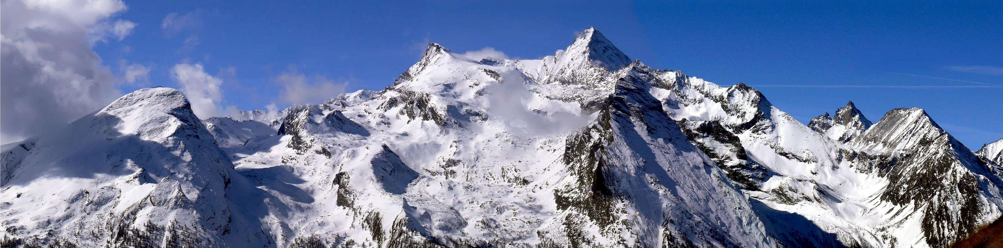
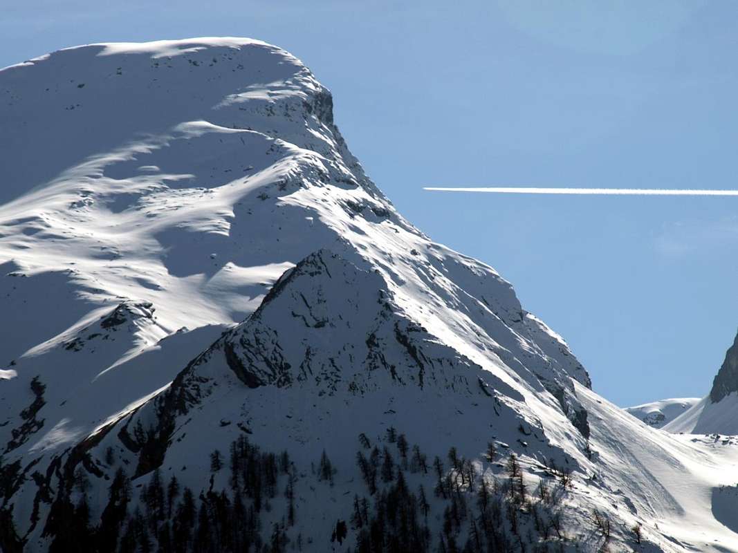
Vallon du Plan Varioz or Vallone of Pian Vario? Both denominations with the first through dialect "patois" by Aosta Valley. Probably adapted to indicate a variant. A variant climb to the adjoining Valley of the Pousset with which it rejoins at the top forming a large isosceles triangle with its apex at the base of the Colle della Rossa (3.190m). Before you cross over, past the watershed, in the opposite Vallone Lauson or Lozon in which the Vittorio Emanuele II° Shelter (2.579m) is sited at the feet of Herbetet (3.778m). Content from the watershed that originates from the Grivola's Punta Rossa, which are directed to the Northeast towards Cogne Common and North above the Crétaz Fraction. It is therefore, going up the Valley of Cogne from Aymavilles, as the last of the deep valleys of the Southwest buttress of this valley before reaching the Valnontey, or by starting from Cogne and downhill towards the West as the first, followed by those of Pousset, Traso or "Tradzo" and Nomenon. All lead up to the famous Grivola (3.969m), or to the its restricted slopes. A crescendo of mountains which then are directed towards the majestic Summit of Gran Paradiso (4.061m), at the height of all the mountains of the magnificent Valley of Cogne. Specifically here we find the Pointe du Pousset and Punta Rossa on the one hand and the Pointe de l'Ouille, Mont Herban the Côte de Forcia and Crête de Lauson on the other. In the middle it is situated the lonely Tête du Gavio (Head) that serves as a link between the two valleys. Let's look in more detail just below ...
Vallon du Plan Varioz o Vallone di Pian Vario? Ambo le denominazioni con la prima in dialetto "patois" valdostano. Probabilmente atta ad indicare una variante.
Una variante di salita all'attiguo vallone del Pousset con il quale si ricongiunge in alto formando un grande triangolo isoscele con il vertice alla base del Colle della Rossa (3.190 m). Prima di sconfinare, passato lo spartiacque, nell'opposto Vallone del Lauson o Lozon nel quale é sito il Rifugio Vittorio Emanuele II° (2.579 m) alle pendici dell'Herbetet (3.778 m). Contenuto dagli spartiacque che s'originano dalla Punta Rossa della Grivola, indirizzantesi a Nordest in direzione di Cogne ed a Settentrione sopra la piccola Frazione di Crétaz. Risulta quindi, risalendo la Valle di Cogne con partenza da Aymavilles, come l'ultimo dei valloni del contrafforte Sudovest di questa vallata prima di raggiungere la Valnontey, oppure partendo da Cogne ed in discesa verso Occidente come il primo, seguito da quelli del Pousset, Traso o "Tradzo" e Nomenon. Tutti risalgono verso la famosa Grivola (3.969 m), oppure alle sue ristrette pendici. Un crescendo di montagne che poi si indirizzano verso la maestosa Sommità del Gran Paradiso (4.061 m), al culmine di tutte le montagne della magnifica Valle di Cogne. Specificamente qui troviamo la Pointe du Pousset e la Punta Rossa da un lato e la Pointe de l'Ouille, il Monte Herban la Côte de Forcia e la Crête de Lauson sullo altro. In mezzo é situata solitaria la Testa del Gavio che funge da collegamento tra i due valloni. Vediamo in maggior dettaglio appena più avanti ...
Even this vallon does not see or achieve great things
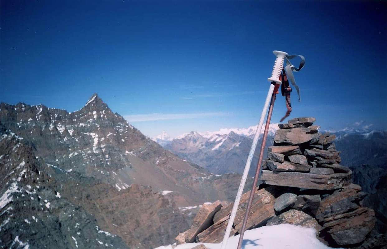
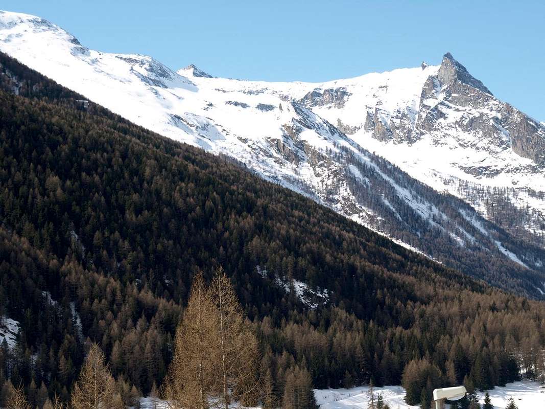
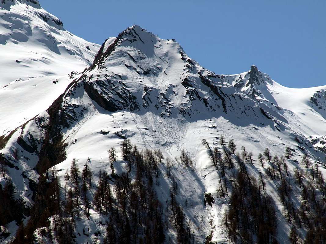
Because do not possess them and at best can become the point of support, through Damiano Gratton Bivouac (3.204m), the Normal Route to the same as an alternative to theVittorio Sella Shelter opposite side of Lauson or Lozon. Revenge for those of Cogne, because the way "historical" from Valsavarenche, too dangerous, has now been almost completely abandoned. After having climbed the easy Northeast Ridge of Punta Rossa (3.630m) by H. and F. Montgomery, S. Taylor with J. Tannler Guide in 1864, starting from the Pousset Hill (3.198m), must indeed wait the beginnings of '900 (1903, 1909, 1913) to record beautiful climbings by Swiss, English Climbers accompanied by local Guides or from Valtournanche on the Punta del Pousset (3.046m) ridges and faces. The rest are things "à vaches" (to cows), as would said by the good Abbé Henry, or easy excursions like Mount Herban and not Erban (3.004m) and a little less for the underlying Mont-de-l'Ouille or "l'Euille" (2.521m), that some small delicate passage presents him to reach the Summit with some bypass on the steep slabs of Southern Crest. Amid "stands" the hemiunknown Tête du Gavio (3.047m), both in plain view from the valley floor as poorly known and "courted" by mountain climbers and hikers. From this unknown and abandoned Summit is "birth" a barely mentioned median spur dividing the actual Vallon of Pousset (further West) from a secondary sector called Pian Vario or Plan Varioz below Mount Herban until to reach the Colle della Rossa (3190m) just under the homonym point (3.630m). The other two are from Punta Rossa, highest Vertex in this valley, this vallon contain respectively reaching the Punta Pousset towards the North and Mont-de-l'Ouille and Vermiana Dèsott Pastures (2.093m) towards the Northeast, immediately above the Hamlet of Crétaz.
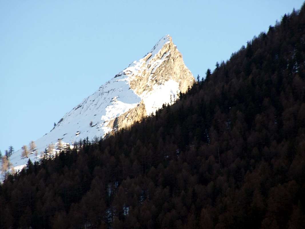
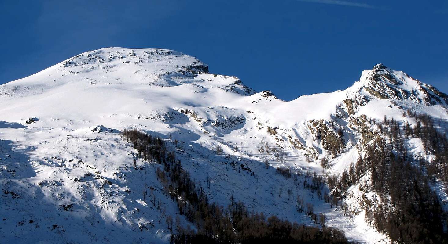
Central sector, above Crétaz Hamlet, of Vario Vallon seeds in winter from North
Anche questo vallone non vede invece realizzare grandi cose, anche perché non le possiede ed al massimo può diventar punto d'appoggio, tramite il Bivacco Damiano Gratton (3.204 m), per la Via Normale verso la medesima Punta Rossa della Grivola in alternativa al Rifugio Vittorio Sella dal versante opposto del Lauson o Lozon. Una rivincita per quelli di Cogne, poiché la via "storica" dalla Valsavarenche, troppo pericolosa, ormai é stata quasi completamente abbandonata. Dopo la salita per la facile Cresta Nordest della Punta Rossa (3.630 m) da parte di H. e F. Montgomery, S. Taylor con la Guida J. Tannler nel 1864 partendo dal Colle del Pousset (3.198 m), bisogna infatti attendere gli inizi del '900 (1903, 1909, 1913) per registrare belle arrampicate da parte di svizzeri, inglesi accompagnati dalle Guide locali o di Valtournanche sulle creste e pareti della Punta del Pousset (3.046 m). Il resto son cose "à vaches", come direbbe il bravo Abbé Joseph-Marie Henry, ovvero facili escursioni come per il Monte Herban e non Erban (3.004 m) ed un pò meno per il sottostante Mont-de-l'Ouille o "l'Euille" (2.521 m), che qualche passaggetto delicato lo presenta per raggiungere la Cima con piccoli aggiramenti sulle ripide placche della Cresta Meridionale e la torretta sommitale. In mezzo "troneggia" la semisconosciuta Testa del Gavio (3.047 m), tanto bene in vista dal fondovalle quanto scarsamente conosciuta e "corteggiata" da alpinisti ed escursionisti. Da questa incognita ed abbandonata Sommità viene "partorito" un appena accennato contrafforte mediano che divide il vero e proprio Vallone del Pousset (più ad Ovest) da un settore secondario denominato Pian Vario o Plan Varioz sottostante al Monte Herban insino a raggiungere il Colle della Rossa (3.190 m) al di sotto dell'omonima punta. Gli altri due che provengono dalla Punta Rossa, Vertice massimo di questo vallone, lo contengono rispettivamente raggiungendo la Punta Pousset verso Nord ed il Mont-de-l'Ouille nonché l'Alpe Vermiana Dèsott (2.093 m) in direzione Nordest al di sopra della sottostante Frazione di Crétaz.
Getting There
BY CAR:
From TORINO, MILANO, etc: Motorway A5. Exit at IVREA or Quincinetto (PIEDMONT) also Pont St. Martin, Châtillon, AOSTA East (Nus), West (Aymavilles) Municipalities.
From Aymavilles towards Cogne Valley Aymavilles (646m) towards Cogne Valley with Regional Road: Vieyes (1.132m) Fraction; continue to Epinel(1.436/52m), Crétaz(1.494m) hamlets, by path in Pian Varrio Vallon at Vermiana Dessus Alp (2.382m) below "l'Euille" and with a small path towards the Colle della Rossa (3.190m), below Punta Rossa della Grivola (3.630m).
Some more or less easy Hikings
1) - Pousset Lower Alp (1.436m): Walk with path n° 26/TVC in South-southeast towards Pianes (1.694m) Pasture; flexing to the Southeast through "Grand Bois" and passing above Récogé (1.798m) Alp reach that of Eyfié (1.950m); from this last, route more in South, towards Pousset Lower Alp (2.176m; old rascards; T/E/F; 1h'50/2h'00).
2) - Pousset Upper Alp, Pointe Pousset (2.520m, 3.045m): excursion from Epinel passing Pousset Lower Alp with path n° 26 in South-southwest until the fork (2.303m). (*** Else with departure by Crétaz through trail n° 25/TVC/26 until P.N.G.P. Cabine 2.289 meters,passing near the fork 2.303 meters, up to the Upper Pousset Alpage). From both continue towards the overlying junction about 2.700 meters and with not numbered small path to the Northwest to Pointe Pousset (3.045) (EE/F+; 2h'15/2h'45).
3) - Gratton Bivouac (3.198m): Excursion from Epinel Hamlet with path n° 26 before in Southeast into the "Grand Bois" (Great Forest) to sources of Pousset Torrent neighboring the homonym lower Pasture (2.176m; wooded "rascards"), crossing below the Northern and Eastern Faces of Punta Pousset (3.045m). After South with path always n° 26, passing through the upper (2.520m), towards the Pousset Pass (3.201m) near the Camp Damiano Gratton (1.998m), just above Traso Glacier (EE/F+; 4h'30/5h'00).
4) - Punta Rossa della Grivola (3.630m): to complete the course on watershed dominating from East to the West the upper plateau of Traso Glacier in terminal part, continue on sparce but always evident traces towards the South and, after bypassing the Altitudes 3.338, 3.364 meters formed from stacked blocks, continue easily with a small snowy ridge reaching the Summit, with the Southeast Face or Normal Route of Grivola in front (EEA/F+; 1h'15/1h'30 from Camp Gratton; 6h'00/6h'30 Epinel or Crétaz Hamlets).
5) - Colle della Rossa (3.190m): excursion by Epinel before in Southeast after South through the trail n° 26 on morainic North Slope towards the hill (EEA/F; 5h'00/5h'30).
6) - Pointe de l'Ouille or "l'Euille" (2.521m): excursion-ascent from Crètaz in South-southwest through the path n° 25/TVC just before Vermiana Damon Alp (2.382m). From here with small path n° 18D on West Slope towards the saddle 2.492 meters and from this with circumvention under the South Crest to Summit (EEA/F; 4h'00/4h'30).
7) - Monte Herban (3.001m): excursion from Crètaz in South-southwest, passing near Vermiana Damon or Dessus Alp (2.382m) through the paths n° 25/TVC/18D on Western Slope towards the saddle 2.492 meters. From this and Southern Via along the enough steep rocky-grassy Northern Slope to the large Summit (EEA/F; 4h'00/4h'30).
8) - Vermiana Pass (2.896m): excursion from Crètaz in South-southwest through the path n° 25/TVC until Plan Varioz in altitude 2.719m); after without path but through annoying screes and tiresome moraine on Sutheastern Slope towards the pass, located between the Crête du Loson (3.047m) Tête-Tsaplane (3.006m; EEA/F; 4h'15/4h'45).
9) - Colle della Rossa (3.190m): long excursion from Crètaz in South-southwest through the trails n° 25/TVC on Northern Slope towards the hill (EEA/F; 5h'00/5h'30).
10) - Testa del Gavio (3.046m): ascent always from Crètaz in South-southwest through the path n° 25/TVC until immediately before the tableland of Plan Varioz in altitude 2.589m; after without path but through ground stones and steep moraines towards the North-northeastern Ridge up to the altitude 2.771 meters. From this through the same North-northeastern Crest, avoiding left (East) a rocky steep step in the middle part, over the acute and inclined to the South turret of narrow Summit (EEA/F; 4h'15/4h'45).
Mountain Condition
Meteo: you can find all the needed informations at the official site of the Valle d'Aosta Region:
"Gran Paradiso itinerari escursionistici" di Franco Brevini, Ed. Musumeci, Luglio 1982.
"Il Parco Nazionale del Gran Paradiso (Valli di Champorcher-Clavalitè-Saint Marcel-Laures-Cogne-Valsavarenche-Conca di Pila" di Giulio Berutto 3/volume 2°, I.G.C., Torino 1981, 2a Ed. 2000.
"Guida dei Monti d'Italia-Gran Paradiso Parco Nazionale" E. Andreis, R. Chabod, M. C. Santis, Club Alpino Italiano/Touring Club Italiano, prima Ed. 1939; seconda Ed. 1963; terza Ed. 1980.
"Guida delle Alpi Occidentali", di Giovanni Bobba e Luigi Vaccarone C.A.I. Sezione di Torino Volume II (parte II), 25 Maggio 1896.
"Rifugi e bivacchi in Valle d'Aosta", di Cosimo Zappelli aggiornata da Pietro Giglio, Musumeci Editore, Luglio 2002.
MAPS:
Kompass "Gran Paradiso Valle d'Aosta Sentieri e Rifugi" Carta Turistica 1:50.000.
Enrico Editore Ivrea-Aosta "Gruppo del Gran Paradiso" 1:50.000.
I.G.C. Istituto Geografico Centrale "Il Parco Nazionale del Gran Paradiso" 1:50.000.
L'Escursionista "Valle di Cogne Carta dei Sentieri" (n° 10) 1:25.000.
L'Escursionista "Tour de la Vallée de Cogne Grand Paradis" 1:25.000.
Parents refers to a larger category under which an object falls. For example, theAconcagua mountain page has the 'Aconcagua Group' and the 'Seven Summits' asparents and is a parent itself to many routes, photos, and Trip Reports.


 1413 Hits
 78.27% Score
 9 Votes