


-
 2759 Hits
-
 75.81% Score
-
 6 Votes
|
|
Area/Range |
|---|---|
|
|
45.67880°N / 7.37249°E |
|
|
Hiking, Mountaineering, Trad Climbing |
|
|
Spring, Summer, Fall, Winter |
|
|
10830 ft / 3301 m |
|
|
Note
La montagna chiama i suoi figli, ed essi rispondono fedelmente al suo appello… Osvaldo Cardellina, Diario alpinistico, 1964-65 Page texts: @ OsvaldoCardellina "Osva", passed away on May 2, 2022. Page owners: Christian Cardellina e Osvaldo Cardellina. Any updates from September 12, 2022: Antonio Giani, page administrator, friend and climbing companion. Testi della pagina: @ OsvaldoCardellina "Osva", scomparso il 2 maggio 2022. Proprietari pagina: Christian Cardellina e Osvaldo Cardellina. Eventuali aggiornamenti dal 12 settembre 2022: Antonio Giani, amministratore della pagina, amico e compagno di salite. |
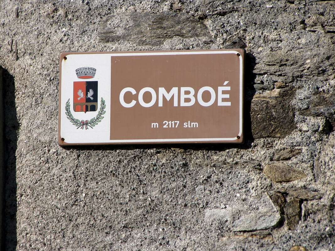
Combuì Overview
 |
Comboé or Combuì? Tous les deux, ie both. Comboé a little more Frenchified, Combuì in the local idiom. Like the other Combuì that exists at the entrance of the Vallon of Arpisson, above the Common of Pollein. But of Combe, Bellecombe, Comba and Combette is filled throughout the Valley of Aosta valley and means more or less large, more or less good, more or less known. So say the Vallon of Comboé is wrong and consists of unnecessary repetition, because Comboé or Combuì already means little valley. Usually solitary and secluded, and sometimes well hidden. An exclusive for the locals that there are a place to escape taking cover from prying eyes. Under high and rugged mountains. This vallon almost a real valley, which, sinuous flowing first South, then to the West to fold forming a great arc toward the North, originates more in below to Comboé's Vallon and Gorge of Dard (Waterfall Ravine), all crossed from the same waters or Torrent de Comboé up to the Dora Baltea, in turn, can be identified in three well distinct parts:
1) - the lower area from Dard's Gorge that flexing in South-southwest reaches progressively the Low Comboé, Combé and Grand Plan to the Arbolle's Gorge.
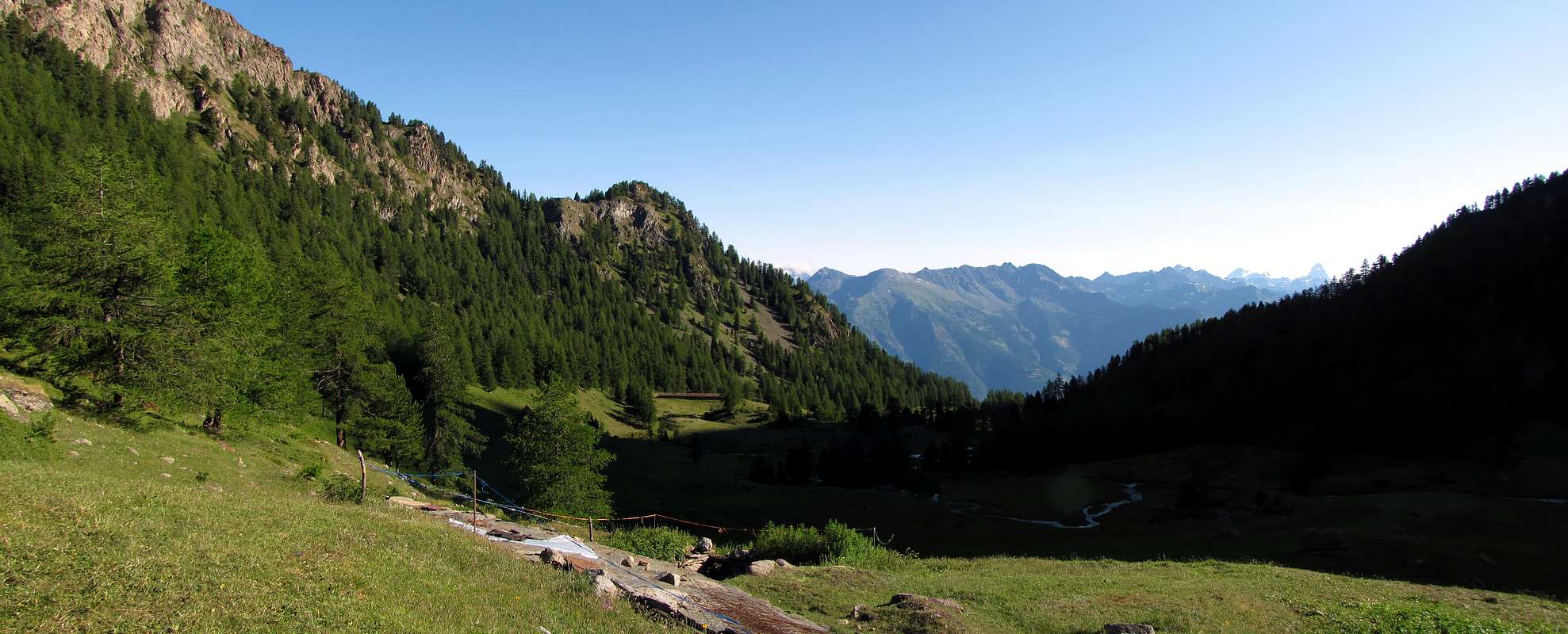
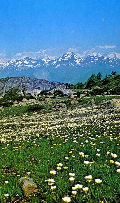
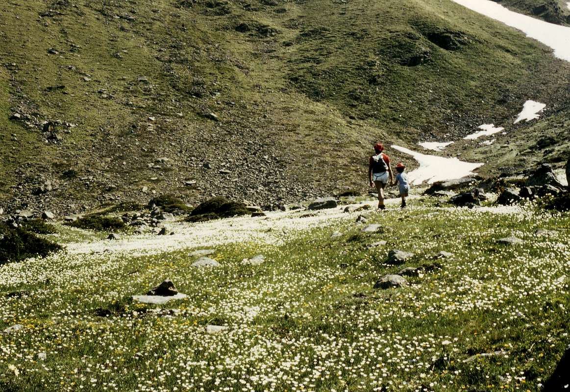
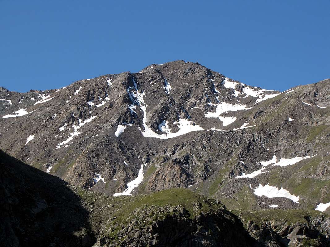
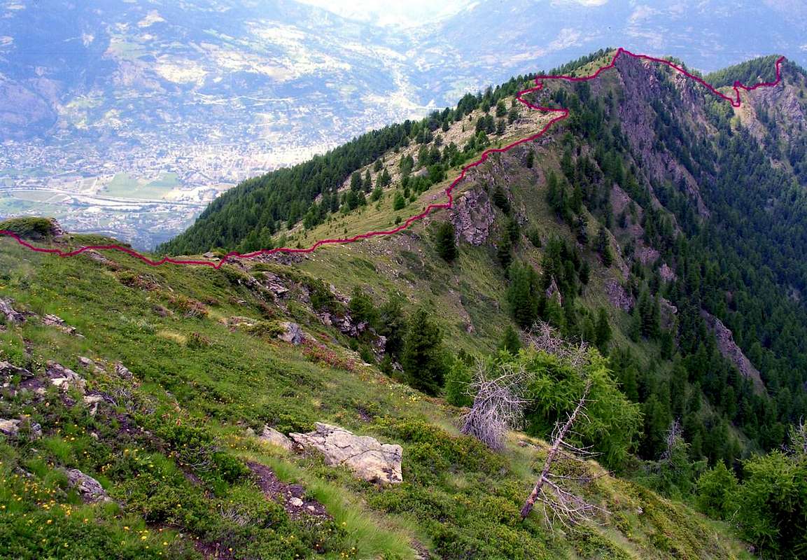
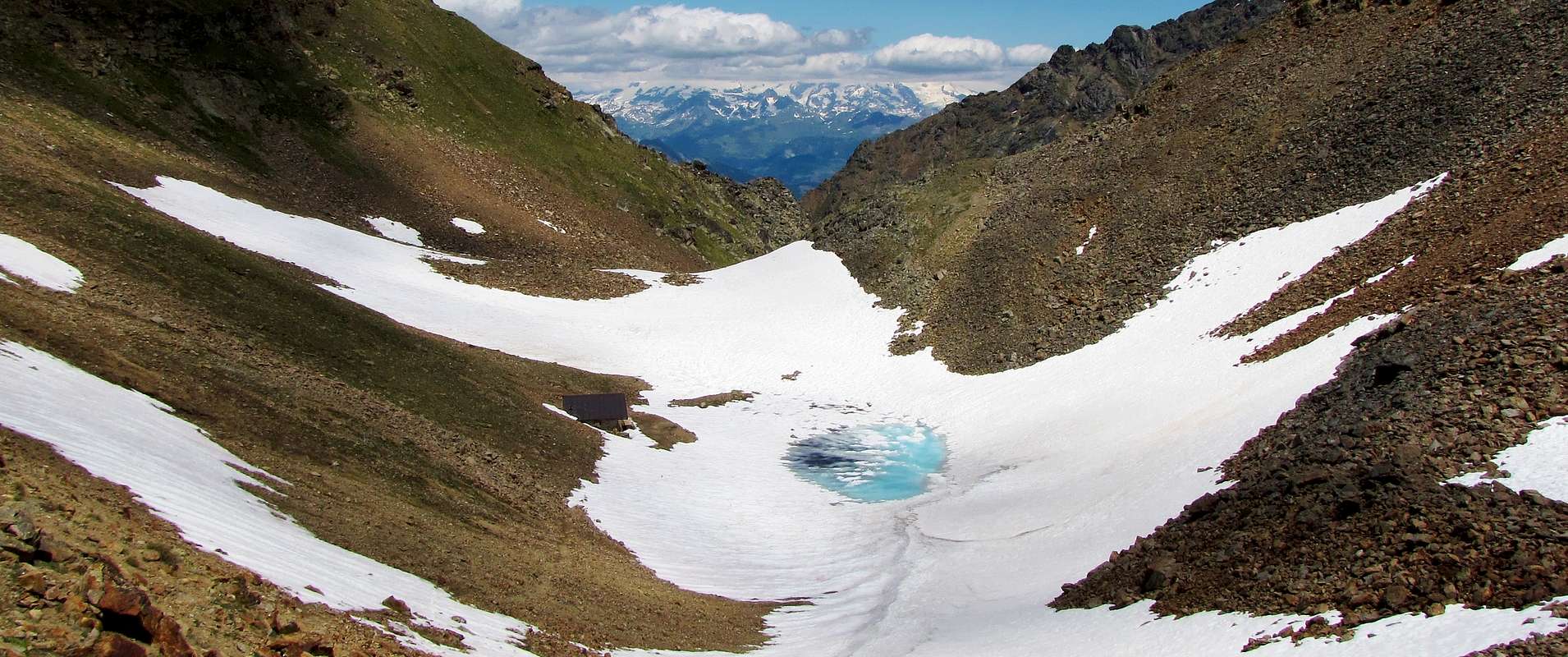
2) - the mid-central zone (here in the photo below) that reaches the Plan de Valé via a steep branch Eastward towards the Mount Emilius (3.559m).
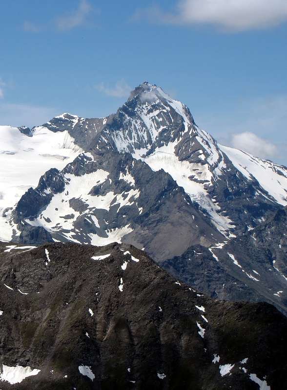
3) - the upper part towards the Becca di Nona (3.142m), and the Mont Ròss de Comboé (3.301m), highest elevation of this little area.
Comboé or Combuì? Tous les deux, cioé tutti e due. Comboé un pò più francesizzato, Combuì nel locale idioma. Come l'altro Combuì esistente all'ingresso del Vallone d'Arpisson, sovra il Comune di Pollein. Ma di Combe, Bellecombe, Comba e Combette é ricolma tutta la Valle di Aosta e significa vallone più o meno grande, più o meno bello, più o meno conosciuto. Per cui dire il Vallone di Comboé é sbagliato e consiste in inutile ripetizione, perché Comboé o Combuì già significa valloncello. In genere solitario ed appartato ed, a volte, ben nascosto. Un'esclusiva per i locali che lì trovano un posto per evadere mettendosi al riparo da sguardi indiscreti. Sotto alte ed aspre montagne. Questo vallone, che, scorrendo sinuoso dapprima verso Sud, poi ad Occidente sino a ripiegare formando un grande arco verso Nord, più in basso origina quello di Comboé e la Gorgia del Dard, tutti percorsi dalle stesse acque o Torrent de Comboé insino a raggiungere la Dora Baltea, a sua volta può essere identificato in tre ben distinte parti:
1) - l'area inferiore Dard's Gorge che flettendo verso Sud-sudovest progressivamente raggiunge il "Basso" Comboé, Combé e Grand Plan nonché verso la Gola d'Arbolle.
2) - la zona medio-centrale (qui nella foto sopra) raggiungente il Plan de Valé tramite una ripida diramazione verso Oriente in direzione del Monte Emilius (3.559 m).
3) - la parte superiore verso la Becca di Nona (3.142 m) ed il Mont Ròss de Comboé (3.301 m), massima elevazione di tutta questa piccola area.
 |
 |
Getting There
BY CAR:
- From TORINO, MILANO, etc: Motorway A5. Exit at IVREA or Quincinetto (PIEDMONT) From IVREA Town: in West towards Pont Saint Martin, Donnas, Bard, Champdepraz, Pontey, Fénis, Saint Marcel, Grand Brissogne, Pollein, Charvensod, Municipalities. From Courmayeur Resort: in East to Morgex, La Salle, Saint Pierre, Sarre, Aosta and Charvensod Municipalities.
- From Charvensod to Dard-Comboé-Arbolle Vallons towards Ponteilles (1.697m) Alp/Waterfall, through dirt road, Comboé Alp/Saint Ours Shelter (2.114m), through dirt road, and Arbolle Refuge (2.516m), near Lakes (2.497m), by Chair Lift to Chamolé Station (2.309m), Lake (2.325m) and muletrack.
- From FRANCE: through the Mont Blanc Tunnel to Entrèves-crossroads to Vény/Ferret Valleys - Courmayeur. By Little Saint Bernard Pass, closed since November until half May to La Thuile Valley - Pré Saint Didier - Courmayeur. It is not necessary to take Motorway A5: you can drive on SS.26, in the direction of AOSTA - IVREA - TURIN.
BY PLANE:
- Aeroporto "Corrado Gex" Saint Christophe (Aosta).
Various Approaches
2) - Pila, Parking lot near Pesein to about 1.865 meters with the path, triplexly numbered 14/19A, with slope to the overhanging and recently restructured Alp of Gorraz Désot (1.930m) and, with direction passing below the Chair lift Northeast for Chamolé Loch near the pylon n°10 of the same, through the Bois Jardin Public (Wood of the Public Garden) to reach at first the alternative 2.049 meters and immediately after the fork 2.099 meters, connecting again itself to the via of approach precedent (E/F; 1h'45).
3) - Parking lot near Pesein to about 1.865 meters with the path, triplexly numbered 14/19A, with slope to the impending and recently restructured Gorraz Désot Alp (Low; 1.930m) and, with direction passing below the Chair lift Northeast for the Chamolé Lakelé near the pylon n° 10, through the Bois Jardin Public, but not reaching the alternative 2.049 meters connecting again itself to the route of approach precedent; on the contrary as soon as before the same, decidedly changing direction in South, to take to climb through a small path not numbered, that goes up parallel to the precedent, wedging itself in a small valley-mountain range. To go up again completely at first her through the Bois Jardin Public, then on a slender trace more and more along the oriental edge of the Bois Chanté (Wood) reaching, in the final line in mean to a small stony ground, to the path/mule-track, always unnumbered, that it unites the Chamolé Lake with the Superior Station, as soon as over and to East of this last (E/F; 1h'45/2h'00).
4) - Through the preceding departures, always from Pila Resort, to reach in succession the two intersections 2.049 meters and 2.099 meters and the ruins of the ancient Alp, now demolished, of Chanté (2.114m). From this point to continue at first with a light descent and later, through light gone up again and leaving to the left (East) the continuation for the nearby Chamolé Pasture (2.152m), to continue into the wood in a narrow and small valley (splendid rich lawns of violets) with a small path unnumbered that to quota about 2.230 meters it draws near and, wanting, it connects him to that deriving (you see following approach) from the Chamolé Pastures. Through this with path n° 14/19°/102 folding up progressively from South toward East to reach the North shore of the Chamolé Lake, near an intake of the water followed by a small bridge in wood (about 2.327 meters; descriptive poster; stings important of arrival and departure for many paths). Wanting to continue toward the Superior Station of the Chair lift instead, to continue with the same one not numbered that, formed a large loop sinusoidal to the Southwest, it is connected, in an underlying vast basin an area of great clapeys (blocks and boulders) greyish, to the approach that climbs from the alternative 2.049 meters and with this to conclude (E/F; same time with the precedent).
 |
 |
 |
 |
 |
5) - Through the precedent itinerary actually to the entry of the small valley toward South, where he leaves on the right the same one, turning in the opposite sense instead (East-northeast) and with the path n° 14/16, with a trace to the limit among the grassland and the wood and with alternate small latch, the Alp of Chamolé is reached (2.152m). From the wide pasture, leaving the path to North that doubled the stall of the cows, the is addressed to Pass Plan Fenêtre, and departing instead the presses the fountain, they simultaneously climb two paths: the first dark one to West and numbered 14, from the near of to fit tub to the taking of the water, South-southwest is addressed to and, reached to altitude 2.189 meters the emissary of the Chamolé Lake, it fords it for then to be connected with itself to the two routes previously described. The second with n° 19 go up dark again to East in the wood, after having overcome a slope with small fall in sight, reaching the lake in the same point of the preceding itinerary, for then continuous to, same numeration, in direction of the Replan South (to be avoided because of too steep descent) and North Hill (2.366 m; E/F; same time).
6) - Pila - Saint Laurent locality (1.800m) or from parking (1.841m), just below the Hotel Lion Noir, with dirt road/path n° 14L to Saint Grat Hermitage (1.787m; fountain and pic-nic wooden area) and through the dirt road starting immediately before the Sanctuary to Upper omonym pasture (about 1.835 meters; fountain) towards Chamolè Alp (2.152m) and through the path n° 16/20A towards Plan Fenêtre Pass (2.221m), Low Comboè little Vallon (2.001m) joint to preceding route (EE/F; 1h'45/2h'00).
7) - From the Sanctuary and of Saint Grat Pasture through the dirt road to overcome the first winding road toward right and to reach a second of it. From this crossroads he abandons another dirt road that goes down to the Alpages of Combatissière (1.750m; in the grassland two very beautiful wooden rascards to visit him) to continue with other two windings and, after a brief rectilinear line, to reach an alternative. From this toward right it continues the road toward the Alp of Chamolé, while in opposite sense (East-northeast) it begins to said similar poderale of the Forest Rangers that reaches alternative the 1.983 meters. From this the aforesaid dirt road is undoubled sending to Southwest deviation that again connects him to that original of departure to altitude 1.953 meters and another ramification toward East-northeast, that flows, subsequently, in to small path addressed at first towards the Punta Valletta (2.164m) and then, with wide turn to South, it reaches Hill Plan Fenêtre. Don't use two anybody, on the contrary from the alternative 1.983 meters to take a path/mule-track unnumbered that, with narrow and rather steep hairpin bends, reaches to the intersection 2.140 meters the trail n° 20 coming from the Pastures of Chamolé and, through this, to reach the hill connecting again itself to the preceding (EE/F; 0h'15 in less, but certainly more tiring).
Da Pila tramite i Colli Plan Fenêtre o di Replan passando dall'Alpe di Chamolé o dal Lago oppure dal Santuario di San Grato
 |
 |
 |
 |
 |
^^^^^^
1) - Da Pila, presso il Ristorante Lion Noir (1.815 m circa), alpeggio soprastante di Pila (1.840 m), tramite il sentiero n° 16 e verso il bivio 2.099 metri, con il sentiero trasverso n° 14/19A/19, proveniente da Gorraz Dèsot; quindi con l'unico sentiero con diverse numerazioni 14/16/19/19A verso l'ex Alpeggio di Chanté (2.114 m; resti ormai completamente in rovina), Prateria ed Alpe di Chamolé (2.152 m; da non attraversare, ma con obbligatorietà di contornarla a Meridione) e con il successivo sentiero n° 16/20A in direzione dell'incrocio 2.190 metri circa (con il sentiero proveniente da San Grato), Colle Plan Fenêtre (2.229/34 m), discesa al Comboé (2.114 m; cappelletta), Comboé Dessous (2.041 m), bivio 1.975 metri circa (croce in legno; con il sentiero proveniente dal Vallone del Dard e relative Alpe e Cascata) verso il Comboé (E/F; 1h'30/1h'45).
2) - Da Pila, Parcheggio presso Pesein a 1.865 m circa con il sentiero, triplicemente numerato 14/19A, con salita alla soprastante e recentemente ristrutturata Alpe di Gorraz Désot (1.930 m) e, con direzione Nordest passando al di sotto della Seggiovia per il Lago di Chamolé presso il pilone n° 10 della medesima, attraverso il Bois Jardin Public (Bosco del Giardino Pubblico) raggiungere dapprima il bivio 2.049 metri e subito dopo quello 2099 metri, riallacciandosi alla via dell'approccio precedente (E/F; 1h'45).
3) - Da Pila, Parcheggio presso Pesein a 1.865 m circa con il sentiero, triplicemente numerato 14/19A, con salita alla soprastante e recentemente ristrutturata Alpe di Gorraz Désott (1.930 m) e, con direzione Norest passando al di sotto della Seggiovia per il Lago di Chamolé presso il pilone n° 10, attraverso il Bois Jardin Public, ma non raggiungendo il bivio 2.049 metri riallacciandosi alla via di approccio precedente; bensì appena prima dello stesso, cambiando decisamente direzione in Sud, prendere a salire tramite il sentierino non numerato, che sale parallelo al precedente, incuneandosi in un valloncello-giogaia. Risalire il medesimo completamente dapprima attraverso il Bois Jardin Public, poi su di una traccia sempre più esile lungo il bordo Orientale del Bois Chanté (Bosco di Chanté) pervenendo, nel tratto finale in mezzo ad una piccola pietraia, al sentiero/mulattiera, sempre senza numerazione, che unisce il Lago di Chamolé con la Stazione Superiore, appena oltre ed ad Oriente di quest'ultima (E/F; 1h'45/2h'00).
4) - Per mezzo delle partenze precedenti raggiungere in successione i due incroci 2.049 metri e 2.099 metri e le rovine dell'Alpeggio diroccato di Chanté (2.114 m); dalla quale continuare dapprima con una leggera discesa e dopo, per mezzo di leggera risalita e lasciando a sinistra (Est) la continuazione per l'Alpeggio di Chamolé (2.152 m), continuare nel bosco in uno stretto valloncello (splendidi prati ricchi di viole) con un sentierino non numerato che a quota 2.230 metri circa s'avvicina e, volendo, si collega a quello risalente dall'Alpe di Chamolé. Tramite questo con sentiero numerato 14/19/102 piegando progressivamente da Sud verso Est raggiungere la sponda Settentrionale del Lago di Chamolé, presso una presa dell'acqua attigua ad una passerella in legno (2.327 metri circa; cartelli segnaletici; punto d'arrivo e partenza per molti sentieri). Volendo invece continuare verso la Stazione Superiore della Seggiovia di Chamolé, continuare con il medesimo non numerato che, formata una grande sinusoide verso Sudovest, si ricollega, in una conca più vasta sottostante un'area di grandi "clapeys" grigiastri, all’avvicinamento che sale dal bivio 2.049 metri e con questo concludere (E/F; stesso tempo).
 |
 |
 |
 |
 |
5) - Tramite il precedente itinerario sino all'ingresso della piccola valle verso Sud, dove si lascia sulla destra la medesima, voltando invece nel senso opposto (Est-nordest) e con il sentiero n° 14/16, con una traccia al limite tra la prateria ed il bosco e con alterno piccolo saliscendi, si raggiunge l'Alpe di Chamolé (2.152 m). Dall'alpeggio, lasciando a Settentrione il sentiero che, doppiata la stalla delle mucche, si indirizza al Col Plan Fenêtre, e partendo invece presso il fontanile, salgono simultaneamente due sentieri, dei quali il primo più ad Ovest e numerato 14, dai pressi di una vasca atta alla presa dell'acqua, si indirizza a Sud-sudovest e, raggiunto a quota 2.189 metri l'emissario del Lago di Chamolé, lo guada per poi riallacciarsi alle due vie precedentemente descritte. Il secondo con n° 19 risale più ad Est nel bosco, dopo aver superato uno spalto con cascatella in vista, raggiungendo il lago nello stesso punto del precedente, per poi proseguire, stessa numerazione, in direzione del Col Replan Nord (2.366 m; E/F; stesso tempo).
6) - Da Pila - San Lorenzo (1.800 m) oppure dal parcheggio (1.841 m), Hotel Lion Noir, con la strada poderale concomitante al sentiero n° 14L, all'interno d'una fitta foresta, verso l'Eremo di San Grato (1.787 m fontana ed area pic nic in legno), posto in uno splendido promontorio erboso, ed attraverso la poderale sterrata con partenza appena prima del Santuario verso il soprastante omonimo alpeggio (1.835 metri circa; fontana) in direzione dell'Alpe di Chamolè Alp (2.152 m) e per mezzo del sentiero n° 16/20A verso il Col Plan Fenêtre (2.221/34 m) e, lasciando sotto il "Basso" Comboè (2.001 m), Comboé (2.112 m) riunificandosi al precedente itinerario (EE/F; 1h'45/2h'00).
7) - Dall'Alpe di San Grato tramite la poderale superare il primo tornante verso destra e raggiungerne un secondo; da questo incrocio di strade, se ne abbandona un'altra che scende alle Alpi di Combatissière (1.750 m; nella prateria due bellissimi ed antichi "rascards" in legno da visitarsi) per continuare con altri due tornanti e, dopo un breve tratto rettilineo, raggiungere un primo bivio. Da questo verso destra continua la strada verso l'Alpe di Chamolé. Mentre in senso opposto (Est-nordest) ne inizia una similare detta del Corpo Forestale che raggiunge il bivio 1.983 metri. Da questo ultimo la suddetta poderale si sdoppia inviando una deviazione a Sudovest che si collega nuovamente a quella originale di partenza a quota 1.953 metri ed un'altra diramazione verso Est-nordest, che sfocia, successivamente, in un sentierucolo, indirizzato dapprima verso la Punta Valletta (2.164 m) e poi, con largo giro a Sud, raggiungente il Col Plan Fenêtre. Non utilizzare nessuna delle due, bensì dal bivio 1.983 metri prendere un sentiero-mulattiera non numerato che, con tortuosi ed alquanto ripidi tornanti, raggiunge all'incrocio 2.140 metri il sentiero n° 20 proveniente dall'Alpe di Chamolé e, tramite questo e non molto distante dalla piccola spianata formante il colle, raggiungere il Col Plan Fenêtre riallacciandosi alla precedente via (EE/F; un quarto d'ora in meno, ma certamente più faticoso).
![]()
Seven trips to suit all tastes ...
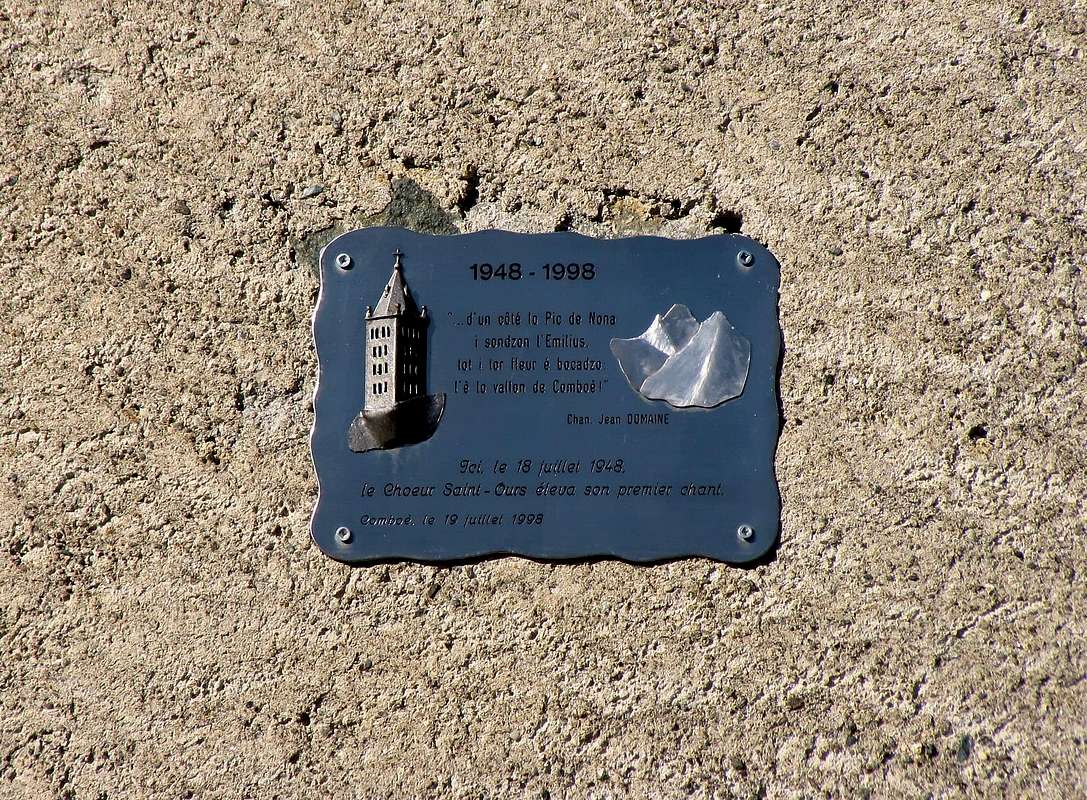
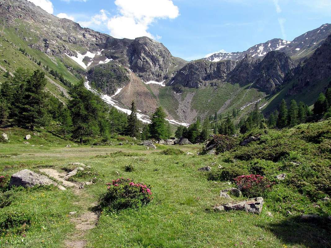
Starting from the Northwest, at the entrance of the Vallon, and continuing counterclockwise. Starting from Comboé not expect you to find great climbing, but lovely walks and excursions yes. Although, to be fair, the Comboé in the past is resulted as crucial passage for climbs very challenging routes like the West Ridge-northwest of Emilius, before it became "Via Ferrata", the North Wall of the same, and yet, at the beginning the Sixties, the conquest of the fearsome Black Triangle. Or, starting from "Low Comboé" and towards the Morion promontory the North Face on the "Becca". But they are climbings concerning a more or less distant time, although later were opened on the same repetitions, new routes and important winter ascents. Or exploration of what little that the territory could still offer. Nothing particularly interesting, but can still propose some regurgitation in search of adventure. But this is not the primary objective, starting today from Comboé, but is to advise a small number of trips made to suit all tastes, always in relation to their skills, capacity and degree of training. Then a proposal aimed at everyone from big to little ones, and on the footsteps of those who, like the Canon Georges Carrel or the Abbot Joseph Henry, loved and explored these rough and ancient mountains; or as simple shepherds who lived together with their livestock seeking a source of sussistanza in this valley. Not least those who have tried in this place, so close to town and yet secluded, peace for reflection or the rest of the summer holidays. Moreover the "Choir of St. Orso", this here since 1948 and always nice to meet after a long and tiring ascent. Among these seven indicated proposals, choose the one that suits you the most; except that you can still make choices completely different ...
^^^^^^
The Vallons most important & the recommended Excursions
1) - Short and easy Walk on Pointe de Ponteilles (2.263m): walk from Comboé (2.112m) with path n° 16/20 in Northwst before towards Col Plan Fenêtre (2.229m), after in North over a rocky-grassy promontory with Cross through a small deviation not reported and unnumbered to the Pointe de Ponteilles just above the homonym waterfall (1.697m) (T/E/F; 0h'30/0h'40). This walk is suitable for children ((beware of exposed stretches East) and can see from high the great landslide of the flood of 2000.
2) - Scenic crossing from Plan Fenêtre Hill towards Signal Sismonda, two Replan Passes, Punta di Replan and Chamolé Lake (2.219m, 2.356m, 2.366, 2.357m, 2.347m, 2.325m): mid long excursion from Comboé with various paths n° 16/20/20A/19 before in Northwest, after in South-southwest along the watershed between Comboé and Pila Basin (EE/F; 2h'00/2h'30). Excursion-traverse suitable for children ((beware of exposed stretches East) and can see from the West the entire Emilius Group.
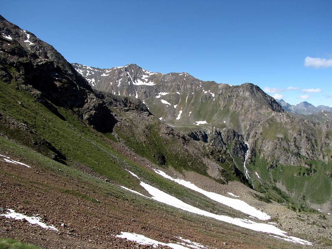
3) - Adventurous trip by Comboé towards Arbolle climbing into a Gorge: (2.219m, 2.500m) through path not numbered, after in South through path n° 16 reaching the ancient Grand Plan Alp in ruins (2.158m) and after by small path into moraines towards the narrow Arbolle Gorge up to the Arbolle Refuge (2.516m) (EE/F+; 1h'30/2h'00). This hike along the old path for transferring steers at upper valley; it is easy but exposed to falling rocks while in winter is very delicate for the oftentime verglass phenomena.
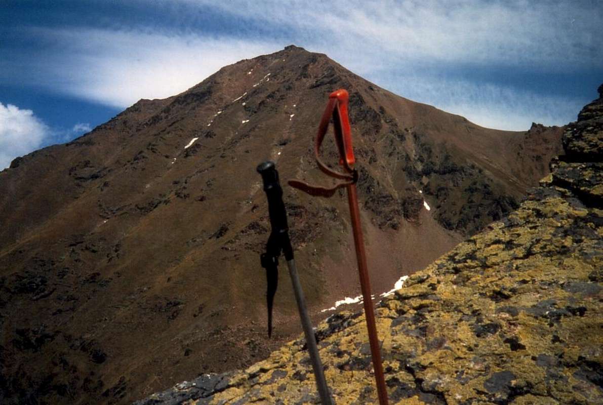
4) - Mixed climbing on Punte del Lago Gelato (3.115m) by West-northwest Eperon: after a partial approach through path n° 16 and crossing South the wide and reddish moraines, enough easy climbing through West-northwest Eperon above Plan Valé (A/PD-/PD+; 4h'30/5h'00). This climb has a fascinating significance until the month of June, when the snow covers the sides of the éperon then lost value in midsummer. If traveled on the edge of the ridge also presents passages of III/III°+, otherwise it requires the delicate circumvented on snowy slopes up to 50°/60°. Better to make the descent via the South Ridge to the Col de Comboé (3.014m) and then back, through a steep reddish-brownish moraines, to the West towards the path diagonally n° 16 from Grand Plan Alpage (2.158m) at the end of vallon. From this (yellow signals) return to Comboé Pastures.
|
|
 |
 |
 |
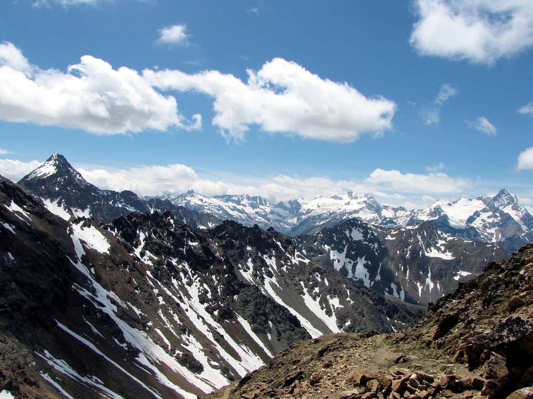 |
5) - Inhabituel traverse from Plan Valé, Gros Scez fork on Col Ròss towards Boulders and Gelato Lakes (2.379m, 2.526m, 3.091m, 2.943, 2.957m): excursion-climbing from Comboé with path n° 16 before in East up to the alternative near the squared boulder called Gros Scez, after through progressively steep moraines pathless up to Col Ròss and following descent towards the wo lakes, now in Arbolle Vallon (E/F; 4h'00/4h'30). This crossing is quite unusual and was done very rarely in the end of the '800 to return from Emilius at Comboé avoiding the wide circle of Arbolle. The offer in the opposite direction, however, noting that it should be carried out before the avalanche descends from the Col Ròss (second half of June) and in any case even better in the presence of hard snow. Otherwise it is boring and too exposed to falling rocks from the overhanging Western Face of Mont Ròss de Comboé. Ascent is not difficult and suitable for good mountains inhabitants, connoisseurs of the snows state. Better if equipped with crampons. Descent on the other side is elementary and you may want to return using the same route. Otherwise go around the Vallon Arbolle and down through the Gorge.
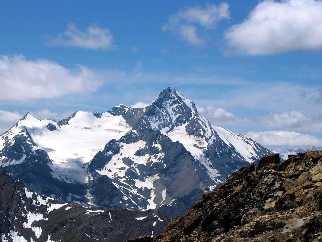
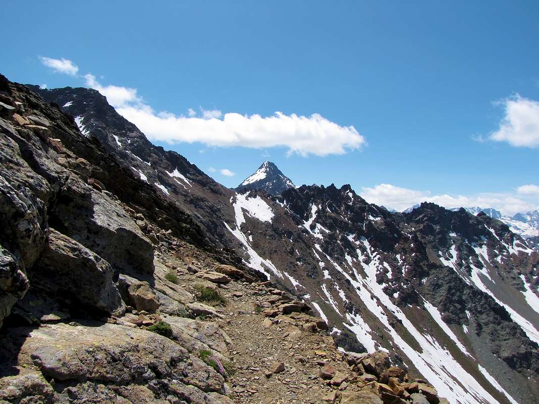
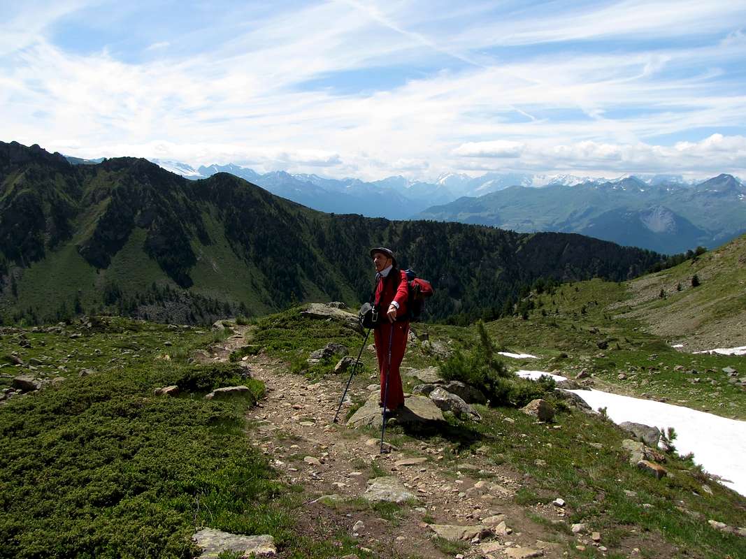
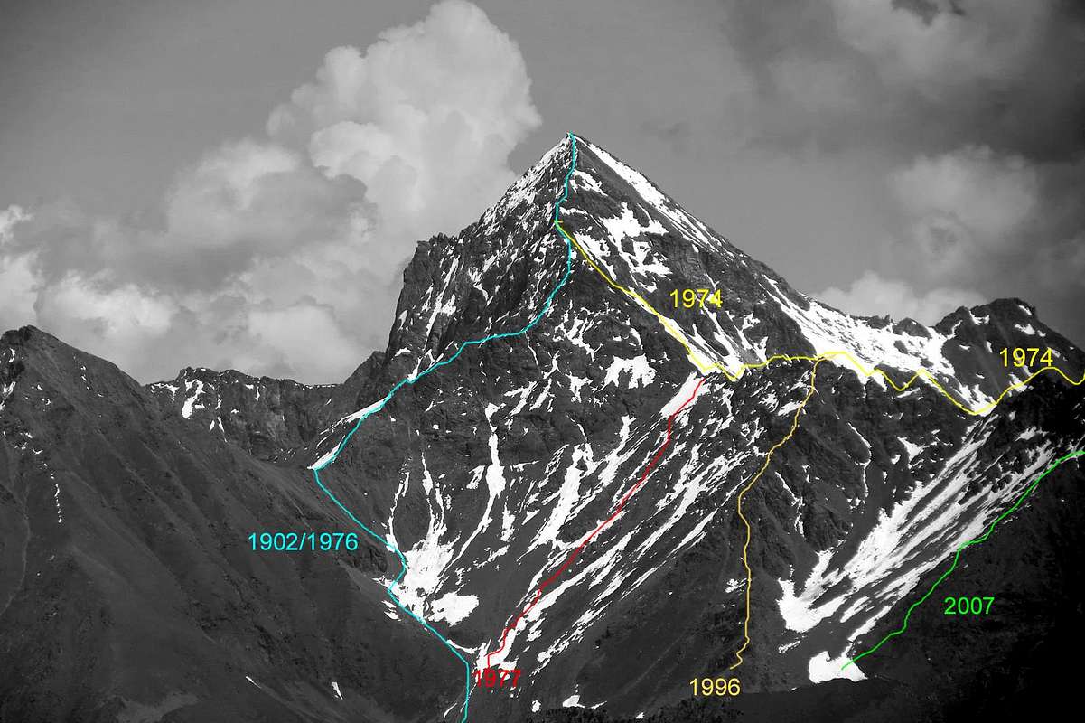
6) - Classic excursion towards Carrel Hill, Federigo Zullo Bivouac and "Via Ferrata" to Monte Emilius (2.912m, 2.907m, 3.559m): excursion-climbing from hill on Northwest Ridge of Mont Ròss de Comboé (3.301m) with subsequent traverse towards the Little Emilius and Mount Emilius through the Western Ridge (3.342m, 3.559m) (A/PD-/PD+; 6h'30/7h'00). This crossing takes place at high altitudes and requires equipment and physical preparation, although since 2004 the via was completely (even overly) furnished. It replaces the old route that, without these measures, very little was covered and it was exclusively reserved for Experts. Lately there have been several detachments of rock, for which reason it is best to take a priori informations. Anyway fascinating climb with breathtaking views above the underlying and impressive North Wall.
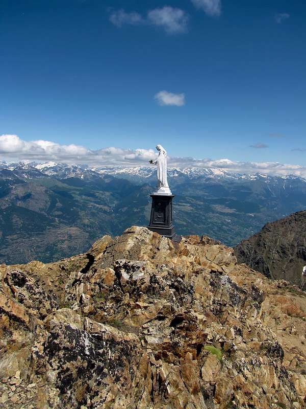
7) - Traditional excursion on Becca di Nona from Plan Valé (2.340, 3.142m): excursion from Comboé with trail n° 16 before in East, after in Northeast with path n° 16A to Southern Slope of Carrel Hill and small not numberded path-track on South-southeast Crest in terminal part (E/F; 3h'00/3h'30). This route, which also serves as approaching the "Via Ferrata", can be replaced by one further West via the mule track n° 16 from the junction nearby Gros Scez climbs the Slope South-southwest. An old path built specifically for the installation of large (5 metres) bronze statue of the Madonna, which took place on Sept. 12th, 1892. More fun with this last rise and downhill with other.
Iniziando da Nordovest, all'ingresso del Vallone, e continuando in senso antiorario. Partendo dal Comboé non aspettatvi di trovare grandi arrampicate, ma belle passeggiate ed escursioni sì. Anche se, ad onor del vero, il Comboé nel passato é risultato come punto cruciale di passaggio per ascensioni molto impegnative come la Cresta Ovest-nordovest dello Emilius, prima che diventasse "Via Ferrata", la Parete Nord del medesimo ed ancora, agli inizi degli Anni Sessanta, la conquista del temibile Triangolo Nero. Oppure, partendo dal "Basso Comboé" e verso il Morion della Parete Nord della "Becca". Ma sono scalate concernenti un tempo più o meno lontano, anche se successivamente sono state aperte sulle stesse delle ripetizioni, nuove vie nonché importanti ascensioni invernali. Oppure la ricerca esplorativa di quel poco che il territorio poteva ancor offrire. Niente di particolarmente interessante, ma in grado di offrire ancora qualche rigurgito nella ricerca di avventura. Non é questo però l'obiettivo primario partendo oggigiorno dal Comboé, bensì consiste nel consigliare una piccola serie di gite rivolte a tutti i gusti, sempre in rapporto alle proprie abilità, capacità ed al grado di allenamento. Una proposta quindi rivolta a tutti, dai grandi ai piccini e sulle orme di quelli che hanno, come il Canonico Georges Carrel o l'Abbé Joseph Henry, amato ed esplorato queste ruvide ed antiche montagne; oppure come i semplici pastori che hanno convissuto insieme alle loro mandrie ricercando una fonte di sussistanza in questo vallone. Non ultimi quelli che hanno cercato in questo luogo, così vicino alla città ed allo stesso tempo appartato, la pace per la riflessione od il riposo delle vacanze estive. Ed inoltre il "Coro di Sant'Orso", qui presente dal 1948 e sempre piacevole da incontrare dopo una lunga e faticosa ascensione. Tra queste sette proposte, scegliete quella che a voi più aggrada; fermo restando che potete pur sempre effettuare scelte completamente diverse ...
^^^^^^
I Valloni più importanti e le Escursioni consigliate
1) - Breve e facile passeggiata sulla Pointe de Ponteilles (2.263 m): camminata da Comboé (2.112 m) con il sentiero n° 16/20 a Nordovest prima verso Col Plan Fenêtre (2.229 m), poi a Nord su un promontorio roccioso-erboso con Croce attraverso una piccola deviazione non segnalata e non numerata alla Pointe de Ponteilles appena sopra l'omonima cascata (1.697 m) (T/E/F; 0h'30/0h'40). Questa passeggiata è adatta ai bambini (attenzione ai tratti esposti Est) e può vedere dall'alto la grande frana dell'alluvione del 2000.
2) - Traversata panoramica dal Colle Plan Fenêtre verso Signal Sismonda, due Passi Replan, Punta di Replan e Lago Chamolé (2.219m, 2.356m, 2.366, 2.357m, 2.347m, 2.325m): escursione di media lunghezza da Comboé con vari sentieri n° 16/20 /20A/19 prima a Nordovest, poi a Sud-sudovest lungo lo spartiacque tra Comboé e Bacino di Pila (EE/F; 2h'00/2h'30). Escursione-traversata adatta ai bambini ((attenzione ai tratti esposti Est) e può vedere da Ovest l'intero Gruppo Emilius.
3) - Escursione avventurosa in Comboé verso Arbolle salendo in una Gola: (2.219 m, 2.500 m) per sentiero non numerato, poi a Sud attraverso il sentiero n° 16 raggiungendo l'antica Malga Grand Plan in rovina (2.158 m) e poi per piccolo sentiero nelle morene verso la stretta Gola delle Arbolle fino al Rifugio Arbolle (2.516 m) (EE/F+; 1h'30/2h'00). Questa escursione lungo il vecchio sentiero per il trasferimento dei manzi in alta valle; è facile ma esposto alla caduta di massi mentre in inverno è molto delicato per i frequenti fenomeni di verglas.
4) - Arrampicata mista su Punte del Lago Gelato (3.115 m) di Eperon Ovest-nordovest: dopo un avvicinamento parziale attraverso il sentiero n° 16 e attraversando a sud le morene larghe e rossastre, abbastanza facile arrampicata attraverso Eperon Ovest-nordovest sopra Plan ValéA /PD-/PD+; 4h'30/5h'00). Questa salita ha un significato affascinante fino al mese di giugno, quando la neve ricopre i fianchi dell'éperon per poi perdere di valore in piena estate. Se percorsa sul filo di cresta presenta anche passaggi di III/III°+, altrimenti richiede il delicato aggiramento su pendii innevati fino a 50°/60°. Meglio effettuare la discesa per la Cresta Sud fino al Col de Comboé (3.014 m) e poi di nuovo, attraverso una ripida morena rossastra-bruna, ad Ovest verso il sentiero in diagonale n° 16 dall'Alpe del Grand Plan (2.158 m) al termine del vallone. Da questo (segnaletica gialla) si ritorna ai Pascoli del Comboé.
 |
 |
 |
 |
 |
5) - Traversata abitata da Plan Valé, bivio Gros Scez sul Col Ròss verso Boulders e Gelato Lakes (2.379m, 2.526m, 3.091m, 2.943, 2.957m): escursione-arrampicata da Comboé con sentiero n° 16 prima ad Est fino al bivio nei pressi il masso squadrato denominato Gros Scez, poi per morene progressivamente ripide e sterrate fino al Col Ròss e in seguito discesa verso i due laghi, ora in località Arbolle Vallon (E/F; 4h'00/4h'30). Questa traversata è abbastanza insolita e si faceva molto raramente alla fine dell'800 per tornare da Emilius a Comboé evitando l'ampia cerchia di Arbolle. L'offerta in senso opposto, però, rilevando che va effettuata prima che la valanga scenda dal Col Ròss (seconda metà di giugno) e comunque ancora meglio in presenza di neve dura. Diversamente è noioso e troppo esposto alla caduta massi dalla strapiombante parete Ovest del Mont Ròss de Comboé. La salita non è difficile e adatta a buoni abitanti della montagna, intenditori dello stato delle nevi. Meglio se muniti di ramponi. La discesa sull'altro versante è elementare e si consiglia di tornare utilizzando lo stesso percorso. Altrimenti aggirare il Vallon Arbolle e scendere attraverso la Gola.
6) - Escursione classica verso Colle Carrel, Bivacco Federigo Zullo e "Via Ferrata" al Monte Emilius (2.912 m, 2.907 m, 3.559 m): escursione-arrampicata dal colle sulla Cresta Nord Ovest del Mont Ròss de Comboé (3.301 m) con successivo traverso verso il Piccolo Emilius e il Monte Emilius per la Cresta Occidentale (3.342m, 3.559m) (A/PD-/PD+; 6h'30/7h'00). Tale traversata avviene in quota e richiede attrezzatura e preparazione fisica, sebbene dal 2004 la via sia stata completamente (anche eccessivamente) arredata. Sostituisce la vecchia via che, senza questi accorgimenti, era percorsa pochissimo ed era riservata esclusivamente agli Esperti. Ultimamente si sono verificati diversi distacchi di roccia, per cui è bene informarsi a priori. Comunque salita affascinante con panorami mozzafiato sopra la sottostante e imponente Parete Nord.
7) - Escursione tradizionale sulla Becca di Nona da Plan Valé (2.340 m, 3.142 m): escursione da Comboé con sentiero n° 16 prima ad Est, dopo a Nordest con sentiero n° 16A al Versante Sud del Colle Carrel e piccolo sentiero non numerato traccia su Cresta Sud-Sudest nella parte terminale (E/F; 3h'00/3h'30). Questo itinerario, che funge anche da avvicinamento alla "Via Ferrata", può essere sostituito da un ulteriore Ovest tramite la mulattiera n° 16 che dal bivio vicino al Gros Scez sale il Versante Sud-sudovest. Un vecchio sentiero costruito appositamente per l'installazione della grande statua bronzea (5 metri) della Madonna, avvenuta il 12 settembre 1892. Più divertimento con quest'ultima salita e discesa con altre.
- Meteo: you can find all the needed informations at the official site of the Valle d'Aosta Region:
- Valle d'Aosta Meteo
Webcam
- WEBCAM on Aosta Valley:
- Webcam
Books and Maps
BOOKS:
- "Guida del Monte Emilius", di Osvaldo Cardellina Editore in collaborazione con il Club Alpino Italiano Sezione di Aosta, Dicembre 1978.
- "Guida dei Monti d'Italia – Emilius Rosa dei Banchi Parco del Mont Avic" di Giulio Berutto e Lino Fornelli - Club Alpino Italiano/Touring Club Italiano, Marzo 2005.
- "Guida delle Alpi Occidentali" di Giovanni Bobba e Luigi Vaccarone C.A.I. Sezione di Torino Volume II (parte II), 25 Maggio 1896.
- "80 itinerari di Escursionismo Alpinismo e Sci Alpinismo in Valle d'Aosta", di Osvaldo Cardellina, Ed. Musumeci, Giugno 1977 (in Italian); seconda Ed. Luglio 1981; terza Ed. Luglio 1984; (in French), prima Ed. Febbraio 1978; seconda Ed. Marzo 1980.
 |
 |
 |
MAPS:
- Kompass "Gran Paradiso Valle d'Aosta Sentieri e Rifugi" Carta turistica 1:50.000.
- L'Escursionista "Conca di Aosta-Pila-Monte Emilius" Carta dei sentieri (n° 4) 1:25.000.
- Hapax "Les Sentiers Comunità Montana Monte Emilius", Luglio 2000 1:25.000.
- Enrico Editore Ivrea-Aosta "Gruppo del Gran Paradiso" 1:50.000.
- I.G.C. Istituto Geografico Centrale, Torino "Carta delle Passeggiate ed Escursioni in V.D.A. Conca di Pila-Gressan, 1:20.000.
 |
External Links
- More about Emilius Another description with 40 shots, 6 panoramas and a "handmade" map, about Emilius.
- Pila web-site Pila, the famous winter station, has an active life even in summertime. In this link, you'll able to find time schedule for Chamolè Chair Lift.
- REGIONE AUTONOMA VALLE D'AOSTA the official site.
- FONDAZIONE MONTAGNA SICURA Villa Cameron, località Villard de la Palud n° 1 Courmayeur (AO) Tel: 39 0165 897602 - Fax: 39 0165 897647.
- A.I.NE.VA. (Associazione Interregionale Neve e Valanghe).
Useful numbers
- Protezione Civile Valdostana località Aeroporto n° 7/A Saint Christophe (Ao) Tel. 0165-238222.
- Bollettino Valanghe Tel. 0165-776300.
- Bollettino Meteo Tel. 0165-44113.
- Unità Operativa di Soccorso Sanitario Tel. 118.