La montagna chiama i suoi figli, ed essi rispondono fedelmente al suo appello…
Osvaldo Cardellina, Diario alpinistico, 1964-65
Page texts: @ OsvaldoCardellina"Osva", passed away on May 2, 2022. Page owners: Christian Cardellina e Osvaldo Cardellina. Any updates from September 12, 2022: Antonio Giani, page administrator, friend and climbing companion.
Testi della pagina: @ OsvaldoCardellina "Osva", scomparso il 2 maggio 2022. Proprietari pagina:Christian Cardellina e Osvaldo Cardellina. Eventuali aggiornamenti dal 12 settembre 2022: Antonio Giani, amministratore della pagina, amico e compagno di salite.
Overview
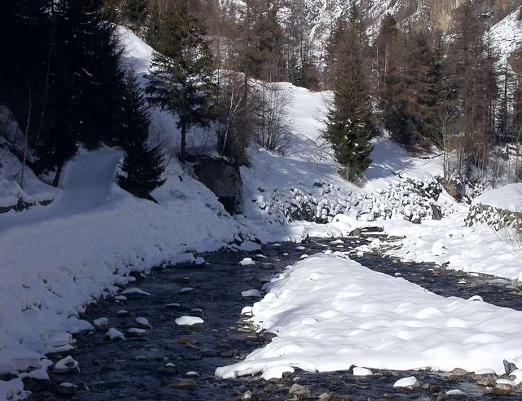
Vallon of the Traso, of the Trayo or Pointe of the Trajo to the locals simply Tradzo all four names granted. Or, and better, anybody, because the real local toponym "sounds" like "Loz Traxioz" and more specifically "loz traxioz bestiarum" otherwise "the track carried by livestock" in the ascent to the pastures above on the right (West) to those of the adjacent Upper and Lower Pousset (East) under the homonymous rocky point. Just from this last, pointed terminal spur that comes from the Punta Rossa of Grivola (3.630m), acts as a divider between two Vallons of Pousset Traso or, by inhabitants "Tradzo", below which are reunited. Just above the Village of Epinel (1.436m) and before the Cogne Valley reaches to Crétaz Hamlet (1.494m) and finally off to the Northeastern Resort of Cogne (1.534m) at the Northeast feet of Gran Paradiso.
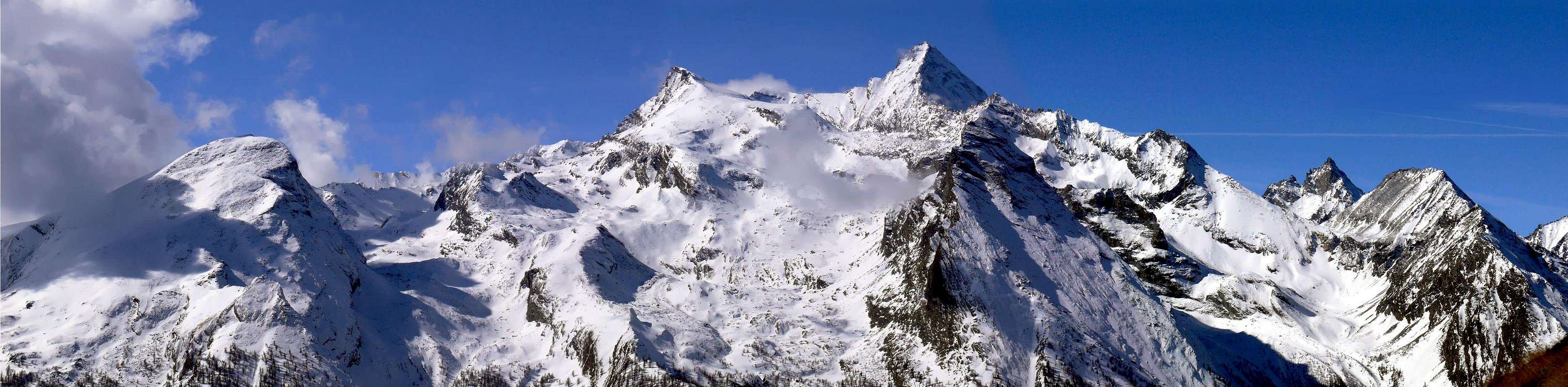
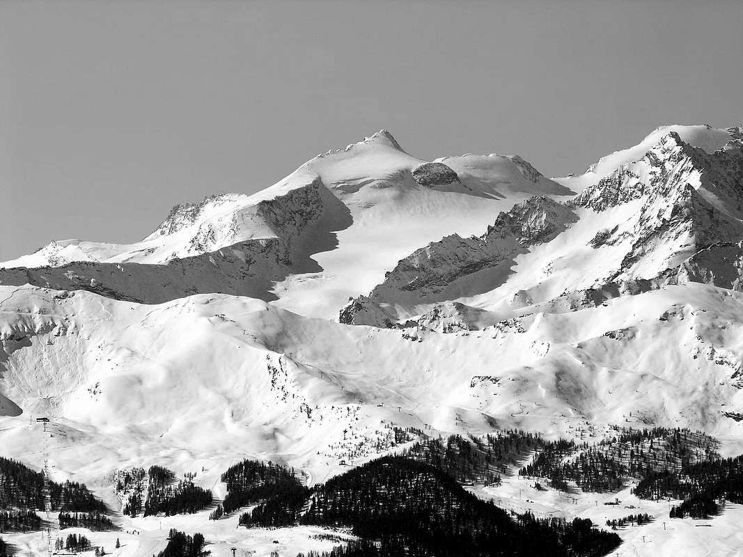
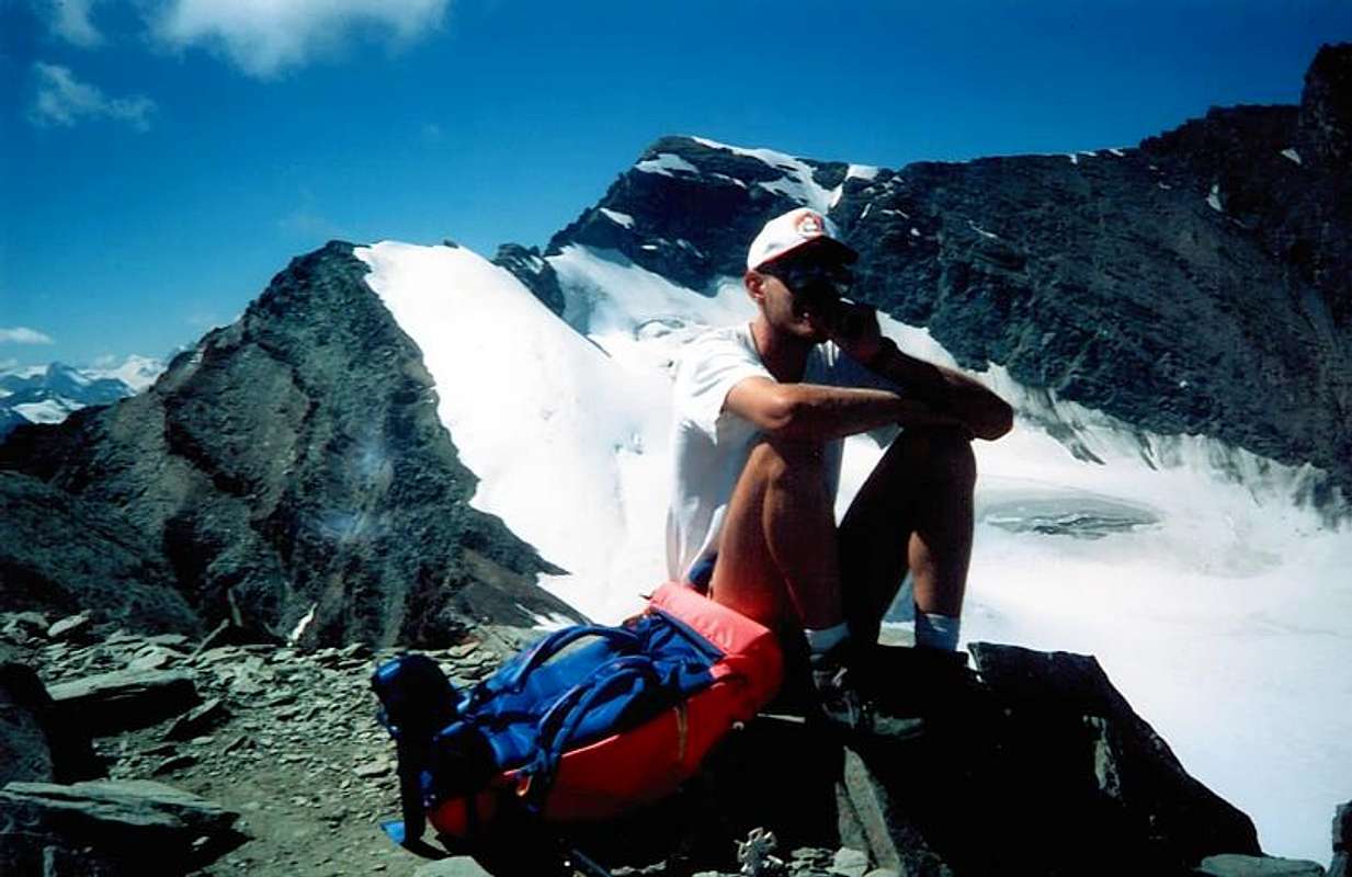
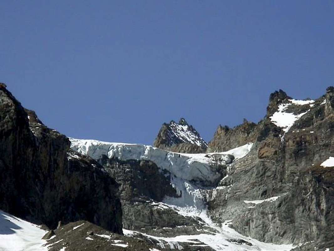
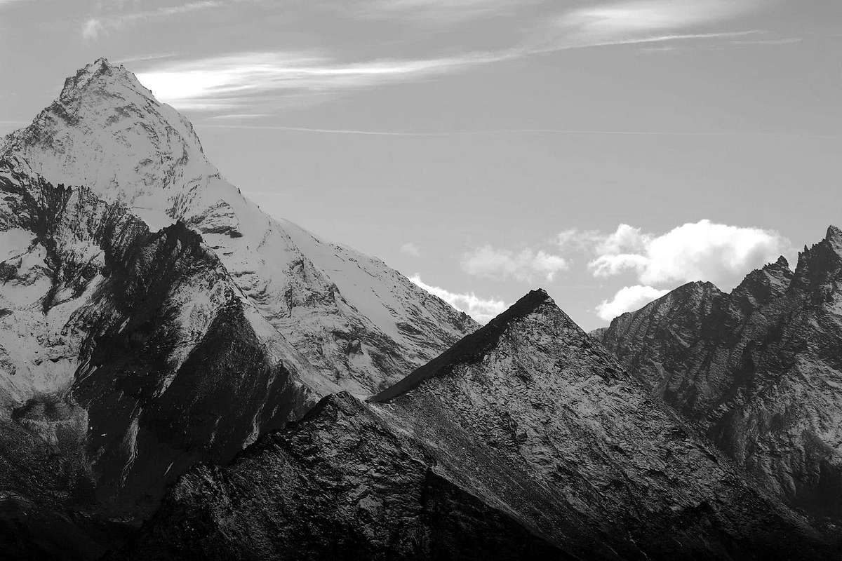
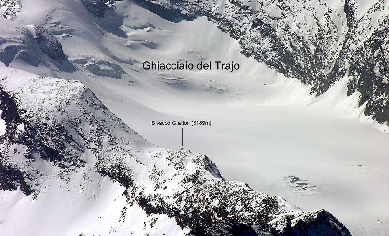
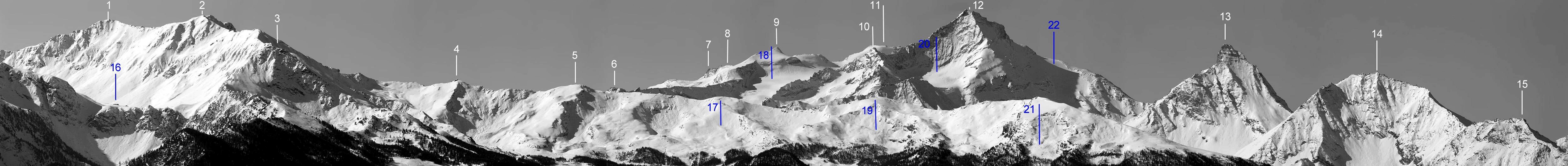
From the latter (4.061m), the highest Summit of the entire Graian Alps (Mont Blanc Chain not included), branches off towards the North along the watershed, dividing this valley from the adjoining of Valsavarenche, which reaches the famous Grivola (3.969m). From this comes down to the North-northeast a bumpy ridge, after forming the Grivoletta (3.514m) and Punta Crevasse (3.303m), he reaches Colle and Punta del Traso between the Vallons of Nomenon (to the West) and Pousset (in East) before going to "die" above the fresh Torrent Grand'Eyvia, or the Great Water. The Punta del Traso so dominates the underlying Villages of Vieyes, Epinel, Crétaz, while the Hill of the Traso (2.877m) sends his impetuous Western winds towards Cogne and then disappear into the Urtier opposite Vallon and to the following Valley of Champorcher, while from the valley floor extends up to the Grivola above its high and namesake glacier. A circular mountain district, content between the adjacent valleys of Pousset (to the East) and Nomenon (to the West), which gradually assume greater height until reaching almost the 4.000 meters of the Grivola. That once rejoined them, before the collapse of its summit turret about forty meters high, while the prosecution Summit today still small rocky landslides, clearly visible above the great Wall Northwest. At its Southern end on a large flat plateau-shaped valley where the "lies" the top of the Glacier du Trayo, between the Damiano Gratton Bivouac to the East and in West to Bivouac Mario Balzola (3.452m) on the famous East-northeast Grivola's Ridge, famous as the "Clochettes Crest", just before the Grivoletta (3.512/3m). One important and semicircular watershed that divides the Traso from Vallone Lauson or Loson in the South, where it is placed the Rifugio Vittorio Sella, by the Valsavarenche in the West. Interesting peaks rise from the Punta della Rossa Grivola (3.630m) to the Nera (Black) (3.683m) and the Bianca (White) (3.787m), where the dividing crest, flexing significantly to the North, forms the Pointe Tuckett (3.806m), already positioned on the vertiginous Ridge South of Grivola. Into the middle-lower part of which we have already pointed out prior, one must observe how the valley splits reaching Colle del Traso (2.873m) located between this and the opposite Vallon of Nomenon over the Fractions of Sylvenoire and Vieyes. This hill, easy to get but with route very long on both sides, is placed between the Pointe Crevasse (3.302m) to the South and Punta del Traso (3.124m) to the North, where the dividing ridge flexes more in the Northeast. While the first section is easy to cross the top but almost totally impractical in that low the latter is passable without problems. In fact, abandoning the upper left (South-southwest) the small valley that contains the Glacier du Mont Grivoletta placed to Eastern foot of the latter and the Pointe Crevasse, a quiet path, starting from the bridge just below Epinel (1.400m) and passing through Trayo Alp ( 2.035m), leads to the hill. But for this and we will speak in greater detail just ahead.
Vallone del Traso, del Trayo o del Trajo e per gli abitanti del posto anche semplicemente Tradzo con concessione di tutti e quattro i toponimi. Anzi di nessuno,perché il vero e locale "suona" come "Loz Traxioz" ed ancora più specificamente "loz traxioz bestiarum" ovvero "il tracciato effettuato dal bestiame" nella salita ai pascoli superiori a destra (Occidente) di quelli dell'adiacente Pousset al di sotto dell'omonima punta rocciosa. Proprio quest'ultima, aguzzo sperone terminale proveniente dalla Punta Rossa della Grivola (3.630 m), funge da divisorio tra i due Valloni del Pousset e del Traso, al di sotto della quale si ricongiungono. Appena al di sopra del Villaggio di Epinel (1.436 m) e prima che la Valle di Cogne raggiunga quello di Crétaz (1.494 m) ed infine il largo Comprensorio di Cogne (1.534 m) alle pendici Nordorientali del Gran Paradiso. Da quest'ultimo (4.061 m), Sommità più elevata dell'intere Alpi Graie (Catena del Monte Bianco esclusa), si diparte verso Settentrione il lungo spartiacque, divisorio questa valle da quella attigua di Valsavarenche, che raggiunge la famosa Grivola (3.969 m). Da questa discende verso Nord-nordest una cresta accidentata ("l'Arete des Clochettes") la quale, dopo aver formato la "figlioletta" Grivoletta e la semisconosciuta poco attraente Punta Crevasse, raggiunge Colle e Punta del Traso tra i Valloni di Nomenon (ad Ovest) e del Pousset prima d'andare a "morire" sopral Torrente Grand'Eyvia, cioé la Grande Acqua. La Punta del Traso quindi domina i sottostanti Villaggi di Vieyes, Epinel e Crétaz, mentre il colle soffia i suoi impetuosi venti Occidentali a Cogne' poi disperdentisi sopra l'opposto dell'Urtier e verso la Valle di Champorcher, mentre dal fondovalle il Traso si distende fino a raggiungere la Grivola sopra il suo alto ed omonimo ghiacciaio. Un circondario di montagne circolare, contenuto tra gli adiacenti valloni del Pousset (ad Est) e del Nomenon (ad Ovest), che assumono gradualmente maggiore altezza fino a raggiungere i quasi 4.000 metri della Grivola. Che una volta li raggiungeva, prima del crollo della sua torre sommitale alta una quarantina di metri, mentre il Vertice accusa ancora oggigiorno piccole frane rocciose, ben visibili, sopra la grande Parete Nordovest. Al suo termine il vallone forma un grande plateau pianeggiante sul quale di "adagia" la parte superiore del Glacier du Trayo, compresa tra il Bivacco Damiano Gratton ad Oriente ed il Bivacco Mario Balzola (3.452 m) sulla famosa Cresta Est-nordest detta delle "Clochettes" appena prima della Grivoletta (3.512/3 m). Uno spartiacque importante e semicircolare che divide il Traso dal Vallone del Lauson o Loson a Meridione, dove é collocato il Rifugio Vittorio Sella, e dalla Valsavarenche ad Occidente. Punte interessanti salgono dalla Punta Rossa della Grivola (3.630 m) alla Nera (3.683 m) ed alla Bianca (3.787 m), dove la cresta divisoria, flettendo decisamente a Settentrione, forma la Punta Tuckett (3.806 m), ormai già posizionata sulla vertiginosa Cresta Sud della Grivola. Della parte medio-inferiore della quale abbiamo già sottolineato antecedentemente, bisogna annotare come il vallone si sdoppi raggiungendo il Colle del Traso (2.873 m) situato tra questo e l'opposto del Nomenon sopra le Frazioni di Sylvenoire e Vieyes. Questo colle, facile da raggiungere ma molto lungo su entrambi i fronti, é collocato tra la Pointe Crevasse (3.302 m) a Meridione e la Punta del Traso (3.124 m) a Settentrione, dove la cresta spartiacque flette maggiormente a Nordest. Mentre il primo settore risulta facile da attraversare nella parte superiore ma quasi del tutto impraticabile in quella bassa, questo settore è transitabile senza problema alcuno. Infatti, lasciato in alto a sinistra (Sud-sudovest) il valloncello che contiene il Glacier du Mont Grivoletta posto a piede Orientale di quest'ultima e della Pointe Crevasse, un tranquillo sentiero, partendo dal ponte appena sotto Epinel (1.400 m) e passando per l'Alpe del Trayo (2.035 m), raggiunge il colle. Ma di questo e con maggior dettaglio parleremo appena più avanti.
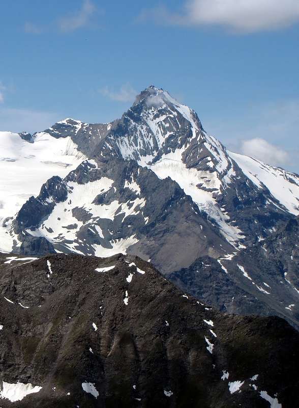
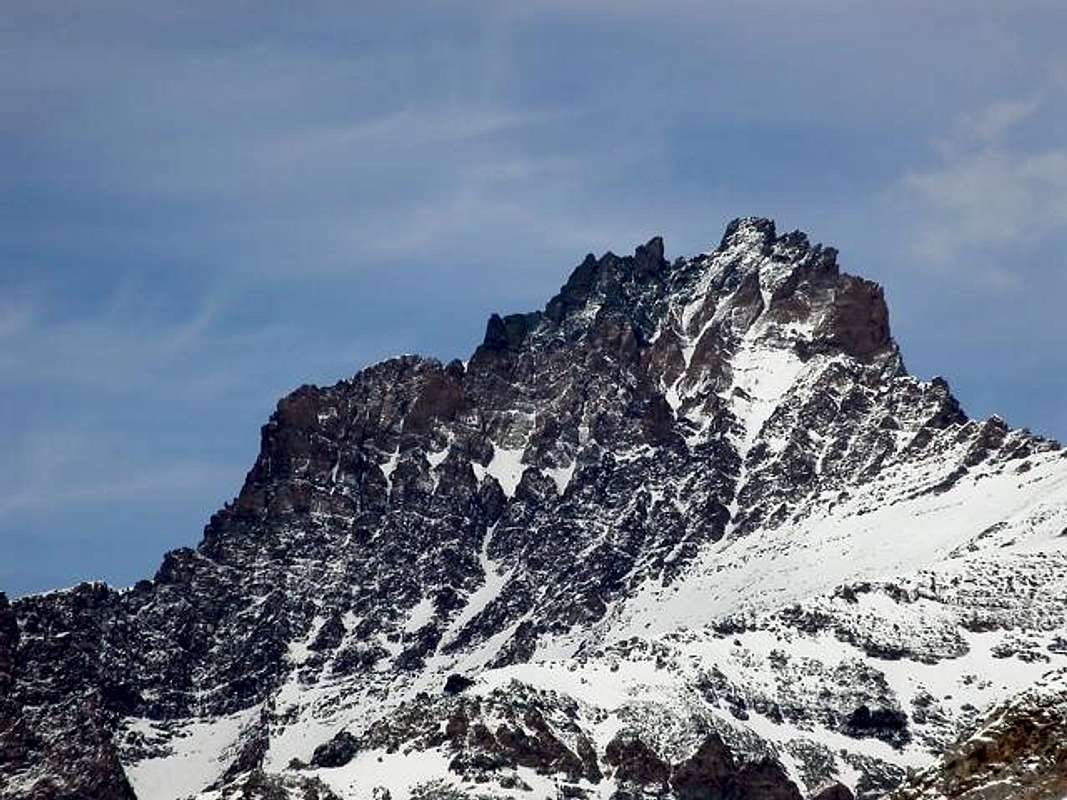
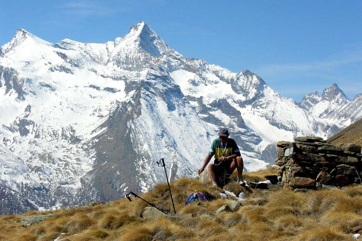
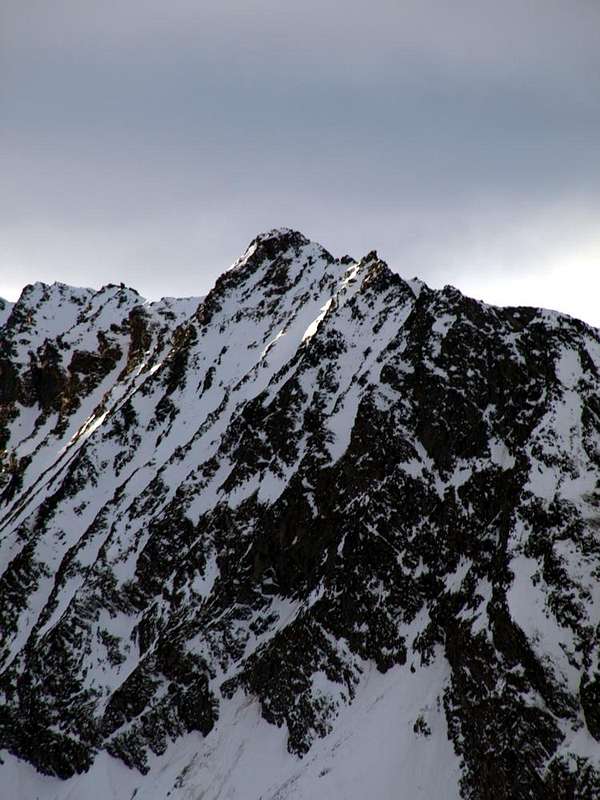
So basically and photographically speaking, this mountain is formed from a single and rather long ridge, arranged on South-southwest / North-northeast axis. Then it has only two sides, although the West is divided into two enough specific parts (North and South) by a small Northern buttress which ends at an altitude of 1.950/2.000 meters above the Bois Ron (Round Wood or, better, Rounded Forest). Both are crossed by steep rocky couloirs, especially the more Western leaning over four small rocky and almost vertical "clogs". On the opposite side of the Traso drops or a similar slope formed by five somewhat crushed and broken rocky ribs that reach the summit ridge in correspondence of four distinct elevations, the second of which (starting from the Traso Colle) constitutes the true Top. So, as I recall, because the height difference amongst them is minimal. But it is not so irrelevant to the path, forcing to small workarounds on the side facing the South. In any case it should remain on the ridge, because the slopes are quite exposed to falling rocks. Anyway this Summit is very little popular and much frequented often, even if in plain view from everywhere, and especially from the Village of Gimillan or Dzimillan, just above Cogne in the South. His exploration takes place, apart from the Normal Route or already Southern Crest probably frequented by hunters and a mountaineering ascent in August 1900, by the British rope comprising G.P. Baker and the renowned and famous Georges Yeld along with Valtournanche Mountain Guides Benedict and Elisée Pession. Are the times of the great explorations, of which tells the Yield in its wonderful reports on the Cogne Valley ("The Mountains of Cogne (Climbers Guides")" with the American Reverend William Auguste Brevoort Coolidge, Edit in London 1893 and "Scrambles in the Eastern Graians 1878-1897", Edit by Fisher-Unwin always in London 1900), and the party on the day 8 August 1910 rises from the "Casolari" (Pastures) Nomenon through the Wall Northwest, in his right side. The descent takes place on the same day by Georges and Benedict by the long Ridge East-northeast, long and indented but not excessively difficult ("Alpine Journal XXV", page 536). It remained the long and dangerous Slope Southeast, but this was way at the end of the 90s, through the highest rocky rib that leads directly to the Summit. Beautiful and close views on La Grivola and over the entire Valley of Cogne to the East and towards opposite side on fascinating Grand Nomenon (3.488 m), above the namesake vallon.
In pratica, topograficamente parlando, questa montagne risulta formata da un'unica e piuttosto lunga cresta, disposta sullo asse Sud-sudovest/Nord-nordest.Quindi presenta due soli versanti, anche se quello Occidentale viene diviso in due parti (Nord ed Ovest) da un piccolo contraforte Settentrionale che si esaurisce a quota 1.950/2.000 metri circa al di sopra del Bois Ron (Bosco Rotondo). Entrambi sono percorsi da ripidi canaloni rocciosi, soprattutto quello più Occidentale che si appoggia sopra quattro "zoccoli" rocciosi e verticali. Sul lato opposto o del Traso scende un versante similare formato da cinque costole rocciose alquanto frantumate che raggiungono la cresta sommitale in corrispondenza di quattro ben distinte elevazioni, la seconda delle quali (partendo dal Colle del Traso) costituisce la vera sommità. Così, se ben ricordo, anche perché il dislivello tra loro risulta minimo. Ma non é così ininfluente per il percorso, costringendo a dei piccoli aggiramenti sul versante rivolto a Mezzogiorno. In ogni caso conviene restare sulla cresta, poiché i pendii sono alquanto esposti alla caduta di pietre. In ogni caso é Sommità veramente poco popolare e molto di rado frequentata, anche se ben in vista da ogni dove e soprattutto dal Villaggio di Gimillan, appena sopra a Cogne verso Sud. La sua esplorazione avviene, a parte la Via Normale o Cresta Sud già frequentata probabilmente da cacciatori ed alpinisticamente salita nell'Agosto del 1900, da parte della cordata inglese composta da G.P. Baker e dal famoso Georges Yeld insieme alle Guide di Valtournanche Benedetto ed Eliseo Pession. Sono i tempi delle grandi esplorazioni, delle quali racconta lo Yeld nei suoi splendidi resoconti sulla Valle di Cogne, e la comitiva nel giorno 8 di Agosto 1910 sale dai Casolrari del Nomenon tramite la Parete Nordovest, nel suo lato di destra. La discesa avviene nello stesso giorno da parte di Georges e Benedetto tramite la lunga Cresta Est-nordest, lunga e frastagliata ma non eccessivamente difficile. Rimaneva il lungo e pericoloso Versante Sudest, ma anche questo é stato percorso alla fine degli Anni '90, tramite la costola rocciosa più alta che conduce direttamente alla Vetta. Splendide e ravvicinate viste sulla Grivola e sopra l'intera Valle di Cogne.
Getting There
BY CAR:
From TORINO, MILANO, etc: Motorway A5. Exit at IVREA or Quincinetto (PIEDMONT) also Pont Saint Martin, Verrès, Châtillon, AOSTA East (Nus) and West (Aymavilles) Municipalities.
From Aymavilles towards Cogne Valley From Aymavilles(646m) towards Cogne Valley with Regional Main Road: Vieyes (1.132m) Fraction; continue to Epinel(1.436/52m) Village, by path in Traso Vallon at Trayo Alp (2.035m) and with traces in terminal parts towards Trajo Pass. Or through the adjacent Pousset Vallon up to the Damiano Gratton Bivouac (3.198/200m).
Approaches & Routes
1) -Epinel Hamlet (1.436m): Walk with path in South-southwest towards Pianes (1.694m) Pastures, fork 1.995 meters, Trajo Alp (2035m) (T/E/F; 1h'50/2h'00).
2) - Trajo Alp (2.035m): Excursion with path n° 27 in West-southwest to Casotto P.N.G.P. (2.155m) and Trajo or Trayo Pass (2.873m) (EE/F+; 2h'15/2h'45).
3) - Trayo Pass (2.873m): Climbing in South through Northern Ridge, with some circumvention in West in final part, to Punta Crevasse (3.302m) (A/F+/PD-; 2h'15/2h'30).
4) -Trayo Pass (2.873m): Climbing in North-northeast through South-southwestern Ridge to Punta del Trayo (3.124m) (A/F+/PD-PD; 1h'00/1h'30).
5) - Gratton Bivouac (3.198m): Excursion from Epinel Hamlet with path n° 26 before in Southeast into the "Grand Bois" (Great Forest) to sources of Pousset Torrent neighboring the homonym lower Pasture (2.176m; wooded "rascards"), crossing below the Northern and Eastern Faces of Punta Pousset (3.045m). After South with path always n° 26, passing through the upper (2.520m), towards the Pousset Pass (3.201m) near the Camp Damiano Gratton (1.998m), just above Traso Glacier (EE/F+; 4h'30/5h'00).
6) - Punta Rossa della Grivola (3.630m): to complete the course on watershed dominating from East to the West the upper plateau of Traso Glacier in terminal part, continue on sparce but always evident traces towards the South and, after bypassing the Altitudes 3.338, 3.364 meters formed from stacked blocks, continue easily with a small snowy ridge reaching the Summit, with the Southeast Face or Normal Route of Grivola in front (EEA/F+; 1h'15/1h'30 from Camp Gratton; 6h'00/6h'30 Epinel or Crétaz Hamlets).
Mountain Condition
You can get weather forecasts at the official site of the Regione Valle d'Aosta:
"Guida dei Monti d'Italia-Gran Paradiso Parco Nazionale" E. Andreis, R. Chabod, M. C. Santis, Club Alpino Italiano/Touring Club Italiano, prima Ed. 1939; seconda Ed. 1963; terza Ed. 1980.
"I Rifugi della Valle d'Aosta" di Stefano Ardito, Ed. Guide iter, Febbraio 2003.
"Guida delle Alpi Occidentali", di Giovanni Bobba e Luigi Vaccarone C.A.I. Sezione di Torino Volume II (parte II), 25 Maggio 1896.
"Rifugi e bivacchi in Valle d'Aosta", di Cosimo Zappelli aggiornata da Pietro Giglio, Musumeci Editore, Luglio 2002.
MAPS:
Kompass "Gran Paradiso Valle d'Aosta Sentieri e Rifugi" Carta Turistica 1:50.000.
Enrico Editore Ivrea-Aosta "Gruppo del Gran Paradiso" 1:50.000.
L'Escursionista "Valle di Cogne Carta dei Sentieri" 1:25.000.
L'Escursionista "Tour de la Vallée de Cogne Grand Paradis" 1:25.000.
I.G.C. Istituto Geografico Centrale "Parco Nazionale del Gran Paradiso" 1:50.000.
Parents refers to a larger category under which an object falls. For example, theAconcagua mountain page has the 'Aconcagua Group' and the 'Seven Summits' asparents and is a parent itself to many routes, photos, and Trip Reports.


 2278 Hits
 79.04% Score
 10 Votes