La montagna chiama i suoi figli, ed essi rispondono fedelmente al suo appello…
Osvaldo Cardellina, Diario alpinistico, 1964-65
Page texts: @ OsvaldoCardellina"Osva", passed away on May 2, 2022. Page owners: Christian Cardellina e Osvaldo Cardellina. Any updates from September 12, 2022: Antonio Giani, page administrator, friend and climbing companion.
Testi della pagina: @ OsvaldoCardellina "Osva", scomparso il 2 maggio 2022. Proprietari pagina:Christian Cardellina e Osvaldo Cardellina. Eventuali aggiornamenti dal 12 settembre 2022: Antonio Giani, amministratore della pagina, amico e compagno di salite.
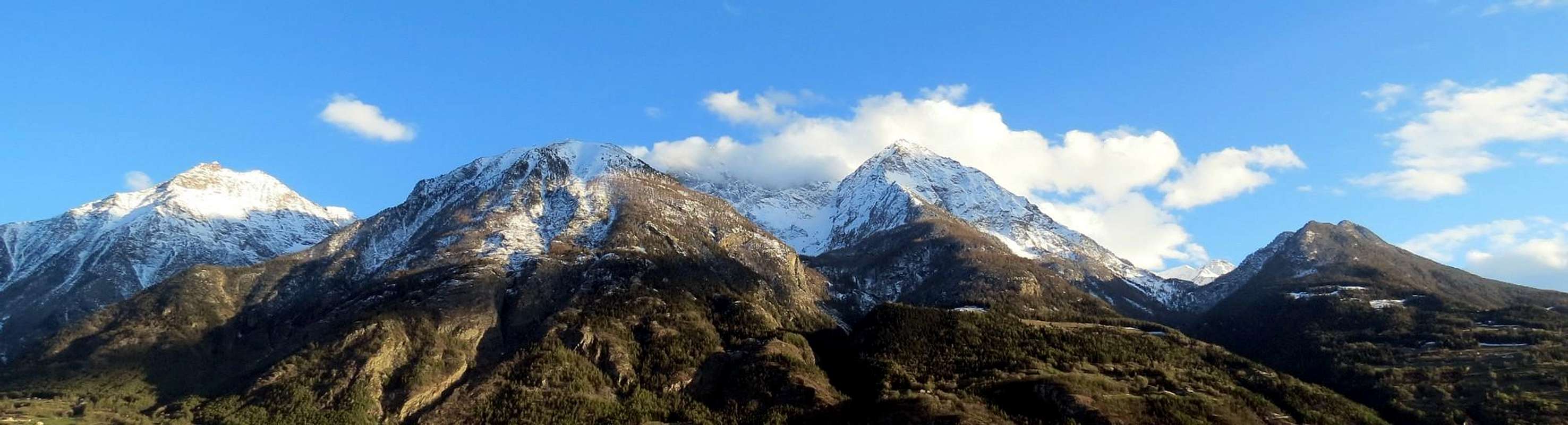
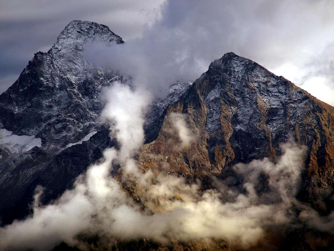
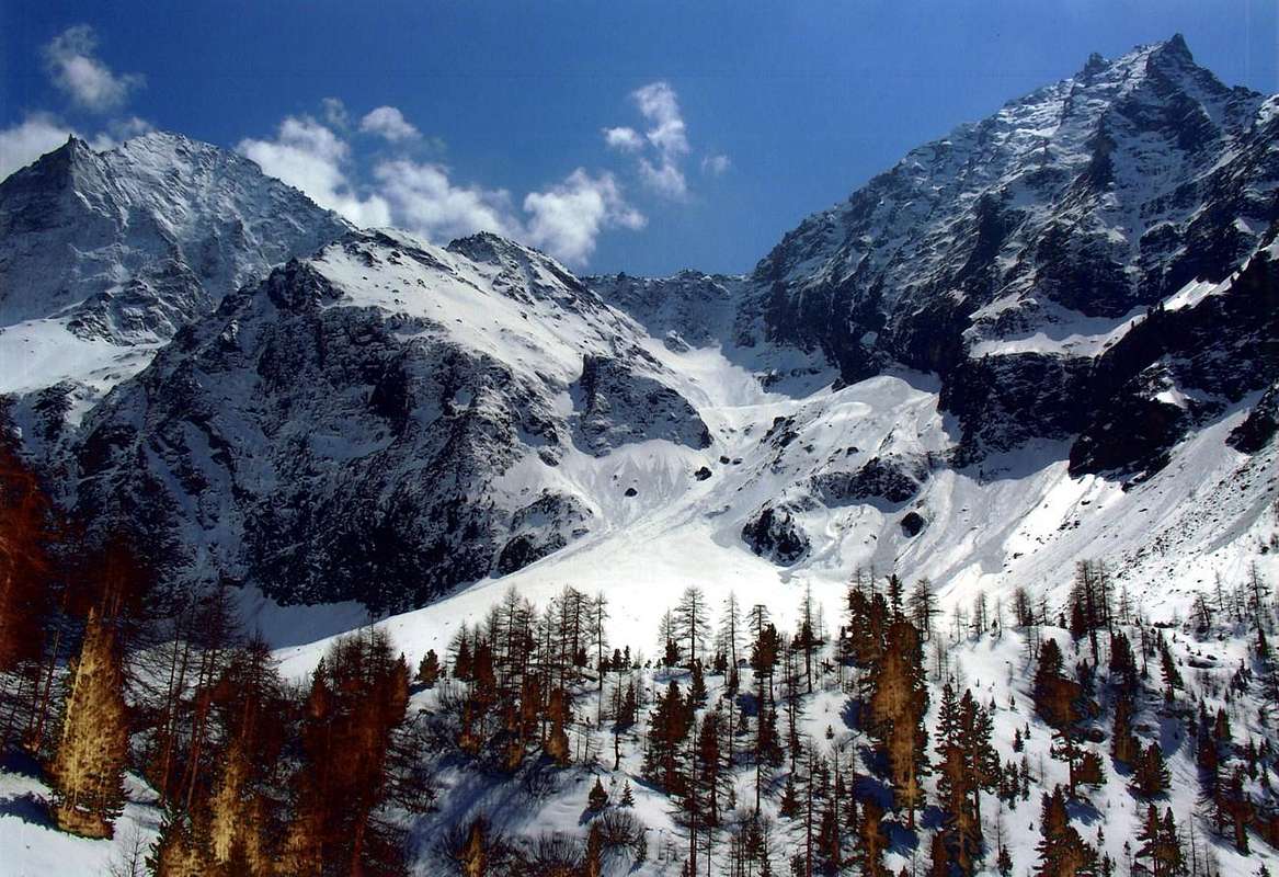
Northern Emilius Overview
Arpisson Vallon.
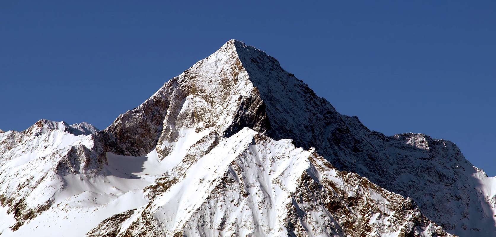
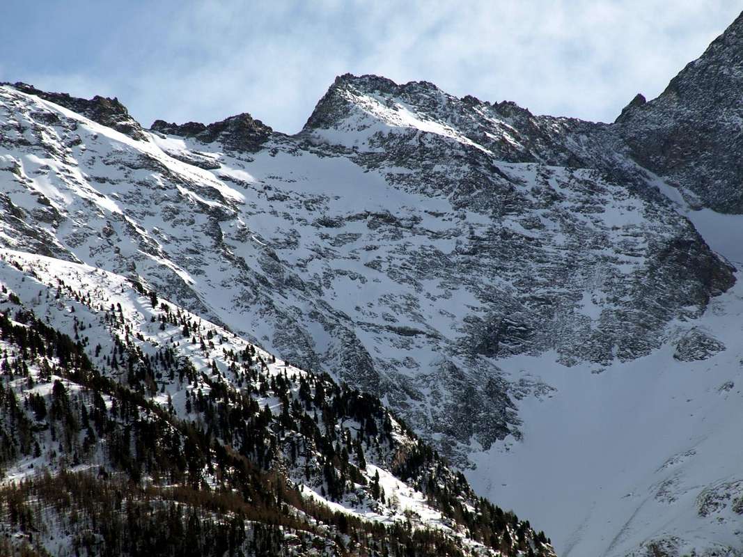
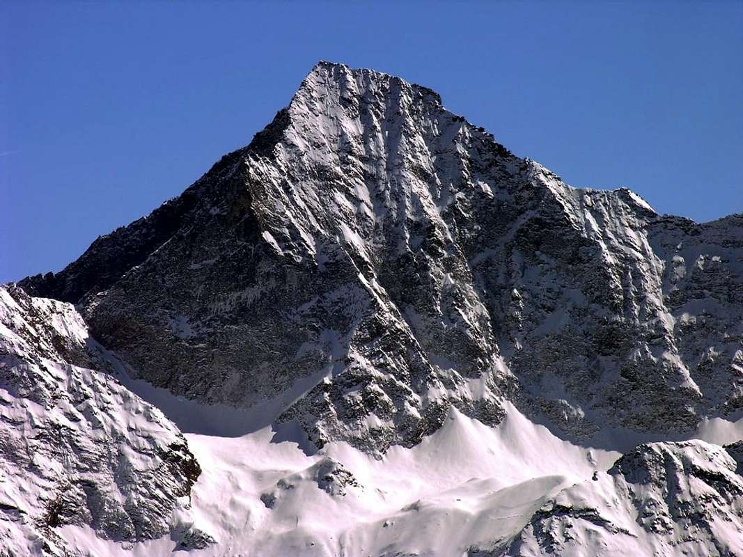
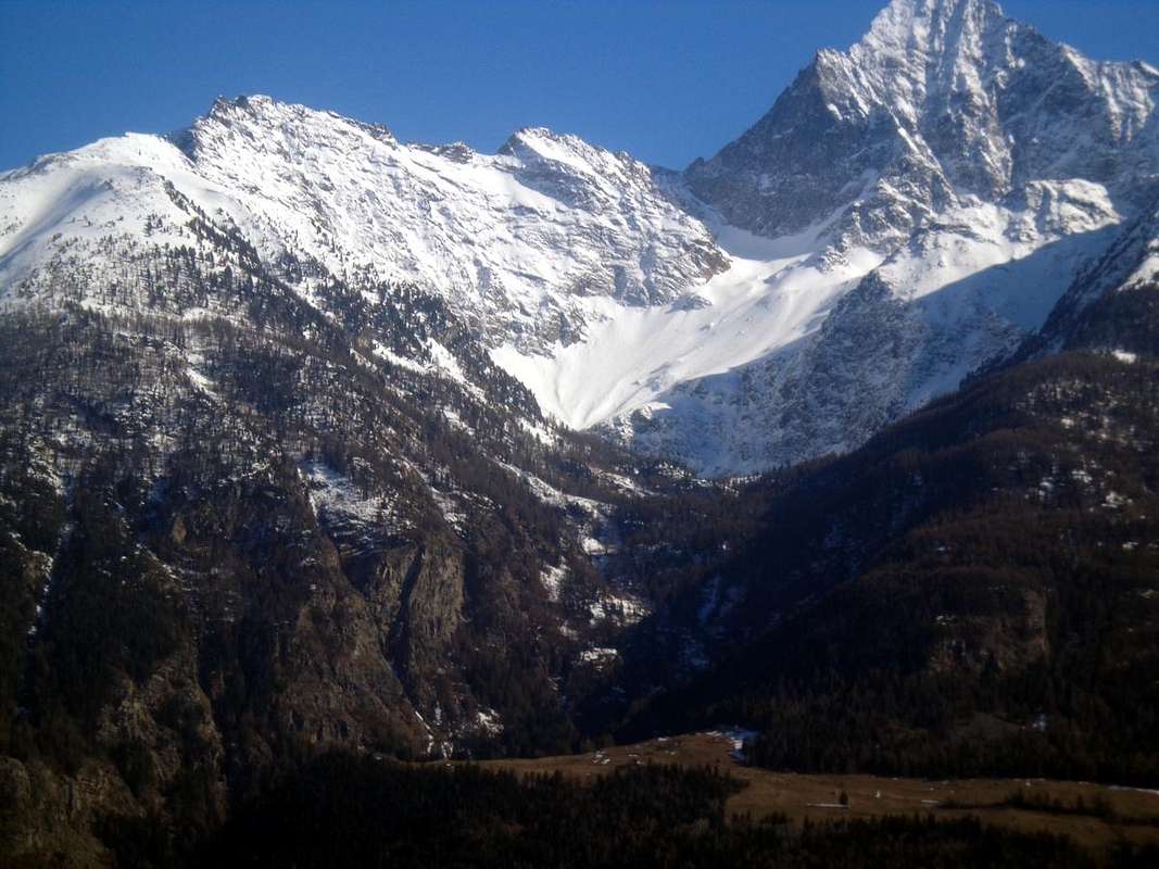
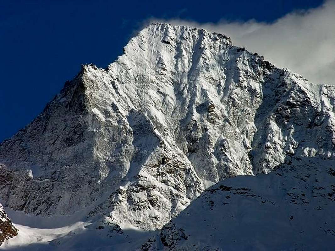
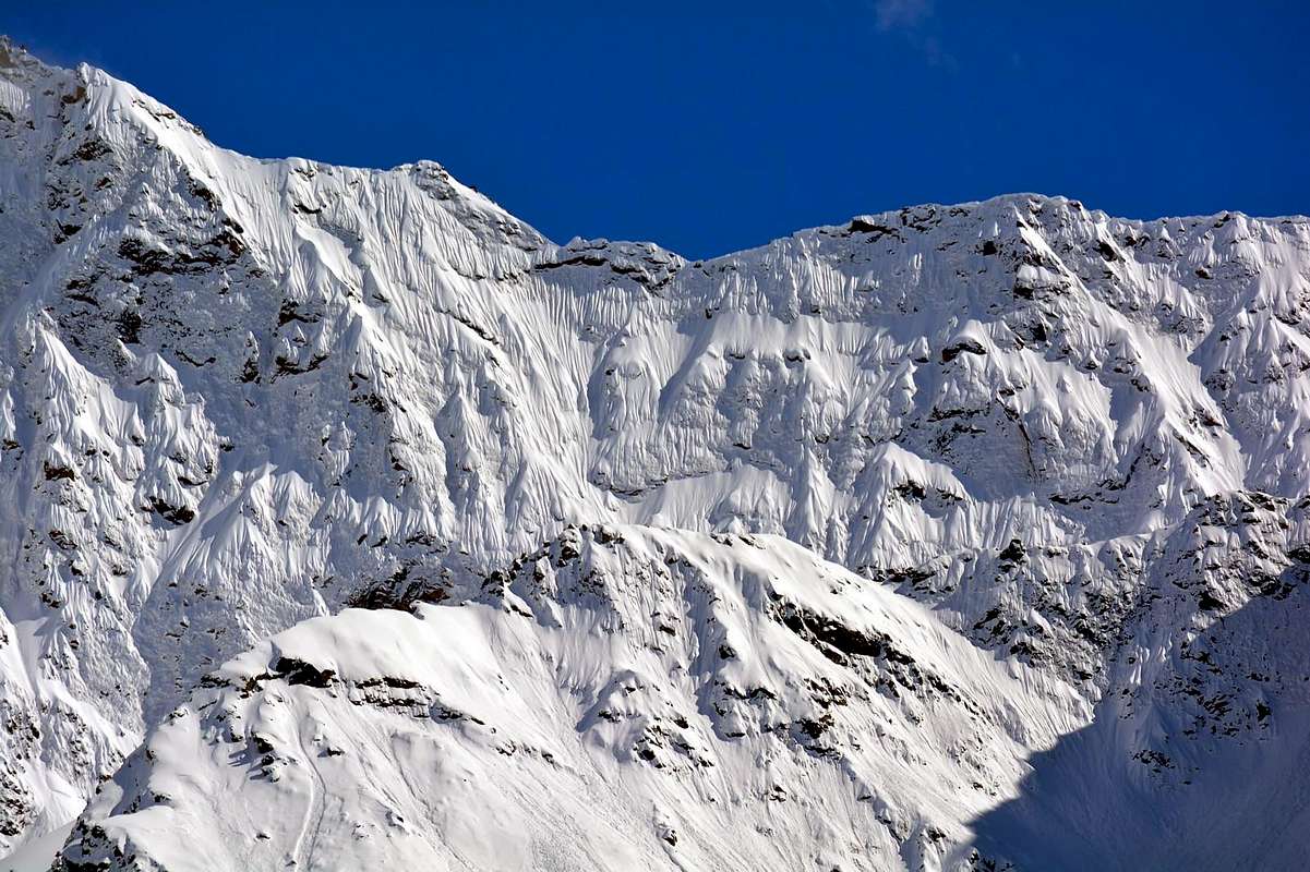
This truly wild and lonely vallon is located South of Pollein, that dominates starting by Emilius with more than 3.000 meters. At the base of the great Northern Face of Mount Emilius, goes up evenly interrupted only by a small plateau, swept by snowslides and avalanches coming down from the "Dent of Becca", immediately below the two Pastures of same name (1.950m, 2.010 m; Lower and Upper) and just before the "Sources of Emilius", that come out from the huge moraine left by the two Glaciers Eastern and Western Arpisson. Including into a watershed in the East, after the Black Triangle of Emilius (3.378m) hence admirable in its magnificence with 400 meters in vertical, progressive form Pass and Tête Blantsette or Becca des Boucs, Col Peckoz, Seneva's Becca with its Northern small towers and his great Western Wall that descends above to the two Pastures of the Arpisson and finally ends with the great promontory of Mont Père Laurent over the Commons of Grand Brissogne and Pollein. Closed off to the South from the North Wall of Emilius, which stretches for almost 2 kilometres to the West, reaching the Col Carrel, gets up to the Becca di Nona or even kown and called as "La Becca"(3.142m) from which descends with the "Crestone North-northeast", adapted to separate this from the next Vallon or Gorge of Dard now on the border with the Municipality of Charvensod. This vallon, said "Lo Cordagnì" or the "The Shoemaker" of the Becca Seneva (3.086m; on rainy days because it looks like a shoemaker bent on his work, looking up from Grand Brissogne), is attended almost exclusively by Shepherds and by chamoises Hunters and Poachers, since all routes except the easy ascent of Mont Père Laurent (2.625m) for it even more unpopular, are very demanding and definitely is preferable to the approach of the Vallon Comboé using the Federigo Camp (2.907m) at the nearby Carrel Hill (2.916m), between Emilius "Becca". A valley that in terms mountaineering began to be explored in August 29 th, 1897 by the strong Mountaineers Ercole Daniele Giovan Battista Devalle with Mountain Guides Valtournanche Anselmo Pession and Luigi Bich with first ascent on Western Wall Becca Seneva and even first absolute of the mountain. The same the next day, after getting off to camp out again at Arpisson, attempted the first ascent of the North Face of Mount Emilius wide, nearly 700 meters high. But they had to go up on the right of the same taking the first path of the Northern Wall near the Little Emilius (3.342m), a more dangerous via that difficult that even today is not repeated probably due to the reasons expressed above.
But they were just the first with this difficult climb to go this valley with real mountaineering intent?
Most likely, since the attempt made on the same side 18 September 1878 by the valiant Martin Baretti (renowned pioneer and famous montaineer of this epoch) and Luigi Bruno both of Turin, accompanied by the very strong Mountain Guides of the Susa Valley Vittorio and Augusto Sibille, presents, as in "Bulletin CAI 1878" page 365, a report somewhat confused, defined in "Statistics Ferrari 1908" for the West Face, instead is almost certainly due to the North. In fact: "... a dangerous and very hard work of 4 to 5 hours for those rocks all covered with ice and cut anywhere from walls impossible to overcome, hard to get around, took us 100 meters from the top. Can not climb higher for the condition of the rocks we conducted the retreat ...". Is to be concluded with total certainty that it is the same way made twenty years later, this result of a withdrawal, but almost certainly in this first case with the approach through the opposite side in Southwest along the Valley of Comboé and via the Colle Carrel (2.912m) and then not starting from the three Martsaouchy (Dèsott, du Milieu and Damon) Pastures just above Pollein Municipality and at entrance of Western Arpisson Vallon. We have to wait almost another thirty years to see the work of other climbers in this valley, starting from the valley floor. We have to wait almost another thirty years to see the work of other climbers in this vallon, starting from the valley floor. Indeed, while the ridges of Mount Emilius are conveniently start from Comboé (West 1902) or the adjoining Vallone Laures (Edge North-northeast 1906), an important visit takes place June 20, 1926 with the first ascent by Amilcare Crétier, Guido Perolino and Giuseppe Riconda of "Crestone" North-northeast of Becca di Nona after bivouacked at Arpisson; the same Crétier and Perolino grant an encore on June 12 of the following year with the first ascent of the East Face of the same. Two goals classy accomplished on land difficult and treacherous, but that has to wait until 1941 for the first and 1978 for the second to see other mountaineers on those two routes. In the first case, however, the climb is via the Vallon Comboé with the crossing of the two ridges of Mount Emilius to the "Becca", while the second is retraced the route from Pastures Martsaouchy and Arpisson. The remoteness of the approach has kept away everyone else. The superstar of Verrès confirms his youth talent with the double first ascent of the North Wall of the Mount Emilius in August 1926 with Renato Chabod and Lino Binel and the year thereafter with the latter, but always starting from Comboé and bivouac into the old House Hunting Baron Egon Beck Peckoz neighboring the Col Carrel. All other climbs, including the Black Triangle by the two Guides of Valpelline "Angelino" Bozzetti and Pietro "Piero" Rosset, take place in this such a way and then looking out and covering only the upper part of the valley, that is between the two East West Glaciers of Arpisson. But from the bottom no goes more anyone and the valley again becomes the exclusive property of the shepherds, partly because even poachers, despite the total disappearance of gamekeepers Baron Egon Beck Peckoz Gressoney, have almost forgotten how to "beat the wild Cordagnì" ...
Vallone dell'Arpisson.
Questo vallone veramente selvaggio e solitario é situato a Meridione del sottostante Comune di Pollein, che domina partendo dall'Emilius con più di 3.000 metri. Collocato proprio alla base della grande Parete Nord del Monte Emilius, sale in modo uniforme interrotto esclusivamente da un piccolo pianoro, spazzato dalle slavine e dalla valanga che scende dalla "Dent" della Becca o Dente della Becca di Nona per oltre 500 metri, subito appresso ai due Alpeggi di ugual nome (1.950 m, 2.010 m; Inferiore e Superiore) ed appena prima delle "Sorgenti dell'Emilius", fuoriuscenti dall'enorme morena lasciata dai due Ghiacciai Orientale ed Occidentale di Arpisson, oggi in fase di regressione. Compreso da un netto spartiacque ad Oriente che, dopo il Triangolo Nero dello Emilius(3.378 m) da qui ammirabile nella sua magnificenza coi suoi 400 metri in verticale, in progressione forma il Col e la Tête Blantsette o Becca des Boucs, il Col Peckoz, la Becca di Seneva con i suoi torrioni Settentrionali e la sua grande Parete Occidentale che scende fino a sopra gli Alpeggi dell'Arpisson, per concludersi infine con il grande promontorio del Mont Père Laurent sopra gli abitati di Grand Brissogne e Grand Pollein. Chiuso verso Mezzogiorno dalla Parete Nord dell'Emilius, che si distende per quasi 2 kilometri verso Occidente raggiungendo il Colle Carrel, si rialza alla Becca di Nona o conosciuta anche come "La Becca" dalla quale scende con il "Crestone Nord-nordest", atto a separare questo vallone dal successivo del Dard ormai ai confini col Comune di Charvensod. Questo Vallone, detto "Lo Cordagnì", ovvero del "Calzolaio", é frequentato quasi esclusivamente dai Pastori e dai Bracconieri, poiché tutte le vie, tranne la facile ascensione al Mont Père Laurent per altro anch'essa poco popolare, sono molto impegnative e sicuramente é preferibile l'approccio dal Vallone di Comboé utilizzando il Bivacco Federigo Zullo (2.907 m) al Colle Carrel (2.916 m), tra Emilius e "Becca". Vallone che sotto il profilo alpinistico ha iniziato ad essere esplorato, dopo bivacco all'Alpe d'Arpisson, il 29 d'Agosto del 1879 dai forti Alpinisti piemontesi Ercole Daniele e Giovan Battista Devalle con le Guide di Valtournanche Anselmo Pession e Luigi Bich con prima salita della Parete Ovest nonché prima assoluta della Becca di Seneva. Gli stessi il giorno appresso, dopo essere scesi nuovamente a bivaccare all'Arpisson, hanno tentato la prima ascensione della larga Parete Nord del Monte Emilius, alta quasi 700 metri; hanno però dovuto "accontentarsi" di salire sulla destra della stessa compiendo il primo percorso della Parete Settentrionale del vicino Piccolo Emilius (3.342 m), una via più pericolosa che difficile, ancor oggigiorno non ripetuta probabilmente a causa delle motivazioni espresse.
Ma sono stati proprio loro i primi a percorrere con questa difficile salita questo vallone con veri intenti alpinistici?
Molto probabilmente, poiché il tentativo effettuato sulla medesima parete il 18 Settembre 1878 da parte dei valorosi Martino Baretti e Luigi Bruno, accompagnati dalle Guide della Val di Susa Augusto e Vittorio Sibille, presenta, come in "Bollettino C.A.I. 1878" pagina 365, una relazione alquanto confusa che, definita in "Statistiche Ferrari 1908" per la Parete Ovest, invece é quasi sicuramente da attribuire a quella Nord. Infatti: "... un pericoloso e faticosissimo lavoro di 4 a 5 ore per quelle roccie tutte coperte di ghiaccio e tagliate ovunque da pareti impossibili da superarsi, difficili a girarsi, ci portò a 100 metri dalla cima. Impossibile prendere più in alto per la condizione delle roccie battemmo in ritirata ...". Vien da concludere con totale certezza che trattavasi della stessa via realizzata venti anni dopo, anche questa frutto d'un ripiegamento, ma quasi certamente in questo primo caso con avvicinamento col Vallone di Comboé e tramite il Colle Carrel e non quindi partendo da Martsaouchy all'imbocco del Vallone Occidentale dell'Arpisson. Bisogna attendere quasi altri trenta anni per vedere all'opera altri alpinisti in questo vallone partendo dal fondovalle. Mentre infatti le creste del Monte Emilius sono percorse partendo dal Comboé (Ovest 1902) o dall'attiguo Vallone delle Laures (Spigolo Nord-nordest 1906), una visita importante avviene il 20 Giugno 1926 con la prima salita da parte di Amilcare Crétier, Guido Perolino e Giuseppe Riconda del "Crestone" Nord-nordest della Becca di Nona dopo bivacco all'Arpisson; gli stessi Crétier e Perolino concedono il bis il 12 Giugno dell'anno seguente con la prima salita della Parete Est della medesima. Una doppietta di gran classe compiuta su di un terreno difficile ed insidioso ma che deve attendere il 1941 per il primo ed il 1978 per il secondo per vedere altri alpinisti impegnati su queste due vie. Nel primo caso però la salita avviene tramite il Vallone del Comboé con traversata delle due creste del Monte Emilius insino alla "Becca", mentre per il secondo viene ripercorso l'itinerario dalle Alpi Martsaouchy ed Arpisson. La lontananza dell'avvicinamento ha tenuto lontano tutti gli altri. Il fuoriclasse "verreziese" conferma il suo talento giovanile con la doppia prima salita dell Parete Nord dell'Emilius in Agosto 1926 con Renato Chabod e Lino Binel ed in quello successivo con quest'ultimo, ma sempre partendo dal Comboé e con bivacco all'antica Casa di Caccia del Barone Egon Beck Peckoz al Col Carrel. Tutte l'altre salite, compresa quella del difficilissimo Triangolo Nero ad opera delle due Guide di Valpelline "Angelino" Bozzetti e Pietro Piero" Rosset, avvengono in siffatto modo e quindi affacciandosi e percorrendo soltanto la parte superiore del vallone, cioé trai due Ghiacciai Occidentale ed Orientale dell'Arpisson. Da sotto non sal più nessuno ed il vallone torna ad essere esclusivo dei pastori, anche perchè i bracconieri han quasi del tutto dimenticato di come "batter lo servazdo Cordagnì" ...
Getting There
BY CAR:
From TORINO, MILANO, etc: Motorway A5. Exit at IVREA or Quincinetto (PIEDMONT).
From IVREA Town: in West towards Pont Saint Martin, Donnas, Bard, Verrès, Châtillon, Pontey, Fénis, Saint Marcel, Grand Brissogne, Pollein, Charvensod, Municipalities. From Courmayeur Resort: in East to Pré St. Didier, Morgex, La Salle, Saint Pierre, Sarre, Aosta, Saint Chistophe; Quart, Grand Brissogne, Pollein Municipalities.
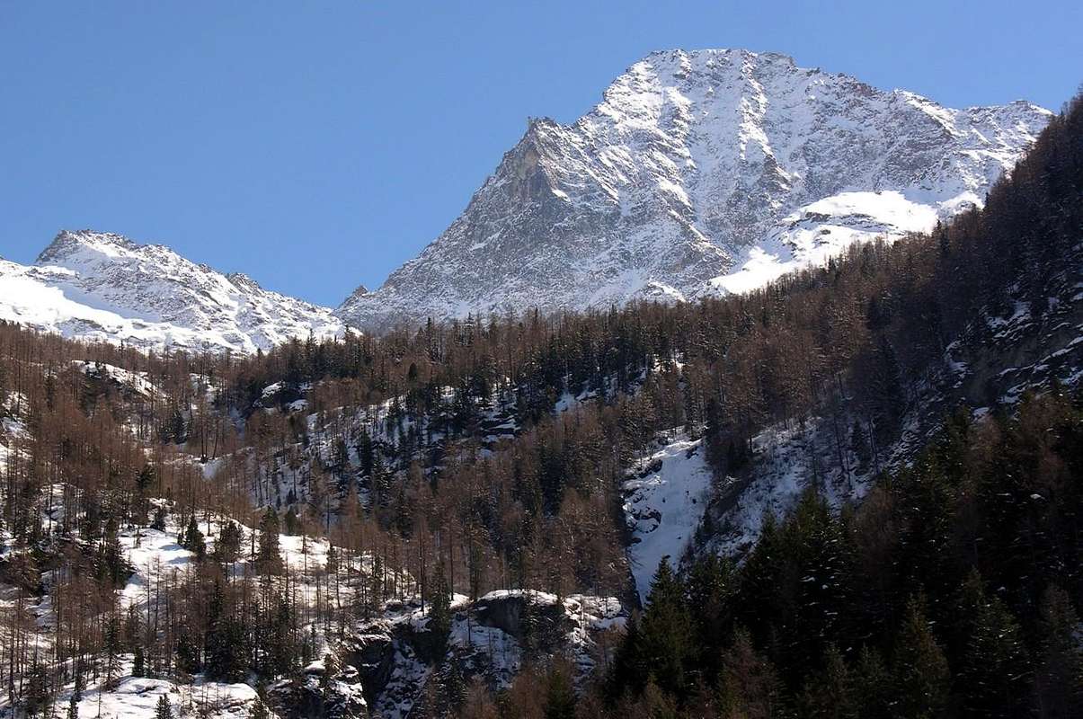
From Charvensod (Main Road from Pont Suaz 567m) up to the fork 951 meters, the dirt road towards Reverier du Tzat, Dessous, Rongachet, Gorrettaz, Barmes, Martsaouchy Dèsott, Martsaouchy du Meitin Villages or Pastures and Martsaouchy Damon and the subsequent path n° 13 towards Arpisson Upper Pasture. Or from Pollein Commune near Chenaux Fraction with Municipal Road towards Tissoniére and Terreblanche Dèsott(1.015m) Pastures and Rongachet Village (1.092m), nearby the Comboé Torrent with wooded bridge (about 1.110m), and previous route in the middle-upper part. From Pollein (575m; secondary road) or from Charvensod (746m; main road and connection) towards Martsaouchy Damon-Arpisson Vallon, through dirt road, and to Arpisson Lower and Upper(2.010m) Alpages with path. From this last to Federigo Zullo Bivouac (2.907m), through moraines on Western Arpisson Glacier.
From FRANCE: through the Mont Blanc Tunnel to Entrèves-crossroads to Vény/Ferret Valleys - Courmayeur. By Little Saint Bernard Pass, closed since November until half May to La Thuile Valley - Pré Saint Didier - Courmayeur. It is not necessary to take Motorway A5: you can drive on SS.26, in the direction of AOSTA - IVREA - TURIN.
BY PLANE:
Aeroporto "Corrado Gex" Saint Christophe (Aosta).
Approaches & Routes
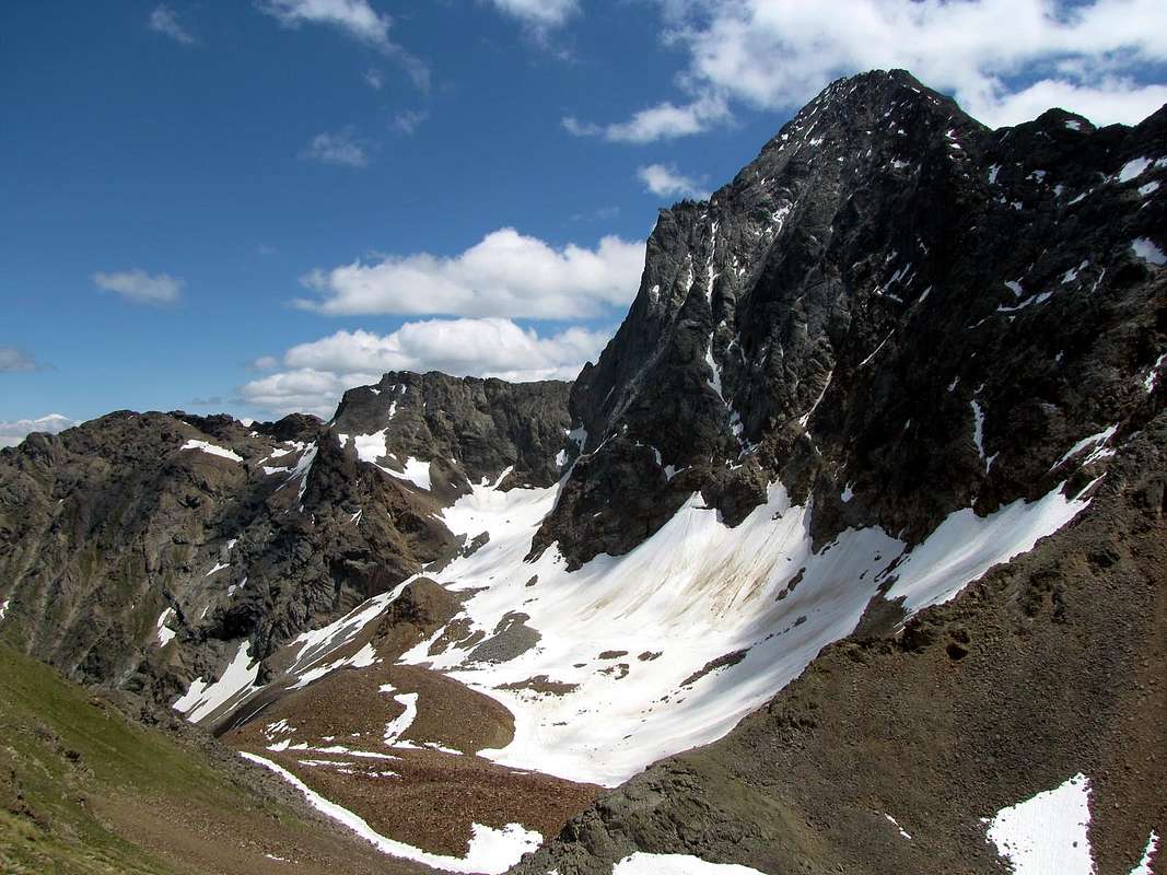
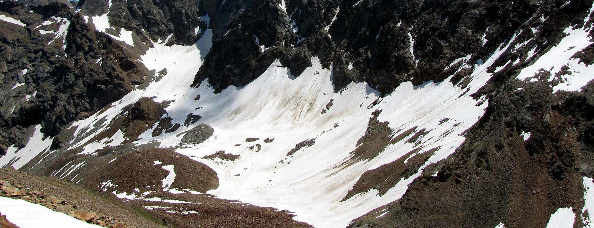
The very wild Western Arpisson, between Mont Père Laurent, Becca di Seneva, Col Peckoz, Tête (Head) and Col Blantsette East and Becca di Nona and the La Dent to the West; closes the vallon toward the South, the Monte Emilius (3.559m), which stretches from East to West always with its great Wall North 2 Km long and that goes down by the Black Triangle, and Emilius with Little Emilius, Mont Ròss de Comboé reaching Col Carrel, which is positioned since July 28th, 1984 the Federigo Zullo Bivouac (2.907m). Specific Regional Road towards Arpisson Vallon: you are reached starting from the Regional Road for Pila-Resort to the junction 951 meters where a farm road in asphalt (ban) leads to the Pastures of Reverier du Tzat and Dessous (1.042m). From here, continue past the small bridge Rongachet (1.100m) above the Torrent de Comboé reaching the nearby small village of the same name (1.092m; *** here comes also a Municipal Road that goes by the Municipality of Pollein departing from Fraction Chenaux at 626 meters); continuing with the private dirt road you reach the isolated House of Gorrettaz (1.089m) and subsequent Pastures of Barmes (1.255m). After through a long diagonal route more in East towards Martsaouchy Dèsott (1.310 meters around), du Meitin (1.349m) and Damon (1.416m). From this point to the South-southwest begins the trail n° 13, which, passing first to the ruins of Alpe Plan Croix (1.744m) reached after the locality called Combué (1.852m), the small tableland of Plan de l'Eitze, the taking of Water and Pastures of Arpisson Lower and Upper (1.951m, 2.010m), where it ends as it continues through a small track for pasture until the steep moraine at the mysterious "Sources of Emilius". Going this on its side left bank (West) with adventurous but tiring path you reach the small basin, where there is a pond, called Pond Peckoz, at the new shelter renovated but always private and closed (2.873m; ex Shelter of Gamekeeper Baron Beck Peckoz of Gressoney Valley, owner of the Reserve then and now Attilio Turati) immediately below the Colle Carrel (2.912m) and near Federigo Zullo Camp (2.907m) at the beginning of the "Via Ferrata" on the West-northwest Ridge Monte Emilius.
Si tratta del più che selvaggio Vallone Occidentale di Arpisson, compreso tra Mont Père Laurent, Becca di Seneva, Col Peckoz, Tête e Col Blantsette ad Est e Becca di Nona e La Dent ad Ovest; chiude la vallata verso Mezzogiorno il Monte Emilius (3.559 m), che si distende sempre da Est ad Ovest con la sua grande Parete Nord lunga circa 2 Km. discendente dal Triangolo Nero, Emilius e Piccolo Emilius, Mont Ròss de Comboé sin al Colle Carrel, dov'é posto dal 24 Luglio 1984 il Bivacco Federigo Zullo (2.907 m). Strada Regionale specifica verso il Vallone Occidentale di Arpisson: si raggiunge partendo dalla Strada Regionale per Pila fino al bivio 951 metri dove una strada poderale in asfalto (divieto di transito) conduce agli Alpeggi di Reverier du Tzat e Dessous (1042 m). Da qui si continua superando il piccolo Ponte di Rongachet (1.100 m) sopra il Torrent de Comboé raggiungendo il vicino Villaggetto omonimo (1.092 m; *** qui arriva anche una Strada che sale dal Comune di Pollein con partenza dalla Frazione di Chenaux a 626 metri); continuando con la poderale si giunge alla Casa isolata di Gorrettaz (1.089 m)ed ai successivi Alpeggi di Barmes (1.255 m). Indi per mezzo d'un lungo diagonale maggiormente ad Est verso Martsaouchy Dèsott (circa 1.310 metri), du Meitin (1.349 m) e Damon (1.416 m). Da questo punto parte verso Sud-sudovest il sentiero n° 13 che, passando dapprima per l'Alpe diroccata di Plan Croix (1.744 m) raggiunge poi il Combué (1.852 m), il piccolo pianoro del Plan de l'Eitze, la presa dell'acqua e gli Alpeggi di Arpisson Inferiore e Superiore (1.951 m, 2.010 m), ove termina mentre continua una piccola traccia da pascolo fino alla scoscesa morena presso le "Sorgenti dell'Emilius". Risalendo questa sul suo lato orografico sinistro (Ovest) con percorso avventuroso ma faticoso si raggiunge la piccola giogaia, dove esiste un laghetto, chiamato Peckoz, presso il nuovo rifugio ristrutturato ma privato e sempre chiuso (2.873 m; ex Ricovero dei Guardiacaccia del Gressonaro Barone Beck Peckoz , proprietario della Riserva ed oggi Attilio Turati) subito al di sotto del Colle Carrel (2.912 m) e del vicino Bivacco Federigo Zullo (2.907 m) all'inizio della "Via Ferrata" sulla Cresta Ovest-nordovest dell'Emilius.
Mountain Conditions
Meteo: you can find all the needed informations at the official site of the Valle d'Aosta Region:
"Guida del Monte Emilius", di Osvaldo Cardellina Editore in collaborazione con il Club Alpino Italiano Sezione di Aosta, Dicembre 1978.
"Guida dei Monti d'Italia – Emilius Rosa dei Banchi Parco del Mont Avic" di Giulio Berutto e Lino Fornelli - Club Alpino Italiano/Touring Club Italiano, Marzo 2005.
"Guida delle Alpi Occidentali" di Giovanni Bobba e Luigi Vaccarone C.A.I. Sezione di Torino Volume II (parte II), 25 Maggio 1896.
MAPS:
Kompass "Gran Paradiso Valle d'Aosta Sentieri e Rifugi" Carta turistica 1:50.000.
L'Escursionista "Conca di Aosta-Pila-Monte Emilius" Carta dei sentieri (n° 4) 1:25.000.
Hapax "Les Sentiers Comunità Montana Monte Emilius", Luglio 2000 1:25.000.
Enrico Editore Ivrea-Aosta "Gruppo del Gran Paradiso" 1:50.000.
I.G.C. Istituto Geografico Centrale, Torino "Carta delle Passeggiate ed Escursioni in V.D.A. Conca di Pila-Gressan, 1:20.000.
External Links
More about Emilius Another description with 40 shots, 6 panoramas and a "handmade" map, about Emilius.
Pila web-site Pila, the famous winter station, has an active life even in summertime. In this link, you'll able to find time schedule for Chamolè Chair Lift.
Parents refers to a larger category under which an object falls. For example, theAconcagua mountain page has the 'Aconcagua Group' and the 'Seven Summits' asparents and is a parent itself to many routes, photos, and Trip Reports.


 2017 Hits
 79.04% Score
 10 Votes