


-
 5416 Hits
-
 80.49% Score
-
 12 Votes
|
|
Area/Range |
|---|---|
|
|
45.50830°N / 7.19332°E |
|
|
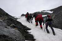
Hiking, Mountaineering |
|
|
Spring, Summer, Fall, Winter |
|
|
Note
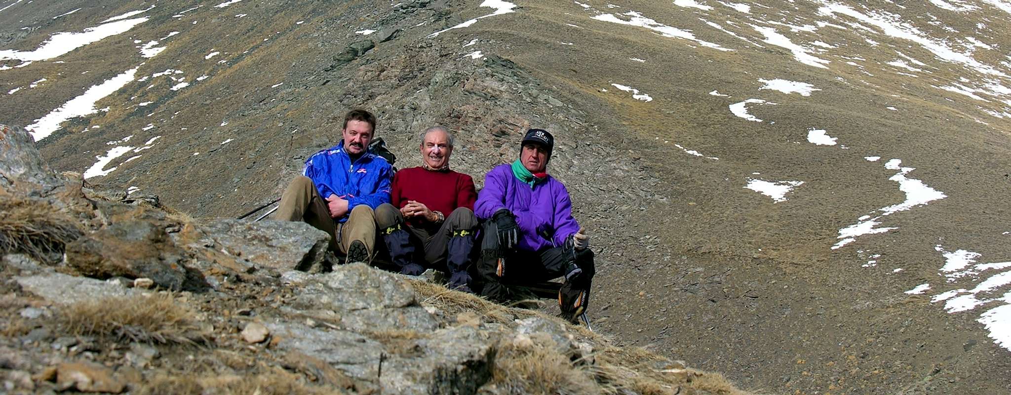
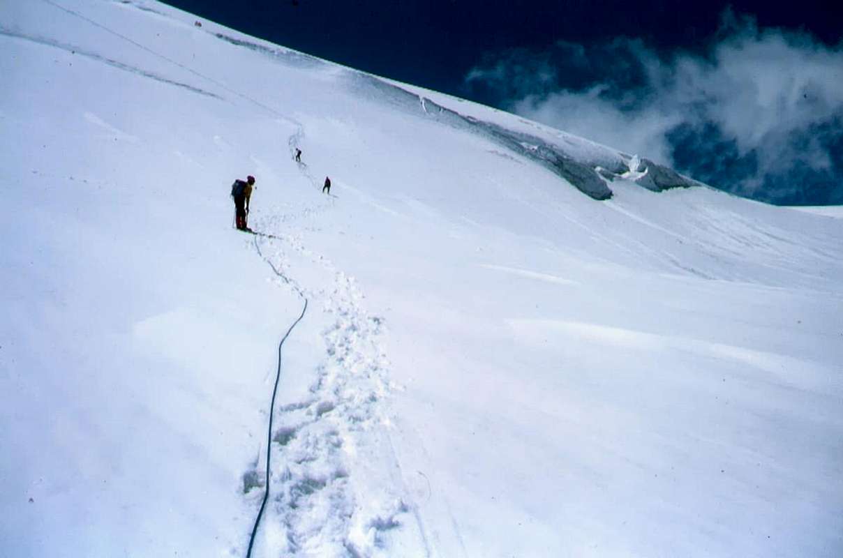
La montagna chiama i suoi figli, ed essi rispondono fedelmente al suo appello… Osvaldo Cardellina, Diario alpinistico, 1964-65 Page texts: @ OsvaldoCardellina "Osva", passed away on May 2, 2022. Page owners: Christian Cardellina e Osvaldo Cardellina. Any updates from September 12, 2022: Antonio Giani, page administrator, friend and climbing companion. Testi della pagina: @ OsvaldoCardellina "Osva", scomparso il 2 maggio 2022. Proprietari pagina: Christian Cardellina e Osvaldo Cardellina. Eventuali aggiornamenti dal 12 settembre 2022: Antonio Giani, amministratore della pagina, amico e compagno di salite. |
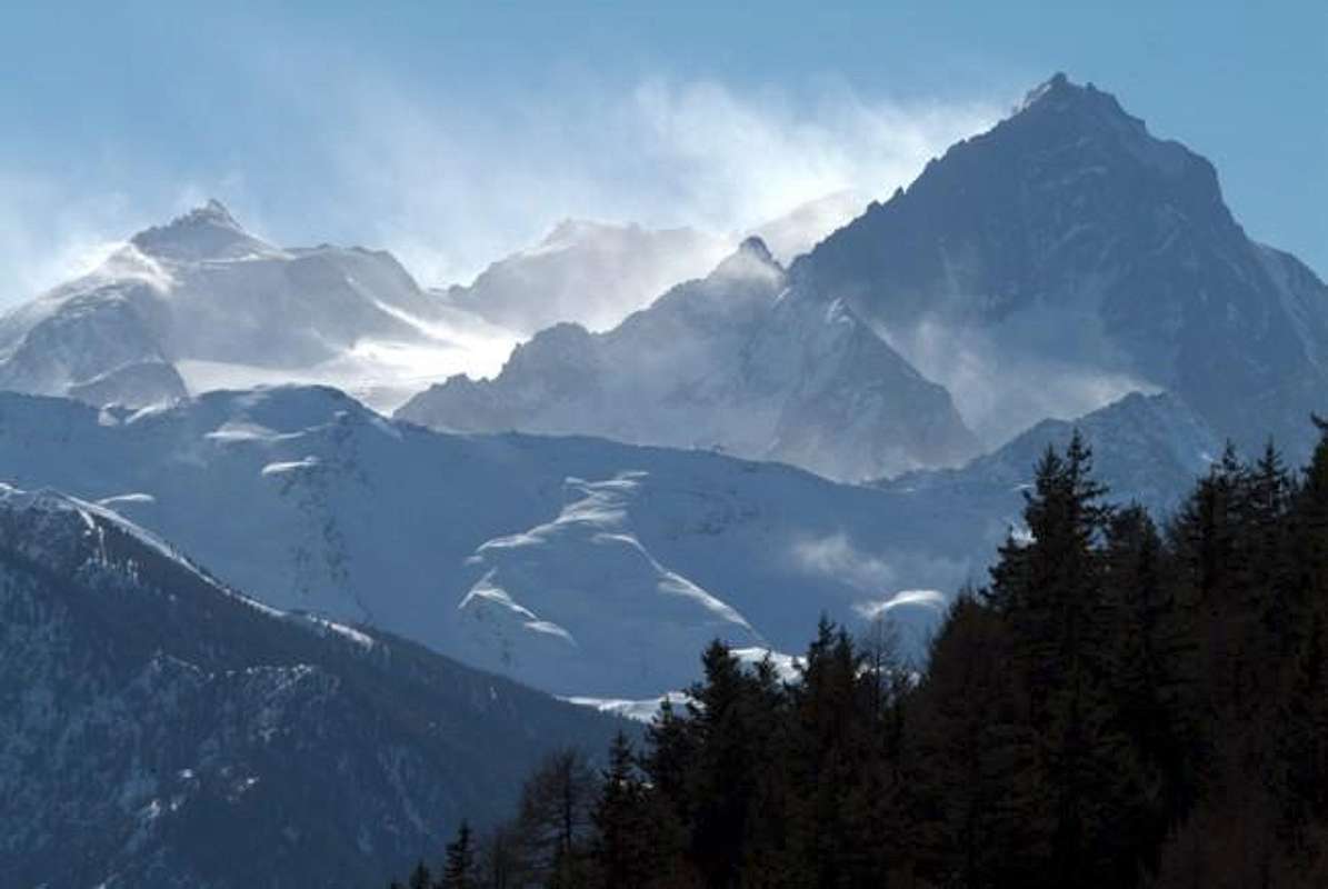
From "Granpa" to Mount Blanc Overview
It is also preferred to split this large area too, so as to include all the Orographic, Hydrographic or right of South Dora Baltea starting from Pont Saint Martin, the entrance to the Valley of Aosta, to finish at Veny Valley, at the foot Mount Blanc. This great extension should be noted incidentally already own with a first part consists of a large triangle with the two oblique Valleys Champorcher (to the East) and Cogne (West) at the sides, while the base is formed from the central axis of the Dora Baltea same. It is left to the first part or part A of this large area or to the treatment, while the Cogne Valley, and then from the Gran Paradiso National Park, were analyzed, progressing Westward, all the other valleys with its vallons to the Val Veny included. So from the Valley of Cogne transiting towards those of Savara, Rhêmes, Valgrisa, La Thuile with its large appendix addressed to the Colle del Piccolo San Bernardo and the final Val Veny that, through the terminal Seigne Hill, leads, like almost all previous, the Haute Tarentaise/Valdisère (to Les Mottets in Glaciers Vallon). Since the latter two, are on opposite borders, the look is directed more to the north where, with the Aiguille des Glaciers, is the starting the majestic Mont Blanc mountain chain that, still belongs to the Graians, describes a discourse in its own right in the history of mountains, before the start, from the Col du Grand Ferret, the Chain of the Pennine Alps. Instead, we want to draw a small profile of these valleys from the point of view of the objectives of their attendance, while also offering some advice/suggestion
 |
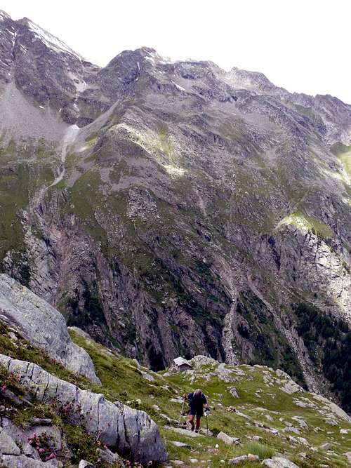
Valsavarenche: offers walking, hiking and some beautiful routes of glacial North Walls of Gran Paradiso, Ciarforon and Becca Monciair; Interesting rock in the South Wall of Becca Moncorvé (various routes), while the other climbs, although not always easy, have gone completely out of fashion. In general, the attendance of this valley is donated to climb along the Normal, the Gran Paradiso (recently more and more fashionable ski-mountaineering), starting from the two Shelters Vittorio Emanuele and the Chabod; fairly easy climb and close Tresenta, while the more distant Teeth Broglio have fallen into total oblivion. Regarding the walks, very often is reached Croix de la Roley (1h from Pont Valsavara) at the beginning of the long Nivolé Tableland; excursions between a classical (long and a little boring) is the achievement of the Col Lauzon or Lauzon starting from Eaux Rousses. The ancient Bioula is instead going by the wayside and the trail of "Re Toio" is going more and more into decay.
Rhêmes Valley: its appeal is addressed to the hiking and to ski-mountaineering; dangerous as interesting as its waterfall in the Eastern and low, as set out at sunrise. With regard to rock climbing, challenging the East Wall of the Granta Pari. But how many know it? Definitely reminds us Casimire Thérisod, strong local Mountain Guide, together with the pioneers who accompanied him, era "golden" classic alpinism. Something is located toward the back of the head with ridges and wall of Roc du Fond, but here is a track off every half-century and then is no longer repeated, such as those on the Great Eastern Wall of the Grande Rousse; down there at the bottom is much easier to meet rising groups in ski-mountaineering at the Calabre Summit, less towards the Galisia Top and some lone hiker to Basei Point. Wonderful trip to the Tsantelèina, hiding back there, now in full French territory; every time someone you meet him because, if it is not in good condition, it is not so easy. As the Great Traversière, a beautiful peak but too "elegant and secluded", remains in his solitude: it is easier to find people in the nearby Walloon of Bassac Déré that direct the hill with the Valgrisa, the sends a peek, maybe photographing. Moreover, a nice walk is the one to Truc Saint Hélène, over the next Hut Benevolo, maybe even reaching Tsanteleina Lake, at the foot of the East Wall of the Granta. Almost all the trips they take from the beginning of this retreat, because the underlying vallons are too wild.
 |
 |
 |
 |
 |
Valley of La Thuile: offers great classic climbs on the glacier, addressed 90% to the Head of the Rutor, Normal Route. Very little in rock climbing, except for the Northern (this way until 1970, a full ascent on ice) and Western Walls of the Great Assaly; interesting ways in ice on the North Becca du Lac and that of Mount Paramont, but the latter is already "off" from the valley itself and descends to the ups and seeds unknown walloons of Baltea. To enter into this basin, a little on its own, you must travel the Walloon des Ussellettes (Normal Route for the Paramont, Becca Bianca, Nera and Lachenal Planaval Pass) and get into it through a narrow slot between Paramont and Head of the Paramont, or with the Passo Alto (High Pass), but, in this case, the lap stretches and not a little. A third hill, the lowest, allows to reach, and always in this valley, starting from a single point of support or Deffeyes Shelter, a beautiful basin between Mount Colmet and Becca Pugnenta where you can admire the Pietra Rossa (Red Stone) Lake; here you can also come from the North, starting from Regional Road to San Carlo Hill (between Morgex and La Thuile), and through the passage at the underlying Arpy Lake, a true summer destination for passionate mountain mass and via an as wide as the dusty farm road.
Valleys of the Little St. Bernard and Lex Blanche in Val Veny: clearly marked walking and hiking, among which we distinguish those at Mount Valaisan (2.891m) and Léchaud Summit, on the border with France, while other tours are simpler and always well marked. Leaving La Thuile-Resort with the National Road to the Piccolo (almost parallel to the old road of Salassians and the Romans) you go to France. From this pass comes from the Tarentaise (the country of Tartarin de Tarasconne?) Air always cold, even in summer; a series of parallel walloons shall be directed to the North to the Berrio Blanc (3.252m), while a numerous "windows" offer stunning views on the Aiguille de Tré-la-Tete. Before reaching the Lake Verney, just below the hill, several departures indicate these valleys, where the latter leads, after the lakes Tormotta and Arguerey, the Léchaud Summit (3.127m). United hikers, but have good legs and equally will; instead requires the Berrio, both from the long Valleys Orgère/Chavannes, something more. On the left or South instead opens the ski resort of Les Suches, kingdom of skiers; but in summer it offers a nice hike to Bella Valletta with its fortifications and, still, you reach the Mount Valaisan where the view sweeps over the Land of France in the nearby Savoy. After passing Pré Saint Didier is reached Courmayeur. Do not panic at the sight of Mount Blanc, because we go somewhere else. Along the Dora of Veny, where does the Baltea, continue towards the Sanctuary of Notre Dame de la Guérison gradually penetrating into this valley to the Lake Combal; on the right, leaving the same and spiers, through the private road of the Walloon de la Lex Blanche, reach Elisabetta Soldini Refuge, not far from the Col de la Seigne. On the left of the dividing line between Mount Crammont (nice excursion from the Lower La Thuile Valley)/Head of Arp/Mounts Favre/Fortin/Percé/Mount and Punta Lechaud divides this valley. There are excursions that require some experience in choosing the path leading up to the Chavannes (2.603m) and Fortin Hills to enter the walloon of the same name and navigate to the Little St. Bernard. Further down, still in Val Veny, you can reach the Rifugio Monte Bianco short walk; wanting to convert the same into a trip you can go to the Hill and Lake Chécrouit or always from the shelter, climb the Mount Chétif (2.343m), a true watchtower on more than neighboring Mountain Chain Monte Bianco to Jorasses.
 |
Valsavarenche: offre passeggiate, escursioni ed alcune belle vie glaciali su Pareti Nord di Gran Paradiso, Ciarforon e Becca di Monciair; in roccia interessante la Parete Sud della Becca di Moncorvé (varie vie), mentre altre ascensioni, anche se non sempre facili, sono passate completamente di moda. In genere la frequentazione di questa valle é devoluta alla salita, lungo la Normale, del Gran Paradiso (recentemente sempre più di moda lo sci-alpinismo) con partenza dai due Rifugi del Vittorio Emanuele e dello Chabod; abbastanza salita la facile e vicina Tresenta, mentre i più lontani Denti del Broglio sono caduti nel totale oblio. Per quanto concerne le passeggiate, molto spesso viene raggiunta la Croix de la Roley (1h da Pont Valsavara) all'inizio del lungo Piano del Nivolé; tra le escursioni una classica (lunga ed un poco noiosa) é il raggiungimento del Col Loson o Lauzon partendo da Eaux Rousses. L'antica Bioula é invece andata nel dimenticatoio e la mulattiera del "Re Toio" sta andando sempre più in disfacimento.
 |
 |
 |
 |
 |
 |
 |
Val di Rhêmes: la sua attrattiva é rivolta all'escursionismo ed allo sci-alpinismo; tanto interessanti quanto pericolose le sue cascate nella parte Orientale e bassa, poiché esposte al levar del sole. Per quanto concerne l'arrampicata in roccia, impegnativa la Parete Est della Granta Parei. Ma in quanti la conoscono? Sicuramente ci riporta in mente la forte Guida locale Casemire Thérisod ed i pionieri che l'accompagnavano nell'epoca "d'oro" dell'alpinismo classico. Qualcosa si trova verso il fondo della testata con creste e parete del Roc du Fond, ma anche qui si traccia una via ogni mezzo secolo e poi non vien più ripetuta, come quelle sulla grande Parete Orientale della Grande Rousse; laggiù in fondo é molto più facile incontrare comitive che salgono in sci alpinismo verso la Calabre, meno verso la Galisia e qualche solitario escursionista alla Basei. Splendida la gita alla Tsantelèina, che si nasconde là dietro, ormai in completo territorio francese; ogni tanto qualcuno l'incontri anche perché, se non é in buone condizioni, non é così facile. In quanto alla Grande Traversière, una bella vetta ma troppo "signorilmente appartata", rimane nella sua solitudine: é più facile trovar gente nel vicino Vallone del Bassac Déré che, diretta al colle con la Valgrisa, le manda una sbirciata, magari fotografandola. Inoltre, una bella passeggiata é quella al Truc Saint Hélène, sopra il vicino Rifugio Benevolo, raggiungendo anche il Lago Tsantèleina ammirando la Est della Granta Parei. Quasi tutte le gite son rivolte alla testa della valle prendendo inizio da questo rifugio, anche perché i sottostanti valloni son troppo selvaggi ed alcuni al limite della percorrenza, forse più per cacciatori esperti che non per escursionisti.
Valgrisenche: può essere considerata, per antonomasia, la Valle dello sci-alpinismo ed anche, purtroppo, dell'eli-ski. Qualcosa di interessante sulle Pareti Nord della Grande Rousse e della Grande Sassière, ma la roccia alquanto rotta espone a pericoli oggettivi, mentre su quest'ultima la "Via del Seracco" sta progressivamente scomparendo. Anche qui il punto d'appoggio base é il Rifugio Bezzi nella parte medio-alta della vallata, mentre lo Chalet de l'Epéé è rivolto allo sci-alpinismo con la Rabuigne ed a qualche sparuto gruppo di collezionisti di cime tanto simpatiche quanto quasi del tutto sconosciute. Altri percorrono valloni solitari che solo i veri amanti della montagna sanno apprezzare (Punte della Luetta e di Felumma, Becca di Pré Damon e They), ma sul versante opposto la traversata Ormelune-Archeboc torna di moda, almeno nello sci-alpinismo, il Vallone di San Grato con il suo magnifico lago é meta degli escursionisti e la gita all'Arp Vieille é dedicata anche agli appassionati delle racchette da neve. In fondo valle i pescatori amano il Lac du Fond, sotto il Passo di Planaval, e gli amatori del rozzo-selvatico (pochi in verità) van ad eplorar la costiera che sale dal Monte Colombo (bella passeggiata) alle Faveroy, Torre Tonda e del Tighet o, meglio, du Tignet, Bec Taillà e Crosatie dove, in discesa, si ricongiungono ai pescatori.
Valle di La Thuile: propone grandi salite classiche su ghiacciaio, rivolte al 90% alla Testa del Rutor, Via Normale. Veramente poco in arrampicata su roccia, tranne le Pareti Nord (questa fino al 1970 una via interamente su ghiaccio) ed Ovest della Grande Assaly; interessanti vie in ghiaccio sulla Nord della Becca du Lac e su quella del Mont Paramont, ma quest'ultima é già "fuori" dalla valle vera e propria e scende verso gli alti e semi sconosciuti valloni della Dora Baltea. Per entrare in questo bacino, un poco a se stante, si deve percorrere il Vallone des Ussellettes (Via Normale per il Paramont, Becca Bianca, Nera, Lachenal e Passo di Planaval) e scendere in esso tramite uno stretto intaglio tra Paramont e Testa del Paramont, oppure con il Passo Alto, ma, in questo caso, il giro si allunga e di non poco. Un terzo colle, il più basso, permette di raggiungere, sempre in questo vallone e partendo dallo unico punto di appoggio o Rifugio Deffeyes, uno splendido bacino tra il Mont Colmet e la Becca Pugnenta dove si ammira il Lago di Pietra Rossa; qui si può giungere anche da Settentrione partendo dalla Strada Regionale del Colle San Carlo (tra Morgex e La Thuile) e tramite il passaggio presso il sottostante Lago d'Arpy, vera meta estiva per la massa appassionata di montagna e tramite una tanto larga quanto polverosa strada poderale.
Valloni del Piccolo San Bernardo e della Lex Blanche in Val Veny: chiaramente indicati per passeggiate-escursioni, tra le quali distinguonsi quelle al Mont Valaisan (2.891 m) ed alla Punta Léchaud, ai confini con la Francia, mentre altre son più semplici e sempre ben segnalate. Abbandonando La Thuile con la Strada Nazionale pel Piccolo (quasi parallela all'antica strada dei Salassi e dei Romani) si va verso la Francia. Da questo valico arriva dalla Tarentaise (il paese di Tartarin de Tarasconne?) un'aria sempre gelida, anche in pien estate; una serie di valloni paralleli s'indirizza a Nord verso il Berrio Blanc (3.252 m), mentre varie "finestre" offrono splendide viste sull'Aiguille de Tré-la-Tete. Prima di raggiungere il Lago Verney, subito sotto il colle, varie partenze indicano questi valloni, dove l'ultimo conduce, dopo i Laghi della Tormotta e di Arguerey, alla Léchaud (3.127 m). Regno degli escursionisti, ma in possesso di buone gambe ed altrettanta volontà; il Berrio invece richiede, sia dal Vallone di Orgère che da quello di Chavavannes, qualcosa in più. Sulla sinistra o Sud si apre invece il comprensorio sciistico di Les Suches, regno degli sciatori; ma in estate offre una bella escursione a Bella Valletta con le sue fortificazioni e, continuando, si raggiunge il Mont Valaisan ove la vista spazia sulla Terra di Francia estendendosi sulla vicina Savoia. Oltrepassato il Comune di Pré Saint Didier si raggiunge Cormayeur. Non spaventatevi alla vista del Bianco, perché noi andiamo da un'altra parte. Costeggiando la Dora di Veny, dove nasce la Dora Baltea, proseguiamo verso il Santuario di Notre Dame de la Guérison addentrandoci progressivamente verso questa valle fino al Lac Combal; lasciando sulla destra il medesimo e le sue guglie, sulla strada poderale del Vallone de la Lex Blanche raggiungiamo il Rifugio Elisabetta-Soldini, non molto distante dal Col de la Seigne, presso le Pyramides Calcaires. Sulla sinistra lo spartiacque tra il Mont Crammont (bella escursione all'imbocco della Valle di La Thuile)/Testa d'Arp/Mont Favre/Mont Fortin/Mont Percé/Mont e Punta Léchaud divide da questa valle. Sono escursioni che richiedon una certa capacità ed esperienza nel scegliere il percorso portando al Fortin ed al Col des Chavannes (2.603 m) per accedere al vallone omonimo e traversare al Piccolo San Bernardo o scendere in Pont Serrand/La Thuile. Più in basso, ancora in Val Veny, si può raggiungere il Rifugio Monte Bianco con breve passeggiata; volendo tramutare la medesima in un'escursione si può proseguire verso il Colle Chécrouit e Lago oppure, sempre dal rifugio, salire al Mont Chétif (2.343 m), vera torre di guardia sulla più che vicina Catena del Monte Bianco insino alle Jorasses.
 |
 |
 |
 |
 |
Getting There
BY CAR:
- From TORINO, MILANO, etc: Motorway A5. Exit at IVREA or Quincinetto (PIEDMONT) AOSTA West/Aymavilles, Villeneuve, Arvier, Morgex, Pré Saint Didier, Courmayeur Municipalities. From Aymavilles (646m) towards Cogne Valley: Vieyes (1.132m), Gontier private Shelter, through path in Nomenon wild Valley. To Cogne (1.534m); through Main Road. To Valnontey (1.678m); Money, Martinotti, Borghi, Pol, Gerard-Grappein, Leonessa, Balzola, Gratton (this last from Epinel or Crétaz) Bivouacs, through paths, moraines and glacier, & Sella Refuge, through muletrack). From Lillaz Fraction (1.607m) to Sogno di Berdzé & Antoldi-Malvezzi Refuges, by dirt road, muletrack or paths in Urtier and Valeille Vallon. To Gimillan Village (1.785m), Nebbia Bivouac, with path in Arpisson Vallon. All the three last through Regional Roads from Cogne. From Villeneuve (670m) to Savarenche Valley, Dégioz-Valsavarenche (1.541m) up to the Pont Valsavarenche (1.946m). Chabod, Vittorio Emanuele, Savoia & Città di Chivasso Refuges through muletracks and Sberna Bivouac, through path, moraines and glaciers. From Villeneuve (670m) to Rhêmes Valley, Introd (880m), Rhêmes Saint Georges (1.171m), Notre Dame (1.725m), through Main Road, up to the Thumel Village (1.887m) with Municipal Road and Benevolo Refuge (2.280m), through dirt farms road or path. From Arvier (776m)-Liverogne (730m) to Valgrisenche Valley up to the Valgrisenche Municupality (1.664m) and Mondanges, Surier, Us(s)eliéres Villages, through Regional Road. Bezzi & Chalet de l'Epée Refuges through paths. From Pré Saint Didier (1.010m) to La Thuile Valley (La Thuile Commune, 1.441m) & Little Saint Bernard Walloon towards the Little Saint Bernard Hill (2.188m), through State Road. Deffeyes Refuge with muletrack from La Joux Fraction. From Courmayeur to Veny Valley, through Regional Road. Monte Bianco & Elisabetta-Soldini Refuges through dirt road.
- From FRANCE: through the Mont Blanc Tunnel to Entrèves-crossroads to Vény/Ferret Valleys - Mountain Guides of Courmayeur - La Saxe Rock Gym - Courmayeur. By Little Saint Bernard Hill, closed since November until half May to La Thuile Valley - Pré Saint Didier - Courmayeur. It is not necessary to take Motorway A5: you can drive on SS.26, in the direction of AOSTA - IVREA - TURIN.
BY PLANE:
- Aeroporto "Corrado Gex" Saint Christophe (Aosta).
Cogne Valley & GRAN PARADISO
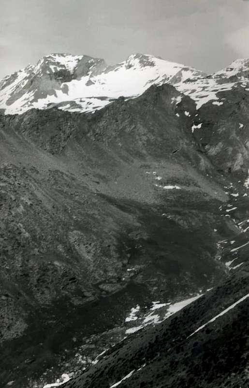
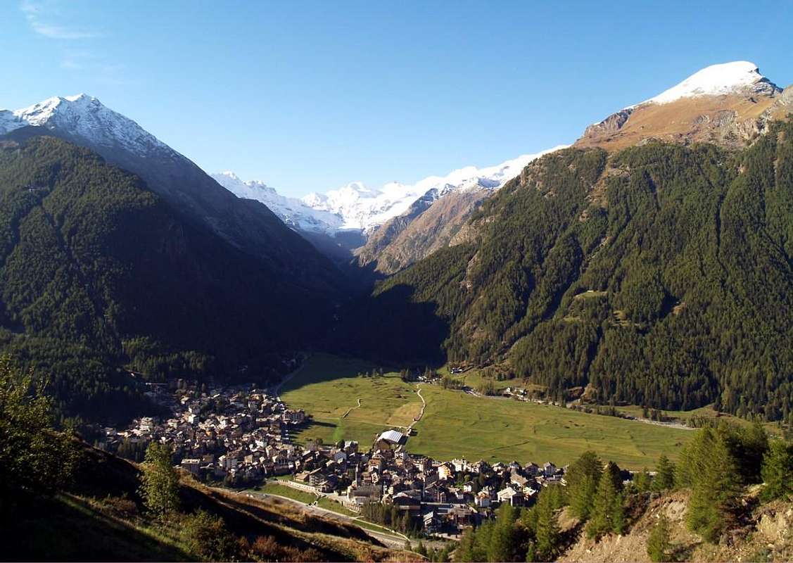
The Valley of Cogne, for its length and breadth, deserves a separate chapter. From the Centra Valley of the Dora, at Aymavilles (640m), stretches towards the hamlet of Southeast reaching Vieyes (1.139m) and subsequently those of Epinel (1.430m) and Crétaz (1.494m) , which belong to Cogne (1.531/45m). It opens like a big tree with the stem consists in this long stretch of the regional road that runs to the left, nearly above, the Torrent Grand'Eyvia (Great Water) and the various small valleys which constitute its ramifications. In the East end with the powerful Urtier Valley that with Pontonnet Hill and Fenetre de Champorcher and join it to the Champorcher Valley, the first through the connection of the Fénis Hill very close "ties" with the Vallon Fénis-Clavalité-High Comba Tersiva. To the North is the great Valley of Grauson, valley in the valley, which leads to the left to the Lakes of Lussert and the Group of Mount Emilius, while to the right divides the Valley of Tessonet-Doreire towards Point Tersiva. All other valleys are addressed in parallel with each other and with almost all glaciers, to the Piedmont, to the West opens the Valley of the Lauson also Lauzon, followed by other minor, including the Appendices of the Gran Paradiso and the Northern Group of The Grivola. The transverse arrangement of this valley than the other side also makes it presents particular meteorological conditions, is a classic for local climbers, in case of bad weather, saying: " Let's see what happens in Cogne ... ". Very often you will find a day with blue sky where the sun shines almost an island between the sea of clouds that around like a pincer the other nearby valleys.
 |
|
- VALLEYS & VALLONS In order to deploy clockwise into Cogne Valley & Gran Paradiso
1) - from Lillaz (1627m), Low Goilles (1.831m) Hamlet, Cret Chapel (2.024m; remains ancient alp) with paths, Tsavanis (2.293m), Manda (2.374m) Pastures, Refuge Sogno di Berdzé (2.531m), near Peradzà Alp (2.546m), with farms dirt road;
2) - to Fenetre de Champorcher (2.826m) and Refuge, Sanctuary Madonna della Neve (famous procession in August 05th), Shelter and Lake Miserin (2.582m, 2.578m), with paths.
Invergneux or Hevergnes small Valley: in North from Tsavanis Alp
1) - fork bridge 2.360 meters, Pianas Alp, fork 2.507 metres, Invergneux Alp (2.524m), with dirt road, and to Pass (2.902m);
2) - descent to Lochs Doreire (Upper 2.844m, West 2.829m, Middle 2.774m, Low 2.734m) in Doreire-Grauson Valleys to Rrvillères-Grauson Vieux-Pila Alp-Ecloseur Alps and Gimillan Hamlet, with various paths.
3) - In Northeast Serra Madou Ridge through traces and easy small rocks, descent and traverse on Tessonet Glacier (dangerous for "verglass" and rocks falling from West-northwest Wall), Tersiva Collar and Point, through Western Slope and North-northwest Crest, with traces or snowfields with frames at beginning of season.
Ponton Vallon:
1) - in Northeast from fork 2.507 meters, Baita Hunters Orlando (2.641m), near Ponton (2.631m) Alp, Loch (2.600m), Pontonnet Lakes (2.808m, 2.816m) to Pontonnet (2.897m), Fénis (2.857m) Hills; in South to
2) - Ponton Tower (3.101m), traces-small rocks on North Slope.
Bassa di Peradzà Vallon: from Refuge Sogno di Berdzé to Souh-southeast, Bassa di Peradzà and topographic important Saddle 2.946 meters, between Cima di Peradzà (3.021m), Bec Costazza (3.092m), through traces on moraine and snowfields and rocky and easy small crests to both.
Nouva Vallon:
1) - from Refuge (or variant from Broillot Alp) in Southwest or Southeast to Cote Gratton and Arietta Pass (2.947m), with paths, minerals transport old muletrack, traces, snowfields and small rocks in final part (little bell on pass); from thys in Southwest to
2) - Testa of Arietta (2.988m), through Northeast easy Crest with blocks. In East-southeast descent traverse to
3) - San Besso Vallon-Campiglia Soana Valleys (ancient renowned procession to San Besso Sanctuary in August, 10th) in Piedmont, with exposed path in upper part below Testa of Nouva. Miserino(i) Vallon: from Lillaz, Tsavanis Pasture, fork 2.363 meters, and in Southeast Broillot (2.399m) Pasture, with dirt road, Miserino splendid Lakes (Eastern 2.664m, Western 2.665m), with path, to Miserino Pass (2.842m) through traces into debris, moraine, blocks and snowfield in final part.
Acque Rosse Vallon: from Lillaz, Broillot Pasture, in South, pond 2.549 meters, Acque Rosse mini Lochs (2.655m, 2.660m) to Acque Rosse Pass (2.947m) below Lavina Tower, with path, remnants of the old mule to transport ore and traces amongst snowfields, blockfields in terminal part.
Bardoney Vallon: from Lillaz, Low Goilles Pasture (1.831m), in Southeast to P.N.G.P. Cabine and
1) - in South to Bardoney Alp (2.245m) and Pass (2.833m), with path;
2) - in West from fork 2.216 meters to Arolla Pass (2.915m), with path.
3) - in East from P.N.G.P. Cabine Loie Lake, with path.
Loie Vallon:
1) - from Lillaz-Querttatset, Loie Alp (2.217m), Loie bautiful Lake (2.346m), with path; in East
2) - Connection P.N.G.P. Cabine (2.156m) to Bardoney Vallon.
3) - possibility of continuation, through the High Route, up to Rifugio Sogno di Berdzé (Dream of the Shepherd).
 |
 |
Bouc-Lavanche small Valleys: hazardous, not viable because the vegetation has covered almost all the old paths. Shortcut not advisable.
Valeille Vallon and branchs: from Lillaz fork 1.699 meters near Tséleret Pasture, alternative 1.910 meters, near Valeille Alp (1.902m):
2) - in South Antoldi-Malvezzi Bivouac, path, traces on moraines, to various montaineering passes through Valeille Glacier (from East to West: Northern, Southern Sengie, Northeast, Southwest Valeille, Scatiglion, Ondezana or Teleccio, G. San Pietro Saddle 3.558 meters, S. Andrea Saddle 3.574 meters, Paganini, Coupé de Money Passes).
Valeille Western secondaries valleys and following crossings to various small valleys on Valnontey-Cogne:
1/a) - Gran San Pietro Vallon from path n° 15 in altitude about 2.125/50 meters in West before pathless along small torrent, after through more steep moraines to Patrì Pass (3.359m), between Northern Patrì Summit/Cissetta Point; difficult descent to
2) - Comba Couteleina-Valnontey, through Patrì Glacier, moraines and from altitude 2.234 meters path n°22C/TVC.
1/b) - From a rocky narrowing in altitude about 2.950 meters in Northwest through moraine, Cissetta Glacier and steep rocks to Valletta Pass (3.251m); descent on
3) - Valletta Glacier in Comba Valletta.
4) - Cis(s)ettaz Vallon from path n° 15 in altitude about 1.950/84 meters in West before without path on moraines to two Valletta Summits (3.352m, 3.315m; small rocks in final part); descent on easy North Crest to Vermiana Pass (3.090m), below Vermiana Summit (3.202m).
5) - Gran Val from path n° 15 in altitude about 1.925/30 meters in West, pathless, on moraines to Vermiana Pass; descent to
6) - Valletta Comba.
7) - Maquenille Vallon from path n° 15 in altitude about 1.870/80 meters in West pathless along torrent, after on moraines to Vermiana Summit.
8/a) - Fenilia/Vigeusaz Vallon from path n°15 in altitude about 1.840/50 meters in West unnumbered small path along small torrent to Fenilia Alpage (2.267m); more in Southwest along torrent and through moraines to Grandzetta Pass (2.926m); descent to
9) - Grandzetta Vallon-Valnontey, with traces, path n° 22.
8) - from Lillaz (1.627m) in South-southwest, path n° 16 to altitude about 2.220/30 meters, below Croux de Montseuc, after more in Southwest, unnumbered path, doubling South Vigeusaz Summit (2.694m), to Fenilia Summit (+; 3.053m; easy rocks). Variant: from Cogne in Southeast, path n° 17, to
8c) - Belvedere (2.064/81m), below Montseuc, Grand Crot Alp, fork/path n°16 from Lillaz Hamlet.
Valnontey long Valley: from Valnontey (1.674m; parking and restaurant) in South
1) - alternative 1.687m, in Southeast Grèndzetta Alp (2.144m) to Plan de la Tornetta (2.467m), with path, into Grandzetta Vallon.
2) - From alternative, Verné Alp (1.721m), Vermiana Village (1.729m) and in Southeast Valletta Alp (2.090m), with path, on Valletta Comba to unnamed loch 2.868m, Vermiana Pass (3.090m), without path and small traces.
3) - From fork 1.800 meters to alternative 2.340 meters before Money Alp (2.334m) on Comba Couteleina, with path;
4) - from fork 2.340 meters in Southeast Money Bivouac (2.872m) on Coupé of Money Vallon, with path equipped and exposed in final part. From bivouac in East to
5) - Coupé de Money Pass (3.383m), with steep moraine and North side of Money Glacier, easy but not crossed into the Vallon below Valeille.
6) - From Vermiana Eurfalets small Bridge up Valnontey Torrent (1.826m), in Southeast Bivouac Alessandro Martinotti (2.588m; below Roccia Viva West Face), in South Bivouac Stefano Borghi (2.684m; below North Wall Becca of Gay-Grand Croux Point);
7) - in South-southwest Bivouacs Carlo Pol and Marcello Gérard-Ettore Grappein (3.183m, 3.200m; at beginning of Tribulation Glacier to Ceresole Point-Roc-Gran and Little Paradiso).
8) - In West Bivouac brothers Lionello and Lucio Leonessa (2.910m; below Herbetet Point-Becca of Montandayné) into Herbetet Vallon, with various paths. * NOTE: over all these routes crossing dangerous glaciers; require skills, experience, area knowledge, adequate equipment and training.
Lauson or Los(z)on Valley: from Valnontey, bridge up Valnontey Torrent, Paradisia Botanic Garden (1.704m) near Tsantelet Hotel, waterfall, Grand Lauson Pastures (2.506m), Refuge Vittorio Sella (2.579m), near P.N.G.P. Cabine, with High Via n° 2 muletrack. From this
1) - long crossing in South to Grand Vallon, Herbetet Vallon, Herbetet Alp (2.441m), near P.N.G.P. Cabine and descent to les Cheseres Alp, head of Valnontey, with path.
2) - in West Lauson Pass (3.296m), through Haute Route n° 2 muletrack.
3) - before in North, with path, after in West, without, Rayes Noires Pass (3.421m);
4) - in North Nera Pass (3.509m), without.
5) - In North-northeast Rossa Pass (3.190m) to Pousset Pass (3.201m), near Bivouac Gratton;
6) - return to South to Punta Rossa of Grivola (3.625m), through easy and debris (snowfields possibility) North-northeast Ridge.
 |
1) - from Crétaz Village (1.494m) in South Ronc Alp (1.663m), Low and Upper Les Ors (1.944m, 2.052m), Low and Upper Pousset Pastures (2.176m, 2.520m), fork about 2.700 meters, Bivouac Damiano Gratton (3.198m), near Pousset Pass (3.201m), with path.
2) - in Northwest Pousset Point (3.045m) through path on Southeast slope and easy rocks on South Crest in final part.
3) - From Epinel Village, bridge up Grand'Eyvia Torrent (1.417m) in Southeast fork near Pianes Alp (1694m), Great Wood, Eyfiè Alp to Low Pousset and same previous routes, with paths.
Trajo or Trayo also Tradzo Vallon:
1) - from Epinel bridge same route to Pianes Alp, and in Southwest Trayo Pasture (2.035m), P.N.G.P. Cabine (2.155m) to Trayo Pass (2.873m); descent to
2) - Bivouac Gontier (2.310m), near P.N.G.P. Cabine and Alp in Nomenon Vallon, with paths.
Nomenon wild Valley: from Vieyes (1.158m) in South Plan Pessey Hamlet (1.382m), Petit Nomenon Alp (1.986m), Mario Gontier Bivouac, near Grand Nomenon Alp (2.323m), with path, in Southeast to
1) - Trayo Pass, with path;
2) - in Southwest Belleface Pass (3.095m), between Grivola (3.969m) and Grand Nomenon (3.488m), with small path-traces on moraine. In West to
3) - Charbonnière Pass (2.916m), morainic-traces and debris.
Ozein Conca-de la Pierre Vallon: from Dailleuy Village (1.480m) in Southeast Titeun, Rompérein Pastures (1.760m, 1.867m), Champchenille, la Pierre Alps (2.212m, 2.119m) with two possibilities to
1) - Point de la Pierre (2.653m), classic ski-mountaineering;
2) - de la Pierre Hill (2.584m), paths.
Northern Valleys of Grand'Eivya: from Epinel (1.430m) in Northwest, Tavaillon (2.013m), Pian di Sèutse (2.198m) Alps to Drinc Pass (2.565m). From thys crossing to:
1) - in Northwest Drinc Point (2.663m), de la Pierre Pass and Point (2.653m);
2) - in Southeast Couis Point (2.660/1m; Arno Bivouac, always open), Piatta di Grevon, Montpers Point, Tsa Sètse Point and Hill (2.815m) to Point of the Valletta (3.090m), by Via Ferrata.
Southern Arpisson Vallon: from Gimillan-upper parking (1.814m), Teppe Plan (1.923m) little Hamlet, with farms road, Arpisson Pasture (2.328m), fork 2.430 meters and
1) - in Northwest Tsa Sètse Vallon to namesake Hill (2.815m), with various paths;
2) - in North Plan Bessey Tableland (2.500m), Franco Nebbia Bivouac (2.741m; water immediately to North), Garin Hill (2.815m) and descent to Arbolle Valley, two lochs and Refuge (2.516m), with paths. In over to Northeast Garin Lake (2.854m), with small path-traces, below West Face of Peak Garin (3.461m).
Grauson-Chaz Fleurie Vallon: from Gimillan-small bridge Tarabouc, Révènti, Ecloseur brige and Pastures (1.903m), Pila Alp, Waterfall (2.021m), Créuzet Alp (2.244m), Grauson Vieux (2.273m); by small bridge up Lussert Torrent to very wild valley, below Southeast Face of Pic Garin.
Grauson-Lussert Vallon: from Grauson Vieux Village, fork 2.390 meters, Hunters House (2.479m; private), Upper Grauson Pasture (2.540m), fork 2.580 meters up Tsezéire Torrent to
1) - four Lussert Lakes (2.713m, 2.790m, 2.906m, 2.923m, the last in South), Laures Pass (3.035m); descent to Laures Vallon, three Laures Lakes, Ménabreaz Shelter (2.546m), with paths.
2) - From Low Lake in East-northeast Vallonet Pass (3.062m), Mount Vallonet (3.101m) by debris traces;
3) - in Northeast Leppe Point (3.306m), from pass through easy South-southeast Crest to three Summits.
Grauson-Corona Vallon: from Low Grauson Vieux, fork 2.390 meters, to fork before Grauson Upper or Nuove Pasture; in Northeast Lake Corona (2.702m), Saint Marcel or Corona's Hill (2.913m) and descent to Grande Chaux Unting House (2.370m) in Saint Marcel Valley, with paths.
Grauson-Doreire Vallon: from
1) - in East fork 2.390 meters to Pralognan (2.416m), Ervillères (2.515m) Pastures, four Doreire Lochs (2.734m, 2.774m, 2.829m, 2.844m), Invergneux or Hevergnes Hill (2.912m) and descent to Hevergnes Alp in Urtier Valley, with various paths.
Grauson-Money Vallon: from Grauson Vieux in Southeast Money Lake (2.550m), with path, Mount Creya (3.015m), small path and traces.
 |
La Valle di Cogne, per la sua lunghezza e vastità, merita un capitolo a se stante. Dalla Valle della Dora, presso Aymavilles (640 m), si allunga verso Sudest raggiunngendo la Frazione di Vieyes (1.139 m) e successivamente quelle di Epinel (1.430 m) e Crétaz (1.494 m), appartenenti a Cogne (1.531/45 m). S'apre a guisa di grand albero con il fusto consistente in questo lungo tratto della strada regionale che scorre a fianco, quasi sopra, il Torrent Grand'Eyvia (Grande Acqua) e le varie vallate che costituiscono le sue ramificazioni. Termina ad Oriente con il potente Vallone dell'Urtier che con i Colli Pontonnet e Fenetre de Champorcher la uniscono alla Valle di Champorcher; il primo tramite l'allacciamento del vicinissimo Colle di Fénis "lega" con il Vallone di Fénis-Clavalité-Alta Comba Tersiva. A Settentrione s' apre il grande Vallone del Grauson, valle nella valle, che porta a sinistra verso i Laghi del Lussert ed il Gruppo del Monte Emilius, mentre a destra si biforca inoltrandosi nel Vallone del Tessonet-Doreire verso la Punta Tersiva. Tutti gli altri valloni son rivolti, in parallelo tra di loro e quasi tutti con ghiacciai, verso il Piemonte; verso Occidente si apre il Vallone del Lauson o Loson, seguito da altri minori, tra le Appendici Settentrionali del Gran Paradiso ed il Gruppo della Grivola. La disposizione trasversale di questa valle rispetto alle altre fa sì che anche dal lato metereologico essa presenti particolari condizioni; é un classico per gli alpinisti locali, in caso di cattivo tempo, il dire: "Andiam a vedere cosa succede in Cogne ...". Molto spesso trovi una giornata con cielo azzurro ove splende il sole, quasi un'isola tra il mare di nuvole che attenagliano le altre viciniori valli.
From the Gran Paradiso Valli and Vallons "fade" to the West
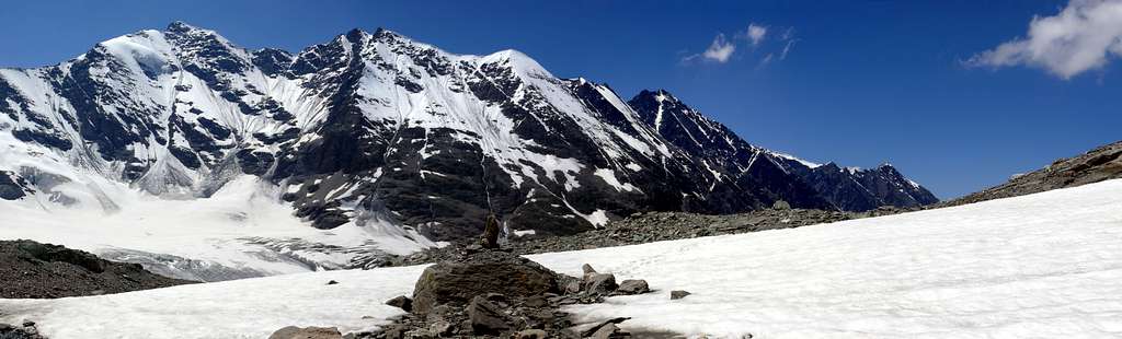
From the Gran Paradiso, only peak in Aosta Valley completely Italian above 4.000 meters, the ridge dividing the Piedmont turns to the Southwest with the summits of Becca Moncorvé, Tresenta, Ciarforon, Becca Monciair and Denti (Jags) of Broglio also Breuil, then falls above the Grand Etret Pass, large glacial window between Pont Valsavarenche and Pont Canavese, and rises again to Mare Percia and the adjacent Point Fourà. From this a long buttress divides the Vallon of Seyva from Nivolé(t) Tableland, the plateau largest in Europe with its eleven Kilometers of grasslands, to finish the eponymous hill near the Refuges Savoia and Chivasso. Here comes Ceresole Reale from a paved road that would have to reach inside the Pont Savara P.N.G.P., but was interrupted and there remain only the dismal track to deface the environment. They say that the inhabitants of this area are all from Pont Canavese, through these hills and valleys. In fact they are a bit special in Aosta Valley ...
 |
- VALLEYS & VALLONS In order to deploy clockwise from the "Granpa" into Valsavarenche/Rhêmes Valleys up to the Becca of Tos Subgroup & Internal Areas
from the alternative before Rovenaud (1.462m), Cabine P.N.G.P. near Maisoncle (1.861m) to Charbonnière Pass (2.916m).
Bocconere Vallon:
from Valsavarenche-Dégioz, Bocconere near Cabine P.N.G.P. (2.104m), Bocconere Upper (2.276m) to Belleface Hill (3.095m).
Leviona(z) Vallon:
1) - from Dégioz-Nex (1.665m) road, Low Leviona(z) near Cabin P.N.G.P. (2.285m), Middle and Upper Leviona (2.646m) Alps to
2) - Lauson or Loson also Lozon Hill (3.296m);
3) - to Western and Eastern Grand Neyron (3.252m) Passes, small paths-traces on moraines;
4) - from this last in East on Montayndainé Vallon to Bivouac Renzo and Sebastiano Sberna (3.401m), through moraines on Herbetet West Crest.
Enfer Vallon: from Upper Levionaz Alp in East to Leviona also Enfer Pass (3.323m), through traces on moraines near Leviona Northern Torrent.
Timorion Vallon:
from Upper Alp in Southeast to Grand Serra or Sertz Pass (3.368m), through traces on moraine along Souhtern Leviona Torrent.
Money Vallon: from parking near Low Praviou (1.829m), Lavassey Pastures (2.194m) to
1) - Montandayné Alp (2.463m) Passage du Grand Neyron, traces on moraine;
2) - Refuge Federico and Renato Chabod (2.710m) with crossing to South at Refuges Vittorio Emanuele II° (2.734m), good path.
1) - Grand Paradis Pass (3.335m);
2) - Montcorvé Pass (3.299m);
3) - Ciarforon Pass (3.317m), through traces on moraines, glaciers.
Montcorvé Vallon: from Pont-Breuil to Dzé Alp (2.424m), unnamed lake 2.830 meters to Ciarforon or Monciair Pass (3.298m), moraines, glacier.
Sei(y)va Vallon: from camping in West of Savara Torrent to Grand Etret Pasture (2.178m), Glacier, Western, Eastern Passes (3.172m, 3.139m).
Grand Collet Vallon: from alternative near alp (1.991m) before to South to Seyvaz Alp (2.364m), after in Southwest to Gran Collet Hill (2.832m).
Nivolé Tableland:
1) - from Pont-camping to la Roley Cross (2.313m), Nivolé Tableland and Alp (2.407m), Refuges Savoia (2.610m) and Chivasso (2.600m) nearby Nivolé Lochs, Hill (2.600/12m). From two Refuges in Northwest Basei Hill (3.160m), with path; from this
2) - in South Basei Point (3.383m), through easy North Crest and small rocky castle in final part (I°+/II°-; exposed to South and delicate with snow; rope required).
3) - in North on edge Nivoletta(z) Pass (3.130m) and possibility of easy traverse to Nivolettaz South and North Points (3.163m, 3.209m), Little and Great Vaudala (3.250m, 3.272m), Rosset Point and Hill, Leynir South and North Points (3.100m, 3.023m, 3.225m, 3.238m) and return to Southeast amongst various Chavaney, Rosset, Leità Lakes (2.846m, 2.703m, 2.701m) on splendid Rosset Tableland. Beautiful ridge hike for experienced hikers (EE/A).
1) - in North near Trebecchi three Lochs, Leynir Pass, Taou or Tout Blanc (3.084m, 3.438m), with path and traces easily on Southwest Slope;
2) - descent to Rhêmes Valley, through Glacier, Vaudaletta Walloon. Beautiful Ski-Mountaineering crossings.
Aouillé Vallon:
1) - from Pont Roley Cross and in Northwest Teureun or Turin Alp (2.396m), Plan Borgno(z) Pasture and Lake (2.672m) on Borgno Tableland, with paths; from this in West Aouillé Glacier and Pass (3.314m), without, through moraine and glacier.
2) - Delicate descent in West by a small and steep icy gully (trail exposed to falling stones from L'Aouillé West-southwest Wall and South Crest), snowfields and moraine to
Vaudaletta(z) Vallon:
Hike in an untamed poorly attended; prior to the establishment of P.N.G.P. frequented by hunters and climbers rare.
Mèyes Vallon: from Pont in North Roley Cross, small bridge up Nivolé Torrent, Teureun, Aouillé Pastures (2.313m, 2.322m, 2.396m, 2.514m) to
1) - North Manteau Pass (2.789m) with path;
2) - in West from fork 2.590 meters to Pertcha Pass (3.148/52m), with path-traces, moraines below Meyes Glacier.
3) - From pass Entrelor Antesummit, Summit and short easy crossing to L'Aouillé Point (3.391m, 3.426m, 3.445m), with traces, small rocks.
 |
|
 |
 |
Entrelor Eastern Vallon:
1) - from Eaux Rousses Hotel-parking in Northwest to Rondzegou, Ploriond, Djouan Pastures (1.974m, 2.126m, 2.226m); from this in Southwest to
2) - three Djouan Lochs (2.507m, 2.516m) between Low/Upper Alps, Lake Noir (2.670m) to Entrelor Hill (3.007m), with path Haute Route n°2. From this
3) - to South easily on ridge Northern and Southern Percià Points, with traces, debris and small rocks at terminal;
4) - descent in Northwest to Western Entrelor Walloon-Rhêmes Valley, path. A classic Ski-Mountaineering trip, where dispute the Trophy Rollandoz.
Sort Eastern Vallon:
1) - from Low Lacs Alp (2.535m) with path-moraine to Sort Pass (2.970m);
2) - to Western Vallon-Rhemes Valley.
Bioula Vallon: from Valsavarenche-Dégioz Chef Lieu (parking 1.525m) to Fontaines, Woods Crottes and Flotta de Payel, Pavillon Royal Chasse near P.N.G.P. Cabine (2.168m); from this in Northwest through old muletrack to Lorguibet/Fourquin de Bioula Saddle to Bioula Point (3.413m).
Néquede-Ran Vallon: from regional road in altitude about 1.530 meters to Perrere and Grotta di Ran Alps (1.720m); from this to connection of Ran two Torrents (1.960m), after along Southern branch without path to Néquede Pass, better Carving (3.022m). Would not recommend crossing.
Chamoussière-Pontes Vallon: from Bois de Clin Village (1.392m) into very wild vallon not easily to Chamoussière Point (2.944m), without path.
Vou-Brenvey Vallons: from Molère Village (1.192m; Church 1.232m) or Fenille Village (1.304m) to West along the two torrents. Same remarks.
Arpilles-Mont Blanc Vallon: from Bioley (1.042m) in Rhemes Valley to South to Arpilles Alp-Gite d'étape E. Dayné (1.809m) in Savara Valley, in South, P.N.G.P. Cabine near Mont Blanc Hill (2.171m); from thys to North Mount Blanc (2.201m), to South Mount Paillasse (2.414 m) with good paths.
- Rhêmes Valley & surroundings
Sort Western Vallon:
1) - from Rhêmes Notre Dame-Bruil-parking to Pra del Bosco, P.N.G.P. Cabine (2.294m), fork about 2.000 meters below Sort Alp (2.448m), traces into moraine to Sort Pass (2.970m);
2) - from this in North Mount Roletta (3.385m), traces, remains of old hunting muletrack and small easy rocks in terminal part on South Crest and Southwest Slope. Descent in East with a sea of blocks-debris in the Eastern Sort Vallon.
Entrelor Western Vallon: from Bruil-parking to Chateau-Quelet, Entrelor Hamlet, Plan di Feyes Pastures (2.403m) Entrelor Hill (3.007m), paths.
Vaudaletta Vallon: from Thumel Village-parking (1.879m), small bridge up Vaudala Torrent, path in parallel with the Torrent and its great Waterfall, Vaudaletta Pasture (2.443m) near P.N.G.P. Cabine (2.480m), ascent-traverse along the bank of the North Vaudaletta Glacier to Leynir Pass; from this in North Taou Blanc, with path and traces easily on Southwest Slope. Ski-mountaineering route. Descent to
Loch Noir Vallon: Djouan Lakes and from this
1) - in Northeast Djouan Alp to Valsavarenche;
2) - in Southeast Manteau Pass, crossing on Meyes Vallon to Pont.
Gran Vaudala Vallon: from Thumel, alternative about 1.990 meters before Saint Pantaleon (2.010m) in Southeast to Grand Vaudala Pasture (2.338m), with path along the Torrent, and from altitude 2.592 meters in East (pond 2.773m in North) to Rosset Pass (3.023m), with path.
High Head Rhêmes Valley: from Benevolo Refuge in South-southeast Low and Upper Basei Pastures (2.309m, 2.412m) to Sources of Rhêmes Doire and Basei Pass, with path and traces in terminal part; from this
1) - in North Nivolettaz,
2) - in South Basei Points.
3) - Descent in East to Nivolé Tableland, with paths. All other valleys to South are covered with large glaciers and adapted exclusively for the Ski-Mountaineering or Climbing.
Comba de Golette: from Refuge Benevolo (2.280m) by small two bridges to Sauches Pasture (2.313m), Golette Lake (2.699m), Bassac Déré Pass (3.154m), with paths and snowfields; from this
1) - in South Quota 3.191, small saddle 3.158 meters to Becca of the Traversière (3.337m), through path-traces and easy small rocks in final part.
2) - Descent in Northwest before with traces, after path to Bezzi Shelter in
Grisenche Valley. Combassa Vallon: from Barmaverein Alpage (2.037m) in West-southwest, path n° 14, to
1) - Forest Rangers Bivouac (2.425m; private, source) and in West to Bassac Hill (3.154m); descent in West-northwest, path n° 12B, to
2) - Bezzi Refuge in Valgrisenche. From bivouac in Northwest, pathless and through moraines, to
3) - Truc Blanc Lake (3.139m), crossing the glacier, Truc Blanc Pass (3.241m); descent in West on
4) - Saint Martin Glacier, and through moraines with traces San Martino Lake (2.770m) and, with path n° 12A, to Bezzi Shelter (2.284m) in Valgrisenche.
 |
 |
 |
Fos Vallon: from Thumel, Fos Pasture (2.062m), with dirt road, and along Fos Torrent without path to Fos Glacier and upper Carving (3.294m).
Torrent Vallon:
1) - from Rhêmes to Torrent Pasture (2.170m) with path on Haute Route n° 2 steeply to Fenêtre de Torrent Pass (2.840m);
2) - descent in West in Epée Vallon to Epée Shelter, with path. From Refuge to
3) - Grisenche Valley, farms road to Arolla, Usellières Villages.
Cussunaz Vallon: from Chanavey (1.696m) path along torrent to Cussunaz Alp (2.260m); traces to point 2.369 meters, ascent on Cussunaz Pass (2.885m). Descent in West Bruille, Praz Londzet, Benevy Pastures (2.481m, 2.220m, 2.095m) to Beauregard Dam in Valgrisenche, with path.
Feleuma(z) Vallon: from Melignon Village (1.570m) to Champ Chevalé Alp, Feleumaz Pasture (2.245m) with path, after moraine to Feleumaz Pass (3.001m); descent in West to Plontaz Pasture (2.003m), traces and path and from this to Mondanges (1.652m) in Valgrisenche, path or dirt road.
Tz(s)aboc-Courthoud Vallon: from Courthoud (1.675m) in Southwest Upper Lor (1.915m) with dirt road, alternative about 2.200 meters before Feleumaz Pasture and in Northwest altitude 2.305 meters to Courthoud Torrent (2.426m), with paths; from this point in West along the same to a small debris basin below the East Face of pass, with grassy, debris and moraine. Through a morainic cone climb to grassy and inclined ledges and two next couloirs (snow possibility) up to the rocky terminal part. Path more dangerous than difficult, it requires good experience and a sure-footed. In Southwest Tzaboc Point, through Northeast Crest with a passages of II°; exposed to Northeast, experience and rope required. Prochetty, Perarsaz, Chairry, Southern Balanche, Ligne, Northern Balanche and la
Guettaz Vallons: All these valleys perpendicular to the watershed between the Becca of the Luetta and Mount of the Ane take their name from their torrents, they have the characteristic of being very steep and dangerous, for which reason they are inadvisable if not in the path at low altitude and not always in every case. A connecting trail crosses from North to South all these valleys, cutting halfway average altitude of about 2.300 meters. A very ancient path connecting that allowed the passage, even with mules, between the Communities of Arvier, Introd and the above hill with the first fraction at the entrance of Valgrisenche Valley, always with all parts of the Valley of Rhêmes. In any case the slopes over this path are really rough and generally routes only by very experienced hunters or mountaineers. The undersides offer steep cliffs furrowed by vertical icy waterfalls in winter, great playground for lovers of this sport. Unfortunately, on the same have already been some terrible misfortunes. The same is reunited with some trails that come from the valley floor, also with Rhêmes Saint Georges-Voix (1.184m), Planpra (1.607m), Courthoud 1.675m) and Melignon (1.570m) Villages.
Dal Gran Paradiso, unica cima in Valle di Aosta completamente italiana sopra i 4.000 metri, la cresta spartiacque con il Piemonte volge verso Sudovest con le vette della Becca di Moncorvé, Tresenta, Ciarforon, Becca di Monciair ed i Denti del Broglio oppure Breuil; quindi scende sopra al Colle del Grand Etret, larga finestra glaciale tra Pont Valsavarenche e Pont Canavese, rialzandosi al Mare Percia ed alla contigua Punta Fourà. Da questa un lungo contrafforte divide il Vallone della Seyva dal Pian del Nivolé, l'altipiano più esteso d'Europa coi suoi undici Kilometri di praterie, per terminare all'omonimo colle presso i Rifugi Savoia e Chivasso. Qui arriva da Ceresole Reale una strada asfaltata che avrebbe dovuto raggiungere Pont Savara all'interno del PNGP, ma è stata interrotta e ne rimangono soltanto le lugubri tracce a deturpare l'ambiente. Dicono che gli abitanti di questa zone provengono tutti da Pont Canavese, attraversando questi colli e valloni. In effetti sono dei Valdostani un poco particolari ... Oltre la cresta divisoria si alza alla Punta Basei e si "spinge" fino al nodo estremo della Galisia, tra queste due regioni e la Valle dell'Isère in Francia. Dalla prima scende verso Nord una lunga catena montuosa che divide la Valle della Savara da quella di Rhêmes; dalla seconda lo spartiacque si dirige ad Ovest in direzione della Tsanteleina e dei suoi satelliti. Dapprima una breve cresta raggiunge la bella Granta Parei; oltre, attraversato il Ghiacciaio di Goletta, raggiunge il Becco della Traversière, dove ha origine lo altrettanto lungo divisorio tra le Valli di Rhêmes e la "fredda" Valgrisa. Più in là si erge superba la Grande Sassière, vertice Meridionale della cresta di confine; da questa infatti lo spartiacque si allunga apparentemente all'infinito verso i Ghiacciai del Ruitor e laggiù, quasi impercettibile se non fosse per la sua massa, il Regno del Monte Bianco.
![]()
![]()
![]()
![]()
![]()
![]()
![]()
 |
 |
More & more to the Far West
From Point Galisia, border triangle between the Aosta Valley, Piedmont and France the crest moves further to the West, leaving behind her beautiful peaks such as the Roc Basagne the Roc of Fond, Point Calabre and the three Tops of Quart Dessus first reach the Bobba Pass and then the important Point Tsantelèina, the Pic of Golette and equally important node of Becca Traversière; here begins the long watershed between the Valleys of Rhêmes Valgrisenche and ending with the Subgroup of Becca of Tos above the promontory of Les Combes, summer residence of the two previous Popes. It closes the high head of the Valley of Rhêmes which descends towards the North with the Glacier Lavassey, Fond, Tsantelèina and, more to the West branch of Rhêmes and Goletta. This whole area is more suitable for the Ski-Mountaineering rather than against Excursionism, just for the presence of glaciers in the end parts. Passes significant unfold in this area by taking the name by them; everyone rises over 3.000 meters and lead to the Vanoise National Park, the most Eastern and the Natural Reserve of the Great Sassière.
- VALLEYS & VALLONS In order to deploy clockwise from the Galisia Point to La Thuile Valley & Inside Areas to Dora Baltea
Tos Vallon: from main road to Valgrisenche alternative to Chamençon (1.236m), Chamin (1.399m), Boregne (2.000m) Villages, with farms dirt road; from this in Southeast into Tos Vallon, pond 2.812 meters, Tos Glacier to North Face of Tos Becca (3.301m), classic ski-mountaineer route.
Maison Forte Vallon: from Gerbelle (1.621m), Chez-Garral (1.621m), Planté (1.656m), la Frassy (1.658m), with municipal road; after dirt road to to Upper Verconey (1.980m), Maison Forte (2.365m) Alps. From this in South
1) - small saddle (2.695m), between Becca de Quatre Dents (2.640m) and Testafochi Shelter (2.695m); in East Feleuma Point (3.213m), through easy East Ridge. In East
2) - wild vallon to Tzaboc Pass (3.082m), through moraines and snowfields; in South
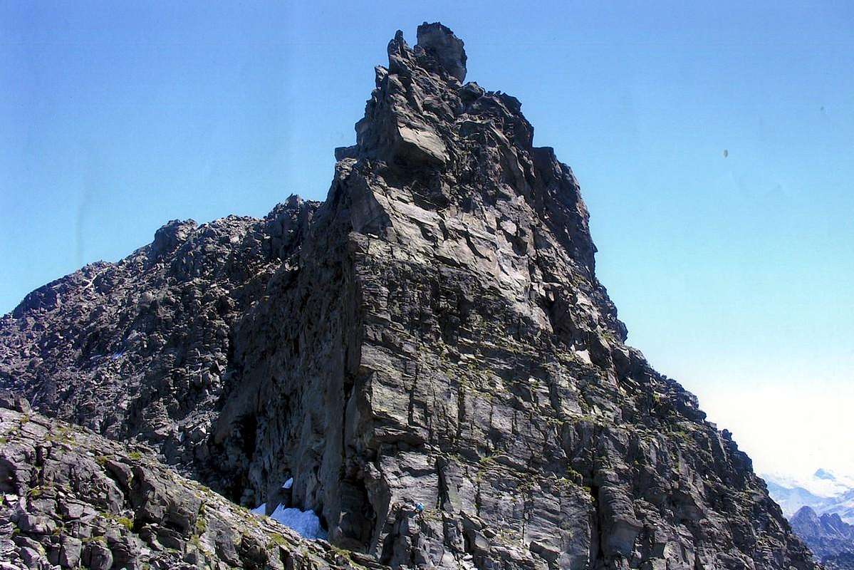
3) - Luetta also Tzaboc Point (3.214m), by rocky Northeast Crest rope required, one exposed passage of II°.
Plontaz-Pré Damon Vallons: from road Valgrisenche Dam Eastern shore to Prariond (2.039m), Pra Londzet (2.184m), Mandaz, Plontaz (2.303m), Bruille Pastures, with farms road. From Plontaz in Northeast to
1) - Testafochi Shelter; in East-northeast to
2) - Feleuma Pass (3.001m), paths. In East to
3) - Becca of Pré Damon (3.234m), directly through traces on grassy along small torrent, moraine and West easy slope with small rocks and a little traverse (15 meters, I°+). From Bruille to East
4) - Cussunaz Pass, path.
5) - Descent to Chanavey (1.696m) Village in
Rhemes Valley. l'Epée Vallon:
1) - from Pra Londzet Pasture (2.184m) in South, fork 2.220 meters, Chalet de l'Epée (2.377m), path. From shelter in East to
2) - Fenetre de Torrent Pass, with path;
3) - descent to Notre Dame in Rhemes Valley, steep trace and following path.
4) - in Southeast Point Rabuigne or Eastern Mount Forciaz (3.261m), with moraine along small brook, Bouque Glacier and North Face (30°/37°), classic Ski-mountaineering.
Comba Vaudet-Grapillon: from Refuge Mario Bezzi (2.284m) northwest direction with paths to Grapillon Torrent, Vaudet or Suessa Hill (2.836m).
Comba du Rocher Blanc: from Refuge Bezzi to Grapillon Torrent, Quota 2.617 meters with path and after by traces to Lake Noir Pass (2.872m).
Col du Mont Vallon: from Rognettaz Desot (1.990m) to Grand'Alpe (1.988m), fork 2.174 meters in Saint Grat Vallon, Mont Hill (2.639m).
Saint Grat Vallon: from fork 2.174 meters in North Lac Torrent to St. Grat Chapel/Loch (2.462m); from this, by traces, to Sachère Pass (2.841m).
Orfeuille Vallon: from Planaval Village (1.557m) through municipal road to Orfeuille Hamlet (1.985m), Plan Petet small Village (2.284m); from this
1) - in South to Becca Ceré (2.434m) on North easy Slope;
2) - in Southwest, without path in moraine, Château Blanc Glacier and Pass (3.266m).
Planaval-Fond Vallon:
1) - from la Clusaz Village (1.631m) to Glacier Alp (2.162m), Fond Barrache (2.310m), with path.
2) - In Southwest to Planaval Pass (3.016m) with path, morainic traces, blocks and steep snowfields in terminal part;
3) - in West from Lake to Mollette also Paramont Pass (2.774m) without path on grassy slopes and moraine towards d'en Haut Vallon.
4) - From Barrache in North Fond Lake (2.439m), with path;
5) - from lake in Southwest Crosatie Pass, Point (2.838m, 2.933m), with paths, small easy rocks in final part. Descent to Lenteney-Tillac Vallons.
- From Arvier to Derby/Morgex Municipalities
1) - from Arvier-Runaz Village (803m), Pesse Village (1.441m), Faveroy Alp (2.050m) and Hill (2.357m), with paths;
2) - descent in Southwest to Baule(i)n Hamlet (1.775m) on Planaval Vallon, through a thin track is not always easy to trace between various rock bands.
Tillac Vallon:
1) - in West from Runaz, Pervod (1.667m), crossing Derby Wood, Petratra (1.685m), Semont, Dailley (1.621m) Villages, with farm road; from thys
2) - to Tillac Alp (1.833m) at beginning of homonym vallon. From alp
3) - through path-traces along torrent, mini Loch (2.018m) and subsequent moraine to Crosatie Pass (2.826m; equipped route on terminal part); from pass easy short East Crest to
4) - Crosatie Point, through path, traces, small easy rocks. In South descent to Fond Lake and Barracks on
5) - Fond-Planaval Vallon to La Clusaz Hamlet, with path.
D'en Haut Vallon also Lantaney or Lenteney: from Le Pont (897m), above La Salle, near Derby Municipalities, Chabodey Hamlet (952m), Pré Maudit (1.118m), dirt road; from this to Lazey (1.510m) Village, path. From thys fork 1.593 meters, Val di Meitin (1.630m), Montagna Alta-Val du Fond (1.649m) Pastures, path-dirt road; from this Promoud Pasture (2.021m) to
1) - Crosatie Pass to Southeast;
2) - Passo Alto-Haut Pass (2.859m) to Southwest, both with paths. From first in South
3) - Fond Vallon-Vagrisenche; from last
4) - Usselletes Vallon-La Thuile Valley, paths.
Leseney Vallon: from alternative 1.593 meters, Joux Village (1.608m), Leseney Alp (2.100m) and from this
1) - with brief path and moraine crossing Torrents Bouilya and Bouatton to Leseney Pass (2.825m);
2) - to West Ameran Pass with small path and traces on very wild little basin.
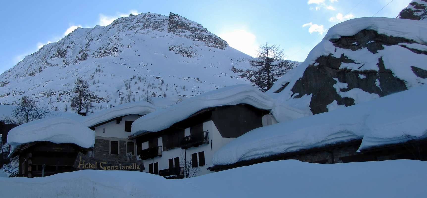
Arpy Basin & Pietra Rossa Vallon: from San Carlo Hill (1.971m), near Hotel Genzianella-parking, to Arpy Lake (2.063m) with dirt road, Pietra Rossa Lake (2.553m), through path; from this to
1) - West Ameran Pass (2.680m), path.
2) - To South by traces in moraine, small glacier in final part Cor(l)met also Comba Sorda Pass (2.836m); in South descent to
3) - Comba Sorda Vallon, Deffeyes Refuge in La Thuile Valley, with paths.
Dalla Punta Galisia, triangolo di confine tra la Valle di Aosta, il Piemonte e la Francia la cresta spartiacque si sposta maggiormente ad Occidente e, lasciando alle sue spalle belle cime come il Roc Basagne, il Roc du Fond, la Punta Calabre e le tre sommità del Quart Dessus raggiunge dapprima il Colle Bobba e successivamente l'importante Punta Tsantelèina, il Pic de Golette e l'altrettanto importante nodo della Becca della Traversière; qui prende inizio il lungo spartiacque tra le Valli di Rhêmes e Valgrisenche terminante con il Sottogruppo della Becca di Tos sopra lo splendido promontorio di Les Combes, soggiorno estivo dei due precedenti Papi. Si chiude l'alta testata della Valle di Rhêmes che scende verso Settentrione con i Ghiacciai di Lavassey, Fond, Tsantelèina e, nel ramo più verso Ovest, di Rhêmes e di Goletta. Tutta quest'area risulta più idonea allo Sci-Alpinismo piuttosto che nei confronti dell'Escursionismo, proprio per la presenza di ghiacciai nelle parti terminali. Colli notevoli si dispiegano in questo settore prendendo la denominazione dai medesimi; tutti si innalzano oltre i 3.000 metri e conducono verso il Parco Nazionale della Vanoise, più ad Oriente, nonché alla Riserva Naturale della Grande Sassière. Ed é proprio da questa bella Cima, la più elevata (3.751 m) sullo spartiacque, ma anche rispetto alle altre appartenenti alle cosiddette zone interne, tra il Gran Paradiso ed il Massiccio del Monte Bianco che la cresta di confine piega decisamente verso Nord; nel suo procedere la medesima scavalca le Punte Plattes des Chamois, il piccolo Sottogruppo del Monte Ormelune, il famoso Col du Mont, la vicina omonima Gran Becca, il successivo Colle della Sachère e la Becca du Lac. In questo punto la cresta si sdoppia: il ramo di destra raggiunge la Testa del Rutor dal quale trae origine quel lungo contrafforte che separa la Valgrisa dalla Valle di La Thuile e terminante con il Mont Paramont ed i suoi satelliti. A sinistra, ovvero più a Nordovest, scende la cresta di frontiera insino al Col de la Seigne. Questo vertice a forma di acutangolo origina questa ultima valle, come vedremo nella successiva sezione. In questa, invece, vengono altresì presi in considerazione i valloni ed i bacini soprastanti la Valle Centrale della Dora Baltea; essi costituiscono un circondario che prende il suo avvio dal Paramont per concludersi a Nordest con il Monte Colombo ed a Nordovest con il Mont Charvet, grossa spalla della Becca Pouignenta.

From La Thuile Valley to Seigne Hill at Mount Blanc
- VALLEYS & VALLONS In order to deploy clockwise from La Thuile Valley/Little Saint Bernard Valley to Seigne Hill in La Lex Blanche Walloon
Ru(i)tor Basin: from Refuge to wide Ruitor Lakes and Glaciers to
1) - Planaval Pass (3.010m) in East with path, moraine snowfields and Flambeau Glacier in final part;
2) - to Doravidi Pass (3.309m) crossing Ruitor Glacier to South-southeast.
3) - To Château Blanc Pass (3.266m) same route, but more to South;
4) - to Ruitor Pass (3.373m), near Deffeyes Cabine again more to South.
5) - Saint Grat Pass (3.285m) to Southwest;
6) - Becca du Lac Pass (3.336m) to west-souhwest.
7) - Noeud des Vedettes (3.285m) to West;
8) - Invernet Pass (3.221m) to Northwest.
9) - Loydon Southeastern Pass (3.089m) to West-northwest;
10) - Loydon Northwestern Pass (2.923m) to West.
11) - Assaly Pass (3.002m) to Northwest. *** All those routes throuhg Glacier of Ruitor; the same require prudence, experience the transit glaciers and proper equipment with rope.
Bellecombe Vallon: from fork about 2.150 meters to West, small bridge 2.197 meters up Ruitor Torrent, Bellecombe Eastern and Western Lakes (2.379m); between these
1) - in South Tachuy five Lochs (2.550m, 2.569m the most) and Hill (2.673m), with path and
2) - Mount Charve (2.927m), through traces on easy rocky East Crest. In West-southwest
3) - tiny loch to Lex Blanche Hill (2.570m), with path;
4) - in Northwest Lakes de Bellecombe (2.631m), Serre Hill (2.705m) and in North traverse
5) - to Mounts Fréduaz (2.909m, 2.933m, 2.932m), without path and easy rocky ridge.
Combes Sozin-Thuilette: from small bridge 2.120 meters after third waterfall to
1) - Comba Sozin Low Lake (2.081m); traverse
2) - to Comba Thuilette and hill nearby quota 2.368 meters to Ponteilles Alp (2.060m).
3) - From hill in West Mount Thuilette (2.428m), through East Crest with short amusing rocky passages; from this
4) - easy crossing on ridge and descent to Upper-Middle Lochs (2.609m, 2.227m), through moraines.
Ponteilles Vallon: from La Joux
1) - to Maisonnettes Pasture (1.894m), Ponteilles Alp (2.060m), with path;
2) - from alp in Southwest to Maisonnettes various ponds. From those in Northwest
3) - Bella Valletta Saddle (about 2.700m), Bella Valletta (2.811m), with traces; from saddle in Southwest
4) - Mount Valaisan (2.891m), through Northeast easy Crest (caution with snow).
5) - From Bella Valletta in North traverse to Belvedere Hill (2.568m), with path and traces also
6) - from quota 2.731 meters on ridge descent in Northeast to Plan of Suches/Ponteilles Alp, with paths.
Belvedere Valley: from La Suche (2.084m), La Suche de Cantamont, Bedalla Tableland to Belvedere Hill and Mount (2.641m), with paths.
- Little Saint Bernard Vallon & surroundings Verney-Tormotta Vallon: from Verney Lake (2.088m), Upper Verney Lake (2.280m), Torveraz Pasture, Saddle about 2.550 meters below Pointe Rousse, Tormotta(z) Lakes (2.486m)
1) - in Westo to Arguerey Pass;
2) - in Northwest to Veys Pass (2.984m), without path and through moraine.
Breuil Vallon: from main road Little Saint Bernard winding 1.861 meters to alternative 1.838 meters before Chaz Pontaille (nice small bridge up Lake Torrent), Chanté Pastures (1.993m), Plan Veyle (2.080m), Biolettaz Alp, Entre deux Eaux Pastures (2.333m), Crotti Alp (2.520m) to
1) - Echelles des Chavannes or East Bassa Serra Hill (2.737m); from this in North
2) - descent to Chavannes Vallon, through path-traces on moraine with farm road to Pont Serrand-La Thuile Resort. In Northwest
3) - to Léchaud Point (2.973m), with moraines and broken rocks on Southeast easy Slope.
Chavannes Vallon:
1) - from fork 1.602 meters before Pont Serrand Village (parking near fountain), Orgères Pastures (1.884m), Monquet Alp, Clos Prevot Alpages, Low Berrio Blanc Pastures, Chavannes d'en Bas, Chavannes d'en Haut Pastures (2.424m); from this to
2) - Chavannes Hill (2.603m). In South to
3) - Lochs of Chavannes Glacier, Bassa Serra Western, Eastern Hills or Echelles des Chavannes and Point (about 2.850m, 2.838m, 2.737m), with path-traces. In South-southwest to
4) - Léchaud Point, path, crossing Chavannes Glacier by rotten rocks easily on Southeast Slope. In Southwest to
5) - Mount Léchaud, through Northeast Crest (a delicate passage of II°-). In North
6) - from Upper Chavannes Pastures to Mount Fortin Lochs, Point (2.758m), with paths and final blocks, near ex-Shelters Major Sonza.
7) - To East Berrio Blanc Pass, high traverse through path.
Orgères Vallon: from Orgères Village (1.884m), along Orgères Torrent, Pond du Walloon of Orgères to Orgères Pass (2.708m), with path.
Youlaz Vallon: from Balme-Sainte Marie Madeleine (1.309m), Alpages Low Arp and Peson (1.871m), Mayen de la Youlaz Pasture (2.035m), Youlaz Lac nearby Shelter Maggiore Reggiani to
1) - Youlaz Hill (2.661m);
2) - Arp Hill (2.570m), paths with traverse and upper connection of the same.
Crammont Vallon: from Miatay (1.868m), Plan Praz Alp (2.099m) to
1) - Mount Crammont (2.737m), steep path on East Slope and Tête of Grand Mount (2.749m), through easy, short traverse on rocky Northeast Crest (carving of I°+); to
2) - Mount or Becca de Nona (2.106m), with path.
Veny Valley: & surroundings Val Planey-Arp Valleys: from Pré Saint Didier Municipality (1.017m) to Champex-Sainte Barbre (1.036m), by asphalt road; from this Planey Hamlet in Southwest to
1) - Granvergne Coastline below Mont Crammont Northeast Face, without path. In Northwest Cré (1.486m), Arpettaz Low, Middle Upper Pralen (1.569m, 1.577m, 1.648m), Champtoret (1.791m), Arp (2.133m) Pastures, with dirt, and from this last in West to
2) - Arp Hill (2.570m);
3) - high traverse on Youlaz Vallon to Youlaz Pass (2.661m).
4) - From pass in South Fourches de la Youlaz (2.808m) to Charmonts Pass (2.815m); in Southwest Berrio Blanc Pass (2.819m) into Charmonts Vallon. In West crossing to
5) - Chavannes Points (2.808m), Mount Fortin (2.758m) on Chavannes Valley, all with paths just below crest; from this
6) - South descent into Chavannes Vallon, by dirt farm, to Pont-Serrand (1.602m), La Thuile (1.447m) with road in Little Saint Bernard Valley. Also
7) - in North to Upper, Low Arp Vieille (2.303m, 2.073m) into Arp Vallon, alternative 1.959 meters near Lake Combal in Val Vény, with path. ***
Easy High Traverse amongst six or seven Vallons. Dolonne-Chécrouit Vallon: from Dolonne (1.212m), Source Vittoria, Golettes Pastures (1.418m), along Dolonne Torrent to the end of vallon. Comba des Vesses: from Courmayeur (1.191m), Goats Bridge (1.226m), Notre Dame de la Guérison little Church (1.444m) alternative after Plan Ponquet (1.480m) to Refuge Mont Blanc (1.666m), by asphalt road; from this in Southwest to
1)- Shelter Maison Vieille (1.956m) near Chécrouit Hill (1.956m), with dirt road and path in final part. From Refuge to
2)- Chécrouit Lake (2.165m), Vesses Loch and Hill 2.428 meters, with path.
Arp Vieille or des Charmonts Vallon: from Val Vény dirt farm road alternative 1.959 meters, Low Arp Vieille Pastures and Upper to
1) - Mont Fortin in Southwest;
2) - to namesake Hill 2.428 meters in Northeast, with paths.
3) - Ability to perform in the opposite direction through the Tour of the Seven Valleys from Coumayeur-Vény Valley to Pré Saint Didier Municipality in Aosta Upper Valley; 4) - also possibility crossing in South into Chavannes Valley to Pont Serrand Village, with paths and farms dirt road to La Thuile Resort, by Little Saint Bernard main road.
Mont Fortin Vallon: from Vény dirt road in altitude about 1.950 meters to South on Northern slopes of Mount Fortin, completely without path.
La Lex Blanche Vallon: from Lake Combal alternative road 1.959 meters through farm dirt along Doire of Vény Torrent to Refuge Elisabetta Soldini (2.197m), near Pyramides Calcaires (2.565m, 2.726m, 2.689m); from this by path to Tsa de la Lex Blanche (2.280m) and Seigne Hill (2.514m).
Ormai Valli e Valloni del "Grampa" son sempre più lontani e gli Orizzonti si rivolgono maggiormente a Nordovest verso il Bianco. Ma la "gugliata" é ancor molto lunga ed, attraversate le Valli Savara, Rhêmes e Grisa, si entra nel vasto Bacino di La Thuile, per poi procedere lungo la lunga cresta di frontiera tra Francia ed Italia. Dal Ruitor verso Nord scende una grande cresta spartiacque raggiungente il Mont Paramont, ove si spezza in due troconi: uno contiene verso Nordovest la Conca d'Arpy, con i suoi due splendidi laghi d'Arpy e Pietra Rossa, fino al Mont Colmet; l'altro procede a Nordest atto a separare i selvaggi Valloni d'en Haut, Tillac e Faveroy soprastanti la Dora Baltea dal lungo Vallone del Fond, con il suo bel lago sottostante la Punta de la Crosatie, concludentesi qual grande finestra con il Passo di Planaval. Sul lato opposto la cresta, questa volta di frontiera, discende dalla Testa del Rutor raggiungendo la Punta Loydon e subito appresso la Grand'Assaly, vero e proprio perno verso Occidente. Lasciando in basso su questo versante la Tarenteise, s'allunga verso la piccola Catena dei Fréduaz ed il Mont Valaisan anticipando il Colle del Piccolo San Bernardo, antica porta d'ingresso per ambo le nazioni. Tutto il confine é segnato dai resti della Seconda Guerra Mondiale con fortini, rifugi naturali, trinceramenti protetti da reticolato e ci é capitato, presso il Mont Charve, di ritrovarne resti con proiettili e bombe esplose, nonché persino nere maschere anti gas in gomma ormai usurata. Oltre, un altro piccolo ma lungo sottogruppo, con cime frastagliate e misconosciute, raggiunge la Punta Léchaud ed il Colle della Seigne. Grandi valloni si rivolgono ad Oriente originando il Sottogruppo del Berrio Blanc indirizzandosi verso La Thuile ed il suo circondario. Dopo si eleva il Monte Bianco, ma é tutta 'n'altra Storia ..."
"A Valley follows another and a Vallon happens to another Ad una Valle ne segue un'altra ed ad un Vallone un altro ancora For a Vallon followed by another and a Valley is followed by a subsequent Pour une Vallée suivi d'un autre et un Vallon qu'il arrive plus tard As a . woodbridge, a .. walkway, ... walk, .... footbridge, ..... wooden walkway, ....... catwalk ....... between a Life and the Other in a RACE to the INFINITE" So we roamed between Valleys & Vallons passing bridges, walkways, crossing streams, torrents or simply fording little brooks also lakes bypassing, admiring flowers, trees, woods, forests, animals, waterfalls, glaciers and mountains. Upwards and downwards. Here and there. Now we take a big leap over the Baltea and go exploring Valli and Northern Valloni ...
Valleys & Vallons Passages
 |
 |
 |
 |
 |
Nous avons donc erré entre Vallées et Vallons passant ponts, les passerelles, les rivières, les torrents qui traversent à gué ou tout simplement de petits ruisseaux ou lacs contournant, en admirant les fleurs, les arbres, les bois, les forêts, les animaux, des cascades, des glaciers et les montagnes. Vers le haut et vers le bas. Ici et là. Maintenant, nous prenons un grand bond en avant au cours de la Doire Baltée et allons explorer Valli et Vallons du Nord ...
 |
 |
 |
 |
 |
Mountain Conditions
- Meteo: you can find all the needed informations at the official site of the Valle d'Aosta Region:
- Valle d'Aosta Meteo
Maps
MAPS:
- Kompass "Gran Paradiso Valle d'Aosta Sentieri e Rifugi" Carta turistica 1:50.000.
- L'Escursionista "Valgrisenche Val di Rhêmes" Carta dei sentieri (n° 3) 1:25.000.
- Enrico Editore Ivrea-Aosta "Gruppo del Gran Paradiso" 1:50.000.
- I.G.C. Istituto Geografico Centrale "Valsavarenche-Valle di Rhêmes-Valgrisenche" Carta dei sentieri e dei rifugi (carta n° 102) 1:25.000.
Important Information
- REGIONE AUTONOMA VALLE D'AOSTA the official site.
- FONDAZIONE MONTAGNA SICURA Villa Cameron, località Villard de la Palud n° 1 Courmayeur (AO) Tel: 39 0165 897602 - Fax: 39 0165 897647.
- A.I.NE.VA. (Associazione Interregionale Neve e Valanghe).
Useful Numbers
- Protezione Civile Valdostana località Aeroporto n° 7/A Saint Christophe (Ao) Tel. 0165-238222.
- Bollettino Meteo (weather info) Tel. 0165-44113.
- Unità Operativa di Soccorso Sanitario Tel. 118.