


-
 7726 Hits
-
 81.18% Score
-
 13 Votes
|
|
Area/Range |
|---|---|
|
|
45.73540°N / 7.31435°E |
|
|
Hiking |
|
|
Summer |
|
|
Note
La montagna chiama i suoi figli, ed essi rispondono fedelmente al suo appello… Osvaldo Cardellina, Diario alpinistico, 1964-65 Page texts: @ OsvaldoCardellina "Osva", passed away on May 2, 2022. Page owners: Christian Cardellina e Osvaldo Cardellina. Any updates from September 12, 2022: Antonio Giani, page administrator, friend and climbing companion. Testi della pagina: @ OsvaldoCardellina "Osva", scomparso il 2 maggio 2022. Proprietari pagina: Christian Cardellina e Osvaldo Cardellina. Eventuali aggiornamenti dal 12 settembre 2022: Antonio Giani, amministratore della pagina, amico e compagno di salite. |
Overview amongst Valli-small Valleys-Valleys & Valloni

In this particular work we wanted to highlight the Valleys and the small Valleys are the basis of any common denominator ascension and that often are too neglected in spite of the Summits. Assembled in a first into Summary H of List, dedicated the mountain ranges, deserves, in our opinion, to be located in the study of the relevant areas of the Aosta Valley in one zone of the valleys, never studied and analyzed in a organic way and systematic. We hope to have, at least partially, scored the purpose. Moreover, the aim was to bring the precent job on the correct track, the same being a summary of Part A/F facing the mountains; therefore fell outside the same making heavy and negating much of the work of synthesis which was the primary destination. This is addressed in Part One of the Valleys & small Valleys and orographic and hydrographic South or right side of Baltea; subsequent work will be devoted to the opposite or Northern, always starting from the Col de la Seigne and Mount Blanc to the ends over the Southern extreme offshoots above little Town of Pont Saint Martin, at the end of the Aosta Valley Region. Always taking into account, as in the seven previous analytical work, the course clockwise we have tried to summarize what are the characteristics and the particular features of the Valleys and the Walloons, starting from the South, or from the little Town of Pont Saint Martin, at Eastern Valley of Aosta, coming from Piedmont, to the famous Tourist Resort of Courmayeur, at the foot of Mount Blanc. Hence our work is split, as at the end of the Vény Valley is the starting that area which is the orographic and hydrographic or right side of the Northern Valley of Aosta. This leaves the border with France at Mount Dolent (3.819m) to begin the next with Switzerland starting from Ferret Hills at the end of the two, same name for both sides, long valleys. From this point on the border ridge walks in the opposite direction toward reaching the Eastern Group of the Grand Golliaz and the much larger and more important of the Mount Velan, leaving to North the majestic Group of Combins, entirely in Swiss territory, even if considered a little "valdotain" so that there is a Community of Grand Combin, reaches the Col Fenetre Durand and Mount Gelé. Then "down" with an endless series of summits to Dent de Bouquetins, Dent d' Hérens, the Matterhorn to the great Mountain Chain of Monte Rosa. From Signalkuppe of this last, leaving even here in the North Point Dufour higher (4.634m), starts the watershed between the Regions of Aosta Valley and Piedmont, again to the small Monbarone above Pont Saint Martin. It closes in such a way the circle of mountains, valleys and walloons belonging to this region, but this second section, highlighting what has already been exposed, will be part of a subsequent job summarizing the Northern part. In this hand, to sum up, we walked through the valleys and gorges of the South from the wild and hemi unknown small valleys, immediately preceding this of Champorcher, the last of this sector or de la Lex Blanche, at the end of the Western Valvény. Valleys and small Valleys begin where "die" glaciers, giving shape to any hint of life with their fresh and uncontaminated waters, as dictated by Mother Nature, the same quench the Climber and Hiker returning from giving a first goal achieved signal of rest, security and contentment. After so much hard work ... And for this reason we have also included some short, or rather telegraphic suggestion about crossings hills or climbing to peaks or Valleys at the end of the small Valleys same. They all crossings or ascents of elementary and easy to climb and hence suitable for everyone, or nearly so. Where there are small steps with some difficulty and especially exposed, or even more simply dangerous in certain circumstances, the factor has been highlighted, indicating the Difficulty Overall and Evaluation thereof.
^^^^^^^
 |
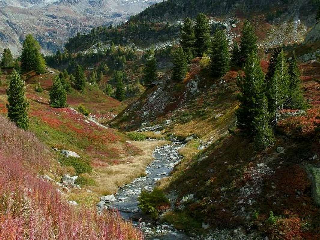
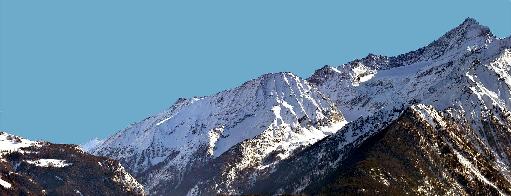
^^^^^^^"Why is it that comes from the Waters of the Vallons Life / Perché é dalle Acque dei Valloni che nasce la Vita", by livioz ![]()
^^^^^^^

Quante son le Valli in Valle di Aosta, oltre a quella Centrale del Fiume Dora Baltea solcandola da Ovest ovvero dai Valloni di Vény e Ferret ai piedi della Catena del Monte Bianco verso Sudest, ove si estende la Valle del Po ? Facile. Far la conta e darne la risposta: son tredici oltre ai tre Valloni di Champdepraz, Fénis-Clavalité e Saint Marcel, che in realtà sono, per l'estensione e l'ampiezza, delle vere e proprie valli. Sei son disposte oltre il limite idrografico Meridionale della Dora Baltea ed in ordine da Est ad Ovest: Champorcher, Cogne, Valsavarenche, Rhêmes, Valgrisenche e Valle di La Thuile. Tutte perpendicolari all'asse centrale della Dora, tranne la prima discendente a coltello da Sudovest verso Nordest. Sul lato opposto ne contiam altre sette e, sempre con lo stesso criterio: Gressoney, Ayas, Valtournanche, Saint Barthélemy, Valpelline, Ollomont con soprastante Conca di By ed, infine, Valle del Gran San Bernardo. Tutte a perpendicolo, tranne quella di Cogne messa di taglio da Sudest a Nordovest. Ancor facile. Ma quanti sono i valloni? Penso che nessun ci abbia mai tentato di farne conto. Innumerevoli, quasi infiniti. Ad ogni passo n'esce fuori un nuovo, come per i funghi. Val quindi la recita di Orazio C I°, II°: "Tu ne quaesieris, scire nefas, quem tibi, quem mihi finem Di dederint.", cioé non farti troppe domande, é nefasto conoscere il fine assegnatoci dagli Dei ? Nient'affatto! Un'impresa impossibile? Può esser, ma noi vogliamo farlo o ... almeno farci 'na prova.
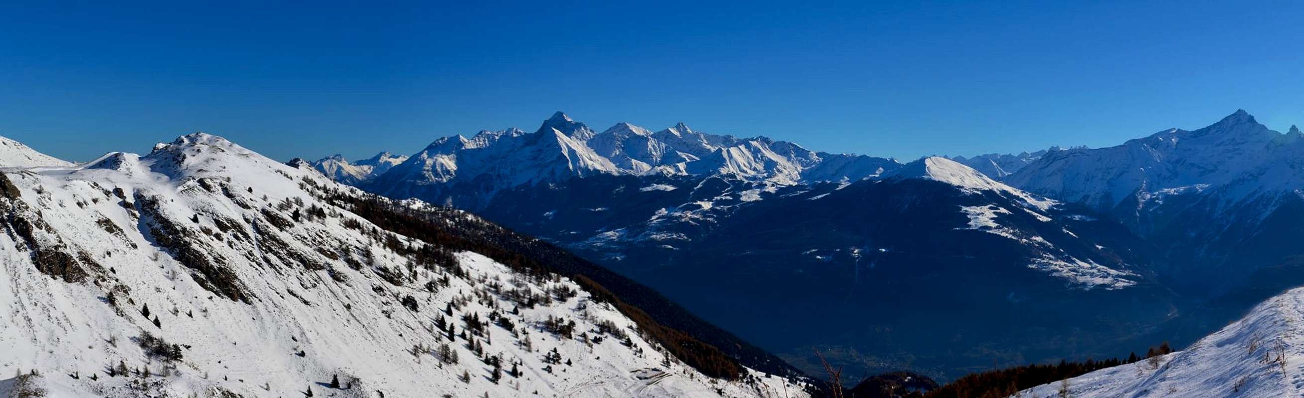
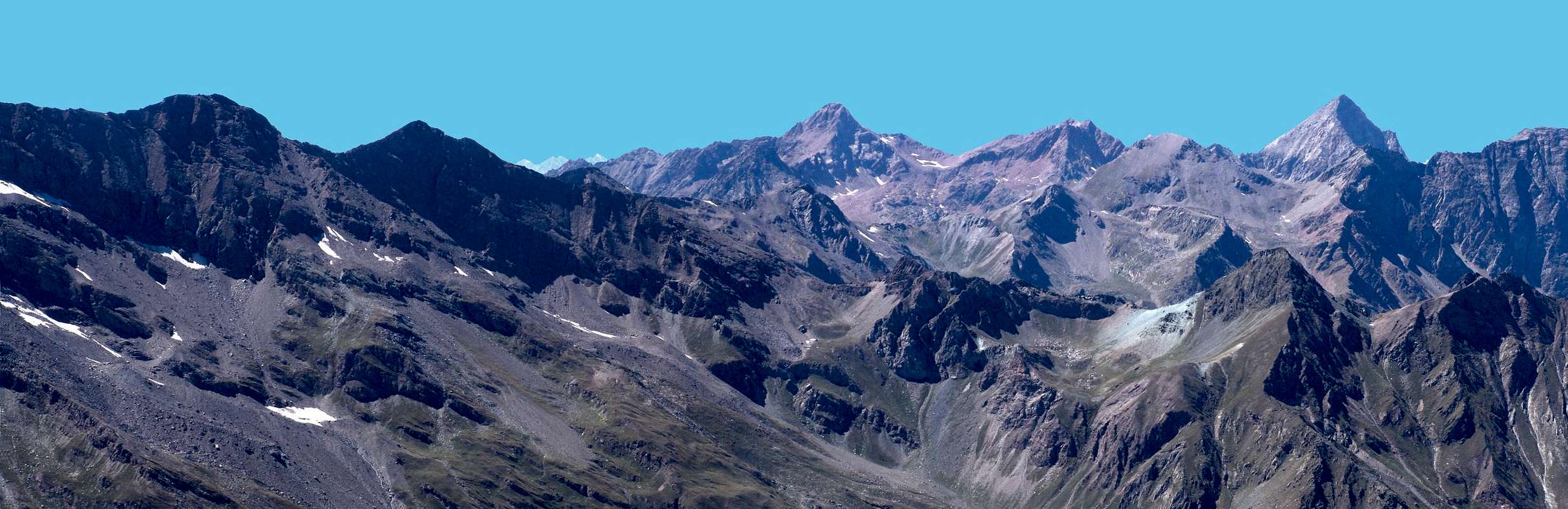
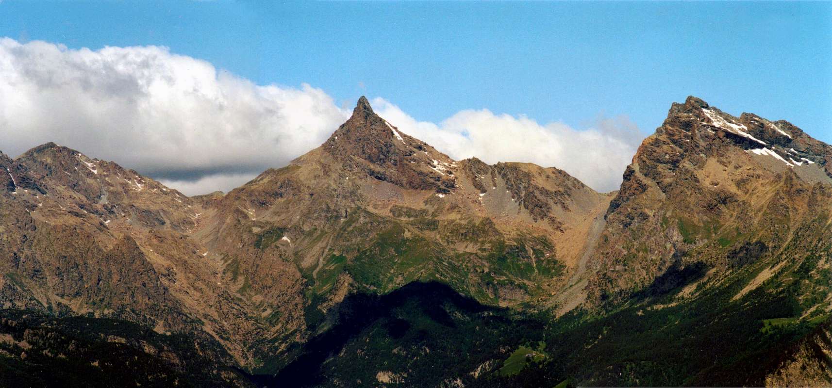
^^^^^^^ "The view scrolls Spaces Unlimited above Valleys & Vallons of Graian Alps", by Emilio BERTONA (emilius) ![]()
^^^^^^^
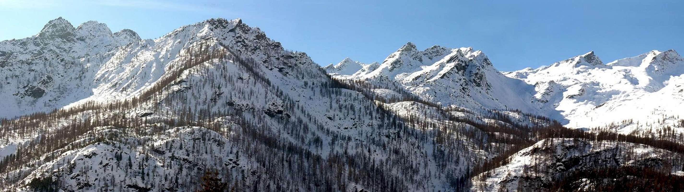
^^^^^^^ "Then the Winter closes Mountains, Valleys & small Valleys in a grip of Frost / Poi l'Inverno serra Montagne, Valli e Valloni in una morsa di Gelo", by emilius ![]()
"The first Lights awaken Nature still asleep in his small Valleys", by emilius ![]()
^^^^^^^
^^^^^^^ "The Morning Sun floods Valleys & Vallons", by emilius ![]()
^^^^^^^
"Other times in vallons known and frequented vallons are flanked fallen into oblivion ", by emilius ![]()
^^^^^^^
Getting There
BY CAR:
- From TORINO, MILANO, etc: Motorway A5. Exit at IVREA or Quincinetto (PIEDMONT).
- From IVREA Town: Pont Saint Martin, Donnas, Hone-Bard, Arnad, Pont Bozet, Champorcher, Champdepraz, Pontey, Fénis, Saint Marcel, Grand Brissogne, Pollein, Charvensod, Gressan, Jovençan, Aymavilles Municipalities. From Pont Bozet (775m) to Champorcher Valley, Camporcher-Château (1.427m), Petit, Grand Mont Blanc, La Cort Villages, towards Dondena Village (2.092m), Dondena & Miserin Refuges, through Royal Road & secondary dirt roads; Barbustel Refuge, through Royal Road and path towards Champdepraz small Valley.
- From Champdepraz (523m) to Lakes small Valley and Voella or Raye Chevrères Village (1.307m; by Regional Road). Barbustel Refuge with path from Voella. From Fénis (537m) to Clavalité and Grand'Alpe Pastures (2.129m; through dirt farms road), just below E. Borroz/Rotary-Clavalité Refuge (2.156m) at Cuneu Alp. From Saint Marcel (630m) to Saint Marcel small Valley and Turati Reserve up to the Mulac & Grande Chaux Hunting Houses & Alp (1.937m, 2.370m).
- From Grand Brissogne (827m) to L'Arp, dirt road, Les Laures small Valley and Ernesto Ménabreaz Shelter at Lower Laures Lake (2.546m, 2.544m), path-muletrack.
- From Pollein (575m; secondary road) or from Charvensod (746m; main road and connection) to Arpisson small Valley and Martsaouchy Damon (1.410m), through dirt farms road, and Arpisson Lower & Upper (1.951m, 2.010m) Alpages with ancient path. Federigo Zullo Bivouac through moraines on Western Arpisson Glacier.
- From Charvensod to Dard-Comboé-Arbolle Gorge and small Valleys towards Ponteilles (1.697m) Alp & Waterfall, through dirt road, Comboé Alp & Saint Ours private Shelter (2.114m), through dirt road, and Arbolle Refuge (2.516m), nearby two Lakes (2.495m, 2.497m), by Chair Lift to Chamolé Station (2.309m), Lake (2.325m) and muletrack. From Charvensod (main road from Pont Suaz 567m) or from Gressan (603m; alternative road) to Tivet, Les Fleurs Hamlets (1.292m, 1.414m) Pila Basin and Pila Resort (low parking nearby Cableway 1.800m; upper parking 1.850m). Arno Shelter (2.660m), always open but unguarded, nearby Couiss Summit on watershed Pila/Cogne Valley. From Jovençan (631m) to Western Pila Conca, exclusively through path-muletrack to Tourlin Dessous (1.466m) and by dirt farms road to Pila-Posse Tennis (1.776m). From Aymavilles (646m) to Western Pila Conca, through Main Road to Cogne Valley, alternative road to Ozein/Turlin Dessus Hamlets and dirt road to Pila-Posse.
- From FRANCE: through the Mont Blanc Tunnel to Entrèves-crossroads to Vény/Ferret Valleys - Mountain Guides of Courmayeur - La Saxe Rock Gym - Courmayeur. By Little Saint Bernard Pass, closed since November until half May to La Thuile Valley - Pré Saint Didier - Courmayeur. It is not necessary to take Motorway A5: you can drive on SS.26, in the direction of AOSTA - IVREA - TURIN.
BY PLANE:
- Aeroporto "Corrado Gex" Saint Christophe (Aosta).
Small VALLEYS & Goals
We have to carry out some information and details on this work, in order to frame it in a right perspective. This Part H, as well as being a Summary of the preceding parts F and G proposes a discussion on the interior valleys with their walloons to the South of the River Dora Baltea. Indeed it is given greater prominence to these because, in our opinion, are, even more than the valleys, to determine the location of its ascent into the mountains. We then drew a map of the same, without claiming to have them visited everyone, incidentally if you think that in every mountain, enclosed between two ridges, there is a slope, a face or a wall, and that the same logically arise from a deep walloon, more or less small, that encircles the base, we can easily understand how the numbers become hyperbolic and confined spaces. However, we treated a large number of these, and certainly all of those which are accessed via a path or at least one track. Among these are the favorite ones that are not part of previous work and that are the internal ones of the valleys to the other of the border with Piedmont has been carried out a description of "telegraph", the same having already been analyzed in great detail in two shares mentioned above. It is given also a starting point for route directing especially in a particular way to the huts, bivouacs, hills and the passes at the end of the same, and in some cases, to some peak of classic and easy access, generally in the presence of a path or of small ridges or slopes is easy to follow. This work, in the Supplementary work itself, it wants to provide an indication to the Hikers, more willing to comply with the particular features of a territory that does not Mountaineers too often diverted by necessity, because the time tyrant, reaching the Top. Also meant to be a tribute to his Friend Emilio Bertona (emilius in SP) died September 20th, 2010, just as he was returning from a trip to Mount Zerbion rose together on many occasions and in all seasons of the same since 1992, and since then so assiduous 1998-2007, there were more than four hundred climbing, ascents, hiking and winter outings with snowshoes. So it is a reminder of his passion for Photography Alpine, for which thing, no matter OVERVIEW, were exclusively used his images.
Dobbiamo effettuare alcune informazioni e precisazioni su questo lavoro, onde inquadrarlo in una giusta ottica. Questa Parte H, oltre ad essere un Sommario delle precedenti Parti F e G, propone una disamina sui valloni interni alle rispettive valli a Meridione del Fiume Dora Baltea. Anzi s'é dato maggiore risalto a questi poiché, a nostro avviso, contribuiscono, più ancora delle vallate, a determinare la località propria di un'ascensione in montagna. Abbiamo quindi tracciato una mappa dei medesimi, senza aver la pretesa d'averli visitati proprio tutti; daltronde se pensate che in ogni monte, racchiusa tra due creste, esiste un versante, una faccia oppure una parete e che le medesime logicamente s'originano da un vallone, più o meno piccolo, che le cinge alla base, si capisce facilmente come i numeri diventino iperbolici e gli spazi limitati. Comunque pensiamo d'aver trattato di un numero importante di questi e sicuramente di tutti quelli ai quali s'accede tramite sentiero od almeno una traccia. Tra questi si sono prediletti quelli non facenti parte di precedenti lavori ed in genere sono gli interni alle valli; per gli altri di confine con il Piemonte é stata effettuata una descrizione "telegrafica", essendo già stati i medesimi analizzati con dovizia di particolari nelle due parti succitate. Si é dato, inoltre, uno spunto di itinerario indirizzando la via in genere verso i rifugi, bivacchi, colli ed i passi, al termine dei medesimi, ed in, alcuni casi, verso qualche vetta di facile e classico accesso, soprattutto in presenza d'un sentiero oppure di piccole creste o versanti di facile percorrenza. Questo lavoro, supplettivo nel lavoro medesimo, vuole infatti offrire un indicazione per gli Escursionisti, più disposti ad osservare le peculiarietà di un territorio che non gli Alpinisti troppo spesso distolti dalla necessità, causa il tempo tiranno, di raggiungere la Cima Inoltre vuole essere un omaggio all'Amico Emilio Bertona (emilius in SP) deceduto il 20 di Settembre 2010, proprio mentre rientrava da un escursione al Monte Zerbion, salito insieme in molte occasioni ed in tutte le stagioni; con lo stesso dal 1992, e poi in modo assiduo dal 1998 al 2007, sono state effettuate oltre quattrocento arrampicate, ascensioni, escursioni ed uscite invernali con le racchette da neve. Quindi trattasi d'un ricordo della sua passione per la Fotografia Alpina, per la quale cosa, a prescindere da OVERVIEW, son state utilizzate esclusivamente le sue immagini.
Towards the Dawn of the Valleys (Low Valley)
This section is devoted to the classification of valleys and vallons existing in Aosta Valley. Were entered all the raw and almost all amongst the existing ones among the latter. Surely in full those rooms where a path, or at least a trace consistent and clear. Were entered others who do not possess either of these two basic requirements, but in a limited way. Furthermore, an indication has been traced from the starting point, in addition to some important intermediate, to that of arrival that consists in a pasture, a well-defined locations or a particular point such as a Shrine or a Oratory and finally a hill. In this regard it must be noted that the analysis is directed only to the internal parts, as with regard to the watershed with Piedmont it is already present, with good detail, in the specific parts F and G, then it is not wanted to propose as useless as a burdensome repetition, but it is carried out a hint referring to the same observations. You are not taken into account in the final part that leads to the tops, except in limited cases where the path is so obvious and safe for the Hikers. In this possibility, only those peaks that are considered, tested in time, constitute a typical and classic hiking; for all other is left to the same, or the Climber, the choice of the various climbing routes depending on the personal goals to achieve.
- VALLEYS & VALLONS In order to deploy clockwise from the Lower Valley Fer Vallon to Champorcher Valley
Moja small Valley: small walloon above Donnas from Donnas, Clapey (317m), Montey, Ronque, Donnes (864) Hamlets, Mont Meillan (1.063m), Valbource, Grand Mognissola (1.350m), Bosciet, Giassit de la Moja (1.715m) Pastures to Moja Alps (1.745m) with path and Andelmel (2.309m), Finestra (2.350m) and Vailet (2.565m) Passes and Saddle 2.174 meters between Mombrignon and Mont Pussuy, through traces.
Champorcher Valley: & surroundings Brenva small Valley (Pont Bozet): from Pont Bozet (775m), Crest Village, Fontana Alp (1.291m) to
1) - la Cavanna (1.644m), Celleras Alp (1.976m) Vallera (2.377m) in Southeast, Dondogna (2.389m) and Valbella (2.550m) in Southwest Passes, with paths-traces. From Fontana to Mialet (1.544m) and Grand Lavassey Alps
2) - Lavere Pass (2.203m), without path; from Creton, Grand Derby (1.747m) Pastures to
3) - Eastern Corni (2.546m) Pass, with path and traces in final part. From Barmé Alp (1.923m) to
4) - Fricolla (2.542m) Pass, path and traces, and
5) - Brouillet (2.450m) Pass, without.
Manda small Valley (Pont Bozet):
1) - from Pont Bozet, Cotetta/Barmafumo, Verney (1.298m), la Frete, Low, Upper Bozet (1.573m) Hamlets; from these in Southeast to
2) - Secco, Nero (1.940m) and Champas Lochs, with paths. From Nero in Southeast, Lavere Pond to
3) - Lavere Pass, without. From Champas, nearby Alp, in South to
4) - Cornuto (2.412m) Lake, near Forest Rangers Cabine and Brouillet Pass, Fricolla Pass and Point (2.676m), traces on short crest. From Bataille in South Chanton, La Manda (2.003m) Alpages to
5) - Chenessy (2.383m) Lake, with traces;
6) - in North-northwest Mount Digny (2.145m), small path. From Mont Digny to Southwest
7) - Mont Giavin (2.431m), through path-traces on small easy crest.
Legna small Valley:
1) - from Outre l'E(y)ve, Porte Alp (1.344m), Montaz Pasture (1.497m), Ourty Alp (1.507m), alternative to Sant'Antoine (1.831m), Chenessy Pastures (2.051m), Peroisa Alp (2.184m) Alp, Chilett Alp (2.351m) and Lake (2.324m); in South
2) - Orti Pass (2.524m), with path-traces. In Southwest
3) - Santanel Pass (2.463m) to Santanel Lake, with path, respectively to Chiusella Valley-Pianprato Vallons in Piedmont.
Vercoche small Valley:
1) - from Ourty, Vercoche Alps (1.879m), Lake (2.202m), Laris Hill (2.581m), paths; to
2) - Pic Molère (2.638m), by crest.
Laris small Valley: from Chardonney (1.455m) in South Pian di Greus, Prarion Alp (1.796m), fork Low Prarion, Low and Upper Laris Alpages (1.950m) after in Southeast Larissa Loch (2.489m) and Hill (2.581m). From this:
1) - Bec or Pic Mol(l)ère by easy Southwest Crest or
2) - to ake Reale (2.449m) in Piedmont, with paths. Alternative: from Dondena (2.097m), Shelter (2.200m), Cimetta Rossa (2.466m) to Larissa Loch, by dirt road.
Banchi deep Valley: from Dondena in South, Shelter, Pian di Roche Alp (2.238m), with path, Rosa Pass (2.957m), through morainic traces Rosa Glacier.
Miserin small Valley: from Dondena, Shelter, to Miserin Refuge, Sanctuary, Lake (2.578m), through dirt road. From thys
1) - in East Mount Rasciàs (2.784m), with traces,
2) - in South Rosa Pass, small path and traces,
3) - in Sout-soutwest Balma Pass (2.941m), traces;
4) - in West Cima di Peradzà (3.021m) or Saddle 2.946 meters, between Peradzà and Bec Costazza (3.092m), by traces on morainic slopes and easy debris crests.
Fenêtre de Champorcher small Valley: from Dondena, Shelter, fork 2.526 meters, between Blanc (2.527m) and Noir (2.551m) Lochs, with dirt road, fork 2.592 meters to Fenetre Pass (2.826m) and descent to Sogno di Berdzé Refuge (2.531m), near Peradzà Alp, in Urtier Vallon, with paths.
Pontonnet small Valley: from Dondena in West, fork 2.526 meters, Pontonnet Lake (2.702m), Fénis Hill (2.857m), Pontonnet Hill (2.897m), with paths.
Glacier deep Valley: from Dondena in West-northwest, bridge about 2.320 meters up Ayasse Torrent and alternative 2.800 meters and in Northeast small saddle before Lake Gelato (2.824m); from this
1) - in Northwest Col Fussì (2.912m), with paths and descent to High Comba Tersiva-Clavalité-Fénis Vallon.
2) - In Northeast Great Shoulder (3.003m) and Mount Glacier (3.186m), with path, traces and easy rocks on crest of final part.
Gias(s)et small Valley: from Dondena, in Northeast Giaset Alp (2.155m) and Loch (2.308m), with path; from this in North Gran Rossa Pass (2.766m) to Gran Lago, through traces. In East path to Giaset Hill (about 2.400m) and
1) - Western Bec Raty (2.417m), by traces or Lake (2.283m), with path.
Raty small Valley: from parking about 1800 metres on Dondena's Royal Road, alternative 1.920 meters around, Sapy Alp (1.979m), Raty Lake (2.283m), with path. From thys
1) - in North Gran Rossa (2.866m); in Northeast Bocon Damon (2.792m), both through traces and easy rocks in terminal crests.
Vernouille-Muffé small Valley: from Champorcher-Château (1.427m), Arbussey, Mont Blanc, La Cort Villages, la Grand Cort Alp (1.944m):
1) - in Northwest Alp and Lake Vernouille (2.145m), with path, to Tête des Hommes (2.614m), through moraine and easy rocks; in North Alp and Lake Muffé (2.019m), Lake Bianco or Croix Hills to Barbustel Refuge in Champdepraz Walloon, with paths.
2) - from the last hill in East Cima Piana (2.512m), by path under West Crest;
3) - in Southeast Cima Piana Hill (around 2.300m), with path. From Lake Muffé in East Cima Perche (2.396m), with path.
Terra Rossa small Valley: from la Grand Cort in East Terra Rossa Hill (2.075m) and from la Cort Arcomy Hill, Point (1952m, 1991m), paths.
Others small Valleys to East: from Mellier (1.293m), Petit Rosier (1.444m) Hamlets to Possoneil also Possoueil Hill (1.842m), with path; from Petit and Grand Rosier (1.452m) Villages or from la Place (1.020m) to Santa Anna Oratory (1.706m), near Plan Fenêtre Hill (1.775m), with paths.
^^^^^^^
Questa sezione é stata rivolta alla classificazione delle valli e dei valloni esistenti in Valle di Aosta. Sono inserite tutte le prime e quasi tutti, tra quelli esistenti, tra i secondi. Sicuramente in modo completo quelli ove sale un sentiero o, perlomeno, una traccia consistente ed evidente. Ne sono stati proposti altri che non possiedono nessuno di questi due requisiti di base, ma in maniera limitata. Inoltre é stata tracciata una indicazione dal punto di partenza, oltre a qualche importante intermedio, a quello d'arrivo consistente in un alpe, una località ben definita oppur un punto particolare quale ad esempio un Santuario od un Oratorio ed infine un colle. A tal proposito si deve evidenziare come l'analisi sia rivolta soltanto alle parti interne, poiché per quanto concerne lo spartiacque con il Piemonte essa risulta già presente, con buona dovizia di particolari, nelle specifiche Parti F e G; quindi non s'é voluto proporre una tanto inutile quanto gravosa ripetizione, bensì si é effettuato un minimo accenno rinviando alle medesime. Non considerata la parte finale che porta ad una sommità, se non in casi limitati laddove il sentiero é talmente evidente e sicuro per l'Escursionista. In questo caso si sono descritte soltanto quelle cime che, collaudate nel tempo, costituiscono un affermato classico dell'Escursionismo; per tutte le altre si lascia al medesimo, oppure all'Alpinista, la scelta delle varie vie di salita a seconda dei personali obiettivi da raggiungere. ^^^^^^^ "Some small valleys are really wild and at the limit of viability", by emilius ![]()
^^^^^^^
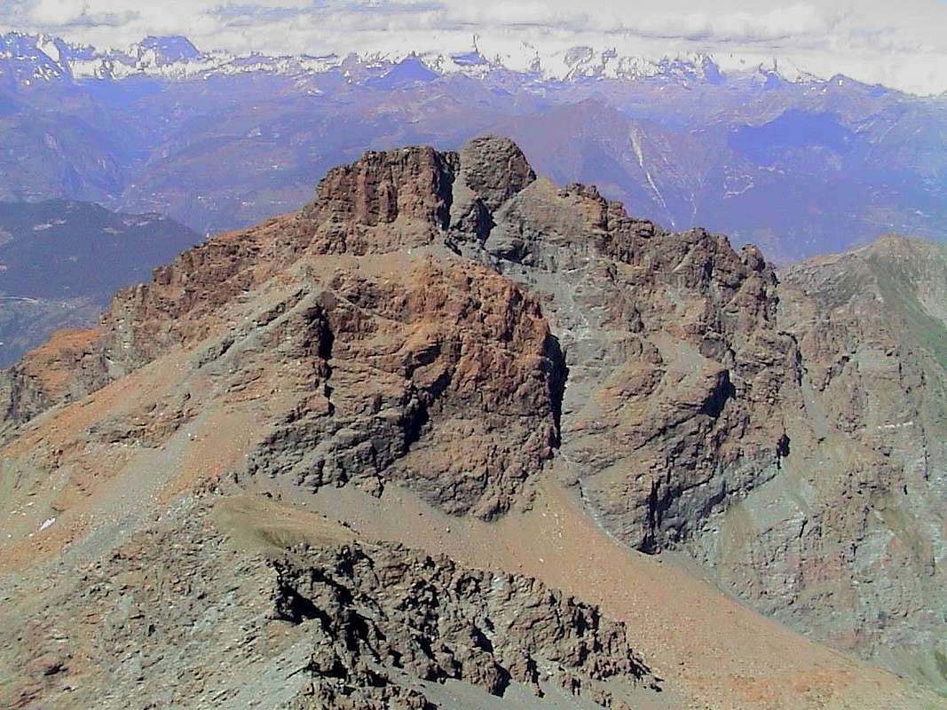
"Invers del Lago Gelato, Avic, Ruvic & the vallons of the ancient Coppermines and iron", by emilius ![]()
^^^^^^^
^^^^^^^ "Cooked and burnt by the sun Vallons of Ponton/Champdepraz stretching from Avic to Varotta Hill, bypass Revì & reach the Barbeston", by emilius ![]()
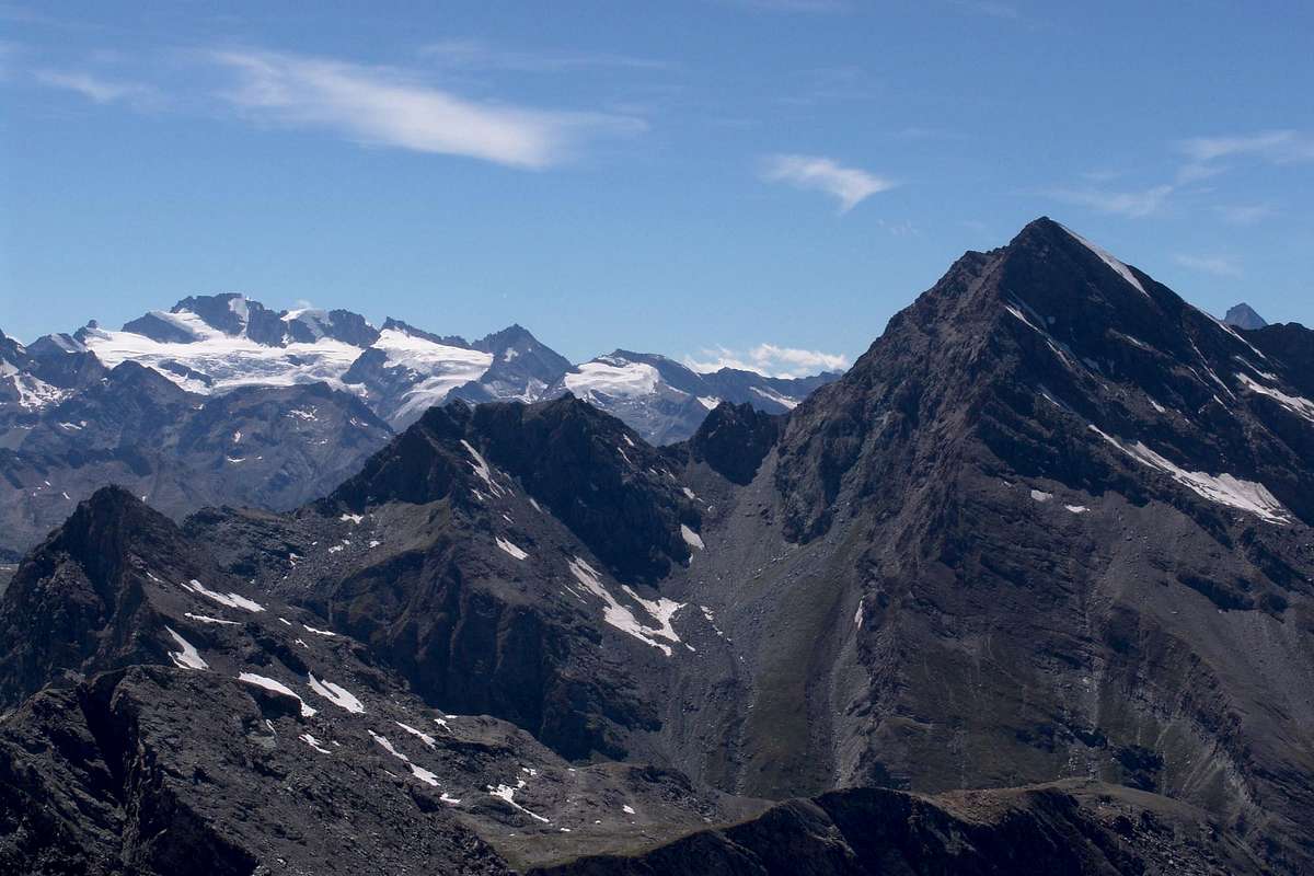
"The High Comba Tersiva and down the branch to the deep Valley of Savoney", by emilius ![]()
^^^^^^^
"On the high Fénis-Clavalité Valley with Eastern Great Avert Vallon", by emilius ![]()
^^^^^^^ "Plan Rué Point from Mount Corquet, between Fénis and Saint Marcel small Valleys also, better, Valleys", by emilius ![]()
^^^^^^^
"The important node topography that descends North from Leppe to Roèzes Range marks the watershed between the small Valleys Saint Marcel/Les Laures", by emilius ![]()
^^^^^^^
"The high small Valleys of Saint Marcel (left) and Les Laures facing North towards the Dora Baltea", by emilius ![]()
^^^^^^^
"Roèzes that dominate the small Valleys Les Laures (of Lakes) & Saint Marcel (of Copper & Manganese Mines)", by emilius ![]()
^^^^^^^
"The really wild small Valley of th'Arpisson wakes up after the long Winter: starts the fight between Rangers and Poachers on the ridges of the Cordagnì", by emilius ![]()
^^^^^^^
Middle/Low Valley and Champdepraz & Lakes small Valleys
This area is determined by the course of the River Baltea in his tract medium-low and extends from West to East by the Municipalities Fénis to those of Pontey, Champdepraz, Montjovet and Hone-Bard; latter, often packaged as name, actually is divided into two municipalities: one to the North of Baltea with its famous Fort overlooking the Baltea and the other on the opposite side of the same at the entrance of the small Valley of Champdepraz. This last can be, for its length and breadth, be in effect a real valley. It has very rich iron mines (now abandoned altogether) and is home to the Natural Park of Mount Avic, rich in Flora and Fauna. Its vallons are of a unique wild beauty and ending at the top with the Vallon of the Lakes, bordered to the South by the Champorcher Valley and to the West by the deep Valleys of Savoney, secondary branch of the Fénis-Clavalité-High Comba Tersiva.
- VALLEYS & VALLONS In order to deploy clockwise from Middle/Low and Champorcher Valley to Champdepraz small Valley & Internal Areas
1) - Arcomy Hill (about 1.960/70m);
2) - Brenve Hill (1.952m);
3) - Eastern Terra Rossa Pass (about 2.000m) and Western (2.075m) or
4) - Cima Piana Pass (about 2.300m).
Pana small Valley: above Champdepraz from Gorf Bridge, Gettaz des Allemands (996m), Quicord, Pana Pastures (1.809m) and Loch (1.902m), Lake Couvert; from lake
1) - in Southwest Cima Piana Pass, with path below West Ridge.
2) - In South Terra Rossa Western (2.075m) and Eastern (about 2.000m) and Brenve also Arcomy (1.952m) Passes. From Pana Alp in East Bec Giavin and traverse to Brenve/Boccoueil small Valley, with path.
Chamdepraz small Valley: Leser small Valley: from Voella or Chevrère (1.307m) in Southeast to Low, Upper Alps (1.900m), Loch (2.019m) and in Southwest connection-paths to Vallette Loch (2.170m) before the Barbustel Refuge (2.132m), with followed numerous variations to two hills and lochs (see below Lakes Vallon).
Lakes small Valley:
1) - from Voella in South to Alp La Serva (1.540m) and Lake (1.801m), Bayet Alp (2.071m), Cousse Alp (2.051m), Refuge Barbustel, with path. From this:
2) - in Southeast Lake Vallette (2.170m) to Col de la Croix (2.287m) and Cima Piana, with path;
3) - in South to Lake Bianco Hill (2.309m) and Champorcher Valley, with paths.
4) - In West-southwest to Bianco, Nero, Cornuto (2.172m) Lochs, Pisonet Alp (2.300m), Gran Lago (2.492m) near Forest Rangers Bivouac (private), Leità Lakes (2.540m), Medzove Pass (2.614m) to Savoney deep Valley in Fénis-Clavalité Valley, with paths.
5) - in South Mount Glacier (3.186m), through North-northeast Crest (passages of I°/II°);
6) - in North Medzove Point, easily with traces.
The Great Gorge: from Voella Village in South Alp La Serva (1.540m) and Lake (1.801m), with path and through moraines into La Gorge, wild valley between L'Invers del Lago Gelato ("To the North than Frozen Loch"; 2.915m) and Mount Orso ("Bear"; 2.717m). Rarely path if not by local experts.
Lake Gelato small Valley: from Voella Pra d'Oursi Pasture (1.791m; signals), Lake Gelato (2.597m) and Mines (2.616m) near Forest Rangers Shelter, with muletrack and path, to 1) - in Southwest Raye Chevrère Hill (2.703m), Lake (2.751m) and Mount Iverta (2.939m) through traces, moraine and "clapeys" (boulders);
2) - in Southeast to Invers of Lake Lelato Hill/Collar and Point (2.915m), by path and traces on brief and easy South Crest.
Varotta small Valley: from Voella, Prà d'Oursy and always in West Varotta Hill (2.589m), between Mounts Avic/Ruvic, to Ponton Vallon, with paths.
Barbeston small Valley: from Voella, Praz d'Oursy and in Northwest Plan Tsaté Alp, Valmeriana Hill (2.281m) to Mount Barbeston (2.482m), with path.
Filone-Barbeston/Lyan small Valley: from Champdepraz, Crestaz (1.293m), Cugnon, Losson (1.353m), Hérin (1.463m) or from Barbuste (1.240m) villages in West
1) - Arp Alp (1.542m) to Mount Barbeston, various paths;
2) - in North-northwest Coppermines to Mount Lyan (2.178m), paths. From Montjovet to Pontey Municipalities
Banchettes small Valley: from Ussel (splendid castle restaured), Petit Monde (626m), Rhodo Village (1.080m) to Marcage Hill (1.146m), with path.
Belle Combe small Valley: from Ussel, Bellecombe (1.018m), Low, Superior, Upper Mont Ros (1.609m), Toule Alps (2.020m). Goddet Hill or Valcrusa (2.110m) to: in East
1) - Mount Lyan (2.178m);
2) - in West-Southwest Mount Barbeston (2.482m), both with path on easy crests. Minerals Valley.
Valmeriana or Molinaz small Valley:
1) - from Pontey-Chiesanuova (523/535m), Pien, Ussert Hamlets (991m) Morgeron Alp. Plan Coca (1.675m) to Valmeriana Pasture (1.791m), through farms dirt road;
2) - from Lassolaz or Torin (466m), Plan Coca, with path. From Valmeriana in South to alternative about 1.820 meters and from this in Southeast Valmeriana Hill (2.281m) to Mount Barbeston, through easy Southwest Crest, with paths.
Ruvic-Orsière small Valley: from Margnier Village (607m) in South Ronchere Pasture to Verthuy-Perrod Hamlets (1.050m) to Southeast at beginning of
Orsières small Valley: with path and from this, without path in forest, to in East
1) - Giron Collar (2.580m), Mount Ruvic (2.922m), through North Ridge (F+, passages of I°/I°+/II°-);
2) - in Southeast Mount Rouvic, through Northwest long Slope by moraine, blocks and easy rock bands or snowfields.
Ponton deep Valley: from Septumian (543m), Arlier or Arly (582m), Praz (748m), Goilluz (893m) Villages to Lusey also Luxe little Village (1.160m), by dirt road; from this in South, long diagonal crossing above Ponton Torrent, to Forest Rangers Bivouac (2.168m) on a rocky tableland, over Ponton Alp (2.015m) in valley floor. From bivouac in East-southeast to
1) - Varotta Hill between Mounts Avic and Ruvic, with steep path. From Hill
2) - in North Mount Ruvic, by West-southwest Face, easy way but complex ,sometimes complicated, interaction between different rock bands and snowfields in final part, experience and rope required;
3) - to Mount Avic through long traverse on North Ridge and North-northeast Face, through small chimneys bluish rocks on castle in terminal part (PD-; passages of I°/II°- on thread; challenging but not difficult, experience, rope required).
Questa Area é determinata dal corso del Fiume Dora Baltea nel suo tratto medio-basso e si estende da Ovest verso Est dal Comune di Fénis a quelli di Pontey, Champdepraz, Montjovet ed Hone-Bard; quest'ultimo, spesso assemblato come denominazione, in realtà é suddiviso in due ben distinte municipalità: una a Nord della Dora Baltea con il suo famoso Forte a strapiombo sulla Dora Baltea e l'altro sulla sponda opposta della medesima all'ingresso del Vallone di Champdepraz. Questo ultimo può essere, per la sua lunghezza e vastità, essere a tutti gli effetti una vera e propria valle. Esso possiede miniere di ferro alquanto ricche (oggi abbandonate del tutto) ed ospita il Parco Naturale del Monte Avic, ricco di Flora e di Fauna. I suoi valloni sono d'una bellezza selvaggia unica e terminano nella parte superiore con il Vallone dei Laghi, confinante a Sud con la Valle di Champorcher ed ad Ovest con il Vallone di Savoney, ramo secondario di quello di Fénis-Clavalité-Alta Comba Tersiva.
Middle Valley and small Valleys & Dora Baltea Inside Areas (Fénis-Clavalité & Saint Marcel small Valleys or Valleys?)
The vallons that characterize this long area of triangular shape, which is a large Appendix North of Gran Paradiso, are all fascinating for the roughness of their Nature. It extends from the Municipalities of Aymavilles, at the Valley of Cogne, in the West up to that of Pontey with its beautiful Castle of Ussel, recently renovated and deserves a visit (in front of we, beyond the Dora, the Municipalities of Châtillon Saint Vincent and the foot of Mount Zerbion); interested progressively down towards East the Communs of Jovençan, Gressan (with the above renowned Pila Basin), Charvensod, Pollein, Grand Brissogne Municipalities, Saint Marcel and Fénis up to Pontey. On the opposite side is bounded by the Municipalities of Cogne, Champorcher and Pont Bozet, all in the Southern slopes of this great area. These last two valleys in reality, for the length of their development, can be considered the valleys themselves, with that Fénis that doubles over his half in the great Valley of Savoney, located between the Mount Rafray and Mount Glacier. Here we will discuss only those addressed to Dora, or to the North, they descend perpendicularly towards the same with the characteristic of the river valleys, that is embedded deep between the walls cut by water over thousands of years. Only the Pila Basin has a look of great glacial valley, witnessed by Hill morainic (lateral moraine of an ancient glacier that much of the "Giant Gargantuà" in popular legend) just above and between the little Town of Gressan. In equal manner to the obvious terracing of the Ancient Glacier Balteo flowing, high over a mile over the floor valley, from Mount Blanc to the gates of the City of Ivrea. These clearly mark the withdrawal of the same, as then highlights the great left lateral moraine called "The Serra" which is just a Northwest of this little town with a series of small lakes that signal and draw with precision the retreat of the ice. Withdrawal also occurred for all these vallons, where now there remain only the pitiful remains, now in permafrost, glaciers of tiny highlight of which now only the two of Walloon of Arpisson, under the North Wall of Emilius, to Leppe in the Valley of the laures below the top and the hill of the same name and that of Tersiva in the Valley Fénis-Clavalité-High Comba Tersiva at the foot of the Tersiva North-northeast Face of the same. The rest have all been "burned" by the sun, by time and by rising temperarure, as they have been worn out these highly ancient rocks, very rich in minerals and therefore mines. Area with large number of lakes, including the Great Lake, the largest in Aosta Valley in the Upper Valley of the Lakes Champdepreaz above, but more specifically for this area of the Lakes Chamolé, Gelato and two of Arbolle, Comboé, Laures, Layet, Lavodilec and Margheron. Present the Nature Hunting Reserve of the Marquis Turati (former Reserve Baron Beck Peckoz) in the small Valley of Saint Marcel, a testimony of a Flora and Fauna of a rich, but always dangerous balance in recent centuries. We like to see the image of these old miners, now that the mines were all closed, intent on dragging downstream with mules their work, even in the cold winters with their big sleds or "Ludzes". Suggestive instead the image of the perpetual struggle between the Rangers and Poachers that until not long ago, many, "beat" the small Valley. More specifically, though, in this area we turn to the two parallel small Valleys coming down from the Point Tersiva towards Baltea Stream or Middle Valley.
^^^^^^^
- VALLEYS & VALLONS In order to deploy clockwise from Fénis/Saint Marcel/Grand Brissogne/Pollein/Charvensod/Gressan/Jovençan to Aymavilles Municipalities
Clavalité-High Comba Tersiva small Valleys: from Chardonney in South La Coutà, Celey (1.570m), Coujeic, Beneyte (1.733m), Le Bayet (1.918m), Meney (1.949m) to Grand Alpe (2.129m) Pastures, with dirt road-path. From fork, immediately before in East, Etsely or Echellier Low (2.097m), Upper also Tramouaille (2.437m) to Etsely Pass (2.812m) and descent to
Savoney small Valley, with path. From Grand Alpe:
1) - in East-southeast Tramouaille de Cuneux (2.509m) to Fussy Pass (2.911m), between Mounts Glacier (3.186m) and Delà (3.139m), with path;
2) - in South-southeast Moussaillon Loch, Pass (2.847m) to Dondena small Valley in Champorcher Valley, with paths.
3) - In South on High Comba Tersiva Fénis Hill (2.833m) to Pontonnet small Valley, with paths. Connection in West with Pontonnet Hill (2.898m), descent in Urtier small Valley-Cogne Valley, with paths.
Pieiller small Valley: from Fénis-Le Perron (582m) Hamlet, Champlan, Crou de Ban (926m), Le Pieiller de Sermoz (1.075m), Maison Longue (1.112m), Le Plany (1.174m), Le Pieiller (1.230m) little Villages, alternative on hairpin road (about 1.200m) to Le Coteau (1.234m) Village, with municipal road or path from valley floor; from this:
1) - in Northeast Mount Saint Julien (1.384m), Saint Grat Sanctuary and, through short descent, Saint Julien Hermitage, with path.
2) - From Le Pieiller road continuation in Southeast to La Morgnettaz (1.245m), Champremier (1.833m) Villages and connection with Les Druges Comba, at the entrance of Saint Marcel small Valley;
3) - or the same connection but with path, starting from The Morgnettaz, passes through the small Villages of Porteron (1.368m; sledge run Combasse), Malplanet (1.495m), Les Druges Low and High (1.567m).
Saint Marcel Valley: Mounts Corquet-Roux small Valley: from Upper Les Druges (1.657m) in South Fontaine Froide (1.810m), Bren (1.961m), Praz Premier (2.011m) Alpages. From this
1) - in Southeast descent to Robioz in Fénis small Valley, with paths;
2) - in Southwest to Crotey Pass (2.486m) to Saint Marcel small Valley, with paths.
3) - In West Corquet old Alp (2.124m); from alp
4) - in South Mount Corquet (2.527m), easily with path.
5) - And yet true West to Mount Roux (2.277m) with its rich Chuc-Servette Mines of iron and copper, through uncertain path often covered with rhododendrons.
Crotey small Valley: from Les Druges, Pouria Pasture (1.586m), Vargney Alp, Chuc-Servette Old Mines (1.810m), Etéley Alp (1.741m), through dirt road; fork 1.836 meters, near Praborna manganese mine (1.891m) and after Etéley (1.750m) in East to Lavanché Alp (2.071m) and in Northeast to Crotey Pass (2.486m); from this in North Mount Corquet, through paths. In Southwest hunters Col de Belfrond (2.598m), on easy ridge.
Plan Rué mini Valley: from Plan Rué Alp (2.103m) on Saint Marcel farms dirt road in East to Belfrond Pass, with traces on grassy slope, earthly couloirs and easy rock bands, and from this in South to Plan Rué Point (2.883m), through traces and easy small rocks on North-northeast Crest.
Terre Bleue small Valley: from Etéley, Mulac-Saint Louis Hunting House (1.937m), Plan Rué Pastures (2.100m, 2.129m), Plan d'Emonin Alp (2.205m), Layet Alp (2.233m) and Lake to Grande Chaux Hunting House and old Alp (2.370m; ruines), through farms dirt road, in East-southeast to Terre Bleue Pass (2.827m) and from this:
1) - in Northeast Grand Avert (2.991m), without path, small traces and easy rocks on Southwest Crest (I°+, one passage of II°-, exposed to Southeast; snowy rope required);
2) - in South traverse to Little Avert (2.947m), through easy North Crest.
Avert-Lavodilec small Valleys: from alternative 2.320 meters before Grande Chaux Hunting House in Southeast to Petite Chaux Pasture (2.419m) in East, with dirt road, and through moraine:
1) - Grand Avert Pass (2.828m), between Grande Crete also Devil's Crest and Grand Avert; from this Grand Avert, through easy (I°) North Crest, with snow rope required;
2) - to Southeast in long crossing Lavodilec Hill (2.863m), with path.
Fenetre small Valley: from Grande Chaux in Southwest alternative 2.601 meters and
1) - in East-southeast Lavodilec Hill, with path; from this in North to Little Avert (2.947m), through debris on Southwest Slope and easy rock band in final part;
2) - in West-northwest Saint Marcel also Corona's Hill (2.913m; precious stone "Ollare" blue), with path, in South easy traverse to Laval Points (3.091m, 3.099m), Gianni Vert (3.150m) Points, with traces.
Grand Vallon: from Grande Chaux or from fork 2.601 meters in West to Vallonet Pass (3.062m), Mount Vallonet (3.101m), with small path-traces.
Petit Vallon: from Grande Chaux to West-northwest Grande Chaux Alp (2.391m), Leppe Pass (3.110m), with path, small path and traces. From this
1) - in North Ilario Antonio Garzotto Point (3.274m), through debris and easy rocks on South Slope; in South Leppe Point, easy Northeast Crest.
Eastern Arpisson deep Valley: from fork 1.836 meters on farms dirt road to Mulac (1.937m) in Northwest long traverse to Choulet Alp (1.821m), small saddle with Cross 1.939 meters towards the entrance into walloon, Salé (2.209m) Alp, with paths, Bonplan Alp (2.374m) to Salé or Grande Roise also Brissogne Pass (3.008m), with rare traces, moraine, blocks and small earthy gullies in terminal part, with snow rope required. From this
1) - in North easily to Becca of Salé;
2) - in South Little Roise Northern Antesummit (3.270m), Summit (3.273/4m), with traces, debris, blocks and small rocks in final part (one passage of II°-/II° on Carving said "Pas du Baton", between the both; rope required), at the beginning of Grande Roise Range.
^^^^^^^
I valloni caratterizzanti questa lunga area a forma triangolare, che costituisce una grande Appendice Settentrionale del Gran Paradiso, son tutti affascinanti per la ruvidità della loro Natura. Essa s'estende dal Comune di Aymavilles, all'imbocco della Valle di Cogne, ad Ovest fino a quello di Pontey con il suo bel Castello di Ussel, da poco tempo ristrutturato e meritevole di visita (di fronte abbiamo, al di là della Dora, i Comuni di Châtillon e Saint Vincent ai piedi del Monte Zerbion); scendendo verso Est interessa progressivamente i Comuni di Jovençan, Gressan (con la soprastante rinomata Conca di Pila), Charvensod, Pollein, Grand Brissogne, Saint Marcel e Fénis fino a raggiungere Pontey. Sul versante opposto viene delimitata dai Comuni di Cogne, Champorcher e Pont Bozet, tutti a Meridione di questa grande zona. Questi due ultimi valloni in realtà, per la lunghezza del loro sviluppo, possono essere considerate delle valli vere e proprie, con quella di Fénis che si sdoppia oltre la sua metà nel grande Vallone di Savoney, sito tra i Monti Rafray e Glacier. Qui tratteremo soltanto di quelli rivolti alla Dora, ovvero a Nord; essi scendono perpendicolarmente verso la medesima con la caratteristica delle valli fluviali, cioé incassati e profondi tra versanti tagliati dalle acque nei millenni. Soltanto la Conca di Pila ha aspetto di grande valle glaciale, testimoniato dalla Collina morenica (morena laterale di un antichissimo ghiacciaio detta del "Gigante Gargantuà" nella leggenda popolare) appena al di sopra e tra l'abitato di Gressan. In altrettanta maniera per gli evidenti terrazzamenti dell'Antico Ghiacciaio Balteo che scorreva, alto oltre un Kilometro sul fondovalle, dal Monte Bianco fino alle porte della Città di Ivrea. Questi segnano con netta demarcazione il ritirarsi del medesimo, come poi evidenzia la grande morena laterale sinistra detta "La Serra" sita subito a Nordovest di questa cittadina con tutt'una serie di laghetti segnalanti e disegnanti con precisione il ritiro dei ghiacci. Lo stesso avvenuto anche per tutti questi valloni, ove ormai permangono solamente i miseri resti, ormai in permafrost, di minuscoli ghiacciai dei quali s'evidenziano ormai soltanto i due del Vallone dell'Arpisson, sotto la Parete Nord dell'Emilius, quello di Leppe nel Vallone delle Laures al di sotto d'omonima punta e colle e quello della Tersiva nel Vallone di Fénis-Clavalité-Alta Comba Tersiva ai piedi della Parete Nord-nordest della medesima. I restanti son stati tutti "bruciati" dal sole, dal tempo e dall'innalzamento delle temperarure; sì come sono state logorate queste antichissime rocce, alquanto ricche di minerali e quindi di miniere. Area con notevole numero di laghi, tra i quali il Gran Lago, il più grande in Valle di Aosta nell'Alto Vallone dei Laghi sopra Champdepreaz ma, più specificatamente per questa zona, dei Laghi di Chamolé, Gelato ed i due di Arbolle, Comboé, delle Laures, Layet, Lavodilec e Margheron. Presente la Riserva Naturale di Caccia del Marchese Turati (ex Riserva Barone Beck Peckoz) nel Vallone di Saint Marcel, a testimonianza d'una Flora e di una Fauna ricca, ma sempre in pericoloso equilibrio negli ultimi secoli. Ci piace vedere l'immagine di questi vecchi minatori, ora che le miniere sono state tutte chiuse, intenti a trascinare a valle con i muli il loro lavoro; anche nei freddi inverni con gli slittoni o "Ludzes". Suggestiva invece l'immagine della lotta perpetua tra i Guardiaparco ed i Bracconieri che fino a non molto tempo fa, numerosi, "battevano" i valloni. Più specificatamente, però, in questo settore ci rivolgiamo ai due Valloni che scendono paralleli dalla Punta Tersiva verso la Dora Baltea e la Media Valle della medesima.
^^^^^^^
Dora Baltea Central Valley (above Aosta Town & surroundings)
This area is available right in the middle of Valle d' Aosta and the town from which it takes its name, or the ancient "Augusta Praetoria Salassorum" by the Praetorian Legions of Rome was once more Cordelia, that is the capital of the Celtic People of Salassians. Over the same dominate the twin pyramids of Mount Emilius and Becca of Nona who have historical importance in the birth of Alpinism in the Aosta Valley, in fact their first ascents carry respectively the dates of 1823 and 1832, a numbers game also strange because the former is more challenging in the second, but was risen early. As, from the historical side, it is given to know. It is distinguished also with another inconsistency: the Eastern side with the Walloons Laures, Arpisson and Dard has remained intact and wild, while the West with the Pila Basin, with the development of the discipline of skiing after the war and downhill mountain bikes, a few years ago, has taken a decidedly more "mundane". So also for the picturesque and the small Valleys of Comboé Arbolle, after the opening of Federigo Zullo Bivouac at Colle Carrel (1984) and the homonymous Refuge to Arbolle (1998). However, there is no mountaineer who has not visited this area, which has been the godfather of many of them. Maybe because Mount Emilius and its surroundings has always been traditionally a mountain clerical and a great expression of Christianity Alps.
- VALLEYS & small Valleys In order to deploy clockwise from Grand Brissogne/Pollein/Charvensod/Gressan/Jovençan to Aymavilles Municipalities
From Grand Brissogne to Pollein/Charvensod/Gressan/Jovençan/Aymavilles Municipalities Les Laures small Valley: from Grand Brissogne (906m), Gremonenche Pasture (1.112m), L'Arp 1.310m), la Vieille (1.629), Le Tramouail Pastures (1.795m) to Dessous Laures Lake and Ménabreaz Shelter (2.544m, 2.546m). From refuge:
1) - in East Salé Pass and Becca (3.008m, 3.187m), traces, blocks, small rocks in right traverse to pass and easy South Crest;
2) - in Southeast Long Lake (2.630m), in South fork 2.763 meters and in West Leppe Pass, Point (3.110m, 3.306m), with path, traces on moraine, snowfields, remains of old Leppe Glacier and easy Northeast Crest.
3) - In North Punta Ilario Antonio Garzotto, debris, easy rocks on South Slope.
4) - From fork in Southwest Upper Lake (2.787m), fork 2.933 meters, Laures Hill, with path, and Mount (3.035m, 3.121m), by easy West Crest and descent to Lussert small Valley and three Lochs, with paths.
5) - In West-northwest from fork 2.933m Arbolle Pass (3.154m), path, final steep earthy gully, and three Punta Rossa (3.400m, about 3.395m, 3.401m), through paths, traces and Northeast Crest, not difficult (F/I°/I°+).
6) - From Dessus Loch (2.787m) in West-northwest Iced Lake, Three Capuchins Pass (3.242m), with debris and snowfields (requires precaution if frozen), to Mount Emilius (3559m), by paths, debris and traces to East under South-southeast Crest or Standard Route.
7)- In West Peckoz Pass (3.042m), Becca of Seneva (3.081m), path and easy South-southwest Crest, under the thread to East.
Western Arpisson deep Valley: from Pila main road, hairpin about 950/60 meters with alternative to Low Reverier (1.042m), Rongachet bridge up Comboé Torrent and followed Village (1.100m), Gorrettaz (1.089m) Hamlet, La Barma (1.255m) Pasture, Marstsaouchy Meitin, Damon Pastures (1.362m, 1.410m), Plan Croix Alp (1.745m; ruins), Arpisson Low, Upper Alps (1.951m, 2.010m); from Alp in East
1) - Mount Père Laurent (2.625m), with rare traces on Western grassy and steep Slope.
2) - In South Emilius Sources into moraine, Western Arpisson Glacier, Carrel Hill and Federigo Zullo Bivouac (2.912m, 2.907m). From this
3) - in East Arpisson Glaciers, below Emilius North Wall, to Peckoz Pass, with traces, moraine under glaciers and delicate traverse in final part (snow or ice possibility, in these conditions rope required; but better than the alternative described below).
4) - Before the pass, Testa Blantsette (3.140m), through West rocky Slope and easy traverse on ridge in South to Blantsette Carving (3.126m): Alternative Route for the traverse to Les Laures small Valley, in descent or with snow through a steep rocky gully with soil; rope required.
5) - Via Ferrata on Northwest Ridge of Mount Emilius, required adequate equipment, technical preparation, training and adaptation to the sense of emptiness;
6) - in Northwest, always from bivouac, Normal Route to Becca of Nona (3.142m), with small path and traces on easy Southeast Crest.
Dard-Comboé-Arbolle Gorge and small Valleys:
1) - various possibilities of departure to Arbolle Refuge (2.516m), nearby two Arbolle Lochs (2.496m).
2) - From Pila main road (the best Saint Salo-Les Gorres 1.835m, Les Pousses Pasture 1.601m or from Upper Reverier to La Mare 1.187m) to Ponteilles Alp (1.706m) and waterfall;
3) - from this to Low Comboé Alp (2.041m), Comboé Pasture (2.114m). In East up Comboé Torrent path to Plan Valé (2.379m; ruins), Gros Scez fork 2.526 meters to
4) - Becca of Nona through path on Southwest Slope;
5) - path to Federigo Zullo Bivouac. From Comboé in South Grand Plan Alp (2.158m; ruins) and
6) - connection to Plan Valé;
7) - gorge to Arbolle Refuge, with paths. From Shelter in North-norteast
8) - Three Capuchins Pass and Mount Emilius;
9) - in Northeast Arbolle Pass and three Rossa Points.
10) - In East Valaisan Pass (3.210m; absolutely not recommended for the various danger);
11) - in East-southeast Garin Hill to Franco Nebbia Bivouac and Arpisson-Gimillan small Valley, with paths.
Pila Basin: from Aosta City by Cable Railway (Place near Cogne Iron & Steel Works), main road or various muletracks. Possibilities with paths to
1) - Plan Fenetre Hill (2.229m), Comboé small Valley and Alp (2.114m), in East Carrel Hill and Federigo Bivouac, with paths, to Becca of Nona, through Southeast Crest with traces/path.
2) - in South Chamolé Alp, Lake, Pass (2.152m, 2.325, 2.641m) to Arbolle small Valley and Refuge, with paths.
3) - From Pass in South easy traverse to Testa Nera (2.820m), through Northeast Crest, Mount Bellefaça (2.970m), Valletta Point (3.090m) on watershed.
4) - From Chamolé Lake in Southwest Plan de l'Eyvie Pasture (2.253m) to Tsa Sètse small Valley and Hill (2.815m) and descent to Arpisson-Gimillan small Valley.
5) - From Hill in East Via Ferrata to Point Valletta (3.090m), rope required;
6) - in Northwest Equipped Via Panorama to Tsa Sètse Point, Piatta of Montpers, Grevon, Couis, Drinc, de la Pierre Points, on watershed Cogne Valley/Pila Basin to la Pierre small Valley/Pila Basin.
^^^^^^^
Questa area si dispone proprio nel centro della Valle d'Aosta e la Città dalla quale essa prende il nome, ovvero l'antica "Augusta Praetoria Salassorum" delle Legioni Pretoriane di Roma; più anticamente era Cordelia, cioé la Capitale del Popolo Celtico dei Salassi. Sopra la stessa dominano le piramidi gemelle del Monte Emilius e della Becca di Nona che hanno un'importanza storica nella nascita dell'alpinismo in Valle di Aosta, infatti le loro prime ascensioni portano rispettivamente le date del 1823 e del 1832; un gioco di numeri anche strano perché il primo é più impegnativo della seconda, ma é stato salito in anticipo. Per quanto, dal lato storico, é dato a sapere. Essa si contraddistingue, inoltre, con un'altra incongruenza: il lato Orientale con i Valloni delle Laures, Arpisson e del Dard é rimasto integro e selvaggio, mentre quello Occidentale con la Conca di Pila, con lo sviluppo della disciplina dello sci dal dopo guerra e della discesa delle mountain bikes, da pochi anni, ha assunto un carattere decisamente più "mondano". Così anche per i pittoreschi Valloni di Comboé e di Arbolle, dopo l'apertura del Bivacco Federigo Zullo al Colle Carrel (1984) e dell'omonimo Rifugio ad Arbolle (1998). Comunque non esiste alpinista che abbia non frequentato questa zona, che ha tenuto a battesimo molti di loro. Forse perché il Monte Emilius ed il suo circondario é sempre stata tradizionalmente una montagna clericale ed una grande espressione della Cristianità alpina.
^^^^^^^
Mountain Conditions
- Meteo: you can find all the needed informations at the official site of the Valle d'Aosta Region:
- Valle d'Aosta Meteo
Maps
MAPS:
- Kompass "Gran Paradiso Valle d'Aosta Sentieri e Rifugi" Carta turistica 1:50.000.
- L'Escursionista "Valgrisenche Val di Rhêmes" Carta dei sentieri (n° 3) 1:25.000.
- Enrico Editore Ivrea-Aosta "Gruppo del Gran Paradiso" 1:50.000.
- I.G.C. Istituto Geografico Centrale "Valsavarenche-Valle di Rhêmes-Valgrisenche" Carta dei sentieri e dei rifugi (carta n° 102) 1:25.000.
Important Information
- REGIONE AUTONOMA VALLE D'AOSTA the official site.
- FONDAZIONE MONTAGNA SICURA Villa Cameron, località Villard de la Palud n° 1 Courmayeur (AO) Tel: 39 0165 897602 - Fax: 39 0165 897647.
- A.I.NE.VA. (Associazione Interregionale Neve e Valanghe).
Useful Numbers
- Protezione Civile Valdostana località Aeroporto n° 7/A Saint Christophe (Ao) Tel. 0165-238222.
- Bollettino Meteo (weather info) Tel. 0165-44113.
- Unità Operativa di Soccorso Sanitario Tel. 118.