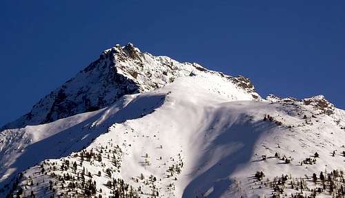
A fine mountain shaped as a wide leaf when seen from East or West; to the North-northeast an high cragged wall ending with a small rocky beak locally named "Lo Cordagnë or Cordagnì" (The Shoemaker), followed by two more twin towers before the main summit. This mountain is nothing but the sequel to Northeast of the edge of Monte Emilius that comes down to the Blantsette Pass, better Carving, (3.137m), the omonymous Summit (3.140m) and the Peckoz Pass (3.042m). Further more the ridge, changing its course to Northwest goes to the Mont Père Laurent (2.625m). Mountain climbing rarely if not by the local inhabitants of grand Brissogne, on which, when the weather is bad they can not climb up to Monte Emilius, operate traditional "Fires of St. Peter and Paul" on June 29th. Even less popular timepiece on the opposite, that the Arpisson, which is usually reached only the Col Peckoz to navigate to les Laures. The same in '800 knew better attendance and up to 1930/40 when it was crossed by the Gamekeepers of the Baron Beck Peckoz of Gressoney. When the Hunting Reserve is it "withdrawn", limiting the current in the Valley of Saint Marcel and owned by the Marquis Turati, interest to this passage is somewhat reduced. Even the famous "Tour of Emilius", in vogue in the Thirties and Forties, is gradually fell into gradual disuse, becoming a prerogative for lovers of the past. Where once dominated the "raids" by Giovanni Matteo "Agostino" Zulian, Elio Saluard mates, today has fallen silent. It is back to 1897, when Becca was still "virgin"; only a few "Good Soul" returns to make her visit, as the guys from "Fires". But when the weather is really bad ... Beyond these considerations, it is to be observed as it is well worth a visit, especially going up from the Vallon of the Laures, if only for the views really unusual, that they have nothing to envy from those of the much more high Emilius. Exceptional views just on this last, which looms as a big tower above Arpisson two Glaciers and Vallon.
Bella montagna a forma di larga foglia, se vista sia da Est che da Ovest; a Nord-nordest presenta un'alta parete dirupata culminante in un piccolo becco roccioso chiamato in loco "Lo Cordagnë o Cordagnì" (Il Calzolaio), che, seguito da altri due torrioni gemelli, precede la vera vetta. La montagna altri non è che la continuazione a Nordest dello spigolo del Monte Emilius che forma in successione il Colle Blantsette (3.137 m), l'omonima punta (3.140 m) ed il Col Peckoz (3.042 m). Oltre la cresta cambiando direzione a Nordovest va a formare il Mont Père Laurent (2.625 m). Montagna raramente salita se non dagli abitanti locali di Brissogne, sulla quale, quando il tempo é brutto non potendo salire al Monte Emilius, effettuano i tradizionali "Fuochi di San Pietro e Paolo" nel giorno del 29 Giugno. Ancor meno frequentata sul versante opposto, ovvero dell'Arpisson, dove in genere viene raggiunto esclusivamente il Col Peckoz per traversare alle Laures. Lo stesso conosceva maggiore frequentazione nello'800 e fino al 1930/40 allorché veniva attraversato dai Guardiacaccia del Barone Beck Peckoz di Gressoney. Allorché la Riserva di Caccia s'é "ritirata", limitandosi all'attuale nel Vallone di Saint Marcel e di proprietà del Marchese Turati, l'interesse per questo passaggio s'è alquanto ridotto. Anche il famoso "Giro dello Emilius", in auge negli Anni Trenta e Quaranta, é via via caduto in progressivo disuso, diventando più una prerogativa per gli amatori del passato. Dove una volta dominavano le "scorribande" di Giovanni Matteo "Agostino" Zulian, Elio Saluard e compagni, oggi é caduto il silenzio. S'é tornati al 1897, quando la Becca era ancora "vergine"; solo qualche "Anima Buona" torna a farle visita, come i ragazzi dei "Fuochi". Ma quando il tempo é veramente brutto ... Al di là di queste considerazioni, é da osservare come la medesima meriti visita, soprattutto salendo dalle Laures, se non altro per i panorami veramente inconsueti, che nulla hanno da invidiare rispetto a quelli del ben più alto Emilius. Viste eccezionali proprio su quest'ultimo, incombente qual grande torre al di sopra dell'Arpisson.
First Ascents
First on the summit: E. Daniele, G. B. Devalle, A. Pession and L. Bich, (Aug 29th, 1897), from Arpisson Upper Alp.
S-SW Arête: E. Daniele, G. B. Devalle, A. Pession and L. Bich, (Aug 29th, 1897), in descent to Peckoz Pass.
S-SW Arête (integral by Peckoz Pass): Osvaldo Cardellina, lone (Jul 26th, 1992), from Peckoz Pass.
W Wall (Left 1897 Route to Northern Turret or Lo CordagnCordagnë): E. Daniele, G. B. Devalle, A. Pession and L. Bich, (Aug 29th, 1897), from Arpisson Alp. First repetition: Osvaldo Cardellina, lone (Oct 10th, 2011), from Reverier Dessous-Rongachet-Gorrettaz-Martsaouchy Damon-Plan Croix-Arpisson Alps.
W Wall (Right 2011 Direct Via to Summit): Osvaldo Cardellina, solo (Oct 12th, 2011), from Reverier Dessous-Martsaouchy Damon-Plan Croix-Low and Superior Arpisson Pastures; in descent through S-SW Ridge to Eastern Arpisson Glacier and directly towards "Emilius's Sources"and Arpisson Alps.
N-W Arête: Renato Chabod, A. Nouchy and G. Riconda, (Jun 15th, 1924), from Arpisson Alp.
N-NE Wall: Osvaldo Cardellina, solo (Sep 16th, 2007), in ascent from Grand Brissogne.
NE Edge: Osvaldo Cardellina, solo (Sep 16th, 2007), in descent to Les Laures Vallon.
E-NE Face: Giovanni Matteo "Agostino" Zulian, lone (in the mid-Sixties), from Les Laures.
Getting There
BY CAR:
From Torino, Milano, etc: Motorway A5. Exit at Aosta Est.
From Switzerland: through the Grand Saint Bernard Tunnel or the namesake Pass.
From France: through Mont Blanc Tunnel or Petit Saint Bernard Pass. It isn't necessary to take Motorway A5: you can drive on SS.26, in the direction of Aosta.
BY PLANE:
Aeroporto "Corrado Gex" Saint Christophe (Aosta).
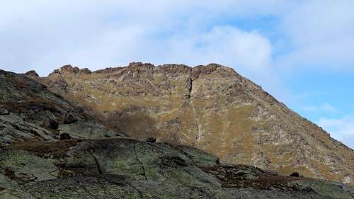
From left: East Crest, East-northeast Face, Northeast Edge, North Wall & North-northwest Ridge, above Lower Laures Walloon.
Approach & Route
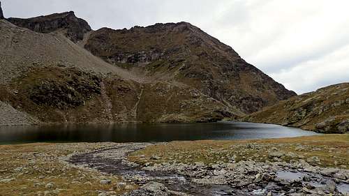
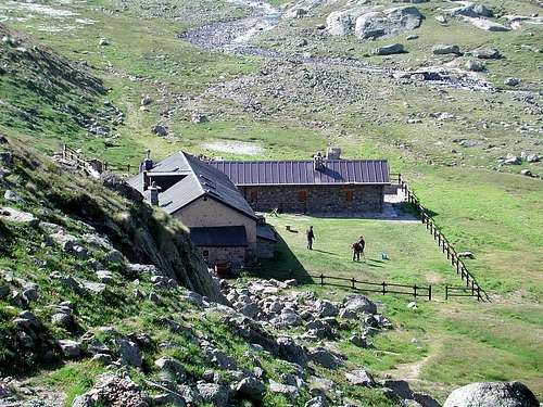
A) - Approach from Les Laures Vallon From the Grand Brissogne (894m), go along the road till the Alpe di Gremonenche (1.000m). From here continue along the dirt road up to l'Arp (1.310m) then, along a path that, bordering the stream (Des Laures), leads to La Vieille (1.623m) and to Le Tramail or Tramouail (1951m) (good shelter when weather is bad). Crossing some small bridges up to the altitude of 2.200 meters, (starting from this point a steep but faster path goes, at right (West), toward the slopes of Becca di Seneva). Better go on toward East forwarding the Becca di Salè (locality called of Black Fountains) and climb the last 400 meters on wide slopes till the top of the rocky terraces (2.600m; here a small chapel dedicated to Jean and "Dino"Charrey brothers and Cino Norat dead in 1929 on the East Wall of Monte Emilius). A short descent leads to the Refuge Ernesto Menabreaz (2.542m, private); the refuge has an open free part (8 places with covers) usable as winter room, on the Eastern bank of Lake of the Laures, under the chain that reaches from Becca Salé Roises.
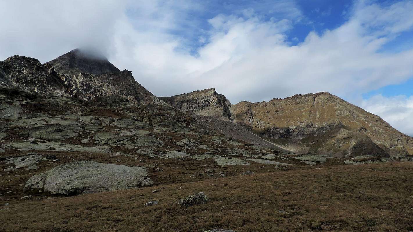
B) - Approach from Federigo Zullo Bivouac at Carrel Hill From Pila (famous ski resort easy and fastly reachable from Aosta using car, bus or cableway), to reach the Plan Fenêtre Hill and Comboè Vallon. From these up to the alternative of the Gros Scez (2.526m); to leave to the left (West) the path for Becca di Nona and to go up again to the Federigo Zullo Bivouac (2.907m; 4h'00). After a short descent to the North to the underlying tiny lake and a subsequent small dewlap, to cross toward East the two Glacier of Arpisson under the Northern Wall of the Mont Emilius (an ancient track that report Maps is almost gone). A passage under the Black Triangle (3.378m) if in "verglass" it asks for the use of the crampons. Crossing more to the South of the glacier paying attention to crevasses, that can not be seen but they exist and are quite deep. To go up again a shoulder diverting to East in quota 2.990/3.000 meters~ and, leaving right the Standard Route to Testa Blantsette, with very delicate traverse on the Northwest Face of the same reach the pass (5h'30/6h'00 Pila; 2h'00/2h'15 Bivouac).
Important Note: in the event of snow with snow (snowslides danger), or with snow (slippery with little possibility of the securities on the rock, definitely broken or even crumbled) it is better to avoid this road turning to the nearest Testa Blantsette or Becca des Boucs (3.140m; Head, Steinbocks) or by means of the choice of the Laures Vallon.
Via through the Peckoz Pass From the Rifugio Ernesto Menabreaz (2.546m) to outline the Lower Lake Laures Northwest and exceed the effluent on a catwalk; go up the trail n° 8 to the Peckoz Pass (3.042m), which in the end along a groove on tracks discontinuous or small snow-capped mountains, and reach it. From pass overcome a first projection with little man (easy to circumvent the East), cross two small humps reaching a small notch; this always pass on the right a little later "pyramid" or cross the same paying attention to the short descent (I°/II°-) reaching a rounded saddle. The next part is configured in the manner of "knuckles of a closed fist with thumb out" lurks in the East through a ledge exposed and with grass, reaching a second narrower and less obvious saddle. You cross this stretch with fun climbing on red rocks, but dangerous because brittle (from II° to II°+ and beyond, depending on the route chosen). Continue on the ridge (I° and II°, or just below the West (exposed but convenient enough downhill to expedite the same) and quite easily touch the cairn at the top with jagged but linear path, passing a series of small carvings with three of these in greater evidence and alternated several smaller pinnacles of fun climbing. Exposed to the East, very exposed to the West (2h'30 from the shelter; 1h'00/1h'15 by pass, even 2h'00 with integral route on thread of the edge). Climb easy but requires a little bit of experience in the research of the via and that, in the presence of snow, completely changes appearance requiring a degree of caution; even more starting from Federigo Bivouac nearby Carrel Hill, because the traverse to reach the pass. In certain situations is quite delicate (see Approach B) and such as to prohibit the same.
Descent: Coming down is along the same route.
A) - Avvicinamento dal Vallone delle LauresDal Comune di Grand Brissogne (894 m), percorrere la strada poderale fino all'Alpe di Gremonenche (1.000m). Da qui continuare lungo la strada sterrata fino a l'Arp (1.310 m) poi, lungo un percorso che, al confine con il Torrente des Laures, porta a La Vieille (1.623 m) e Le Tramail o Tramouail (1951 m) (buon riparo col cattivo tempo). Attraversando alcuni ponticelli fino alla quota di 2.200 metri, (a partire da questo punto un sentiero ripido ma più veloce va, a destra (Ovest), verso le pendici della Becca di Seneva). Meglio proseguire verso Est in direzione della Becca di Salè (località detta delle Fontane Nere) e salire gli ultimi 400 metri su ampi pendii fino alla sommità delle terrazze rocciose ((2.600 m; qui una piccola cappella dedicata ai fratelli Jean e "Dino" Charrey ed a Cino Norat morti nel 1929 sulla Parete Est del Monte Emilius). Una breve discesa porta al Rifugio Ernesto Menabreaz (2.542 m, privato); il rifugio ha una parte libera aperta (8 posti letto con coperte) utilizzabile come sala d'inverno, sulla sponda Orientale del Lago Inferiore di Laures, sotto della catena che congiunge la Becca di Salé alle due Roises.
B) - Avvicinamento dal Bivacco Federigo Zullo presso il Colle Carrel Da Pila (nota località sciistica, raggiungibile da Aosta in auto, pullman o funivia), raggiungere il Colle Plan Fenêtre e il Vallone di Comboè. Da questi fino al bivio del Gros Scez (2.526 m); lasciare a sinistra (Ovest) il sentiero per la Becca di Nona e risalire al Bivacco Federigo Zullo (2.907 m; 4h'00). Dopo una breve discesa a Nord al sottostante laghetto ed alla piccola giogaia successiva, traversare verso Est i due Ghiacciai dell'Arpisson sotto la Parete Nord del Monte Emilius (un'antica traccia che riportano le Carte é quasi del tutto scomparsa); un passaggio sotto il Triangolo Nero dell'Emilius (3.378 m), se in "verglass", richiede l'uso dei ramponi. Attraversare più a Sud sul ghiacciaio facendo attenzione ai crepacci, che non si vedono ma esistono e sono alquanto profondi. Risalire una spalla a Nord deviando a Est a quota 2.990/3.000 metri~ e, lasciando sulla destra la Via Normale per la Testa Blantsette, tramite una delicata traversata sulla Faccia Nordovest della medesima raggiungere il passo (5h'30/6h'00 da Pila; 2h'00/2h'15 dal Bivacco Federigo Zullo).
Nota importante: in caso d'innevamento con neve alta (pericolo di slavine), oppure con neve fresca (terreno scivoloso con scarsa possibilità d'effettuar le sicurezze sulle rocce piuttosto sgretolate se non addirittura marce) é meglio evitare questa via rivolgendosi alla vicina Testa Blantsette (3.140 m) od effettuando la scelta del vicino Vallone des Laures.
Via tramite il Col Peckoz Dal Rifugio Ernesto Menabreaz (2.546 m) contornare il Lago Inferiore di Laures a Nordovest e superare l'emissario su di una passerella; risalire il sentiero n° 8 per il Col Peckoz (3.042 m), che nel finale percorre un canalino su tracce discontinue o piccoli nevati, e raggiungerlo. Dal Colle superare un primo risalto con ometto (facilmente aggirabile ad Est), superare due piccole gibbosità raggiungendo un intaglietto; da questo oltrepassare sempre sulla destra una successiva piccola "piramide" oppure attraversare la medesima facendo attenzione alla breve discesa (I°/II°-) raggiungendo una sella arrotondata. La successiva parte configurata a guisa di "nocche di una mano chiusa con pollice in evidenza" s'aggira sempre ad Est tramite una cengia esposta e con erba, raggiungendo una seconda più stretta e meno evidente sella. Oppure attraversare questo tratto con divertente arrampicata su rocce rossastre, ma pericolose perché molto fragili (dal II° al II°+ ed oltre, a seconda del percorso scelto). Continuare sul filo di cresta (I° e II°), o appena sotto ad Ovest (abbastanza esposto ma conveniente in discesa per sveltire la stessa) e toccare abbastanza facilmente l'ometto presso la vetta con percorso frastagliato ma lineare, passando una serie di minuscoli intagli con tre di questi in maggior evidenza ed alternati a diversi piccoli pinnacoli di divertente arrampicata. Itinerario esposto ad Est ed alquanto, in alcuni tratti, ad Ovest (2h'30 dal rifugio; 1h'00/1h'15 dal passo; anche 2h'00 con percorso integrale sul filo di cresta). Asensione facile, ma con necessaria capacità di ricerca nell'individuare la via e che, in presenza di neve, cambia completamente aspetto richiedendo una certa cautela; ancor più partendo dal Bivacco Federigo Zullo al Colle Carrel, perché l'attraversata per raggiungere il colle in certe situazioni risulta alquanto delicata (vedi sopra Avvicinamento B) e tale da sconsigliarla desisamente.
Discesa: Lungo l'itinerario di salita.
Difficulties
Expert Hiker, some passages of I°; EE/F+. F+/PD- climbing along the S-SW ridge (I°/II°).
E/F+ con passi di I°. EE/PD in caso di innevamento; F+/PD- percorrendo integralmente la cresta S-SW (I° e II°).
Equipment
Hiking gear, rope is useful for the ridge.
Da escursionismo; corda percorrendo la cresta integralmente.
"Guida delle Alpi Occidentali" di Giovanni Bobba e Luigi Vaccarone C.A.I. Sezione di Torino Volume II (parte II), 25 Maggio 1896.
"Guida del Monte Emilius" di Osvaldo Cardellina Editore in collaborazione con il Club Alpino Italiano Sezione di Aosta, Dicembre 1978 (in Italian).
"Montagnes Valdôtaines" di Renato Chabod, Ed. Tamari Bologna, 1974.
"Guida dei Monti d'Italia – Emilius Rosa dei Banchi-Parco del Mont Avic" di Giulio Berutto e Lino Fornelli - Club Alpino Italiano/Touring Club Italiano, Marzo 2005.
"Diari Alpinistici" di Osvaldo Cardellina e Indice Generale accompagnato da Schedario Relazioni Ascensioni 1964-2019 (unpublished).
MAPS:
Kompass "Gran Paradiso Valle d'Aosta Sentieri e Rifugi" Carta Turistica 1:50.000.
Hapax "Les Sentiers" Comunità Montana Monte Emilius, Luglio 2000 1:25.000.
L'Escursionista "Conca di Aosta-Pila-Monte Emilius" Carta dei sentieri (n° 4) 1:25.000.
Enrico Editore Ivrea-Aosta "Gruppo del Gran Paradiso" 1:50.000.
L'Escursionista "Valle di Cogne" Carta dei Sentieri 1:25.000.
I.G.C. Torino "Carta delle Passeggiate ed Escursioni in V.D.A. Conca di Pila-Gressan" 1:20.000.
Hapax "Les Sentiers de Charvensod" Comune di Charvensod, Giugno 2003 1:25.000.
Parents refers to a larger category under which an object falls. For example, theAconcagua mountain page has the 'Aconcagua Group' and the 'Seven Summits' asparents and is a parent itself to many routes, photos, and Trip Reports.

 9162 Hits
 93.1% Score
 41 Votes