


-
 2711 Hits
-
 80.49% Score
-
 12 Votes
|
|
Mountain/Rock |
|---|---|
|
|
45.64970°N / 7.37593°E |
|
|
Mountaineering, Trad Climbing |
|
|
Spring, Summer, Fall, Winter |
|
|
10689 ft / 3258 m |
|
|
Note
|
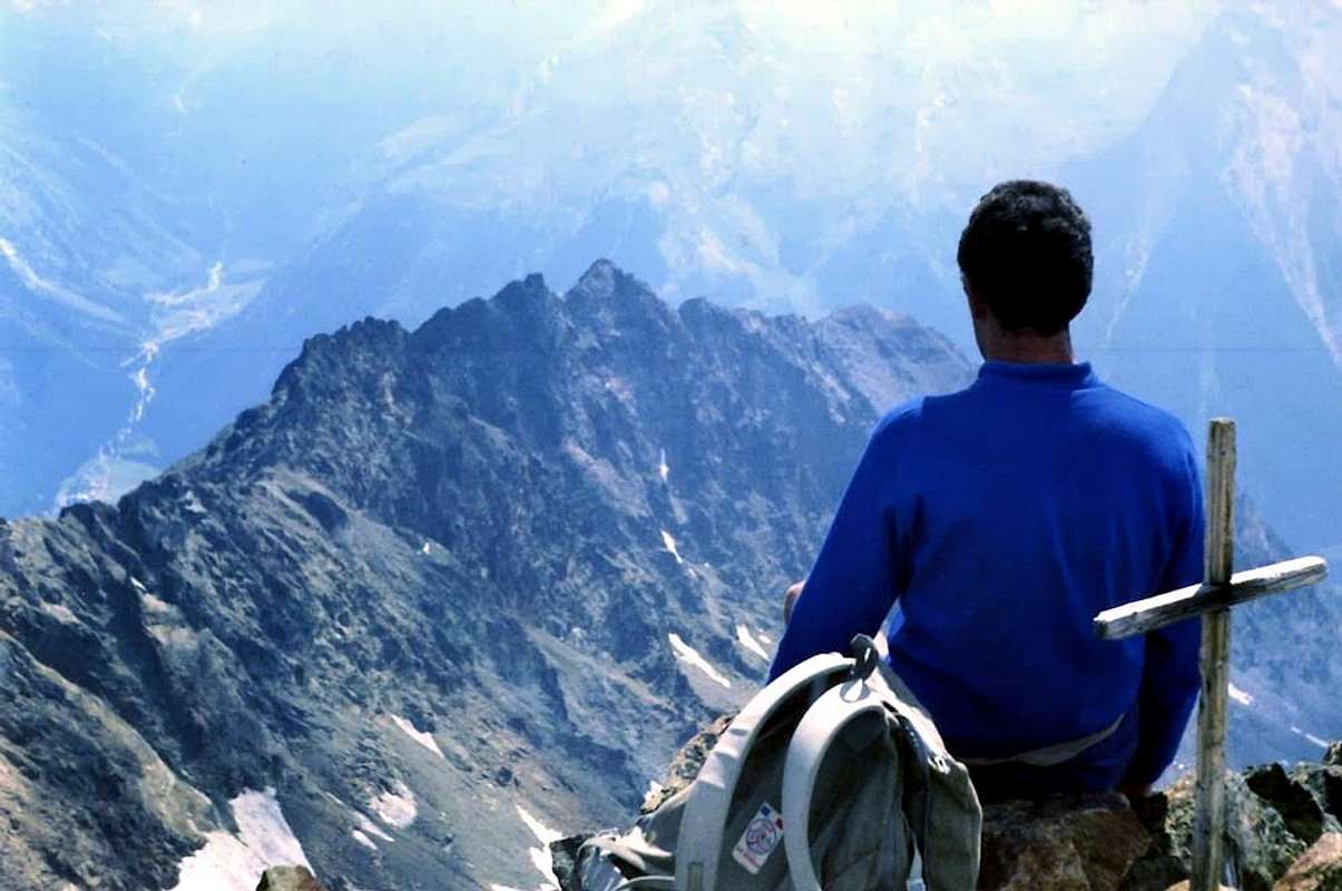
La montagna chiama i suoi figli, ed essi rispondono fedelmente al suo appello… Osvaldo Cardellina, Diario alpinistico, 1964-65 Page texts: @ OsvaldoCardellina "Osva", passed away on May 2, 2022. Page owners: Christian Cardellina e Osvaldo Cardellina. Any updates from September 12, 2022: Antonio Giani, page administrator, friend and climbing companion. Testi della pagina: @ OsvaldoCardellina "Osva", scomparso il 2 maggio 2022. Proprietari pagina: Christian Cardellina e Osvaldo Cardellina. Eventuali aggiornamenti dal 12 settembre 2022: Antonio Giani, amministratore della pagina, amico e compagno di salite. |
Overview
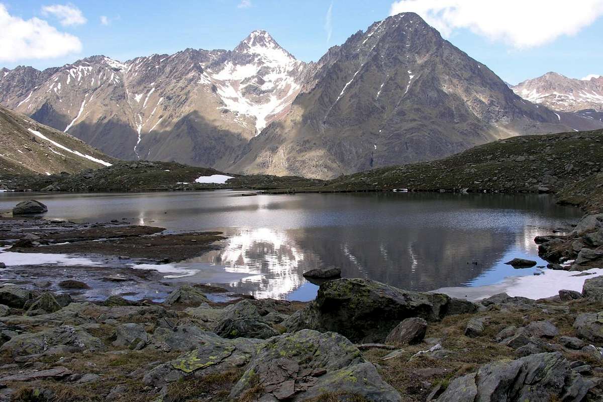
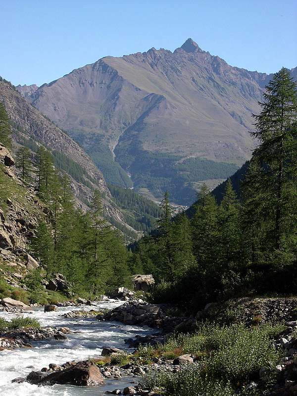
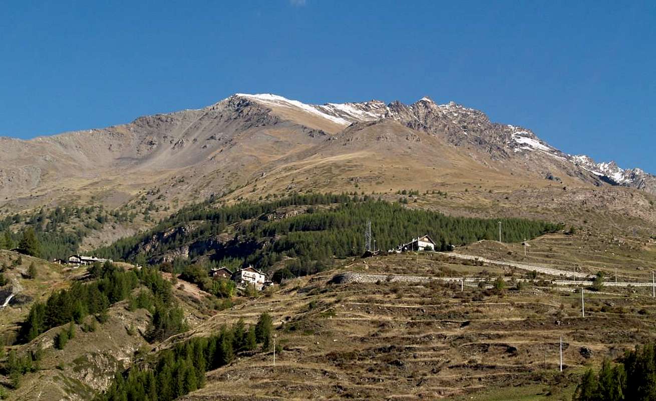
This Summit is part of the little Subgroup Pic Garin (3.451m), place among the Vallons Grauson East and Arpisson on the opposite side, above Gimillan fraction (1.787m) in the Cogne Valley. Practically this subgroup is the appendage of the Southern Group of Mont Emilius (3.559m), starting from the Central Valley of Dora Baltea, looks to the Group of Gran Paradiso (4.061m) to reach the Cogne Valley. A long Buttress South-southwest down from Peak Garin (3.451m) to finish above the two Villages Gimillan and Epinel (1.436m). Along the way various forms Summit: the two elevations of Pointe Fleurie or Punta Fiorito (3.260/1m), three of Punta Lavà (3.214m), Fleurie or Fiorito Pass (about 3.170/80m), Arpisson Tower (3.231m) and, after the Pila Northeast pass (about 3.090 meters), the three Summit of Coupées Arpisson (Southwest 3.215/18m, Central 3.220/4m, Northeast 3.231m) and the Punta with the same name (3.035m). Here the dividing crest splits: a branch turns to the Southeast towards the rocky-grassy promontory Tsaplana (2.681m), immediately above Gimillan or Dzimillan; the other sinks more in the Southwest constituting the extreme Eastern side of the Arpisson Vallon.
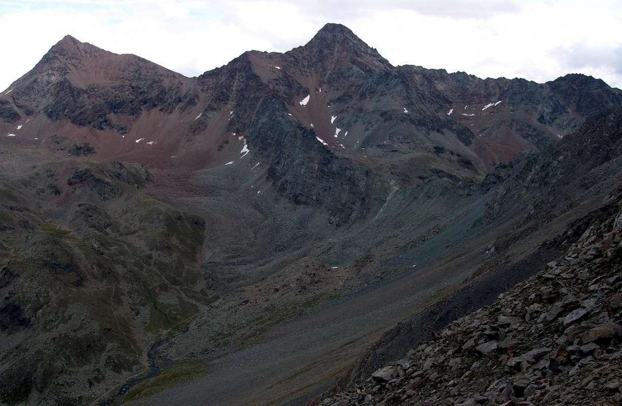
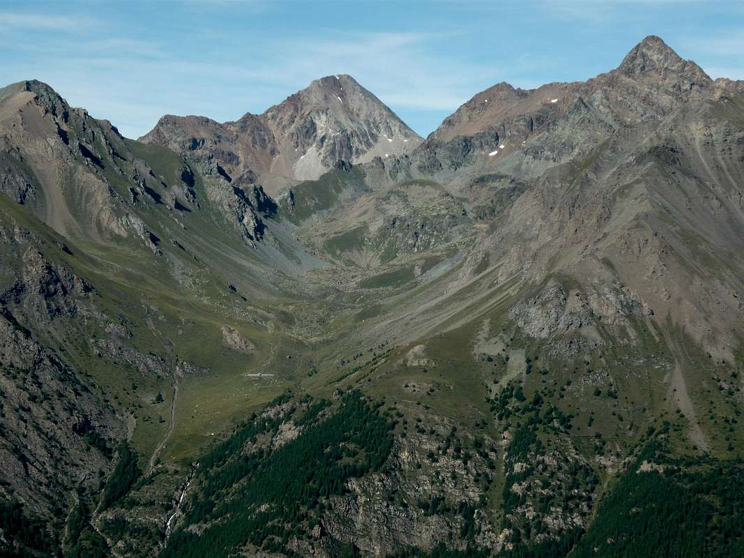
Topographic Note: from this point of view it should be noted that all these are aligned on the axis Summit North/South and present almost exclusively only two sides turned to the West over the Valley of Arpisson, at the base of the South-southwest Face of Punta Garin, and to East to steep grassy slopes called locally Côtes de Lavà, high above the passage of Torrent de Lussert that, at the bottom, called the Torrent Gru (Great from Grauson). Some ridges not in evidence mark the Face West, whereas the opposite, less articulate, is divided into two parts by a rocky outcrop from Punta Fleurie down towards East-southeast; the latter separates the Côtes by a small vallon, called the Chaz-Fleurie, at the foot of the Southeast Slope Punta Garin and the South of the Tour Grauson (3.240m). The rugged, indented and long ridge that connects these two important Summits divides these secondaries vallons from that higher and far more extensive than the Vallon Grauson, branch Lussert, with his four beautiful lakes at the base of the Col des Laures (3.036m), Punta homonymous (3.367m) and the East Top of the three Punta Rossa Emilius (3.400m). On the opposite side instead is located along the Vallon of Arpisson from Garin Hill and Lake (2.815m, 2.854m) down to above the Villages Crétaz and Epinel. A unique bivouac, Franco Nebbia (2.740m,once you placed at the Becca Luseney in St. Barthélemy Valley) is located at the foot of West Face Garin, a little out of use for the climb to the Tower, but achievable by crossing up in average altitude towards Southeast.

This sector, although very close to the well known Cogne, has always been rarely visited even by the locals so that in my interview with the famous Mountain Guide Cogne Vincenzo Perruchon said "Cenzi" took place at the Hotel "Roccia Viva" in the early eighties the same, as was experienced hunter, I knew not provide information on this long mountain range, just above his house. The climbs of the same turned exclusively to start and at the end of the same, or to walk to Tita (Head) Tsaplana also called in loco Tsaplanne, the easy hike to Punta Arpisson (3.035m) and the pyramid of Punta Garin. Said to be "Cenzi" that over there was upward every day or almost everything is to say, imagine for others who have not done a fold when they christened the Pointes "Couppì" (in reality Coupèes or Cut Summits) in Punte Coppi. Just above their home. Maybe it was necessary to turn to the old inhabitants of 1800, when they were called generically Vachères Summits, as to their base on the Eastern of the steep Côtes Lavà grazing cattle, but these unfortunately no longer exist, and even the cows are gone far from those steep pastures, as evidenced even from the ruined of Perché Pasture. Imagine then to the Tower Arpisson that remains hidden back there, compressed between Pila Northeast and Fiorito Hills and is not seen even from the village below. Even more hidden remains the Punta Fiorito or Pointe Fleurie, which dominates the Eastern side of Creuzet Pastures (2.244m) and Grauson Vieux Alpages (2.273m). Since its Ante Summit South (3.252m; 40 meters before the summit tooth) descends to the East-southeast a bold ridge ending above the steep parts in the more Morthern Côtes Lavà, just above the Torrent Lussert-Gru. This separates the small valley that rises to the steep Colle Fiorito (3.170 meters about) from the less steep and broader said the Chaz-Fleurie and even Val Crôt Fleurie in the surrounding between Pointe Fleurie-Pic Garin-Tour Grauson. A place forgotten by the Mountaineers, as scarcely profitable, and even discarded by the Hunters, because they are too complicated to achieve and to cross. So we have to wait until the end of the '800 to see someone pass on these crests and only in August 13 of 1897 the tower is reached by George Yeld Mountain Guide Valtournanche François Pession (see "Alpine Journal XVIII°", n° 38 pages 517-525 and "RM CAI", p. 133); but more about that later in a right after small "Historical Note". Let's say though that the Compton and his party, which immediately got round to West tooth summit and then the real Peak, were fascinated by the view offered from this tower on the entire Valley Cogne, saying that he had nothing to envy by the famous of nearby Pousset (3.046m).
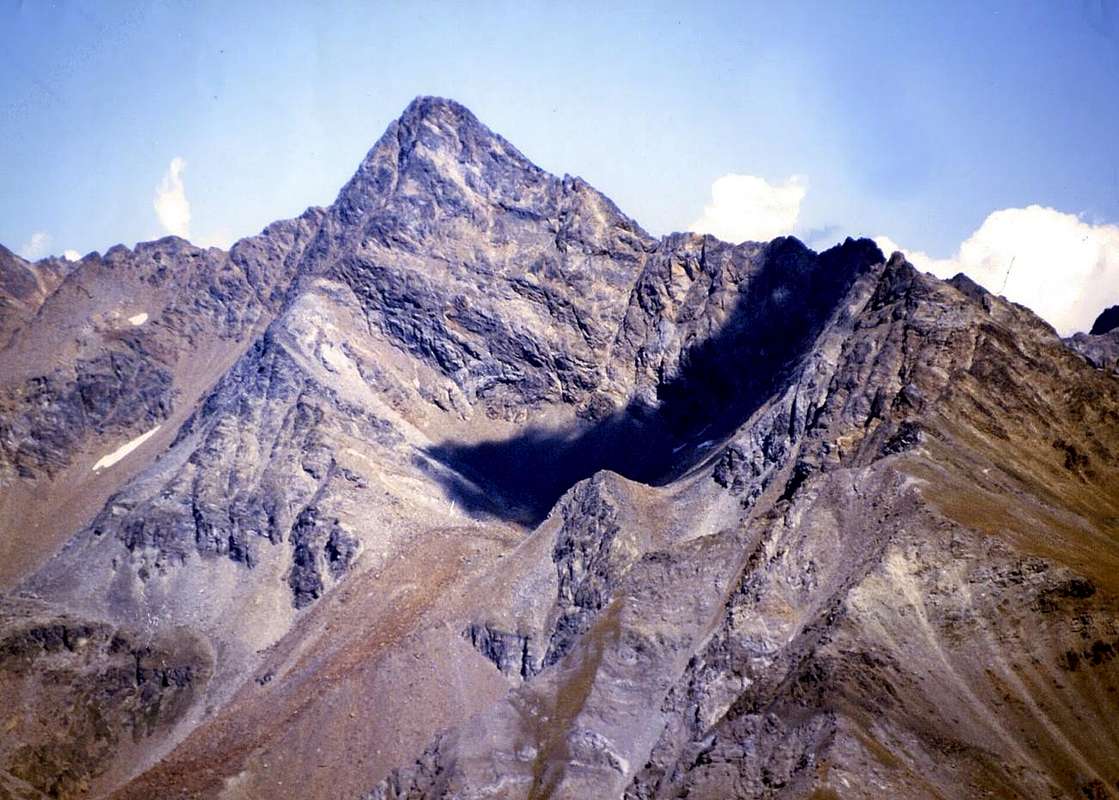 |
Questa Cima fà parte del piccolo Sottogruppo del Pic Garin (3.451 m), posto tra i Valloni del Grauson ad Oriente e dell'Arpisson sul lato opposto, al di sopra della Frazione di Gimillan o Dzimillan (1.787 m) nella Valle di Cogne. Praticamente questo sottogruppo costituisce l'appendice Meridionale del Gruppo del Monte Emilius (3.559 m) che, partendo dalla Valle Centrale della Dora Baltea, si proietta verso il Gruppo del Gran Paradiso (4.061 m) raggiungendo l'adiacente Valle di Cogne. Un lungo Contrafforte Sud-sudovest scende dalla Punta o Pic Garin (3.451 m) per terminare sui due Villaggetti di Gimillan ed Epinel (1.436 m). Strada facendo forma varie Sommità: le due elevazioni della Punta Fleurie o Fiorito (3.260/1 m), le tre consecutive della Punta di Lavà (3.214 m), il Colle Fleurie o Fiorito (3.170/80 metri circa), la Torre di Arpisson e, dopo il Colle di Pila Nordest (3.090 metri circa), le tre Punte Coupées di Arpisson (3.215/18 m, 3.220/4 m, 3.231 m), il Colle Sudovest e l'omonima Punta (3.035 m). Qui la cresta divisoria si sdoppia: un ramo volge verso Sudest in direzione della Testa Tsaplana (2.681 m), proprio al di sopra della Frazione di Gimillan; l'altro s'affonda più a Sudovest costituendo l'estrema sponda Orientale del dischiuso Vallone dell'Arpisson che continua sino al bivacco Franco nebbia ed al subito soprastante Colle o, come era anticamente denominata, "Bassa" di Garin. Nota topografica: da questo punto di vista bisogna notare che tutte queste Sommità risultano allineate sull'asse Nord/Sud e presentano quasi esclusivamente due unici versanti rivolti ad Occidente sopra il Vallone di Arpisson, alla base della Parete Sud-sudovest della Punta Garin, ed ad Oriente verso ripidi pendii erbosi chiamati in loco Côtes de Lavà, alti sopra lo scorrere del Torrent de Lussert che, nella parte inferiore, prende il nome di Torrent Gru (Grosso). Alcune piccole nervature, non in grande evidenza, segnano il Versante Ovest, mentre l'opposto, ancor meno articolato, viene diviso in due parti da uno sperone roccioso che dalla Punta Fleurie scende verso Est-sudest; quest'ultimo separa le Côtes Lavà da uno squallido valloncello, detto della Chaz-Fleurie, ai piedi del Versante Sudest della Punta Garin e di quello Meridionale della possente Tour Grauson (3.240 m). La robusta, frastagliata e lunga cresta che collega queste due importanti Sommità divide questi valloni secondari da quello più elevato nonché ben più esteso del Vallone di Grauson, ramo del Lussert, con i suoi quattro splendidi laghi alla base del Col des Laures (3.036 m), dell'omonima Punta (3.367 m) e della Vetta Orientale della Punta Rossa dell'Emilius (3.400 m). Sull'opposto invece trovasi il lungo Vallone di Arpisson che dal Colle Garin e Lago (2.815 m, 2.854 m) scende fino a sopra le Frazioni di Crétaz ed Epinel. Un bivacco, il Franco Nebbia (2.740 m), é collocato alle pendici Ovest della Garin, un pò fuori d'uso per la salita alla Torre, ma raggiungibile con traversata in quota a Sudest.
Questo settore, seppure molto vicino alla conosciutissima Cogne, é sempre stato raramente visitato, anche dagli abitanti locali tanto che in un mio colloquio con la famosa Guida di Cogne Vincenzo Perruchon detto "Cenzi" avvenuto allo Hotel "Roccia Viva" nei primi Anni Ottanta lo stesso, per quanto fosse cacciatore esperto, non mi sapeva fornire informazioni su questa lunga catena montuosa, proprio sopra casa sua. Le ascensioni della medesima si rivolgevano esclusivamente all'inizio ed al termine della stessa, ovvero alla passeggiata alla Tsaplana o Tsaplanne, all'escursione alla facile Punta di Arpisson (3.035 m) ed alla piramide della Punta Garin. Detto da "Cenzi" che da quelle parti era sù tutti i giorni o quasi é tutto dire, immaginiamo per gli altri che non hanno fatto una piega quando hanno battezzato le Pointes "Couppì" in Punte Coppi. Proprio sopra casa loro. Forse era necessario rivolgersi ai vecchi abitanti del 1800, quando queste genericamente erano chiamate Punte Vachères, poichè alla loro base Orientale sulle ripide Côtes Lavà si pascolava il bestiame, ma questi purtroppo non esiston più ed anche le vacche sono sparite da quei ripidi pascoli, come testimonia l'alpeggio diroccato del Perché. Immaginiamoci poi per la Torre d'Arpisson che rimane nascosta là dietro, compressa tra i Colli di Pila Nordest e Fiorito e che non si vede neppur dal sottostante villaggio. Ancora più occultata rimane la Punta Fiorito o Pointe Fleurie, che sul lato Orientale domina gli Alpeggi del Créuzet (2.244 m) e di Grauson Vieux (2.273 m). Dalla sua Antecima Meridionale (3.252 m circa; 40 metri prima del dente sommitale) scende verso Est-sudest un ardito crestone che termina sopra le ripide parti più a Nord delle Côtes Lavà, appena al di sopra del Lussert-Gru; questo separa il piccolo vallone che sale verso il Colle Fiorito (3.170 metri circa) da quello meno ripido e più largo detto della Chaz-Fleurie ed anche Val Crôt Fleurie nel circondario tra Pointe Fleurie-Pic Garin e Tour Grauson. Un luogo obliato dagli Alpinisti, poiché poco remunerativo, e scartato anche dai Cacciatori, perché troppo complicato da raggiungere e battere. Così dobbiam attendere la fine dell'800 per veder qualcuno transitare su queste creste e soltanto nell'Agosto 1897 la Torre viene raggiunta da George Yeld con la Guida di Valtournanche François Pession (vedi "Alpine Journal XVIII°", n° 38 alle pagg. 517-525 e "RM C.A.I.", pag. 133); ma di ciò parleremo in una subito appresso piccola "Nota Storica". Diciamo però che il Compton e la sua comitiva, i quali aggirarono immediatamente ad Ovest il dente sommitale e quindi la vera Vetta, rimasero affascinati dal panorama offerto dalla Torre sull'intera Valle di Cogne, affermando che non avesse nulla da invidiare a quello ormai celeberrimo del viciniore Pousset (3.046 m).
Abloom History
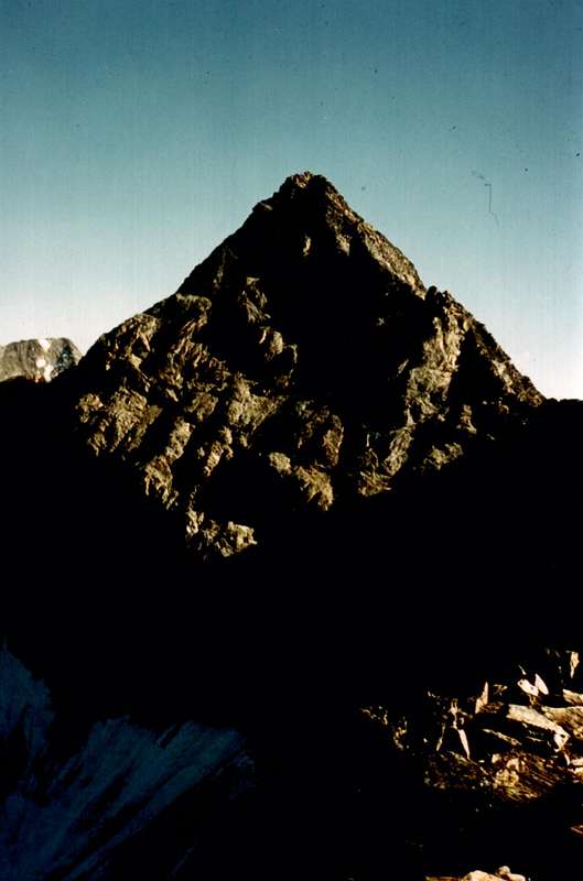
This Summit is well located in all the Old Maps, including his name expressed in Italian. Under the same throughout the long Buttress South-southwest, descending from the Pic Garin reaches the Punta Arpisson (3.035m), is signaled only the Punta Fiorito (Flowery) or Fleurie (3.252 meters) which is assessed against 3.260/1m, as the latest surveys. As we have already announced in this Overview crest has not been sufficiently known in time and is therefore poorly attended; this applies not only to the Tower of Arpisson and to the Punta Fleurie but throughout the watershed between the Vallons Arpisson West and Grauson-Chaz Fleurie opposite or East. Incidentally in those days were the highest Summit to draw the interest of the Pioneers of the Alps, so it is true that you have to wait until Summer 1856 to see the first ascent of the Pic Garin by Abbots Balthazar Chamonin and Pierre Chanoux; starting from Aosta Town and no one knows which way, but so this particular mattered little compared to their achievement "du Sommet". A few ascension in August of 1866 by the Abbé Aimé Gorret with Jean Pierre Carrel and four boys by East-southeast Slope from Chaz-Fleurie small and desolate Vallon, one on the opposite crest or of Arpisson Vallon by Officer of Alpine Troops Cesare Pavese with two soldiers of the 9a Company, in August 1875, and then is to "snoop" the famous Giovanni Bobba with the two of Cogne Edoardo Bèrard and Anselmo Perret, in September of 1886. But everything always turned to Garin and is likely to take place on the information and then fill in the famous "Guide of the Western Alps Graians and Pennine, 1896" in collaboration with Luigi Vaccarone. But, before it is edited this Guidebook, the first day of September 1894 there's more "curious"; are the British C. Baker, C. and F. W. Hiatt Oliver accompanied by no other than from the very famous Swiss Guide Alexander Burgener. They want to climb the Ridge Southwest, still a virgin, but we understand that they do not know the territory: instead of going to the Northwest into the vallon below Arpisson go to the Northeast in that Grauson then, probably recommended by those Mountaineers Cogne that to go to the Garin Pass through this part, enter the Chaz-Fleurie a wild vallon. Awaits them a nasty surprise, because the South Buttress-southwest to bar their way. "Pas des problèmes", are certainly not the hocks and the breath to our lack. Undaunted climb to Colle Fiorito (about 3.170/80 meters), bypassing over the buttress and "voila" are on true track. Down in the Vallon Arpisson doing so the first crossing of the Col Fleurie, cross Glacier Garin, then still existing, and you carry on the great Garin Shoulder (3.207/8m); with some bypass to the West in the end reach the Top. When will there in September 18th, 1902 Abbot Joseph Henry Guide Grégoire Comé Charvensod not known this ascension and thinks have made him for first. Horses of breed, indeed real mules! But in those days seemed things "normal", as the Mountaineers had "other legs" and completely different Mindset.
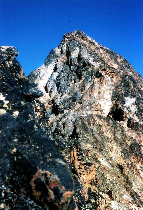
They are the first to set foot on this spur, then comes the "wanderer" British Mountaineer George Yeld, which first goes, at the beginnig of the summer 1897, to take a look at the hill of the Southwest for to explore, with the two Guides Valtournanche François and Sylvain Pession, and then with the first time on the Tower of Arpisson, August 13th, 1897. When a week right after arrive W.C. Compton and A.V. Valentine Richard accompanied by the same Alexander and Siegfried Burgener, downhill via the South Ridge of Garin, find the small stone cairn on Summit of Yeld. While Yeld was down towards the Northeast to reach a wide circle, having found the road blocked by a rock wall, the Huts of Grauson, they descend to Southeast recommending this route in "Alpine Journal, 1897 ", XVIII ° n. 38, pages 517-25, and to observe the way: "... this is not the top of the point indicated altitude 3.252m I.G.M., in the "Climbers Guide" called Punta Arpisson; its appearance is the most impressive of the latter waves seemed more appropriate to his ascent, call Tower instead Punta ... is likely to become popular: it is a better vantage point of the much-vaunted Pousset and, although no controls on an expansive view as Garin, has the advantage of being up one side and down the other ." Sic! For eighty and one (81!) years you will not see more anyone, but at least now it has a name. Is in fact reached again September 17th, 1978 during the first complete crossing by "Cornass" of Arpisson to Peak Garin. Another climb the record probably in the summer of 1980 or 1981 by Prof. Franco Brevini and Companions, but through the Pila Northeast Pass from Western Slope or from Arpisson Walloon; then you have to wait until the beginning of the 2000s when Erik Rosazza with a climbing partner reach in the winter (first ascent) as in the previous route and then crossing to the Garin. In a previous attempt of January 08th, 1978 Osvaldo Cardellina Lamazzi with Giuseppe and Marco Cossard had reached the Pass Pila Northeast starting from Gimillan and navigating to Tsaplana, Punta Arpisson and all three Pointes Coupées d'Arpisson; the last one had stopped to Punta Arpisson, while the other two had been "surprised" by the darkness o the Hill Northeast, then performing a thrilling descent without light in the canyon of around 1.000 meters above the Wateralls of Pila near the homonym Pasture (around 2.000m, 2.021m) with return to Gimillan Hamlet to Midnight. In addition to two ascents solitary Osvaldo Cardellina (see First Ascents) on the Southwest Wall and downward direct Face West, do not know more both climbs the Tower of Arpisson, excluding Punta Arpisson, that the South Buttress-southwest. In confirmation as discussed immediately above.
Questa Punta é ben collocata in tutte le Vecchie Carte, compreso il suo toponimo espresso in italiano. Nelle medesime in tutto il lungo Contrafforte Sud-sudovest che, scendendo dal Pic Garin arriva fino alla Punta di Arpisson, viene segnalata esclusivamente la Punta Fiorito o Fleurie valutata in 3.252 metri contro i 3.260/1 m, come dai rilevamenti più odierni. Come già preannunciato in Overview questa cresta non é stata conosciuta sufficientemente nel tempo e quindi risulta scarsamente frequentata; ciò vale non soltanto per la Torre di Arpisson e la Punta Fleurie, bensì per tutto lo spartiacque tra i Valloni di Arpisson ad Ovest e del Grauson-Chaz Fleurie all'opposto. Daltronde a quei tempi erano le Sommità più elevate a richiamare l'interesse dei Pionieri delle Alpi, tanto é vero che bisogna attendere l'estate del 1856 per vedere la prima salita del Pic Garin da parte degli Abati Balthazar Chamonin e Pierre Chanoux. con partenza da Aosta e non si sà per qual via, tanto questo particolare contava proprio poco in confronto al raggiungimento "du Sommet". Ancora qualche ascensione il 23 di Agosto del 1866 da parte dell'Abbé Aimé Gorret con Jean Pierre Carrel e quattro ragazzi dal Versante Est-sudest o della Chaz-Fleurie, una su quello opposto o di Arpisson dell'Ufficiale degli Alpini Cesare Pavese con due soldati della 9a Compagnia Alpina il 9 di Agosto 1875 e poi viene a "curiosare" il famoso Alpinista-Scrittore Giovanni Bobba con i due di Cogne Edoardo Bèrard ed Anselmo Perret, il 6 di Settembre del 1886. Ma sempre il tutto rivolto alla Garin e probabilmente viene a cogliere informazioni sul posto per compilare la celebre "Guida delle Alpi Occidentali Alpi Graie e Pennine, 1896" in collaborazione con l'amico Luigi Vaccarone.
Ma, prima che venga editata questa guida, il primo giorno di Settembre 1894 arrivan altri "curiosi"; sono gli inglesi C. Baker, C. Hiatt e F.W. Oliver accompagnati nientepopodimeno che dalla celeberrima Guida svizzera Alexander Burgener. Voglion salire la Cresta Sudovest, ancor vergine, ma ben si capisce come non conoscano il territorio: invece d'andare a Nordovest verso il Vallone dell'Arpisson vanno a Nordest in quello del Grauson per poi, probabilmente consigliati da quelli di Cogne che alla Garin passano da questa parte, entrare nella Chaz-Fleurie, un selvaggio valloncello secondario. Li attende una brutta sorpresa, perchè il Contrafforte Sud-sudovest sbarra loro la strada. "Pas des problèmes", non son certamente i garretti ed il fiato che mancano ai nostri. Imperterriti salgono al Colle Fiorito (3.170/80 metri circa), scavalcano il contrafforte e "voilà" son sulla giusta rotta. Scendono nel Vallone di Arpisson effettuando così la prima traversata del Col Fleurie, attraversano il Ghiacciaio di Garin, allora ancora esistente, e si portano sullo Spallone della della Garin (3.207/8 m); con qualche aggiramento ad Ovest nella parte terminale raggiungono la Sommità. Quando lì passerà il 18 Settembre del 1902 l'Abbé Henry con la Guida Grégoire Comé di Charvensod non sà di questa ascensione e pensa di aver compiuto lui la prima. Cosa da cavalli di razza, anzi da veri muli! Sono i primi a mettere piede su questo contrafforte, poi arriva quel "gironzolone" di George Yeld, che prima và a dare un'occhiatina al Colle di Pila Sudovest con le due Guide di Valtournanche François e Sylvain Pession e quindi insieme al primo sale per la prima volta la Torre d'Arpisson, il 13 Agosto 1897. Quando una settimana giusta appresso arrivano W.C. Compton e A.V. Valentine Richard acconpagnati da Alexander e Siegfried Burgener, in discesa tramite la Cresta Sud della Garin, trovano l'ometto in pietra lasciato sulla Sommità da Yeld. Mentre Yeld era sceso verso Nordest per raggiungere con un largo giro, avendo trovato la strada sbarrata da un salto roccioso, le Capanne del Grauson, loro scendono verso Sudest consigliando questa via in "Alpine Journal, 1897", XVIII° n. 38, pagine 517-25, ed al proposito osservano: "... questa cima non é nel punto indicato quota 3.252 m I.G.M., che la "Climbers Guide" chiama Punta di Arpisson; il suo aspetto é più imponente di quest'ultima onde parve più opportuno, ai suoi salitori, chiamarla Torre invece che Punta ... probabilmente la Torre di Arpisson é destinata a divenire popolare: é un punto panoramico migliore del tanto decantato Pousset e, quantunque non comandi su di un esteso panorama come la Garin, ha il vantaggio di poter essere salita da un lato e discesa dall'altro." Sic! Per ottantun (81!) anni non si vedrà più anima viva, ma almeno da adesso un nome ce l'ha. Viene infatti nuovamente raggiunta il 17 Settembre 1978 durante la prima traversata integrale dai "Cornass" dell'Arpisson alla Punta Garin. Un'altra ascensione la registriamo probabilmente nell'estate del 1980 o 1981 da parte del Prof. Franco Brevini e Compagni, che però pervengono al Colle di Pila Nordest dal Versante Occidentale ovvero di Arpisson; poi bisogna attendere l'inizio degli Anni 2000 quando Erik Rosazza con un compagno la raggiungono in inverno come nel precedente itinerario per poi traversare fino alla Garin. In un antecedente tentativo dell'8 di Gennaio 1978 Osvaldo Cardellina con Giuseppe Lamazzi e Marco Cossard avevano raggiunto il Colle di Pila Nordest partendo da Gimillan e traversando alla Tsaplana, Punta di Arpisson e tutte e tre le Pointes Coupées; l'ultimo s'era fermato alla Punta di Arpisson, mentre gli altri due erano stati "sorpresi" dal buio al colle, effettuando poi una discesa thrilling senza luce nel canalone di 1.000 metri sopra le Cascate di Pila con rientro a Gimillan per Mezzanotte. Oltre a due ascensioni solitarie di Osvaldo Cardellina (vedi First Ascents) sulla Parete Sudovest ed in discesa diretta sulla Faccia Ovest arrivando dalla Punta Fleurie, non si conoscono ulteriori salite sia alla Torre di Arpisson che, esclusa la Punta di Arpisson, sul Contrafforte Sud-sudovest. A conferma di quanto sovraesposto.
First Ascents
- First ascent of the summit ridge, discarding the Tooth of the Top to the West: the mountaineering consortium W.C. Compton and A.Valentine Richards with the Mountains Guides Swiss Alois and Sigfried Burgener, Aug 20th, 1897, in descent from Pic Garin after the ascent through the Southwestern Ridge.
- First on Tooth of true Summit: Osvaldo Cardellina and Camillo Roberto Ferronato; Sep 17th, 1978, in ascent from Gimillan during the climbing on entire SW Buttress from Punta di Arpisson.
- In winter: probably Erik Rosazza and Companions; in Winter 2000/01?, in ascent from Gimillan, Arpisson Alp and through Northeast Pila Pass by West Couloir and South Crest.
- South-southwest Crest: Osvaldo Cardellina and Camillo Roberto Ferronato; Sep 17th, 1978, from Gimillan to "Arpisson Cornass" and traverse on entire S-SW Buttress.
- North Crest: Osvaldo Cardellina and Camillo Roberto Ferronato; Sep 17th, 1978, in descent, after the integral traverse by Punta di Arpisson, towards the Garin's Carving.
- East-southeast Crest: Osvaldo Cardellina, lone; May 18th, 2008, from Grauson Vieux with traverse to Tour d'Arpisson (West Face in descent).
- Great traverse (Punta di Arpisson, through Southwest Ridge and subsequent traverse towards Pointes Coupées-Arpisson Tower-Punte di Lavà-Punta Fleurie also Fiorito-Pic Garin): Osvaldo Cardellina and Camillo Roberto Ferronato; Sep 17th, 1978, in ascent from Gimillan to small saddle 2.317 meters, below "Arpisson Cornass".
Getting There
BY CAR:
- From Turin or Milan: Motorway A5. Exit in Aosta Ovest. Drive to the near Aymavilles; follow in the direction of Cogne Valley. Or Exit Aosta East to Gr. Brissogne and St. Marcel. From Switzerland: through the Grand St. Bernard Tunnel or the homonym Pass). Drive to Aosta, then follow Courmayeur direction on SS.26. Just after Sarre, turn to the left, in the direction of Cogne Valley, the main side valley in the South after the City of Aosta.
- From FRANCE: through Mont Blanc Tunnel or Petit St. Bernard Pass). It isn't necessary to enter in Motorway A5, you can drive through SS.26 Aosta direction. Before arriving at the Village of Sarre, follow the sign and turn right towards the Valley of Cogne.Specific Roads After Aymavilles Municipality, the SR.47 crosses the Villages of Vieyes (1.158m; ancient small Sainct Grat Church with various frescoes), Epinel (1.436m) and Crétaz (1.534m) and after about 25 Km. arrives at Cogne (1.534m; important Seat of P.N.G.P. since 1922). Follow the road signs for Gimillan and Lillaz (renowned three waterfalls); arrived at a round-about, recently built in proximity of the St. Anthony Chapel, go left along the scenic route leading to the small Villages of Montròz (1.702m), Gimillan (1.787m); 1,5 and 3 Km. after Cogne Center. Usually no parking problem neeighbor the bell tower of a little chapel in center (ten seats for cars; stone fountain below the bell tower), also near the bridge above Gimillan Torrent (small parking in soil nearby the asphalt road).
BY PLANE:
- Aeroporto "Corrado Gex" Saint Christophe (Aosta).
Approaches by Grauson & Arpisson Vallons
Approach A from "Low" Grauson Vallon:
From Gimillian center (1.787m) agrees, passing the small road that double the Bell Tower on the left near an old and beautiful stone fountain, go up to the upper parking lot at the Playground (1.814m) or continue even through the narrow asphalt road to the sign ban in altitude 1.850 meters about, just before a hairpin with small votive chapel of 1926. Here we start with a route n° 3/TVC, reaching the tiny Village of Pian di Teppe (1.923m).
Note: you can avoid this stretch by a brief path-shortcut into the woods that goes between this alp and this more in bottom of Serve (1.923m), arriving at an intersection shortly before the next fork); from this point, where also ends the farm road, follow it to the Northwest the same to the junction around 1.970/80 meters where you leave, continuing the same into the Vallon below Arpisson. Instead continue to the right (Northeast; wooden signpost on a tree) with path n° 3B; after a long diagonal one enters a loop that runs through a small and secondary walloon with an exposed path you reach a wooded area before an esplanade with scattered blocks. Turning to the North with hairpin bends you reach the point 2.247 meters under a rock feature; leave the same on the left and again with direction Northeast reach the hairpin 2.362 meters which came shortly before the ancient Alp Perché (2.398m; now abandoned and in ruins). Continue for a short time with this direction but then change in Northwest reaching a strip of crumbling rocks (2.503m) which easily crosses. Immediately below the path, becoming steeper, runs along the right bank of a grassy gully (attention to the crossing in case of snow or very consistent) to fold in toward the southwest in the direction of a grassy plateau just below the Summit. A short right turn leads to the statue of the Madonna on the Top (EE/F; 2h'00/2h'30 but in winter even 3h'00/4h'00 Gimillan).
Avvicinamento A dal "Basso" Vallone del Grauson:
Da Gimillian (1.787 m) conviene, passando nella viuzza che doppia il Campanile a sinistra presso una vecchia fontana in pietra, salire al parcheggio superiore presso il Parco Giochi (1.814 m) oppure proseguire ancora tramite la stretta stradina in asfalto fino al cartello di divieto a quota 1.850 metri circa, poco prima d'una Cappelletta votiva del 1926 in un tornante a gomito. Si parte con un sentiero n° 3/TVC, che raggiunge il minuscolo Villaggio di Pian di Teppe (1.923 m).
Nota: si può evitare questo tratto tramite un un sentierino-scorciatoia dentro il bosco risalente tra quest'alpe e la sottostante di Serve (1.923 m), arrivando ad un incrocio di poco precedente il successivo bivio); da questo punto, ove termina anche la poderale, si segue verso Nordovest il medesimo fino al bivio 1.970/80 metri circa dove lo s'abbandona, proseguendo lo stesso verso il Vallone di Arpisson. Continuare invece a destra (Nordest; cartello indicatore in legno sopra un albero) con il sentiero n° 3B; dopo un lungo diagonale si entra in un ansa attraversante un valloncello secondario e con percorso esposto verso Sud si raggiunge una zona alberata precedente una spianata con blocchi sparsi. Volgendo a Settentrione con stretti tornantini s'arriva al punto 2.247 metri sotto una caratteristica roccia; lasciarla sulla sinistra e nuovamente con direzione Nordest pervenire al tornante 2.362 metri precedente di poco l'antica Alpe Perché (2.398 m; oggigiorno abbandonata ed in rovina). Continuare ancora per breve tempo con questa direzione, poi cambiare in Nordovest raggiungendo una fascia di rocce sgretolate (2.503 m) che facilmente s'attraversa. Subito appresso il sentiero, diventando più ripido, costeggia la sponda orografica destra di un canalone erboso-petroso (attenzione alla traversata in caso di neve alta o poco consistente) per ripiegare progressivamente verso Sudovest in direzione d'un plateau erboso giusto al di sotto della Sommità. Una breve svolta a destra conduce presso la statua della Madonna posta sulla Cima (EE/F; 2h'00/2h'30, ma d'inverno anche 3h'00/4h'00 da Gimillan).
 |
 |
 |
 |
 |
Approach B by "Middle" Grauson: from the bridge just to the West of Gimillan (1.814m; small parking lot), take the private road that climbs towards the Northeast, leaving on the right the little Village of Tarrabouc (1.831m; small chapel, now closed), take the path n° 8, surpassed the Ràvènti very old Alp (1.895m; ruins) reaches a small votive chapel, with a diagonal dominating the Torrent de Lussert, and a short descent to reach the Alpe di Tchezen near the small wooden bridge and the old Alp of L'Ecloseur (1.903m; The Narrowing; 0h'35). A long diagonal in the middle of meadows, destroyed by the 2000 and then reclaimed and restored, leads to Pila Pasture (2.021m; beautiful waterfall ruined by the recent overbuilding), past the rocky promontory above (propped up wooden steps to the iron base) you enter a small vallon that goes with numerous hairpin bends. The highest plateau leads to a first junction to the isolated Alp Cròuzet (2.244m) and, soon after, a subsequent in Southeast where the salt route n° 8C to Mount Creya (3.015m); abandon both diversions and instead continue with the same in a small wood. The long diagonal with over 100 meters of elevation gain over the Torrent de Lussert reaches a prominently cross on the lawn at the next headland and the Grauson Vieux Pastures (2.273m; just South at the side of the path fresh spring called Prà Veudan; 1h'05/in total 1h'40/5).
Avvicinamento B dal "Medio" Grauson: Dal ponte appena ad Ovest di Gimillan (1.814 m; piccolo parcheggio) prendere la strada poderale che sale verso Nordest; lasciando a destra il Villaggetto di Tarrabouc (1.831 m; piccola Cappella, chiusa) proseguire con il sentiero n° 8 che, sorpassato il Ràvènti (1.895 m; rovine), raggiunge una piccola cappella votiva; con un diagonale, dominando il Torrent de Lussert, ed una breve discesa raggiungere l'Alpe di Tchezen il vicino piccolo ponte in legno e la vecchia Alpe di Ecloseur (1.903 m; La Strettoia; 0h'35). Un lungo diagonale in mezzo ai prati, distrutti dall'alluvione del 2000 e poi bonificati, conduce all'Alpe Pila (2.021 m; bella cascata rovinata dalle recenti cementificazioni); superando il soprastante promontorio roccioso (gradini in legno puntellati alla base in ferro) si entra in un valloncello che si risale a furia di stretti tornanti. Il pianoro superiore conduce ad un primo bivio per l'isolata Alpe Cròuzet (2.244m) e, subito dopo, ad un successivo dove a Sudest sale il sentiero n° 8C per il Monte Creya (3.015 m); abbandonare entrambe le deviazioni e proseguire invece con la stessa in un boschetto. Il lungo diagonale con oltre 100 metri di dislivello sopra il Torrent de Lussert raggiunge una croce ben in vista sul promontorio ed il successivo prato presso l'Alpe di Grauson Vieux (2.273 m; appena a Sud a lato del sentiero fresca sorgente detta di Prà Veudan; 1h'05; 1h'40/5).
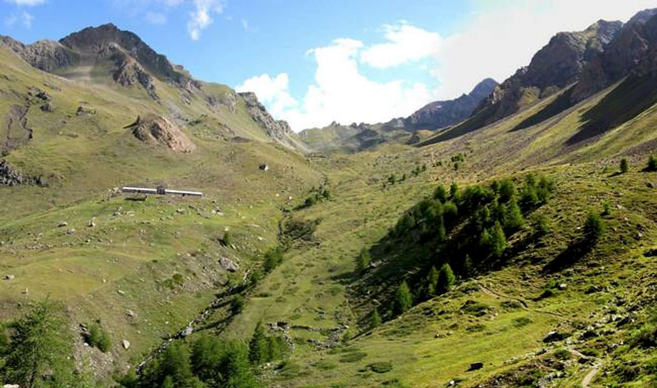
Approach C from the Vallon of Arpisson with departure from Gimillan or Epinel Hamlets: the Pian di Bessey (Bessey Tableland), before Franco Nebbia Bivouac and Garin Hill, can also be reached from the Valley Cogne crossing in his entirety the Walloon of the Arpisson with departure from the Fraction of Epinel (1.452m) or, preferably, reaching the Pastures of Arpisson (2.328m; spring) after a long crossroad from the Village of Gimillan (1.787m), through the path n° 3/TVC. From these, to climb the entire walloon through a small but very good path that crosses it in his mean and, left to the left the deviation for the Hill Tsa Setze, to reach an ample tableland known as Pian Bessey (Tableland; spring), having to the shoulders for the whole slope the spectacular perspective to the Grivola (around 2.550/70 meters; 1h'45/2h'15 from Gimillan). Otherwise from Epinel Village (1.430m) instead you can reach the Arpisson Alpage with trail n° 2, which crossed the Torrent Arpisson to the Northeast of the same name, first reach the Alpagee de Teuvre (1.792m) and then changing the direction in Northwest, to Tsavanis Pasture (1.859m, where comes the path n° 3A, starting from Gimillan). The last stretch more to the North, crossed again the torrent to the Alp Arpisson (2.328m; E; 2h'15/2h'45).
 |
 |
 |
 |
 |
Avvicinamento C dal Vallone di Arpisson partendo da Gimillan od Epinel: Il Pian di Bessey, prima del Bivacco Franco Nebbia (2.740 m) ed il Col Garin (2.815 m), può esser raggiunto anche dalla Valle Cogne percorrendo nella sua interezza il Vallone dell'Arpisson con partenza dalla Frazione di Epinel (1.452 m) oppure, preferibilmente, raggiungendo gli Alpeggi dell'Arpisson (2.328 m; sorgente) dopo una lunga traversata da Gimillan (1.787 m), tramite il sentiero n° 3/TVC. Da questi, salire il vallone tramite un buon sentiero che lo percorre nel suo mezzo e, lasciata a sinistra la deviazione per il Colle di Tsa Setze, raggiungere un ampio pianoro-altipiano noto come Pian di Bessey, avendo alle spalle per tutta la salita la prospettiva spettacolosa sulla Grivola (circa 2.550/70 m; E; 1h'45/2h'15 dal Villaggio di Gimillan). Altrimenti dalla Frazione di Epinel (1.430 m) si può raggiungere l'Alpe di Arpisson con il sentiero n° 2 che, attraversato verso Nordest l'omonimo torrente, raggiunge dapprima l'Alpe di Teuvre (1.792 m) e poi, cambiando la direzione in Nordovest, quella di Tsavanis (1.859 m; dove arriva anche il sentiero n° 3A partendo da Gimillan). Un ultimo tratto più a Nord, attraversato nuovamente il torrente su di una passerella, raggiunge l'Alpe di Arpisson (2.328 m; E; 2h'15/2h'45).
Approach D going from "Low" Vallon of Grauson by arriving to Arpisson: always from the parking lot in the center of Gimillian Village (1.787m) with the previous route, via the route n° 3/TVC, until the junction about 1.970/80 meters after the Alp/Village Pian Teppe where not abandon, going instead into the vallon below Arpisson through a long diagonal to the Northwest that first path with enough exposed in South, crossing the Comba Vachère and other small secondaries vallons, then moves into a more open, reaching the small saddle 2.317 meters. This is placed at the end of the Southwest Ridge of Punta Arpisson and immediately below those small and crooked horns called by the inhabitants "Cornas dell'Arpisson" (2.751m, 2.607m); a short descent diagonally leads to a walkway above the Torrent Arpisson under a water outlet. Forded the same and with a short climb with hairpin bends you reach the nearby pasture (E/F; 1h'30/1h'45). Also you can avoid the same on his right reaching the small water intake, earning a quarter hours but losing a nice stop, and continuing to the bottom of the vallon in the midst of small springs gradually cross the moraine below the rocky ribs of Punta vArpisson up to the altitude of about 2.590/2.600 meters. A long steep trail easily, but rather laboriously, leads to the above mentioned traits grassy-detrital towards Pila Southwest Hill (around 3.028 meters; EE/F+; 3h'00/3h'30 from Gimillan).
Avvicinamento D passando dal "Basso" Vallone del Grauson tramite il collegamento a quello di Arpisson: sempre dal parcheggio nel centro di Gimillian (1.787 m) con la precedente via, tramite il sentiero n° 3/TVC, fino al bivio 1.970/80 metri circa dopo l'Alpe Pian di Teppe ove non lo si abbandona, proseguendo invece verso il Vallone di Arpisson tramite un lungo diagonale ad Nordovest che dapprima con percorso abbastanza esposto a Sud, attraversando la Comba Vachère ed altri valloncelli secondari, si porta successivamente in un'area più aperta raggiungendo la selletta 2.317 metri. Questa é posta al termine della Cresta Sudovest della Punta di Arpisson e subito al di sotto di quei piccoli corni detti in loco "Cornas dell'Arpisson" (2.751 m, 2.607 m); una breve discesa diagonale conduce ad una passerella sopra il Torrent Arpisson al di sotto d'una presa dell'acqua. Guadato il medesimo e con breve risalita a stretti tornanti si raggiunge l'alpeggio (E/F; 1h'30/1h'45. Oppure é possibile evitar lo stesso a destra raggiungendo la presina dell'acqua, guadagnando un quarto di ora ma perdendo una bella sosta, e, continuando sul fondo del vallone in mezzo a sorgentelle, progressivamente attraversare la morena sottostante i costoloni rocciosi della Punta di Arpisson fino alla quota di 2.590/2.600 metri circa. Una tanto ripida quanto appen'accennata traccia conduce per tratti erboso-detritici facilmente, ma piuttosto faticosamente, al Col di Pila Sudovest (3.028 metri circa; EE/F+; 3h'00/3h'30 da Gimillan).
Route
Through traverse from Arpisson Tower: from the villages of Epinel or Gimillan (better) climb towards the North reaching the base of the South-southwest Buttress of Punta Garin whence continue with three distinct possibility of following the same:
1) - by Gimillan to reach the Testa Tsaplana (2.681m) and from this the above Punta Arpisson (3.031/5m), whence start the crossing bypassing the three Pointes Coupées of Arpisson to go down to Col Pila Northeast.
2) - Getting to the same starting from the trail to the Alp Arpisson and, come to the small saddle 2.317 meters, leave the same, going up to the overhanging "Cornass" of Arpisson (2.507m); by the same continue through the Southwest Ridge with the stroke of first.
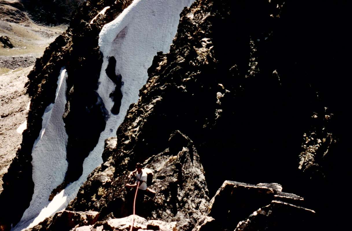
3) - Also from Gimillan or Epinel reach the Arpisson Pasture (2.228m; see approaches); this climb to the North-northeast with the path n° 2/3/TVC to Col Garin until you reach the Plan Bessey in altitude of 2.250 meters around. Left the same, up to the East on stony ground and with the final part of the steepest in a narrow gully rocky-debris get to Pila Northeast Col (3.090 meters about), located between the Pointe Coupée Northeast and the Tower of Arpisson (A; from F+ to PD-; on average 4h'30/5h'00 for all the possibilities to the Tower of Arpisson). Reached the Tour d'Arpisson, coming from Pointe Coupée of Arpisson Northeast with descent from this through the ridge to the Northeast towards the Pila Northeast Pass (almost a carving), easily navigate the eight small elevations that form the Summit. A short and easy descent on blocks leads to Colle Fiorito (3.170/80 meters) from which it continues to the North past always on the edge of the ridge the three tiny elevations calls Tips Lavà (3.214m; steps of I°+/II°-). The next stretch leads to Southern Antetop (3.152m), whence after some forty meters you reach the sharp tooth summit, the ascent of which (II°/II°+) provides some attention to the exposure and the presence of lichen on the rock (A/PD/PD+; 1h'30/1h'45 from Colle di Pila Northeast; 6h'00/7h'00 in total).
In traversata dalla Torre di Arpisson: dai Villaggi di Epinel o Gimillan (meglio) salire verso Settentrione pervenendo alla base del Contrafforte Sud-sudovest della Punta Garin donde proseguire con tre distinte possibilità di percorrere il medesimo:
1) - raggiungere da Gimillan la Testa Tsaplana (2.681 m) e da questa la soprastante Punta di Arpisson (3.031/5 m); da qui iniziare la traversata scavalcando le tre Pointes Coupées d'Arpisson donde scendere al Col di Pila Nordest.
2) - Arrivare alla medesima partendo dal sentiero per l'Alpe Arpisson e, giunti alla selletta 2.317 metri, abbandonarlo salendo verso i "Cornass" dell'Arpisson (2.507 m); dagli stessi proseguire tramite la Cresta Sudovest con qualche tratto di I°.
3) - Sempre da Gimillan od Epinel raggiungere l'Alpe di Arpisson (2.228 m; vedi gli avvicinamenti); da questa salire verso Nord-nordest con il sentiero n° 2/3/TVC per il Col Garin fino ad arrivare al Plan Bessey in altitudine di 2.250 metri circa. Lasciato il medesimo, salire verso Est su pietraia e con la parte finale più ripida in un angusto canalino roccioso-detrico pervenire al Col di Pila Nordest (3.090 metri circa), sito tra la Pointe Coupée Nordest e la Torre di Arpisson (A; da F+ a PD-; mediamente 4h'30/5h'00 per tutte le possibilità sino alla Torre di Arpisson). Raggiunta la Torre, arrivando dalla Pointe Coupée di Arpisson Nordest con discesa da questa tramite la Cresta Nordest al Col di Pila Nordest quasi a mò d'intaglio, traversare facilmente le otto piccole elevazioni che costituiscono la Sommità. Una breve e facile discesa su blocchi sparsi conduce al Colle Fiorito (3.170/80 metri circa) dal quale si continua verso Settentrione superando sempre sul filo di cresta le tre minuscole elevazioni chiamate Punte di Lavà (3.214 m; passaggi di I°+/II°-). Il tratto successivo porta all'Antecima Sud (3.152 m), donde dopo una quarantina di metri si raggiunge l'aguzzo dente sommitale, la cui scalata (II°/II°+) prevede qualche attenzione per l'esposizione e per la presenza di lichene sulla roccia (A/PD-/PD+; 1h'30/1h'45 dal Colle di Pila Nordest; 6h'00/7h'00 in totale).
Difficulty & Equipment
From PD- to PD for the entire crossing.Da PD- a PD per l'intera traversata.
For Mountaineering, but surely better if with rope.
Da Alpinismo, ma certamente meglio se con corda.
Mountain Condition
Meteo: you can find all the needed informations at the official site of the Valle d'Aosta Region:
Books and Maps
- "80 itinerari di Escursionismo Alpinismo e Sci Alpinismo in Valle d'Aosta", di Osvaldo Cardellina, Ed. Musumeci, Giugno 1977 (in Italian); seconda Ed. Luglio 1981; terza Ed. Luglio 1984; (in French), prima Ed. Febbraio 1978; seconda Ed. Marzo 1980.
- "Guida del Monte Emilius" di Osvaldo Cardellina Editore in collaborazione con il Club Alpino Italiano Sezione di Aosta Dicembre 1978.
- "Guida dei Monti d'Italia – Emilius-Rosa dei Banchi-Parco del Mont Avic" di Giulio Berutto e Lino Fornelli - Club Alpino Italiano/Touring Club Italiano, Marzo 2005.
- "Diari Alpinistici" di Osvaldo Cardellina e Indice Generale accompagnato da Schedario Relazioni Ascensioni 1964-2019 (unpublished).
 |
 |
 |
- Kompass Gran Paradiso Valle d'Aosta "Sentieri e rifugi-Carta turistica" 1:50000.
- L'Escursionista "Valle di Cogne Carta dei Sentieri" (n° 10) 1:25.000.
- L'Escursionista "Tour de la Vallée de Cogne Grand Paradis" Carta dei sentieri 1:25.000.
- IGC-Istituto Geografico Centrale "Gran Paradiso La Grivola Cogne" Carta 1:25000.
- Hapax "Les Sentiers" Comunità Montana Monte Emilius luglio 2000 1:25.000.
Important Information
- REGIONE AUTONOMA VALLE D'AOSTA the official site.
- FONDAZIONE MONTAGNA SICURA Villa Cameron, località Villard de la Palud n° 1 Courmayeur (AO) Tel: 39 0165 897602 - Fax: 39 0165 897647.
- SOCIETA' GUIDE ALPINE DI COGNE Tel. 347/9473526 – 328/1373728.
- A.I.NE.VA. (Associazione Interregionale Neve e Valanghe).
- Soccorso Alpino Cogne (SAR) Tel. 3482685406.
- Protezione Civile Valdostana località Aeroporto n° 7/A Saint Christophe (Ao) Tel. 0165-238222.
- Bollettino Meteo (weather info) Tel. 0165-44113.
- Unità Operativa di Soccorso Sanitario Tel. 118.