
-
 7302 Hits
-
 82.48% Score
-
 15 Votes
|
|
Mountain/Rock |
|---|---|
|
|
45.67880°N / 7.37268°E |
|
|
Mountaineering |
|
|
10778 ft / 3285 m |
|
|
Overview
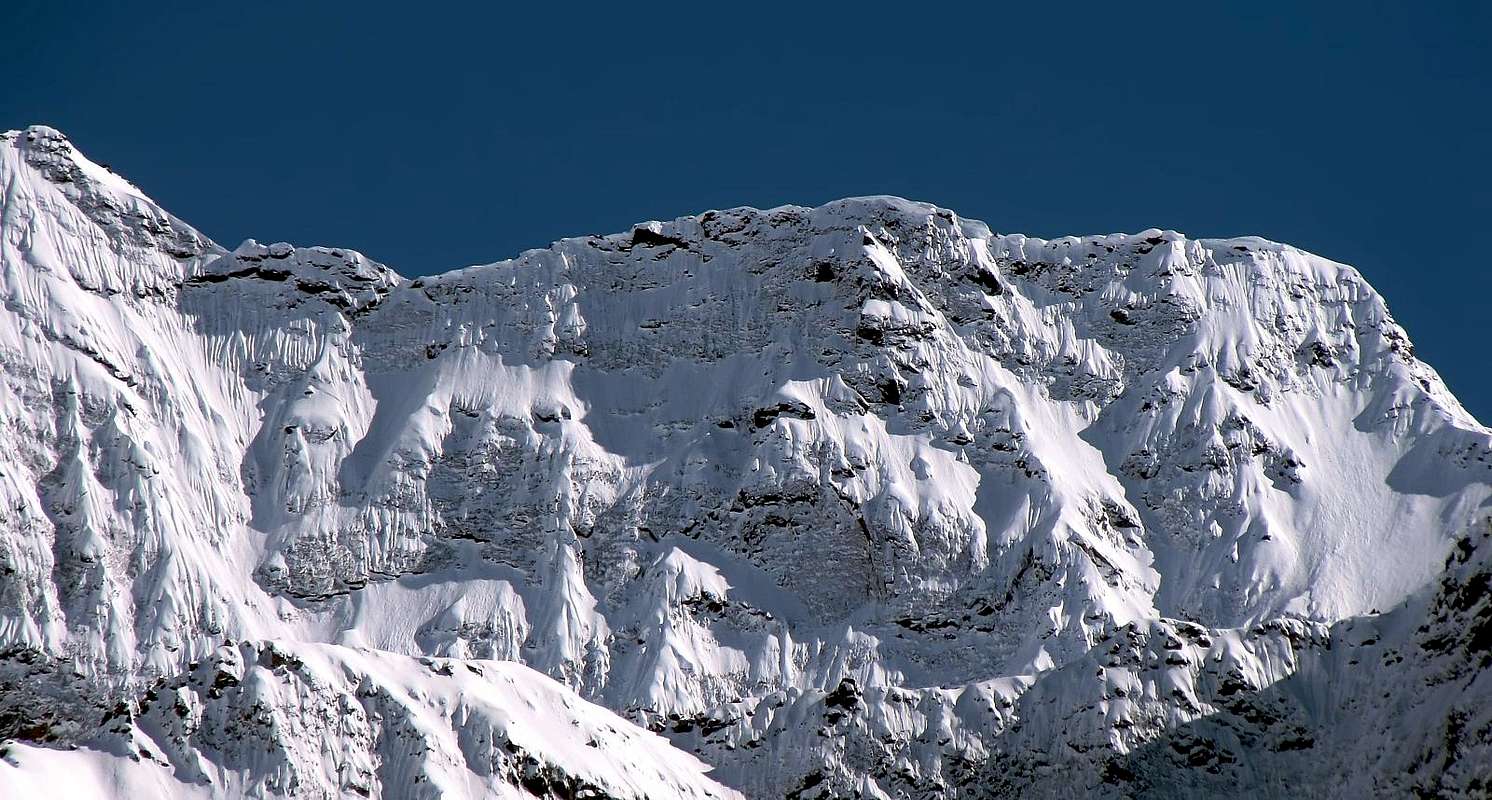
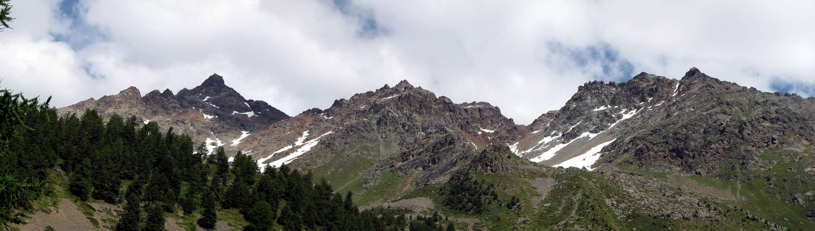
Great west shoulder of the Emilius Mountain, in winter the slope north assumes an aspect "Himalayano". To west introduces him as a perfect pyramid. (Famous the "Via Ferrata" on the crest NW).
Grande spallone a ovest del Monte Emilius, in inverno il suo Versante Nord assume un aspetto Himalayano. A ovest si presenta come una piramide perfetta. (Famosa la via ferrata sulla sua cresta NW).
First Ascents
- First on the summit: Abbé Henry and Gregorio Comè, (Sep 17th, 1902)?.
- First in winter (from Carrel Pass or Col Ross?): Nerino Gobbo of Trieste, in winter (1940/1941).
- NW Arête: Abbot Joseph Henry and Gregorio Comè, (Sep 17th, 1902).
- N Wall: Abbot Joseph Henry and Gregorio Comè, (Sep 17th, 1902), in descent.
- SW Arête (from Ross Pass): Osvaldo Cardellina and Camillo Roberto Ferronato, (Jul 11th, 1977).
- W Wall: Osvaldo Cardellina, solo, (Jun 06th, 1999).
Getting There
BY CAR:- From Torino, Milano, etc: Motorway A5. Exit at Aosta Est.
- From Switzerland: through the Grand Saint Bernard Tunnel or the namesake Pass.
- From France: through Mont Blanc Tunnel or Petit Saint Bernard Pass. It isn't necessary to take Motorway A5: you can drive on SS.26, in the direction of Aosta.
BY PLANE:
- Aeroporto "Corrado Gex"; Saint Christophe (Aosta).
![]()
Route
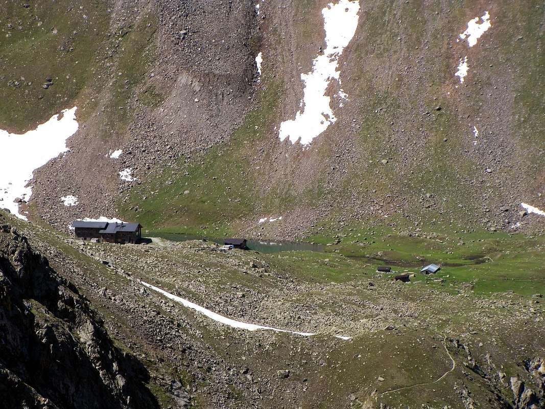
From Pila (famous ski resort easy and fastly reachable from Aosta using car, bus or cableway), get the Chamolé Lake (2.311m) on foot or by a chairlift, and the homonymous pass above (2.641m). To go down to the Refuge Abolle (2.507m) and to go up again to the "Lago Gelato" to continue toward NW up to the "Laghetto dei Macigni" and from this to directly go up again the south slope on broken rocks without forced run (2h'00/2h'30).Da Pila (nota località sciistica, raggiungibile da Aosta in auto pullman o funivia), raggiungere il lago di Chamolé (2.311 m, anche qui in seggiovia o a piedi), e l'omonimo colle superiore (2.641 m). Scendere al rifugio Abolle (2.507 m) e risalire al lago Gelato, continuare verso NW fino al laghetto dei Macigni e da questo risalire direttamente il versante sud su sfasciumi e rocce rotte senza percorso obbligato (2h'00/2h'30).
Difficulty
Easy anf for Experienced Hikers EE/F+.L'itinerario è da considerarsi EE/F+.
Fixed Bivouac Federigo Zullo (2.907m), Carrel Pass. Difficulty: E (Hikers).
Da alto escursionismo.
Campings
Remember that free camping is forbidden (except for emergency reasons, over 2.500m, from darkness until dawn). |
 |
 |
 |
 |
Mountain Condition
- Meteo: you can find all the needed informations at the official site of the Valle d'Aosta Region:
- Valle d'Aosta Meteo
Webcam
- WEBCAM on Aosta Valley:
- Webcam
Books and Maps
BOOKS:- "Guida del Monte Emilius", di Osvaldo Cardellina Editore in collaborazione con il Club Alpino Italiano Sezione di Aosta, Dicembre 1978.
- "Guida dei Monti d'Italia – Emilius Rosa dei Banchi Parco del Mont Avic" di Giulio Berutto e Lino Fornelli - Club Alpino Italiano/Touring Club Italiano, Marzo 2005.
- "Guida delle Alpi Occidentali" di Giovanni Bobba e Luigi Vaccarone C.A.I. Sezione di Torino Volume II (parte II), 25 Maggio 1896.
- "Diari Alpinistici" di Osvaldo Cardellina e Indice Generale accompagnato da Schedario Relazioni Ascensioni 1964-2019 (inediti).
 |
 |
 |
MAPS:
- Kompass "Gran Paradiso Valle d'Aosta Sentieri e Rifugi" Carta turistica 1:50.000.
- L'Escursionista "Conca di Aosta-Pila-Monte Emilius" Carta dei sentieri (n° 4) 1:25.000.
- Hapax "Les Sentiers Comunità Montana Monte Emilius", Luglio 2000 1:25.000.
- Enrico Editore Ivrea-Aosta "Gruppo del Gran Paradiso" 1:50.000.
- I.G.C. Istituto Geografico Centrale, Torino "Carta delle Passeggiate ed Escursioni in V.D.A. Conca di Pila-Gressan, 1:20.000.
Important Information
- REGIONE AUTONOMA VALLE D'AOSTA the official site.
- FONDAZIONE MONTAGNA SICURA Villa Cameron, località Villard de la Palud n° 1 Courmayeur (AO) Tel: 39 0165 897602 - Fax: 39 0165 897647.
- A.I.NE.VA. (Associazione Interregionale Neve e Valanghe).
Useful numbers
- Protezione Civile Valdostana località Aeroporto n° 7/A Saint Christophe (Ao) Tel. 0165-238222.
- Bollettino Valanghe Tel. 0165-776300.
- Bollettino Meteo Tel. 0165-44113.
- Unità Operativa di Soccorso Sanitario Tel. 118.
Acknowledgements
The fundamental support given by my friend "Osva".