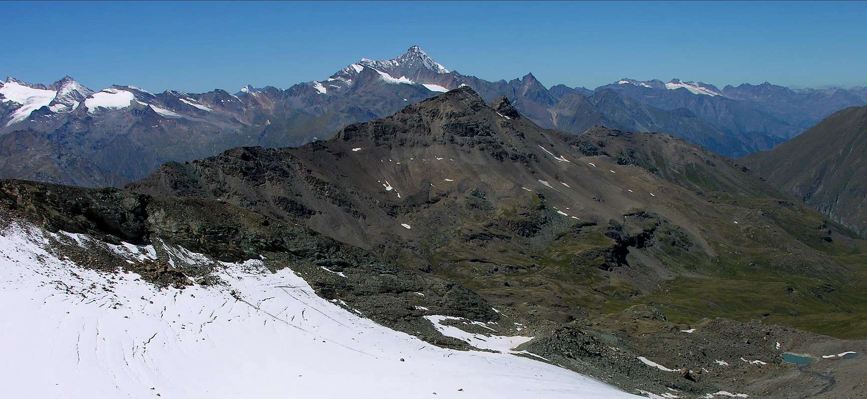
Wide and almost flat Summit, this is the highest point of the ridge dividing the Grauson from Urtier Valleys in the high part of the Cogne Valley. Very good panoramic view on Gran Paradiso Group, on Monte Emilius and on the close Punta Tersiva.
Sommità ampia e quasi piatta, risulta il punto più elevato della cresta che divide il Vallone del Grauson da quello dell'Urtier Valli, nella parte superiore della Valle di Cogne. Bella vista panoramica sul Gruppo del Gran Paradiso, sul Monte Emilius e sulla vicina Punta Tersiva.
"Topographically Crossing"
This long watershed is a natural continuation of the Ridge West-southwest from the Punta Tersiva (3.515m) down first toward the Serra Madou or Madù (3.220m) and then to the Pass of Invergneux, also called des Hevergnes (2.902m). From this ridge rises again forming a small Subgroup, called the Penne Blanche, act to divide Urtier Walloon in the South than the Grauson-Doreire-Tessonet in the North. At first, proceeding Westward, the partition reaches a Unnamed Quote (3.080m) and insignificant; this ridge, flexing most at Northwest, reach the small rocky turrit Testa (Head) of Vallonet (3.152m) and immediately below the highest elevation of the entire coastal or Penne Blanche Eastern, exactly 100 meters higher. This part of the ridge, if with on wire path, may propose some challenging step, however the rock is definitely not good; but several workarounds are possible, generally on the North side. From the Top ridge falls easily to a small saddle (3.148m) and then reach the jagged Summit of Western Penne Blanche (3.205m); this stretch of the via is simple and requires only the climbing of some blocks of rock to reach this latest Vertex, with the possibility of support to the South. In this area to the North there is a steep walloon-basin that contained the ancient Glacier Penne Blanche, of which there is still a sign of life at the top, below the North Slope of Western Summit. A small snowfield with traces of ice and small sources report it. From this last Summit crest, just bending to the West-southwest, comes to a slightly less wide but more pronounced second saddle (3.130m) and the next with the same name or Punta Coupée (3.211m; Cut Point). To the north there is a small walloon that contains the tiny Lake Tzte or Testa (2.753m) and is limited to the West by a spur that descends from Punta Coupée. Even this stretch is not particularly difficult and some short step can be avoided, this time in the North; also continuing on the other side, after a short initial step, continues with the same features first reaching a fairly narrow notch (3.105m) and soon after, zigzagging in a few block, the Testa (Head) of Money (3.130m). Here the ridge turned decidedly to the Northwest and, increasingly becoming "the possibilities on walking", reaches a small and insignificant altitude (3.022m), the next large saddle (2.971m) and with quiet walk Mont Creya (3.015m). This part of the terminal, between the Testa Money and Mount Creya, dominates to the North a small basin that contains the beautiful Lake of Money (2.550m), just above the Alp of Grauson Vieux (2.273m). Then the ridge declines significantly in the Northwest towards the Torrent de Lussert, marked by large stone cairns. Instead, all the Southern Slope of this small chain is even more "unfriendly" than the Northern. Formed by steep rock groins burned and ground, interspersed with grassy and detrital gullies, falls above the Pastures of Gueula, Seutse or Suches and Taveronna (2.369m) connected to each other by a private farms dirt road that goes from the lower middle of the Walloon Urtier towards Northwest. All routes, except to the Pas d'Invergneux initial and the final from Colonna Mines at Mount Creya, are definitely inadvisable and more suitable for Hunters chamois than for Hikers.
Questo lungo spartiacque costituisce la naturale continuazione della Cresta ovest-sudovest che dalla Punta Tersiva (3.515 m) scende dapprima verso la Serra Madou o Madù (3.220 m) per poi raggiungere il Passo di Invergneux, detto anche des Hevergnes (2.902 m). Da questo la cresta si rialza formando un piccolo Sottogruppo, chiamato dei Penne Blanche, atto a dividere il Vallone dell'Urtier a Mezzogiorno da quello del Grauson-Doreire-Tessonet a Settentrione. Dapprima, procedendo verso Ovest, il divisorio raggiunge una Quota Innominata (3.080 m) e poco significativa; da questa la cresta, flettendo maggiormente a Nordovest, raggiunge il castelletto roccioso della Testa di Vallonet (3.152 m) e subito appresso la massima elevazione dell'intera costiera o Penne Blanche Orientale, esattamente di 100 metri più elevata. Questo tratto di cresta, se percorso sul filo, può proporre qualche passaggio impegnativo peraltro su roccia decisamente non buona; però sono possibili diversi aggiramenti, generalmente sul lato Nord. Dalla Sommità la cresta scende facilmente ad una selletta (3.148 m) per poi raggiungere la frastagliata Sommità del Penne Blanche Occidentale (3.205 m); questo tratto di percorso é semplice e richiede solo lo scavalcamento di alcuni blocchi rocciosi per raggiungere quest'ultima Sommità, con possibilità di appoggiare a Sud. In questo settore a Settentrione esiste una ripida conca-vallone che conteneva anticamente il Ghiacciaio di Penne Blanche, del quale si riscontra ancora un segno di vita nella parte alta, al di sotto del Versante Settentrionale della Sommità Ovest. Un piccolo nevaio con tracce di ghiaccio e sorgentelle lo segnala. Da quest'ultima Cima la cresta, piegando appena ad Ovest-sudovest, arriva ad una di poco meno larga ma più marcata seconda sella (3.130 m) ed alla successiva ed omonima Punta o Punta Coupèe (3.211 m). Verso Nord esiste una piccola conca che contiene il minuscolo Lago di Tzte o di Testa (2.753 m) ed é limitata ad Ovest da uno sperone discendente dalla Punta Coupée. Anche questo tratto non presenta particolari difficoltà e qualche breve passaggio può essere evitato, questa volta a Settentrione; pure la continuazione sul lato opposto, dopo un breve passaggio iniziale, prosegue con le medesime caratteristiche raggiungendo dapprima un abbastanza stretto intaglio (3.105 m) e subito dopo, zigzagando tra qualche blocco, la Testa di Money (3.130 m). Qui la cresta volge decisamente a Nordovest e, diventando sempre di più "camminabile", raggiunge una piccola ed insignificante quota (3.022 m), la successiva larga sella (2.971 m) e con tranquilla passeggiata il Monte Creya (3.015 m). Questa parte terminale, tra la Testa di Money ed il Monte Creya, domina verso Nord un piccolo bacino che contiene il bel Lago di Money (2.550 m), appena al di sopra dell'Alpe di Grauson Vieux (2.273 m). Poi la cresta declina decisamente a Nordovest verso il Torrent de Lussert, contrassegnata da grandi ometti in pietra. Invece, tutto il Versante Meridionale di questa piccola catena si presenta ancora più "inospitale" di quello Settentrionale. Formato da ripidi costoloni di roccia arsa e frantumata, alternati ad erbosi e detritici canaloni, scende sopra gli Alpeggi di Gueula, Seutse o Suches e Taveronna (2.369 m) collegati tra di loro da una strada poderale risalente dal medio-basso Vallone dell'Urtier verso Nordovest. Tutti i percorsi, tranne quello iniziale verso il Pas d'Invergneux ed il finale dalle Miniere di Colonna al Monte Creya, sono decisamente sconsigliabili e maggiormente indicati a Cacciatori di camosci piuttosto che agli Escursionisti.
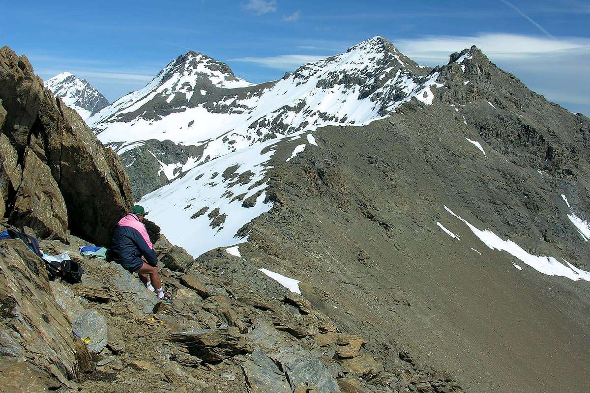
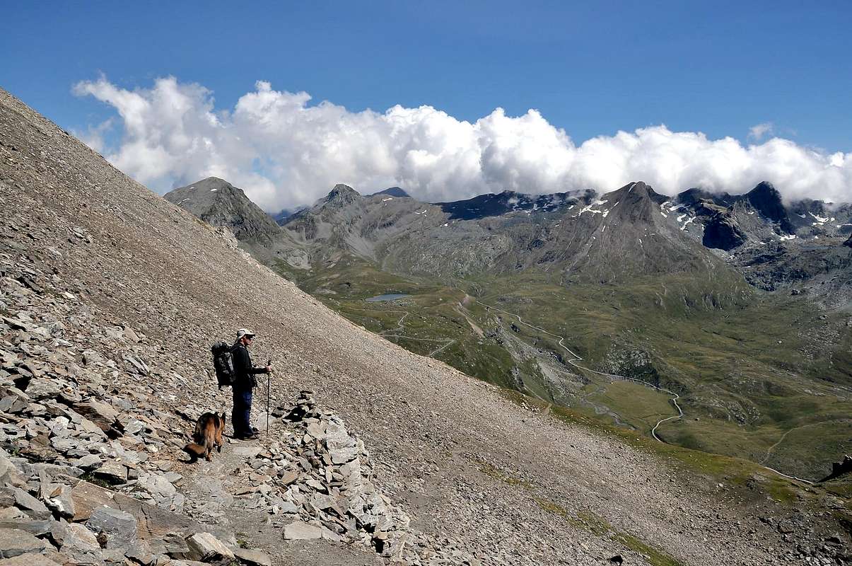
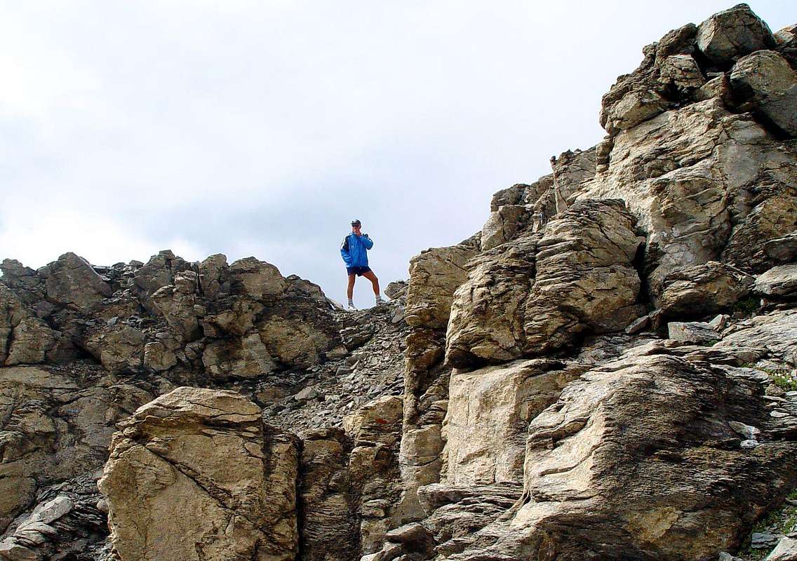
On ridge in Integral Traverse from Mont Creya towards Punta di Money, Punta Coupée, Penne Blanche
First Ascents
First on the summit: Unknown.
N Slope: Giovanni Bobba and Friends, (Jul 28th, 1886), in ascent.
S Slope: Giovanni Bobba & Friends, (Jul 28th, 1886), in descent. This route has been traveled, always downhill, even by Osvaldo Cardellina and Companions, mid Eighties.
N Slope of Western Summit: Osvaldo Cardellina, Nicola Colajanni, Davide Fioretti, Francesco Fioretti and Gianfranco Vicentini, (Aug 14th, 2003), in ascent from Gimillan.
N-NE Edge (Eastern Summit): Osvaldo Cardellina, Nicola Colajanni, Davide Fioretti, Francesco Fioretti and Gianfranco Vicentini, (Aug 14th, 2003), in descent to Ervillères.
Integral Traverse: Osvaldo Cardellina and Giuseppe Lamazzi (Jul 21th, 1985), in crossing from Quota 2943 meters of Mont Creya to Invergneux Pass.
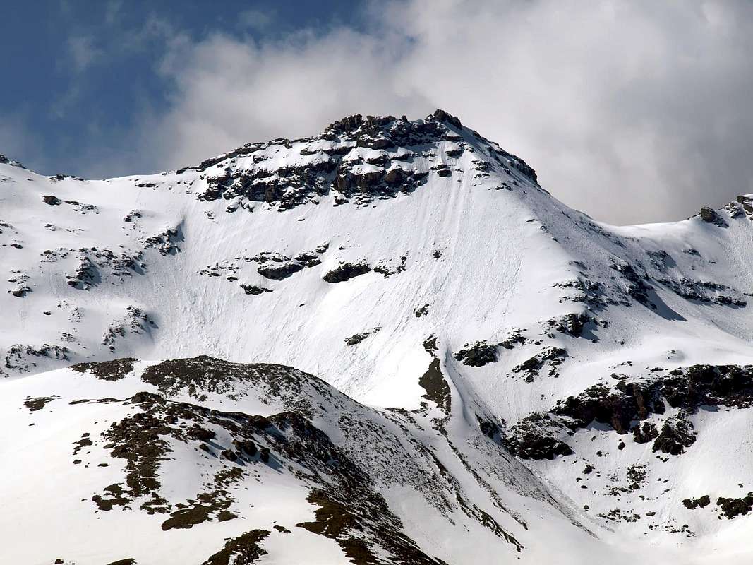
Eastern Penne Blanche. Left: E Ridge, NE Face, N-NE Edge and N Face
Getting There
BY CAR:
From Torino, Milano, etc: Motorway A5. Exit in Aosta Ovest. Drive to the near Aymavilles. Follow in the direction of Valle di Cogne.
From Switzerland: through the Grand St. Bernard Tunnel or the homonym Pass). Drive to Aosta, then follow Courmayeur direction on SS.26. Just after Sarre, turn to the left, in the direction of Valle di Cogne.
From France: through Mont Blanc Tunnel or Petit St. Bernard Pass). It isn't necessary to enter in Motorway A5, you can drive through SS.26 Aosta direction. Before arriving at the Village of Sarre, follow the sign and turn right towards Valley of Cogne. After Aymavilles, the Regional Road n°47 crosses the Villages of Vieyes, Epinel and Crétaz and after about 25 Km. arrives at Cogne (1.534m). Follow the road signs for Gimillan and Lillaz(1.607m), 2 Kilometers after Cogne Center; arrived at a round-about, recently built in proximity of the St. Anthony Chapel, go left along the scenic route leading to the Village of Gimillan (1.787m) 2,1 Kilometers after Cogne-Resort. Usually for both no parking problem.
BY PLANE:
Aeroporto "Corrado Gex" Saint Christophe (Aosta).
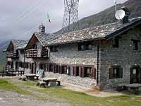
Lillaz Tourist Fraction in East of Cogne Municipality, by Silvia Mazzani
Approaches
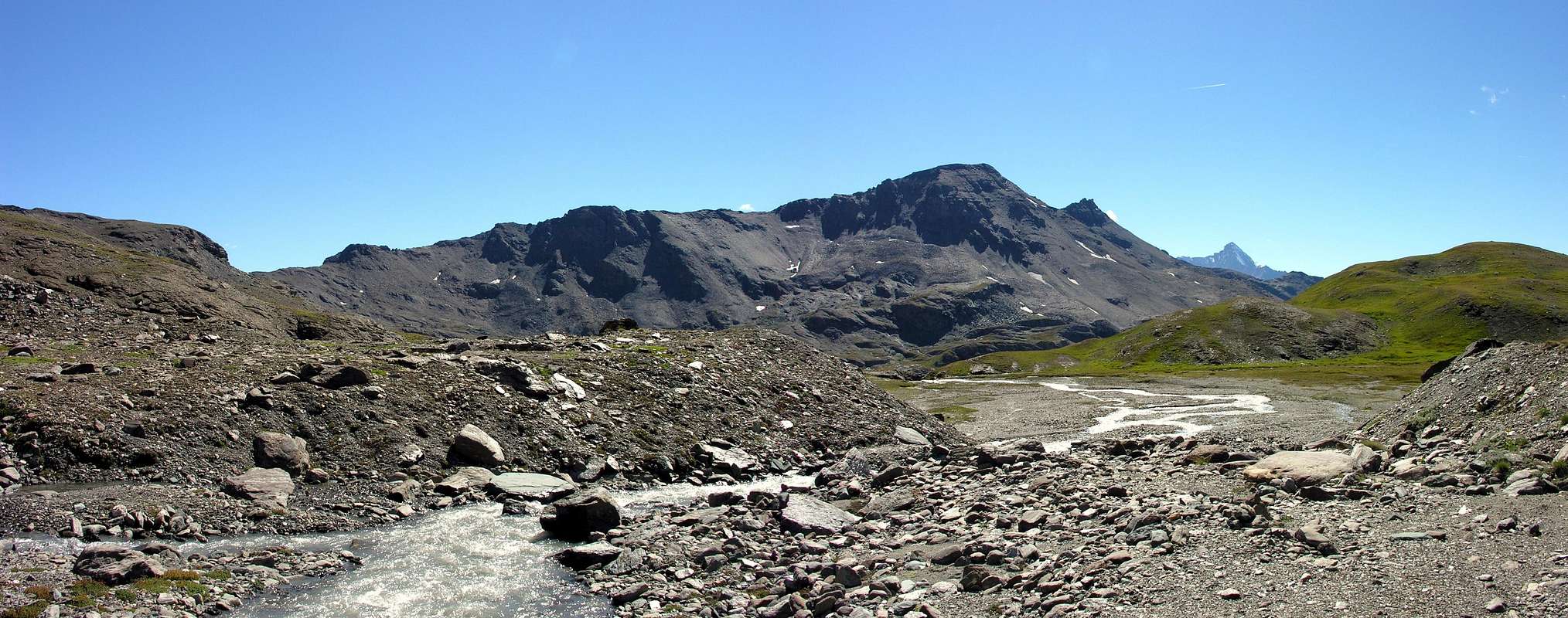
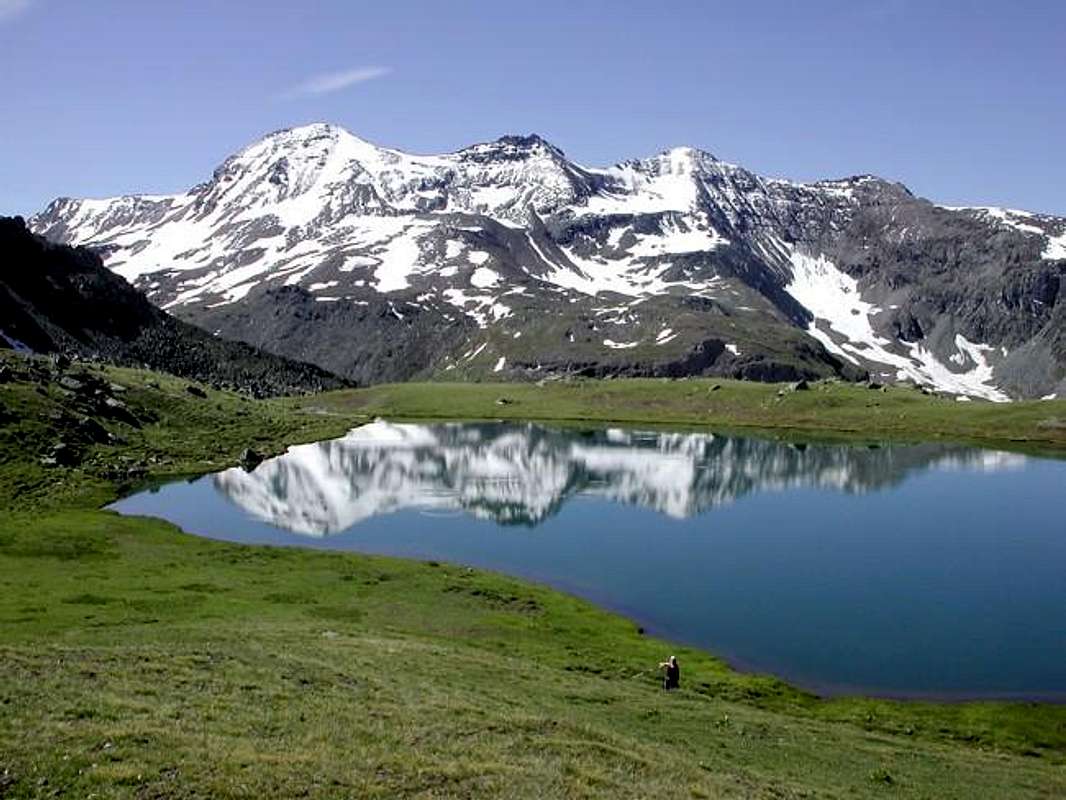
From snowy Invergneux Pass or des Hevergnes (2.905m) to Bec Costazza, Cima Peradzà & (in background) Rosa dei Banchi
Approach A (through Grauson-Doreire Valley) - go right starting from the car park of Gimillan: after few meters the indications for Lussert Lakes, St. Marcel Pass, etc. are found. The pathway is indicated by the yellow circle 9A and by yellow strips marked on stones along the route. The path begins going immediately uphill, then the slope decreases as we go beyond a little chapel dedicated to the Virgin (1.836m). Soon the path resumes to go up and splits in two, before it begins to penetrate into the Grauson Valley: it's possible to continue following the right one that goes down as far as the Ecloseur Bridge (1.904m), but in such a case we must go up again; it's better to follow the left one that, in practice without losing height, arrives at the bridge under the Alpeggio Pila (2.025m), cross it and, following the stepped pathway, overcome the rocky bastion with a fine waterfall aside. At this point the path turns right markedly entering, high on the torrent, into a small valley; by an alternation of steep and slight slopes, it reaches a panoramic cross, on the edge of a pleasant plateau (superb view of the far Grivola!). The path goes through the meadows, slightly descending: after the Alpi di Grauson Vecchie (2.271m), cross the torrent on the Pikaciù Bridge and begin again to go up, reaching the wide upper part of the Grauson Valley. For the first time the Tersiva put it in appearance, while, looking into the distance, the end of the valley appears, close by the Passo d'Invergneux (2905m) and the Serra Madù or Madou, WSW Ridge of the Tersiva. Shortly afterwards one meets the signs indicating the ways on the left to Laures Pass (3.035m) and St. Marcel or coronas Hill (2.916m). On the contrary go straight ahead along the pathway n° 8/TVC, few meters later you can see on the left the Alpeggio Pralognan (2.418m). Continue as far as the semi ruins of the Alpage Ervillières (2.519m). After the pastures follow toward East along the path leading to Doreire Lower Lake (2.731m), board it on the right side and, on tracks, get the Upper Lake (2.844m). On toward South and in about 20' tyou get the Invergneux Pass (2.905m).
"Western" Variant: wanting to make the full crossing departing from Mont Creya to Penne Blanche Eastern arriving at the Pass of Invergneux, should follow the approach below. As for the crossing itself, however, makes reference to "Topographically Crossing", which is described with the same meticulous detail is against the topographic exposure in the technical report of the route. From Grauson Vieux, or rather, from the junction immediately after entering the grassy plateau (2.298m), turn right (Southeast) and via the route n° 8C, passing under some benches of rock, and reach over across the torrent which descends from Lake of Money (2.550m), at his emissary to the South of that. Rounding to the right (West) to come up with the lake heading Southwest via a small path not numbered, and the same, gradually turns into a track between steep grassy slopes. Follow it up to about 2.910/20 meters, where it disappears just below the Crest Northwest near the 2.968 meters altitude. Along this (endless meadows of edelweiss), you will soon reach the Top (E; 1h'30/1h'45 from Grauson Vieux).
Approaching the Pass of Invergneux with the Way from Grauson-Doreire Vallon & through the three Lakes Doreire
Avvicinamento A (attraverso il Vallone Grauson-Doreire) - partendo dal parcheggio di Gimillan indirizzarsi sulla destra: dopo pochi metri si riscontrano le indicazioni per i Laghi di Lussert ed il Colle di St. Marcel, ecc. Il percorso è indicato da cerchio giallo e da strisce, sempre in giallo, marcate sulle pietre lungo il percorso. Lo stesso inizia subito in decisa salita, poi la pendenza diminuisce, appena al di là d'una cappellina votiva dedicata alla Vergine (1.836 m). Dopodiché il sentiero riprende a salire dividendosi in due, appena prima di penetrare nella Vallone del Grauson vero e proprio: è possibile continuare a seguire quella diretta che scende fino al Ponte dell'Ecloseur (1.904 m), ma in siffatto caso successivamente si deve risalire; è meglio seguire quello di sinistra che, in pratica senza perdere dislivello, arriva al ponte sottostante l'Alpeggio di Pila (2.025 m). Lo si attraversa e, seguendo un percorso a gradini, si supera il bastione roccioso con una bella cascata subito a lato. A questo punto il percorso svolta marcatamente a destra per entrare, alto sul torrente, in un valloncello; alternando pendii ripidi e lievi, raggiunge una croce panoramica, ai margini di un piacevole altopiano (superba vista del lontano Grivola!). Il sentiero attraversa con leggera discesa i prati: dopo la Alpi di Grauson Vecchie (2.271 m), attraversare il torrente sul Ponte Pikaciù e ricominciare a salire, raggiungendo l'ampia parte superiore del Vallone del Grauson. Appare, per la prima volta, la Punta Tersiva, mentre, guardando più in lontananza, appare al termine del vallone medesimo, vicino al Passo d'Invergneux (2.905 m) e la Serra Madù o Madou, il crinale Ovest-sudovest della Tersiva. Poco appresso s'incontrano le indicazioni per le vie verso il Col di Laures (3.035 m; sulla sinistra) e di St. Marcel o Col Coronas (2.916 m). Al contrario proseguire direttamente lungo il sentiero n° 8/TVC, lasciando subito sulla sinistra l'Alpeggio di Pralognan (2.418 m). Continuare fino alle semi rovine dell'Alpeggio d'Ervillières (2.519 m). Dopo i pascoli, procedere verso Est lungo il sentiero che conduce al Lago Doreire Inferiore (2.731 m); passando a bordo del lato destro e, tramite sentiero, arrivare a Lago Superiore (2.844 m). Risalire a Sud e in circa 20 minuti pervenire al Passo d'Invergneux (2.905 m).
Variante "Occidentale": volendo effettuare la traversata integrale con partenza dal Monte Creya al Penne Blanche Orientale con arrivo al Passo d'invergneux, conviene seguire lo avvicinamento sottostante. Per quanto concerne la traversata medesima, invece, si fà riferimento a "Topographically Crossing", dove la stessa é descritta con minuzioso dettaglio sia nei confronti della esposizione topografica che nella relazione tecnica della via. Da Grauson Vieux, o meglio, dal bivio subito dopo l'ingresso nel plateau erboso (2.298 m) deviare a destra (Sudest) e tramite il sentiero n° 8C, passando al di sotto di alcuni banchi di roccia, raggiungere ed oltrepassare il torrente discendente dal Lago di Money (2.550 m), presso il suo emissario Meridionale. Doppiando sulla destra (Ovest) il lago salire con direzione Sudovest tramite un sentierino non numerato; lo stesso, progressivamente, si tramuta in una traccia tra ripidi pendii prativi. Seguirlo fino a 2.910/20 m~, dove scompare appena al di sotto della Cresta Nordovest nei pressi della quota 2.968 metri. Percorrendo questa (prati con molte stelle alpine), in breve si raggiunge la Cima (E; 1h'30/1h'45 dal Grauson Vieux).
Approach B (from Lillaz towards Urtier Walloon and by Sogno di Berdzé Refuge - : starting from Cogne (1.534m) you must arrive (bus or car) to the car parking of Lillaz (1.617m). Follow the path n° 13/TVC/Alta Via n° 2 below upaved road, until reach Baite di Gollies Low and Upper (1.831m, 1.869m; here you can also get along the same route with slightly longer, less direct but certainly more scenic). Move on until tiny Church of Crêt (2.020m; wooden fountain), clearly visible from lowlands. Once gone beyond Tsavanis (2.296m; fountain), preceded by a magnificent waterfall upon the Torrent Urtier and above the private farms dirt road and Manda (2.370m) Pastures, the refuge is reached, immediately after a fresh spring water from a rock in a great boulder (3h'30/3h'45, from Lillaz parking). From Sogno di Berdzè (2.526m) Refuge, (2h'00/2h'15, from the Hut "Sogno di Berdzé"). From the shelter continue towards the Northeast through the previous path to the Fenêtre de Champorcher 2742 meters to the junction with the source; from this point instead to continue with the Northwest trail n° 10F, which after passing a pond, through a long diagonal to Alp Ponton (2.631m; there is a shortcut unnumbered just below), which also ends the private farm dirt road comes from Manda Pasture. Traced through this passing under the "Baita Hunters Orlando" (2.641m) and proceed by way of a short link that leads to the path n° 10C for Pass Invergneux. With a long diagonal, followed by a few bends in the end, you reach the hill (1h'10/1h'25) from the refuge.
Direct Variant: not wanting from Refuge Sogno di Berdzé and having the aim to make the trip in one day, with the same route to reach the junction 2.360 meters before Manda Pasture. After leaving the farm dirt private road to the East to the refuge, cross the small stone bridge over the Torrent Urtier and continue with the one that goes to the North. Continue with the trail n° 100, concurrent with it and, along the Alp Pianas (2.405m), reach the next alternative 2.507 meters; leave again towards the East branch to Alp Ponton (2.631m) and continue towards the Northwest reaching the Alp of Invergneux ((2.524m, mini parking in soil), where the same ends. A small path unnumbered toward Northeast connects quickly with the trail n° 10D/TVC which comes from the "Baita Hunters Orlando" (2.641m), from which the previous route to the Pass of Invergneux (E F; 1h'20/1h'35 from the junction below).
Variant "Low": wanting instead to make the entire journey in direction West/East, ie from Mount Penne Blanche Creya to and from this fall Pass of Invergneux, reached, again via the farm road from Lillaz, the junction 2.280 meters, just before the cascade of Alp Tsavanis (2.393m). Abandoned the way to that direction, he turns to the West-northwest through another branch of the farm dirt road concomitant with the trail n° 10C itself surpasses successions in the Alps Gueula Dèsott and Damon (2.342m, 2.377m), Seutses (2.389m) to that of Taveronna (2.369m), where the road ends. Instead the path continues through the meadows (initially not easy to identify) and with semi circular path enters the Walloon of Liconi. Forded the torrent of the same name in a short time it goes back to the old and abandoned buildings for workers Mining Colonna (2.390m). From Colonna continue with path n° 5 to the Northeast climbing to the overlying Liconi Ironmines (2.495m), just below the Mont Salet (2.764m); from these down to the bottom of the deep walloon of the same name and Liconi reaching the torrent crossing for twice. Returning to the left (West) and continue towards the North, again on a comfortable path and passed three bends, reaching the South-southwest Crest that connects to the Mont Salet. With this easy to reach the Summit (2h'30/3h'00 from the lower alternative). From this make the whole journey as described in "Topographically Crossing".
Avvicinamento B (da Lillaz attraverso il Vallone dell'Urtier appoggiandosi al Rifugio Sogno di Berdzé - : dall'abitato di Cogne (1.534 m) in bus o in auto raggiungere la ridente frazione di Lillaz (1.617 m), dove si parcheggia l'auto nel grande piazzale sito quasi al centro del villaggio. Percorrere il sentiero n° 13/TVC/Alta Via n° 2 al disotto della strada poderale e lungo la sponda Settentrionale del Torrente Urtier fino alle Baite di Gollies Dessous e Dessus (1.831 m, 1.869 m; qui si può arrivare anche percorrendo la medesima con itinerario leggermente più lungo, meno diretto, ma sicuramente maggiormente panoramico); continuare fino alla Chiesetta del Crêt (2.020 m; bella fontana scavata nel legno), ben visibile dal basso, e oltrepassati gli Alpeggi di Tsavanis (2.296 m; fontana), preceduto da una bella cascata sopra il Torrent Urtier al di sopra della poderale, ed il successivo di Manda (2.370 m) si raggiunge il Rifugio "Sogno di Berdzè" (Sogno di Pastore) presso l'Alpe di Peradzà, subito dopo un tornante seguito da un lungo rettilineo in leggera ascesa giusto appresso una fresca sorgente sgorgante da un gran masso nella roccia (3h'30/3h'45 dal parcheggio di Lillaz). Dal Rifugio Sogno di Berdzé (2.526 m) continuare verso Nordest tramite il precedente sentiero per la Fenêtre de Champorcher fino al bivio 2.742 metri con sorgente; da questo punto continuare invece verso Nordovest con il sentiero n° 10F che, oltrepassato un laghetto, tramite un lungo diagonale raggiunge l'Alpe Ponton (2.631 m; esiste una scorciatoia non numerata appena più in basso), dove termina anche la strada poderale proveniente dall'Alpe Manda. Risalire tramite questa passando sotto la "Baita dei Cacciatori Orlando" (2.641 m) e procedere per mezzo di un breve collegamento che conduce al sentiero n° 10C per il Passo di Invergneux. Con un lungo diagonale, seguito da alcuni tornanti nella parte finale, si giunge al colle (1h'10/1h'25) dal rifugio.
Variante Diretta: non volendo partire dal Rifugio Sogno di Berdzé ed avendo lo scopo di effettuare l'escursione in un sol giorno, con lo stesso itinerario raggiungere il bivio 2.360 metri prima dell'Alpe Manda. Lasciata ad Est la strada poderale per il rifugio, oltrepassare il piccolo ponte in pietra sopra il Torrent Urtier e continuare con quella che prosegue verso Settentrione. Continuare con il sentiero n° 100, concomitante con la medesima e, costeggiando l'Alpe Pianas (2.405 m), raggiungere la successiva biforcazione 2.507 metri; lasciare ancora verso Est la diramazione verso l'Alpe Ponton (2.631 m) e proseguire verso Nordovest raggiungendo l'Alpe di Invergneux 2.524 metri, dove la stessa termina. Un piccolo sentiero non numerato verso Nordest si collega in breve tempo con il sentiero n° 10D/TVC che proviene dalla "Baita dei Cacciatori Orlando" (2.641 m), donde con il precedente itinerario al Passo d'Invergneux (E/F; 1h'20/1h'35 dal bivio sottostante).
Variante "Bassa": volendo invece effettuare l'intera traversata in senso Ovest/Est, cioé dal Monte Creya al Penne Blanche e da questo discendere al Passo d'invergneux, raggiunto, sempre tramite la strada poderale da Lillaz, il bivio 2.280 metri, appena prima della cascata dell'Alpe Tsavanis (2.393 m). Abbandonata la via per quella direzione, si volge ad Ovest-nordovest tramite un altro ramo della strada poderale concomitante con il sentiero n° 10C La stessa sorpassa in successioni le Alpi Gueula Dèsott e Damon (2.342 m, 2.377 m), Seutses (2.389 m) per arrivare a quella di Taveronna (2.369 m), ove finisce la strada. Il sentiero continua invece tra i prati (inizialmente non facile l'individuazione) e con percorso semi circolare entra nel Vallone di Liconi. Guadato l'omonimo torrente, in breve tempo si risale alle vecchie ed abbandonate costruzioni per gli operai delle Miniere di Colonna (2.390 m). Da Colonna continuare con il sentiero n° 5 verso Nordest salendo alle soprastanti Miniere di Liconi (2.495 m), subito al di sotto del Mont Salet (2.764 m); da queste scendere sul fondo del Vallone di Liconi raggiungendo lo stesso torrente attraversandolo per due volte. Ritornati a sinistra (Ovest) continuare verso Settentrione e, sempre su comodo sentiero e superati tre tornanti, raggiungere la Cresta Sud-sudovest che si collega al Mont Salet. Tramite questa facilmente raggiungere la Sommità (2h'30/3h'00 dal bivio). Da questa effettuare l'intera traversata come descritto in "Topographically Crossing".
Descent from Invergneux Pass towards Hevergnes/Ponton/Pianas/Manda/Tsavanis Alpages into the Urtier Valley
Routes
Route A (Standard Route) - reached the Pass of Invergneux (2.905m) through the Approach A, now along the ridge that, Westward, leads to the Testa del Vallonet (3.135m) keeping the Northern side of the aerial ridge where some walk ups are followed by some short rock easy climbing passages and in less than one hour you get the Summit East. Rope can be useful.
Note: For more details on this part of the ridge see above"Topographically Crossing", which also describes the entire voyage Westward to Mount Creya, bypassing also Penne Blanche Western, Punta Coupée and Testa of Money and related passes and collars between the one and the other.
Integral Ridge from Invergneux Pass to Testa del Vallonet and the Penne Blanche or Standard Route
Via A (Normale) - raggiunto il Pas dell'Invergneux (2.905 m) tramite l'Avvicinamento A, da questo traversare ad Ovest lungo il crinale che conduce alla Testa del Vallonet (3.135 m), restando sul lato Settentrionale della aerea cresta, dove alcuni alti muretti sono seguiti da alcuni brevi passaggi di roccia con facile arrampicata ed in meno di un'ora s'arriva al Vertice Orientale. D'utilità la corda.
Nota: per maggiori dettagli in questo tratto di cresta vedere sopra"Topographically Crossing", dove inoltre viene descritta l'intera traversata verso Ovest fino al Monte Creya, oltrepassando anche il Penne Blanche Occidentale, la Punta Coupée e la Testa di Money con relativi colli e colletti tra l'una e l'altra.
Route B ("Historic Via" through the North-northwestern Slope) - this route has a meaning "historic" and, most likely, has not been repeated. This via is "told" in B&V 1896, page 67, following an ascent by Giovanni Bobba and Companions took place July 28th, 1886 (see RM 1887, page 197). The same, reached the Lake of Money (2.550 m), conducted a long crossing to Southeast up to the ancient Glacier Penne Blanche (to confirming that then existed) then conclude with Face North-northwest composed of rocks smashed. The descent was made directly through the South Slope. Not dangerous and, all in all, "amusing", as transits from Lake Money going to Puy-de-Vardettaz (2.574 m), large glacis below the Pointe Coupée, deserves to be frequented although, unfortunately, the glacier no longer exists. The first climbers but strangely, despite the description in "Guide of the Western Alps" by the same Bobba, they carried ascension starting more directly from Ervillières Alpage, not changing effects in the "substance".
Via B (Versante Nord-nordovest) - questo itinerario ha un significato "storico" e, molto probabilmente, non é stata più ripetuta. Questa via viene "raccontata" in B&V 1896, pagina 67 a seguito di una salita di Giovanni Bobba e Compagni avvenuta il 28 Luglio 1886 (vedi RM 1887, pagina 197). Gli stessi, raggiunto il Lago di Money, (2.550) effettuarono una lunga traversata verso Sudest fino al Ghiacciaio di Penne Blanche (a conferma che allora esistesse) per poi cocludere con il Versante Nord-nordovest composto da rocce sfasciate. La discesa venne effettuata direttamente tramite il Versante Sud. Non pericolosa e, tutto sommato, "divertente", poiché transita dal Lago di Money passando al Puy-de-Vardettaz (2.574 m), ampio spalto sottostante la Pointe Coupée, merita di essere frequentatata, anche se, purtroppo, il ghiacciaio non esiste più. I primi salitori però stranamente, nonostante la descrizione in "Guida delle Alpi Occidentali"dello stesso Bobba con la lunga traversata appena sopra descritta, effettuarono l'ascensione partendo più direttamente dall'Alpeggio di Ervillières, senza poi, in siffatto modo, cambiare sostanzialmente l'ascensione medesima.
North Face of Western Penne Blanche, between E Crest/NW Edge
Route C (North Face of Punta crossing the West and East) - is a parallel via to the West than that of 1886 by Giovanni bobba with the companions, so as to directly address the short rock wall below the Top and then cross to the West Summit Western. Starting Alpages of Ervillières, take enough to climb through steep meadows with scattered blocks in a small walloon; continue amongst three secondary torrents, without fixed course, leaving on the right (West) the tiny Quote of 2.799 meters or Punta Ervillières. Thus reaching a wide and progressively steep stony located at the base of the North Face of Penne Blanche Western, leaving just left the miserable residue of ancient Glacier Penne Blanche (small sources). Through large blocks stacked rise up against the rocks that form the small end wall; with climbing pretty easy (I°+/II°-) and looking for the best route out directly on the Summit (3.205m). Or, certainly with less difficulty, leaning to the right through the Northwest Corner, which contains the same right. On the edge of the ridge, or bypassing some stretch the same to the South, down to the underlying large saddle (3.148m) and, continuing more easily on the West Crest of Penne Blanche Eastern, quickly reach the Vertex (EE/A/F+; 2h'30/3h'00 from Ervillières Alpages; 6h'00/6h'30 from Gimillan Hamlet).
Via C (Faccia Nord della Punta Ovest e traversata alla Est) - risulta una via parallela ad Ovest rispetto a quella del 1886, tale da affrontare direttamente la corta parete rocciosa sottostante la Punta Ovest per poi attraversare verso la Sommità Occidentale. Partendo dall'Alpe di Ervillières, prendere a salire tramite abbastanza ripidi prati con blocchi sparsi in un valloncello; si prosegue tra tre torrenti secondari, senza percorso obbligato, lasciando sulla destra (Ovest) la minuscola Quota 2.799 metri o Punta di Ervillières. Raggiungere così una vasta e ripida pietraia sita alla base della Faccia Nord del Penne Blanche Occidentale, lasciando subito sulla sinistra i miseri residui dell'antico Ghiacciaio di Penne Blanche (piccole sorgenti). Tramite grandi blocchi accatastati salire fino contro le rocce che formano la piccola parete terminale; con arrampicata abbastanza facile (I°+/II°-) e cercando il tracciato migliore uscire direttamente sulla Sommità (3.205 m). Oppure, sicuramente con minori difficoltà, appoggiando sulla destra tramite lo Spigolo Nordovest, che contiene la medesima a destra. Sul filo di cresta, oppure aggirando in qualche tratto il medesimo a Sud, scendere alla sottostante larga sella (3.148 m) e, continuando più facilmente sulla cresta Ovest del Penne Blanche Orientale, raggiungere in breve la Sommità (EE/A/F+; 2h'30/3h'00 da Ervillières; 6h'00/6h'30 da Gimillan).
Route D (Edge North-northeast of Eastern Top) - this route can be used for a more direct descent towards the Alp of Ervillières, or to go down the route n° 8/TVC that by it rises to Pas d'Invergneux (2.902m), along the three Lakes Doreire. In this way you avoid the long crossing back down to the hill that descends through the same East Crest. From the Summit down to the Northeast, through snowfields residues or steep scree, until you reach a large "balcony" suspended above a steep and wide wall that slopes from South to North. From this point to turn gradually to the left (Northwest), reaching the edge of a fairly sharp edge facing North-northeast; down through this with very broken rocks interspersed with gravel ledges (I°+), or resting on the couloir that accompanies him on the left bank (convenient if with good snow). After you get to the stony base (sometimes large residues snowfield) to a point 2.862 meters, near a small torrent and secondary tributary to the North of the Torrent Doreire. Wanting to go to Ervillières should follow the same, otherwise continue in the same direction, reaching the above path n° 8/TVC at Lower Lake Doreire (2.734m), the largest of the three. This route can also be carried uphill, but is not advisable with much snow.
Via D (Spigolo Nord-nordest della Punta Est) - questa via può essere utilizzata per una discesa più diretta verso l'Alpe di Ervillières, oppure per calare verso il sentiero n° 8/TVC che dalla medesima sale al Pas d'Invergneux (2.902 m), costeggiando i tre Laghi Doreire. In questo modo si evita di percorrere nuovamente in discesa la lunga Cresta Est, che scende al colle stesso. Dalla Sommità scendere a Nordest, tramite nevai residui o ripida pietraia, fino a raggiungere un largo "balcone" sospeso sopra una ripida ed estesa parete digradantesi da Sud verso Nord. Da questo punto volgere gradualmente a sinistra (Nordovest) raggiungendo il filo d'un abbastanza marcato spigolo rivolto a Nord-nordest; scendere tramite questo con rocce molto rotte inframezzate da cenge ghiaiose (I°+), oppure appoggiando sul canale che l'accompagna sulla sinistra orografica (conveniente se con neve buona). Al termine si arriva alla pietraia di base (a volte larghi residui di nevaio) ad un punto di altitudine 2.862 metri, presso un torrentello secondario ed immissario a Settentrione del Torrente Doreire. Volendo scendere ad Ervillières conviene seguire il medesimo, altrimenti continuare nella stessa direzione raggiungendo il suddetto sentiero n° 8/TVC presso il Lago Doreire Inferiore (2.734 m), il più grande dei tre. Questo itinerario può essere effettuato anche in salita, ma é sconsigliabile con molta neve.
During Penne Blanche Crossing, between Punta di Money/Mont Creya
Difficulties & Equipment
The route can be rated for Expert Hikers with some climbing capacity EE/F+.
Il percorso può essere valutato per Escursionisti Esperti con una minima capacità di arrampicata EE/F+.
High Hiking gear, a rope can be useful on the final ridge.
Equipaggiamento da Alto Escursionismo; una corda può essere d'utilità sulla cresta finale.
Campings
Remember that free camping is forbidden (except for emergency reasons, over 2.500m, from darkness until dawn).
Mountain Condition
You can get meteo information at the official site of the Regione Valle d'Aosta:
"Guida delle Alpi Occidentali" di Giovanni Bobba e Luigi Vaccarone C.A.I. Sezione di Torino Volume II (parte II), 25 Maggio 1896.
"Guida dei Monti d'Italia Emilius Rosa dei Banchi Parco del Mont Avic" di Giulio Berutto e Lino Fornelli - Club Alpino Italiano/Touring Club Italiano, Marzo 2005.
"Diari Alpinistici" di Osvaldo Cardellina e Indice Generale accompagnato da Schedario Relazioni Ascensioni 1964-2019 (unpublished).
MAPS:
Kompass "Gran Paradiso Valle d'Aosta Sentieri e Rifugi" Carta Turistica 1:50.000.
Enrico Editore Ivrea-Aosta "Gruppo del Gran Paradiso" 1:50.000.
I.G.C. Istituto Geografico Centrale Torino "Gran Paradiso-La Grivola-Cogne" 1:25.000.
L'Escursionista "Tour de la Vallée de Cogne Grand Paradis" Carta dei sentieri 1:25.000.
I.G.C. Istituto Geografico Centrale Torino "Il Parco Nazionale del Gran Paradiso" (3) 1:50.000.
L'Escursionista "Valle di Cogne Carta dei Sentieri" (n° 10) 1:25.000.
A.I.NE.VA. (Associazione Interregionale Neve e Valanghe).
A.IA.T. Cogne Gran Paradis via Bourgeois n° 34 Tel. 0165-74040. E-mail: aiat@cogne.org
Ezio Sport articoli sportivi - via Bourgeois n° 64 Tel. 0165-74204.
Useful numbers
Soccorso Alpino Cogne (SAR) Tel. 3482685406.
Protezione Civile Valdostana località Aeroporto n° 7/A Saint Christophe (Ao) Tel. 0165-238222.
Bollettino Meteo (weather info) Tel. 0165-44113.
Unità Operativa di Soccorso Sanitario Tel. 118.
Acknowledgements
The fundamental support given by my friend "Osva" for all texts, "Topographically Crossing" and translation into Italian. In addition I want to thank Gabriele Roth for the translation of the text from italian.
Parents refers to a larger category under which an object falls. For example, theAconcagua mountain page has the 'Aconcagua Group' and the 'Seven Summits' asparents and is a parent itself to many routes, photos, and Trip Reports.

 9344 Hits
 88.19% Score
 26 Votes