
-
 17278 Hits
-
 95.97% Score
-
 56 Votes
|
|
Mountain/Rock |
|---|---|
|
|
45.65550°N / 7.37762°E |
|
|
Mountaineering |
|
|
11322 ft / 3451 m |
|
|
Overview
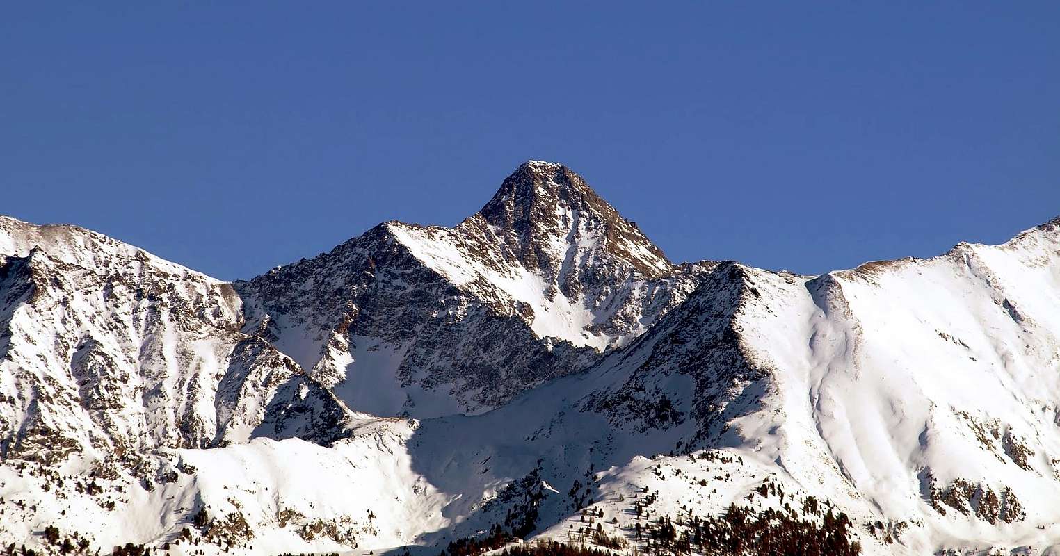
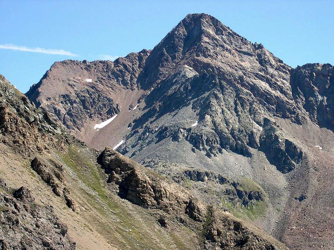
Punta Garin (also called Picco Garin, 3.451m) is a beautiful pyramidal summit which ranks third in both height and importance in the small Emilius Group, after Monte Emilius (3.559m) and Punta Tersiva (3.515m). It is without doubt the boldest peak of the whole massif. Its ascent is easier than appearances would suggest, but none of its sides allows a simple walk-up. From its summit one can enjoy wonderful views of the Gran Paradiso Massif and many other mountains of Valle d'Aosta.
Its Normal Routes stop by the following Walloons of the Grauson and the small of the Chaz Fleurie, departing from the Village of Gimillan (1.787m) in the Valley of Cogne, and through the Slope East-southeast, while arriving from the Basin of Pila Resort him transits through the Lake of Chamolé (2.325m) and the homonym Hill (2.641m) to reach the lonely "Vallone" of the Arbolle; from this, exploiting the Garin Hill (2.815m) and going up again to the homonym lake, basic the of the rocky pyramid it is reached. The slope happens for the Crest N-NW (* from us here described as route in phase of descent), that finishes with a steep Edge North, or through, to right, the parallel W-SW Ridge, however more binding and with a delicate passage in the final part of the ascension. It is possible besides to climb these two itineraries departing from Gimillan Village and crossing the large Walloon of the Arpisson, that brings to the recently new positioned Franco Nebbia Bivouac, as soon as under to the perfectly square Lake Garin (2.854m). Or the other Normal Route, surely the simplest and easy unties him through the very long Walloon of the Grauson, always with departure from the Village of Gimillan; the same one (* * not exposed here, but abundantly illustrated by the various pictures) it goes up again the homonym "vallone" up to the Alps of Grauson Vieux (= Old Grauson Pastures; 2.276m) and, overcome the Torrent de Lussert through a small wooden bridge of enough recent construction (* * * once it was had to effect a ford of not easy realization, when the same one formed the flood, also jumping from a boulder to the other inside the stream), it is penetrated in a small and wild walloon, says of the Chaz Fleurie, that conducts through deep reddish ground stones, between Garin Peak and Grauson Tower, to the Slope East-southeast. With this, or supporting on the neighboring (to Northern) East Crest over the Notht-northeast Wall, the Summit of the peak is reached. All the other streets are more binding and they ask for a knowledge of the territory to reach the various attacks of the faces, as well as the ability to manage in the choice of the route, above all for safety matters, since, the quality of the rock not being good, it compromises us to the fall of stones, especially in the slope of all the walls of the mountain (even if, to onor of the truth, in various and numerous ascensions a few for all the routes and in so many years we have never found the fall of an only stone). The same are in number of five (simplifying in clockwise: West, North, Northeast, East and South) with as many crests in order and always clockwise beginning from the described Route: Southwest, Northwest, Edge Northeast, East and South with this last that originates the long S-SW Buttress (Fleurie and Lavà Points, Arpisson Tower, three Coupées Points), in direction of the Valley of Cogne, up to the Point of Arpisson. The whole constitutes of the Point Garin a perfect pyramid with some splendid lines and perhaps second only to the Emilius Mountain, of a little more elevated, in this GROUP of mountains, situated immediately to Midday of the City of Aosta and places to horse among the Central Valley of the River Dora Baltea and the district real and true of the Gran Paradiso, above the small City and Ski-Resort of Cogne, with its National Park. Excluded by the same since to the of here of the River Grand'Eyvia (= Great Water Stream), is frequented nevertheless from the same splendid fauna-wildlife, because the animals don't recognize the border set by the men. In as for panoramic point it doesn't have anything to envy towards the neighbors and very famous Peaks of the Emilius (3.557/9m sited to Northern) and the Tersiva (3.515m; at East-southeast), being practically positioned to the center of the Valley of Aosta and therefore with a sight to radial of 360°. Fall for many decades in the oblivion and almost exclusively frequented by few connoisseurs and mountain climbers of the place, "SHE" has known to certain "awakening" and to discreet share thanks to the construction of the Shelter of Arbole (2.516m), near the homonym lake, and the position, in 2004,of the Camp out or Bivouac Franco Nebbia (2.740m; ex Becca of Luseney; 4/5 places bed; water as soon as above on the right with rising coming from the lake) in the most elevated part of the Walloon of the Arpisson, near the Lake Garin.
 |
La Punta Garin (conosciuta anche come Picco oppure Pic Garin 3.451 m) é una bella piramide importante e terza nell'altezza tra le sommità del piccolo Gruppo del Monte Emilius (3.559 m), subito dopo lo stesso e la Punta Tersiva (3.515 m). Risulta, senza dubbio alcuno, il più audace ed ardito picco dell'intero gruppo. La sua ascensione risulta alquanto più semplice e facile di quanto avrebbe potuto apparire, ma nessuno dei suoi lati presenta una salita "passeggiata". Dalla sua Sommità si può godere di splendide viste sul Massiccio del Gran Paradiso, nonché sulla maggior parte dei monti della Regione Valle d'Aosta.
 |
Le sue Vie Normali passano dai successivi Valloni del Grauson e di Chaz Fleurie, partendo dal Villaggio di Gimillan (1.787 m) in Valle di Cogne, e per mezzo del Versante E-SE, mentre provenendo dalla Conca di Pila si transita attraverso il Lago di Chamolé (2.325 m) e l'omonimo Colle (2.641 m) per arrivare al Vallone dell'Arbolle; da questo, sfruttando il Col Garin (2.815 m) e risalendo all'omonimo lago, si raggiunge la base rocciosa della piramide. La salita avviene per la Cresta N-NO (* da noi qui descritta come itinerario in fase di discesa), ove si trasforma terminando con un più ripido Spigolo Nord, oppure per mezzo della parallela Cresta O-SO, però maggiormente impegnativa e con un passaggio delicato nella parte finale dell'ascensione, verso la Parete Sud per poi rientrare in cresta. E' possibile inoltre salire questi due itinerari partendo da Gimillan ed attraversando il Vallone dell'Arpisson, che porta al Bivacco Franco Nebbia, di recente posizionato appena sotto al perfettamente quadrato Lago Garin (2.854 m). Oppure l'altra via Normale, sicuramente la più semplice e facile, si snoda attraverso il Vallone del Grauson, sempre con partenza dal Villaggio di Gimillan; la stessa ( * *qui non esposta, ma abbondantemente illustrata dalle varie foto) risale l'omonimo vallone fino alle Alpi di Grauson Vieux (= Vecchio Grauson; 2.276 m) e, superato il Torrent de Lussert tramite un ponticello in legno di abbastanza recente costruzione.
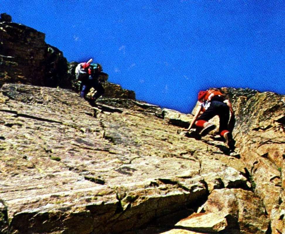 |
The STANDARD ROUTE to Peak, from Gimillan and through Grauson/Chaz Fleurie Valleys over Lussert Torrent in Sep 17th, 1978.
Getting There
BY CAR: A) Pila- From the Aosta Est exit of the Motorway take SS 26 toward the city. Carefully follow the signs that point to the popular ski resort of Pila. Past the town of Pont Suaz, Strada Regionale n°18 starts to climb; after a few hairpins it reaches the City of Charvensod (746m), 3 km from Aosta. Another 10 km will take you to the Village of Peroulaz (1.382m); a final 5 or 6 km and a few more hairpins will eventually bring you to Pila (1.807).
- From Torino, Milano, etc: Motorway A5. Exit at Aosta Ovest. Drive to the nearby Aymavilles. Follow in the directions for Valle di Cogne.
- From Switzerland: through the Grand St. Bernard Tunnel or the namesake pass). Drive to Aosta, then follow signs for Courmayeur along SS.26. Just past Sarre, turn left, in the direction of Valle di Cogne.
- From France: through Mont Blanc Tunnel or Petit St. Bernard Pass). It isn't necessary to take Motorway A5, you can drive along SS.26 in the direction of Aosta. Before reaching the Village of Sarre, follow the sign and turn right towards Valle di Cogne. After Aymavilles, SR.47 crosses the Villages of Vieyes (1.142m), Epinel (1.452m) and Cretaz (1499m) and then arrives at Cogne (1.534m) after a total of about 25 Km. Follow the road signs for Gimillan and Lillaz to a round-about, recently built in proximity of the St. Anthony Chapel, then go left along the scenic route leading to the Village of Gimillan (1.787m), 3 km from Cogne. Usually no parking problems.
- Aeroporto "Corrado Gex" Saint Christophe (Aosta).
First Ascents
 |
- W-SW? Arête (First Ascent Absolute with Unknown Route, but probably?): Abbots Balthazar Chamonin and Pierre Chanoux, (Summer 1856), in ascent directly from Aosta Town, through this crest or other unknown route ("Statistica delle prime ascensioni nel gruppo del Gran Paradiso" 1908, by Agostino Ferrari; "Bulletin of C.A.I.", 1908 e "L'Alpinisme et le Clergé Valdotain", 1905 e 1908, work of Abbot Joseph Maria Henry, page 43, from private informations by Agostino Ferrari).
1) - or the same one didn't know of the Route of slope 1856 or
2) - that indeed the first mountaineers of the mountain have used the Arête W-SW. In every case
3) - the first slope, certainly known and strengthened, on this last crest competes to the party English 1894 formed by C. Baker, C. Hiatt, F. W. Oliver and the very famous Mountain Guide Swiss Alexander Burgener (you see under), even if partial and with a run inusuale and really complicated and surely more repeated, originating the same from the Valleys Grauson-Chaz Fleurie in Oriental Slope, through link with Tall Arpisson Valley to West; besides
4) - the first complete, as well as almost integral, slope is still up to a party English or that of 1897 composed from W. C. Compton, A. Valentine Richards with the renowned Swiss Mountain Guides Alois and Siegfried Burgener. To conclude
5) - the rope 1902 of the Aosta Valley didn't not only effect the first slope, as from them believed, but not even the second on the contrary the third one if not, more probably, the fourth grade as this study-search shows even.
6) - For the detail, the part "lacking", or the jump with dihedral, was crossed by the rope Cardellina-Lamazzi in Aug of 1973, in shift, causes the bad weather, from the South Wall;
7) - other routes completed the discourse of this Crest West-southwest with different climb on the Great Shoulder 3.207/8 meters, that make real part of the same crest.
8) - The most meaningful remains that of Aug 1986 with real run of all the same thin from his more distant base; and, finally speaking of it,
9) - through the 1902 itinerary (Henry-Comé) the first winter also happened absolute of the mountain from their brothers "Ansel" and Pierluigi Falcoz, in December 1936. 10) - To integration as well as correction than appeared in "Guide of the Mount Emilius", 1978, to the pages 76/8 and in Guide of the C.A.I. "Emilius Rosa of Banchi Park of the M. Avic", 2005, to the pages 88/9. Final observations: he remains therefore unsolved the small one "mystery" of the itinerary of the first slope, strengthened by the affirmations that the Abbé Henry it effects in "The Alpinisme et the Clergés Valdotain", 1905, where the same, oddly and in contradiction, it assigns the first ascension of the mountain to the party of the Abbé Aimé Gorret (the famous one "Bear of the mountain" winning of the Italian Route to the Cervino also Matterhorn in 1865) of Aug 23th, 1866, or ten years I approach. The busillis khan perhaps be disclosed by someone better of us, even rummaging in burdens ecclesiastical file (the first two mountaineers in fact they were of the priests), or in burdens mansard or old basement. 156 YEARS from his slope, will remain otherwise, later exactly and forever the SECRET, such to make dark even imaginary fabulous and the history of this ancient mountain.
 |
But where did they pass The First ones: to left on the Ridge Northwest and then on the Edge North, or to the center along the Crest Southwest?.
1) - o lo stesso misconoscesse il percorso dell'ascensione del 1856 o
2) - che davvero i primi montanari della salita alla montagna abbiano utilizzato l'Arête W-SW. In ogni caso
3) - il primo percorso, certamente assodato su questa ultima cresta, compete alla comitiva degli inglesi 1894 formata da C. Baker, C. Hiatt, F. W. Oliver in compagnia della celeberrima Guida svizzera Alexander Burgener (vedi appresso), anche se parziale e con un inusuale percorso veramente complicato e certamente mai più ripetuto, originandosi lo stesso dal concatenamento tra i Valloni Grauson-Chaz Fleurie ad Oriente ed Alto Arpisson ad Ovest; inoltre
4) - il primo percorso completo, nonché quasi integrale, è da accreditare ancora ad altra comitiva inglese del 1897 composita da W. C. Compton, A. Valentine Richards con le alquanto rinomate Guide svizzere Alois e Siegfried Burgener. Per concludere
5) - la cordata del 1902 della Valle dell'Aosta non effettuò non solo il primo percorso, come da loro creduto, ma neanche il secondo, bensì contrariamente il terzo se non addirittura e più verosibilmente il quarto, come questo piccolo studio-ricerca dimostra.
6) - Per il dettaglio, la parte "mancante", ovvero il salto con diedro, fu percorsa dalla cordata Cardellina-Lamazzi nell'Agosto del 1973, in ripiego, causa il cattivo tempo, dalla Parete Sud;
7) - altri percorsi completarono il discorso di questa Cresta Ovest-sudovest con tracciati diversi sullo Spallone 3.207/8 metri, pur facente parte della cresta medesima.
8) - Il più significativo permane quello dell'Agosto 1986 con reale percorso di tutta la stessa fino dalla sua base più distante; e, finalmente a proposito d'essa,
9) - attraverso l'itinerario del 1902 (Henry-Comé) avvenne pure la prima ascensione invernale assoluta della montagna da parte dei due fratelli aostani "Ansel" e Pierluigi Falcoz nel Dicembre del 1936.
10) - Ciò esposto vale ad integrazione ed altresì qual correzione nell'apparso in "Guida del Monte Emilius", 1978, alle pagine 76/8 ed in Guida del C.A.I. "Emilius Rosa dei Banchi Parco del M. Avic", 2005, alle pagine 88/9. Osservazioni finali: rimane quindi insoluto il piccolo "mistero" dell'itinerario della prima salita, rafforzato dall'affermazioni che l'Abbé Henry effettua in "L'Alpinisme et le Clergé Valdotain", 1905, ove lo stesso, stranamente ed in contraddizione, assegna la prima ascensione della montagna alla comitiva dell'Abbé Aimé Gorret (il famoso "Ours de la montagne" vincitore della via italiana al Cervino nel 1865) del 23 Agosto 1866, ovvero dieci anni appresso. Forse il busillis potrà essere svelato da qualcuno più bravo di noi, magari rovistando in qualche archivio ecclesiatico (i primi due salitori infatti erano dei preti), oppure in qualche mansarda o vecchio scantinato. Altrimenti, dopo esattamente 156 ANNI dalla sua salita, rimarrà e per sempre il SEGRETO, tale da rendere ancora più immaginaria e fabulosa la storia di questa antica montagna.
 |
 |
 |
 |
- W-SW Arête: First Winter Absolute Ascent, Anselme and Pierluigi Falcoz, (Dec 25/26th, 1936), in ascent from Aosta Town-Pila-Comboé Valley, descent through N Face, Diagonal Route.
- W-SW Arête (E Slope of Quota 3.207/8m, SW Crest and a mini couloir into W-NW Face in terminal part): C. Baker, C. Hiatt, F. W. Oliver and Alexander Burgener, (Sep 01th, 1894), in ascent from Grauson/Chaz Fleurie Valleys, crossing Eastern/Western Slopes of Fleurie Pass, to Arpisson Tall little Basin, below the South Wall.
- W-SW Arête (S-SE Edge of Quota 3.207/8m, SW Crest and S Face in terminal part): Osvaldo Cardellina, Walter Bianquin and Ilario Antonio Garzotto, (Aug 21 th, 1965); in ascent and in day from Grande Cerise little Village (Pila Basin) - Chamole Loch and Pass-Garin Pass and Loch and Arpisson High little Basin, under the South Face and descent through the West Face of small Collar 3.195/3.200m around or Abbot Joseph Henry-Gégoire Comé (Sep 18th, 1902) Route.
- W-SW Arête (S-SW Face of Quota 3.207/8m ): Osvaldo Cardellina, Alessandro Cardellina, Christian Gianni Ilario Cardellina, Domenico Demichelis, Giuseppe Lamazzi, Danilo Blanc and Giorgio Pinna, Aug 31th, 1986, in ascent from Pila Resort-Chamolé Lake and Hill-Arbolle Valley-Garin Pass and Loch and Tall Arpisson Valley.
- W-NW Wall (Route of Right): Anselme "Ansel" Falcoz, (the first in Aug 1936 and in several times), in ascent and in day from Fernier Alp (Pila Basin) towards Chamolé Pass-Garin Pass.
- W-NW Wall (Central Pillar-Side S): Ezio Savin and Silvano Grisoni, (1979?, probably), in ascent in day from Gimillan Village, through Arpisson Valley-Plan Bessey Tableland-Garin Loch.
- W-NW Wall (Central Pillar-Side N): Osvaldo Cardellina, lone, (Aug 09th, 1992), in ascent and in day from Pila Resort-Chamolé Pass-Arbolle Valley-Garin Pass and Lake.
- W-NW Wall (Couloir of Left, between West Pillar and N Edge): Osvaldo Cardellina and Dario Sergio Cardellina, (Sep 22th, 1966), in descent, after ascent along Direct Route on Western Face of Quota 3.207/8m and W-SW Arête in terminal part, with start from La Grande Cerise little Village (Pila Area) -Chamolé and Garin Pass and Lakes.
- W-NW Wall (Route of Left): Osvaldo Cardellina and Giuseppe Lamazzi, (Sep 02th, 1984), in ascent and in day from Pila Resort-Chamolé Lake and Pass-Garin Pass and Loch.
- N-NW Arête and under to left of N Edge (Normal Route from Arpisson Walloon or from Pila Basin): Cesare Pavese with two soldiers, (Aug 09th, 1875), in ascent from Pila Basin?.
- N Edge (Integral plumbline): Emilio Bertona and Osvaldo Cardellina, (Jul 30th, 1998), in ascent in day from Pila Basin-Garin Pass and Lake and S-SW Face of "Cornass" Garin Peak.
- N Face (Direct or Left Route, in parallel with N-NE Edge): Osvaldo Cardellina, lone (Jun 17th, 1990), in ascent and in day from Gimillan Village-Grauson/Tall Lussert Valleys.
- N-NE Edge: Osvaldo Cardellina, Gianni Junod, Giorgio Boglione and Giovanni De Paoli, (Jul 18th, 1968), in descent after ascent through North Edge, with Beginning Variant S-SW Couloir.
- N-NE Wall: Osvaldo Cardellina, solo, (Sep 09th, 2007), in ascent and in day from Gimillan-Grauson/Lussert Valleys and descent through S Crest and S-SE Couloir.
 |
 |
 |
 |
 |
- E-SE Arête: Giovanni Bobba, Edoardo Bérard and Anselmo Perret, Sep 06th, 1886 , (SE Slope, in ascent), in descent to Grauson Pass and from pass, by North Slope, descent to Lussert Glacier and Lussert Tall Valley-Lussert Lochs and Grauson Valley (first replay descent of 1866).
- E-SE Arête (Integral on Crest): Osvaldo Cardellina, solo, (Jun 17th, 1990), in descent on thread up to Grauson Pass and Chaz Fleurie Valley, after ascent by North Face Direct Route.
- E-SE Arête (crossing from Grauson Tower - Great Gendarme - Indented Tower - Bifide Tower - Red Gendarme - E-SE Crest): Vincenzo Perruchon and Jacques Serres, (? th?; 1972 ?).
- E-SE Arête (North Wall of "Gendarme Rosso" - "Red Gendarme"): Aldo Cambiolo and Luciano Ratto (and traverse through W Arête of Tour Grauson), from Grauson/Lussert Valleys.
- E-SE Arête (North Wall of "Red Gendarme" and traverse through E-SE Arête to Garin Point): Aldo Cambiolo, Enrico Barbero, Paola Grasso and Luciano Ratto, (Sep th?, 1998); in ascent from Lussert Glacier and descent towards Chaz Fleurie/Grauson Valleys.
- E-SE Slope (Route of Right or Standard Route): Aimé Gorret, J. P. Carrel and three schoolboys and the young Lorenzo (?), (Aug 23th, 1866), in ascent through Grauson/Chaz Fleurie Valleys and in descent with descent by N Slope of the Grauson Pass to Lussert Glacier and Tall Lussert/Grauson Valleys.
- North Wall of "Red Gendarme" from Lussert Glacier and traverse with descent S Face of Grauson Pass): Aldo Cambiolo and Luciano Ratto, (Summer, 1997?), and descent through S-SE Slope of Garin Point towards Chaz Fleurie/Grauson Valleys/Gimillan Village.
- E-SE Wall (Route of Left): Osvaldo Cardellina, lone, (Jul 24th, 1988), in ascent from Gimillan Village-Grauson/Chaz Fleurie Valleys.
- E-SE Face (S Arête and SE "Rib Winding"): Osvaldo Cardellina, lone, (Jul 24th, 1988), in descent to Chaz Fleurie/Grauson Valleys, after the ascent through E-SE Face Route of Left.
- E-SE Face (S Arête and S-SE Couloir): Osvaldo Cardellina, lone, (Sep 09th, 2007), in descent to Chaz Fleurie/Grauson Valleys, after the ascent of N-NE Face.
- S Arête ( and partial traverse as far as Arpisson Tower): W. C. Compton, A. V. Valentine Richard and Alexander, with Swiss Mountain Guide Siegfried Burgener, (Aug 08th, 1897), in descent along Chaz Fleurie/Grauson Valleys, after the ascent through W-SW Crest, Edge between S-SW Slope and W-SW Face of Quota 3.207/8m.
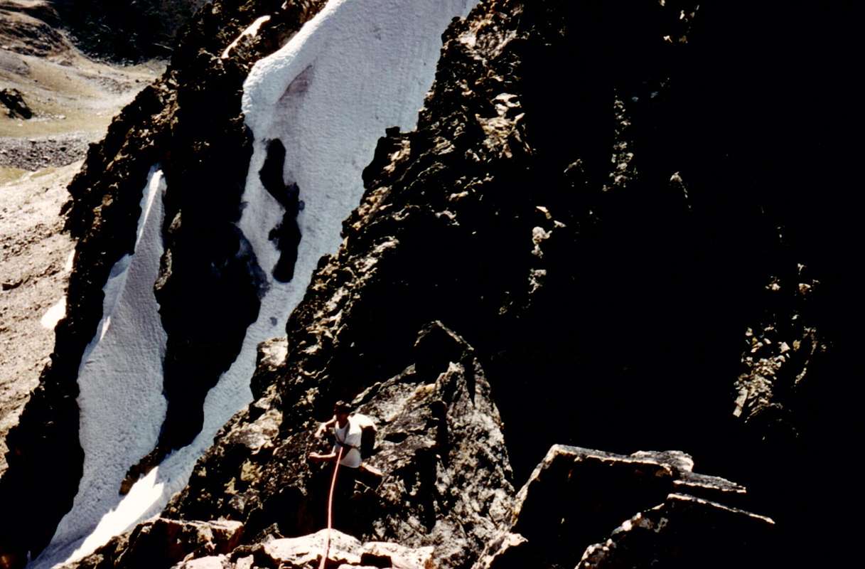
- S-SW Buttress (Integral from Arpisson Point and first in ascent): Osvaldo Cardellina and Camillo Roberto Ferronato, (Sep 17th, 1978), in ascent from Gimillan Village.
- Half of S-SW Buttress and S Arête (and partial traverse as far as from W Slope of Pila NE Pass): Franco Brevini and Companions, (Summer 1981?), in ascent with partial traverse as far as from W Slope of Pila NE Pass, from Gimillan Village and through Arpisson Valley and Alp.
- S Wall and SW Crest (Left Route and first Integral ascent of final part of ridge): Osvaldo Cardellina and Giuseppe Lamazzi, (Aug 26th, 1973), in ascent and in day from Pila Resort.
- S Wall (Directly and Integral): Osvaldo Cardellina and Camillo Roberto Ferronato, (Aug 27th, 1978), in ascent from Gimillan-Arpisson Valley. For the Great Crossings by the Point Garin toward the three Red Points and the Arbolle Pass, the Point des Laures and the homonym hill, the Peak and the Pass of the Three Capuchins and the Emilius Mountain it consults "ALL ROUTES (40) OF PEAK GARIN (3.451m)", always in SP
 |
 |
Approach & Route in Ascent
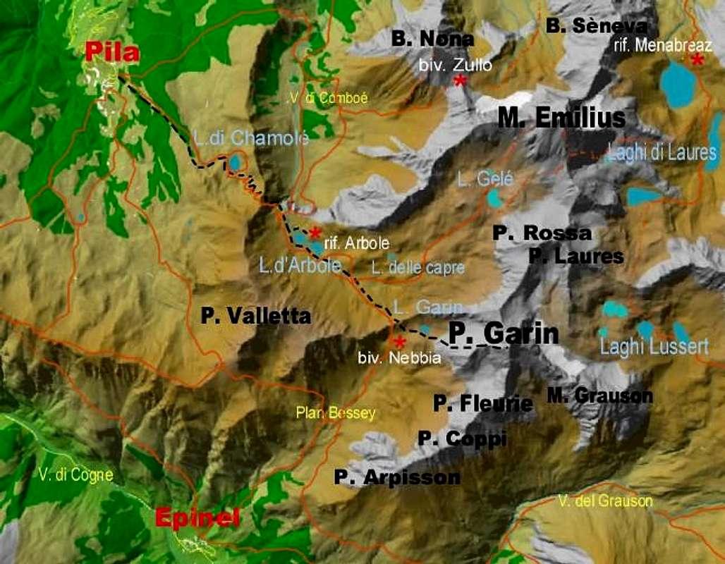
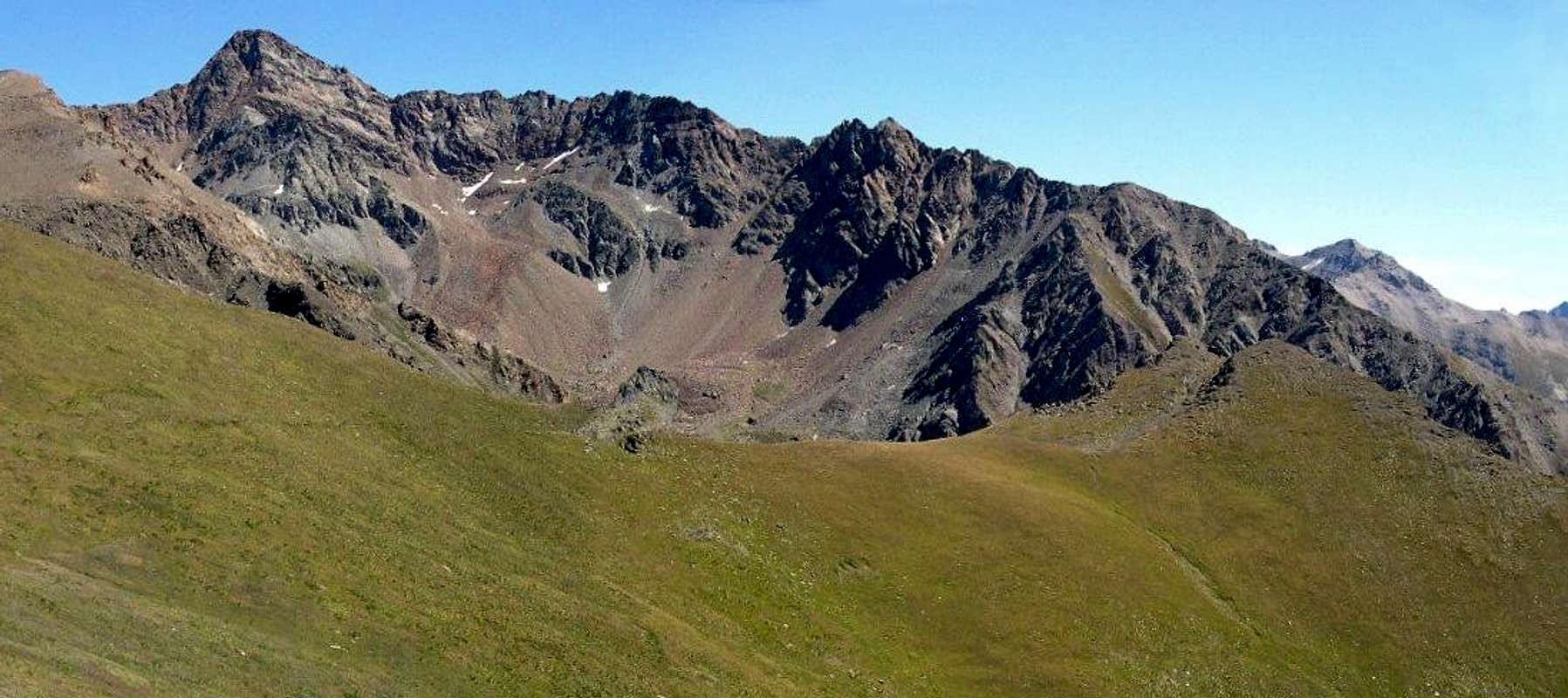
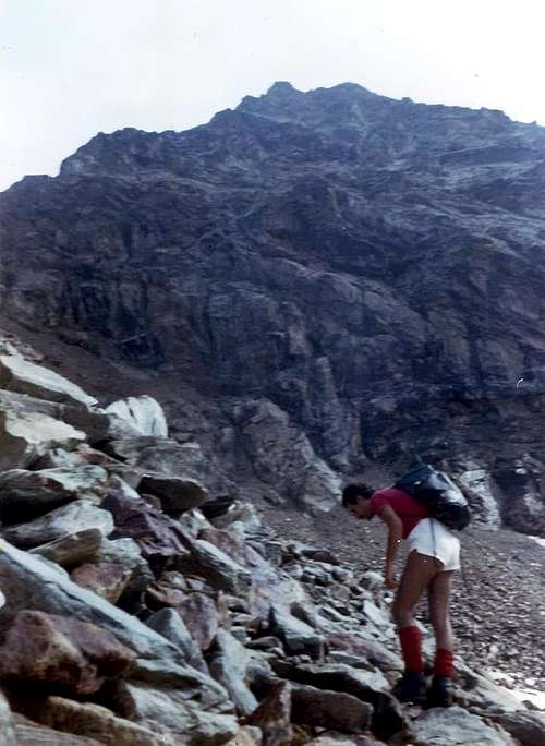
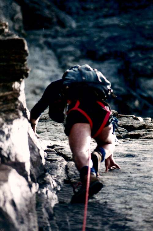
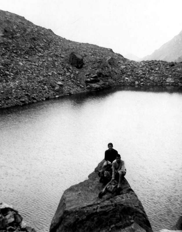
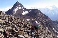
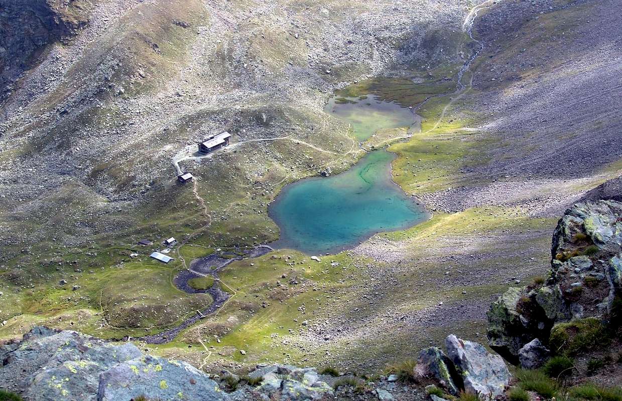
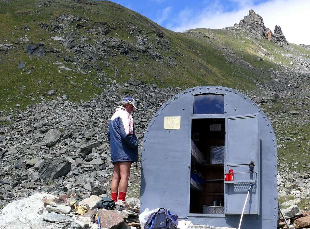
From Pila Resort, through Chamolé's Lake and Pass, Arbolle's Valley and Lochs, Garin Pass and Lake and West-southwest Crest in terminal part on the Peak Garin: To park in the great inferior square of Pila (1.800 meters around) and with underlying run the Chair Lift of Chamolé to reach its Superior Station (2.309m) and from this through the path tourist muletrack n° 19 B to go himself to the Lake of Chamolé (2.325m) approximately in 1h'20. Continuous To along the Northern border of this thin last to alternative the for the two Necks of Replan, that they leaves aloft on the left (Northeast; abundant signalings and path n° 19); to take instead, at first with to long diagonal to the right, the path n° 19A that it conducts to the Pass of Chamolé (2.641m), hands of entry to the Walloon of the Arbole also Arbolle. From the collar, engraved on the NE Crest of the Testa Nera (= Black Head; 2.820m), to come down to the homonym Hut that rises in the proximity and as soon as above (2.526m) of a beautiful double lake to (2.496m and 2.498m). To continue on the floor walloon with run, with some latches, toward East and mainly following the course of the torrent up to the alternative for the Emilius Mountain (that he leaves on the left, always NE) continuing instead again along the course of the torrent that reaches, after having overcome the ancient ruins of the Alp Les Poulains (= Shelter for Little Horses), a taking of the water well in sight (good point for brief standstill) to the strata of the ancient Glacier of the Mount Emilius, with his trespass and desolate moraines. From this point the path n°18/TVC become smaller and not always easy to find; overcoming some backs with great stones alternated to minuscule mountain ranges brings him toward the last steep but easy line, situated immediately under to the Garin Pass (2.815m; 3h'30/3h'45 from Pila Resort). Hardly below the hill, and from not a lot of time, he has been positioned on the side of Arpisson the small one I Camp out fixed to form of barrel Franco Nebbia (2.740m; n°6 places bed). From Pass Garin, not to come down to the same one and, instead, to cross the enough steep grassy-stone slant under the Steeples and the Bell Tower of Arbolle aiming toward the beautiful Lake Garin (2.853m), that ogles, square, at the base of the West Wall of the Peak.
VARIANT: the Lake Garin can also be reached from the Valley Cogne crossing in his entirety the "Vallone" of the Arpisson with departure from the Fraction of Epinel (1.452m) or, preferably, reaching the Pastures of the Arpisson after a long crossroad from the Village of Gimillan (1.787m). From these, to climb the walloon through a good path that crosses it in his mean and, left to the left the deviation for the Pass of Tsa Setze, to reach an ample tableland known as Pian Bessey, having to the shoulders for the whole slope the spectacular perspective of the Grivola. Before reaching the steep slant, that with narrow small hairpin bends reaches the pass, to continue to the right on a small trace reaching the I camp out; immediately above the same a path brings shortly time, supporting himself in a small debris valley, as soon as more on the right (East), to the Western bank of the Lake Garin.
 |
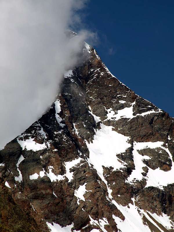
From this point the Peak stately Garin dominates from the than above approximately of 600 meters with his brown reddish Wall West, inclusive between the Ridge/Edge N-NO and the great SW Crest that on his right (South) form the Great Shoulder 3.207/8m). Wanting to follow this itinerary, to edge the lake and for steep moraine (in beginning of season a great only snowfield, that goes down from the basal rocks until inside the loch), steep deposits and alternate slopes subject to landslides to small rocks to go approximately himself toward Southeast at the base of the same crest fifty-fifty route among the West Wall of the Point Garin and the Western Slope of the Great Shoulder; climbing a small rocky couloir to go up again this brief line bringing himself to a small Collar, 3.195/3.200m around, in crest among the two aforesaid. From this point to easily follow the ridge that from easy progressively more difficulty becomes up to reach a characteristic binding rocky jump for a dihedral that it cuts it in the half suom (in correspondence to an uphill street well visible cliff also from under); the same can be coasted along on the left, or terminal part of West Wall, as they did the some first mountaineers English in 1894 or to the right for a steep plate on the South Wall, as they chose in the second ascent of the Crest or the Abbot Joseph Maria Henry and the Guide of Charvensod Grégoire Comé, in the Summer of 1902, or to directly climb it (III°+) as decided the rope Cardellina-Lamazzi in shift from the South Wall, because of a sharp pain snowfall. The last line is "airy and aerial" and very amusing; the same justifies almost alone the whole run. (3h'00/4h'00 from Lake Garin).
Dal Villaggio Turistico di Pila, attraverso il Lago ed il Colle di Chamolé, Vallone dell'Arbolle ed i suoi due Laghi, Colle Garin ed omonimo Lago e finale con la Cresta Ovest-sudovest della Punta Garin: Parcheggiare nel grande piazzale inferiore di Pila (1.800 metri circa) e con percorso sottostante la Seggiovia di Chamolé raggiungerne la Stazione Superiore (2.309 m), nonché da questa, tramite il sentiero mulattiera turistico n° 19 B, portarsi al Lago di Chamolé (2.325 m) approssimativamente in 1h'20. Continuare lungo il bordo Settentrionale di questo ultimo insino al bivio per i due Colli di Replan, che si lasciano in alto sulla sinistra (NE; abbondanti segnalazioni e sentiero n°19); prendere invece, dapprima con un lungo diagonale a destra, il sentiero n° 19A conducente al Colle di Chamolé (2.641 m), vera porta d’ingresso al Vallone dell'Arbole od Arbolle. Dal colletto, inciso sulla Cresta NE della Testa Nera (2.820 m), discendere all'omonimo Rifugio che sorge nella prossimità ed appena sopra (2.526 m) di un bel doppio lago a (2.496 e 2.498 m). Proseguire sul fondovalle con percorso, con qualche saliscendi, verso Oriente e seguendo principalmente il corso del torrente fino al bivio per il Monte Emilius (che si lascia sulla sinistra, sempre NE) proseguendo invece ancora lungo il corso del torrente che raggiunge, dopo aver superato gli antichi ruderi dell'Alpe Les Poulains (= Rifugio dei Puledrini), una presa dell'acqua ben in vista (ottimo punto per breve sosta) alle falde dell'Antico Ghiacciaio del Monte Emilius, con le sue sconfinate e desolate morene. Da questo punto il sentiero n° 18/TVC diventa più minuto e non sempre facile da trovarsi; superando alcuni dossi con "clapeys", o pietroni, alternati a minuscole giogaie ci si porta verso l'ultimo tratto più ripido ma facile, situato subito al di sotto del Colle Garin (2.815 m; 3h'30/3h'45 da Pila). Appena più dabbasso del colle, e da non molto tempo, è stato posizionato sul lato di Arpisson il piccolo Bivacco fisso, a forma di botte, Franco Nebbia (2.740 m; n°6 posti letto). Da Colle Garin, non discendere al medesimo ed, invece, attraversare il pendio erboso-pietroso abbastanza ripido sotto le Guglie ed il Campanile d'Arbolle puntando verso il bel Lago Garin (2.853 m), che occhieggia, squadrato, alla base della Parete Ovest del Picco. VARIANTE: Il Lago Garin può esser raggiunto anche dalla Valle Cogne percorrendo nella sua interezza il Vallone dell'Arpisson con partenza dalla Frazione di Epinel (1.452 m) oppure, preferibilmente, raggiungendo gli Alpeggi dell'Arpisson dopo una traversa lunga dal Villaggio di Gimillan (1.787 m). Da questi, salire il vallone tramite un buon sentiero che lo percorre nel suo mezzo e, lasciata a sinistra la deviazione per il Colle di Tsa Setze, raggiungere un ampio pianoro-altipiano noto come Pian Bessey, avendo alle spalle per tutta la salita la prospettiva spettacolosa della Grivola. Prima di raggiungere il più ripido pendio, che con stretti tornantini raggiunge il colle, proseguire su di una piccola traccia più a destra raggiungendo il bivacco; subito sopra lo stesso un sentiero porta in breve tempo, appoggiandosi in un valloncello detritico, appena più sulla destra (Est), alla sponda Occidentale del Lago Garin.
 |
 |
 |
 |
Da questo punto il Picco Garin maestoso domina dal di sopra approssimativamente di 600 metri con la sua bruno-rossiccia Parete Ovest, compresa tra la Cresta/Spigolo N-NO e la grande Cresta SO, che sulla sua destra (S) forma lo Spallone 3.207/8 m). Volendo seguire questo itinerario, contornare il lago e per ripida morena (in inizio di stagione un grande unico nevaio, che dalle rocce basali scende fino dentro il lago), detriti ripidi e franosi alternati a roccette portarsi verso Sudest alla base della cresta medesima all'incirca a mezza strada tra la Parete Ovest della Punta Garin e il Versante Occidentale dello Spallone; salendo un canalino detritico-roccioso rimontare questo breve tratto portandosi ad un Collettino, 3.195/3.200 m circa, in cresta tra le due suddette. Da questo punto seguire facilmente la cresta che da facile progressivamente divien più difficile fino a raggiungere un salto roccioso impegnativo e caratteristico per un diedro che lo taglia nel suom mezzo (in corrispondenza ad una erta rupe ben visibile anche da sotto); lo stesso può essere costeggiato sulla sinistra, tramite un canalino della parte finale della Cresta Ovest, come fecero i primi certi salitori della cresta, Inglesi, nel 1894 od a destra per una ripida placca sulla Parete Sud, come scelsero i secondi salitori della medesima, ovvero l'Abate Joseph Maria Henry e la Guida di Charvensod Grégoire Comé, nell'Estate del 1902, oppure salirlo direttamente (III°+) come decise la cordata Cardellina-Lamazzi in ripiego dalla Parete Sud, a causa di una fitta nevicata. L'ultimo tratto è "arioso" ed aereo e molto divertente; lo stesso giustifica quasi da solo il percorso intero. (3h'00/4h'00 da Lago Garin).
Descent & Elevation
DESCENT: from Northeastern Summit (in effects the Summit is composed from two points lists: the Sout-southwestern Summit and the North-northeastern, the most high; * * * * * iron Cross, while on the Point SW existed once a Cross in wood, until the Seventies, is goes destroyed in the time, while on the Northern Peak in the time, since the half of Seventies/Eighties a tumult has been built in stone or cairn, that he is mostly always magnified, to sign of a vast attendance of the peak; you see the exposed old photographs) to use for the Route of Descent the following and underlying sequence: North Edge of Garin from the Summit to little Collar 3.300m about, East Ridge of Mount Valaisan, descent through the North Crest of the same to Valaisan Pass and, through the Western Slope, Arbolle Walloon and two with same name Lochs, Chamolé Hill and Lake towards Pila Tourist Resort. And in detail: descend along the Crest of the NorthWest Ridge. After a few ups and downs you will get to Passo di Valaisan (3.196m) in about 1h'30. From the pass, on fine scree (careful!) descend toward Arbole Valley, through the path n° 14 towards the Mount Emilius, until you reach the primitive trail. Watch out for the frequent rockfall from the ramparts above you.
 |
 |
 |
 |
 |
DISCESA: Dalla Sommità Nordorientale del picco (in effetti la Punta Garin risulta formato da due distinte Sommità: la Vetta Sud-sudoccidentale e la Vetta Nord-nordorientale, la più elevata; * * * * * croce in ferro, mentre sulla Punta SW esisteva una volta una Croce in legno andata distrutta nel tempo, mentre sulla Vetta Settentrionale nel tempo è stato costruito un tumulo in pietra, che, a partire dalla metà degli Anni Settanta/Ottanta, si è sempre maggiormente ingrandito, a segno di una più vasta frequentazione del picco; (vedi l'esposizione delle vecchie fotografie) seguire, per la Via di Discesa, la sottostante schematizzazione: Spigolo Nord della Garin dalla Vetta sino al Colletto 3.300 metri circa, Cresta Est del Mont Valaisan, discesa per mezzo della Cresta Settentrionale dello stesso verso il Pas du Valaisan e da questi, lungo il suo versante Occidentale, al Vallone dell'Arbolle ed omonimi Laghi, attraversamento del Colle di Chamolé e rispettivo Lago in direzione di Pila. Ed in dettaglio: scendere lungo la Cresta NO, che all'inizio forma uno Spigolo rivolto più a Nord. Dopo qualche saliscendi, scavalcato il Mont Valaisan, dirigersi verso il Pas du Valaisan (3.196 m) impiegando all'incirca 1h'30. Dal medesimo, tramite un primo tratto in terriccio, detriti e ghiaioni (prestare attenzione!) ridiscendere sul Vallone dell'Arbole o Arbolle, per mezzo del sentiero n° 14 per il Monte Emilius, sin quando si riincontra il primitivo sentiero percorso in salita. Tenere una costante vigilanza a causa delle non infrequenti scariche originantesi dalla sovrastante bastionata rocciosa. Elevation gain: about 1.700 meters both from Pila Tourist Resort and Gimillan Village in Valley of the Cogne, less than 1.200m if you use the Chairlift Pila-Chamolè. Ascent time: 7h'00/8h'00 in all. Dislivello da percorrersi: all'incirca 1.700 metri sia con partenza dal Centro Turistico di Pila che prendendo le mosse dal Villaggio di Gimillan in Valle di Cogne, un pò meno di 1.200 metri utilizzando la Seggiovia da Pila alla Stazione Superiore di Chamolé. Tempo necessario per la salita: Dalle 7h'00 alle 8h'00 complessive.
 |
 |
 |
 |
 |
Equipment
Mountaineering equipment. A rope is recommended.
Equipaggiamento da Alpinismo. E' consigliabile aver dietro una corda.
Campings
Remember that free camping is forbidden (except for emergency reasons, over 2.500m, from darkness until dawn).
Huts
Mountain Condition
- Meteo: you can find all the needed informations at the official site of the Valle d'Aosta Region:
- Valle d'Aosta Meteo
Webcam
- WEBCAM on Aosta Valley:
- Webcam
Books and Maps
BOOKS:- "Guida delle Alpi Occidentali" di Giovanni Bobba e Luigi Vaccarone C.A.I. Sezione di Torino Volume II (parte II), 25 Maggio 1896.
- "80 itinerari di Escursionismo Alpinismo e Sci Alpinismo in Valle d'Aosta", di Osvaldo Cardellina, Ed. Musumeci, Giugno 1977 (in Italian); seconda Ed. Luglio 1981; terza Ed. Luglio 1984; (in French), prima Ed. Febbraio 1978; seconda Ed. Marzo 1980.
- "Guida del Monte Emilius" di Osvaldo Cardellina Editore in collaborazione con il Club Alpino Italiano Sezione di Aosta, Dicembre 1978 (in Italian).
- "Diari Alpinistici" di Osvaldo Cardellina e Indice Generale accompagnato da Schedario Relazioni Ascensioni 1964-2019 (inediti).
- "Rifugi e bivacchi in Valle d'Aosta" di Cosimo Zappelli aggiornata da Pietro Giglio. Musumeci Editore, Luglio 2002.
- "Guida dei Monti d'Italia – Emilius-Rosa dei Banchi-Parco del Mont Avic" di Giulio Berutto e Lino Fornelli - Club Alpino Italiano/Touring Club Italiano, Marzo 2005 (in Italian).
- "Ascensioni 1964-1969" Diario Alpinistico di Ilario Antonio Garzotto (unpublished).
 |
 |
 |
 |
 |
 |
 |
 |
MAPS:
- Kompass "Gran Paradiso Valle d'Aosta Sentieri e Rifugi" Carta Turistica 1:50.000.
- Hapax Luglio 2000 "Les Sentiers Comunità Montana Monte Emilius" 1:25.000.
- Enrico Editore Ivrea-Aosta "Gruppo del Gran Paradiso" 1:50.000.
- I.G.C. Istituto Geografico Centrale Torino "Carta delle Passeggiate ed Escursioni in V.D.A. Conca di Pila-Gressan" 1:20.000.
- L'Escursionista "Tour de la Vallée de Cogne Grand Paradis" Carta dei sentieri 1:25.000.
- L'Escursionista "Conca di Aosta-Pila-Monte Emilius" Carta dei sentieri (n° 4) 1:25.000.
- L'Escursionista "Valle di Cogne" (carta n°10) 1:25.000.
Important Information
- REGIONE AUTONOMA VALLE D'AOSTA the official site.
- FONDAZIONE MONTAGNA SICURA Villa Cameron, località Villard de la Palud n° 1 Courmayeur (AO) Tel: 39 0165 897602 - Fax: 39 0165 897647.
- SOCIETA' GUIDE ALPINE DI COGNE Tel. 347/9473526 – 328/1373728.
- A.I.NE.VA. (Associazione Interregionale Neve e Valanghe).
- A.IA.T. Cogne Gran Paradis via Bourgeois n° 34 Tel. 0165-74040. E-mail: aiat@cogne.org
- Ezio Sport articoli sportivi - via Bourgeois n° 64 Tel. 0165-74204.
Useful numbers
- Soccorso Alpino Cogne (SAR) Tel. 3482685406.
- Protezione Civile Valdostana località Aeroporto n° 7/A Saint Christophe (Ao) Tel. 0165-238222.
- Bollettino Meteo (weather info) Tel. 0165-44113.
- Unità Operativa di Soccorso Sanitario Tel. 118.