
-
 144615 Hits
-
 96.77% Score
-
 63 Votes
|
|
Mountain/Rock |
|---|---|
|
|
36.16970°N / 117.088°W |
|
|
Hiking, Mountaineering, Scrambling |
|
|
Spring, Summer, Fall, Winter |
|
|
11049 ft / 3368 m |
|
|
Overview
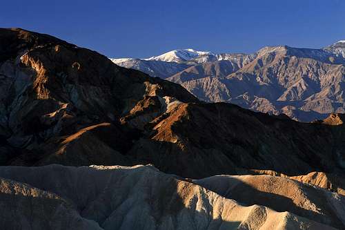
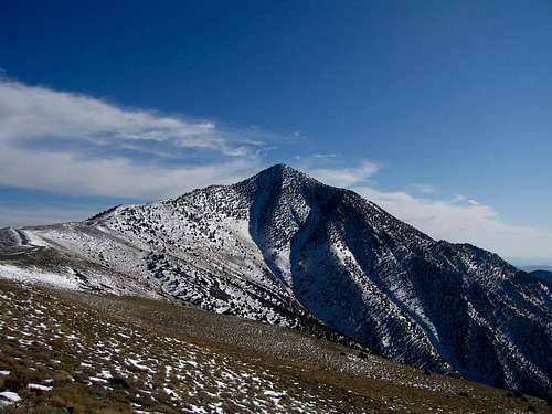
Telescope Peak (11,049 ft) is the highest point in Death Valley National Park, and the 22nd most prominent peak in the lower 48 states. It's part of the Panamint Mountains, and rises about 11,300 ft above Badwater Basin (-282 ft), the lowest point in the Western Hemisphere. This dramatic rise in elevation covers across only a 17 mile distance. The peak is so named because "you could see no further with a telescope." The standard route trail starts at the Mahogany Flat campground (8,133 ft) and has a one way distance of 7 miles. The grade is moderate, and heads over (or around) Rogers Peak, and follows the beautiful north ridge until the last steeper section to the summit. Ice axes and crampons are often necessary in winter. The summit rewards you with spectacular views of Death Valley and Mount Charleston to the east and the High Sierra, Mount Whitney, the White Mountains and Panamint Valley to the west.
 Telescope Peak Telescope Peak |
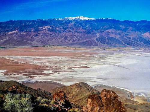 Telescope Peak from Dantes View Telescope Peak from Dantes View |
 On the North Ridge of Telescope Peak On the North Ridge of Telescope Peak |
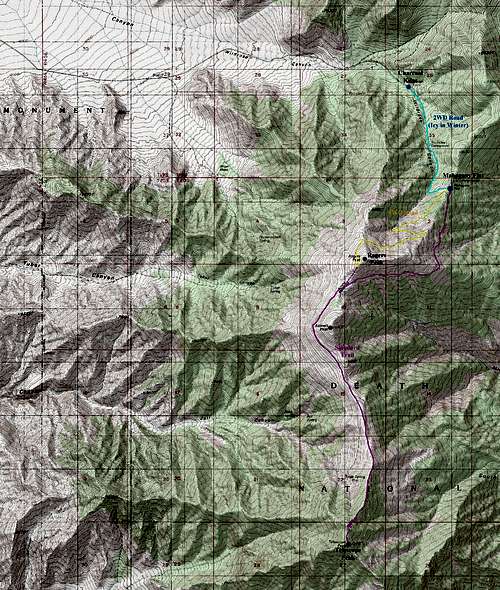
Getting There - Mahogany Flats Trailhead
From Los Angeles, take CA 14 north and just before the highway enters Red Rock Canyon State Park, turn right on the road to Randsburg. At the only major fork in the road (before it hits US 395), go left. At the junction with US 395, turn left and go about 2 miles and take the road to Trona. When this roads ends at CA 178, go right. Pass through Trona and descend into Panamint Valley. At the only major junction, go straight (left goes to Death Valley via CA 190 over Towne Pass) to Wildrose. At the stop sign in Wildrose, turn right and drive up the dirt road to the Charcoal Kilns (start hiking here if the dirt road to Mahogany Flat is closed at the gate). If your vehicle has low clearance (2WD), park at Charcoal Kilns (elev: 6,960 ft); otherwise, continue on the dirt road for about 1.5 miles to the entrance of Mahogany Flat campground (requires 4WD vehicle). If the road from Panamint Valley to Wildrose is closed (it is often washed out), you must make a long detour, going over Towne Pass to Emigrant, then south to Wildrose over Emigrant Pass. From Las Vegas, take US 95 north to Beatty, then NV 58 to CA 190. Cross Death Valley to Emigrant, and proceed as above.
For a real physical endurance test, try starting at Shortys Well, below sea level!
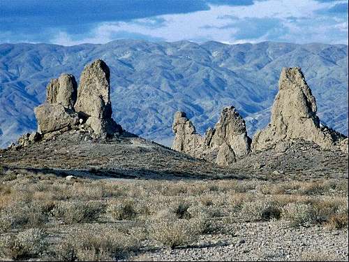 The Trona Pinnacles The Trona Pinnacles |
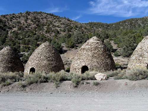 The Charcoal Kilns The Charcoal Kilns |
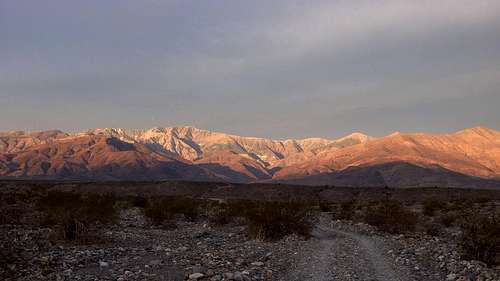 Telescope Peak from Shorty Well Telescope Peak from Shorty Well |
Route Description
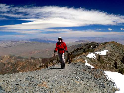
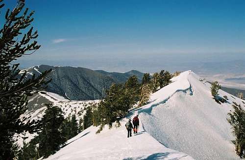
Summiting Telescope Peak
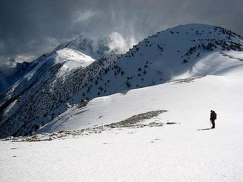
Sometimes there is lots of snow!
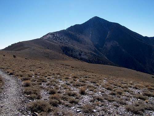
The Telescope Peak trail is well marked once you get to the Mahogany Flat Campground. Don't follow the road up to the communication towers on top of Rogers Peak (marked as yellow line in map below). This will only add elevation to your total climb and you will have to go cross country back down to the trail on the south side of the peak (unless you want to add a second peak!) The sign at the trailhead says it is 7 miles to Telescope Peak, but it's probably a little less. Total distance is roughly 12.3 miles with 3,300 ft of elevation gain.
The trail passes Rogers Peak on the east and then Bennett Peak on the west before heading up the north ridge and ending with several switchbacks to the summit of Telescope. The trail is very easy to follow and it would be nearly impossible to get lost even in a complete whiteout (that almost never happens here). The summit of Telescope is actually slightly behind the highpoint that is visible as you hike up the trail.
Death Valley Morning Report
The Death Valley Morning Report is no longer available on the Internet. Please see the National Weather Service 7-Day forecast for specific weather information. A road condition report (phone recording) is available by calling (760) 786-3200. Press 1 and then press 4 from the menu. The road conditions message is updated as conditions change.
Camping/Red Tape
Climbers are asked to fill out a voluntary backcountry camping permit for backcountry hiking or camping at the Visitor or any ranger station. During winter, the road above Charcoal Kilns is often closed by snow and/or ice (adding 3 miles to your roundtrip distance). Camping at Mahogany Flat (8,133 ft) is free. It officially opens on March 1st and closes on November 30th, according to Death Valley National Park. It has 10 sites and there is no water. Backcountry camping is allowed two miles beyond the end of the road. One could also camp near the Charcoal Kilns in winter, but it isn't recommended in summer.
When To Climb
The trail starts at Mahogany Flat at the entrance to the campground. It goes around to the east of Rogers Peak (9,994 ft), at which point the pointed summit of Telescope Peak first becomes visible. The trail then skirts Bennett Peak (9,980 ft), follows the ridgeline up to the base of Telescope Peak and then climbs rather steeply to the summit. Telescope Peak is usually snow-free by early June, and can remain snow free through November. The mountain is usually climbed from early May until mid-November, but is a very common winter climb as well. In winter, it's a good idea to bring an ice axe and crampons. Also, if you're going in winter, please consider checking in at the Wildrose Ranger station before and after your climb (although this certainly isn't mandatory).
 Telescope Peak during a dry winter Telescope Peak during a dry winter |
 Summer on Telescope Peak Summer on Telescope Peak |

John - Sep 25, 2001 12:36 pm - Hasn't voted
Untitled CommentThe snow-free hiking trail from Mahogany Flats is on the east side of the North Ridge while the popular winter trail is along the North Ridge itself (Ref: Keith Martin).
forjan - Sep 26, 2001 4:31 pm - Hasn't voted
Untitled CommentRogers Peak (9,994 ft) and Bennett Peak (9,980 ft) are short scrambles from the Telescope Peak summer trail.
Wildrose Peak (9,064 ft) offers a fine summit view and can be easily climbed from the Charcoal Kilns via a trail.
alexlennon - May 8, 2015 4:32 pm - Hasn't voted
Road AccessHiked Telescope yesterday 5/7/15- the Wildrose-Trona road was closed between the junction with Panamint Valley Rd and the Wildrose CG. Emigrant Canyon Rd is open the whole way. Also for what it's worth, I was able to get up to Mahogany flats in a Toyota Camry with pretty much no problem. It was definitely bumpy, but not rutted out like the description says here. Maybe I just caught it at a good time- I would say high clearance is recommended but not a must.
Rigel007 - Jun 12, 2016 12:54 pm - Hasn't voted
June 10th 2016Road: We rented a Yukon SUV in Vegas expecting to need high clearance but the road from the Kilns to Mahogany Flat was fairly well maintained and passable with any non-low rider. There were a few ruts but we found that a Lexus and a VW Passat had arrived before us. Temperature: Passing through Stovepipe Wells, the air temp was 123 degrees on June 8th. Road surfaces are probably fifty or so degrees higher. Odds of tire problems in DVNP go up substantially. Make sure you have a functional full size spare and jack in whatever you're driving. Drive slow on dirt roads after your tires have been exposed to high heat. Auto Service at Furnace not available when temps are above 110 F. You may be driving on a spare to Beatty or Pahrump. Wind: If you're camping at Mahogany, plan for high winds at night. I'd estimate 20-35 mph wind sustained with strong gusts most of the night. Bring plenty of stakes to secure your fly, or better yet just go without it. Better plan is to camp below the ridge at the second high camp and drive to Mahogany the day you hike. The climb: Moderately steep for the first 2 miles, levels off for a few miles then easy switchbacks to the peak. Spectacular views. Garmin registered a bit less than 13 miles round trip. 3.5 hours up.
oliverd - Nov 20, 2018 3:45 am - Hasn't voted
Great walk but poor views in NovemberEnjoyed the hike in mid November, but limited visibility due to terrible fires in California. Road was in bad condition about two miles before Charcoal Kilns (was in slightly better condition from Charcoal Kilns to Mahogany Flat Campground). https://hikingtheworld.blog/2018/11/10/telescope-peak-death-valley/
Gman182 - Apr 28, 2019 8:50 am - Hasn't voted
Road closuresCurrently Mahogany Flats is unaccessible due to upper wildrose road being closed. The road is being repaired from flash floods and there is no completion date being posted by the NPS at this time.