Hiking, Mountaineering, Trad Climbing, Sport Climbing, Toprope, Bouldering, Ice Climbing, Aid Climbing, Big Wall, Mixed, Scrambling, Via Ferrata, Skiing
La montagna chiama i suoi figli, ed essi rispondono fedelmente al suo appello…
Osvaldo Cardellina, Diario alpinistico, 1964-65
Page texts: @ OsvaldoCardellina"Osva", passed away on May 2, 2022. Page owners: Christian Cardellina e Osvaldo Cardellina. Any updates from September 12, 2022: Antonio Giani, page administrator, friend and climbing companion.
Testi della pagina: @ OsvaldoCardellina "Osva", scomparso il 2 maggio 2022. Proprietari pagina:Christian Cardellina e Osvaldo Cardellina. Eventuali aggiornamenti dal 12 settembre 2022: Antonio Giani, amministratore della pagina, amico e compagno di salite.
Overview
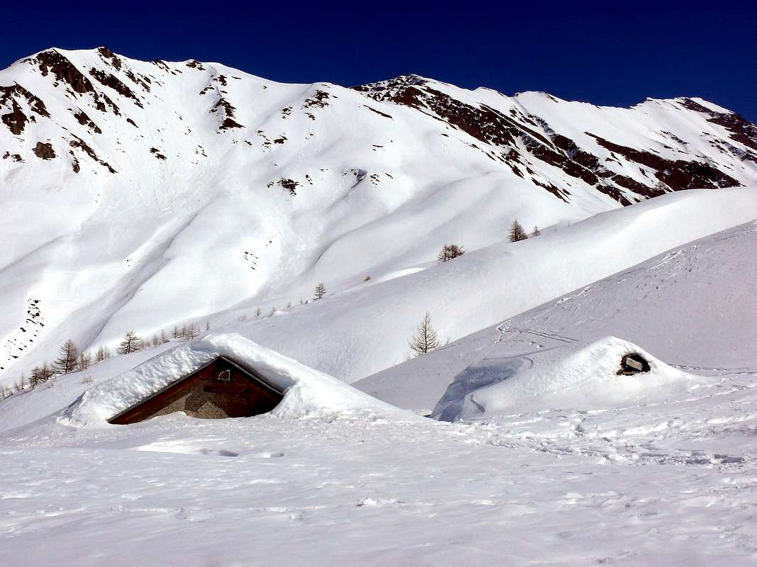
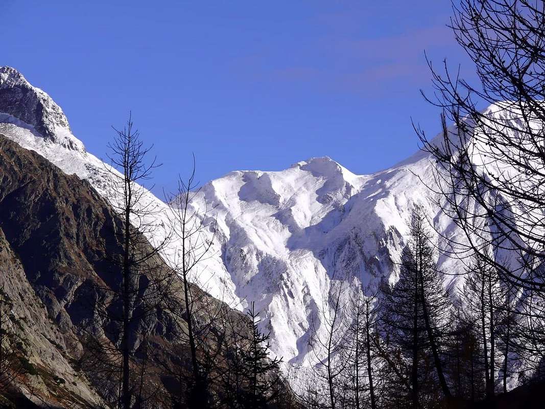
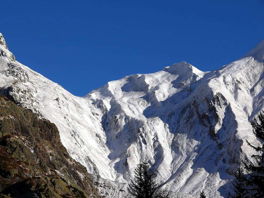
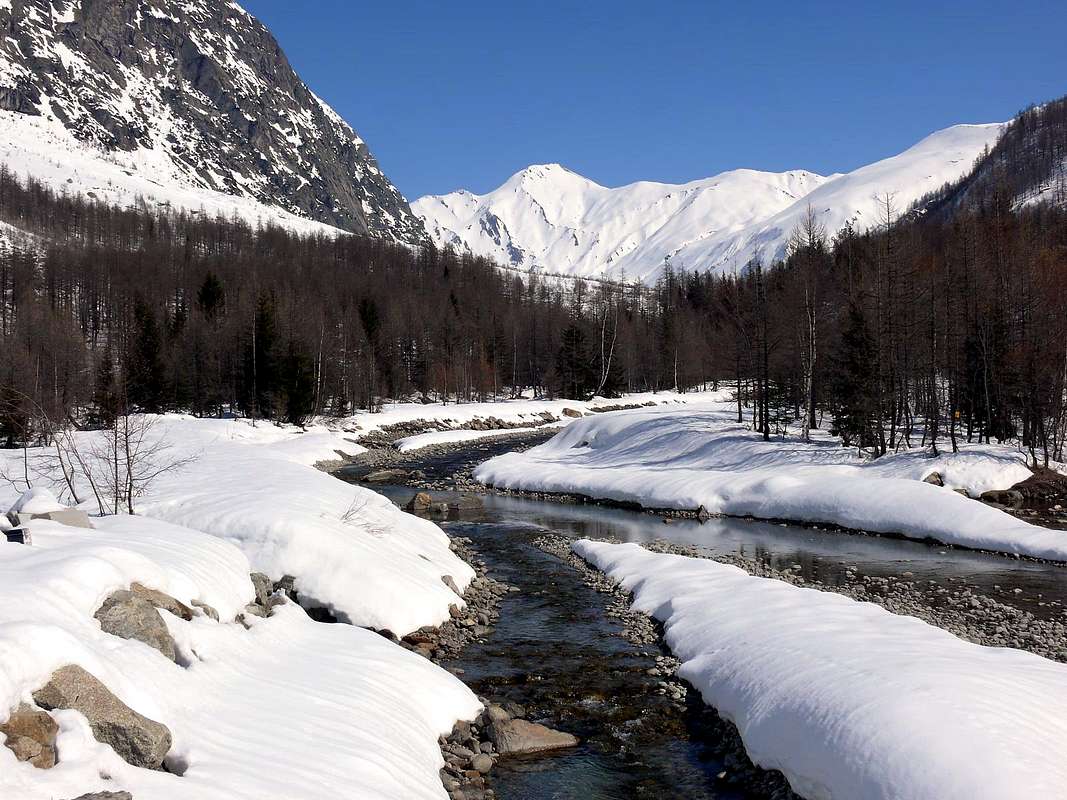
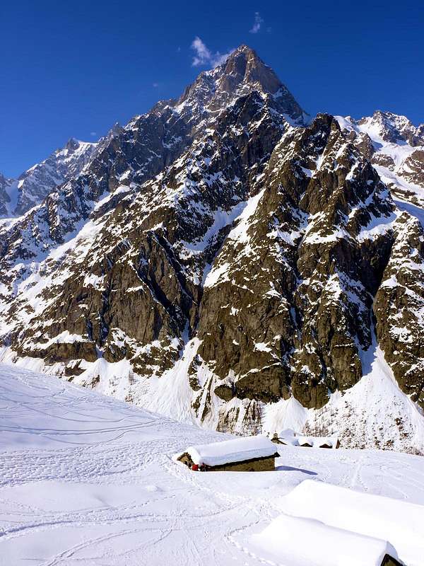
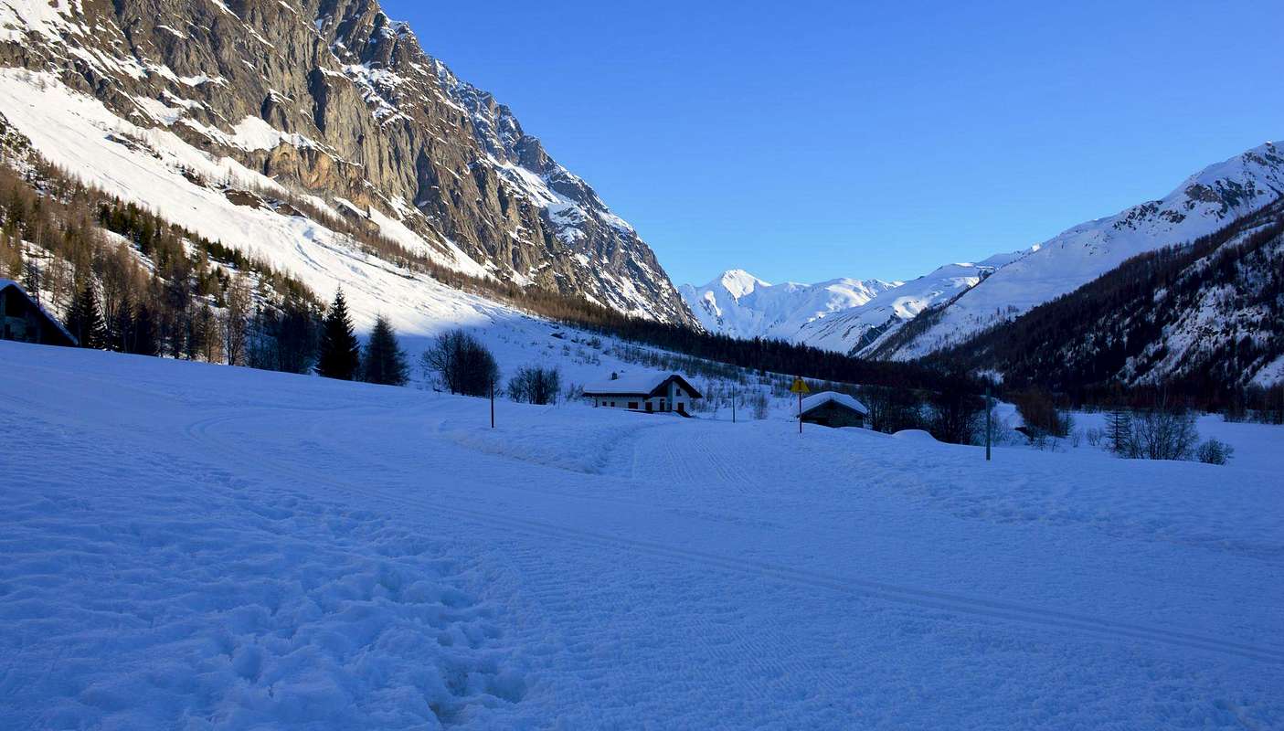
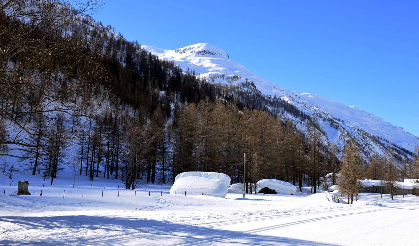
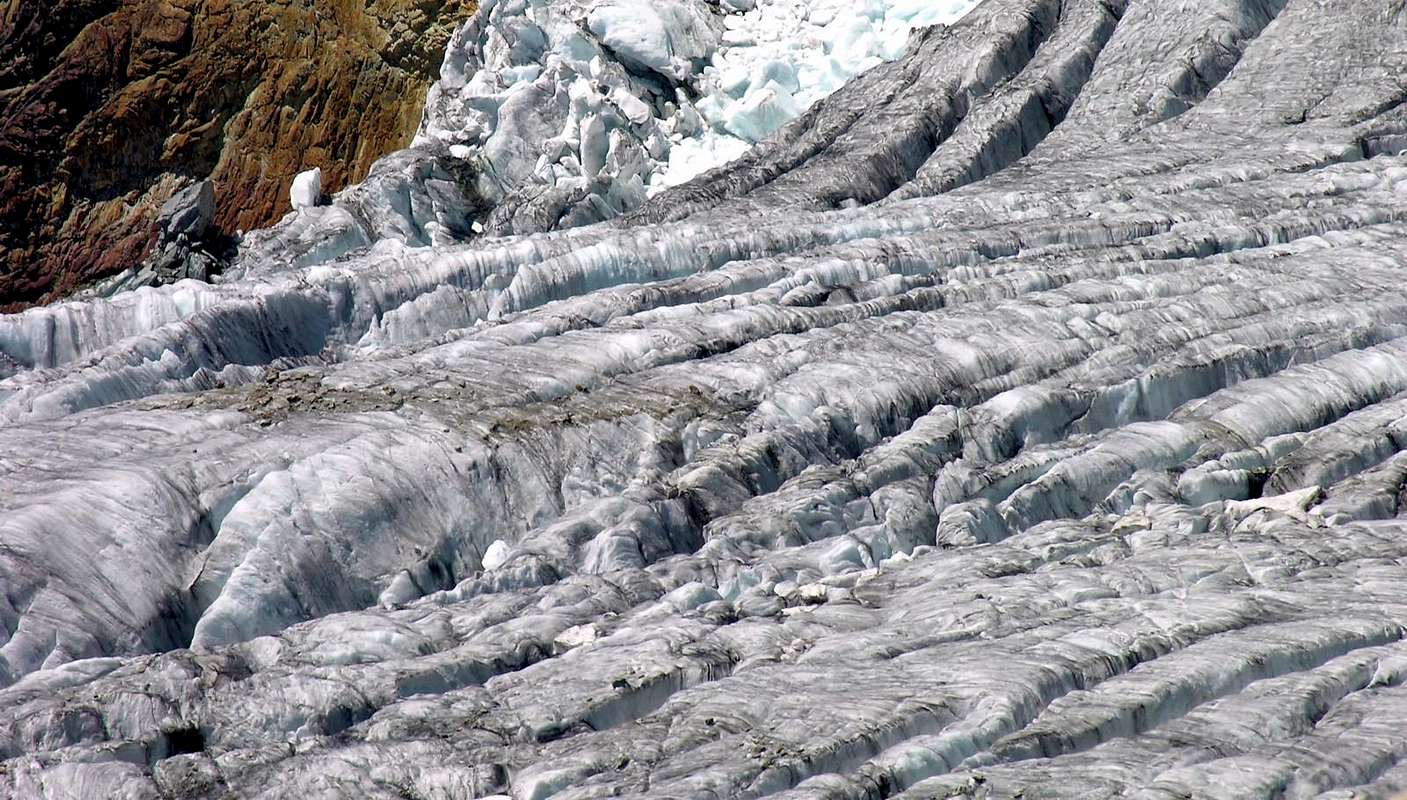
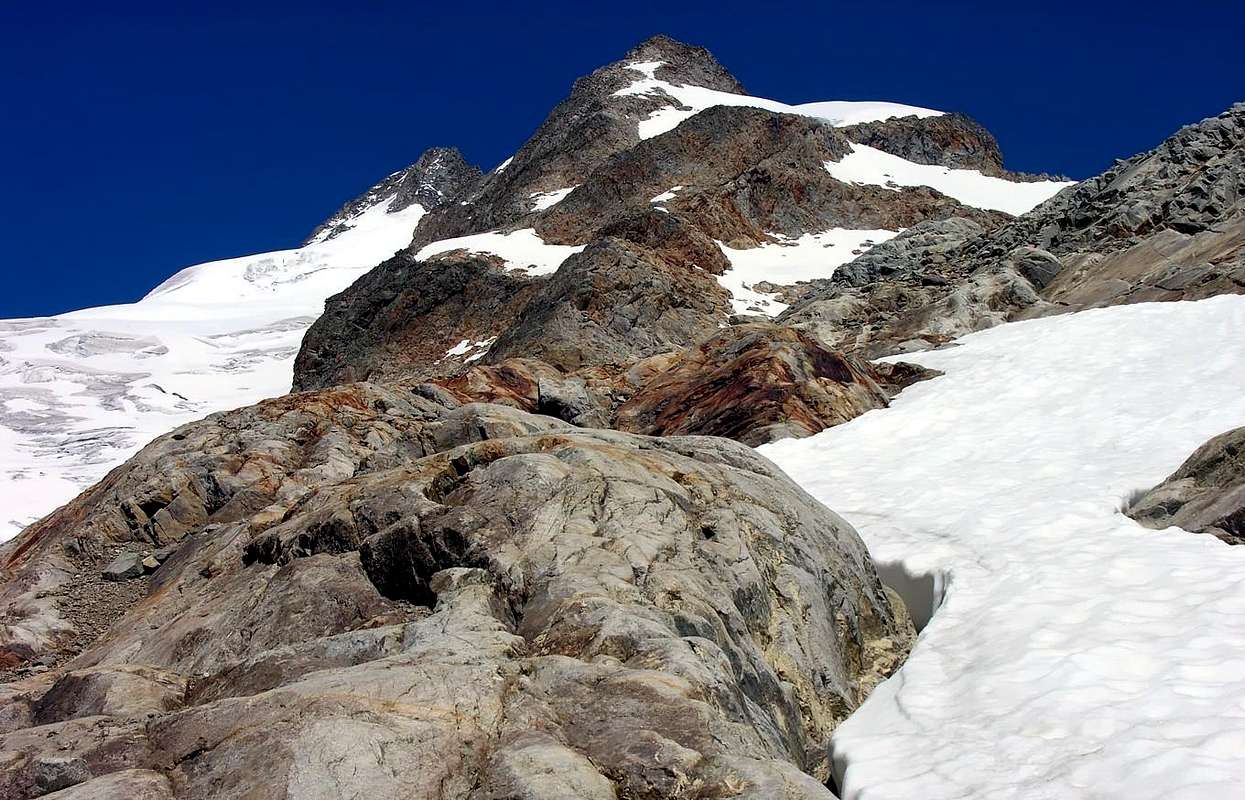
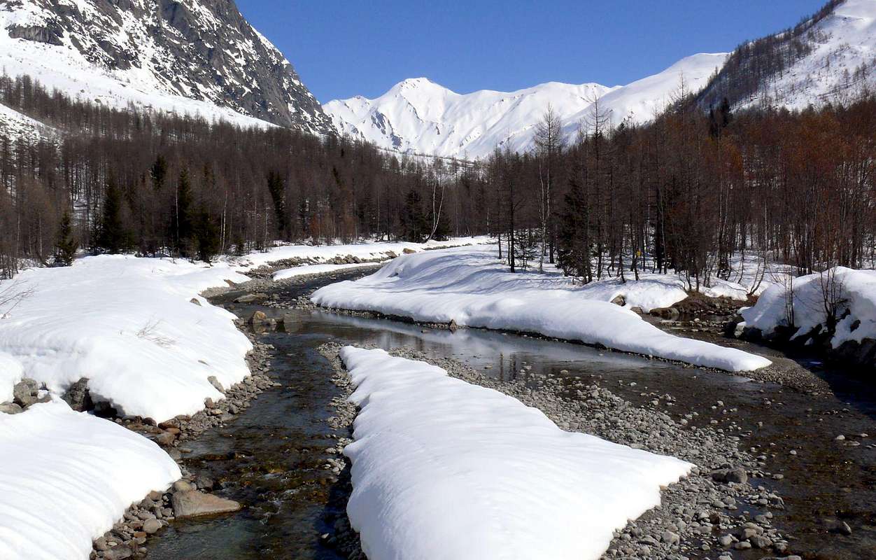
From Entrèves to the North lies the Italian Val Ferret up the two homonym hills and then down with the homologous in Switzerland. For this, as for Val Veny, we have two completely different areas: the watershed with France that the Colle del Gigante reaches, through the elegant crest of Rochefort, the Grandes Jorasses Punta Walker (4.208m), peak maximum, and from this then turns to the North-northeast to the Mont Dolent (3.819m) is formed by a series of Aiguilles (Petites Jorasses, Aiguilles de Leschaux, de l'Eboulement, de Talèfre, de Triolet) with an average altitude of 3.800 meters. On the watershed opposite or Eastern, first to Switzerland and then with several Italian and valleys to the Val Sapin, we find that more modest elevations are some more relevant as the Grand Summit Golliaz (3.237m) and Grande Rochère (3.326m). Even the geological structure appears completely diverse: the first are large ridges and granite walls overlooking wild glaciers (Fréty, Rochefort, Planpincieux, Grandes Jorasses, Praz Sec, Tronchey, Frébouge or Fréboudze, Greuvettaz, Triolet, Pré de Bard and Grapillon) among which are "clinging" shelters or bivouacs and from which recorded big and calamitous avalanches or collapse of seracs hanging. While on the second, made up of very ancient rocks among which predominate micaschists transformed, we have now reduced to crest slopes and steep rocks increasingly most covered with grass layers as you down towards South (Mont de la Saxe) and on which the ice they have now gone a long time.
Da Entrèves verso Settentrione si estende la Val Ferret italiana fino ai due colli omonimi per poi discendere con l'omologa in Svizzera. Anche per questa, come per la Val Veny, abbiamo due settori completamente differenti: lo spartiacque con la Francia che dal Colle del Gigante raggiunge, tramite l'elegante Cresta di Rochefort, le Grandes Jorasses Punta Walker (4.208 m), apice massimo, e da questa volge poi a Nord-nordest fino al Mont Dolent (3.819 m) è formato da una serie d'Aiguilles (Petites Jorasses, Aiguilles de Leschaux, de l'Eboulement, de Talèfre, de Triolet) con una media di altitudine di 3.800 metri. Sullo spartiacque opposto od Orientale, dapprima con la Svizzera e poi con diverse e secondarie vallate italiane e fino alla Val Sapin, troviamo elevazioni più modeste che ostentano alcune Sommità più rilevanti come il Grand Golliaz (3.237 m) e la Grande Rochère (3.326 m). Anche la struttura geologica appare completamente diversificata: sul primo troviamo grandi creste e pareti di granito che sovrastano antichi, selvaggi e ripidi ghiacciai (Fréty, Rochefort, Planpincieux, Grandes Jorasses, Praz Sec, Tronchey, le due ramificazioni del Frébouge o Fréboudze, i due di Greuvettaz, i tre del Triolet, Prè de Bard e Grapillon) sui quali sono "abbarbicati" rifugi o bivacchi e dai quali si registrano grandi e calamitose valanghe o crolli di seracchi pensili, spesso sino a raggiungere pericolosamente il fondovalle. Mentre sul secondo, formato da rocce molto antiche tra le quali predominano i micascisti trasformati, abbiamo versanti e creste ormai ridotti a più o meno ripide pietraie sempre più ricoperte da strati erbosi man mano che si degrada verso Mezzogiorno (Mont de la Saxe) e sui quali i ghiacci sono ormai spariti da molto tempo.
Even here, as was done for the Val Veny, I'm not to bore you with the list of the various refuges, bivouacs, the countless trails and endless Summit existing. If you want to have further details can be found in My Lists of the May 27th, 2010 with "
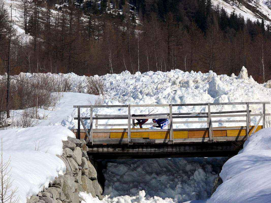
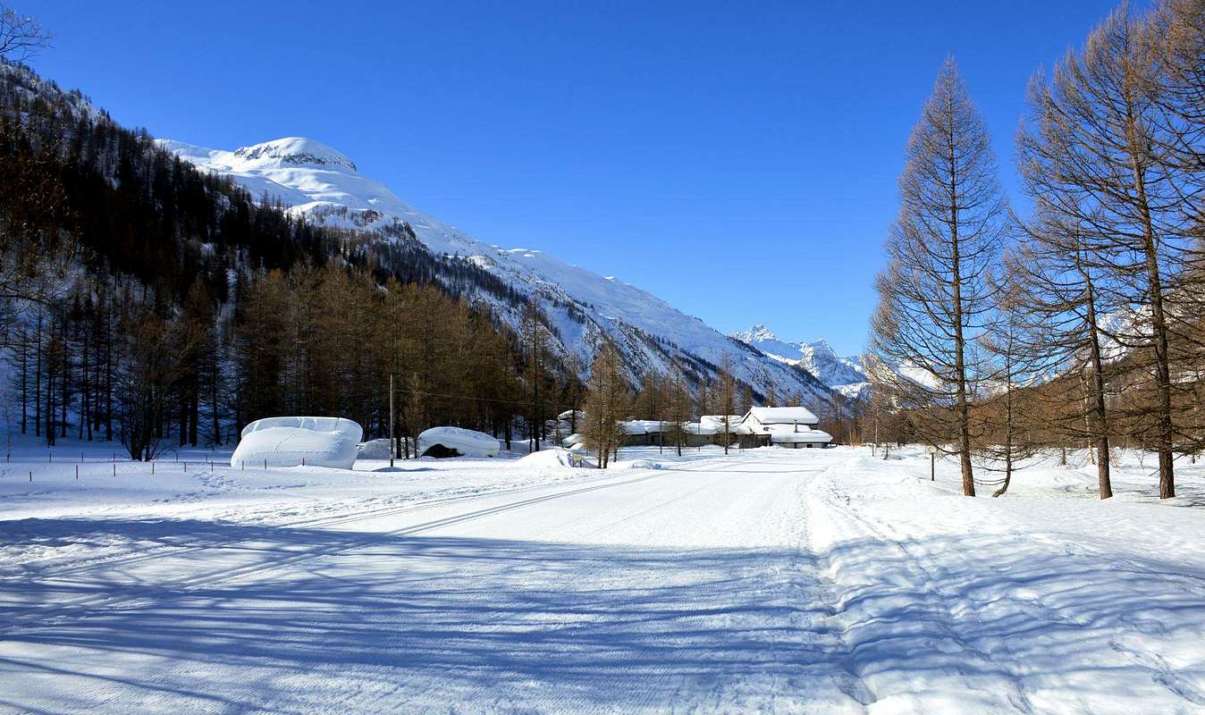
A) - MOUNT BLANC / GREAT JORASSES / AIGUILLE VERTE - LEFT SIDE First Part" and in other published works always in SP, where you will have news about it in the long and wide with great satisfaction to your liking and just and healthy curiosity. This is beyond the aim of this work, which simply give a total hatch of the valley and its particular features, perhaps by offering some special characteristic and curious. The above is useful to make understand what are the characteristics of sports activities that take place at the interior of this valley, in fact, while the Northern side sees the practice of mountain climbing, and above all of a high standard, the opposite is quite suitable for the practice of Hiking and the Ski-Mountaineering, two activities that you can enjoy large spaces unspoiled lavishing great views over the entire Mountain Chain of Mont Blanc but especially prominent in the area between the Grandes Jorasses and the Dolent-Tour Noir. Dutiful also reporting as the Dolent is, if not the only, one of the few in Europe Summit on the border of three countries: Italy, France and Switzerland. On the valley floor instead you have to register, thanks to the special climatic conditions such as to allow an early arrival of winter and a prolonged standing snow, great activities Cross-country skiing with a great track always well prepared. In addition to the "Snob", as this valley a little it is, we find a beautiful golf course nearby the Village Tronchey and another even on the Mont de la Saxe to 2.300 meters and which are also held walks with horses, favorite by paths that lead to Refuge Walter Bonatti at the Alp of Malatrà and the Giorgio Bertone on the promontory of Mont de la Saxe. At the Southern end of this and above the eponymous village is a climbing wall, on which the August Holiday you can go to observe the evolution of the Alpine Guides in the day of their Festival. Returning to the valley floor, to write down the first thing that the Regional Road that runs in the summer is subject to limited traffic for which I should present the barrier is not too late, as they are allowed a set number of passages after which it is allowed only the return traffic.
But first things: by Courmayeur goes up to Etrèves Hamlet (1.366m) from which in a short time in the Palud (1.370m, starting point of the "Cable Way of the Glaciers", leading in turn to "Pavillon", two Refuges Turin at the Colle del Gigante, Aigille de Midi and then down to Chamonix-Mont Blanc); from here and continue across Northeast along the Western shore hydrographic you reach the Village of Montitaz, the "Camping Grandes Jorasses" near Planpincieux (1.593m), the Village of Pont and the "Golf Club" Tronchey (1.623m, 1.687m). Further on you get to the three of Praz Sec (d'en bas, du milieu and d'en haut; 1.653m) to then get to Lavachey (1.640m) at the foot of the Glacier de Frèbouge and just before leaving for the Valley Malatrà; then, passing for the first time on the other side of the Dora di Ferret and away for a short distance from the same, the road passes beneath the Alps Greuvettaz reaching those Arnouva or Arp Nouva at a large square (1.769m; ban on driving). From this point continues as farm road coming to Elena Hut at the Alp of Prè de Bar (2.062m), where it ends; a path to the Northeast leads to the Col du Grand Ferret (2.531m) and another to the North than the Petit (2.510m, with deviation in the Northwest to the two Bivouacs of Dolent, Cesare Fiorio), both at the turn of Tête de Ferret (2.714m) as well as at the end of the valley.
Anche qui, come già fatto per la Val Veny, non sto ad annoiarVi con l'elenco dei vari Rifugi, Bivacchi, degli innumerevoli sentieri e delle infinite Sommità esistenti. Volendo avere maggiori informazioni le trovate in My Lists del 27 Maggio 2010 con "
A)- MOUNT BLANC / GREAT JORASSES / AIGUILLE VERTE - LEFT SIDE First Part" ed in altri lavori pubblicati sempre in SP, dove avrete ragguagli al riguardo in lungo ed in largo con vostro gradimento ed ampia soddisfazione di giusta nonché sana curiosità. Questo esula dall'obiettivo del lavoro, che si limita a dare un tratteggio complessivo della valle e delle sue peculiarietà, magari offrendo qualche particolare caratteristico piuttosto curioso. Quanto sopra esposto é utile a fare comprendere quali siano le caratteristiche sportive delle attività che si svolgono all'interno di questa vallata; infatti mentre il lato Settentrionale vede la pratica dello Alpinismo, anche e soprattutto di alto livello, quello opposto risulta alquanto idoneo alla pratica dell'Escursionismo e dello Sci-Alpinismo, due attività che permettono di sfruttare grandi spazi ancora incontaminati elargendo grandiose vedute sull'intera Catena del Monte Bianco ma in principal modo nel settore tra le Grandes Jorasses ed il Dolent-Tour Noir. Doverosa inoltre la segnalazione di come il Dolent sia, se non l'unica, una delle poche Sommità in Europa al confine di tre Nazioni: Italia, Francia e Svizzera. Sul fondovalle invece si deve registrare, grazie anche alle particolari condizioni climatiche tali da permetter un precoce arrivo dell'inverno ed uno stazionamento prolungato della neve, una grande attività di Sci da fondo con una splendida pista sempre ben curata. Inoltre per gli "Snob", poichè questa valle in fondo un pò lo è, troviamo un bel campo da golf presso il Villaggio di Tronchey ed un altro addirittura sul Mont de la Saxe a 2.300 metri circa e sul quale si svolgono anche passeggiate con cavalli, favorite dai sentieri che conducono al Rifugio Walter Bonatti presso l'Alpe di Malatrà ed al Giorgio Bertone sul promontorio del Mont de la Saxe. Al termine Meridionale di questo ed al di sopra dell'omonimo abitato trovasi una palestra di roccia, sulla quale nel giorno di Ferragosto si possono andare ad osservare l'evoluzioni delle Guide Alpine nel giorno della loro Festa. Ritornando al fondovalle, da annotare "in primis" che la Strada Regionale che lo percorre in estate è soggetta a traffico limitato per la qual cosa conviene presentarsi allo sbarramento non troppo tardi, poichè sono consentiti un numero prestabilito di passaggi (all'incirca 1500?) dopo di chè è consentito esclusivamente il traffico di ritorno.
Ma andiamo con ordine: da Courmayeur si sale ad Etrèves (1.366 m) donde in breve tempo a la Palud (1.370 m; punto di partenza della "Funivia dei Ghiacciai", che porta in successione al "Pavillon", Rifugi Torino al Colle del Gigante, Aigille de Midi per poi scendere a Chamonix-Mont Blanc); da qui e continuando verso Nordest lungo la sponda idrografica Occidentale si raggiugono il Villaggio di Montitaz, il "Camping Grandes Jorasses" di Planpincieux (1.593 m), il Villaggio di Pont ed il "Golf Club" di Tronchey (1.623 m, 1.687 m). Più avanti si arriva ai tre di Praz Sec (d'en bas, du milieu e d'en haut; 1.653 m) per quindi giungere a Lavachey (1.640 m), ai piedi del Glacier de Frébouge e poco prima della partenza pel Vallone di Malatrà; indi, passando per la prima volta sul lato opposto della Dora di Ferret ed allontanandosi per breve tratto dalla stessa, la strada passa al di sotto delle Alpi di Greuvettaz raggiungendo quelle di Arnouva od Arp Nouva presso un grande piazzale (1.769 m; divieto di transito). Da questo punto continua come poderale arrivando al Rifugio Elena presso l'Alpe di Prè de Bar (2.062 m), ove termina; un sentiero verso Nordest conduce al Col du Grand Ferret (2.531 m) ed un altro a Nord a quello del Petit (2.510 m, con deviazione a Nordovest per i due Bivacchi del Dolent e Cesare Fiorio), entrambi a cavallo della Tête de Ferret (2.714 m) nonchè al termine della valle.
Getting There
BY CAR:
From TORINO, MILANO, etc: Motorway A5. Exit at IVREA or Quincinetto (PIEDMONT) From IVREA Town: in West (Southern side) to Pont Saint Martin, Donnas, Bard, Champdepraz, Pontey, Fénis, Saint Marcel, Grand Brissogne, Pollein, Charvensod, Gressan, Jovençan, Aymavilles, Villeneuve, Arvier, Avise, Morgex and to Pré Saint Didier, Courmayeur Municipalities. From Courmayeur Resort: in East to Morgex, La Salle, Saint Pierre, Sarre, Aosta Municipalities. From Courmayeur-la Palud(1.370m), towards Montitaz, Planpincieux (1.593m) Villages, Tronchey (1.620m), Praz Sec du Milieu, Lavachey (1.640m), Arnouva Dèsot (1.769m) Villages, through Municipal Road, to Malatrà Vallon and Walter Bonatti Refuge. Also from Arp Nouva to Elena Refuge (2.062m), through dirt road on valley floor; or from the fork after Planpincieux, small bridge, towards Leuchey Dèsott, Damon Pastures to Mont de la Saxe Hump/Giorgio Bertone Refuge.
From FRANCE: through the Mont Blanc Tunnel to Entrèves-crossroads to Vény/Ferret Valleys - Mountain Guides of Courmayeur - La Saxe Rock Gym - Courmayeur. By Little Saint Bernard Pass, closed since November until half May to La Thuile Valley - Pré Saint Didier - Courmayeur. It is not necessary to take Motorway A5: you can drive on SS.26, in the direction of AOSTA - IVREA - TURIN.
BY PLANE:
Aeroporto "Corrado Gex" Saint Christophe (Aosta).
All its small & secondaries Valleys
VALLEYS & small Valleys In order to deploy clockwise from Courmayeur-Entrèves towards the Ferret Valley & Grapillon small Valley
In Courmayeur Municipality Ferret Valley with Northwestern, Western & Northeastern surroundings Grandes Jorasses small Valley: from Planpincieux (1.593m; parking) with path n°21 to Boccalatte-Piolti/Gr. Jorasses Refuge (2.604m). Freboudze small Valley: from Lavachey-Frébouge (1.640m, 1.654m) with path unnumbered to Giusto Gervasutti Bivouac (2.835m). Petite Jorasses small Valley: from Gervasutti Refuge-Bivouac through North ramification of Frébouge Glacier to Petite Jorasses Pass (3.520m). Leschaux-Greuvetta small Valley: from Courmayeur-Entrèves-Montitaz-Planpincieux-Arnouva (signal no transit; 1.769m) with Ferret Regional Road; from this point with dirt road and path n°23 to fork 1.875 meters and, with Northwest direction, to Dalmazzi or Triolet Refuge (2.584m).
Talèfre-Triolet small Valley and Basins: from refuge through:
a) - the first ramification or Northern of Triolet Glacier to Triolet Pass (3.705m);
b) - the second ramification or Northwestern to Talèfre Pass (3.544m);
c) - the third ramification of Triolet Glacier to Savoie Pass (3.491m);
d) - the fourth or Talèfre Basin, in West, to Pierre Joseph Pass (3.508m);
e) - the fourth or Talèfre Basin, in Southwest, to Leschaux Pass (3.433m). Pré de Bar small Valley: from Arnouva along Ferret Valley with dirt road up to the last winding road before Elena Refuge (2.062m); after in Northwest with path n° 24 to Little Ferret Hill (2.540m) and through path-traces to Fiorio Bivouac-Dolent Refuge (2.780m). Grapillon small Valley: from bivouac or shelter in North-northwest to large Saddle 3.358 meters between Mount Grapillon and Little Grapillon. Italian Ferret Valley: from Courmayeur towards the Refuge Elena (2.062m), near Pré de Bar Alpage, with Regional and dirt road also by other paths; from this in Northeast to Great Ferret Hill (2.531m) through path n°25/TMB (Tour of Mount Blanc).
Historical and some small notes Inquisitiveness
Little Histories & tiny Amenities
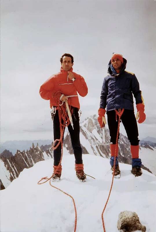
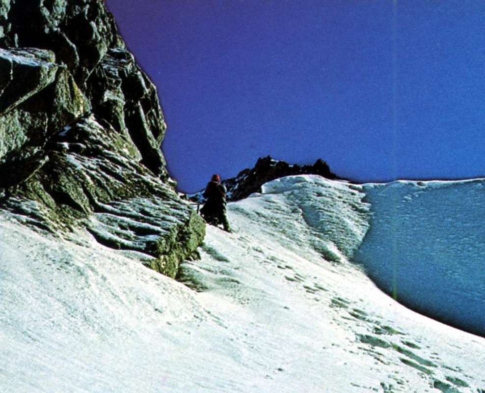
If you have to go to Mont Dolent (3819m) or simply to Réfuge du Dolent and Fiorio Bivouac (2.780m) do not lose direction. How to lose direction? Just like that! When you get to Elena Hut or at the first of the hairpin just below him and at the Doire de Ferret and not be in a hurry, crossing the same, start going up towards Northwest towards the front of the Glacier de Pré de Bard: a series of signals color blue invites you to do so, especially if climbs in the dark. The same follow the shore hydrographic right (Southeast) of the same, but then to 2.250/300 meters about disappears constituting the old route, long since abandoned; a series of seracs and wide and treacherous crevasses in fact prevent the crossing to the North and then to the bivouacs (until the Eighties only the Fiorio). You'll have to force back wasting, ascent and descent, a good hour and a half. Just what it has happened to us in the now far away in August of 1979, when because of the rush to climb the Dolent through the long Ridge Grapillon, we made that mistake. Already the climb in the day and through the Normal Route is long, imagine having to do the same for the long ridge that Southeast from Punta Allobrogia, bypassing Grapillon and Petit Mont Grapillon, leads to the Summit. An unforgivable mistake that we force to arrive at 16.00 in a violent storm and with a French group of rope climbers, after the climbing on the North Face and that now in rapid descent to below lightning, meeting us at about 200 meters from the Top there apostrophe violently "Vous êtes vraiment fou de vouloir continuer à monter sous cette lourde orage! or You are really crazy to continue with this storm!". And they're right, but, you know, the Youth ... But you no, it will not happen because you have been warned! When you reach the hairpin bend, continue to the Rifugio Elena: a good small path n° 24 to the North up towards the Col du Petit Ferret (2.510m); by this double crossing, at first in the Southwest and then to Northwest, it will lead to the two camps. Do not underestimate this stretch than double the altitude in 2.517 meters near the end of the long South Crest of Punta Allobrogia; in the Eighties a young couple here have lost their lives: she is sliding along a stretch with grass "ollina" and he, in trying to hold her by the hair, was dragged along. But even if you want to climb the Dolent for Normal Route do not it underestimate: a few years later a Belgian girl, with the dad, have slipped down the upper ice going to crashing on the glacier after a terrible fall. Why the Mountain is like that and not always forgives mistakes. I understand better this and the invective of the French from when in July 1986 I was struck, in a trivial ascension, by lightning ...
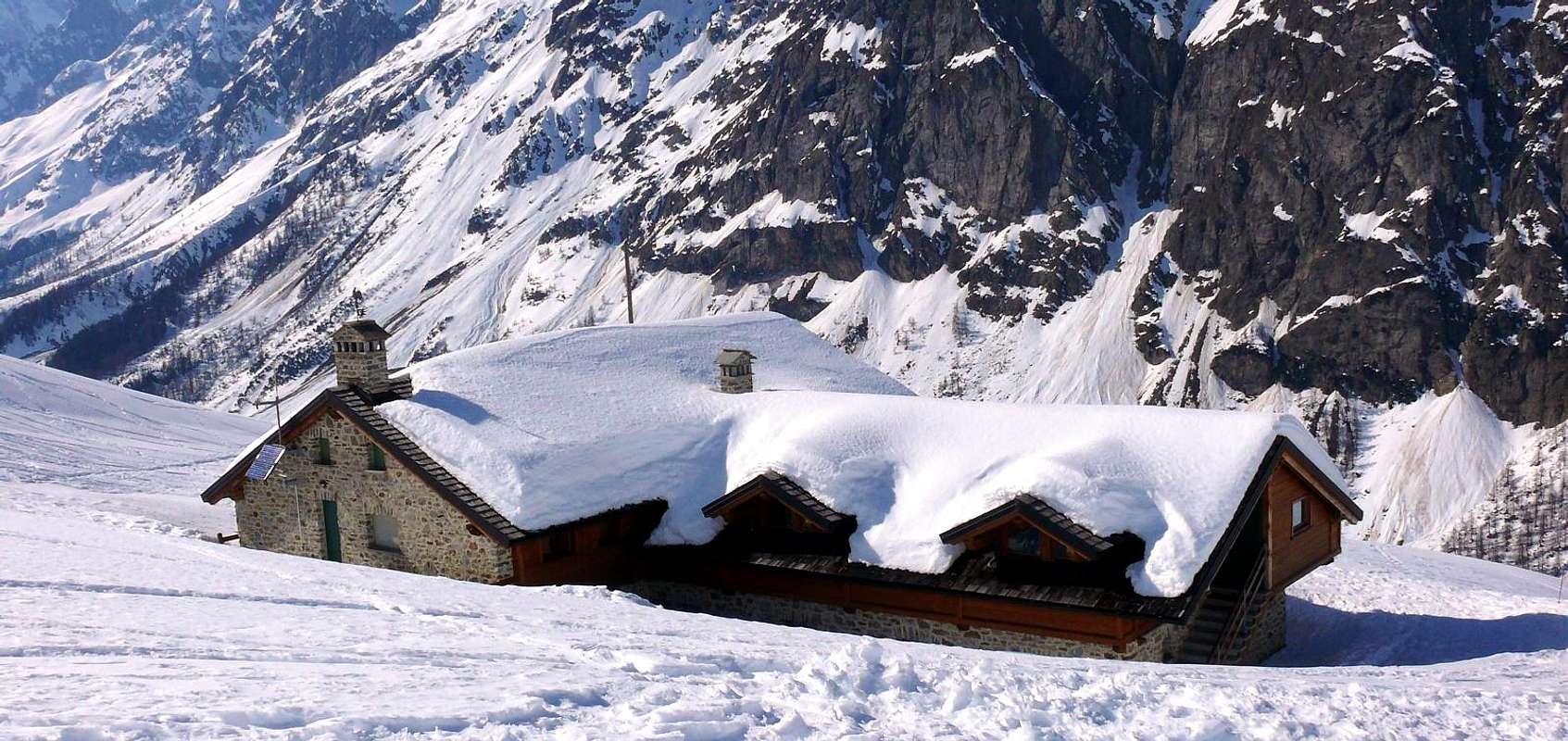
Never mind the other areas of this side: are aimed at Mountaineers. And even very experts. At best, a good hike to Refuge Dalmazzi or of Triolet (2.584m) by the trail n° 23 meeting at the upper part some iron chain; but other shelters or bivouacs (Gabriele Boccalatte-Mario Piolti the Jorasses, Mario Jachia the Aiguille de l'Evêque, Giusto Gervasutti to Leschaux, Gianni Comino to Monts Rouges de Greuvetta (z) are the starting points for big climbs and some of them not easily accessible. Rifugio Elena, and also bivouacs Cesare Fiorio with the precautions recommended above, are the first a nice easy Walk and the second a good Excursion aimed at those who have more interest scenic or photografic that not to the climbing. Rifugio Elena, completely destroyed by an avalanche in 1960, it was rebuilt always near Alpe Pré de Bard or Pré de Bar and still Prou de Bar, a term originally Celtic-Ligurian meaning Meadow of the Rock; moreover the word Bard is very common in the Valley of Aosta (see also Bard Fortress) and the same result as the Noble Family Dalbard. The same was dedicated to Queen Elena of Savoy and Princess of Montenegro (* January 8, 1873, Cetinje, Montenegro - + November 28, 1952, Montpellier, France) and spouse of Vittorio Emanuele III° of Savoy (1896-1947), which it is also the name of the fifth Top of Grandes Jorasses (4.042m), climbing 22 August 1898 from the Duke of Abruzzi with the Guides of Courmayeur Giuseppe Petigax, Laurent Croux, Cesare and Felice Ollier after winning also the Punta Margherita (4.066m). The Bivouac Cesare Fiorio, placed here since 1952, remembers instead the talented climber and pioneer of climbing without Mountain Guides, climbing partner of Carlo Ratti. In the social outing and winter to Punta Gnifetti in the New Year of 1894 he brought a freeze with its amputation of a leg rather than abandon a dying comrade. He has been dedicated to the beautiful Summit (3.332m) at the entrance of the Valpelline and above the Municipality and at the beginning of the long Ridge towards the Mounts Morion. On the opposite side we have instead of Eastern or beautiful possibilities for day trips in Ski-Mountaineering inwardly of the small Valleys of Ban Darrey, of Bellecombe, the Malatrà, of Arminaz and Western slopes of Mont de la Saxe until the Refuge Giorgio Bertone. The same, however, require caution and good knowledge of the state of the snow, limiting the path to the initial portions certainly less dangerous and exposed to avalanches, as in the case of Rifugio Walter Bonatti at the Alpe Lower Malatrà. Beautiful, varied and rather safe trips Excursion in the same valleys with the ability to move from one to the other or to cross the divide to the valleys further East.
Se devi andare al Mont Dolent (3.819 m) o semplicemente al Réfuge du Dolent e Bivacco Fiorio (2.780 m) non perdere la rotta. Come perdere la rotta? Proprio così! Quando arrivi al Rifugio Elena od al primo dei tornanti subito al di sotto e presso la Doire de Ferret non aver fretta e, traversata la medesima, non incominciare a salire subito verso Nordovest in direzione del fronte del Glacier de Pré de Bard: una serie di segnalazioni di color blù ti invita a farlo, soprattutto se sali col buio. Le stesse seguono la sponda idrografica destra (Sudest) del medesimo, ma poi a quota 2.250/300 metri circa di colpo scompaiono costituendo la vecchia via, ormai da lungo tempo abbandonata; una serie di seracchi e di larghe ed infide crepacce infatti impediscono la traversata verso Nord e quindi ai bivacchi (fino agli anni Ottanta solo il Fiorio). Dovrai per forza tornare indietro sprecando, tra salita e discesa, una buon'ora e mezza. Proprio quello che successe a noi nell'ormai lontano Agosto del 1979, allorchè a causa della fretta, per salire il Dolent dalla lunga Cresta del Grapillon, abbiamo commesso questo errore. Già la salita in giornata e tramite la Via Normale risulta lunga, immaginiamo dovendo compiere la medesima per la lunga Cresta Sudest che dalla Punta Allobrogia, scavalcando Petit Grapillon e Mont Grapillon, conduce alla Cima. Un errore imperdonabile che ci costrngerà ad arrivare alle ore 16.00 sotto un violento temporale e con una cordata di francesi, salita per la Parete Nord e che ormai in rapida discesa sotto ai fulmini, incontrandoci a circa 200 metri dalla Vetta ci apostrofa violentemente "Vous êtes vraiment fou de vouloir continuer à monter sous cette lourde orage!". Avevan proprio ragione ma, si sà, la Gioventù ... Ma a Voi no, non succederà poiché siete stati avvisati! Quando arrivate al tornante, continuate verso il Rifugio Elena: un buon sentierino n°24 verso Nord sale verso il Col du Petit Ferret (2.510 m); da questo una doppia traversata, dapprima a Sudovest e poi a Nordovest, vi condurrà ai due bivacchi. Non sottovalutate questo tratto che doppia la quota 2.517 metri quasi al termine della lunga Cresta Sud di Punta Allobrogia; negli anni Ottanta una giovane coppia vi ha perso la vita: lei é scivolata lungo un tratto con erba "ollina" e lui, nel cercar di trattenerla pei capelli, é stato trascinato via insieme. Ma anche se volete salire il Dolent per la Normale non sottovalutate la cosa: pochi anni dopo una ragazza belga, insieme al papà, son scivolati in discesa nella parte superiore ghiacciata andando a sfracellarsi sul ghiacciaio dopo terribile caduta. Perchè la Montagna é sì fatta e non sempre perdona errori commessi. Ciò meglio ho capito l'invettive francesi quando nel Luglio del 1986 son stato colpito, in banale ascensione, dal fulmine in Vetta ...
Lasciate stare le altre zone di questo versante: sono rivolte ad Alpinisti. Ed anche esperti. Al massimo effettuate una buona Escursione al Rifugio Dalmazzi o del Triolet tramite il sentiero n°23 incontrando nella parte superiore qualche breve tratto con catene in un canalino roccioso; ma gli altri rifugi o bivacchi (Gabriele Boccalatte-Mario Piolti alle Jorasses, Mario Jachia all'Aiguille de l'Evêque, Giusto Gervasutti alla Leschaux, Gianni Comino ai Monts Rouges de Greuvetta(z) sono punti di partenza per grandi ascensioni ed alcuni dei quali neppur facilmente raggiungibili. Il Rifugio Elena, ed anche i Bivacchi Cesare Fiorio con le precauzioni sopra testé raccomandate, costituiscono il primo una bella e facile Passeggiata ed il secondo una buona Escursione rivolte a chi ha più interessi panoramici oppur fotografici che non alpinistici. Il Rifugio Elena, completamente distrutto da una valanga nel 1960, é stato ricostruito sempre nei pressi dell'Alpe Prè de Bard o Prè de Bar ed ancora Prou de Bar, termine con origine celto-ligure significante Prato del Monte o della Roccia; tralaltro il vocabolo Bard é molto diffuso in Valle di Aosta (vedi anche Forte di Bard) e dallo stesso deriva il nome della Nobile Famiglia Dalbard. Lo stesso é stato dedicato alla Regina Elena di Savoia nonché Principessa del Montenegro (* 8 gennaio 1873, Cettigne, Montenegro - + 28 novembre 1952, Montpellier, Francia) nonché coniuge di Vittorio Emanuele III° di Savoia e terzo Re d'Italia (1896–1947); alla Regina d'Italia è dedicata anche la quinta punta delle Grandes Jorasses (4.042 m), salita il 22 Agosto 1898 dal Duca d'Abruzzi colle Guide di Courmayeur Giuseppe Petigax, Laurent Croux, Cesare e Felice Ollier in traversata dopo aver conquistato anche la Punta Margherita (4.066 m). Il Bivacco Cesare Fiorio, qui collocato dal 1952, ricorda invece il valente alpinista e pioniere dell'alpinismo classico nonché senza Guide Alpine, compagno di cordata di Carlo Ratti; nella gita sociale ed invernale alla Punta Gnifetti nel Capodanno del 1894 riportò un congelamento con relativa amputazione d'una gamba pur di non abbandonare un compagno morente. A lui é stata dedicata meritatamente la bella Sommità (3.332 m) all'ingresso della Valpelline e sopra l'omonimo Comune ed all'inizio della lunga Cresta dei Mont Morion. Sul versante opposto od Orientale abbiamo invece delle belle possibilità di effettuare gite di Sci-Alpinismo all'interno dei Valloni del Ban Darrey, di Bellecombe, del Malatrà, di Arminaz ed alle pendici Occidentali del Mont de la Saxe e fino al Rifugio Giorgio Bertone. Le stesse richiedono però prudenza e conoscenza dello stato del manto nevoso, limitando il percorso ai tratti iniziali sicuramente meno pericolosi ed esposti alle valanghe, come nel caso del Rifugio Walter Bonatti presso l'Alpe Inferiore di Malatrà. Belle, varie e sicure le gite Escursionistiche negli stessi valloni con la possibilità anche di passare da un all'altro o di attraversare lo spartiacque verso quelli più ad Est.
Campings
Remember that free camping is forbidden (except for emergency reasons, over 2.500m, from darkness until dawn).
Mountain Conditions
You can get meteo information at the official site of the Regione Valle d'Aosta:
Parents refers to a larger category under which an object falls. For example, theAconcagua mountain page has the 'Aconcagua Group' and the 'Seven Summits' asparents and is a parent itself to many routes, photos, and Trip Reports.


 6293 Hits
 81.18% Score
 13 Votes