La montagna chiama i suoi figli, ed essi rispondono fedelmente al suo appello…
Osvaldo Cardellina, Diario alpinistico, 1964-65
Page texts: @ OsvaldoCardellina"Osva", passed away on May 2, 2022. Page owners: Christian Cardellina e Osvaldo Cardellina. Any updates from September 12, 2022: Antonio Giani, page administrator, friend and climbing companion.
Testi della pagina: @ OsvaldoCardellina "Osva", scomparso il 2 maggio 2022. Proprietari pagina:Christian Cardellina e Osvaldo Cardellina. Eventuali aggiornamenti dal 12 settembre 2022: Antonio Giani, amministratore della pagina, amico e compagno di salite.
Overview
The Legna's Vallon is a secondary valley of the main Champorcher Valley, with which it connects to the village of Outre l'Eyve, located at the foot of the valley which splits nearby at that of Ourty (1.507m). With an essential hatch it could be summarized vertically as follows the narrow Valle della Legna or in "patois" Franco-Provençal Leigne 's Vallon and even known in very ancient times as Alleigne Valley (see just in bottom "HISTORICAL NOTE" with various considerations):starting from the small Hamlet said of Outre l'E(y)ve Hamlet, beyond Ayasse Torrent, to continue South towards Porte Alp (1.344m), Montaz Pasture (1.497m), Ourty Alp (1.507m), alternative to Sant'Antoine (1.831m), Chenessy Pastures (2.051m), Peroisa Alp (2.184m), Chilett Alp (2.351m) and homonym Lake (2.324m); after again to the South... In Southern, on the border with the Piedmont region, the Colle di Santanel(2.464m) opens out, identifiable by a characteristic small rocky tooth and named in "Les Sentiers de Champorcher - The Champorcher paths", 25.000 card in the third edition updated and corrected in August 2001; as well as in "Map of the paths and refuges 9 IVREA BIELLA BASSA VALLE D'AOSTA"., published in 50.000 by the CENTRAL GEOGRAPHICAL INSTITUTE of Turin in August 1978 and taking up the tablets of the rilevation of the I.G.M.. (Italian Military Geographical Institute) of 1933. While the ancient (1896) "Guide of the Western Alps Vol. II, PART 2a". by Giovanni Bobba & Luigi Vaccarone on page 23 calls it identically, but also with the alternative of Colle di Perausa. On both sides there is a trace of a path, more evident on the side of Aosta 's Valley (numbered 41) than on that of Piedmont, also because it collapsed in the part above Pianprato (1.551m) due to the floods of 1993 and 2000 (See "EMILIUS ROSA DEI BANCHI PARCO DEL MONTE AVIC", pages 291-3, by Giulio Berutto & Lino Fornelli in "GUIDE TO THE MOUNTAINS OF ITALY", Edit. CAI/TCI, March 2005. These sources, together with "GUIDE TO THE AUTONOMOUS REGION OF THE AOSTA VALLEY" by Mario Aldrovandi, Edit. S.P.E. by C. Fanton, Turin 1964 where on pages 146-7 thus we find it, they form the basis of all this study, as well as for this hill, on the entire and complete Vallone della Legna. We have identified
1) - this hill as a starting point for the description of the three border watersheds, also because it is the less elevated and easier to transit towards Piedmont (Towards Pianprato); two other important hills open up more to the East with the
2) - Colle degli Orti (2.634 m) near Monte Marzo or Mont Mars (2.756m) and
3) - the Colle dei Corni (2.624 m) immediately West of the Monte dei Corni (2.779m). This turns out to be the head of the valley that from Monte Santanel (2.721m) heads towards the Southeast, climbing over Monte Facciabella (2.654m), until it reaches Monte Marzo, from where the border ridge goes towards East-northeast reaching Monte dei Corni (Mount of the Horns). From these two junctions (Santanel and Corni) the dividing crests also depart, the Vallone della Legna with the one further West of Vercoche and the ridge that from the last of the two descends, always towards the North, to divide it to the East from that adjacent of the Manda also Amanda, this last above Pont Bozet Municipality.
Il Vallone della Legna é una valle secondaria della principale di Champorcher, con la quale si connette presso il villaggetto di Outre l'Eyve, posto ai piedi della valle che si sdoppia presso quello d'Ourty (1.507 m).Valle della Legna oppure Vallone della Legna, pur conosciuto in tempi più remoti siccome Vallon de l'Alleigne: partendo dalla Frazione di Champorcher Outre l'E(y)ve, Alpe Porte (1.344 m), Alpeggio di Montaz (1.497 m), Alpe d'Ourty (1.507 m), alternativa in direzione di Sant'Antoine (1.831 m), Alpi di Chenessy (2.051 m), Alpe Peroisa (2.184 m), Alpeggio del Chilett (2.351 m) e Lago omonimo (2.324 m); poi a Sud ... A Meridione si apre, ormai al confine con la Regione Piemonte, il Colle di Santanel(2.464 m), individuabile per un caratteristico dentino roccioso e così nominato in "Les Sentiers de Champorcher - I sentieri di Champorcher", carta al 25.000 nella terza edizione aggiornata e corretta dell'agosto 2001; così come in "Carta dei sentieri e dei rifugi 9 IVREA BIELLA BASSA VALLE D'AOSTA", edita al 50.000 dall'ISTITUTO GEOGRAFICO CENTRALE di Torino nell'agosto del 1978 e riprendendo le tavolette della levata dell'I.G.M. (Istituto Geografico Militare Italiano) del 1933. Mentre l'antica (1896) "Guida delle Alpi Occidentali Vol. II, PARTE 2a" di Giovanni Bobba & Luigi Vaccarone in pagina 23 lo chiama identicamente, ma anche con l'alternativa di Colle di Perausa. Su ambo i lati passa una traccia di sentiero, più evidente sul lato valdostano (numerato 41) che non su quello piemontese, anche perché franato nella parte soprastante Pianprato (1.551 m) a causa delle alluvioni del 1993 e del 2000 (Vedi "EMILIUS ROSA DEI BANCHI PARCO DEL MONTE AVIC", pagg. 291-3, di Giulio Berutto & Lino Fornelli in "GUIDA DEI MONTI D'ITALIA", Edit. CAI/TCI, marzo 2005. Queste fonti, insieme a "GUIDA DELLA REGIONE AUTONOMA DELLA VALLE D'AOSTA" ad opera di Mario Aldrovandi, Edit. S.P.E. di C. Fanton, Torino 1964 dove in pagg. 146-7 così lo ritroviamo, costituiscono la base di tutto questo studio, oltreché per questo colle, sull'intero e completo Vallone della Legna. Abbiamo individuato
1) - questo colle come punto di partenza per la descrizione dei tre spartiacque, anche perché risulta come quello meno elevato nonché di più facile transito nei confronti del Piemonte (Verso Pianprato); altri due colli importanti si aprono maggiormente ad Oriente con il
2) - Colle degli Orti (2.634 m) vicino al Monte Marzo o Mont Mars (2.756 m) e
3) - il Colle ccidentale dei Corni (2.624 m) subito ad Ovest del Monte dei Corni (2.779 m). Questa risulta essere la testata del vallone che dal Monte Santanel (2.721 m) si dirige verso Sudest, scavalcando il Monte Facciabella (2.654 m), fino a raggiungere il Monte Marzo, donde la cresta di confine si indirizza ad Est-nordest raggiungendo il Monte dei Corni. Da questi due snodi (Santanel e Corni) si dipartono anche le creste divisorie il Vallone della Legna con quello più ad Occidente di Vercoche e la dorsale che dall'ultimo dei due scende, sempre verso Settentrione, a dividerlo ad Est da quello adiacente della Manda oppure Amanda, quest'ultimo sopra al Comune di Pont Bozet .
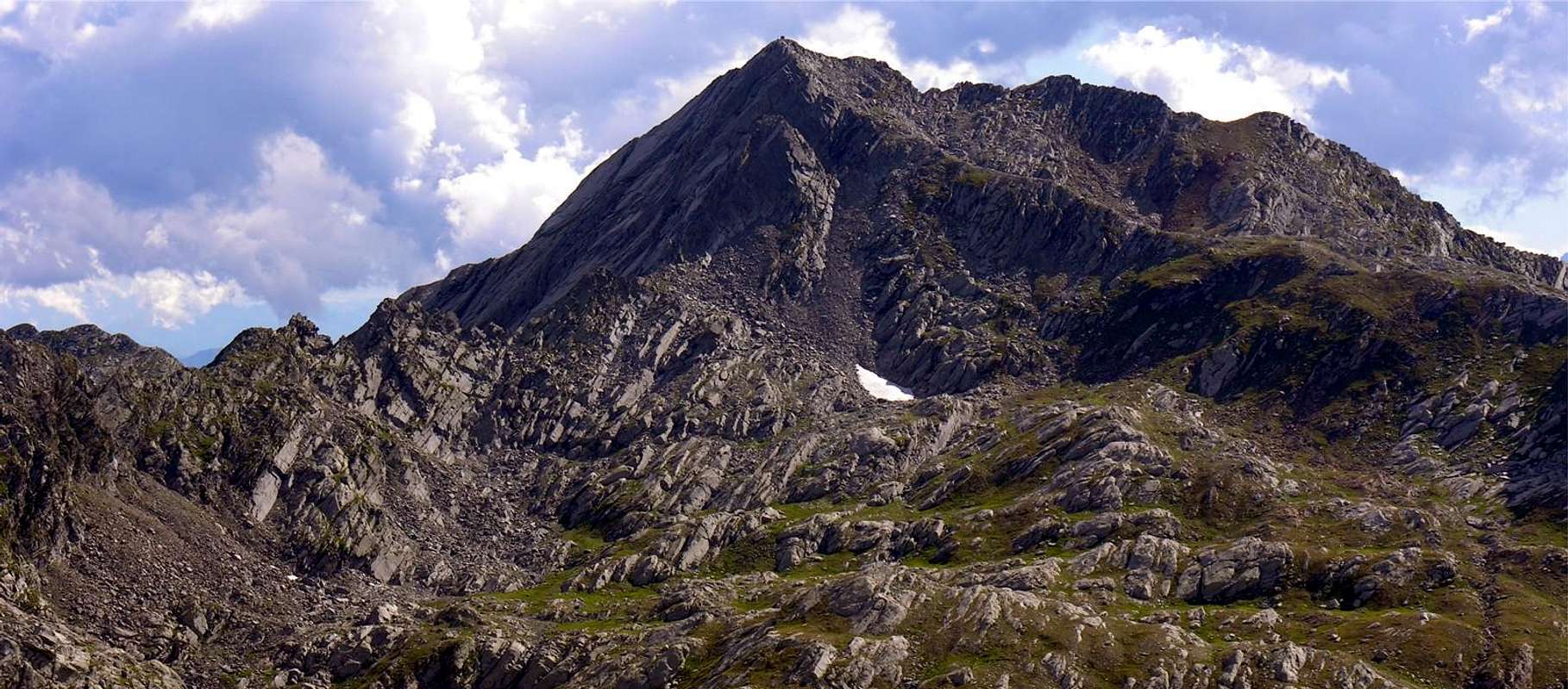
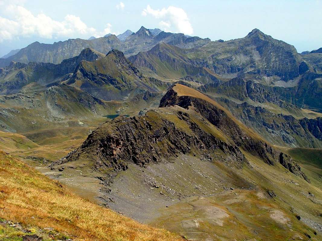
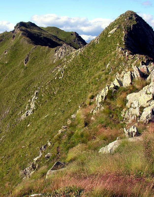
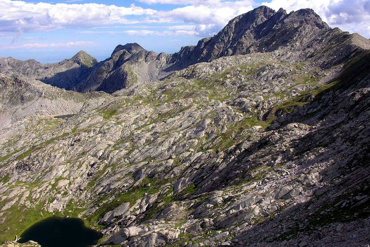
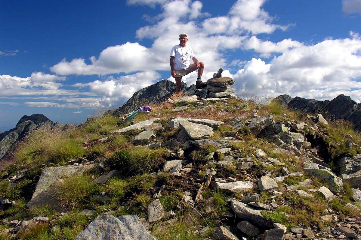
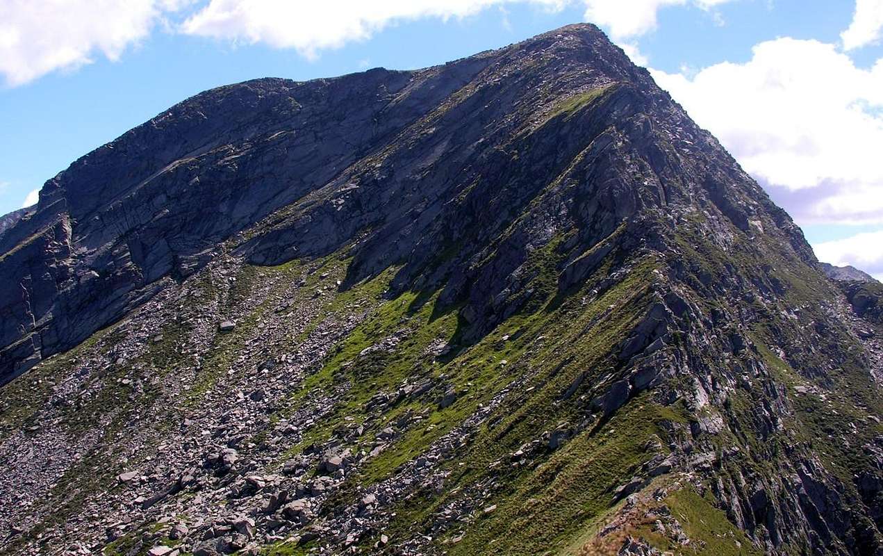
In addition to those that we will see later, as well as positioned on the internal watersheds amongst Legna, Vercoche (to the West) and Manda or Amanda (in East) adjacent small valleys, all these Summits are part of the Group of Mount Marzo (2.756m), located between the Valleys of Champorcher and Pianprato Soana and Chiusella in Piedmont. In fact the group membership is, though less known, that of Monte dei Corni (2.779m), this being the highest Summit in this part of the watershed with the Aosta Valley and immediately to the East of the previous year. From this last down towards the North a secondary buttress act to separate the Valley of Manda or Amanda to the East by the West to that of Legna. After the Fricolla Pass (2.542m) (*** connecting the two in their highest part through Bruillet Col (2.450m), but in reality is divided from the next Vallon of Brenve) stands up to the crest of the same name Point (2.676m) above Lake Cornuto (2.450 m; Horned); then the ridge continues, sinuous, forming the Ridge Chenessy (2.756m) that "serrated" form a series of at least four elevations (2.616m, 2.665m, 2.650m, 2.616m) before reaching the Punta Chenessy (2.630m). This, call B&V 1896, page 26 of Costa Canessi with altitude 2.631 meters, even if only slightly less high stands out more as isolated. At his feet to the East lies the small lake of the same name (2.383m), while on the opposite side down with rocky cliffs-grassy above Alpe Chenessy (2.051m) in the adjoining Vallon of the Legna (Wood). A ridge facing North-northeast continues steeply towards the Hills of Manda (around 2.390 meters) and Detrà (about 2.350 meters), separated by a small Summit 2.414 meters. Besides the watershed continues further Northeast forming the rounded Mont Giavin (2.431m), Col de Creuset (2.121m) to end with the Mont Digny (2.145m) above the Crest Lutta and small Villages Frassiney and Trambesere, now on the bottom of the valley. Although well visible when looking from the North or from the nearby Park of Monte Avìc , there are little known mountains and even less popular, if not by the locals or somewhere fancier of rarities, as evidenced by the poor mound found on the summit (see photo), even though the reality "Guide of the Western Alps", same page, noted: "... highlight (trigonometric signal) of the dividing Range between the valleys of the Legna and Amanda ..."; sign that more than 100 years before it was already known and frequented. At least from Topografi State Piedmont-Sardinian, but also demonstrating that "King Toio" was jealous of his possessions and controlled them better than they do today. However remain Vallons most frequented by Fishermen that the Mountaineers or Hikers, and perhaps especially because of the long and exhausting approaches, such as not to stimulate the average hiker too much. This vast area, which stretches to the East towards the Canavese and Ivrea and Southeast to the Po Valley and the City of Turin, constitutes the extreme offshoots of the Gran Paradiso after the last major Summits of the Tower of Lavina and the Rosa dei Banchi, for which it still belongs to the Mountain range of Graian from here dates back to the Mont Blanc. From this you can enjoy pleasant views of the surroundings from Monte Marzo, but also on the number of small seeds Summits abandoned that stretch towards the Lower Valley. Frontally instead, taking advantage of the Chain from Mont Glacier (3.186m) slopes down more and more towards East-Northeast "opening" the view, you can admire the Valleys Marmore, Lys and Gressoney until their term, ie the Matterhorn and the extended Chain Monte Rosa from Breithorns, Lyskamms, Zumstein, Dufour, Gnifetti and the partition with Piedmont. A general but useful overview, this, to better frame the territory we are going to visit, as well as located between the Southeasterner sector of the Aosta Valley and the Northwesterner of Piedmont. Instead, analyzing the opposite or western watershed on the border with the Vallone di Vercoche and carrying out but stepping back we must return to the Mont Santanel from which part to the Northeast an intermediate ridge between that of Chenessy (East) and the next that from Colle Larìs reaches the Bec de Larìs (2.426m), after overtaking the Bec Molère (2.638m). This long watershed offers a buttress that by flexing in the Northeast, runs out on the Alpe di Ourty (1.527m) where the valley splits sending towards the South "Vallone della Legna or of Wood" and Southwest towards the Lakes Vercoche, Piana and Molère. The same is formed by a rocky ridge, apparently quite tricky at the sight, coming down with Punta, Collar, Crest and Tower Vorèa (2.544 meters, 2.450 meters, 2.442 meters).
Oltre a quelle che vedremo in seguito, nonché posizionate sugli spartiacque interni con Vercoche e Manda, tutte queste Sommità fà appartengono al Gruppo del Monte Marzo (2.756 m), posto tra le Valli di Champorcher e Pianprato Soana e Chiusella in Piemonte.In realtà il gruppo di appartenenza risulta, anche se meno conosciuto, quello del Monte dei Corni (2.779 m), essendo questa la Sommità la più elevata in questo tratto di spartiacque con la Valle di Aosta e subito ad Oriente della precedente. Da questo ultimo scende verso Settentrione un contrafforte secondario, atto a separare il Vallone della Manda o Amanda ad Est da quello della Legna ad Occidente. Dopo il Colle della Fricolla (2.542 m) (*** collegamento tra i due nella loro parte più elevata tramite il Col Bruillet (2.450 m), ma in realtà si divide dal successivo Vallone di Brenve) la cresta si rialza all'omonima Punta (2.676 m), sopra il Lago Cornuto (2.450 m); quindi la cresta prosegue, sinuosa, formando la Cresta di Chenessy (2.756 m) che "seghettata" forma una serie di almeno quattro elevazioni (2.616 m, 2.665 m, 2.650 m, 2.616 m) prima di raggiungere la Punta di Chenessy (2.630 m). Questa, chiamata in B&V 1896, pagina 26 Costa di Canessi con quota 2.631 metri, anche se di poco meno alta si distingue maggiormente poiché isolata. Ai suoi piedi ad Est si trova il laghetto omonimo (2.383 m), mentre sull'opposto versante scende con dirupi roccioso-erbosi al di sopra dell'Alpe Chenessy (2.051 m) nel Vallone attiguo della Legna. Una cresta rivolta a Nord-nordest continua ripida verso i Colli della Manda (2.390 metri circa m) e Detrà (2.350 metri circa), separati da una piccola Sommità 2.414 metri. Oltre lo spartiacque continua più a Nordest formando il tondeggiante Mont Giavin (2.431 m), il Col de Creuset (2.121 m) per terminare con il Mont Digny (2.145 m) sopra la Cresta di Lutta ed i piccoli Villaggi di Frassiney e Trambesere, ormai sul fondo valle. Seppure ben in vista guardando da Settentrione ovvero dal Parco del Monte Avìc, risultano montagne poco conosciute ed ancora di meno frequentate, se non dagli abitanti locali o da qualche amatore delle cose rare, come dimostra il misero tumulo trovato sulla Sommità (vedi foto), anche se per la verità "Guida delle Alpi Occidentali", identica pagina, segnala: "... punto culminante (segnale trigonometrico) della catena divisoria tra i Valloni della Legna e della Amanda ..."; segno che oltre 100 anni prima era già cosciuta e frequentata. Almeno dai Topografi dello Stato Piemontese-Sardo, ma anche a dimostrazione che "Re Toio" era geloso dei suoi possedimenti e li controllava meglio di come fanno oggigiorno. Comunque rimangono valloni più frequentati dai Pescatori che dagli Alpinisti od Escursionisti, anche e forse soprattutto a causa dei lunghi ed estenuanti avvicinamenti, tali da non troppo stimolare l'escursionista medio. Questa vasta area, distendentesi ad Oriente verso il Canavese ed Ivrea ed a Sudest verso la Pianura Padana e la Città di Torino, costituisce le propaggini estreme del Gran Paradiso dopo le ultime importanti Sommità della Torre di Lavina e della Rosa dei Banchi, per la qual cosa appartiene ancora alla Catena montuosa delle Alpi Graie che da qui risale fino a quella del Monte Bianco. Da questa si godono piacevoli vedute sul circondario a partire dal Monte Marzo, ma anche su quella serie di piccole Cime semi abbandonate allungantesi verso la Bassa Valle. Frontalmente invece, approfittando della catena che dal Mont Glacier (3.186 m) digrada sempre più verso Est-nordest "aprendo" la vista, si posson ammirare le Valli del Marmore, Lys e Gressoney fino a lor termine, cioé al Cervino ed all'estesa Catena del Rosa dai Breithorns, Lyskamms, Zumstein, Dufour, Gnifetti ed al divisorio col Piemonte. Una panoramica generica ma utile, questa, per meglio inquadrare il territorio che andiamo a visitare, nonché collocato tra il settore Sudorientale valdostano ed il Nordoccidentale piemontese. Invece, analizzando lo spartiacque opposto od Occidentale al confine con il Vallone di Vercoche e quindi effettuando però un passo indietro dobbiamo ritornare al Mont Santanel dal quale parte verso Nordest una cresta intermedia tra quella di Chenessy (Est) e la successiva che dal Colle Larìs raggiunge il Bec de Larìs (2.426m), dopo aver scavalcato il Bec Molère (2.638m). Questo spartiacque propone un contrafforte che, flettendo a Nordest, si esaurisce sopra l'Alpe di Ourty (1.527m) dove la valle si sdoppia inviando verso Meridione il Vallone della Legna ed a Sudovest quello dei Laghi Vercoche, Piana e Molère. Il medesimo é formato da una cresta rocciosa, apparentemente piuttosto ostica allo sguardo, che scende con Punta, Colletto, Cresta e Torre di Vorèa (2.544 metri, 2.450 metri, 2.442 metri) fino sull'alpeggio succitato.
HISTORICAL NOTE
From Outre l'Eve (about 1.207/29 meters; "beyond the Torrente Ayasse water") take path n° 4, just West of the hamlet and head Southeast to the Cret Chapel (1.344m). So we will just more in bottom describe, talking about the approach to Vallone della Legna. In this way, it would seem that it should be a valley full of trees and therefore wood. The concept is not wrong, but the interpretation is both summary and superficial. In reality, however, we need to know how to interpret how it has evolved, from an etymological point of view, over time. Where, going back to more distant ages, it is easy to find out how everything "sacralized" in a perfect liaison with what "animistic" preceded it. The fact is that that wood was not the shrub vulgarly destined to the generic fire in order to heat itself, but to a wooden tool destined to enunciate a specific sacredness. In fact, that wood is "given birth" by the combination of the Celtic monosyllable "Al", that is holy, and by the Latin noun "lignum", that is wood. So we wanted with this term, made up of two entries, or Vallon de l' Alleigne also Great Valley of the Saint Cross, not so much to indicate the Vallone della Legna, but instead to define that locality as that of the "Santo Legno" also "Sacred Wood". A sacred and well-defined place, probably identifiable from a votive chapel pre-existing also to the current one of Outre - Lève or Outreleve; with name all attached, as in the Gran San Bernardo Valley for the village of Echevennoz, actually the two hamlets of Echevennoz Desòtt and Damon, that is below and above, an anagram or contraction of "L'ey qui vèn à nos" that is the water that comes to us. Coming from the Torrent that descends from the Northern sides of Mont Fallère and the Croix de Chaligne or, and maybe still better, "Tzalignes" Summit. Where the combination leads the entry Tza or Tsa, also Cha if Frenchized, to join with the radical "ligne" or "lignum"; which then becomes here: the Top above the Alpe Lignum, with the large wooden stables below. With a procession in mid-August, starting from the Municipality of Gignod. Although another version makes it derive from "Alpe del Fulmine", as, in fact, a lightning bolt had entered the main stable and with a sinusoidal path had killed fifty of the hundred cows inside the stable. Passing under the belly of one and over the back of the other. With a "diabolically perfect" path and such, however, that in the collective imagination there is in existance presence something divine. This concept is valid for many other places in the Aosta Valley, thus linking both wood and lightning to some higher entity. That is the wood to pass on the Cross of Jesus Christ and the lightning to represent the fire of the Devil. Returning to "our" Vallon de l'Alleigne, we see how this dualism characterizes the entire Champorcher Valley, such as the adjacent Cogne Valley and the neighboring Canavese valleys in Piedmont Region. A series of ancient "true legends" underlines the contrast between San Porciero, San Besso and the Roman Legions which generally represent Evil; well imitated by the subsequent "invasions" of the Spaniards, Austrians and, lastly, the French. The poor inhabitants had no choice but to take refuge in the sacred valleys, where it was hoped that Beelzebub would not enter. Finally, to note a possible right spelling in the term Outre l'Eve or Outreleve, which could adduce the toponym to Outre - l - ève: in any case we know that we are going beyond the waters of the furious Ayasse Torrent, descending from Miserin 's various Lochs.
Da Outre l'Eve (1.207/29 m; "al di là dell'Acqua del Torrent Ayasse") prendere il sentiero n° 4 appena ad Ovest del villaggetto e salire con direzione Sudest alla Cappella del Cret (1.344 m). Così descriveremo appena sotto, parlando dell'avvicinamewnto al Vallone della Legna. In tal modo enunciato, sembrerebbe di doversi trattare di un vallone ricco di alberi e quindi di legna. Non é sbagliato il concetto, ma l'interpretazione risulta tanto sommaria quanto superficiale. Nella realtà, invece, bisogna saper interpretare quanto s'é evoluto, dal punto di vista etimologico, nel tempo. Dove, retrocedendo ad epoche più lontane, é facile scoprire come tutto si sia "sacralizzato" in una perfetta liaison con quanto di "animistico" lo precedesse. Sta di fatto che quel legno non era l'arbusto volgarmente destinato al generico fuoco onde riscaldarsi, bensì ad un legno destinato ad enunciare una specifica sacralità. Quel legno infatti viene "partorito" dalla combinazione del monosillabo celtico "Al", ovvero santo, e dal sostantivo latino "lignum", cioé legno. Quindi si voleva con questo termine, composto da due voci, ovvero Vallon de l' Alleigne oppure Vallone della Santa Croce, non tanto indicare il Vallone della Legna, quanto invece definire quella località come quella del "Santo Legno". Un luogo sacro e ben definito, probabilmente individuabile da una cappella votiva preesistente anche all'attuale di Outre - Lève oppure Outreleve; tutto attaccato, come nella Valle del Gran San Bernardo per il villaggetto di Echevennoz, in realtà le due frazioni di Echevennoz Desòtt and Damon, cioé di sotto e di sopra, anagramma o contrazione di "L'ey qui vèn à nos", ovvero l'acqua che viene a noi. Proveniente dal Torrent discendente dal versante Settentrionale del Fallère e della Punte Chalignes oppure Croix de Chaligne. e forse ancor meglio, "Tzalignes". Dove la combinazione porta la voce Tza o Tsa, anche Cha se francesizzata, ad unirsi con il radicale "ligne" ovvero "lignum"; che quindi qui diventa: la Punta sovrastante l'Alpe Lignum, dalle grandi stalle lignee sottostanti. Con tanto di processione a metà agosto, partendo dal Comune di Gignod. Anche se un'altra versione lo fà derivare da "Alpe del Fulmine", poichè, in effetti, un fulmine era entrato nella stalla principale e con percorso sinusoidale aveva ucciso cinquanta delle cento mucche dentro la stalla. Passando sotto il ventre dell'una e sopra il dorso dell'altra. Con percorso "diabolicamente perfetto" e tale, comunque, da far ricorrere nell'immaginario collettivo a qualche cosa di divino. Questo concetto vale per molte altre località della Valle d'Aosta, legando quindi sia il legno che il fulmine a qualche entità superiore. Ovvero il legno per tramandare la Croce del Cristo ed il fulmine per rappresentare il fuoco del Diavolo. Ritornando al "nostro" Vallon de l'Alleigne, vediamo come questo dualismo caratterizzi l'intera Valle di Champorcher, come l'attigua Valle di Cogne e le limitrofe valli del Canavese in Piemonte. Una serie di antiche "vere leggende" sottolinea il contrasto tra San Porciero, San Besso e le Legioni Romane che, in genere, rappresentano il Male; ben imitate dalle successive "invasioni" di spagnoli, austriaci e, da ultimo, francesi. Ai poveri abitanti non restava che rifugiarsi nelle valli sacre dentro le quali, si sperava, che Belzebù non entrasse. Infine, da annotare ancora una possibile giusta ortofrafia nel termine di Outre l'Eve od Outreleve, che potrebbe addurre il toponimo a Outre - l' - ève: in ogni caso sappiamo che stiamo andando al di là delle acque del furioso Torrent Ayasse.
Getting There
BY CAR:
From TORINO, MILANO, etc: Motorway A5. Exit at IVREA or Quincinetto (PIEDMONT) From IVREA Town: Pont Saint Martin (345m), Donnas (322m), Bard, Hône(364m), Municipalities with deviation to the West-southwest from this last up to the Pontboset or Pont Bozet, second Municipality (775/80m) at the entrance into the Champorcher Valley, that goes up before to the West, after Northwest and West-southwest.
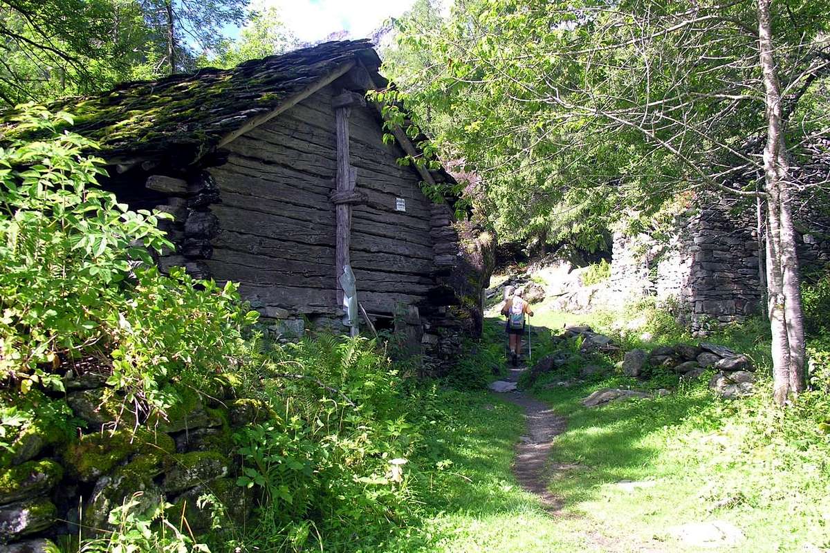
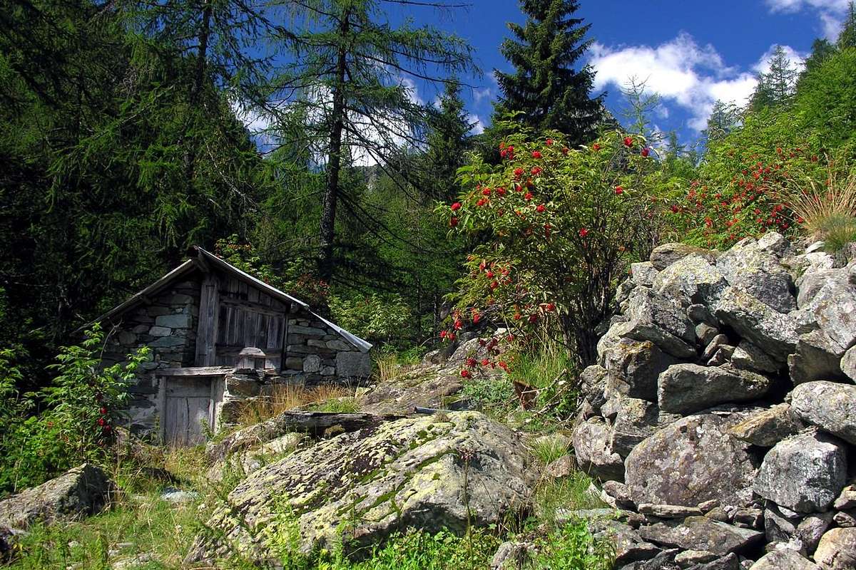
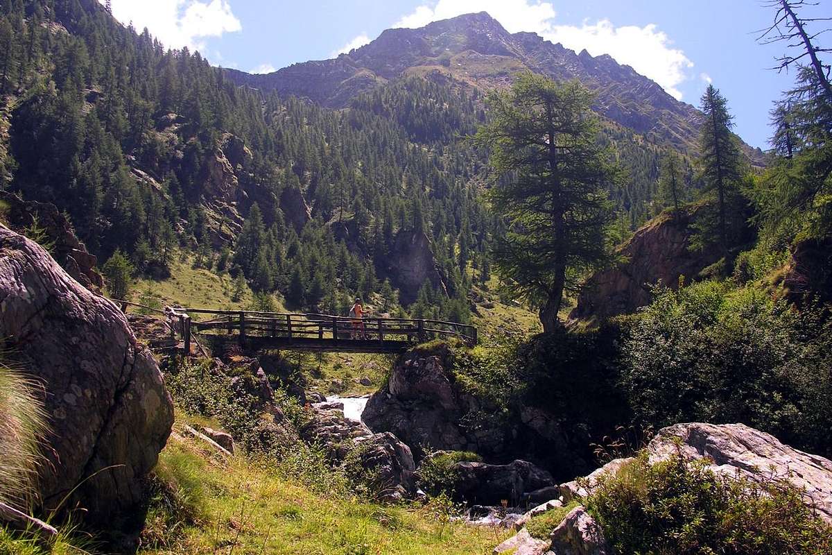
Specific Main Road From Pont Bozet(775/80m) towards Champorcher Valley, passing through Gorbelu(635m), Chateigne, Pialemont, Trambesère, Savin(978m), La Place(1.020m), Selleret(1.136m) Villages up to the crossroads just before Verana (1.255m), Mellier (1.293m), Coudreyt(1.299m) and small Hamlets ; from this fork, fording Ayasse Torrent, reach Outre l'Eyve or Outreleye Village, at the said location Moulin Parié(+ votive chapel; 1 Km, 1.233m), at the begginning of trail towards the Leigne Vallon also Alleigne Valley and reaching in short time another votive chapel known as Cret 's Chapel(1.297m).
From FRANCE: through the Mont Blanc Tunnel to Entrèves-crossroads to Vény/Ferret Valleys - Mountain Guides of Courmayeur - La Saxe Rock Gym - Courmayeur. By Little Saint Bernard Pass, closed since November until half May to La Thuile Valley - Pré Saint Didier - Courmayeur. It is not necessary to take Motorway A5: you can drive on SS.26, in the direction of AOSTA - IVREA - TURIN.
BY PLANE:
Aeroporto "Corrado Gex" Saint Christophe (Aosta).
Approach and travel through the valley / Avicinamento e percorrenza della valle
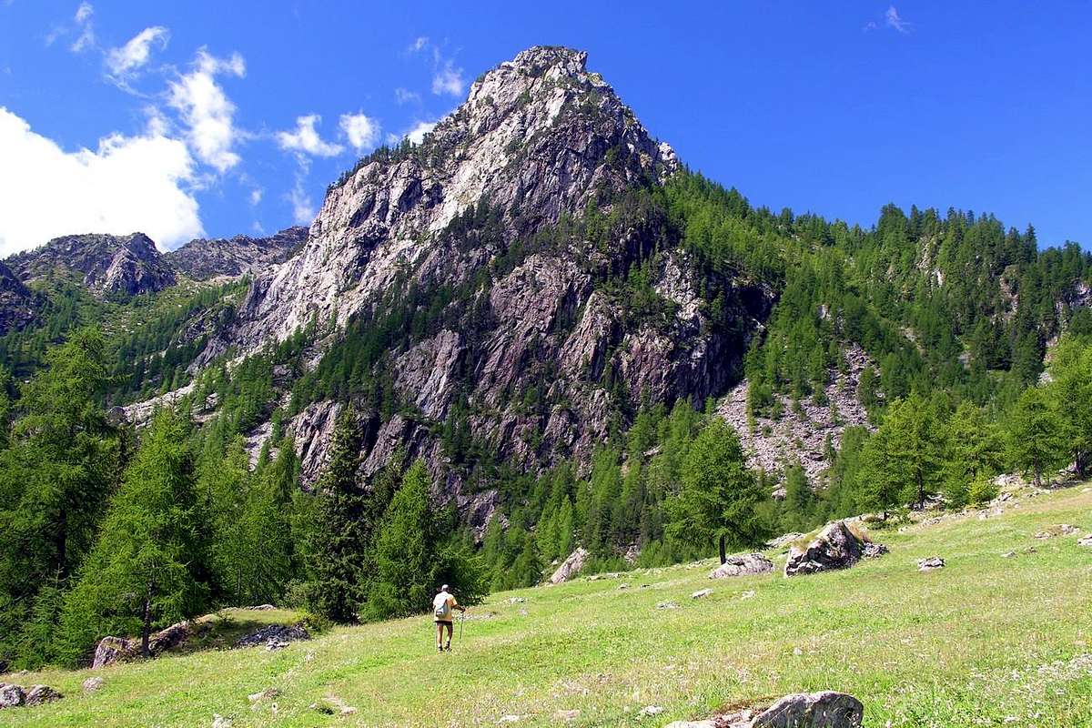
Approach from Outre l'Eve Hamlet through Legna's Vallon From Outre l'Eve or and better Outreleye (1.207/29m; "beyond the water of the Ayasse Stream") take the trail n° 4 just West of the small village with a first little votive chapel and go with Southeast direction to the Chapel of Cret (1.344m), where the same is directed more to the South. Immediately after reaching the junction at the Pian Bouch Pasture (1.354m) and, leaving the left (East) path n° 3C leading to Mont Digny, continuing instead to Southwest coming to Alp of Ourthy (1.344m), just below enough long Vorèa Buttress where the trail splits. Leaving right branching in the Southwest that, through the path n° 4F, reach Lake Vercoche, continue to Southeast with the opposite entering the "true" Legna's Vallon. Turning next to the left or Southeast of Legna Torrent (coming down from the Lakes Chiletto and Giorso) bank orographic you get to nearby Alps Sanaveus (1.781 m) and San Antonio Case Vecchie (1.817m; " Old Homes"), where it still leaves on the right exit to Lake Chiletto or, better, Lac de Chilet (2.324m). Continue always Southeast to Alp Creton (1896m) without reaching the next Chenessy (2.051m), both at the foots of Pointe de Chenessy. Here ends the approach and starts the various trails or specific routes (E/F; 1h'30/2h'00).
Avvicinamento da Outre l'Eve tramite il Vallone della LegnaDa Outre l'Eve (1.207/29 m; "al di là dell'Acqua del Torrent Ayasse")prendere il sentiero n° 4 appena ad Ovest del villaggetto e salire con direzione Sudest alla Cappella del Cret (1344 m), ove il medesimo s'indirizza più a Sud. Subito dopo raggiungere il bivio presso l'Alpe Pian Bouch (1.354 m) e, lasciando sulla sinistra (Est) il sentiero n° 3C conducente al Mont Digny (2.145 m), continuare invece a Sudovest arrivando all'Alpe d'Ourthy (1.344 m), sotto la Cresta di Vorèa formante un piccolo contrafforte, dove il sentiero si sdoppia. Lasciando a destra la ramificazione a Sudovest che, tramite il sentiero n° 4F, raggiunge il Lago Vercoche (2.202 m), continuare a Sudest con l'opposta entrando nel "vero" Vallone della Legna. Passando a fianco della sponda orografica di sinistra del Torrente della Legna, che scende dai Laghi Chiletto (2.322 m) e Giorso (2.160/70 metri circa), arrivare alle viciniore Alpi di Sanaveus (1.781 m) e subito dopo di Sant'Antonio Case Vecchie (1.817 m), dove si lascia ancora sulla destra la deviazione per il Lago Chiletto. Proseguire sempre a Sudest per l'Alpe Creton della Legna (1.896 m) senza raggiungere la successiva di Chenessy (2.051 m) Qui termina l'avvicinamento ed iniziano i varii percorsi (E/F; 1h'30/2h'00).
10 and more Walks Excursions & Climbings recommended
Some of the most important and the recommended Walks Excursions Climbings (10) even in the surroundings or in adjacent Valleys of Manda or Amanda (to the East) and Vercoche (West)
1) - Gorge of the Ratus (about 930m): Walk from Pont-Bozet, crossing the bridge avove Ayasse Torrent, with path in South-southeast to Brenve Torrent (T; 0h'30).
2) - Re Tempio Chapel (1.474m): Excursion with path before in South-southeast to Crest di Sotto (1.061m; Lower) Pastures; after to the Southeast, crossing Echellier Bois (Wood) and Brenve Torrent towards Larsine Pasture (about 1.380m). Finally through very tight switchbacks on the trail at the terminal part (E/F; 2h'15/2h'30).
3) - "Five Lochs Tour" into the Manda (z) or Amanda vallon (2.176m) or to Punta di Chenessy (2.630m): Excursion before with path in Southwest to Bozet di Sopra (1.573m; Upper) Alpage and following fork about 1.600 meters; after in Southesat crossing the forest to the entrance in a small valley, between Bec Chaty and Grand Bec, always with path to Lago Secco or Lac Sec (1.750m; Dry) immediately under the Betasson Alp (1.833m), Lago Nero (1.943m; Black); after with short return to previous small fork and with path to the West Lac de Champas just before the homonym Alp (1.928m, 1.967m). From this last, without path and along the torrent towards the two ramification of the same:
a) - in Southwest to Chenessy Lake (2.384m), below Chenessy Ridge and Point.
b) - In Southeast to Cornuto or Cornouy Lake (2.413m), near Forest Rangers Bivouac and below Punta della Fricolla (EE/F; 4h'00/4h'45). Also
4) -Climbing from Mandaz Alp (2.004m) (*** reached from Champas Lake and Alp with crossing from previous routes or directly in walloon floor passing Bozet (1.759m) and Chanton (1.859m) Pastures) by enough easy East-northeast Face and North Crest in final to Punta di Chenessy also towards Manda Pass (about 2.385/90 meters) and by North-northeast Crest in terminal part (two enough exposed steps) (EE/A/F+/PD-; 2h'15/2h'30)
5) - Fricolla Pass or Col de l'Alleigne (2.550m; "Tours of Three Vallons"): Excursion pathless and through traces into the moraines in South from Cornouy Lake to Brouillet Pass (2.450m); after through a brief descent with traces in adiacent Brenve Vallon above Alp Breuil (2.090m). Finally by Eastern Slope, with traces, to pass with. Moreover possibility of descent in Legna's Vallon towards Chenessy and Peroisa Alps, Case Nuove Sant' Antonio Pastures and Outre l'Eve Village (EE/F; 3h'45/4h'15).
6) - Mont Digny (2.145m): Excursion from Pont-Bozet/Delivret Village with path to Bozet di Sopra (1.573m); after in Northwest by path in East Slope (E/F; 2h'45/3h'00).
7) - Outre l'Eve (1.299m) to Punta di Vòrea (2.554m): Excursion-Climbing with path before in South-southwest to Ourthy (1.507m) Pastures, after in South to Saint Antoine Case Nuove (1.833m; New Homes). From this three possibilities:
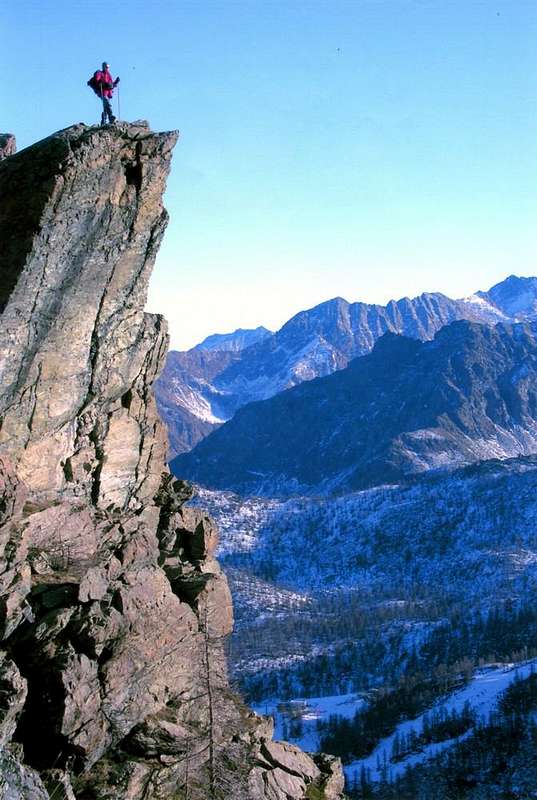
a) - along a small torrent between steep moraines in West towards Vorea Carving (around 2.455/60 meters) and by North-northeast Crest with steps from II° to III° (Normal Via; A/PD/PD+/AD-; 3h'45/4h'5 Outre l'Eve 0h'30 from carving). Or
b) - through less steep moraines in Southwest at the base of East-northeast Spur with climbing (steps from I°+ to II°/II°+/III°-) on edge of the ridge (A/PD/PD+/AD/AD+; 2h'15/2h'45). Also,
c)- continue from Sant'Antonio Case Nuove to Peroisa Alp (2.184m); leaving left the path to Chiletto Lake go in a small and narrow vallon reaching the South-southwester Ridge at a typical pinnacle shaped cannon. With te same, climbing enough easy on the thread, to Summit (A/F+; 2h'15/2h'45 Peroisa; better route for the descent).
8/9) - Outre l'Eve towards Chilétt or Vercoche Lochs: Excursion with path in Southwest towards Ourthy (1.507m) Alp; from the following fork
a) - in South to Legna's Vallon up to the Lac de Chilet (létt) or Chiletto (2.394m; EE/F; 2h'45/3h'15), below Santanel Hill and Monte Nero. In Southwest to
b) - in Southwest to Vercoche or Vercoce Vallon up to the two homonym Lakes (2.202m, 2.215m) and overhanging Mulère small Loch (2.316m), below Pointe Vòrea and Ridge (2.394m; EE/F; 2h'30/3h'00).
10) - Lake Vercoche to Bec Mollère or Pic Mulère (2.641m): Excursion-Climbing in Southwest from lake through a small path amongst moraines to Larìs Eastern Hill (2.581m); from this through Southwestern Slope to a small West Shoulder and finally by short Southwest Crest (an exposed step) to Top (EE/A/F/F+; 1h'30/1h'45 lake).
Campings
Remember that free camping is forbidden (except for emergency reasons, over 2.500m, from darkness until dawn).
Mountain Conditions
You can get meteo information at the official site of the Regione Valle d'Aosta:
"Guida delle Alpi Occidentali" di Giovanni Bobba e Luigi Vaccarone C.A.I. Sezione di Torino Volume II (parte II), 25 Maggio 1896.
"Guida dei Monti d'Italia–Emilius Rosa dei Banchi Parco del Mont Avic" di Giulio Berutto e Lino Fornelli-Club Alpino Italiano/Touring Club Italiano, Marzo 2005 (in Italian).
MAPS:
Enrico Editore Ivrea-Aosta "Gruppo del Gran Paradiso" 1:50.000.
I.G.C. Istituto Geografico Centrale Torino "Ivrea Biella e Bassa Valle d’Aosta" (n° 9), 1:50.000.
L'Escursionista "Valle di Cogne Carta dei Sentieri" 1:25.000.
Parents refers to a larger category under which an object falls. For example, theAconcagua mountain page has the 'Aconcagua Group' and the 'Seven Summits' asparents and is a parent itself to many routes, photos, and Trip Reports.


 2052 Hits
 77.48% Score
 8 Votes