
|
|
Mountain/Rock |
|---|---|
|
|
37.89470°N / 107.823°W |
|
|
San Miguel |
|
|
Mountaineering |
|
|
Summer |
|
|
12740 ft / 3883 m |
|
|
Overview
Gold Hill rises to the northeast of Palmyra Peak in Telluride Ski Resort near the town of Telluride in the San Juan Mountains of southwestern Colorado. Gold Hill has only 160 ft of prominence and is therefore not a ranked peak but it is an officially named Colorado summit.Several ski lifts go up the slopes of Gold Hill to various spots on its slopes. In summer, these lifts are closed. There is however a gondola line that operates year round going from the town of Telluride (8740 ft) to a place called St. Sophia Station (10540 ft) before dropping into Telluride Mountain Village (9560 ft). From St. Sophia Station, you could follow the “See Forever Trail” up the ski runs to reach the summit of Gold Hill. A more scenic option is to start in the town of Telluride and hike up Bear Canyon Trail. Gold Hill is often climbed as a 9.8 mile loop up from St. Sophia Station and down into Bear Creek Canyon to end in the town of Telluride.
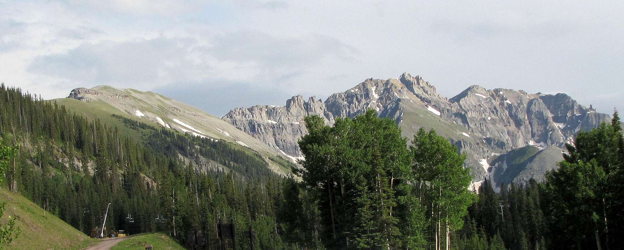
L to R: Gold Hill, Palmyra Peak & Silver Mountain, north face
Getting There
Bear Canyon/Wasatch Trailhead is at the south end of Pine Street in Telluride. Gondola to St. Sophia Station is at the south end of Oak Street. Parking in Telluride is limited. Start early.The other end of Gondola to St. Sophia Station is in the center of Telluride Mountain Village. No public parking is available here. You must park at the pay garages on Mountain Village Blvd. some distance away or stay at local establishments.
Route, up St. Sophia Station, down Bear Creek Canyon
 Map
MapAll distances are per my GPS
From St. Sophia Station follow the signs for “See Forever Trail” up the ski slopes and maintenance roads all the way to the top of Gold Hill. At 12260 you will reach the top of “Gold Hill Express” Ski Lift and at 12480 ft the top of “Revelation Bowl” Ski Lift at the base of a cliff. The maintenance road goes on the east side of the cliff making switchbacks to reach the very broad summit of Gold Hill.
 Dallas Peak
 Dallas Peak
 Lone Cone & Little Cone
Views from the summit of Gold Hill:
 The Wilsons
 Telluride Airport
 Mountain Village & Dallas Peak
 St. Joaquin Ridge
 Palmyra Peak
 Wasatch Mountain
 Mt. Sneffels
Since this trail is often used as a descent route, I will describe it as such.
All distances are per my GPS
From the summit of Gold Hill, head north retracing your route back down See Forever Trail. At an elevation of 12200 ft, just to the north of Gold Hill Express Ski Lift, you will see a trail on the east side going north down into Bear Creek Canyon. Turn onto this trail and follow it downhill.
 St. Joaquin Ridge
 Wasatch Mountain
 St. Joaquin Ridge
After a few switchbacks, you will reach the junction with Wasatch Trail.

Right goes uphill. Turn left and follow the trail downhill.

 St. Joaquin Ridge


After a few more switchbacks, you will reach the junction with the East Fork of Wasatch Trail. Continue left downhill.


You will then find yourself on top of a water cascade. The trail goes down on the west side of the cascade.


The trail continues down.


The trail makes more switchbacks. Bear Creek Waterfall will be visible.
 Bear Creek Waterfall

You will then reach Bear Creek Trail and follow it north to reach the trailhead at the end of Pine Street in Telluride. To reach the gondola, turn left heading west. Cross the stream over a bridge and continue west until you reach Oak Street.

 Peak 13510 ft & Ajax Peak