
-
 435 Hits
-
 75.81% Score
-
 6 Votes
|
|
Mountain/Rock |
|---|---|
|
|
39.59035°N / 106.41564°W |
|
|
Eagle County |
|
|
Hiking, Skiing |
|
|
Spring, Summer, Fall, Winter |
|
|
9928 ft / 3026 m |
|
|
Overview
Lions Head Rock
Elevation: 9928 ft
Distance: 4.5 miles round trip
Elevation Gain: 1,458 ft
A quick trip to this little mountain provides both an excellent workout and reward of sweeping views of Mount of the Holy Cross. This rock called Lions Head Rock is signture and iconic feature for town of Miniturn. If you visiting area, driving thru or simply if you ar peak bagger this is perfect little adventure for you.
|
|
|
Getting There
DIRECTIONS: You get to the Lionshead Trail from Hwy 24 in Minturn, which is just south of I-70 and just west of Vail. As you enter Minturn, look for bridge to the left as 24 merges into Main Street. Take this left turn and pass north of the large Saloon. Just past the Saloon is Rail Rd. Turn right here and then left on Taylor Road. This dead ends nears some homes. You will probably see one or two cars parked in a small parking area to the left. The trailhead itself is up a short (100 yard) spur that travels between the houses. A small wooden sign marks the start. Note this is the same trailhead for Game Creek. Lionshead splits of a half a mile up the trail.
Route
|
|
|
|
|
|
HIKE:
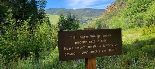
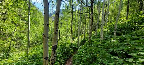
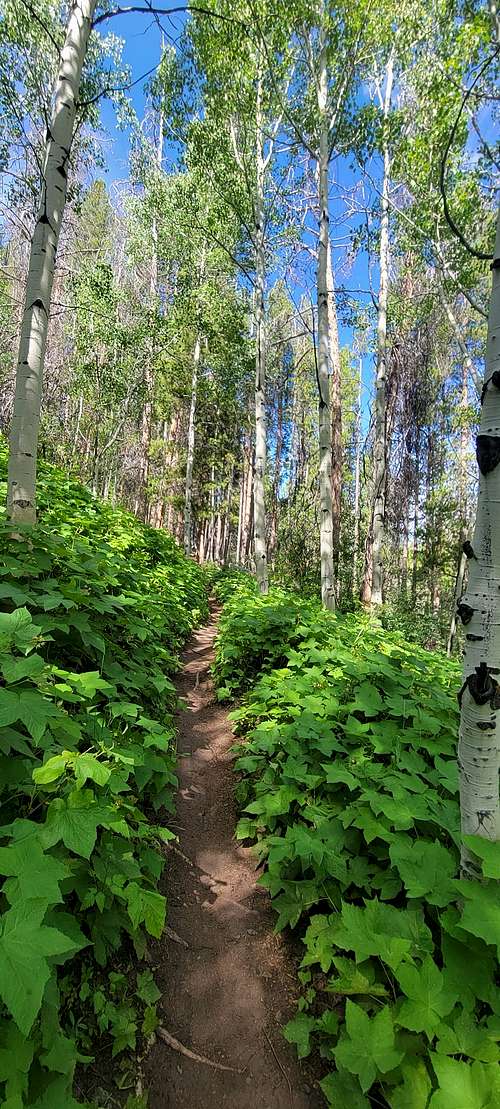
The trail rises sharply, than moderates, climbing into a leafy crevasse of aspen woods. Pass private property ( please respect) and arrive quickly at the junction for the Lions Head trail at 0.05 miles. Take right turn.
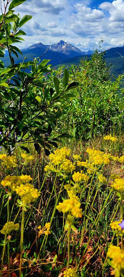
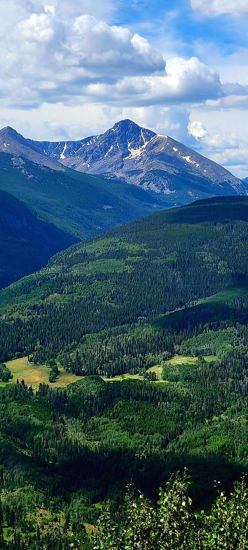
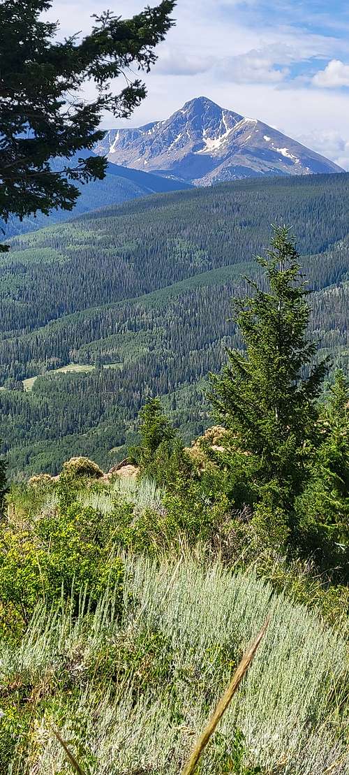
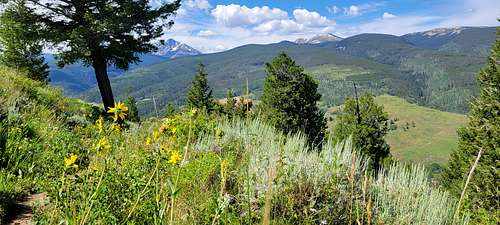
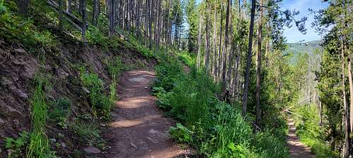
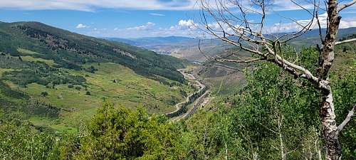
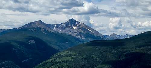
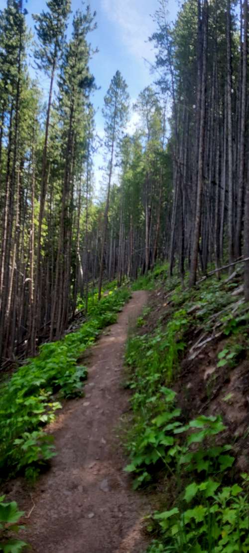
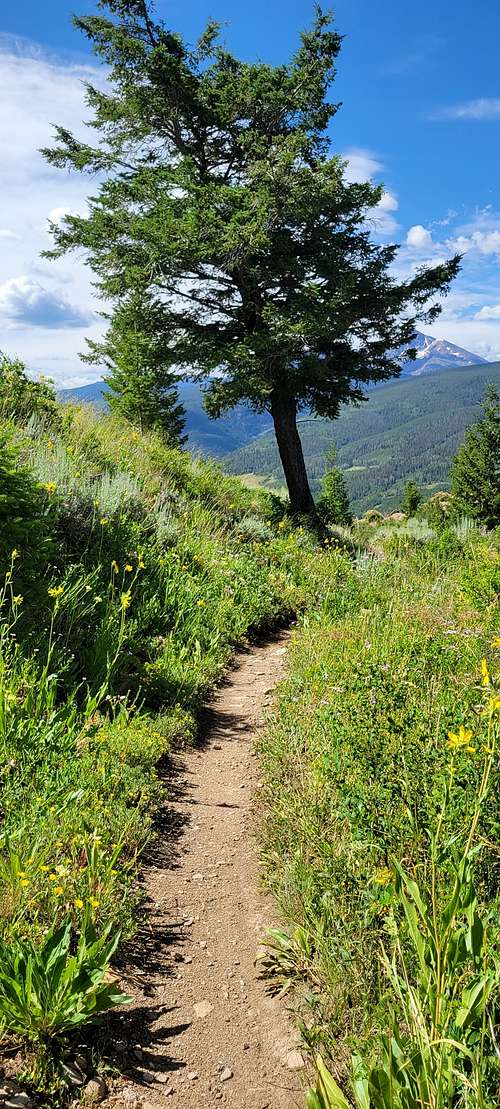
Trail takes you through a moist area where mountain bikers have damaged trail in attempts to navigate the wetland. Soon old roadway steepens but you will enjoy beautiful aspen trees and and red raspberry-like thimbleberries . The ascent remains unyielding, however icy shadows in the pines provide relief. A breakout frames another splendid view. Finally, an flat open area leads to the king-of-beasts vista from tawny rock outcropping shaped like lions head. Turn your head around to views from Tigiwon and Two Elk area at the left to Eagle, Vail and Avon beyond on the right. Look for the Mount of Holly Cross and Notch Mountain in the middle.
|
|
|
Red Tape
The falling of Lionshead Rock (Well, part of it)
Residents in Minturn heard a loud rumbling around 8 p.m. on March 4, 2014. Some residents described it as a helicopter while others thought it was a bomb, but in reality, it was a large piece of Lionshead Rock breaking off from the south side of the rock face.
The boulder rolled down the mountain, breaking into two pieces on the way down. The boulders hit the railroad tracks, just missing the buildings located nearby. It is believed that the boulder cracked off due to the freeze-thaw cycle that commonly occurs each spring in Colorado.
A large section of the Lionshead rock sits on top of railway track debris in Minturn after tumbling down the mountain on the night of March 4, 2014.Dominique Taylor photo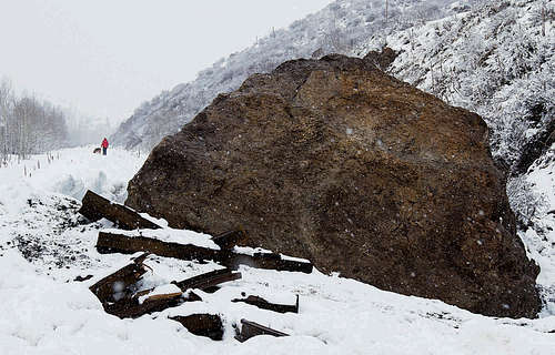
The freeze-thaw cycle is a process in which water melts and flows into the crevices of the rock, before refreezing and expanding. This happens over and over, slowly widening these fractures in the rock. In the case of Lionshead Rock, the freeze-thaw cycle eventually widened a crack so much that part of the rock broke free.
Lionshead Rock as it stands today
After the 2014 rock fall, the outlook for the remaining portion of the rock was uncertain. Luckily, the half of Lionshead Rock that did not fall is still standing today and functions as part of a popular hiking and mountain biking trail in the summer. The Lionshead Rock trail is a four-mile round trip with just over 1,500 feet of elevation change.
Once arriving at the top, you will see a beautiful view of the town of Minturn and the surrounding cliffs. As you look at the cliffs, look at the different shades of color in the bands that have formed, this tells the story of the formation of the cliffs and the seas that were once here.
Then, take a moment to look down at Lionshead Rock and see if you can spot any of the fossils that have been preserved within the limestone. These fossils serve as evidence that Lionshead Rock was once a coral reef. Whether you are hiking to Lionshead for the first time or it is a regular route you enjoy, take a minute while you are up there to appreciate the view and the history that is held in this special rock.
Camping
CAMPING:
Please note, there is no camping within the Town of Minturn. The nearest camping is at Halfmoon Campground at the top of Tigiwon Road # 707, near the boundary for the Holy Cross Wilderness in a forested setting. This is a first come, first serve campground. All wilderness regulations must be observed when traveling in the wilderness (foot and horse travel only). This campground is located at the trailheads for several hiking trails and is heavily used by hikers who are climbing Mount of the Holy Cross. Due to the nature of the Forest Road to the campground and the short parking spurs within the campground, the Halfmoon Campground is not suitable for most RVs. There is a printable Recreation Quicksheet for this campground which is complete with directions, details, and other information about this campground.
For information on other camping areas in the region, visit https://www.fs.usda.gov/.
External Links
https://etbtravelphotography.com/2020/10/02/happy-hiking-game-creek-trail/
https://www.minturn.org/explore-minturn
https://youtu.be/bmYxq0dk_R0?si=Te3dVeV5tds4kXN0
https://listsofjohn.com/peak/3244