
-
 17772 Hits
-
 89.77% Score
-
 30 Votes
|
|
Mountain/Rock |
|---|---|
|
|
39.70560°N / 106.2599°W |
|
|
13085 ft / 3988 m |
|
|
Gore Range Overview
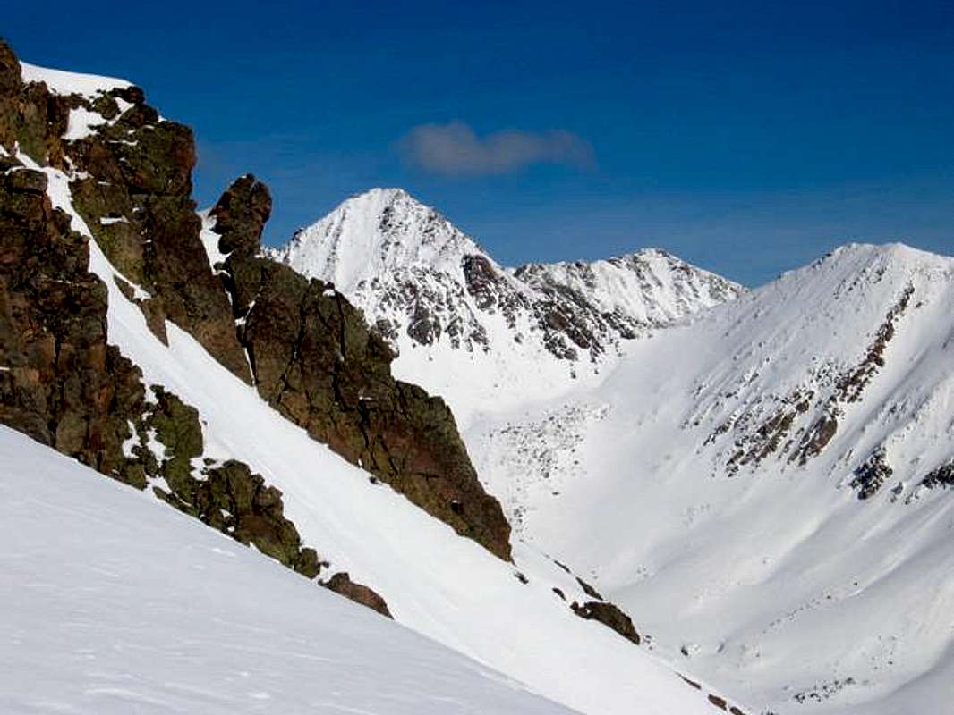
Peak X, Peak Z Prime, and North Vista Peak under a mantle of febuary snow.
 Colorado’s spectacular but barely known Gore Range is host to many alpine summits over 13,000-ft and many more summits over 12,000-ft. In the relatively short stretch from Gore Pass in the north to Tenmile Creek in the south, the Gore range is densely populated with 50 some mountains over 12,000-ft. The Gores, rather then consisting of large isolated mountains rising from the timber or tundra, consist instead of dramatic serrated ridges, with the summits being ridge junctions or highpoints. These dramatic ridges are riddled with gnarled, tooth-like spires that have mesmerized many world-class climbers. Many of these high and wild ridges actually have names like, The Zodiac Spires, Ripsaw Ridge, Red Diamond Ridge and The Grand Traverse.
 Geologicaly the Gore Range is a fault-block mountain range. Similiar to the Sangre de Cristos of Colorado and the Tetons of Wyoming in that these ranges are bounded by faults that broke and shifted, thrusting up the mountains while downdropping the valleys. Although the rock is similiar to the Idaho Springs Formation of the Front Range, the rugged Gore's contrasting orogensis makes these mountains look quite different from the glaciated folded anticline that makes up the Front Range. Glaciers played an extensive role in carving the cirques and spires that abound in the Gores. Many of the drainages are choked by large terminal moraines at their lower reaches and cut by successive headwalls higher up. Many headwalls are graced with gorgeous waterfalls.
The Gore Range is almost completely encompassed by the Eagles Nest Wilderness. This 133,325 acre Wilderness Area was established in 1976. It is popular (especialy the Vail side) but wilderness protection has granted a lasting pristine quality that is palpable. Despite the network of access trails, many drainages (the upper reaches in particular) remain trail-less. Wilderness regulations do apply; please follow them as this area is a real treasure.
Only 60 miles at its closest point from Denver, the Gore Range as a whole is relatively unknown. Due to the lack of mining roads that criss-cross more popular mountain ranges the interior of the Gore Range can be difficult to reach. Of the summits of the Gore Range none attain the magic 14,000-ft mark, which accounts for some of the range's obscurity. The monarch of the Gore Range is the 13,534-ft. Mount Powell at the north end of the range. Overall, the west side of the Gore Range is more accessible than the east. If approaching from the east, expect long, tedious, bushwhacking adventures with difficult route finding.
A result of the Gore Range's obscurity is that few of the summits are officially named. The Colorado Mountain Club and enterprising climbers have often bestowed their own names. These unofficial designations often are the "alphabet" designations of the early CMC trips (relics of the 1930's) or the more inspired names that came later on (The Spider, Mount Solitude, etc). A list of these names and their elevations can be found at Gerry and Jennifer Roach's wonderful website. The process of educating one's self about these mountains is quite rewarding. Hand label your maps.
Those of us who are determined to spend some time climbing the Gores should own updated U.S. Geological survey topography maps and brush up on their compass skills. Precise planning and execution are of paramount importance when selecting routes in this range. With solid route finding, many of these quiet summits can be climbed without a rope. Major faces and long jagged ridges provide unlimited technical climbing opportunities as well. An ice axe is highly recommended on any early season climbs.
Please do your own research and homework for the Gores because this mountain range lacks any current guidebook exposure. After developing strong map reading skills, go and discover for yourself the Gore Range magic you occasionally hear about.
Please see Theron Welch's excellent page on the Gore Range for more information. His photos and descriptions are inspiring and informative. Thank you Mr. Welch.
Text graciously provided by Kane with some elaboration by myself.
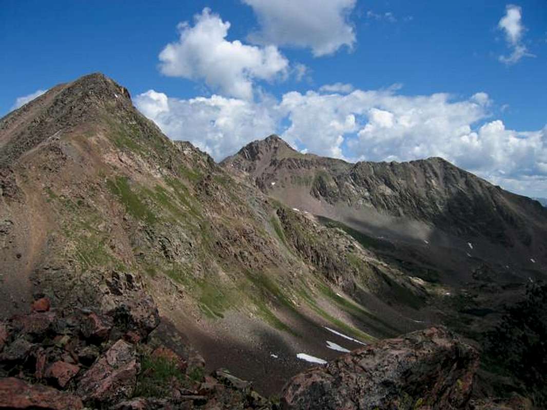
Peak X, Peak Z, and Z Prime from North Vista Peak in August 2005.
Peak X Overview
Peak X's summit with Peak Z in the distance.
Peak X resides at the southern end of the alphabatized summits of the Gore Range. It is on the same ancillary ridge as Peak Z and Peak Y. This ridge seperates the very remote and wild South Slate Creek drainage and Boulder Creek drainage. Peak X is the veritable paradigm of south central Gore virtue. It offers serenity in rough country with nary a soul around.
Peak X is somewhat challenging to approach as the two drainages that bind it on the north and south are trail less. As such it is most easily approached from the west by way of Usable Pass. This unconventional route has a certain elegence to it. The actual climbing on Peak X is quite typical of the Gores as well... Steep grass gulleys offer passage through scruffy little cliffs. The region between Usable Pass and Peak X is cursed with some rather tipsy scree and talus but once on X's south western slopes the talus is avoidable and much of the rock solid. The most enjoyable scrambling is found along the ridge crest of X's west ridge.
Peak X's position offers some astoundingly good views. The main body of the Gore Range lies just to the north and the summits of Peak Q, Peak L, Peak Z, and Peak Y rake the skyline in close proximity. Further north Mount Powell and portions of the Ripsaw Ridge can be seen. The valleys below Peak X are lonely to behold and are not likely visited often.
Peak X's nomenclature results from it being on of the Gore Range's alphabet summits. In 1932, CMC members Carl Erickson and Edmund Cooper used letters to assign summits in the obscure Black Creek Basin and the CMC subsequently tended and expanded the system (Jacobs & Ormes- Guide to Colorado Mountains)(Taken from Kane's Gore Range Overview). Peak X as such rises from a rugged ridge that breaks away from Peak W near Unnamed 12,710 and then winds east to Peak Z.
Peak X is one of my favorite mountains.
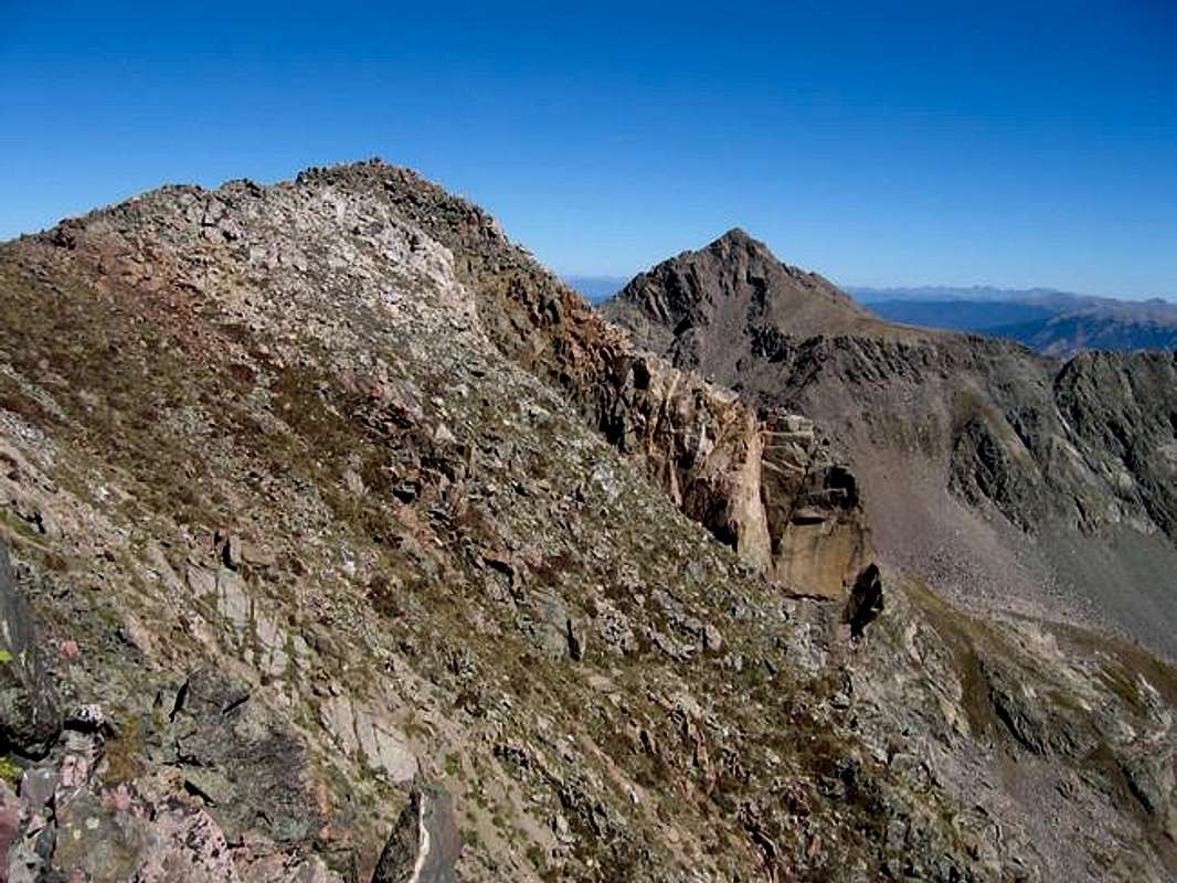
Peak X from Peak W.
Maps & Directions
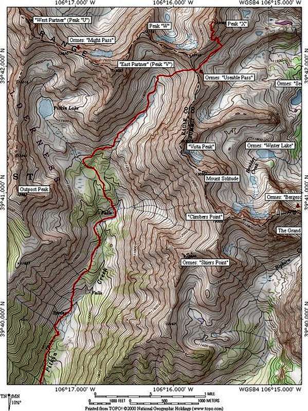
Usable Pass Route on Peak X: class 3, 12.8 miles roundtrip, 4,530 feet elevation gain.
Pitkin Lake Trailhead:
Locating the Pitkin Lake Trailhead is easy. From Denver, take I-70 west, past the Eisenhower Tunnel and on to the popular ski towns of Dillon and Silverthorne. Continue past Copper Mountain Ski Resort and on to Vail Pass. From Vail Pass, descend down to the city of Vail, Colorado and take exit 180, your first Vail exit on the right. Turn right and quickly make another right and drive about .2 mile east. Look for the trailhead on the left next to some private condos.
Directions per Kane.
Usable Pass Route on Peak X: class 3, 12.8 miles roundtrip, 4,530 feet elevation gain.
From the Pitkin Lake Trailhead follow the trail up steep slopes as it climbs out of the Vail Valley. After approximately a mile the angle relents dramaticaly as you enter the Pitkin Creek basin. The trail continues on past two waterfalls. After climbing up the headwall that contains the second falls continue for a half mile before leaving the comforts of the trail. Bushwhack along a creek flowing in from the basin between Vista Peak and East Partner Peak. There is a use trail in this area that may aid your progress. Stay on the north side of the creek. Once at the false timberline caused by converging avalanche paths (there is a nice tarn here as well) Usable Pass is visible ahead at the south end of the rugged ridge running off Peak W. This is the key to getting to X from the west. The valley leading to Usable Pass is gorgous. It also is one of the few high valleys in the Gores I have seen not troubled by extensive willows. The avalanches keep them in check.
Approaching Usable Pass the terrain gets looser. At the pass one is granted the first view of Peak X. The next challenge is getting down the east side of Usable Pass. The eastern side is cliffy with a steep dirt and rock gully running down from it. In august this gulley frightened me with a thick tongue of ice running down it. In late september is was more managble with just dirt. If you do this route if June through august an ice ax would be advisable.
From the bottom of the gulley contour across a boulder field aiming towards a diaganal gulley cutting accross a short cliff band. This allows access to the broken south west face of Peak X. Negotiate alternating rock and grass to get to the west ridge. Contour around a minor rock outcrop and continue along the southwest face. A cairn marks a mini couloir that re-attains the ridge. Finish up with some easy class three scrambling and a little ridge walk. The summit is cairned.
Return via the same route.
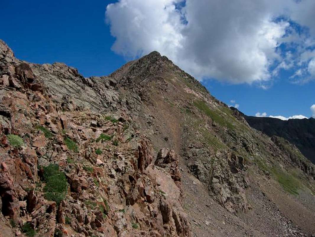
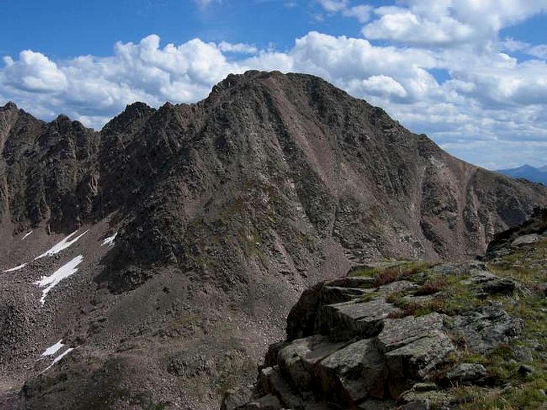
Peak X from Usable Pass.
Red Tape
“Red Tape” per attm
No permits or fees are required. Like all wilderness areas no mechanized or motorized vehicles are permitted within the Eagles Nest boundaries.
Wilderness is land set aside as part of wild America, where man can be a visitor. The natural environment has not been disturbed. Travel is restricted to foot or horseback. No mechanized equipment is allowed.
For more information, contact the U.S. Forest Service at the # below:
Additional Resources:
Eastern Portion of the Wilderness:
Dillon Ranger District
680 River Parkway
Silverthorne, CO 80498
970-468-5400
or
Western Portion of the Wilderness:
Holy Cross Ranger District
P.O. Box 190, 24747 US HWY 24
Minturn, CO, 81645, Phone: 970-827-5715
When To Climb
Peak X's location beyond the Pitkin Lake drainage would expose one to extreme avalanche danger during the winter months (all the meadows along the Pitkin Lake trail are run-out zones for avalanche paths). For this reason ascent is recomended for June to October.
Camping
Camping is available at several locations along the Pitkin Lake Trail. Decent spots are available below both sets of falls marked on the map. The meadows above the second falls offer opportunities to get away from the trail. Pitkin Lake would make an idyllic base for attempts on any of the summits that surround the Pitkin Lake Basin, Peak X included.
Mountain Conditions
Expect snow in the Gore Range until early June.
Click image to enlarge
Click here to view a 7-day forecast for The Gore Range
