


|
|
Mountain/Rock |
|---|---|
|
|
41.49029°N / 112.5079°W |
|
|
Box Elder |
|
|
Hiking, Scrambling |
|
|
Spring, Summer, Fall, Winter |
|
|
7372 ft / 2247 m |
|
|
Overview
Featured is Messix Peak, the highpoint of the Promontory Mountain Range located in northern Utah. Messix is one of those peaks tucked away out there, though relatively close to the Wasatch Front. The views from it's summit on a clear day can offer some great panorama of Willard and Ben Lomond Peaks across the Bear River Bay area, west across the Great Salt Lake with Desert Peak 50 miles distant. The view south from the summit is excellent showing the descending portion of the range to Promontory Point, the southern most portion of the range.Messix is one of those unique summits which has it's own challenges. Probably the first and foremost is the private property in which it resides, all the area surrounding the canyon and summit are privately owned. No trespassing signs, barbed wire fences and locked gates mark the landscape limiting access to the summit.
Another thing about Messix is it's prominence factor. It comes in at #54 on Utah's 100 Most Prominent Peaks list, and also #54 on the Utah 2000 FT Prominence Peak list. Messix has a prominence of 2,452 feet.
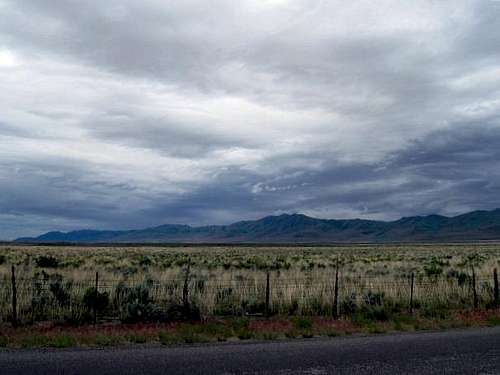 A look at Messix while en-route from the north east.
 The trail head/start of the route on the west side of the road.
  One of the cliffbands on the ridge in Messix Canyon.
 Wasatchvoyage and Greg heading down
Getting There
The main access to the Promontory Range and Messix Peak is that from I-15 west of Brigham City, Utah. Take exit 365 on I-15, loop around to the west and continue 2.7 miles into Corinne. Once reaching the west portion of Corinne, the intersection highway 13 and 83 is reached. Continue driving straight, the road heading west. Continue from the intersection for 17.6 miles. At this point you will notice signs for the Golden Spike Historical site. Turn left here, west. This junction is known as Lampo junction. Drive west for 2 miles. The road continues west to the historical site, another road turns left, south leading to Promontory Point. Take the left road and head south for 10.3 miles. At this point you will be directly east of Messix Peak and Canyon. The trail head area is marked by a locked gate to the west, a small home/ranch area to the east. There is just enough room to park on the east side of the road on the embankment. WGS84 GPS data for this location is: 41.29783 N, 112.28101 W at 4,330 feet. Dean's great shot of the contrast of life and death along the ridge.
 Greg's cool group shot, taken at the summit area.
 Summit benchmark.
 Red Tape
The main issue here with this area is the private property and access issues. SP member Kadee worked hard on getting the information for the property owners. To protect the identity and privacy of the property owners it is asked that you PM Kadee for this information, if you are planning a trip out there. If permission is granted to cross the area to the summit please respect the land and livestock on it. It may be a good idea to leave a note on your dashboard while you are up there to let other residents out there know why you are parked there.UPDATE 07/01/2010: For the respect of the property owners and because of several emails received, I have decided to only give out the owner's information once a year around May-June. Please do not email me for the information until next year, as we have already contacted the land owners this year. -Kadee
There are a couple of barbed wire fences which you may have to either crawl under or climb over, obvious caution should be used here not only for damage control to the fence but also yourself.
Another issue out here, especially during the heat of summer are the rattlesnakes! According to the property owner they are abundant and a wary eye should be kept where you step.
During hunting season, don't even think about this mountain. It becomes a hunting preserve and you will NOT be able to get permission. So, spring and early summertime are the best chances for permission. Also, leave no litter and as mentioned above, respect the land so that those who follow you might be able to get permission as well.
Camping
Developed camping.The closest developed campground to the area other than the KOA in Brigham City is Box Elder Campground, located near the Mantua Reservoir. Info for this campground:
Description: Elevation 5200 feet. 26 campsites, 4 group sites, and 9 picnic sites with a fantastic view of nearby Mantua Reservoir. The reservoir is a little more than a mile away, and is a popular area for fishing and boating. No charge for day use.
Location: From Brigham City go 4 miles east on US 89-91.
Address: Logan Ranger District
Wasatch Cache National Forest
1500 East Highway 89
Logan, UT 84321 Phone: 435-755-3620
Season: May - October
Fee: yes
Reservations: tel: 1-877-444-6777
Box Elder Campground link here.
------------------------------------------------------
At large camping.
Car camping on the side of the road near the summit is probably out of the question due to the private lands surrounding the area. Much of the area on the Promontory Range is less than ideal for setting up a camp somewhere. It is recommended that you look into the northern Wasatch to the east of the area if you are interested in off-piste camping.
When to climb and gear.
This peak due to it's lower elevation can be climbed year round.Winter/Spring.
The temperatures can drop below zero here during the middle of winter. Proper winter attire will be needed. The mountain can accumulate some snow, however the southern aspect can be free of snow at times. It would be wise to carry a set of snowshoes and gaiters in your vehicle in case you get out there and are surprised by the snow depths. The spring season will provide you with a lot of mud on the lower portion of the mountain, a good watertight set of boots with decent traction and perhaps trekking poles can help with this issue. Also in spring, this is tick country so pay attention if you are there in tick season.
Summer
The summer season from July into August will see stiflingly hot temperatures on the mountain and according to the landowners, rattlesnakes. Pay attention to where you put your hands on any rocky area and where you sit. Rattlesnakes do not like to be sat upon. Sunscreen, a hat and lots of water are recommended. The route mentioned is on the south facing aspect, a good early morning start can help beat the heat wave sure to come.
Fall
Hunting season makes this mountain off limits to visitors and becomes a private hunting preserve. I would not want to be there at this time of year.Hunting season often starts in late August.
Route information.
Messix Canyon route:Class I and II, and III. (Depending on your route.)
One way mileage: 2.5 miles.
Total elevation gain: 3,042 feet.
See the "Getting There" section for the trail head location. WGS84 GPS datum coordinates for this location are: 41.29783 N, 112.28101 W at 4,330 feet.
From the locked gate, crawl under and begin heading directly west up to the base of the mountain through grass and some minor brush. You will arrive at a small gully after about half a mile. Follow the bottom of the gully for several hundred yards through trees, and then head up and out of the gully to the north. From this point the base of the mountain is close at hand and you will soon be on a dirt track heading in a south west direction. Continue south west for another half mile into the mouth of Messix Canyon. At this point head north west through the trees in the bottom of the canyon for .25 miles. The route we found to work is the ridge between the left and right forks of the canyon directly in the middle. The route steepens here at this point, working your way up over some talus mixed with grass and small shrubs. Watch out for the larger plants with big, succulent leaves as they act like banana peels! Once reaching roughly 6,200 feet the ridge levels off a bit. There are two minor cliff bands which can be bypassed to the north east, or you can climb directly up and over them making for class III on some portions. After the second cliffband the ridge steepens again up to the summit ridge for half a mile. Once at the summit ridge the peak will be to your left less than .25 miles away, south west and is a quick class II jaunt along some limestone ledges.
 Utah Geologic Relief Map.
[img:629163:alignleft:medium:Half way up Messix Canyon.]
[img:629151:alignleft:medium:One of the cliffbands on the ridge in Messix Canyon.]
[img:629139:alignleft:medium:Wasatchvoyage and Greg heading down]
[img:629145:alignleft:medium:Dean's great shot of the contrast of life and death along the ridge.]
[img:629176:alignleft:medium:Looking at the summit once reaching the ridge.]
[img:630134:alignleft:medium:Greg's cool group shot, taken at the summit area.]
[img:629065:alignleft:medium:Summit benchmark. ]
---------------------------------------------------------------------
The Cave.
While heading up, Dean, Kadee, Greg and I took the right fork of Messix Canyon which involved a lot of side stepping on loose talus and scree. We reached a point where we saw a cave on the north west side of the canyon which we check out. See the map photo above for this location, just to the north of the ridge route mentioned at roughly 6,300 feet. The cave has a large opening though not deep. It looked as though someone has a fire in there as a lot of the rock had charcoal deposits on it. This may be worth a short side trip for those interested. If checking out this cave while heading up to the summit, there is a short class III scramble up a cliffband just to the north of the cave. This is full of loose limestone rock, use caution at this point.
Mountain weather.
The closest town for reference to weather is that of Corinne, Utah. Please check the weather link for Corinne below before heading out to the area.Corinne weather link here.

Geology.
Like so many of the other desert ranges in north and central Utah, is the prominent Oquirrh Formation, which is a layered strata of limestone, mainly gray and light tan, with thin beds of quartzite. The age of the formation dates back to 270 to 325 million years old. This formation is huge in depth, often over 20,000 feet thick is some places. If you check out the darker gray colored limestone on the mountain, you will find smaller shell specimens dispersed throughout. In some locations larger specimens are found, which resemble that of worms, and small fiberous plants.[img:543628:alignleft:medium:Utah Geologic Relief Map.]